American Forces
370 Men
28 Cannon
Casualties
1 Killed; 18 Wounded
British Forces
3000 Men
38 Ships
28 Cannon (not including those on ships)
13 Killed; 18 Wounded
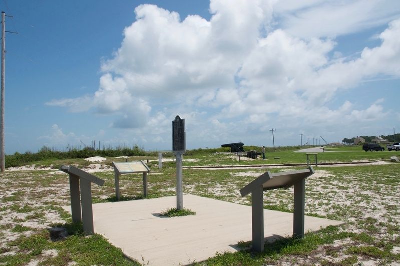
A map of the Second Battle of Fort . . . — — Map (db m118334) HM
A County Older Than the State
Lauderdale County
created Feb. 6, 1818
by Alabama Territorial Legislature (Alabama became a state in 1819).
Named for Col. James Lauderdale, cavalryman under Gen. John Coffee and Andrew Jackson, War of . . . — — Map (db m35185) HM
Side A (North side) In the fall of 1806 a group of settlers led by William and James Sims, traveled from east Tennessee on flatboats down the Tennessee River and up the Elk River to this area. They landed near Buck Island and spread out . . . — — Map (db m85454) HM
I am Ezekiel Reynolds, a citizen of Concord, Massachusetts Colony. My neighbors and I banded together to defend our families and farms and resist the taxation without representation in the British Parliament. We are called Minutemen for our speed in . . . — — Map (db m71404) WM
The purpose of this monument is to forever stand as a tribute to our nation's Founding Fathers who created the two most important documents that laid the foundation of our country: the Declaration of Independence and the U.S. Constitution. This . . . — — Map (db m67581) HM
Freedom Shrine
Created by the National Exchange Club
to strengthen citizen appreciation
of our American heritage
Presented by the Exchange Club of Stamford
Dedicated June 14, 1979
[ Reproductions of historic American documents are . . . — — Map (db m38610) HM
Commissioned in 1809 by U.S. President Madison, Frederick Lee served in the U.S. Revenue Cutter Service until 1829, providing security for the New Haven port and protection of American Ships on Long Island Sound.
On October 10, 1814, . . . — — Map (db m243260) HM WM
Fourth President of the United States-Father of the Constitution-Author of the Bill of Rights-Madison Connecticut Incorporated 1826 — — Map (db m243187) HM
Although the United States won the War of 1812, the searing memory of the nation’s capital in flames continued to disturb the public and Congress alike. The British had entered the Chesapeake Bay, continued up the Potomac River, and set fire to . . . — — Map (db m48353) HM
From 1927 until the late 1950s, the landscaped grounds across the street were the Hillcrest Children’s Center. It was founded downtown in 1814 as the Washington City Orphan Asylum by Marcia Burnes Van Ness and President Madison’s wife Dolley. . . . — — Map (db m130930) HM
The Embassy of Mexico incorporates the two surviving facades of a set of seven row houses known as “The Seven Buildings”. This complex has an intimate relationship with American history, and the government of Mexico is proud to honor and . . . — — Map (db m89348) HM
Welcome to downtown Washington, DC — an area rich in history, culture, and places to see. You will enjoy visiting the following sites located in the vicinity of this sign.
St. John's Church
Every US president since James Madison . . . — — Map (db m112204) HM
On August 24, 1814, President James Madison rode out to Bladensburg, Maryland, to observe the state of the American troops defending the nation's capital. U.S. General William Winder, now sure of the direction of the British approach, marched . . . — — Map (db m87590) HM
Every President of the United States since President James Madison has attended occasional services here. Many of them were communicants of the parish.
This building was completed in 1816 from plans of Benjamin Henry Latrobe.
an adjacent . . . — — Map (db m39126) HM
Site of dwelling house owned by Ex-President of the United States James Madison 1828 to 1836 ———— Home of his widow Mrs. Dolly Payne Madison 1837 to 1849 ———— Home of Rear Admiral Charles Wilkes, . . . — — Map (db m2174) HM
The Octagon once was the city residence of wealthy Virginia landowner Colonel John Tayloe III. After the British burned the White House and other government buildings, President James Madison accepted Tayloe's invitation to use the Octagon as . . . — — Map (db m87563) HM
Built between 1799 and 1802 by Colonel John Tayloe III (1771-1828) and his wife Ann Ogle Tayloe (1772-1855)
Dr. William Thornton (1759-1828)
Architect
Occupied by President and Mrs. Madison from August 1814 to March 1815 after the burning . . . — — Map (db m40225) HM
This building known as the Octagon built in 1800 for Col. John Tayloe of Mount Airy, Virginia, was occupied by President Madison after the burning of the President's House by the British on August 14, 1814. Here the Treaty of Ghent was ratified by . . . — — Map (db m117643) HM
The author of our National Anthem was a lawyer, patriot, community leader and poet. His home and law office stood approximately 100 yards west of here. Francis Scott Key lived there from 1803 to about 1833 with his wife, the former Mary Taylor Lloyd . . . — — Map (db m120) HM
In 1814 this was the home of the Charles Carroll family, fiends of President James Madison and his wife, Dolley. Carroll came to the President’s House on August 24, as Madison was returning from the defeat at Battle of Bladensburg. Soon word arrived . . . — — Map (db m95914) HM
Erected by
The National Society of the Colonial Dames of America
In Grateful Commemoration of the Signing of the Constitution
by the following delegates in Philadelphia September 17, 1787
Attest: William Jackson, Secretary . . . — — Map (db m189261) HM
Welcome to downtown Washington, DC — an area rich in history, culture, and places to see. You will enjoy visiting the following sites located in the vicinity of this sign.
Clockwise from top left:
St. John's Church
Every . . . — — Map (db m113345) HM
For Americans, August 24, 1814, was one of the darkest days of the War of 1812. After a victory at nearby Bladensburg, Maryland, British soldiers marched on Washington, destroying the U.S. Capitol and many other public buildings. . . . — — Map (db m130366) HM
The original Library of Congress occupied a room in the U.S. Capitol. When British troops burned the Capitol in 1814, the collection was destroyed. After the war Thomas Jefferson helped re-establish the library by selling to Congress at a . . . — — Map (db m80848) HM
"All men are born equally free and independent. And have certain inherent natural rights... among which are the enjoyment of life and liberty, with the means of acquiring and possessing property, pursuing and obtaining happiness and . . . — — Map (db m111342) HM
June 12, 1812
America Declares War
April 27, 1813
York Captured
August 30, 1813
Creeks Attack Fort Mims
September 10, 1813
Battle Of Lake Erie
October 5, 1813 . . . — — Map (db m152435) WM
1 • Mount Vernon Red Maple Planted in honor of the Founders of the City of Sanford, Florida on February 10, 1992. This red maple has been grown from seeds collected at Mount Vernon, President George Washington's beloved home on the . . . — — Map (db m214875) HM
1 • Ponce de León Live Oak Planted on November 27, 2001 in memory of Eunice R. Rabette. The Ponce de León Live Oaks grow near the spot at Port Charlotte, Florida, where the explorer first came ashore in April 1513. 2 • Treaty Live . . . — — Map (db m214873) HM
This County, created by Act of the Legislature December 5, 1811, is named for James Madison, Virginia Democrat, fourth President of the United States, 1809-‘17. The site for Danielsville was given by Gen. Allen Daniel of Revolutionary fame. In . . . — — Map (db m29863) HM
This City of Monroe, settled in 1818 and incorporated Nov. 30, 1821, was named for James Monroe, fifth President. Born in Virginia in 1758 he fought in the Continental Army. He served in the Virginia legislature, in Congress and the Senate, and as . . . — — Map (db m20718) HM
Theodore Roosevelt Letter On Cuba
On January 22, 1907, President Theodore Roosevelt wrote to Secretary of War William Howard Taft rejecting the idea of a protectorate over Cuba and expressing his determination that the United States should . . . — — Map (db m169581) HM
John Jacob Hays was born in New York circa 1770. His family emigrated to North America from the Netherlands in 1720. The Hays family belongs to Congregation Shearith Israel, the oldest Jewish Congregation in the United States.
John Jacob Hays . . . — — Map (db m140422) HM
Delaware, 1st State
December 7, 1787
1609 • Henry Hudson visited Delaware Bay
1638 • Swedish colonists established Fort Christina, Delaware's first permanent settlement, and founded the colony of New Sweden
1655 • Dutch captured New . . . — — Map (db m47214) HM
In the fall of 1809, William Clark was summoned to Washington from St. Louis by President Madison to discuss the governance of the Louisiana Purchase Territories, which he had explored with Meriwether Lewis during the Jefferson administration. . . . — — Map (db m39981) HM
Born Eng., 1756, came America, 1767. Became Methodist preacher at age 20, riding the circuits in Md., Va., Ky. Came to Louisville from Leesburg, Va., 1818. Moved Warren Co., Ky., and then 7 miles south of Russellville in 1822. Died in 1836 after 60 . . . — — Map (db m123367) HM
Burial place of John Littlejohn, esteemed Methodist preacher. He came to Russellville in 1822 and conducted camp meetings, services, & ministered throughout Logan Co. While he was a sheriff in Virginia, during the War of 1812, he was entrusted by . . . — — Map (db m123402) HM
(Side A) For James Madison, Virginia patriot whose political foresight led to the formation of many of our basic democratic principles. He was a member of Virginia's Constitutional Convention and her First Assembly, 1776. He was also . . . — — Map (db m30883) HM
Simon Kenton, local militia leader, often greeted new families at Limestone Creek, emptying into the Ohio. Tobacco is inspected and weighed in the late 1780s, when Limestone is chartered as Maysville and Mason County created by Virginia. Folks . . . — — Map (db m83961) HM
Panel 1Only twenty-nine years after winning its independence from Great Britain in the American Revolutionary War, the United States found itself at war once again with its former mother country. The War of 1812 began on June 18, 1812 when Congress . . . — — Map (db m114827) HM
1st Lieut., 24th Infantry, U.S. Army, appointed by President Madison, 1812-1815. Judge of W. Baton Rouge parish. Mortally wounded in duel with another judge, fought with sabres at Pinckneyville, Miss. — — Map (db m143804) HM
The embargoes leading to war caused economic hardship in Augusta, and news of war generated disdain in this Federalist Town. Citizens mounted a protest by hanging an effigy of President Madison from the public wharf and flying an . . . — — Map (db m153146) HM
Light House Bistro serves the community as a gathering place for patrons from all walks of life. This Artwork by Sally Wern Comport pays tribute to the area's history and the people that make it special. The Presidents Hill neighborhood is named . . . — — Map (db m237501) HM
Just north of this building, facing Main Street, stood Mann’s Tavern where twelve delegates from five states met in 1786 to discuss commercial problems of the new nation. Their call for another convention in Philadelphia to render the government . . . — — Map (db m130220) HM
The seat of Maryland government, the State House was at the center of the state's planning for the War of 1812, both locally and in coordination with President Madison's administration in Washington, D.C. Near constant fear of invasion by the . . . — — Map (db m63499) HM
The William and Robert Smith vault, another of Maximilian Godefroy's Egyptian-flavored designs, belonged to one of early Baltimore's most successful and accomplished families.
William Smith followed his brother John from Lancaster, . . . — — Map (db m6638) HM
As dawn approached on June 26th, 1814, the United States Chesapeake Flotilla and American shore batteries launched a poorly-coordinated attack against the British.
Under the cover of darkness, U.S. Army and Marine units, aided by 20 flotillamen, . . . — — Map (db m81031) WM
Residents along the Patuxent watched nervously as wave after wave of British warships approached the tiny town of Benedict. For months enemy raiders had terrorized Southern Maryland. Benedict felt their sting twice in June 1814. Now, August 19-20, . . . — — Map (db m68046) HM
In 1812, the United States of America was less than 30 years old, and only one generation had been raised to adulthood under the American flag. Many people still personally remembered the daring and exhausting fight to win independence from . . . — — Map (db m128731) HM
War of 1812
Great Britain had been at war with France since 1793 and imposed several trade restrictions that the newly formed United States of America found unbearable.
On June 18, 1812, the United States of America declared War on Great . . . — — Map (db m128748) HM
The Chestertown waterfront seems quiet today, but it was a flashpoint in the American colonists' struggle for liberty.
Kent County, long loyal to England, found its ancestral ties weakening with each new generation born on American soil. . . . — — Map (db m138241) HM
Many Washington residents fleeing the British invasion in August 1814 converged on this quiet village. Brookeville also provided a haven for hungry soldiers as they headed for Baltimore following the American Defeat at Bladensburg. . . . — — Map (db m76403) HM
In this village President Madison and members of his official family found refuge in the home of Caleb Bentley, first Postmaster of Brookeville, following the burning of the Capitol and the White House by the British army. Many other refugees from . . . — — Map (db m363) HM
Erected in ca. 1798, the Federal style Bentley House was the first substantial structure to be built in Brookeville. In 1814 it was the home of Caleb and Henrietta Bentley. Caleb was the town's first postmaster and merchant, and the house includes . . . — — Map (db m76398) HM
In this house
August 26-27 1814
President
James Madison
and
Richard Rush
Attorney General • were
sheltered after the burning by the British of the public buildings at Washington
August 24-25, . . . — — Map (db m364) HM
On August 26, 1814 this house provided shelter for President Madison and his official party during the British burning of the federal buildings in Washington, D.C. in the War of 1812.
The following day, August 27th, the Secretary of State . . . — — Map (db m365) HM
The Battle of Bladensburg on August 24, 1814, ended in defeat for the United States and allowed the British to invade Washington, D.C. Once the Americans realized the British route of advance, there was little time to prepare. They . . . — — Map (db m61550) HM
As the militia – local citizens—defended this road, then known as the Bladensburg or Washington turnpike, from approaching British troops in 1814, three historical figures stood in the thick of the battle at or near this point: . . . — — Map (db m73241) HM
The Second of three defensive lines blocking the British advance on Washington stretched along here. It was located on the first set of hills overlooking the river. The American militia was unprepared to face seasoned war veterans. Holding firm . . . — — Map (db m69353) HM
The Second of three defensive lines blocking the British advance on Washington stretched along here. It was located on the first set of hills overlooking the river. The American militia was unprepared to face seasoned war veterans. Holding firm . . . — — Map (db m73131) HM
On August 24, 1814, American and British forces battled at Bladensburg for three hours. President Madison was on-site, confident his troops would block the British advance on Washington. At the second defensive line he watched the . . . — — Map (db m214693) HM
Judge Gabriel Duvall built Marietta in 1812-13 and in the 1830s added a two-story wing on the north side. Duvall was distinguished for a lifetime of public service which included election to the Maryland state legislature and the United States . . . — — Map (db m3630) HM
“I cannot express to you the distress it has occasioned at the Battle of Bladensburg. We heard every fire. …Our house was shook repeatedly by the firing upon forts and bridges, and illuminated by the fires in our Capital.” Mary DeButts, . . . — — Map (db m48949) HM
Captain Paul Cuffe
Paul Cuffe (1759-1817) was a sea captain, merchant, philanthropist, community leader, civil rights advocate and abolitionist.
Here are some significant details about his life.
Westport, MA: site of the . . . — — Map (db m77468) HM
[ left panel ]
Welcome – You Are Entering
Fort Sewall
Marblehead Massachusetts
Fort Sewall is a unique earthwork fortification positioned to defend Marblehead for over three centuries. In 1644 the provincial government granted . . . — — Map (db m36601) HM
[Top Marker]
In July of 1789, Representative Elbridge Gerry, native of Marblehead, signer of the Declaration of Independence, and Vice President of the United States under President James Madison, filed H.R. Bill 12 in Congress, . . . — — Map (db m21453) HM
Preacher “One of the most useful qualifications of a good minister is that he have a lively sense of religion upon his own heart.” John Witherspoon Born in Gifford, Scotland, in 1723, Witherspoon was educated at the . . . — — Map (db m44842) HM
Eloquently fired the spirit of the people with poems and ballads promoting the cause of liberty. Friend of James Madison and Thomas Jefferson, published the Jersey Chronicle, first newspaper in Monmouth County. — — Map (db m76324) HM
4th President of the United States Dedicated 2003 President Madison Our namesake. Madison, CT. & N.J. [ Back of Monument: ] From ‘Bottle Hill’ to ‘Madison’ in 1834. This monument is hereby presented through the generosity of the Mayor and . . . — — Map (db m33505) HM
Fitting the Ships of War at the Scajaquada Creek Boat Yard In the early 1800s, the United States being a country of less than 50 years, began to recognize the need to have military transport routes to connect and supply its forts. The waterways . . . — — Map (db m236060) HM
Son of a revolutionary patriot Born in Fox Meadows (Now Scarsdale) N.Y. June 21, 1774 Died in Tompkinsville, Staten Island N.Y. June 11, 1825 Governor of New York State 1807-1817 — Vice President of the United States 1817-1825 Military . . . — — Map (db m41207) HM
This serene site was once the bustling lifeline to the West Point Foundry, an industrial marvel and a technological powerhouse of its day. On the Waterfront Just after the War of 1812, President James Madison designated Cold Spring as one of . . . — — Map (db m44564) HM
Water and Power West Point Foundry was one of America’s great early ironworks. An internationally renowned center of innovation and manufacturing, it’s been called the Silicon Valley of its day. Shortly after the War of 1812, President James . . . — — Map (db m168263) HM
Site of the colonial Eagle Tavern, a leading haven of area rebels during the American Revolution. Operated by Gerardus van Schoonhoven. Famous guests included Alexander Hamilton, Thomas Jefferson and James Madison. — — Map (db m115398) HM
Served in the Continental Army under the command of General Washington. Appointed as Accountant of the War Department by Washington and served under Presidents Adams, Jefferson and Madison. For his services in the Continental Army, received a land . . . — — Map (db m227846) HM
When Ohio and the United States were mostly rural, cemeteries were often located on the family farm. For many of these cemeteries few or no records exist. Available records suggest that this small site is the Francis H. Game Cemetery established . . . — — Map (db m66462) HM
Clintonville
This community located in Section 2 of Clinton Township, was
settled in 1813 by Thomas Bull. The land was formerly owned
by John Rathbone for whom Rathbone Road is named. Its early
growth was due largely to a number of . . . — — Map (db m92853) HM
The Village of Adamsville commemorates life in this area as it was
during the early to mid-19th century. The original Adamsville settlement was located on the banks of Raccoon Creek. roughly one-half
mile east of this site. Adam Rickabaugh . . . — — Map (db m123072) HM
These three buildings are the three oldest structures on campus. Together they form Dickinson’s Historic Triangle.
West College, “Old West”, to your left
West College was designed in 1803 by Benjamin Latrobe, the architect . . . — — Map (db m152465) HM
West College – known affectionately as Old West – traces its roots to February 1803, when the college’s main building burned to the ground after four years of costly construction. In a bind, the college trustees appealed for help. . . . — — Map (db m35322) HM
What was the War of 1812? America declared war against Great Britain on June 18, 1812. The conflict lasted for over two years. Many historians believe that the war was the inevitable outcome of Britain's continued interference in U.S. . . . — — Map (db m129898) HM
This "National Road" connected east and west in the 1800s. George Washington proposed a route to join the western frontier to the eastern seaboard in the late 1700s. His idea was later promoted by Albert Gallatin, Secretary of the Treasury under . . . — — Map (db m342) HM
"...his personal Character, as well as his present Designs,
entitle him to the most cordial Regards."
Patrick Henry, Governor of Virginia
March 25, 1785
Early American Statesman
In 1780, 19-year old Albert Gallatin . . . — — Map (db m139472) HM
On June 18th, 1812, the United States Congress declared war on Great Britain, at the request of President James Madison. The British had blockaded the U.S. coast, seized American ships, and impressed their seamen. Also, the Canadians supported . . . — — Map (db m136458) HM
SOCIETY HILL. Where the past meets the present.
You are now walking down streets laid out over three centuries ago. In the 18th century you might have crossed paths with Benjamin Franklin, George Washington or Thomas Jefferson. . . . — — Map (db m31304) HM
A Brief Timeline of Freedom and Slavery at this Site
Before • For hundreds of years, Algonquian-speaking peoples lived here.
1682 • The city of Philadelphia was founded.
1767 • The house was built by Mary Lawrence Masters, a slaveholder . . . — — Map (db m102465) HM
Born: February 22, 1732, Westmoreland County, Virginia
Married: Martha Danbridge Curtis, (1732-1802), January 6, 1759
Children: John and Martha Curtis (adopted)
Died: December 14, 1799, at Mount Vernon, Virginia
Education: No formal . . . — — Map (db m89399) HM
On November 14. 1809, the Tennessee General Assembly passed an Act which brought Giles County, and its County Seat, Pulaski, into being. The new six hundred square
mile county was formed from land ceded to the State in 1805 by treaty with the . . . — — Map (db m168698) HM
This marker is one of four which laid out one square mile (640 acres=one section) in 1841. A land grant was issued in 1809 and 1813 to the City of Pulaski and the County of Giles by James Madison, President of the United States. — — Map (db m151109) HM
This marker is one of four which laid out one square mile (640 acres=one section) in 1841. A land grant was issued in 1809 and 1813 to the City of Pulaski and the County of Giles by James Madison, President of the United States. — — Map (db m151145) HM
This strategic point on Lake Champlain was occupied by Native Americans for thousands of years. In 1690 Jacobus deWarm build a small stone fort here. The French build a wooden stockade in 1731, erecting Fort St. Frederic across the lake in 1734. . . . — — Map (db m85414) HM
The peaceful international border here owes some of
its location to the War of 1812 and Vermonter
William Czar Bradley.
The War of 1812 between the United States and
Great Britain officially ended with the Treaty of
Ghent, signed December 24, . . . — — Map (db m140028) HM
In 1788 James Monroe purchased an 800-acre farm here to be close to his friend Thomas Jefferson and to establish a law office. In 1799 the Monroes moved to their new Highland plantation adjacent to Monticello and sold the first farm. In 1817 the . . . — — Map (db m8762) HM
This chimney and foundation are all that remain of the “joiner’s shop”, one of the first structures on Mulberry Row. From about 1775, free and enslaved workmen produced some of the finest woodwork in Virginia. Sawyers and carpenters felled oak, . . . — — Map (db m80860) HM
Thomas Jefferson founded the University of Virginia. The cornerstone of its first building was laid on October 6, 1817, in the presence of three presidents of the United States—Jefferson, James Madison, and James Monroe. In 1825, the . . . — — Map (db m61101) HM
The West End in the 19th century centered on Duke Street and Diagonal Road. Large undeveloped, the area was devoted to stockyards, agricultural shipment, and "a" notorious business: the slave trade. The house at 1707 Duke Street (left) was part . . . — — Map (db m151028) HM
171 entries matched your criteria. The first 100 are listed above. The final 71 ⊳