48 entries match your criteria.
Honey Springs Battlefield Historical Markers
Honey Springs Battlefield was the site of the largest of approximately 107 documented Civil War military engagements in Indian Territory (present-day Oklahoma). Six trails allow visitors to walk portions of the battlefield and read intrepretive markers about actions that occurred.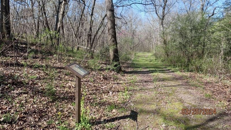
By Mark Hilton, March 20, 2024
Looking west from the Southern Camps Marker.
1 ► Oklahoma, McIntosh County, Oktaha — Southern Camps — Honey Springs Battlefield — Interpretive Trail Four · Battle at the Bridge —  |
| 2 ► Oklahoma, McIntosh County, Rentiesville — 1st Choctaw & Chickasaw Mounted Rifles — Honey Springs Battlefield — Interpretive Trail Five · Last Engagement — |
| 3 ► Oklahoma, McIntosh County, Rentiesville — Battlefield Archaeology — Honey Springs Battlefield — Interpretive Trail Six · Honey Springs Depot — |
| 4 ► Oklahoma, McIntosh County, Rentiesville — Burying the Dead — Honey Springs Battlefield — Interpretive Trail Five · Last Engagement — |
| 5 ► Oklahoma, McIntosh County, Rentiesville — Honey Springs Depot on the Texas Road — Honey Springs Battlefield — Interpretive Trail Six · Honey Springs Depot — |
| 6 ► Oklahoma, McIntosh County, Rentiesville — How We Know What We Know · Soldiers' Letters — Honey Springs Battlefield — Interpretive Trail Six · Honey Springs Depot — |
| 7 ► Oklahoma, McIntosh County, Rentiesville — The Armies Rest and Recuperate — Honey Springs Battlefield — Interpretive Trail Five · Last Engagement — |
| 8 ► Oklahoma, McIntosh County, Rentiesville — The Confederate Headquarters and Reserve Units — Honey Springs Battlefield — Interpretive Trail Six · Honey Springs Depot — |
| 9 ► Oklahoma, McIntosh County, Rentiesville — The Final Engagement — Honey Springs Battlefield — Interpretive Trail Five · Last Engagement — |
| 10 ► Oklahoma, McIntosh County, Rentiesville — The Texas Road — Honey Springs Battlefield - 1863 — |
| 11 ► Oklahoma, McIntosh County, Rentiesville — Treating the Wounded — Honey Springs Battlefield — Interpretive Trail Five · Last Engagement — |
| 12 ► Oklahoma, Muskogee County, Oktaha — "Follow Me!" · The U.S. Infantry and their Weapons — Honey Springs Battlefield — Interpretive Trail Two · Federal Artillery Line — |
| 13 ► Oklahoma, Muskogee County, Oktaha — 1st and 2nd Regiments of Cherokee Mounted Rifles — Honey Springs Battlefield — Interpretive Trail Three · Confederate Line — |
| 14 ► Oklahoma, Muskogee County, Oktaha — 1st and 2nd Regiments of Creek Mounted Volunteers — Honey Springs Battlefield — Interpretive Trail Three · Confederate Line — |
| 15 ► Oklahoma, Muskogee County, Oktaha — 1st Indian Home Guard — Honey Springs Battlefield — Interpretive Trail One · Federal Bivouac — |
| 16 ► Oklahoma, Muskogee County, Oktaha — 1st Kansas Colored Volunteer Infantry — Honey Springs Battlefield — Interpretive Trail One · Federal Bivouac — |
| 17 ► Oklahoma, Muskogee County, Oktaha — 29th Texas Cavalry & 20th Texas Cavalry — Honey Springs Battlefield — Interpretive Trail Three · Confederate Line — |
| 18 ► Oklahoma, Muskogee County, Oktaha — 2nd Colorado Infantry — Honey Springs Battlefield — Interpretive Trail One · Federal Bivouac — |
| 19 ► Oklahoma, Muskogee County, Oktaha — 2nd Indian Home Guard — Honey Springs Battlefield — Interpretive Trail One · Federal Bivouac — |
| 20 ► Oklahoma, Muskogee County, Oktaha — 3rd Indian Home Guard — Honey Springs Battlefield — Interpretive Trail One · Federal Bivouac — |
| 21 ► Oklahoma, Muskogee County, Oktaha — 3rd Wisconsin Cavalry — Honey Springs Battlefield — Interpretive Trail One · Federal Bivouac — |
| 22 ► Oklahoma, Muskogee County, Oktaha — 5th Texas Partisan Rangers and Lee's Light Battery — Honey Springs Battlefield — Interpretive Trail Three · Confederate Line — |
| 23 ► Oklahoma, Muskogee County, Oktaha — 6th Kansas Cavalry — Honey Springs Battlefield — Interpretive Trail One · Federal Bivouac — |
| 24 ► Oklahoma, Muskogee County, Oktaha — Battle for the Bridge — Honey Springs Battlefield — Interpretive Trail Four · Battle at the Bridge — |
| 25 ► Oklahoma, Muskogee County, Oktaha — Breaking the Confederate Line — Honey Springs Battlefield — Interpretive Trail Two · Federal Artillery Line — |
| 26 ► Oklahoma, Muskogee County, Oktaha — Breaking the Line, Hand-to-Hand Combat — Honey Springs Battlefield — Interpretive Trail Three · Confederate Line — |
| 27 ► Oklahoma, Muskogee County, Oktaha — Defending the Bridge · and other Fighting along Elk Creek — Honey Springs Battlefield — Interpretive Trail Four · Battle at the Bridge — |
| 28 ► Oklahoma, Muskogee County, Oktaha — Farming and Communities · along the Texas Road — Honey Springs Battlefield — Interpretive Trail Four · Battle at the Bridge — |
| 29 ► Oklahoma, Muskogee County, Oktaha — Hopkin's Battery of Kansas Artillery — Honey Springs Battlefield — Interpretive Trail One · Federal Bivouac — |
| 30 ► Oklahoma, Muskogee County, Oktaha — How We Know What We Know — Letters, Diaries, & On-The-Spot Reporting Honey Springs Battlefield — Interpretive Trail Four · Battle at the Bridge — |
| 31 ► Oklahoma, Muskogee County, Oktaha — How We Know What We Know · Archeological Surveys & Interviews — Honey Springs Battlefield — Interpretive Trail Four · Battle at the Bridge — |
| 32 ► Oklahoma, Muskogee County, Oktaha — How We Know What We Know · Official Reports — Honey Springs Battlefield — Interpretive Trail Four · Battle at the Bridge — |
| 33 ► Oklahoma, Muskogee County, Oktaha — Prelude to Battle — Honey Springs Battlefield — Interpretive Trail One · Federal Bivouac — |
| 34 ► Oklahoma, Muskogee County, Oktaha — Primitive Trail to Elk Creek Overlook — Honey Springs Battlefield — Interpretive Trail Three · Confederate Line — |
| 35 ► Oklahoma, Muskogee County, Oktaha — Short Trail to the Creek — Honey Springs Battlefield — Interpretive Trail One · Federal Bivouac — |
| 36 ► Oklahoma, Muskogee County, Oktaha — Smith's Battery of Kansas Artillery — Honey Springs Battlefield — Interpretive Trail One · Federal Bivouac — |
| 37 ► Oklahoma, Muskogee County, Oktaha — The Army of the Frontier — Honey Springs Battlefield — Interpretive Trail One · Federal Bivouac — |
| 38 ► Oklahoma, Muskogee County, Oktaha — The Artillery — Honey Springs Battlefield — Interpretive Trail Two · Federal Artillery Line — |
| 39 ► Oklahoma, Muskogee County, Oktaha — The Battle Begins — Honey Springs Battlefield — Interpretive Trail Two · Federal Artillery Line — |
| 40 ► Oklahoma, Muskogee County, Oktaha — The Cavalry — Honey Springs Battlefield — Interpretive Trail Two · Federal Artillery Line — |
| 41 ► Oklahoma, Muskogee County, Oktaha — The Confederate Center — Honey Springs Battlefield — Interpretive Trail Three · Confederate Line — |
| 42 ► Oklahoma, Muskogee County, Oktaha — The Confederate Right — Honey Springs Battlefield — Interpretive Trail Three · Confederate Line — |
| 43 ► Oklahoma, Muskogee County, Oktaha — The Federal Left · The Phillips' Brigade — Honey Springs Battlefield — Interpretive Trail Two · Federal Artillery Line — |
| 44 ► Oklahoma, Muskogee County, Oktaha — The Federal Right · Judson's Brigade — Honey Springs Battlefield — Interpretive Trail Two · Federal Artillery Line — |
| 45 ► Oklahoma, Muskogee County, Oktaha — The March from Fort Gibson — Honey Springs Battlefield — Interpretive Trail One · Federal Bivouac — |
| 46 ► Oklahoma, Muskogee County, Oktaha — The Texas Road — Honey Springs Battlefield — Interpretive Trail Three · Confederate Line — |
| 47 ► Oklahoma, Muskogee County, Oktaha — The Toll Bridge and Fords · Crossing Elk Creek — Honey Springs Battlefield — Interpretive Trail Four · Battle at the Bridge — |
| 48 ► Oklahoma, Muskogee County, Oktaha — Waiting for History — Honey Springs Battlefield — Interpretive Trail Three · Confederate Line — |