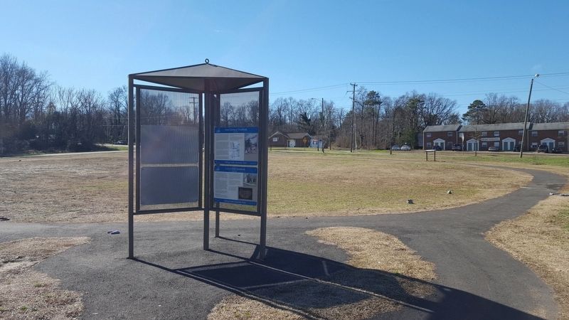
Near U.S. 1 at Marina Drive, on the right when traveling north.
Archibald Cary established an iron forge on the south bank of Falling Creek in 1750. The Chesterfield forge, as it was known, converted pig iron into bar iron. Initially unprofitable and shut down, the forge would be restarted and become . . . — — Map (db m101039) HM
Near U.S. 1 at Marina Drive, on the right when traveling north.
This is the location of the first iron furnace established in the New World, started in 1619 and completed in 1622. Iron ore had been extracted from James River outcrops as early as 1608, and these samples were shipped to England. The Virginia . . . — — Map (db m101038) HM
Near U.S. 1 at Marina Drive, on the right when traveling north.
The Falling Creek Ironworks site is located seven miles south of Richmond, along Falling Creek, adjacent to Jefferson Davis Highway. The location also serves as a gateway to the area and is a draw for visitors to the Falling Creek Greenway with . . . — — Map (db m101040) HM
On G Road at Elk Grove Drive, on the right when traveling south on G Road.
General Characteristics
Primary function: Close air support
Contractor: Fairchild Republic Co.
Power plant: Two General Electric TF34-GE-100 turbofans
Thrust: 9,065 pounds each engine
Length: 53 feet, . . . — — Map (db m289194) HM
On L Road at J Road, on the right when traveling north on L Road.
This marker commemorates the remains of six African Americans discovered approximately 75 yards west of this site during construction of the Defense Supply Center Richmond's Child Development Center in October of 1998.
Analysis prepared at . . . — — Map (db m289177) HM
Near Fort Darling Road, on the left when traveling east. Reported permanently removed.
May 15, 1862 When Federal gunboats round the bend, they enter a shooting gallery. Confederate soldiers and marines along the riverbanks rake the decks with musket fire. These batteries, ninety feet above the water, are perched too high for . . . — — Map (db m14897) HM
On L Road at Cemetery Road, on the right when traveling east on L Road.
A North American deer (Cervus Canadensis), the largest existing deer, resembling the moose but not as large, is found in North America, Scandinavia, Germany, Russia and Siberia, "Wapiti" is Shawnee for white rump and tail.
Around the turn of . . . — — Map (db m236670) HM
On U.S. 1 0.3 miles north of Chester Road, on the right when traveling south.
Around the turn of the 20th century, James Bellwood, a farmer who lived on this property, imported a pair of Rocky Mountain Elk from Yosemite National Park and Washington State. The elk made themselves at home in the shady groves an pastureland . . . — — Map (db m271177) HM
On U.S. 1 0.3 miles north of Chester Road (Virginia Route 145), on the right when traveling south. Reported permanently removed.
Around the turn of the 20th century, James Bellwood, an agriculturalist and the owner of this property set aside a few acres to be used as a wooded preserve and imported a pair of elk from Yosemite National Park and Washington State. The elk became . . . — — Map (db m271178) HM
Near Fort Darling Road 0.5 miles north of Bellwood Road.
John Smith recalled visiting the Arrohateck Indian capital during a May 1607 expedition led by Christopher Newport. The town was located on the northern shore of the James River opposite of here and was noted on John Smith’s 1612 Map of Virginia. . . . — — Map (db m37032) HM
Near Fort Darling Road 0.5 miles north of Bellwood Road.
“Mr. President, these are the young heroes of Fort Darling…. The President took them all by the hand and personally thanked them for their magnificent conduct and example, ordered that each one should receive a Medal of honor and to be . . . — — Map (db m37027) HM
On C Road 0 miles south of North 5th Street, on the right when traveling south.
This artifact is a poignant reminder of the horrific events which occurred on September 11th 2001.
Never forget that evil cannot be allowed to fester, and that good men and women stand ready to defend this nation in front of those who are . . . — — Map (db m289201) WM
On U.S. 1 0.1 miles south of L Road, on the right when traveling south.
General Characteristics
Service: Navy and Marine Corps
Primary function: multi-role attack and fighter aircraft.
Contractor: Prime, McDonnell Douglas; major subcontractor, Northrop.
Date deployed: November . . . — — Map (db m289148) HM
On L Road at 6th Street, on the left when traveling west on L Road.
The F-15 Eagle is an all-weather, extremely maneuverable, tactical fighter designed to permit the Air Force to gain and maintain air supremacy over the battlefield.
The F-15's superior maneuverability and acceleration are achieved through high . . . — — Map (db m289149) HM
On 5th Street 0.1 miles south of H Road, on the left when traveling south.
The F-16 Fighting Falcon, a compact, multi-role, highly maneuverable fighter aircraft, has proven itself in air-to-air combat and air-to-surface attack. In an air combat role, its maneuverability and combat radius exceeds that of all potential . . . — — Map (db m289175) HM
On G Road just south of Elk Grove Drive, on the right when traveling south.
The F-4 Phantom II is a tandem two-seat, twin-engine, all-weather, long-range supersonic jet interceptor and fighter-bomber originally developed for the Navy by McDonnell Douglas Aircraft. It first entered service in 1960. Proving highly . . . — — Map (db m289190) HM
Near Fort Darling Road 0.5 miles north of Bellwood Road.
Immediately after the battle, men of Chesterfield County’s own Southside Artillery, along with others, worked to strengthen the fort. The section before you was likely their first project. Eventually the earthworks around you formed an enclosed . . . — — Map (db m37029) HM
Near 6th Street at Bellwood Farms Road, on the right when traveling north.
Building 25, also known as Quarters 1, was composed of two individual houses that were originally constructed in 1901 as living quarters for laborers building the trolley lines between Richmond and Peterburg. Timber for the buildings was grown on . . . — — Map (db m289147) HM
Near Fort Darling Road 0.5 miles north of Bellwood Road.
It was the end of an era: the advent of the ironclad made traditional wooden-hulled warships obsolete. Despite this, the Confederates used a centuries-old device here: the hot-shot furnace. Inside the furnace, solid shot were heated red-hot. Clay . . . — — Map (db m55350) HM
On C Road 0.1 miles south of North 5th Street, on the right when traveling south.
Length: 19.5 ft (5.94 m)
Width: 7.25 ft (2.21 m)
Height: 5.66 ft (1.73 m)
Weight: 4,980 lb (2,260 kg)
Bore diameter: 105 mm
Maximum effective range: 6.99 mi (11.27 km)
Rate of fire (Maximum): 10 . . . — — Map (db m289202) HM
Near Fort Darling Road 0.5 miles north of Bellwood Road.
When Federal gunboats rounded the distant bend in the James, they entered a shooting gallery. Confederate soldiers and Marines along the riverbanks raked the decks with musket fire. Confederate guns here in the fort opened fire. The river . . . — — Map (db m37028) HM
On U.S. 1 north of Marina Drive, on the right when traveling north.
This stone and brick cottage is an example of the tourist courts that were popular along Route 1 in the early- to mid-20th century. During this time, Route 1 was the main highway running from Maine to Florida. In 1920, R.D. Moore built approximately . . . — — Map (db m133678) HM
On G Road at Elk Grove Drive, on the left when traveling south on G Road.
The armed OH-58D Kiowa Warrior is a single-engine, single-rotor, 4-bladed military helicopter used for observation, utility, and direct-fire support. The OH-58D is equipped with two universal quick-change weapons pylons. Each pylon can be armed . . . — — Map (db m289195) HM
On 3rd Street 0.1 miles west of L Road, on the right when traveling east.
This monument represents our tribute to our American Indian ancestors who occupied this land between 3,500 BC - 1,200 BC and used it as a seasonal procurement site. The site has since evolved into a world class supply center for the twenty first . . . — — Map (db m289182) HM
Near Fort Darling Road, on the left when traveling east.
On May 15, 1862, during the Battle of Drewry’s Bluff, Southern marksmen in rifle pits – including two companies of Confederate States Marines – swept the gun deck of USS Galena, severely limiting its ability to fight. The U.S. . . . — — Map (db m14901) HM
On Cemetery Road, on the left when traveling east.
This plot is reserved in perpetuity for the Gregory family, who owned a working plantation here between 1797 and 1866.
This site was settled in 1610 by the Thomas Sheffield family under a royal patent of 2,300 acres from the Crown of England. The . . . — — Map (db m143045) HM
Near Fort Darling Road 0.5 miles north of Bellwood Road.
During the Peninsula Campaign in the spring of 1862, a variety of innovative weapons saw action. But nothing captured the public’s attention more than ironclad warships, in particular the USS Monitor. After its epic duel with the CSS . . . — — Map (db m55346) HM
On C Road south of North 5th Street, on the right when traveling south.
The Virginia National Guard State Headquarters Building's design is environmentally responsible and compatible with its historic setting.
The Headquarters Building is located within the Bellwood-Richmond Quartermaster Depot Historic District, . . . — — Map (db m289203) HM
On C Road south of North 5th Street, on the right when traveling south.
The Virginia National Guard State Headquarters Building and Site are models of energy and environmental innovation.
Sustainable Energy Use
The Headquarters Building's energy source includes electricity provided by a solar photovoltaic . . . — — Map (db m289206) HM
Near U.S. 1 at Marina Drive, on the right when traveling north.
The history associated with Falling Creek Park spans more than 400 years. Numerous industries existed along the creek from the 17th to the early 20th century.
The earliest industry that existed at this location was the first iron furnace . . . — — Map (db m101036) HM
On U.S. 1 at Marina Drive, on the right when traveling north on U.S. 1.
Vanished now but for a trace, Falling Creek is the site of the first industrial ironworks in the New World. The close proximity of iron ore, wood for fuel and power provided by the falling water made the Falling Creek site perfect for this . . . — — Map (db m32587) HM
Near U.S. 1 at Marina Drive, on the right when traveling north.
The site of Virginia’s first wayside park was established in 1934. It was developed to serve as a picnic area by the Virginia State Highway Department and the Chesterfield Garden Club in 1933-1934. A State Historical Marker located in . . . — — Map (db m101042) HM
Near U.S. 1 at Marina Drive, on the right when traveling north.
The United Daughters of the Confederacy conceived of the Jefferson Davis Highway in 1913, along the same series of roads in Virginia that U.S. Route 1 later followed. The Virginia General Assembly officially designated the United Daughters of the . . . — — Map (db m101041) HM
Near U.S. 1 at Marina Drive, on the right when traveling north.
The United Daughters of the Confederacy conceived of the Jefferson Davis Highway in 1913, along the same series of roads in Virginia that U.S. Route 1 later followed. The Virginia General Assembly officially designated the United Daughters of the . . . — — Map (db m101045) HM
Near U.S. 1 at Marina Drive, on the right when traveling north.
Located at this site was the beginning of one of the earliest residential communities in Chesterfield County.
Historic Village Of Bensley
Created by Albert Bensley in 1909, the Village of Bensley was marketed as a modem, convenient . . . — — Map (db m101037) HM
Near U.S. 1 at Marina Drive, on the right when traveling north.
Located at this site was the beginning of one of the earliest residential communities in Chesterfield County.
Historic Village Of Bensley
Created by Albert Bensley in 1909, the Village of Bensley was marketed as a modem, convenient . . . — — Map (db m101044) HM
Near U.S. 1 at Marina Drive, on the right when traveling north.
The Falling Creek Ironworks site is located seven miles south of Richmond, along Falling Creek, adjacent to Jefferson Davis Highway. The location also serves as a gateway to the area and is a draw for visitors to the Falling Creek Greenway with . . . — — Map (db m101043) HM
Near Henricus Park Road 1.3 miles east of Coxendale Road.
This monument is erected in memory of the English settlers who died in the 1622 Indian attack that was organized by Chief Opechancanough. On March 22, 1622, the Powhatan chiefdom launched a coordinated offensive against the English settlements . . . — — Map (db m278728) HM
Near Old Bermuda Hundred Road east of Ramblewood Drive, on the right when traveling east.
A Bomb Proof Church ?
The purpose of this structure remains a mystery. It may be the remains of one of the "Bomb Proof” churches that were built in this part of the Howlett Line. One such church was built by men of the 17th Virginia, . . . — — Map (db m101030) HM
Near Enon Church Road east of Ramblewood Drive, on the left when traveling west.
John Smith and some fellow Englishmen made an exploratory trip up the James River just weeks after settling at Jamestown, passing by the high rock cliff that projects into the channel of the Appomattox River near its confluence with the James. The . . . — — Map (db m271175) HM
On Battery Dantzler Road 0.2 miles east of Old Stage Road, on the left when traveling east.
In 1862, Confederate authorities considered locating the main defensive James River battery here to block the Union navy’s approach to Richmond. They chose Drewry’s Bluff instead because they feared that Union forces would bypass this position by . . . — — Map (db m16058) HM
Near Battery Dantzler Road 0.2 miles east of Old Stage Road.
First named Ft. Howlett, the battery was renamed after Col. Olin M. Dantzler, who was killed on June 2, 1864, in an attempt to capture Ft. Dutton. Leading the 22nd South Carolina Inf. the attack failed. Battery Dantzler played a major role in . . . — — Map (db m16066) HM
On Battery Dantzler Court 0.3 miles east of Old Stage Road, on the left when traveling east.
Confederate forces began construction of this earthen fort known as Battery Dantzler on May 18, 1864. The Confederates occupied this position after the Battle of Ware Bottom Church. In that action, Union Major General Benjamin F. Butler's Army of . . . — — Map (db m185614) HM
On West Hundred Road (Virginia Route 10) at Old Stage Road, on the right when traveling east on West Hundred Road.
A half-mile northeast stands Battery Dantzler, named for Col. Olin Miller Dantzler, 22d South Carolina Infantry (killed in action nearby on 2 June 1864), and constructed in May-June 1864 to block the Union navy's approach to Richmond. The battery . . . — — Map (db m17113) HM
On West Hundred Road (Virginia Route 10) 0.1 miles east of Parker Lane, on the right when traveling east.
Here, on May 10, 1864, as part of Butler’s Bermuda Hundred Campaign, 3400 Federals and 2000 Confederates fought the Battle of Chester Station. This monument is erected in their memory by the Chester Station Camp #1503. Sons of Confederate . . . — — Map (db m17092) HM
On West Hundred Road (Virginia Route 10) east of Parker Lane, on the right when traveling east. Reported missing.
On May 5, 1864, Gen. Benjamin F. Butler’s Union Army of the James landed at Bermuda Hundred to sever direct communication between Richmond and Petersburg. Five days later, desperate to keep the connection open, 2,000 Confederates under Gen. Robert . . . — — Map (db m235891) HM
On West Hundred Road (Virginia Route 10) near Parker Lane, on the right when traveling east.
On May 5, 1864 Union Gen. Benjamin F. Butler's Army of the James landed at Bermuda Hundred to sever Confederate communication lines between Richmond and Petersburg. Five days later to keep the connection open, 2,000 Confederates under . . . — — Map (db m245750) HM
On Bermuda Hundred Road 1.4 miles east of Allied Road, on the right when traveling east.
Established 1613 by Sir Thomas Dale.
First incorporated Virginia town 1614.
Home of John Rolfe, colony recorder, who married Pocahontas.
Rev. Alexander Whitaker ministered here.
Early port of Richmond.
Erected … 1938 by Bermuda Hundred . . . — — Map (db m17109) HM WM
On Bermuda Hundred Road 1.4 miles east of Allied Road, on the right when traveling east.
Before determining to settle at Jamestown, the English sought a safe place to plant their colony further west along the James River. On that trip, John Smith and his fellow Englishmen found an Appamattuck Indian town in the vicinity of Bermuda . . . — — Map (db m17134) HM
On East Hundred Road (Virginia Route 10), on the right when traveling west. Reported missing.
A mile north, on the site of an important Appamatuck Indian village, Sir Thomas Dale established Bermuda Hundred in 1613. The hundred was a traditional English jurisdiction of one hundred families. Dale, the deputy governor and marshal of Virginia, . . . — — Map (db m298740) HM
On Bermuda Hundred Road 1.4 miles east of Allied Road, on the right when traveling east. Reported permanently removed.
Union Gen. Benjamin Butler’s 30,000-man Army of the James landed here without opposition on May 5, 1864. Despite his surprise arrival, Butler proved unable to take advantage of the unprepared Confederate defenders below Richmond.
He pushed west . . . — — Map (db m17108) HM
On Bermuda Hundred Road 1.4 miles east of Allied Road, on the right when traveling east.
In the spring of 1864, Union Gen. Ulysses S. Grant, commander of all Federal armies, ordered advances throughout the Confederacy. On May 5, Union Gen. Benjamin F. Butler landed his Army of the James here on Bermuda Hundred to operate against . . . — — Map (db m291775) HM
Near Ware Bottom Spring Road 0.1 miles east of Old Stage Road, on the right when traveling east.
This prominent battery in Robert E. Lee’s Army of Northern Virginia often went by its nickname, “The Boy Company.” Although the average battery member was 25 years old, the company had several lads between the ages of 14 and 19.
Under its . . . — — Map (db m66324) HM
Near Henricus Park Road 1.3 miles east of Coxendale Road.
The story of Dutch Gap demonstrates the importance of the river throughout history revealing a partnership of man’s use of land and water. Today, the river’s commercial and recreational activities continue, providing a backdrop to Dutch Gap’s . . . — — Map (db m16159) HM
On U.S. 1 0.1 miles south of West Hundred Road ( Route 10), on the right when traveling north.
At this station, two miles west, the Union army of the James, turning toward Richmond, fought an action on May 10, 1864 and tore up the railroad. — — Map (db m17097) HM
On Henricus Park Road 1.3 miles east of Coxendale Road, on the right when traveling east.
Free enterprise had its beginnings in the New World on this site in 1611. Sir Thomas Dale, following orders from the London Company to "find a more beautiful place," moved westward from Jamestown and built a town out of the wilderness.
The . . . — — Map (db m278730) HM
On East Hundred Road (Virginia Route 10) at Point of Rocks Road, on the right on East Hundred Road.
Colonel Thomas Lygon, who came to the Virginia colony in the early 1640s from Worcestershire, England, patented several large parcels of land on the north bank of the Appomattox River in an area known as The Cowpens, near Mount My Lady, which was . . . — — Map (db m17131) HM
On U.S. 1 0.2 miles north of Leighworth Boulevard, on the right when traveling north.
On 2 June 1864, Confederate Gen. P. G. T. Beauregard sent Maj. Gen. Bushrod Johnson's troops toward nearby Federal pickets to reconnoiter their strength. The Confederate troops initially captured the northern portion of the Federal picket line, but . . . — — Map (db m17122) HM
Near Old Bermuda Hundred Road east of Ramblewood Drive, on the right when traveling east.
Construction of the Howlett Line
The earthworks here were constructed after the Battle of Ware Bottom Church. Prior to that, this area was the advanced picket line for the Army of the James and would have consisted of a series of rifle . . . — — Map (db m73982) HM
On Virginia Route 301 0.2 miles south of Willis Road, on the left when traveling south.
On a line that here crossed the Richmond–Petersburg turnpike, Confederate troops under command of General G.T. Beauregard attacked the Federal army of Major-General B.F. Butler on May 16, 1864 and forced its withdrawal to the Bermuda Hundred . . . — — Map (db m14275) HM
On Perrymont Road 0.1 miles north of Norcliff Avenue, on the left when traveling north.
Here, on the second line of the Drewry’s Bluff defences, Confederate troops were concentrated May 12-15, 1864, to take the offensive against a Federal force that had advanced from Bermuda Hundred under command of General B.F. Butler and had cut the . . . — — Map (db m14274) HM
Near Henricus Park Road 1.3 miles east of Coxendale Road, on the left when traveling east. Reported permanently removed.
1611 Sir Thomas Dale and his men, using a tactic developed in the Dutch Low Country, dug a ditch and erected a fence across the neck of the peninsula for the defense of Henricus.
1864 Federal forces under General Benjamin Butler . . . — — Map (db m288108) HM
Near Henricus Park Road 1.3 miles east of Coxendale Road (County Route 615).
With the opposing armies locked in a protracted struggle around Petersburg and Bermuda Hundred, the James and Appomattox Rivers assumed added importance. In August 1864, Union Gen. Benjamin Butler began excavations at Dutch Gap. When completed, . . . — — Map (db m16150) HM
Near Henricus Park Road 1.3 miles east of Coxendale Road.
The trail at Dutch Gap traces the old channel of the James River. Before the river was rerouted, there was a ferry landing on the opposite shore called Osborne’s Landing. This may have been the location of the enigmatic Port Cotage referenced by . . . — — Map (db m288111) HM
On North Enon Church Road (Virginia Route 618) at Bermuda Hundred Road, on the right when traveling north on North Enon Church Road.
Enon Baptist Church was organized on 8 October 1849. The church was built here on a one-acre tract given by the founder, John Alexander Strachan. In May 1864, during the Civil War, Union army troops under Maj. Gen. Benjamin F. Butler dismantled Enon . . . — — Map (db m24990) HM
On Henricus Park Road 1.3 miles east of Coxendale Road, on the right when traveling east.
You are now on Farrar's Island. Here in 1611, Sir Thomas Dale established the "Citie of Henryco", one of Virginia's first four primary settlement areas under the Virginia Company of London. Later, this land was part of a 2,000-acre patent issued . . . — — Map (db m278731) HM
On U.S. 1 0.1 miles north of Osborne Road, on the right when traveling south.
In 1611, Farrar's Island was the site of the "Citie of Henrico," one of Virginia's first four primary settlement areas under the Virginia Company of London. Later, it was part of a 2,000-acre land patent issued posthumously to William Farrar in . . . — — Map (db m16018) HM
Near Henricus Park Road 1.3 miles east of Coxendale Road, on the right when traveling north.
On August 10, 1864, Colonel Alonzo Alden, who commanded the 169th N.Y. Infantry, brought his regiment here and took command of all the troops working at "Dutch Gap Canal." Those troops were his regiment, the 16th NY Heavy Artillery, several . . . — — Map (db m278806) HM
On Centralia Road (Virginia Route 145) just west of Chester Road ( Route 144).
In 1867, the African American members of
nearby Salem Baptist Church separated and
founded Salem African Baptist Church. The
new congregation held worship services under
a brush arbor before constructing a building
here on a one-acre tract . . . — — Map (db m107773) HM
Dedicated to the memory of the men of the First Virginia Infantry Regiment. Army of Northern Virginia. Killed near this place on 16 May 1864.
Alphonzo A. Figner, Company I
Archibald D. Govan, Company D
Jerry Toomey, Company B
James A. . . . — — Map (db m25012) HM
Near Greyledge Boulevard at Greyledge Court, on the right when traveling east.
Fort Wead was built in June, 1864 by members of the 1st NY Engineers, assisted by the labors of various infantry units of the Army of the James. The fort was named after Col. Frederick M. Wead of the 98th NY Infantry, killed at the battle of Cold . . . — — Map (db m184750) HM
On Iron Bridge Road (Virginia Route 10) west of Branders Bridge Road, on the right when traveling east.
After African American patrons campaigned for a new high school, the Chesterfield County School Board opened the consolidated George Washington Carver High School here in 1948. Carver, which replaced the old Hickory Hill and Daniel Webster Davis . . . — — Map (db m149856) HM
Near Henricus Park Road 1.3 miles east of Coxendale Road, on the right when traveling north.
Are these the grave holes of the first Union soldiers KIA here during the fighting in the Civil War?
On August 13, 1864 several units of the Army of the James were ordered to move up into positions at the historical narrow neck of land . . . — — Map (db m278811) HM
On U.S. 1 at Wonderview Drive, on the right when traveling north on U.S. 1.
This old inn was the headquarters of Major-General B. F. Butler's Union Army of the James during the Battle of Drewery's Bluff, May 16, 1864. The inn was so named because of its location about midway between Richmond and Petersburg. — — Map (db m16043) HM
On U.S. 1 at Wonderview Drive, on the right when traveling north on U.S. 1.
As Grant grappled with Lee in the Wilderness and near Spotsylvania Court House in May 1864, Union Gen. Benjamin Butler landed with 30,000 troops at Bermuda Hundred, eight miles east of here. Butler’s objective was to open another front and to . . . — — Map (db m16041) HM
Near Henricus Park Road 1.3 miles east of Coxendale Road.
The Colonial Dames
Of America in the
State of Virginia
A.D. 1910
Erect this monument on the site
Of the Town of Henricopolis
To commemorate the college
And university which on
May 26, 1619.
The Virginia Company of
London decreed . . . — — Map (db m16149) HM
Near Henricus Park Road 1.3 miles east of Coxendale Road.
Near this spot, the Arrohateck Indians greeted John Smith and his compatriots during their May 1607 exploration upriver from Jamestown. Smith’s 1612 Map of Virginia shows Arrohateck towns on both shores of the James below present-day Richmond. . . . — — Map (db m16335) HM
Near Ware Bottom Spring Road 0.1 miles east of Old Stage Road, on the right when traveling east.
These earthworks are part of the Confederate defensive position known as the Howlett Line. It was a string of interconnected redoubts and entrenchments that stretched for eight miles. The line took its name from the Howlett House located at its . . . — — Map (db m66325) HM
Near Ware Bottom Spring Road 0.1 miles east of Old Stage Road, on the right when traveling east.
These earthworks are part of the strong Confederate defensive position known as the “Howlett Line.” Composed of a string of interconnected redoubts and trenches, the line ran eight miles north and south and was named for the Howlett House which . . . — — Map (db m164337) HM
Near Old Bermuda Hundred Road east of Ramblewood Drive, on the right when traveling east.
The ground you are standing on would have been a very dangerous place from May of 1864 until the fall of Petersburg in April of 1865. In front of you is one of the many gun positions that the Confederates used to protect the Howlett Line. This . . . — — Map (db m73964) HM
On Henricus Park Road 1.4 miles east of Coxendale Road, on the left when traveling east.
As the small band of Jamestown colonists explored the upper reaches of the tidal James River in May 1607, they stopped twice at the town of Arrohateck, home to an estimated 255 Algonquian-speaking natives. On both occasions they were welcomed by . . . — — Map (db m278732) HM
On U.S. 1 at County Route 288, on the right on U.S. 1.
The Union Army of the James, retiring across Proctor's Creek in this vicinity after the battle of Drewry's Bluff, May 16, 1864, turned east into the Peninsula between the James and Appomattox Rivers, where it was "Bottled" by Confederate forces. — — Map (db m16045) HM
On Henricus Park Road 1.3 miles east of Coxendale Road, on the right when traveling east.
Dr. Pastore learned of the presence of Mt. Malady, the first hospital in North America, situated at the 1611 Citie of Henricus. He developed the concept of its reconstruction, promoted local interest in the project, acquired various parcels of . . . — — Map (db m278729) HM
Near Henricus Park Road 1.3 miles east of Coxendale Road.
(panel 1)
John Smith Explores the Chesapeake
Captain John Smith explored the Chesapeake Bay in the early 1600s seeking precious metals and a passage to Asia. He traveled the James, Chickahominy, and York rivers in 1607, and led . . . — — Map (db m128321) HM
On Henricus Park Road 1.4 miles east of Coxendale Road, on the left when traveling east.
Captain John Smith explored the Chesapeake Bay in the early 1600s seeking precious metals and a passage to the Pacific. He traveled the James, Chickahominy and York rivers in 1607, and led two major expeditions on the Chesapeake from Jamestown in . . . — — Map (db m278734) HM
On Henricus Park Road 1.4 miles east of Coxendale Road, on the left when traveling east.
Explore the places John Smith and the English colonists traveled in the early 1600s. Learn about the thriving American Indian communities and the bountiful richness that still exists in the region today.
For more than 3,000 miles, the . . . — — Map (db m278733) HM
On U.S. 1 0.4 miles north of Old Bermuda Hundred Road, on the right when traveling north.
To the east, Confederate Gen. Robert E. Lee briefly made his headquarters at Clay's house on 17 June 1864. There he received full details of the Union army's attack on Petersburg that began the evening of 15 June 1864. Lee learned that Lt. Gen. . . . — — Map (db m272904) HM
On East Hundred Road (Virginia Route 10) 0.1 miles west of Allied Road, on the right when traveling west.
Mary Randolph, a native of Chesterfield County and author of the first American regional cookbook, lived nearby at Presquile Plantation during the last two decades of the 18th century after her marriage to David Meade Randolph in 1782. The couple . . . — — Map (db m11678) HM
Near 251 Henricus Park Road 1.3 miles east of Coxendale Road, on the right when traveling east.
The earthen mound you see here is the Civil War remains of an 1864 mortar position built under fire by the 1st New York Engineers in September 1864. Men of the 1st Connecticut Heavy Artillery brought 8-inch mortars here to engage Confederate . . . — — Map (db m288508) HM
1688 entries matched your criteria. The first 100 are listed above. Next 100 ⊳