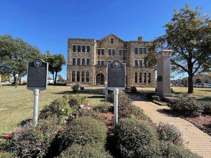
On South Center Street (State Highway 79), on the right when traveling north.
Jesse James, celebrated 1860s-82 Missouri outlaw, used to visit in Archer City in house built by Stone Land and Cattle Company for its manager, Allen H. Parmer (1848-1927), his Confederate comrade of the Civil War and husband of his sister Susan . . . — — Map (db m187140) HM
On South Center Street at East Plum Street, on the left when traveling south on South Center Street.
This congregation began as a mission in 1880, the same year Archer City was organized. The earliest pastors, including the Rev. D.D. Duncan and the Rev. I.N. Crutchfield, were circuit riders who also served neighboring counties. Members of Archer . . . — — Map (db m269323) HM
On State Highway 79 0.3 miles north of Sam Cowan Road, on the right when traveling south.
A part of the Peters Grant, 1841
Created January 22, 1858
Organized July 27, 1880
Named in honor of
Dr. Branch Tanner Archer
1790-1856
Texas Commissioner to the
United States, 1835, Member of
Congress, Secretary of War
of . . . — — Map (db m187144) HM
On State Highway 25 4.5 miles west of State Highway 79, on the right when traveling west.
The civilized world first heard of copper in this area from Texas Rangers after an 1860 campaign against Comanches on the Pease River, about 100 miles to the northwest. The Ranger Captain, Lawrence S. ("Sul") Ross, later to serve Texas as Governor, . . . — — Map (db m17912) HM
On South Center Street (State Highway 79), on the right when traveling north.
M. P. Andrews No. 1, drilled in 1911, reached oil sands at 920 feet. Well first flowed oil, March, 1912, at rate of 10 barrels a day.
Production in this shallow sand development area fell off when oil prices dropped, but rose after other . . . — — Map (db m187139) HM
On East Pecan Street at North Sycamore Street, on the right when traveling west on East Pecan Street.
By 1909 Archer County had outgrown its original jail, a 16-foot square frame building. Construction on this larger facility was completed in Sept. 1910. The sandstone structure was designed with living quarters for the sheriff and his family on the . . . — — Map (db m187143) HM
On East Main Street (State Road 25) at N Center St (State Road 79), on the right when traveling west on East Main Street.
Archer County was given its name Jan. 22, 1858 by an act of the Texas Legislature in honor of Branch Tanner Archer's service in the Texas Republic. Archer was born in Virginia on Dec. 31, 1790, where he later studied medicine. He came to Texas to . . . — — Map (db m269326) HM
On South Center Street (State Highway 79), on the right when traveling north.
Strategically established during Civil War on defense line Red River to Rio Grande where Gainesville-Fort Belknap Road crossed west fork Trinity River about 10 miles south, 4 miles east of Archer City. Texas Frontier Regiment patrolled area . . . — — Map (db m187138) HM
On State Highway 79 at Falls County Road, on the right when traveling south on State Highway 79.
Landowner Charles E. Graham (1872-1937) in 1908 granted the Wichita Falls and Southern Railroad a route across his property and platted a town at this site. Anarene was named for his wife Annie Lawrence Graham, daughter of pioneer cattleman J. . . . — — Map (db m187146) HM
On South Oak Street at West Plum Street, on the left when traveling south on South Oak Street.
Soon after Archer City was laid out in 1879, a building intended for a saloon was bought by residents for use as a schoolhouse. In February 1880, eight members organized First Baptist Church in the school building and worshiped there until a . . . — — Map (db m269324) HM
On Farm to Market Road 210 0.7 miles east of Dugan Road, on the right when traveling west.
In the mid-1700s, Indians of this region met at a trading ground near this site with Frenchmen who brought them manufactured goods, sometimes including guns and ammunition - products denied them by the Spanish who held sovereignty, but could not . . . — — Map (db m187195) HM
On South Center Street (State Highway 79), on the right when traveling north.
This stone is erected
to the memory of
Sheriff E. Harrison Ikard
by the Commissioner's Court
American Legion
and loyal friends
in recognition of
a man who holding sacred
a public trust
answered duties call
fearless unto . . . — — Map (db m187141) HM
On Farm to Market Road 368 at Stonewall Road, on the right when traveling north on Road 368.
Area Confederate veterans officially formed the Stonewall Jackson Camp #249, United Confederate Veterans, in 1897. The group purchased 106 acres located south of Holliday, along Holliday Creek, as a permanent location for meetings and reunions. . . . — — Map (db m187233) HM
On U.S. 82 Frontage Road at Business U.S. 277, on the right when traveling east on U.S. 82.
Born Hollidaysburg, Pennsylvania; came to Texas about 1835, joined Texian Army, and was one of 24 survivors of the Goliad Massacre, March 27, 1836. Joined Texian-Santa Fe Expedition, and en route to New Mexico, Aug. 4, 1841, carved his name on a . . . — — Map (db m187196) HM
On Farm to Market Road 368 at Dad's Corner Road, on the right when traveling north on Road 368.
The result of a 1923 oil boom, development of a town at this site included some twenty-two businesses, including a food stand operated by a man with the nickname "Dad", which provided a name for the settlement. Located at this crossroads were a . . . — — Map (db m187230) HM
On Farm to Market Road 368 at Geraldine Road, on the right when traveling north on Road 368.
In 1901, after failing to locate suitable land in Oklahoma, the American Tribune New Colony Company of Indianapolis acquired over 59,000 acres in this area for an immigration project. A post office was established in March 1902, and by grand . . . — — Map (db m187227) HM
On South Main Street (Farm to Market Road 368) 0.1 miles south of Olive Street (Business U.S. 277), on the right when traveling south.
The town of Holliday was officially organized near Holliday Creek in 1890, when the city was platted. The Wichita Valley Railway was built through the area, and a post office was established. In that same year, Maggie Elizabeth Holt and H.W. . . . — — Map (db m128750) HM
On State Highway 16 at Prideaux Road, on the right when traveling south on State Highway 16.
On August 3, 1859 US Indian Agent Robt. S. Neighbors passed this way and camped near here with 1,051 Indians, carts, wagons, cattle, horses and four companies of US Cavalry and Infantry en route to Indian Territory Oklahoma to relocate the tribes . . . — — Map (db m157928) HM
On State Highway 114 at 5th Street, on the right when traveling west on State Highway 114.
In 1910, thirty years after the Texas Legislature created Archer County, the Gulf, Texas & Western Railroad began extending its track from Jacksboro to Seymour. That year the Trinity Townsite Company laid out a new town along the tracks on land . . . — — Map (db m187149) HM
On State Road 114 at Ranch to Market Road 1285, on the right when traveling east on State Road 114.
Residents of this part of Archer County in the 1880s included Ireland native James Colgan and his wife, Nancy. Most other area families were of Bohemian descent, with names including Kulhanek, Bohac, Kunkel and Pechacek. The GT&W Railroad came in . . . — — Map (db m254055) HM
On State Highway 114 at 5th Street, on the right when traveling west on State Highway 114.
After living 1854-58 on the reservation set aside by State of Texas near Camp Cooper (30 mi. SW), the Comanche Indians with their goods were removed to Oklahoma. Near this spot on a head branch of Kickapoo Creek (so named, 1830) the . . . — — Map (db m187150) HM
In 1909, a group of Czech immigrants began to meet in parishioners' homes around Megargel to celebrate Holy Mass with Father Philibert Haase. The Czech community built the present house of worship in 1916. On May 1, 1917, the church was dedicated to . . . — — Map (db m254058) HM
On State Highway 79 0.1 miles east of Hilton Road, on the right when traveling south.
The Trinity, a major Texas river rises 250 yards west of this 1250-foot mound. South of this site water drains to the Brazos, and north and west to the Red. This high point has been important in Texas history. It guided Capt. Diego Parilla to battle . . . — — Map (db m187147) HM
On U.S. 281 at 2nd Street, on the right when traveling south on U.S. 281.
German native John H. Meurer (b. 1850) settled his family in this area about 1900 when he became a land agent for H. J. Scott of the Clark and Plumb Company. In selling over 60,000 acres of land, Meurer helped to establish the towns of Windthorst . . . — — Map (db m157893) HM
On Saint Marys Street at North Chuch Street on Saint Marys Street.
Born August 7, 1930, Paul J. (Buddy) Himmels was the only living son in a family of eleven children born to Paul H. and Theresa (Goedtkin) Himmels of Windthorst, Texas. Paul had one brother, Francis (d. 1940), and nine sisters, Helen Berend, Ida Mar . . . — — Map (db m269252) WM
On Saint Marys Street at North Church Street on Saint Marys Street.
USMC 6th Div
Born November 18, 1925
Rhineland, Texas
Killed In Action
Okinawa, Japan
May 14, 1945
Leo loved. He loved his family: all 9 siblings; his parents, Anton and Grace Blake. He loved homemade bread, real milk and reading . . . — — Map (db m269251) WM
On Saint Marys Street at North Church Street on Saint Marys Street.
Gary was born on May 24, 1985 in Wichita Falls, Texas, to Angela and J.B. "Nubbin" Johnston. He has 2 sisters, Holly and Sabrina, and one nephew, Ethan Scott. He started school in Archer City where he played little league baseball, basketball and . . . — — Map (db m269253) WM
On Saint Marys Street at North Church Street on Saint Marys Street.
Obtaining 75,000 acres of Archer County land for a farm colony in 1891, German-American Catholics planted cross here and laid off Windthorst around a 20-acre site for church, school, and rectory. Ernest Hoff built town's first structure, a home. . . . — — Map (db m269250) HM
On South Washington Street at McLain Street, on the left when traveling south on South Washington Street.
Created February 1, 1858 Organized April 23, 1879
Named in honor of Dr. Henry W. Baylor
1818-1854
Indian fighter and Ranger Captain served in the Mexican War.
Seymour, the County Seat — — Map (db m178509) HM
On North East Street at East Morris Street, on the right when traveling north on North East Street.
Built 1877 by Charles Holman, builder-carpenter from Sweden. Stone was quarried south of town. Over the years, structure housed school, churches, newspaper office and a community center.
It was purchased by J. E. McClelen in 1949 and restored . . . — — Map (db m187153) HM
On Farm to Market Road 1286 0.5 miles south of State Highway 114, on the right when traveling south.
One of four couples who were cofounders of town of Seymour; he was born in Tennessee, she in Arkansas. Wealthy plantation owners, they came to this area in 1878 after economic hardships of Civil War and Reconstruction.
From 160 acres of land . . . — — Map (db m254052) HM
On North East Street at East Oregon Street, on the left when traveling north on North East Street.
Organized March 1880 with 12 members: Mr. and Mrs. N. M. Bandy, Mr. Banteau, Miss May Boone, Judge and Mrs. R. J. Browning, Mr. and Mrs. Buck McEwen, Mr. and Mrs. E. A. Ransom, Mr. and Mrs. Windy Turner.
Early services were held in Baylor . . . — — Map (db m187154) HM
On U.S. 82 0.7 miles west of U.S. 183, on the right when traveling east.
Principal cattle trail from Texas to Kansas and beyond from 1876 to 1887; superseded the Chisholm Trial after Dodge City replaced Abilene as the main intermediate northern beef market.
As its name implies, the Western Trail ran west of the . . . — — Map (db m187155) HM
On East Street at County Highway 466, on the right when traveling south on East Street.
Established in 1908, when services and masses were held in Mary's Creek schoolhouse or in home of Matt Marak. First church edifice was built 1909, with John Cocek, Marak, Leopold Skrehot, and Alois Sykora, trustees. Father Paul Mosler was installed . . . — — Map (db m200400) HM
On State Highway 114 0.4 miles east of Hale Road, on the right when traveling west.
Platted in 1910 on the Gulf, Texas and Western Railroad, Westover developed into a small market center providing goods and services for area farmers and ranchers. J. W. Stevens offered part of his ranchland for the townsite, which was given the . . . — — Map (db m187151) HM
On State Highway 114 0.4 miles east of Hale Road, on the right when traveling west.
One-half mile east of this site is the location of the former Westover School, which served students in this part of Baylor County from 1910 until 1950. School classes first met in the Church of Christ building in Westover until trustees constructed . . . — — Map (db m187152) HM
On Farm to Market Road 1286 0.5 miles south of State Road 114, on the left when traveling south.
Sheriff of Baylor County 1912-1916. A champion of the law, he was feared by the many rustlers and bandits in area. He gave his life in the line of duty.
First wife was Barnetta (Ashton); second, Sarah E. (Scott). He was Presbyterian. . . . — — Map (db m254054) HM
On North 3rd Street, on the left when traveling north.
The town of Bangs was established on the route of the Santa Fe Railroad, which deeded land to the city for a school. The first school building, a two-room frame structure on the south side of the railroad tracks, was completed in 1892. Miss Clemie . . . — — Map (db m290737) HM
On Crockett Drive at Memorial Park Drive, on the right when traveling north on Crockett Drive.
Texas National Guard units of the 36th Infantry Division "Texas Division" from 71 cities received orders to mobilize on November 25, 1940 at Camp Bowie, Brownwood, Texas, to prepare for war. They were known as the T-Patchers for the shoulder patch . . . — — Map (db m254279) HM WM
On Center Avenue at Austin Avenue on Center Avenue.
It is estimated that the song “Hey Paula” has been played almost every day somewhere in the world since it was recorded in the fall of 1962. The song and its performers, Paul and Paula, exhibited the “Universal Lovers” image and theme that was . . . — — Map (db m220768) HM
On Morris Sheppard Drive at Crockett Drive, on the left when traveling east on Morris Sheppard Drive.
The 10.5 cm leFH 18 (German: leichte Feldhaubitze "light field howitzer") is a German light howitzer used in World War II and the standard artillery piece of the Wehrmacht, adopted for service in 1935 and used by all divisions and artillery . . . — — Map (db m247836) HM
On Burnett Road south of Memorial Park Drive, on the right when traveling north.
Joe Henry (J.H.) Childs was born in Cross Plains on 17 January 1920. He attended Cross Plains schools where he was an outstanding athlete in multiple sports. He graduated from Cross Plains High School in 1938 and played on the freshman football team . . . — — Map (db m247986) HM
On Burnett Road at Morris Sheppard Drive on Burnett Road.
The 8cm kanon vz. 30 (canon model 30) was Czech field gun used in World War II. It was in service from 1930-1945. Gun captures after the German invasion of Czechoslovakia in March 1939 were taken into Wehrmacht service as the 8cn FK 30(t). It was . . . — — Map (db m247838) HM
Near East Commerce Street west of Kelcy Way, on the right when traveling west.
Lednicky Park is named in honor of Ben Lednicky, for his
work on the roadside parks of Texas.
Lednicky began his career with the Texas Highway
Department after graduating from Texas A&M University
in 1937. His career was dedicated to the . . . — — Map (db m246097) HM
On Crockett Drive south of Memorial Park Drive, on the right when traveling north.
Brigadier General Dan L. Locker, USAF MC was born 23 June 1946 in San Antonio to Dr. and Mrs. Braswell Locker. Raised in Brown Co., he graduated from Brownwood High School in 1964 then Southwest Texas State in 1967. After teaching school at Early . . . — — Map (db m248787) HM WM
On Crockett Drive south of Memorial Park Drive, on the right when traveling north.
Brigadier General (BG) Stephen D. Korenek was born on 7 September 1946. He began his 35 year Army career as a distinguished military graduate from Texas A&M University on 25 May 1968. He was commissioned an Infantry Second Lieutenant and completed . . . — — Map (db m248194) HM WM
On South Greenleaf Street at East Adams Street, on the right when traveling north on South Greenleaf Street.
One of ten children, Brooke Smith was born in 1853 to Paulina Thilman (Doswell) and John Snelson Smith, Jr. In Hanover County, Virginia. The family moved to Indiana in 1860 and then to Waco, Texas ten years later. There, Brooke became a clerk at . . . — — Map (db m220761) HM
On East Commerce Street, on the right when traveling south.
Created August 27, 1856; Organized March 21, 1857. Named for Capt. Henry S. Brown; came to Texas in 1824; Indian trader and fighter, commanded a company at the Battle of Velasco, member of the Convention of 1832; county seat, Brownwood 1856; moved . . . — — Map (db m220746) HM
On North Broadway Street at North Center Avenue, on the right when traveling west on North Broadway Street.
In 1901, Brown County commissioners determined their 1881 jail no longer met the needs of the county, and voters authorized the issuance of bonds to pay for the construction of a new facility. The commissioners hired Martin, Moodie and Co. of . . . — — Map (db m201806) HM
On East Depot Street 0.1 miles east of South Greenleaf Street.
Built in 1914 immediately east of the Brownwood Santa Fe Railroad Depot, this was one of a series of restaurants operated along the Santa Fe line by the Fred Harvey Company, product of railroad agent Fred Harvey's idea to provide superior food and . . . — — Map (db m220757) HM
Santa Fe Railroad Depot
has been listed in the National Register of Historic Places by the United States Department of the Interior
1976
Brownwood Santa Fe Passenger Depot
Railroad construction began in Brown County in 1884, and . . . — — Map (db m201803) HM
Near Crockett Drive at Memorial Park Drive, on the right.
The original Camp Bowie was a World War I training
camp near Fort Worth, Texas. On September 19, 1940,
the U.S. War Department authorized construction
of a new "Camp Bowie" near Brownwood. On
September 27, 1940 work began on the site. The . . . — — Map (db m246099) HM
On Crockett Drive at Memorial Park Drive, on the right when traveling north on Crockett Drive.
This is the only known surviving piece of the original 100 foot flagpole that was located on the west side of the Camp Bowie Parade Ground. It was 12 inches in diameter with a circular base made from native stone and four points of the compass set . . . — — Map (db m251050) HM WM
On South Broadway Street at Fisk Avenue, on the right when traveling west on South Broadway Street.
Located 13 mi. southwest, this camp was one of a chain of Texas frontier posts a day's horseback ride apart from the Red River to the Rio Grande. Occupied by the Texas Frontier Regiment. Patrols and scouting parties frequently sent out kept Indian . . . — — Map (db m220747) HM
On Crockett Drive at Memorial Park Drive, on the right when traveling north on Crockett Drive.
This memorial is dedicated to all Veterans - Active Duty, Retired, Honorably Discharged, National Guard, and Reserves - living and deceased - who answered the call and served in any branch of our Armed Forces (especially those from Brown County who . . . — — Map (db m254288) WM
On Crockett Drive at Memorial Park Drive, on the right when traveling north on Crockett Drive.
Corporal Charles E. Kelly (born September 23, 1920, Pittsburgh, PA) Company L, 143rd Infantry Regiment, 36th Infantry Division "Texas Division", was the first man to be decorated with the Congreessional Medal of Honor on the European continent in . . . — — Map (db m254336) HM WM
John Wesley Hardin was one of the most notorious outlaws of the old west and Charlie Webb was a Brown County sheriff's deputy who was shot and killed by Hardin. Charlie Webb was a Texas Ranger and served Brown and San Saba Counties. In 1874 Webb had . . . — — Map (db m248265) HM
On East Commerce Street (U.S. 67/84), on the right when traveling west.
Settled 1857. Acquired a post office 1858. An oil vein ruined 1860s water well of townsite donor Greenleaf Fisk. Wagon-yard keeper Martin Meinsinger sold medicinal oil from 1878 well. Commercial drilling began 1889.
Farming, cotton sales, . . . — — Map (db m263954) HM
On Austin Avenue (Farm to Market Road 2524) at Avenue D, on the right when traveling north on Austin Avenue.
The oldest "Educational Building" in constant use in Texas. Built by Modie and S.R. Coggin, it was opened in 1876 as Coggin Academy.
It became Daniel Baker College in 1889, being used for classrooms and home for Dr. B.T. McClelland, founder of . . . — — Map (db m248288) HM
On South Broadway Street at North Center Avenue, on the left when traveling west on South Broadway Street.
Brothers Samuel R. Coggin (1831-1915) and Moses J. "Mody" Coggin (1824-1902), prominent area ranchers, business leaders, and philanthropists, in partnership with businessman William Claibourne "Clay" Parks (1883-1916) completed this two-story . . . — — Map (db m220748) HM
On Crockett Drive at Memorial Park Drive, on the right when traveling north on Crockett Drive.
Colonel Jack T. Bradley was Brownwood most decorated war veteran. He was born in Brownwood on June 6, 1918. After attending Howard Payne for two years. He entered the Army Air Corps Flying Cadet Program in 1941. After extensive training, his unit . . . — — Map (db m254566) HM
On Crockett Drive south of Memorial Park Drive, on the right when traveling north.
Corporal Kennith W Wheeler, USMC, was born in Brownwood on December 20, 1945 to Mr. and Mrs. Alvie I Wheeler from May. He graduated from May High School in 1964. He was the most decorated big country soldier in the Vietnam War. He was killed in . . . — — Map (db m248147) HM WM
On North Fisk Avenue near South Broadway Street, on the right when traveling north.
Brown County, created in 1856 and organized two years later, has had four courthouses. Pioneer settler Welcome William Chandler donated land for the first courthouse, a log cabin. The county moved the building twice, first two miles to the Billy . . . — — Map (db m125933) HM
On Austin Avenue (Farm to Market Road 2524) at Avenue D, on the right when traveling north on Austin Avenue.
Affiliated with the Presbyterian Church and named for early Texas circuit-riding minister Daniel Baker (1791-1857), this institution was founded in 1888 by the Rev. Brainard Taylor McClelland: (1845-1901). The college officially was chartered on . . . — — Map (db m248275) HM
On Austin Avenue at Avenue C, on the right when traveling north on Austin Avenue.
Mary Elizabeth (Mollie) Wright Armstrong was instrumental in establishing optometry as a profession in Texas during the first half of the 20th century. A native of Bell County, she briefly attended Baylor Female College in Belton, where she met her . . . — — Map (db m248289) HM
On Bailey Street at Beaver Street, on the left when traveling east on Bailey Street.
Rev. Emanuel Henderson (c.1856-1913), an African American Methodist Episcopal minister, was a circuit-riding preacher between Brownwood and Groesbeck for the West Texas Conference of the M.E. Church. In 1902, citizens of the Bailey Addition met to . . . — — Map (db m248293) HM
On Crockett Drive south of Memorial Park Drive, on the right when traveling north.
One of the most consequential missions of WWII was the first daylight bombing of Berlin, the most heavily defended target in Europe. The Germans did not believe it could be done. A small group of U.S. bombers and fighters proved them wrong, and two . . . — — Map (db m248193) HM
On Crockett Drive south of Memorial Park Drive, on the right when traveling north.
Medal of Honor recipient George Matthew Shelton was born in Brownwood, Texas on December 23, 1877, the son of Amos and Octavia Shelton. He entered the US Army in 1898. Private Shelton was a member of Company I, 23rd Infantry Regiment. On April 26, . . . — — Map (db m248793) HM WM
Greenleaf Fisk, a pioneer who later would be known as the "Father of Brownwood," gave the city five acres in 1868 for a public burial ground. It is now the Main City Cemetery of Brownwood. The original main gate to the cemetery was given by the . . . — — Map (db m248268) HM
On South Broadway Street west of North Fisk Avenue, on the right when traveling west.
Donor of present townsite of Brownwood, Fisk was noted as a soldier, public servant, surveyor and businessman. The son of English parents, he was born in New York. As a boy he was so studious that he voluntarily gave up recess periods to read. In . . . — — Map (db m126061) HM
On Crockett Drive at Memorial Park Drive, on the right when traveling north on Crockett Drive.
The Gulf War (A.K.A. Persian Gulf War, first Iraq War, Liberation of Kuwait) consisted of Operation Desert Shield from 2 August 1990 to 16 January 1991 for operations leading to the build up of troops and defense of Saudi Arabia; and Operation . . . — — Map (db m254575) HM
A native of Virginia, Henry Ford (c.1845-1910) came to Texas in 1869 and worked as a cowboy on several central Texas ranches. He settled in Brownwood in 1876 and served several terms as county clerk and as a city councilman. A respected civic . . . — — Map (db m248274) HM
On Center Avenue at Austin Avenue, on the right when traveling north on Center Avenue.
The Pecan Valley Baptist Association was formed by representatives of Baptist congregations in this area in September 1876. Meeting at Indian Creek in June 1889, the association acted on an executive committee resolution calling for the creation of . . . — — Map (db m220749) HM
On Crockett Drive at Memorial Park Drive, on the right when traveling north on Crockett Drive.
Operation Iraqi Freedom (OIF) "Iraq War" 20 March 2003 through 18 December 2011. The Iraq War began on 20 March 2003 with the invasion of Iraq by a United States led coalition that toppled the government of Saddam Hussein. This was based on the . . . — — Map (db m254581) HM
On Crockett Drive south of Memorial Park Drive, on the right when traveling north.
The American Legion was established on March 15, 1919 and was granted a national charter by Congress in September, 1919 to help the 2 million veterans who served in Europe in World War One. The American Legion is our nations largest wartime veterans . . . — — Map (db m248185) HM WM
On Center Avenue at Depot Street, on the right when traveling south on Center Avenue.
Brownwood businessman and civic leader J.A. Walker (d. 1944) built this home in 1901. A prominent Texas Baptist, he was an early benefactor to Howard Payne University. The Colonial Revival styling of the Walker home reflects his status as a leader . . . — — Map (db m220751) HM
On Crockett Drive south of Memorial Park Drive, on the right when traveling north.
Navy Commander John Anderson Moore was born on January 12, 1910, in Brownwood, Texas. He attended the United States Naval Academy and was commissioned on June 2, 1932. He served on the USS Arizona (which was sunk by the Japanese on December 7, 1941) . . . — — Map (db m248790) HM
On U.S. 377 at County Road 233, on the right when traveling south on U.S. 377.
Born Callie Russell Porter in Indian Creek, Katherine Anne Porter moved to Hays County with her family following her mother's death in 1892. She left Texas in 1915 and worked as an actress, teacher, reporter, and publicist in such places as Chicago, . . . — — Map (db m220752) HM
On Crockett Drive at Memorial Park Drive, on the right when traveling north on Crockett Drive.
After World War II, Korea was divided into North Korea and South Korea at the 38th parallel as a product of the Cold War between the Soviet Union and the United States. Both Korean governments claimed to be the legitimate government of Korea, and . . . — — Map (db m251049) HM WM
On Beaver Street at Cordell Street, on the left when traveling north on Beaver Street.
Named for Bishop Benjamin Franklin Lee (1841-1926), Lee Chapel African Methodist Episcopal Church was organized in 1888. Led by the Rev. George E. Smith, who also organized the first school for Blacks in Brownwood, the congregation first held . . . — — Map (db m248291) HM
On Crockett Drive at Memorial Park Drive, on the right when traveling north on Crockett Drive.
Our boys who, made the supreme sacrifice in World War II
R. Glen Allen •
Jesse R. Allman •
Elman A. Anderson •
Wade E. Andrews •
Wayne Baker •
Wendell W. Beaty •
Harry Bediger •
J. Jarvis Belvin •
Charles E. Berry •
Lonnie L. Bien . . . — — Map (db m251068) WM
On Crockett Drive south of Memorial Park Drive, on the right when traveling north.
Lieutenant Colonel (LTC) Robert R. (Bob) Turner was born on 10 August 1934 in Coleman, Texas, and graduated from Mozelle High School in 1951. He enlisted in the 36th Infantry Division, Texas Army National Guard on 28 September 1952.
Within 16 years . . . — — Map (db m248789) HM WM
On Crockett Drive south of Memorial Park Drive, on the right when traveling north.
Lieutenant General (LTG) James "Terry" Scott was born on 17 August 1942. He graduated from Coleman High School in 1960 and from Texas A&M University in 1964. He was commissioned as an Army Infantry officer. LTG Scott's 32 years of military . . . — — Map (db m248213) HM WM
On Burnett Road south of Memorial Park Drive, on the right when traveling north.
L.D. Cox, a survivor of one of the most tragic disasters in US Navy history, was born on 12 April 1926 in Sidney, Texas. He graduated from Sidney High School and joined the Navy in 1944. L.D. served aboard the heavy cruiser USS Indianapolis (CA-35) . . . — — Map (db m248141) HM WM
On Crockett Drive at Memorial Park Drive, on the right when traveling north on Crockett Drive.
The 1st Battalion, 141st Infantry Regiment, 36th Infantry Division, "Texas Division", Texas National Guard, was surrounded by German forces in the Vosges Mountains in France on 24 October 1944. They are known as the "Lost Battalion - Vosges . . . — — Map (db m251090) HM
On Crockett Drive south of Memorial Park Drive, on the right when traveling north.
Lieutenant Colonel (LTC) John (Jake) Spearman Palmer Jr was born in Brown county on 26 January 1902. He went to school in Brown County and graduated with a civil engineering degree from Texas A&M&m in 1923. He joined the Texas National Guard 36th . . . — — Map (db m247843) HM WM
On Crockett Drive at Morris Sheppard Drive, on the right when traveling north on Crockett Drive.
The M44 was an American-made self-propelled 155 mm howitzer based on the M41 Walker Bulldog tank chassis, first introduced in the early 1950s. Flaws in its design prevented it from seeing action in the Korean War, but the type went on to serve in . . . — — Map (db m247830) HM
On Crockett Drive at Morris Sheppard Drive, on the right when traveling north on Crockett Drive.
The M60, the first American main battle tank entered service in 1960. it succeeded the M48 Sherman Tank, providing increased operation range and mobility while only requiring minimum refueling and servicing. The M6043 is a fully tracked heavily . . . — — Map (db m247832) HM
On Burnett Road south of Memorial Park Drive, on the right when traveling north.
Major Billy T Branch is member #25 in the Force Recon Association and is on the board of directors. Historically, Force Recon was the premiere Marine Corps Special Operations Unit, performing deep reconnaissance and direct action clandestine . . . — — Map (db m248091) HM WM
On Crockett Drive south of Memorial Park Drive, on the right when traveling north.
James Earl Rudder was born on 6 May 1910 and graduated from Texas A&M University in 1932. He was commissioned as a Second Lieutenant in the Army Reserve. In 1933, he worked as a football coach and teacher at Brady High School. He was called to . . . — — Map (db m248207) HM
On Crockett Drive at Memorial Park Drive, on the right when traveling north on Crockett Drive.
MG Fred L. Walker (revered commanding General of the Fighting 36th Infantry Division) was born on June 11, 1887, in Fairfield County, Ohio and graduated from Ohio State University in 1911. He entered the regular army on February 11, 1911. He . . . — — Map (db m254270) HM WM
On Burnett Road south of Memorial Park Drive, on the right when traveling north.
Jack Leo Carlson was born in Brownwood on 20 August 1917 to Torje Carlson and Vertna Ragsdale Carlson. He graduated from Brownwood High School in 1935 and graduated from Texas Tech University where he was on the college golf team. Jack joined the US . . . — — Map (db m248008) HM
On Crockett Drive south of Memorial Park Drive, on the right when traveling north.
Marvin Lee "Lefty" Gardner was born on 10 September 1921. He joined the Army Air Corps at age 21. Lefty flew 34 missions in the European theater in World War II in B-24s and B-17s and received the Distinguished Flying Cross, Air Medal with three oak . . . — — Map (db m247844) WM
On Burnett Road south of Memorial Park Drive, on the right when traveling north.
We honor military families and spouses of all soldiers, sailors, airman, and marines. All military families and spouses have the recurring nightmare of the dreaded military vehicle driving to their door with the chaplain to inform them of their . . . — — Map (db m248016) WM
On Burnett Road south of Memorial Park Drive, on the right when traveling north.
Norman John Sheril Chesser was born on 12 February 1919, graduated from Indian Creek High School in Brown County, and attended Daniel Baker College in Brownwood. He was stationed in the Philippine Islands when Pearl Harbor was attacked by the . . . — — Map (db m248144) HM WM
On Burnett Road south of Memorial Park Drive, on the right when traveling north.
This heavy howitzer was in service from 1939-1951 and served with Italy during World War II. Weighing 12,000 pounds, this piece of artillery came in three models: the 37, 41, & 42. The barrel Length was 9.95 feet long and shell weighed 93.8 pounds. . . . — — Map (db m248018) HM
On East Depot Street 0.1 miles east of South Greenleaf Street.
The 142nd Infantry Band of the 36th division of the U. S. Army began during the first World War. Band leader R. Wright Armstrong reformed the group in Brownwood in Nov. 1921. They played at such notable events as American Legion Conventions in New . . . — — Map (db m220759) HM
On Crockett Drive at Memorial Park Drive, on the right when traveling north on Crockett Drive.
"Operation Enduring Freedom - Afghanistan" (OEF-A) 7 October 2001 through 31 December 2014 (succeeded by Operation Freedom's Sentinel). In response to the terrorist attacks on 11 September 2001 (on the World Trade Center in New York and the . . . — — Map (db m254578) HM
1312 entries matched your criteria. The first 100 are listed above. Next 100 ⊳