By Barry Swackhamer, August 7, 2019
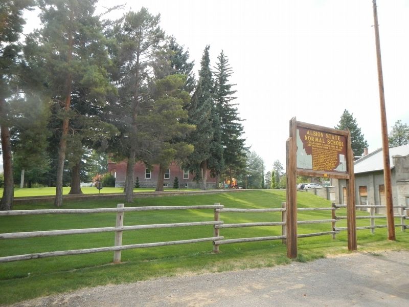
Albion State Normal School Marker
| On State Highway 77 at East Miller Hall Court, on the left when traveling north on State Highway 77. |
| On Main Street (State Highway 77 at milepost 18) near South Street, on the right when traveling north. |
| On State Highway 77 at milepost 18, 0.2 miles south of North St., on the right when traveling north. |
| On City of Rocks Road (Road 3075 S) near Twin Sisters Road (Highway 3400 S), on the right when traveling west. |
| On West 3700 South near Junction Valley Road, on the left when traveling west. |
| On City of Rocks Road (Road 3075 S) at Elba-Almo Road, on the left when traveling west on City of Rocks Road. |
| On Twin Sister Road (Road 3400 S) near City of Rocks Road (Road 3075 S), on the left when traveling west. |
| On City of Rocks Road (Road 3075 S) near Twin Sisters Road (Road 3400 S), on the right when traveling south. |
| On Twin Sister Road (Road 3400 S) near Birch Creek Road, on the left when traveling west. |
| On Elba-Almo Road near 3000 South, on the left when traveling south. |
| On Circle Creek Overlook Road near City of Rocks Road (Highway 3075 S), on the left when traveling west. |
| Near City of Rocks Road (Road 3077 S) near Twin Sisters Road (Road 4300 S), on the left when traveling west. |
| On Elba-Almo Road at 3000 South, on the right when traveling south on Elba-Almo Road. |
| On Twin Sister Road (Road 3400 S) near Birch Creek Road, on the left when traveling west. |
| On Twin Sister Road (Road 3400 S) near City of Rocks Road (Road 3075 S), on the left when traveling west. |
| On Elba-Almo Road near 3000 South, on the left when traveling south. |
| On Twin Sister Road (Road 3400 S) near Birch Creek Road, on the left when traveling south. |
| On U.S. 30 at milepost 250, 0.2 miles east of S 800 W, on the left when traveling east. |
| On U.S. 30 at milepost 253, 0.2 miles east of West 7 South, on the left when traveling east. |
| On U.S. 30 at milepost 253 near South 300 West, on the left when traveling west. |
| On Yale Road (County Road 2880 E) near Laynes Road, on the right when traveling south. |
| On Yale Road near Heglar Canyon Road, on the right when traveling west. |
| On Idahome Lane near Interstate 84, on the right when traveling west. |
| On State Highway 81 at milepost 8 near Idahome Road, on the right when traveling south. |
| On Yale Road near Laynes Road, on the left when traveling south. |
| On Elba-Almo Highway (at milepost 7) near Forest Road 708, on the left when traveling south. |
| On Elba-Almo Road at Grandview Road (County Road 1950 S), on the left when traveling south on Elba-Almo Road. |
| On Elba-Almo Highway (at milepost 7) near Forest Road 708, on the left when traveling south. |
| On State Highway 77 at Tilfer Road (County Road 1250 S), on the right when traveling west on State Highway 77. |
| On State Highway 77 at milepost 3, 0.6 miles east of 1700 S. Road, on the right when traveling east. |
| On Tilfer (County Road 1250s) near State Highway 81, on the right when traveling south. |
| On Gamble Lane (County Highway 1700 S) at State Highway 77, on the right when traveling east on Gamble Lane. |
| On Birch Creek Road (Junction Valley Road) near Twin Sisters Road (Road 3400 S), on the left when traveling south. |
| On Blaine Avenue near West Main 2000 South, on the left when traveling south. |
| On State Highway 27 at milepost 1, 0.2 miles north of 1800 South Road, on the right when traveling south. |
| On Twin Sister Road (Road 3400 S) near Birch Creek Road (Junction Valley Road), on the right when traveling west. |
| On Blaine Avenue near West Main 2000 South, on the left when traveling south. |
| On River Road at Bliss Grade Road on River Road. |
| Near Ritchie Road 0.4 miles north of County Road E2350S. |
| On U.S. 30 at milepost 176, 1.8 miles south of E 2000 S, on the left when traveling north. |
| Near Ritchie Road 0.4 miles north of County Road E2350S. |
| Near Ritchie Road 0.4 miles north of County Road E2350S. |
| On Bell Rapids Road near Upper Salmon Falls Road, on the left. |
| Near Bell Rapids Road near Upper Salmon Falls Road, on the right when traveling west. |
| Near Bell Rapids Road near Upper Salmon Falls Road, on the right when traveling west. |
| On South 950 East at North State Street on South 950 East. |
| Near River Road at U.S. 30. |
| Near Bell Rapids Road near Upper Salmon Falls Road, on the left when traveling west. |
| Near Bell Rapids Road near Upper Salmon Falls Road, on the left when traveling west. |
| Near Bell Rapids Road near Upper Salmon Falls Road, on the right when traveling west. |
| On Bell Rapids Road near Upper Salmon Falls Road, on the left when traveling west. |
| Near Bell Rapids Road near Upper Salmon Falls Road, on the left when traveling west. |
| On Bell Rapids Road near Upper Salmon Falls Road, on the right when traveling west. |
| On South Idaho Street, on the right when traveling north. |
| On Hunt Road west of County Road S1400E, on the right when traveling west. |
| On Hunt Road 0.2 miles west of S1400E. |
| On Hunt Road west of County Road S1400E, on the right when traveling west. |
| On Hunt Road 0.2 miles west of S1400E. |
| On Hunt Road 0.2 miles west of S1400E. |
| On State Highway 25 at Hunt Road on State Highway 25. |
| On Hunt Road 0.2 miles west of S1400E. |
| Near Hunt Road 0.2 miles east of County Road S1400E, on the left when traveling east. |
| On an unnamed road at Hunt Road on an unnamed road. |
| On 1400 East at Hunt Road, on the left when traveling north on 1400 East. |
| Near Hunt Road near South 1450 East, on the right when traveling east. |
| On Hunt Road near South 1400 East, on the right when traveling east. |
| On U.S. 93 at milepost 51, 0.8 miles north of Golf Course Road, on the right when traveling north. |
| On State Highway 75 0.9 miles south of West Magic Road, on the right when traveling north. |
| On Highway 93 0.2 miles south of State Highway 24, on the right when traveling north. |
| On U.S. 93 0.2 miles south of State Highway 24, on the right when traveling north. |
| On State Highway 24 at milepost 10 at North 374 Lane East, on the right when traveling east on State Highway 24. |
| On 100 South Road (State Highway 25) near 1150 West Road, on the right when traveling east. |
| On East Baseline Road near North 200 East, on the right when traveling east. |
| On Balanced Rock Road 1 mile west of Castleford Glenns Ferry Road, on the left when traveling west. |
| On East 4100 North (U.S. 30) near Kacy Meadows Lane, on the right when traveling west. |
| On U.S. 30 near Kacy Meadows Lane, on the right when traveling west. |
| On U.S. 30 at milepost 190, 0.6 miles north of N 1000 E, on the right when traveling north. |
| On U.S. 30 at milepost 190, 0.6 miles N 1000 E, on the right. |
| On U.S. 30 at milepost 187, 0.1 miles Chisholm Drive, on the left when traveling north. |
| On U.S. 30 at milepost 187, 0.1 miles south of Chisholm Drive, on the left when traveling north. |
| Near State Highway 50 0.3 miles north of County Road E3900N, on the left when traveling north. |
| On U.S. 30 near Little Cedar Street, on the left when traveling west. |
| On U.S. 30 at milepost 227 near Little Cedar Street, on the left when traveling west. |
| Near State Highway 50 0.3 miles north of County Road E3900N, on the left when traveling north. |
| On Stricker Cabin Road at East 3200 North (Pumpland Road), on the left when traveling east on Stricker Cabin Road. |
| On Pumpland Road/3200 North at Stricker Cabin Road, on the right when traveling east on Pumpland Road/3200 North. |
| On U.S. 30 at milepost 227, 0 miles east of Rock Creek Road, on the left when traveling east. |
| On Stricker Cabin Road near East 3200 North (Pumpland Road), on the right when traveling east. |
| On Stricker Cabin Road at East 3200 North (Pumpland Road), on the left when traveling east on Stricker Cabin Road. |
| Near Stricker Cabin Road near East 3200 North (Pumpland Road), on the left when traveling east. |
| On Stricker Cabin Road at East 3200 North (Pumpland Road), on the right when traveling east on Stricker Cabin Road. |
| Near State Highway 50 0.3 miles north of County Road E3900N, on the left when traveling north. |
| On Twin Falls Grade near 4050 North Road, on the right when traveling north. |
| On Twin Falls Grade near 4050 North Road, on the right when traveling north. |
| On Twin Falls Grade near 4050 North Road, on the left when traveling north. |
| On U.S. 30 at milepost 234, 0.2 miles west of E 3500 N, on the right when traveling east. |
| On U.S. 93 at milepost 11 near 1900 East Road, on the right when traveling south. |
| On Champlin Road near North 3339 East. |
113 entries matched your criteria. The first 100 are listed above.
The final 13 ⊳
