190 entries match your criteria. Entries 101 through 190 are listed.⊲ Previous 100
West Virginia Civil War Trails Historical Markers
By Devry Becker Jones (CC0), October 11, 2020
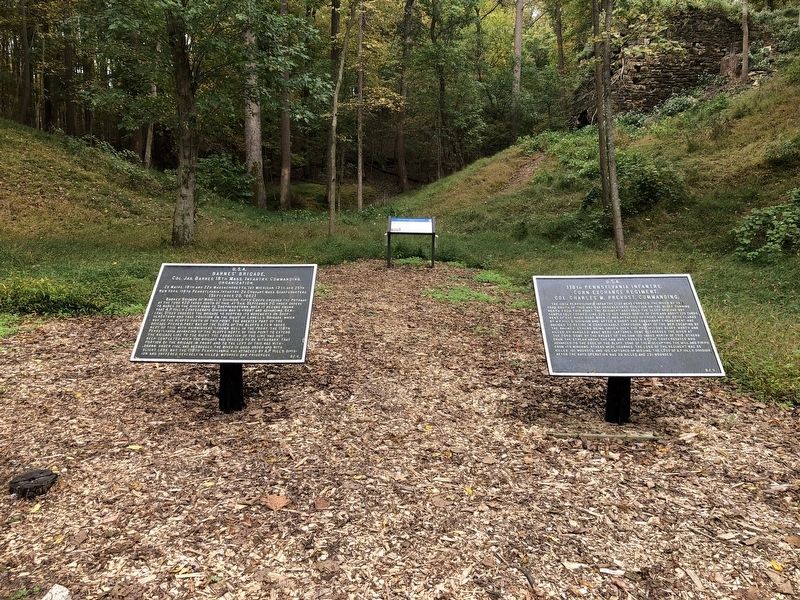
Battle of Shepherdstown Marker
| 101 ► West Virginia, Jefferson County, Shepherdstown — Battle of Shepherdstown — Deadly Crossing — Antietam Campaign 1862 — |
| On River Road (County Road 17/1) 0.1 miles west of Trough Road (County Road 31/1), on the right when traveling east. | |||
| 102 ► West Virginia, Jefferson County, Shepherdstown — Elmwood Cemetery — “ . . . and yet the cry was for more room.” — |
| On S. Duke Street, on the right when traveling south. | |||
| 103 ► West Virginia, Jefferson County, Shepherdstown — Fountain Rock — "Crows… will have to carry their provender with them" — 1864 Valley Campaign — |
| On Kearneysville Pike (State Highway 480) at Sweaningen Way on Kearneysville Pike. | |||
| 104 ► West Virginia, Jefferson County, Shepherdstown — Shepherdstown — “The Whole Town was a Hospital” — Antietam Campaign 1862 — |
| On German Street (West Virginia Route 230) at King Street (West Virginia Route 480), on the right when traveling west on German Street. | |||
| 105 ► West Virginia, Kanawha County, Charleston — Baptism By Fire — To Arms! — |
| On Kanawha Boulevard (U.S. 60) at Florida Avenue, on the right when traveling east on Kanawha Boulevard. | |||
| 106 ► West Virginia, Kanawha County, Charleston — Battle of Charleston — Downtown Battleground — Jenkins's Raid — |
| On Kanawha Boulevard at McFarland Street, on the right when traveling south on Kanawha Boulevard. | |||
| 107 ► West Virginia, Kanawha County, Charleston — Battle of Charleston — Lightburn's Retreat — Jenkins's Raid — |
| On Kanawha Boulevard (U.S. 60) at Ohio Avenue, on the right when traveling east on Kanawha Boulevard. | |||
| 108 ► West Virginia, Kanawha County, Charleston — Charleston's Civil War Sites — The Past is Present — |
| On Kanawha Boulevard. | |||
| 109 ► West Virginia, Kanawha County, Charleston — Kanawha Riflemen — Hometown Boys in Gray — |
| On Kanawha Boulevard East, 0.1 miles west of Elizabeth Street, on the left when traveling west. | |||
| 110 ► West Virginia, Kanawha County, Charleston — Military Occupation — A Bitter Pill to Swallow — |
| On Kanawha Boulevard at Court Street on Kanawha Boulevard. | |||
| 111 ► West Virginia, Kanawha County, Charleston — Presidential Presence — Tending to Family, Fort, and Ferry — |
| On Kanawha Boulevard at Court Street, on the right when traveling south on Kanawha Boulevard. | |||
| 112 ► West Virginia, Kanawha County, Charleston — The 35th Star — West Virginia Statehood — |
| On Kanawha Blvd East (U.S. 60) near Greenbrier Street, on the right when traveling east. | |||
| 113 ► West Virginia, Kanawha County, Charleston — War At The Front Door — Littlepage Mansion — |
| On Washington Street (U.S. 60) at Cairns Court, on the right when traveling south on Washington Street. | |||
| 114 ► West Virginia, Kanawha County, Malden — The Necessary Ingredient — Malden's Salt Works — |
| On Malden Drive (County Route 60/6) at Cypress Drive, on the right when traveling south on Malden Drive. | |||
| 115 ► West Virginia, Lewis County, Weston — Jackson’s Mill — Stonewall Jackson’s Boyhood Home |
| Near Jacksons Mill Road (County Route 10) 0.2 miles west of Sycamore Lick Road, on the right when traveling west. Reported missing. | |||
| 116 ► West Virginia, Lewis County, Weston — Jackson’s Mill — Stonewall Jackson’s Boyhood Home — |
| On Jacksons Mill Road (County Route 10) 2.6 miles north of U.S. 19, on the right when traveling west. | |||
| 117 ► West Virginia, Lewis County, Weston — Trans-Allegheny Lunatic Asylum — No Asylum from War — |
| On Asylum Drive at South River Avenue, on the right when traveling north on Asylum Drive. | |||
| 118 ► West Virginia, Lewis County, Weston — Weston in the Civil War — Target of Raids — Jones-Imboden Raid — |
| On Center Avenue (U.S. 19) just north of 1st Street, on the right when traveling north. | |||
| 119 ► West Virginia, Marion County, Fairmont — A. Brooks Fleming House — A Role in the Action — Jones-Imboden Raid — |
| On Jefferson Street at Washington Street, on the right when traveling south on Jefferson Street. | |||
| 120 ► West Virginia, Marion County, Fairmont — Attack on Fairmont — Watching from the Kearsley House — Jones-Imboden Raid — |
| On Madison Street at Cleveland Avenue, on the left when traveling south on Madison Street. | |||
| 121 ► West Virginia, Marion County, Fairmont — Battle for the Bridge — The Foundry Fight — Jones-Imboden Raid — |
| On Everest Drive just north of Merchant Street (West Virginia Route 73), on the left when traveling east. | |||
| 122 ► West Virginia, Marion County, Fairmont — Francis H. Pierpont Home — “Father of West Virginia” — |
| On Quincy Street (U.S. 19) at Jackson Street (U.S. 19), on the right when traveling north on Quincy Street. | |||
| 123 ► West Virginia, Marion County, Fairmont — Graves of the Pierponts — In Memoriam — |
| On Maple Avenue at Pennsylvania Avenue (U.S. 19), on the left when traveling east on Maple Avenue. | |||
| 124 ► West Virginia, Mason County, Glenwood — Albert Gallatin Jenkins — Home of a General — |
| Near Ohio River Road (West Virginia Route 2) at Homestead Road, on the right when traveling south. | |||
| 125 ► West Virginia, Mercer County, Princeton — McNutt House — Sole Survivor — |
| On North Walker Street at Honaker Street (U.S. 19), on the left when traveling north on North Walker Street. | |||
| 126 ► West Virginia, Mineral County, Keyser — Fort Fuller — Defending New Creek Station — |
| Near Fort Avenue at James Street, on the left when traveling west. | |||
| 127 ► West Virginia, Monongalia County, Morgantown — Morgantown — Westover Bridge — Jones-Imboden Raid — |
| Near Garrett Street at Moore Street. | |||
| 128 ► West Virginia, Monroe County, Alderson — Alderson's Ferry — Strategic Crossing — |
| On South Monroe Street (West Virginia Route 3) at Railroad Avenue on South Monroe Street. | |||
| 129 ► West Virginia, Monroe County, Union — Chapman House — Confederate Father and Son — |
| On Main Street (U.S. 219) at Middle Street, on the right when traveling south on Main Street. | |||
| 130 ► West Virginia, Monroe County, Union — Crook's Occupation of Union — Confederate Union under Federal Control — |
| On Main Street (U.S. 219) at Nota Street, on the right when traveling north on Main Street. | |||
| 131 ► West Virginia, Monroe County, Union — Gen. John Echols House — Confederate General from Union — |
| On 2nd Street at Pump Street, on the right when traveling west on 2nd Street. | |||
| 132 ► West Virginia, Monroe County, Union — Union College — "Hurrah for the Southern Confederacy — |
| On South Street at Pump Street on South Street. | |||
| 133 ► West Virginia, Monroe County, Union — Union, Western Virginia — History All Around — |
| Near 5th Street (U.S. 219), on the right when traveling north. | |||
| 134 ► West Virginia, Morgan County, Berkeley Springs — A Winter Refuge — Berkeley Springs Hotel — Jackson's Bath-Romney Campaign — |
| On Washington Street at Liberty Street on Washington Street. | |||
| 135 ► West Virginia, Morgan County, Berkeley Springs — Battle for Bath — Struggle in the Snow — Jackson's Bath-Romney Campaign — |
| On Fairfax Street at Washington Street (West Virginia Highway 9) on Fairfax Street. | |||
| 136 ► West Virginia, Morgan County, Berkeley Springs — Camp Mud — Unger's Crossroads Bivouacs — Jackson's Bath-Romney Campaign — |
| On Ungers Store Road at Winchester Grade Road (County Route 13) on Ungers Store Road. | |||
| 137 ► West Virginia, Morgan County, Berkeley Springs — Campaign in the Snow — Jackson Captures Bath and Romney — Jackson's Bath-Romney Campaign — |
| On Fairfax Street at North Washington Street (West Virginia Highway 9) on Fairfax Street. | |||
| 138 ► West Virginia, Morgan County, Berkeley Springs — Skirmish at Sir Johns Run — "We leveled our pieces and blazed away" — Jackson's Bath-Romney Campaign — |
| On Sir Johns Run Road (County Road 3) at Slonaker Lane (County Road 3/1), on the left when traveling north on Sir Johns Run Road. | |||
| 139 ► West Virginia, Morgan County, Great Cacapon — Engagement at Great Cacapon — Struggle in the Snow — Jackson's Bath-Romney Campaign — |
| On Cacapon Road (County Route 9) 2 miles south of Prospect Peak Lane. | |||
| 140 ► West Virginia, Nicholas County, Keslers Cross Lanes — Kesslers Cross Lanes — "Battle of Knives and Forks" — |
| On Summerville Lake Road (State Highway 129) 0.6 miles south of Whitewater Road (County Route 9), on the left when traveling south. | |||
| 141 ► West Virginia, Nicholas County, Summerville — Nancy Hart — Legendary Spy — |
| On Main Street (State Highway 41) at Church Street on Main Street. | |||
| 142 ► West Virginia, Ohio County, Wheeling — Camp Carlile — Union Camp at Wheeling Island — The First Campaign |
| Near North Wabash Street, 0.1 miles north of Zane Street (U.S. 40), on the left when traveling north. Reported permanently removed. | |||
| 143 ► West Virginia, Ohio County, Wheeling — Camp Carlile — "A Warlike Appearance" — |
| On North Wabash Street, 0.1 miles north of Zane Street (U.S. 40/250), on the left when traveling north. | |||
| 144 ► West Virginia, Ohio County, Wheeling — Independence Hall — Beginning of Statehood — The First Campaign |
| On 16th Street (West Virginia Route 2) east of Market Street, on the right when traveling west. Reported permanently removed. | |||
| 145 ► West Virginia, Ohio County, Wheeling — Slave Auction Block — "Sold down river" — |
| On 10thStreet (U.S. 40) at Market Street (West Virginia Route 2), on the left when traveling west on 10thStreet. | |||
| 146 ► West Virginia, Ohio County, Wheeling — The Athenaeum — "Lincoln's Bastille" — |
| On 16th Street (West Virginia Route 2) at Market Street, on the right when traveling east on 16th Street. | |||
| 147 ► West Virginia, Ohio County, Wheeling — The First Campaign — Civil War Begins in the Mountains of (West) Virginia — The First Campaign |
| On 16th Street (State Highway 2) east of Market Street. Reported permanently removed. | |||
| 148 ► West Virginia, Ohio County, Wheeling — Wheeling Custom House — West Virginia Independence Hall — |
| On 16th Street (West Virginia Route 2) just east of Market Street (West Virginia Route 2), on the right when traveling west. | |||
| 149 ► West Virginia, Ohio County, Wheeling — Wheeling Hospital — Treating Union and Confederate Soldiers — |
| Near Main Street (West Virginia Route 2) north of 2nd Street, on the right when traveling south. | |||
| 150 ► West Virginia, Pendleton County, Franklin — McCoy House — Union Headquarters — 1862 Valley Campaign — |
| On South Main Street at Chestnut Street on South Main Street. | |||
| 151 ► West Virginia, Pendleton County, Riverton — Last Union Raid — End of the War in Pendleton County — |
| On U.S. 33, 2 miles west of Bland Hills Road, on the right when traveling west. | |||
| 152 ► West Virginia, Pocahontas County, Bartow — Camp Bartow — Springtime Snow and Mud — Jones-Imboden Raid — |
| On U.S. 250, 0.3 miles west of West Virginia Route 28, on the right when traveling west. | |||
| 153 ► West Virginia, Pocahontas County, Bartow — Camp Bartow — Battle of Greenbrier River — The First Campaign — |
| On Old Pike Road (County Route 3) at West Virginia Highway 28, on the right when traveling west on Old Pike Road. | |||
| 154 ► West Virginia, Pocahontas County, Bartow — The Great Raid — Path of Destruction — Jones-Imboden Raid — |
| On U.S. 250 at Old Pike Road (County Route 3), on the left when traveling west on U.S. 250. | |||
| 155 ► West Virginia, Pocahontas County, Bartow — War In West Virginia — A Decisive Campaign — The First Campaign — |
| On U.S. 250 at Old Pike Road (County Route 3), on the left when traveling west on U.S. 250. | |||
| 156 ► West Virginia, Pocahontas County, Hillsboro — Union Camp — Prelude to Battle of Droop Mountain — |
| On Main Street (U.S. 219), on the right when traveling south. | |||
| 157 ► West Virginia, Pocahontas County, Hillsboro — William L. "Mudwall" Jackson — 19th & 20th Virginia Cavalry C.S.A. — November 3-5, 1863 — |
| On U.S. 219 at Steven Hole Run Road (County Route 219/8), on the right when traveling south on U.S. 219. | |||
| 158 ► West Virginia, Pocahontas County, Hillsboro — Yankee Army Camp — November 5, 1863 — |
| On Main Street (U.S. 219), on the right when traveling south. | |||
| 159 ► West Virginia, Pocahontas County, Marlinton — Greenbrier Covered Bridge — Vital Crossing — |
| On 8th Street (West Virginia Route 39) at 1st Avenue, on the right on 8th Street. | |||
| 160 ► West Virginia, Pocahontas County, Minnehaha Springs — Camp Northwest — Jackson’s Huntersville Line — |
| On West Virginia Route 92 at West Virginia Route 39, in the median on State Route 92. | |||
| 161 ► West Virginia, Preston County, Rowlesburg — Battle of Rowlesburg — The River Road — Jones - Imboden Raid — |
| On River Road (State Highway 72) 0.6 miles north of Northwestern Turnpike (U.S. 50), on the right when traveling north. | |||
| 162 ► West Virginia, Preston County, Rowlesburg — Battle of Rowlesburg — B&O Railroad Bridge — Jones - Imboden Raid — |
| On Cannon Hill Road, 0.1 miles north of Maple Avenue (County Route 51), on the right when traveling north. | |||
| 163 ► West Virginia, Preston County, Rowlesburg — Battle of Rowlesburg — Covered Bridge — Jones-Imboden Raid — |
| On George Washington Highway (U.S. 50) at Hamilton Lane, on the right when traveling south on George Washington Highway. | |||
| 164 ► West Virginia, Putnam County, Buffalo — Buffalo Presbyterian Church — Mustering the Troops — |
| On Lafayette Street (West Virginia Route 62) north of High Street, on the right when traveling north. | |||
| 165 ► West Virginia, Putnam County, Buffalo — Raiders in Buffalo — Clashing with Jenkins — Jenkins’s Raid — |
| On High Street just east of Lafayette Street (West Virginia Route 62), on the right when traveling east. | |||
| 166 ► West Virginia, Randolph County, Beverly — Battle Of Rich Mountain — Making McClellan's Reputation — The First Campaign — |
| On Rich Mountain Road (County Route 37/8) 5 miles west of Seneca Trail (U.S. 250), on the left when traveling west. | |||
| 167 ► West Virginia, Randolph County, Beverly — Beverly — Crossroads of Conflict — The First Campaign — |
| On Main Street (U.S. 219), on the right when traveling south. | |||
| 168 ► West Virginia, Randolph County, Beverly — Occupied Beverly — Caught in the Midst of Conflict — |
| On Main Street (U.S. 219) at Railroad Street on Main Street. | |||
| 169 ► West Virginia, Randolph County, Beverly — 23 — Randolph County Jail — Confining the "Bogus State Sheriff" — Jones-Imboden Raid — |
| On Walnut Street Extended at Court Street on Walnut Street Extended. | |||
| 170 ► West Virginia, Randolph County, Beverly — The First Campaign — Civil War Begins in the Mountains of (West) Virginia — The First Campaign — |
| On Main Street (U.S. 219), on the right when traveling south. | |||
| 171 ► West Virginia, Randolph County, Elkins — War in West Virginia — "That Remarkable Campaign" — The First Campaign — |
| On Railroad Avenue at 3rd Street, on the right when traveling south on Railroad Avenue. | |||
| 172 ► West Virginia, Randolph County, Huttonsville — Camp Elkwater — Gateway to the Tygart Valley — The First Campaign |
| On Seneca Trail (Route 219) 0.4 miles south of Kumbrabow Forest Road (County Route 219/16), on the right when traveling south. Reported unreadable. | |||
| 173 ► West Virginia, Randolph County, Huttonsville — Huttonsville — The Army of the Northwest — The First Campaign — |
| On Seneca Trail (U.S. 219) at Staunton-Parkersburg Turnpike (U.S. 250) on Seneca Trail. | |||
| 174 ► West Virginia, Randolph County, Huttonsville — Huttonsville — On the Eve of Battle — Jones-Imboden Raid — |
| On Railroad Street (U.S. 219) at U.S. 250 on Railroad Street. | |||
| 175 ► West Virginia, Ritchie County, Harrisville — Harrisville — Confederate Raid — Jones - Imboden Raid — |
| 176 ► West Virginia, Roane County, Spencer — Capturing Spencer — Surrender by Trickery — Jenkin's Raid — |
| On Main Street (U.S. 33) near Market Street, on the left when traveling east. | |||
| 177 ► West Virginia, Roane County, Spencer — Spencer — The Siege of Spencer — The Blue and Gray Trail — |
| On Main Street (U.S. 33), on the left when traveling east. | |||
| 178 ► West Virginia, Roane County, Spencer — Spencer — Major Civil War Events Impacting Spencer and Roane County — The Blue and Gray Trail — |
| On Main Street (U.S. 33), on the left when traveling east. | |||
| 179 ► West Virginia, Tucker County, Parsons — Clash at Corricks Ford — Death of Garnett — The First Campaign — |
| On Poplar Street, 0.1 miles south of Mill Street, on the left when traveling south. | |||
| 180 ► West Virginia, Tucker County, Parsons — Corricks Ford — Retreat Becomes Disaster — The First Campaign — |
| Near Main Street (U.S. 219), on the right when traveling east. | |||
| 181 ► West Virginia, Upshur County, Buckhannon — Destruction at the Courthouse — The Raiders Strike — Jenkins's Raid — |
| On West Main Street (County Route 151) at Locust Street (West Virginia Highway 20), on the right when traveling east on West Main Street. | |||
| 182 ► West Virginia, Upshur County, Buckhannon — Jenkins in Buckhannon — The Raiders Strike — Jenkins's Raid — |
| On Marion Street at Barbour Street, on the right when traveling west on Marion Street. | |||
| 183 ► West Virginia, Upshur County, Buckhannon — McClellan's Buckhannon Camp — Prelude to Rich Mountain — The First Campaign — |
| On Park Street at Gum Street, on the right when traveling south on Park Street. | |||
| 184 ► West Virginia, Upshur County, Buckhannon — The Bassel House — The Columns Unite — Jones-Imboden Raid — |
| On Midlick Road (County Route 5/7) at Old Weston Road (County Road 12), on the right when traveling north on Midlick Road. | |||
| 185 ► West Virginia, Upshur County, Cleveland — Kesler's Raid — Capture of Upshur County Militia — |
| On Ireland - Rock Cave Road (State Highway 20) at Flatwood Run Road (County Route 20/13) on Ireland - Rock Cave Road. | |||
| 186 ► West Virginia, Wirt County, Burning Springs — Burning Springs Oil Field — "...drank all the whiskey and burned all the oil" — Jones-Imboden Raid — |
| On Little Kanawha Parkway (West Virginia Route 5) 0.9 miles north of Straight Creek-Burning Spring Road, on the right when traveling north. | |||
| 187 ► West Virginia, Wood County, Parkersburg — Creating West Virginia — Parkersburg's Wartime Politicians — |
| On 3rd Street at Juliana Street (West Virginia Route 68), on the right when traveling north on 3rd Street. | |||
| 188 ► West Virginia, Wood County, Parkersburg — Fort Boreman — Protecting the B&O Railroad — |
| On Fort Boreman Drive, 1 mile south of Robert Byrd Highway (U.S. 50). | |||
| 189 ► West Virginia, Wood County, Parkersburg — Vital Transportation Center — McClellan Occupies Parkersburg — |
| On Little Kanawa Connector north of Ann Street, on the right when traveling north. | |||
| 190 ► West Virginia, Wyoming County, Oceana — Civil War Romance — Thompson and Martilia Walker — |
| On Route 10, 1.4 miles Route 85, on the right when traveling west. | |||
190 entries matched your criteria. Entries 101 through 190 are listed above. ⊲ Previous 100