By David Seibert, August 9, 2010
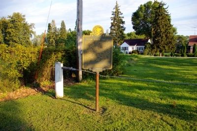
Plum River Falls Marker
| On Unnamed Road in Old Mill Park 0.1 miles east of Chicago Avenue (U.S. 52), on the right when traveling east. |
| On Sangamon Street at N. Bay Street on Sangamon Street. |
| On Sangamon Street at N. Bay Street on Sangamon Street. |
| On 134th Place at St. Lawrence Avenue, on the right when traveling east on 134th Place. |
| Near Des Plaines Avenue south of Eisenhower Expressway (Interstate 290), on the right when traveling south. |
| On Broadway Avenue at Rice Street, on the right when traveling north on Broadway Avenue. |
| On Butler Place near Courtland Avenue, on the left when traveling east. |
| Near Barrypoint Road at Bloomingbank Road. |
| On Fairbank Road 0.3 miles west of Coonley Road. |
| On Plainfield Road at Wolf Road, on the right when traveling west on Plainfield Road. |
| Near Chief Shabbona County Forest Preserve 0.5 miles south of Preserve Road. |
| On East Comanche Avenue (Illinois Route 30) at Indian Road, on the right when traveling east on East Comanche Avenue. |
| On West Army Trail Boulevard at John F. Kennedy Drive on West Army Trail Boulevard. |
| On Maple Avenue east of Lyman Avenue, on the right when traveling east. |
| On Maple Avenue near Lyman Avenue, on the right when traveling east. |
| On Hobson Road (County Route 2) 0.2 miles east of Washington Street, on the right when traveling west. |
| On Court Place, on the right when traveling south. |
| Near S. Brainard Street 0.1 miles south of East Chicago Avenue. Reported permanently removed. |
| On Jackson Avenue west of Main Street. |
| On Jefferson Avenue at Mill Street, on the right when traveling east on Jefferson Avenue. |
| Near Brainard Street 0.2 miles south of Chicago Avenue, on the right when traveling west. |
| On County Farm Road (County Route 43) at Manchester Road on County Farm Road. |
| On County Farm Road near Manchester Road. |
| On Old Fort Road 0.2 miles east of Illinois Street, on the left when traveling east. |
| On Old Fort Road 0.2 miles east of Illinois Street, on the left when traveling east. |
| On East Myrtle Street east of Illinois Street, on the right when traveling east. |
| On Old Fort Road east of Illinois Street, on the right when traveling east. |
| On Old Fort Road east of Illinois Street, on the right when traveling east. |
| On Old Fort Road east of Illinois Street, on the right when traveling east. |
| On Old Fort Road east of Illinois Street, on the right when traveling east. |
| Near Riverside Avenue north of State Avenue. |
| On 2625th Road (Illinois Route 351) at East 350th Road (County Road 62), on the right when traveling east on 2625th Road. |
| On East Prospect Avenue west of Catherine Street, on the right when traveling east. |
| On Franklin Grove Road, on the right when traveling west. |
| On Hurd Road 0.2 miles east of Jackson Street, on the right when traveling east. |
| On 10th Avenue West at 1st Street (U.S. 67), on the right when traveling west on 10th Avenue West. |
| Near Rodman Avenue 0.1 miles Government Bridge, on the right when traveling east. |
| On Locust Street north of Commercial Street, on the left when traveling north. |
| On West Blackhawk Road at North Monument Road, on the right when traveling east on West Blackhawk Road. |
| On West Blackhawk Road at North Monument Road, on the right when traveling east on West Blackhawk Road. |
| On West Blackhawk Road at North Monument Road, on the right when traveling east on West Blackhawk Road. |
| On North Washington Street at East Main Street, on the right when traveling north on North Washington Street. |
| On West Main Street (U.S. 150), on the left when traveling east. |
| On West Rice Street west of South Beaumont Road, on the right when traveling west. |
| On West Rice Street west of South Beaumont Road, on the right when traveling west. |
| On County Highway B west of State Highway 27, on the left when traveling west. |
| On Main Street (County Highway C) at Mill Street (State Highway 131) on Main Street. |
| On County Route ID at Division Street (County Route F), on the left when traveling east on County Route ID. |
| Near County Highway F 0.2 miles south of U.S. 151, on the right when traveling south. |
| On Observatory Drive 0.1 miles east of North Charter Street, on the right when traveling west. |
| Near Wilson Street at Martin Luther King, Jr. Boulevard, on the left when traveling west. |
| On East Wilson Street at South Franklin Street, on the right when traveling east on East Wilson Street. |
| On State Highway 19 0.5 miles east of County Route K, on the right when traveling east. Reported permanently removed. |
| On State Highway 78 0.4 miles south of County Road Y, on the left when traveling south. |
| On Pheasant Branch Road 0.4 miles north of Whittlesey Road, on the right when traveling north. |
| On State Highway 78 0.4 miles south of County Route Y, on the left when traveling south. |
| On County Road Y 0.1 miles east of Governor Dodge Road, on the right when traveling east. |
| On State Highway 23 at Irving Lane, on the left when traveling south on State Highway 23. |
| On Commerce Street at Fountain Street, on the left when traveling north on Commerce Street. |
| Near County Highway C east of State Highway 23, on the right when traveling east. |
| Near County Highway C 2 miles west of U.S. 14, on the right when traveling west. |
| On County Route N 2 miles south of Wisconsin Highway 106, on the left when traveling south. |
| On Milwaukee Avenue East, on the left when traveling east. |
| On County Route H 0.2 miles north of Young Road. Reported missing. |
| On East Main Street at Rock River, on the right when traveling east on East Main Street. |
| On County Route Y 3 miles County Route M, on the left when traveling north. Reported missing. |
| Near County Route Y 3 miles north of County Route M. |
| On Main Street (State Highway 78) at Mineral Street, on the right when traveling east on Main Street. |
| On County Highway E (State Highway 171) north of Park Drive, on the left when traveling north. |
| On U.S. 14 0.1 miles east of Yeager Lane, on the left when traveling east. |
| Near State Highway 80 north of County Highway D, on the left when traveling north. |
| Near Public Avenue at State Street. |
| Near Interstate 90 at milepost 187, on the right when traveling west. |
| On U.S. 51 0.5 miles south of West Happy Hollow Road, on the right when traveling south. |
| On Palmer Drive 0.1 miles west of East Racine Street (U.S. 14), on the left when traveling west. |
| On Storrs Lake Road at South Janesville Street (Wisconsin Highway 26 / 59), on the left when traveling east on Storrs Lake Road. |
| On State Highway 60 near Neuhelsel Road, on the left when traveling west. |
| Near State Highway 54 at McKeeth Road, on the right when traveling east. |
| On Great River Road (State Highway 35) 2.5 miles north of Main Street (State Highway 82), on the right when traveling north. |
| On Great River Road (State Highway 35) 2.5 miles north of Main Street (State Highway 82), on the right when traveling north. |
| Near County Road BI 1.9 miles west of Great River Road (State Highway 35). |
| On County Highway UU 0.8 miles west of Orlando Road, on the left when traveling west. |
| On State Highway 82 at Anderson Ridge Road, on the right when traveling west on State Highway 82. |
| On State Highway 82 0.8 miles west of Fortner Avenue, on the right when traveling west. |
| On State Highway 82 0.8 miles west of Fortner Avenue, on the right when traveling west. |
