185 entries match your criteria. The first 100 are listed. ⊳
Trails West Inc. Historical Markers
Trails West marks the California, Applegate, Overland Trails as well as other related Western Trails with their notable "T" Rail markers. They have over 600 markers in place.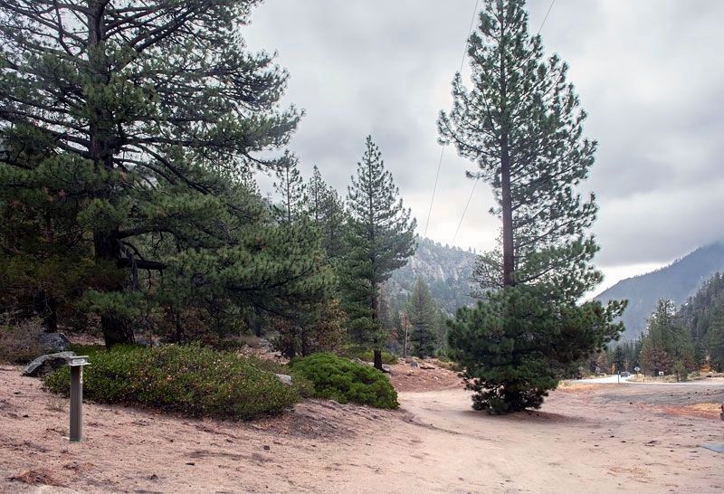
By Alvis Hendley, October 22, 2022
Carson Trail - Crooked Trail Marker
1 ► California, Alpine County, Alpine Village — CR-39 — Carson Trail - Crooked Trail —  |
| On California Route 88, on the left when traveling east. | |||
| 2 ► California, Alpine County, Alpine Village — CR-38 — Carson Trail - First Crossing in Mad Canyon — |
| On Crystal Springs Road, on the right when traveling west. | |||
| 3 ► California, Alpine County, Alpine Village — CR-37 — Carson Trail - To West Carson Canyon — |
| On Carson Pass Highway (California Route 88) at Emigrant Trail, on the left when traveling east on Carson Pass Highway. | |||
| 4 ► California, Alpine County, Kirkwood — CR-43 — Carson Trail - Ascent to Carson Pass — |
| Near Carson Pass Scenic Byway (California Route 88). | |||
| 5 ► California, Alpine County, Meyers — LP-3 — Luther Pass Trail - Came to Grass Lake — |
| On Luther Pass Road (California Route 89) 4 miles north of Route 88, on the left when traveling north. | |||
| 6 ► California, Alpine County, Meyers — LP-2 — Luther Pass Trail - Luther Pass — |
| Near Luther Pass Road (California Route 89), on the left when traveling north. | |||
| 7 ► California, Alpine County, Picketts Junction — CR-40 — Carson Trail - Hope Valley — |
| On Burnside Road, on the right when traveling south. | |||
| 8 ► California, Alpine County, Picketts Junction — LP-1 — Luther Pass Trail - Leaving the Carson Trail — |
| On Burnside Road, on the right when traveling south. | |||
| 9 ► California, Amador County, Singleton Springs — CR-55 — Carson Trail - Leek Springs — Carson Trail — |
| On Mormon Emigrant Trail (NF-5) 1 mile west of 88 ( Route 88), on the right when traveling west. | |||
| 10 ► California, Butte County, Berry Creek — B047 — Beckwourth Trail – Berry Creek — |
| On Oroville-Quincy Highway (Route 162). | |||
| 11 ► California, El Dorado County, Placerville — CR-66 — Carson Trail - Wagon Road to Placerville — |
| On Holm Road, on the right when traveling west. | |||
| 12 ► California, El Dorado County, Placerville — CR-67 — Carson Trail - Wagon Road to Placerville — |
| On Cedar Ravine Road, on the right when traveling east. | |||
| 13 ► California, El Dorado County, Pleasant Valley — CR-64 — Carson Trail - Descent to Pleasant Valley — |
| On Pleasant Valley Road at Newtown Road, on the right when traveling east on Pleasant Valley Road. | |||
| 14 ► California, El Dorado County, Pleasant Valley — CR-63 — Carson Trail - Pleasant Valley — |
| On Pleasant Valley Road, on the right when traveling east. | |||
| 15 ► California, El Dorado County, Pleasant Valley — CR-65 — Carson Trail - Wagon Road Junction — |
| On Pleasant Valley Road, on the left when traveling east. | |||
| 16 ► California, El Dorado County, Pollock Pines — CR-62 — Carson Trail - To Pleasant Valley — |
| On Starkes Grade Road at Sly Park Road, on the right when traveling east on Starkes Grade Road. | |||
| 17 ► California, El Dorado County, South Lake Tahoe — JC-10 — Johnson Cutoff - Ascent of Johnson Pass — |
| On South Upper Truckee Road 0.3 miles north of Egret Way, on the right when traveling north. | |||
| 18 ► California, El Dorado County, South Lake Tahoe — LP-4 — Luther Pass Trail - Enter Lake Valley — |
| On South Upper Truckee Road 1 mile west of Route 89, on the left when traveling west. | |||
| 19 ► California, El Dorado County, South Lake Tahoe — LP-5 — Luther Pass Trail - Prepared for the Ascent — |
| On South Upper Truckee Road 0.3 miles north of Egret Road, on the right when traveling north. | |||
| 20 ► California, Lassen County, Chilcoot-Vinton — B-7 — Beckwourth Trail - Long Valley — |
| On Scott Road 2.3 miles south of Route 70, on the left when traveling south. | |||
| 21 ► California, Lassen County, Litchfield — N-26 — Nobles Trail - Soldiers Bridge — |
| On U.S. 395, on the right when traveling north. | |||
| 22 ► California, Lassen County, Old Station — N-36 — Nobles Trail - Butte Creek Meadow — |
| On Forest Road 32N21 0.5 miles south of Route 44, on the left when traveling south. | |||
| 23 ► California, Lassen County, Old Station — N-34 — Nobles Trail - Dry Valley — |
| Near California Route 44 8.4 miles north of Mooney Road, on the left when traveling north. | |||
| 24 ► California, Lassen County, Susanville — N-28 — Nobles Trail - Big Spring — |
| Near California Route 44 4.9 miles north of Route 36 when traveling north. | |||
| 25 ► California, Lassen County, Susanville — N-30 — Nobles Trail - Bridge Creek — |
| Near Bridge Creek Springs Road 1 mile north of Merrill Flat Road. | |||
| 26 ► California, Lassen County, Susanville — N-29 — Nobles Trail - First Nobles Pass — |
| On Bridge Creek Springs Road 2 miles north of Route 44, on the right when traveling north. | |||
| 27 ► California, Lassen County, Susanville — N-27 — Nobles Trail - Fork in the Road — |
| On Eagle Lake Road 0.2 miles north of Route 36, on the right when traveling north. | |||
| 28 ► California, Lassen County, Susanville — N-26 — Nobles Trail - Rooptown — |
| On North Weatherlow Street near Nevada Street, on the right when traveling north. | |||
| 29 ► California, Lassen County, Westwood — L - 38 — Lassen Trail - Westwood — |
| Near 3rd Street (County Route A21), on the right when traveling east. | |||
| 30 ► California, Modoc County, Alturas — L-3 — Lassen Trail - Conical Rocks — |
| Near U.S. 395. | |||
| 31 ► California, Modoc County, Alturas — L-5 — Lassen Trail - Pit River Ford — |
| On S Main St (U.S. 395), on the left when traveling south. | |||
| 32 ► California, Modoc County, Canby — L-10 — Lassen Trail - Foot Wear — |
| On Route 139, on the right when traveling south. | |||
| 33 ► California, Modoc County, Canby — L-11 — Lassen Trail - Pit River Canyon — |
| On Pit River Road (County Route 84) near Turner Creek Road, on the right when traveling west. | |||
| 34 ► California, Modoc County, Canby — L-8 — Lassen Trail - Rattlesnake Butte — |
| On County Route 54 at County Route 70, on the left when traveling east on County Route 54. | |||
| 35 ► California, Modoc County, Davis Creek — A-32 — Applegate Trail - Descent to Goose Lake — California Trail — |
| On U.S. 395 at milepost 50.6, on the right when traveling south. | |||
| 36 ► California, Modoc County, Davis Creek — A-31 — Applegate Trail - Descent to Lassen Creek — California Trail — |
| On County Route 133C 0.3 miles south of South Willow Ranch Road (County Route 47), on the left when traveling south. | |||
| 37 ► California, Modoc County, Davis Creek — A-33 — Applegate Trail - New Road to Yreka — California Trail — |
| On Westside Road (County Route 48) near U.S. 395, on the left when traveling west. | |||
| 38 ► California, Modoc County, Davis Creek — A-37 — South Road - Applegate Trail — |
| On Crowder Flat Rd (Forest Road 73), on the right when traveling south. | |||
| 39 ► California, Modoc County, Davis Creek — A-35 — South Road - Devil's Garden — California Trail — |
| On FS 46N02 at FS 46N05A, on the right when traveling south on FS 46N02. | |||
| 40 ► California, Modoc County, Davis Creek — A-36 — South Road - Fletcher Creek — California Trail — |
| Near no nearby street. | |||
| 41 ► California, Modoc County, Davis Creek — A-34 — South Road - McGinty Creek — California Trail — |
| Near no nearby street. | |||
| 42 ► California, Modoc County, Fort Bidwell — A-28A — Applegate Trail - Fandango Pass Ascent — California Trail — |
| On Fandango Pass Road (County Route 9) 2.5 miles north of Surprise Valley Road, on the right when traveling north. | |||
| 43 ► California, Modoc County, Fort Bidwell — A-28B — Applegate Trail - Fandango Pass Descent — California Trail — |
| On Fandango Pass Road 3.8 miles north of Surprise Valley Road, on the left when traveling north. | |||
| 44 ► California, Modoc County, Fort Bidwell — A-30 — Applegate Trail - Through the Forest — California Trail — |
| On Forest Road 30 2 miles south of County Route 133C, on the left when traveling south. | |||
| 45 ► California, Modoc County, Newell — A-44 — Applegate Trail - Bloody Point — California Historical Landmark No. 8 — California Trail — |
| On Old Alturas Highway (County Route 114) 1.1 miles north of County Route 101, on the left when traveling north. | |||
| 46 ► California, Modoc County, Newell — A-40 — Applegate Trail - Pothole Spring — California Trail — |
| On 46N19. | |||
| 47 ► California, Modoc County, Newell — BC-1 — Burnett Cutoff - At Klamath [Tule] Lake — |
| On Old Alturas Highway (County Route 114) 1.1 miles north of County Route 101, on the left when traveling north. | |||
| 48 ► California, Modoc County, Newell — BC-3 — Burnett Cutoff - Over a Prairie — |
| On Route 46N23 0.1 miles east of Route 139, on the left when traveling east. | |||
| 49 ► California, Modoc County, Perez — BC-5 — Burnett Cutoff - Across Barren Ground — |
| Near Clear Lake Road, on the right when traveling west. | |||
| 50 ► California, Modoc County, Tule Lake — BC-2 — Burnett Cutoff - Muddy Waters — |
| On Old Alturas Highway (County Route 140) at Route 139, on the right when traveling north on Old Alturas Highway. | |||
| 51 ► California, Nevada County, Alta Sierra — T-62 — Truckee Trail - All Hills and Ravines — |
| On Taylor Crossing Road at Dog Bar Road, on the left when traveling east on Taylor Crossing Road. | |||
| 52 ► California, Nevada County, Alta Sierra — T-63 — Truckee Trail - Among the Foothills — |
| On Dog Bar Road at Owl Hill Court, on the left when traveling north on Dog Bar Road. | |||
| 53 ► California, Nevada County, Chicago Park — T-60 — Truckee Trail - Forks Right & Left — |
| On Colfax Highway (California Route 174) at Lower Colfax Road, on the left when traveling north on Colfax Highway. | |||
| 54 ► California, Nevada County, Cisco Grove — T-47 — Truckee Trail - Ascent to Lake and Valley — |
| On an unnamed dirt road, on the right. | |||
| 55 ► California, Nevada County, Grass Valley — T-68 — Truckee Trail - Approaching Rock Creek — |
| Near Garden Bar Road at Countryside Ranch Road, on the right when traveling east. | |||
| 56 ► California, Nevada County, Higgins Corner — T-66 — Truckee Trail - Approaching Sacramento Valley — |
| On Garden Bar Road at Troy Road, on the left when traveling south on Garden Bar Road. | |||
| 57 ► California, Nevada County, Higgins Corner — T-65 — Truckee Trail - Last of the Foothills — |
| On Wolf Road at Duggans Road, on the left when traveling north on Wolf Road. | |||
| 58 ► California, Nevada County, Nevada City — NC-9 — Nevada City Road - Leaving Washington Ridge — |
| On Conservation Road 0.5 miles north of Route 20, on the right when traveling north. | |||
| 59 ► California, Nevada County, Nevada City — NC-6 — Nevada City Road - No Water on Washington Ridge — |
| On California Route 20 at Ridgewood Road, on the left when traveling east on California Route 20. | |||
| 60 ► California, Nevada County, North san juan — HP-16 — Henness Pass Road - Oak Tree Ranch — |
| On Oak Tree Road at Tyler Foot Road, on the right when traveling south on Oak Tree Road. | |||
| 61 ► California, Nevada County, Omega — NC-3 — Nevada City Road - Washington Ridge Summit — |
| On State Highway 20, on the left when traveling east. | |||
| 62 ► California, Nevada County, Washington — NC-4 — Nevada City Road - Opposite Washington Diggings — |
| On Skillman Road 0.1 miles east of Route 20, on the left when traveling east. | |||
| 63 ► California, Nevada County, You Bet — T-57 — Truckee Trail - Steep Hollow Descent — |
| Near Chicago Park Powerhouse Road. | |||
| 64 ► California, Placer County, Dutch Flat — T-55 — Truckee Trail - Camel’s Hump — |
| On Lowell Hill Road. | |||
| 65 ► California, Placer County, Dutch flat — T-53 — Truckee Trail - Deadman Flat — |
| On Lowell Hill Road. | |||
| 66 ► California, Placer County, Soda Springs — T-42 — Truckee Trail - Leaving Summit Valley — |
| On Soda Springs Road 0.8 miles south of Donner Pass Road, on the left when traveling south. | |||
| 67 ► California, Placer County, Soda Springs — T-43 — Truckee Trail - Through Boulder Field — |
| On Kidd Lakes Road 2 miles west of Soda Springs Road, on the right when traveling west. | |||
| 68 ► California, Placer County, Sugar Bowl Ski Resort — T-41 — Truckee Trail - To Summit Valley — |
| On Old Donner Summit Road 0.9 miles south of Sugar Bowl Road, on the left when traveling east. | |||
| 69 ► California, Plumas County, Beckwourth — B-10 — Beckwourth Trail - Head Waters of Feather River — |
| On Main Street, on the left when traveling east. | |||
| 70 ► California, Plumas County, Beckwourth — B - 11 — Beckwourth Trail – The Road Forks — |
| Near Feather River Highway (Route 70), on the left when traveling west. | |||
| 71 ► California, Plumas County, Chilcoot — B-8 — Beckwourth Trail - Beckwourth Pass — |
| On Chilcoot Avenue 0.3 miles south of Route 70, on the left when traveling west. | |||
| 72 ► California, Plumas County, Meadow Valley — B-35 — Beckwourth Trail – Grizzly Creek — |
| On Oroville-Bucks Lake Road. | |||
| 73 ► California, Plumas County, Meadow Valley — B-34 — Beckwourth Trail – Haskins Valley — |
| On Oroville-Bucks Lake Road. | |||
| 74 ► California, Plumas County, Meadow Valley — B 33 — Beckwourth Trail – Rich Valley — |
| On Bucks Lake Road, on the right when traveling west. | |||
| 75 ► California, Plumas County, Quincy — B-24A — Beckwourth Trail – American Ranch — |
| On Jackson Street at Coburn Street on Jackson Street. | |||
| 76 ► California, Plumas County, Quincy — B-23 — Beckwourth Trail – Greenhorn Creek Canyon — |
| Near California Route 70 at milepost 49.5. | |||
| 77 ► California, Plumas County, Quincy — B-24 — Beckwourth Trail – New England Ranch — |
| On Quincy Junction Road at Chandler Road, on the right when traveling north on Quincy Junction Road. | |||
| 78 ► California, Plumas County, Vinton — B-9 — Beckwourth Trail - Beckwourth Valley — |
| On California Route 70 at Cow Camp Road, on the right when traveling west on California Route 70. | |||
| 79 ► California, Shasta County, Anderson — N-58 — Nobles Trail - Bear Creek — |
| On Dersch Road 0.3 miles west of Hyrax Road, on the right when traveling west. | |||
| 80 ► California, Shasta County, Old Station — N-27 — Nobles Trail - Butte Creek — |
| On Forest Road 32N21 4.7 miles south of Route 44, on the right when traveling south. | |||
| 81 ► California, Shasta County, Old Station — N-40 — Nobles Trail - Devil's Half Acre — |
| Near Volcanic Legacy Scenic Byway (California Route 44), on the left when traveling west. | |||
| 82 ► California, Shasta County, Old Station — N-39 — Nobles Trail - Hat Creek Rim — |
| Near Volcanic Legacy Scenic Byway (California Route 44) 1.3 miles north of Forest Route 32N32, on the right when traveling west. | |||
| 83 ► California, Shasta County, Old Station — N-41 — Nobles Trail – Hat Creek Station — |
| Near California Route 44/89, on the left when traveling north. | |||
| 84 ► California, Shasta County, Old Station — N-42 — Nobles Trail - Little Hat Creek Hill — |
| On California Route 44 0.1 miles east of McElroy Road, on the left when traveling east. | |||
| 85 ► California, Shasta County, Old Station — N-44 — Nobles Trail - Lost Camp Station — |
| Near Volcanic Legacy Scenic Byway (California Route 44), on the right when traveling east. | |||
| 86 ► California, Shasta County, Old Station — N-43 — Nobles Trail - Lost Creek Route 1855 & Later — |
| Near Forest Service Road 32N12 at McElroy Road. | |||
| 87 ► California, Shasta County, Old Station — N-35 — Nobles Trail - Poison Lake — |
| On California Route 44 at Pittville Road, on the left when traveling west on California Route 44. | |||
| 88 ► California, Shasta County, Old Station — N-38 — Nobles Trail - Snow Capped Mountains — |
| Near Volcanic Legacy Scenic Byway (California Route 44) 1.2 miles north of Forest Route 32N56, on the right when traveling north. | |||
| 89 ► California, Shasta County, Old Station — N-48 — Nobles Trail – Third Nobles Pass — |
| On California Route 44/89, on the left when traveling north. | |||
| 90 ► California, Shasta County, Redding — N-60 — Nobles Trail - Canon House — |
| Near Westside Road. | |||
| 91 ► California, Shasta County, Shasta — N-61 — Nobles Trail - Shasta City — |
| On 15432 Eureka Way (California Route 299) at 2nd Street, on the right when traveling west on 15432 Eureka Way. | |||
| 92 ► California, Shasta County, Shingletown — N - 56 — Nobles Trail – Charley’s Ranch — |
| Near California Highway 44 south of Ogburn Road, on the left when traveling west. | |||
| 93 ► California, Shasta County, Shingletown — N-57 — Nobles Trail - Foot of the Mountain Station — |
| Near Dersch Road 2.6 miles south of Route 44, on the right when traveling south. | |||
| 94 ► California, Shasta County, Shingletown — N - 53 — Nobles Trail – Junction — |
| On Ritts Mill Road north of California Highway 44, on the right when traveling north. | |||
| 95 ► California, Shasta County, Shingletown — N-55 — Nobles Trail - Shingletown — |
| Near California Route 44 west of Emigrant Trail/Wilson Hill Road, on the right when traveling west. | |||
| 96 ► California, Shasta County, Summertown — N-49 — Nobles Trail - Manzanita Creek — |
| On Forest Route 17 0.1 miles south of Route 44, on the left when traveling south. | |||
| 97 ► California, Shasta County, Summertown — N-47 — Nobles Trail - Table Mountain — |
| On Forest Service Road 32N13F, on the right when traveling south. | |||
| 98 ► California, Shasta County, Viola — N-52 — Nobles Trail - Battle Creek Ford — |
| Near Deer Flat Road 0.1 miles west of Manzanita Creek Drive, on the right when traveling west. | |||
| 99 ► California, Shasta County, Viola — N-51 — Nobles Trail - Deer Flat — |
| On Deer Flat Road 0.9 miles north of Route 44, on the right when traveling north. | |||
| 100 ► California, Shasta County, Viola — N-50 — Nobles Trail - Manzanita Chute — |
| Near California Route 44 3.3 miles west of Mineral Road (County Route 17), on the left when traveling west. | |||
185 entries matched your criteria. The first 100 are listed above. The final 85 ⊳