80 entries match your criteria.
Eleanor Roosevelt Historical Markers
Markers in this series follow the details of the life of Eleanor Roosevelt. In addition to being a notable American First Lady, she was also a delegate to the United Nations, and a notable advocate for civil rights in the early 20th century.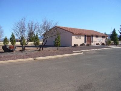
By Bill Kirchner, March 3, 2010
Douglas International Airport Marker
1 ► Arizona, Cochise County, Douglas — Douglas International Airport —  |
| On West Airport Road near 10th Street, on the right when traveling north. | |||
| 2 ► California, San Diego County, San Diego, Marina — Balboa Park — The city’s haven for culture and leisure — |
| Near Convention Way at Marina Park Way, on the right when traveling west. | |||
| 3 ► Connecticut, Western Region, Danbury — 12 — Marian Anderson — Danbury, Connecticut — The Museum in the Streets — |
| On Main Street at Library Place, on the right when traveling north on Main Street. | |||
| 4 ► Delaware, Sussex County, Selbyville, Baltimore Hundred — SC-154 — Home of John G. Townsend, Jr. — |
| On S. Main Street (Delaware Route 54) near McCabe Street, on the right when traveling south. | |||
| 5 ► District of Columbia, Washington, Northwest Washington, Downtown — White House Kitchen Garden — National Park Service, U.S. Department of the Interior — |
| On E Street Northwest west of 15th Street Northwest, on the right when traveling west. | |||
| 6 ► District of Columbia, Washington, Northwest Washington, LeDroit Park — 4 — Government Girls — Worthy Ambition — LeDroit Park/Bloomingdale Heritage Trail — |
| On 3rd Street Northwest at U Street Northwest, on the left when traveling north on 3rd Street Northwest. | |||
| 7 ► District of Columbia, Washington, Northwest Washington, Sheridan-Kalorama — 2131 R Street N.W. — |
| On R Street Northwest just west of Florida Avenue Northwest, on the right when traveling west. | |||
| 8 ► District of Columbia, Washington, Northwest Washington, Sheridan-Kalorama — 14 — Women of Influence — Sheridan Kalorama — Call Box Restoration Project — |
| On Tracy Place Northwest at Kalorama Road Northwest, on the right when traveling west on Tracy Place Northwest. | |||
| 9 ► District of Columbia, Washington, Southeast Washington, Barney Circle — Seafarers Yacht Club — 1950 M Street, SE — African American Heritage Trail, Washington DC — |
| On M Street Southeast east of Water Street Southeast, on the right when traveling east. | |||
| 10 ► District of Columbia, Washington, Southwest Washington, Southwest Waterfront — "a magnificent waterfront entranceway…" — |
| Near Maine Avenue Southwest at 9th Street Southwest, on the right when traveling east. | |||
| 11 ► District of Columbia, Washington, Southwest Washington, Southwest Waterfront — Can you identify these famous Civil Rights leaders? — All four lived in this Southwest DC neighborhood! |
| On 7th Street Southwest south of G Street Southwest, on the right when traveling north. Reported unreadable. | |||
| 12 ► District of Columbia, Washington, Southwest Washington, Southwest Waterfront — Cherry Blossoms — |
| On Water Street Southwest just south of M Place Southwest, on the left when traveling north. | |||
| 13 ► District of Columbia, Washington, Southwest Washington, Southwest Waterfront — Dr. Dorothy Height — |
| On 7th Street Southwest south of G Street Southwest, on the left when traveling south. | |||
| 14 ► District of Columbia, Washington, Southwest Washington, West Potomac Park — A Carefully Crafted Image — Prologue — Franklin Delano Roosevelt Memorial — |
| On Ohio Drive Southwest south of West Basin Drive Southwest, on the right when traveling north. | |||
| 15 ► District of Columbia, Washington, Southwest Washington, West Potomac Park — The United Nations — 1945 / Fourth Term — Franklin Delano Roosevelt Memorial — |
| Near Ohio Drive Southwest 0.2 miles south of West Basin Drive Southwest, on the right when traveling north. | |||
| 16 ► Florida, Seminole County, Sanford — Hellen Keller Grove — Featured Tree — Hellen Keller Southern Magnolia — |
| On South Elm Avenue just south of West 6th Street, on the left when traveling south. | |||
| 17 ► Georgia, Floyd County, Rome — Ellen Louise Axson Wilson — Wife of the 28th President of the United States — |
| Near Unnamed Cemetery Road 0.1 miles north of Myrtle Street. | |||
| 18 ► Georgia, Fulton County, Roswell — 060-40B — Bulloch Hall — |
| On Mimosa Boulevard at Bulloch Avenue, on the left when traveling north on Mimosa Boulevard. | |||
| 19 ► Georgia, Tift County, Tifton — Henry Tift Myers — 1907-1968 — |
| Near Main Street (Love Avenue) (U.S. 41) just north of 1st Street East, on the left when traveling north. | |||
| 20 ► Indiana, Jefferson County, Madison — Clifty Inn — Welcoming visitors since 1924 — |
| Near Cfp Canyon Road north of Clifty Hollow Road, on the right when traveling east. | |||
| 21 ► Indiana, Jefferson County, Madison — History of Clifty Falls — |
| On Canyon Road at Clifty Hollow Road, on the right when traveling north on Canyon Road. | |||
| 22 ► Indiana, Marion County, Indianapolis, Downtown — Franklin & Eleanor Roosevelt — (FDR: January 30, 1882 - April 12, 1945 | AER: October 11, 1884 - November 1, 1962) — |
| On West Walnut Street east of North Capital Avenue, in the median. | |||
| 23 ► Indiana, Marion County, Indianapolis, Mile Square — 49.2016.2 — Senate Avenue YMCA |
| On West Michigan Street at North Senate Avenue, on the right when traveling east on West Michigan Street. Reported missing. | |||
| 24 ► Louisiana, Orleans Parish, New Orleans, Seventh Ward — Fannie C. Williams / Valena C. Jones Elementary School — |
| On North Miro Street at Anette Street, on the left when traveling east on North Miro Street. | |||
| 25 ► Maine, Waldo County, Belfast — 20 — The Nut House / Ah ! La noix — Belfast, Maine — The Museum in the Streets — |
| Near Searsport Avenue (U.S. 1), on the right when traveling west. | |||
| 26 ► Maryland, Prince George's County, Fairmount Heights — 72-09-40 — Sylvan Vista Baptist Church — 1103 60th Avenue — Documented Property, Built in 1925 — |
| On 60th Avenue at L Street, on the right when traveling north on 60th Avenue. | |||
| 27 ► Maryland, Prince George's County, Greenbelt — Anna Eleanor Roosevelt Memorial Tree — |
| On Crescent Road 0.2 miles west of Greenhill Road, on the right when traveling west. | |||
| 28 ► Maryland, Prince George's County, Greenbelt — Eleanor Roosevelt — |
| Near Crescent Road near Southway. | |||
| 29 ► Massachusetts, Hampshire County, Northampton — Upper Main Street — |
| Near Main Street (Massachusetts Route 10) at Masonic Street, on the right when traveling east. | |||
| 30 ► Mississippi, Adams County, Natchez — Intersection of Main and North Pearl streets — Natchez Trails — |
| On Main Street at North Pearl Street, on the left when traveling west on Main Street. | |||
| 31 ► New Jersey, Essex County, Newark, Central Ward — Eleanor Roosevelt — October 11, 1884 - November 7, 1962 — |
| On Park Place / Wayne Shorter Way south of Center Street, on the left when traveling south. | |||
| 32 ► New Jersey, Essex County, West Orange — Mina Miller Edison — Women's Heritage Trail — |
| On Honeysuckle Road, on the right when traveling west. | |||
| 33 ► New Jersey, Monmouth County, Middletown Township, Sandy Hook — 28 — World War II Victory Garden — Fort Hancock — |
| On Kessler Road, on the left when traveling north. | |||
| 34 ► New York, Columbia County, Kinderhook — Eleanor Roosevelt at Ichabod Crane — |
| Near New York State Route 9H 0.2 miles north of Fischer Road, on the right when traveling south. | |||
| 35 ► New York, Dutchess County, Hyde Park — Springwood — |
| Near Albany Post Road (U.S. 9) at FDR Drive, on the left when traveling north. | |||
| 36 ► New York, Dutchess County, Red Hook — Montgomery Place Orchards — |
| On New York State Route 9G north of West Market Street ( Route 199), on the left when traveling north. | |||
| 37 ► New York, Kings County, Brooklyn, Bedford-Stuyvesant — Eleanor Roosevelt Playground — 1.211 acres — |
| On Kosciuszko Street east of Lewis Avenue, on the left when traveling east. | |||
| 38 ► New York, Nassau County, Oyster Bay — Old Orchard — Sagamore Hill National Historic Site — National Park Service, U.S. Department of the Interior — |
| Near Sagamore Hill Road, on the right when traveling east. | |||
| 39 ► New York, New York County, Manhattan, Greenwich Village — Eleanor Roosevelt — |
| On East 10th Street. | |||
| 40 ► New York, New York County, Manhattan, Greenwich Village — Eleanor Roosevelt — |
| On Washington Square West near Washington Sqaure North. | |||
| 41 ► New York, New York County, Manhattan, Greenwich Village — Fiorello La Guardia Statue — La Guardia Gardens |
| On LaGuardia Place near Bleeker Street, on the right when traveling north. Reported missing. | |||
| 42 ► New York, New York County, Manhattan, Greenwich Village — Shirley Hayes and the Preservation of Washington Square Park — |
| On Washington Square North near Fifth Avenue, on the left when traveling west. | |||
| 43 ► New York, New York County, Manhattan, Lenox Hill — Eleanor Roosevelt — 1884 - 1962 — |
| On East 74 Street. | |||
| 44 ► New York, New York County, Manhattan, Upper West Side — Anna Eleanor Roosevelt — 1884 – 1962 — |
| On Riverside Drive at West 72nd Street, on the left when traveling north on Riverside Drive. | |||
| 45 ► New York, New York County, Manhattan, Upper West Side — Eleanor Roosevelt Monument — Riverside Park — |
| On Riverside Drive north of West 72nd Street, on the right when traveling south. | |||
| 46 ► New York, Ulster County, Highland — Mid-Hudson Bridge Dedication — 400 Years of History — |
| Near Haviland Road 0.5 miles east of U.S. 44, on the left when traveling east. | |||
| 47 ► North Carolina, Polk County, Tryon — Tryon Toy House — |
| On East Howard Street (U.S. 176) at North Trade Street (U.S. 176), on the left when traveling east on East Howard Street. | |||
| 48 ► Ohio, Athens County, Athens — Ohio University's Distinguished Visitors — |
| Near East Union Street. | |||
| 49 ► Ohio, Belmont County, Claremont — Willow Grove Mine was toured by Eleanor Roosevelt — |
| On Willow Grove Road (County Route 4) 0.3 miles west of Jungle Inn Road, on the right when traveling east. | |||
| 50 ► Ohio, Delaware County, Delaware — University Hall and Gray Chapel — |
| Near South Sandusky Street. | |||
| 51 ► Pennsylvania, Fulton County, McConnellsburg — Traveling the Lincoln Highway — Lincoln Highway Heritage Corridor — |
| On Lincoln Highway East (Pennsylvania Route 16), on the left when traveling east. | |||
| 52 ► Pennsylvania, Philadelphia County, Philadelphia, Rittenhouse Square — 20th & Walnut — On this block in 1939 — |
| On Walnut Street just east of South 20th Street, on the right when traveling west. | |||
| 53 ► Pennsylvania, Philadelphia County, Philadelphia, William Penn Annex East — On this block in 1939 — |
| On South 7th Street at Chestnut Street (County Road 3008), on the right when traveling north on South 7th Street. | |||
| 54 ► Pennsylvania, Westmoreland County, Norvelt, Mount Pleasant Township — Norvelt — |
| On Mt Pleasant Road 0.1 miles north of Iris Lane, on the right when traveling north. | |||
| 55 ► Tennessee, Grundy County, Monteagle — 2E 75 — Highlander Folk School — 1932-1962 — |
| On Tracy Road (U.S. 41) at Justus Street, on the left when traveling north on Tracy Road. | |||
| 56 ► Texas, Swisher County, Happy — 14105 — Happy Public Schools — |
| On NW 3rd Street at North Mabie Avenue, on the right when traveling west on NW 3rd Street. | |||
| 57 ► Vermont, Windsor County, Royalton, South Royalton — Wagon Wheels Farm — Tourists Accommodated, 1937-1942 — |
| On Vermont Route 110 1 mile north of Route 14, on the right when traveling north. | |||
| 58 ► Virginia, Fairfax County, Lorton — 19 — "Forward Into Light," Toward Equality, 1920 - Present / The 19th Amendment — |
| On Lorton Road 1 mile south of Ox Road (Virginia Route 123), on the left when traveling east. | |||
| 59 ► Virginia, Grayson County, Whitetop — UE-9 — White Top Folk Festival — |
| On Whitetop Mountain Road (County Route 600) at Mud Creek Lane, on the left when traveling north on Whitetop Mountain Road. | |||
| 60 ► Virginia, Grayson County, Whitetop — Whitetop — Mt. Rogers — The Crooked Road — Virginia’s Heritage Music Trail — |
| On HIghlands Parkway (U.S. 58) close to Old Park Road (County Route 754), on the right when traveling west. | |||
| 61 ► Virginia, Hampton, Briarfield — The Original Cooperative Center — Commercial Hub — Explore Hampton 2010: From the Sea to the Stars — |
| On North Mary Peake Boulevard 0.3 miles south of West Walker Road, on the right when traveling south. | |||
| 62 ► Virginia, York County, Yorktown — USS Yorktown |
| Near Water Street at Ballard Street (Virginia Route 1020), on the right when traveling west. Reported missing. | |||
| 63 ► West Virginia, Monongalia County, Morgantown — Seneca Glass Company — |
| On Beechurst Avenue (West Virginia Route 7) north of 7th Street when traveling north. | |||
| 64 ► West Virginia, Monongalia County, Osage — Eleanor Roosevelt — 1933 — |
| On Scotts Run Road (County Road 19/25) at Number Three Hill Road (County Road 19/26), on the right when traveling south on Scotts Run Road. | |||
| 65 ► West Virginia, Monongalia County, Pursglove — Scotts Run / The First Shack — |
| On West Virginia Route 7 east of #8 Hollow Road, on the left when traveling east. | |||
| 66 ► West Virginia, Monongalia County, Westover — Monongalia High School — |
| On West Park Avenue at Connecticut Avenue, on the right when traveling west on West Park Avenue. | |||
| 67 ► West Virginia, Preston County, Arthurdale — Arthurdale — |
| On North Mountaineer Highway (West Virginia Route 92) at D Road 16, on the right when traveling south on North Mountaineer Highway. | |||
| 68 ► West Virginia, Preston County, Arthurdale — Community At Arthurdale — |
| On Q Road at A Road, on the right when traveling south on Q Road. | |||
| 69 ► West Virginia, Preston County, Arthurdale — The Great Hall — |
| Near Q Road just south of A Road, on the left when traveling south. | |||
| 70 ► West Virginia, Preston County, Aurora — Preston County / Maryland — |
| On George Washington Highway (U.S. 50) 2 miles west of Garrett Highway (U.S. 219), on the right when traveling west. | |||
| 71 ► West Virginia, Preston County, Bruceton Mills — Monongalia County / Preston County |
| On Coopers Rock Road (County Road 73/73) 0.2 miles west of County Road 73/12, on the right when traveling west. Reported missing. | |||
| 72 ► West Virginia, Preston County, Glade Farm — Preston County / Pennsylvania — |
| On West Virginia Route 26 near at the Pennsylvania state line, on the right when traveling south. | |||
| 73 ► West Virginia, Preston County, Hopemont — Preston County / Maryland — |
| On West Virginia Route 7 near the state line with Maryland, on the right when traveling west. | |||
| 74 ► West Virginia, Preston County, Silver Lake — Preston County / Maryland — |
| On Seneca Trail (U.S. 219) 0.3 miles north of Hock Back Road (County Road 118), on the right when traveling south. | |||
| 75 ► West Virginia, Randolph County, Beverly — Humboldt Yokum House — |
| On Main Street (U.S. 219) at Fountain Street, on the right when traveling south on Main Street. | |||
| 76 ► West Virginia, Randolph County, Beverly — West Virginia Historic New Deal / CCC Trail — Tygart Valley Homesteads — |
| On Seneca Trail (U.S. 250), on the right when traveling north. | |||
| 77 ► West Virginia, Randolph County, Elkins — Kump House / Herman Guy Kump — |
| On South Randolph Street (U.S. 33) at 11th Street (U.S. 48), on the right when traveling north on South Randolph Street. | |||
| 78 ► New Brunswick, Campobello Island, Campobello — James and Sara Roosevelt Cottage — |
| Near Glensevern Road (New Brunswick Route 774) north of Route 774, on the left when traveling north. | |||
| 79 ► New Brunswick, Campobello Island, Welshpool — Passamaquoddy Tribe / La Tribu Passamaquoddy — |
| Near no nearby street. | |||
| 80 ► New Brunswick, Campobello Island, Welshpool — Roosevelt Campobello International Park / Le Parc International Roosevelt de Campobello — |
| Near Sycamore Street Northwest (New Brunswick Route 774) north of Narrows Road, on the left when traveling north. | |||