171 entries match your criteria. The first 100 are listed. ⊳
Former U.S. Presidents: #04 James Madison Historical Markers
By Sandra Hughes, May 31, 2018
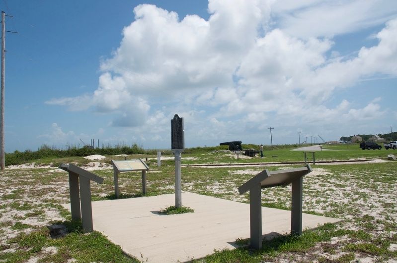
Second Battle of Fort Bower Marker
| 1 ► Alabama, Baldwin County, Fort Morgan — Second Battle of Fort Bowyer — February 8-12, 1815 — |
| On Fort Morgan Road (Alabama Route 180) 2 miles west of Dune Drive, on the left when traveling west. | |||
| 2 ► Alabama, Lauderdale County, Florence — Lauderdale County — |
| On West Alabama Street at South Court Street, on the right when traveling west on West Alabama Street. | |||
| 3 ► Alabama, Limestone County, Elkmont — Sims Settlement |
| On Easter Ferry Road south of Morris Road (County Road 49), on the right when traveling south. Reported missing. | |||
| 4 ► Alabama, Madison County, Huntsville — Revolutionary War — 1775 - 1783 — |
| On Monroe Street Northwest at Washington Street Northwest, on the left when traveling east on Monroe Street Northwest. | |||
| 5 ► California, San Luis Obispo County, Atascadero — Your American Heritage Monument — |
| Near El Camino Real near Mercedes Avenue (California Route 41), on the right when traveling north. | |||
| 6 ► Connecticut, Fairfield County, Stamford, Downtown — Freedom Shrine — |
| On Atlantic Street at Main Street, on the right when traveling north on Atlantic Street. | |||
| 7 ► Connecticut, New Haven County, Madison, Madison Center — Captain Frederick Lee — 1776 - 1831 — Citizen of Madison and Hero of War of 1812 — |
| On Meeting House Lane just west of Island Avenue. | |||
| 8 ► Connecticut, New Haven County, Madison, Madison Center — James Madison Memorial — 1751-1836 — |
| On Meeting House Lane just west of Island Avenue. | |||
| 9 ► Connecticut, New London County, New London, Fort Trumbull — The Third System — |
| Near East Street, on the left when traveling south. | |||
| 10 ► District of Columbia, Washington, Northwest Washington, American University Park — 15 — For the Children — Top of the Town — Tenleytown Heritage Trail — |
| On Nebraska Avenue Northwest at Van Ness Street Northwest, on the right when traveling south on Nebraska Avenue Northwest. | |||
| 11 ► District of Columbia, Washington, Northwest Washington, Downtown — "The Seven Buildings" — Erected c. 1795 — |
| On Pennsylvania Avenue Northwest west of 19th Street Northwest, on the right when traveling west. | |||
| 12 ► District of Columbia, Washington, Northwest Washington, Downtown — Discover DC / McPherson Square — |
| On Vermont Avenue Northwest at I Street Northwest, on the right when traveling south on Vermont Avenue Northwest. | |||
| 13 ► District of Columbia, Washington, Northwest Washington, Downtown — Fleeing the Executive Mansion — Star-Spangled Banner National Historic Trail — National Park Service, U.S. Department of the Interior — |
| Near H Street Northwest at Madison Place Northwest, on the right when traveling east. | |||
| 14 ► District of Columbia, Washington, Northwest Washington, Downtown — St. John's Church — Lafayette Square — Protestant Episcopal — |
| On 16th Street Northwest / Black Lives Matter Plaza north of H Street Northwest, on the right when traveling north. | |||
| 15 ► District of Columbia, Washington, Northwest Washington, Downtown — The Dolly Madison House — |
| On H Street Northwest at Madison Place Northwest, on the right when traveling east on H Street Northwest. | |||
| 16 ► District of Columbia, Washington, Northwest Washington, Foggy Bottom — Peace at Last! — Star-Spangled Banner National Historic Trail — National Park Service, U.S. Department of the Interior — |
| On New York Avenue Northwest at 18th Street Northwest when traveling west on New York Avenue Northwest. | |||
| 17 ► District of Columbia, Washington, Northwest Washington, Foggy Bottom — The Octagon — |
| On New York Avenue Northwest east of 18th Street Northwest, on the right when traveling west. | |||
| 18 ► District of Columbia, Washington, Northwest Washington, Foggy Bottom — The Octagon — |
| On 18th Street Northwest at New York Avenue Northwest, on the right when traveling north on 18th Street Northwest. | |||
| 19 ► District of Columbia, Washington, Northwest Washington, Georgetown — Francis Scott Key — 1779-1843 |
| On M Street Northwest at 34th Street Northwest, on the left when traveling west on M Street Northwest. Reported permanently removed. | |||
| 20 ► District of Columbia, Washington, Northwest Washington, Georgetown — Georgetown Refuge — Star-Spangled Banner National Historic Trail-War of 1812 — National Park Service, U.S. Department of the Interior — |
| On Q Street Northwest at 27th Street Northwest, on the right when traveling west on Q Street Northwest. | |||
| 21 ► District of Columbia, Washington, Northwest Washington, Georgetown — In Grateful Commemoration of the Signing of the Constitution — 1787 - 1937 — |
| On Q Street Northwest just west of 27th Street Northwest, on the right when traveling west. | |||
| 22 ► District of Columbia, Washington, Northwest Washington, Penn Quarter — Discover DC / Metro Center — |
| On 13th Street Northwest at G Street Northwest, on the right when traveling north on 13th Street Northwest. | |||
| 23 ► District of Columbia, Washington, Northwest Washington, The Ellipse — White House Ablaze — Star-Spangled Banner National Historic Trail — National Park Service, U.S. Department of the Interior — |
| On 15th Street Northwest north of Constitution Avenue Northwest (U.S. 50), on the left when traveling north. | |||
| 24 ► District of Columbia, Washington, Southeast Washington, Capitol Hill — Destroying the Library — Star-Spangled Banner National Historic Trail — National Park Service, U.S. Department of the Interior — |
| On Pennsylvania Avenue Southeast at 3rd Street Southeast, on the right when traveling west on Pennsylvania Avenue Southeast. | |||
| 25 ► District of Columbia, Washington, Southwest Washington, East Potomac Park — Forgotten Founder — National Mall and Memorial Parks, George Mason Memorial — National Park Service, U.S. Department of the Interior — |
| On East Basin Drive Southwest at Ohio Drive Southwest, on the left when traveling west on East Basin Drive Southwest. | |||
| 26 ► Florida, Santa Rosa County, Milton — The War Of 1812 — 1812 - 1815 — Santa Rosa Veterans Memorial Plazza — |
| Near Willing Street, 0.1 miles west of Caroline Street. | |||
| 27 ► Florida, Seminole County, Sanford — Mount Vernon Grove — Featured Tree — Mount Vernon Red Maple — |
| Near West 7th Street just west of Myrtle Avenue, on the right when traveling west. | |||
| 28 ► Florida, Seminole County, Sanford — Ponce de León Grove — Featured Tree — Ponce De León Live Oak — |
| Near Myrtle Avenue just north of West 7th Street, on the left when traveling north. | |||
| 29 ► Georgia, Madison County, Danielsville — 097-1 — Madison County — |
| On General Daniels Avenue (State Highway 8) at Madison Street, in the median on General Daniels Avenue. | |||
| 30 ► Georgia, Walton County, Monroe — 147-3 — James Monroe — |
| On South Broad Street (Georgia Route 11) 0 miles south of East Washington Street, on the right when traveling north. | |||
| 31 ► Illinois, Madison County, Alton — Freedom Shrine — |
| On Tavernier Way, 0.2 miles south of West MacArthur Drive (Illinois Route 111/140), on the left when traveling south. | |||
| 32 ► Illinois, St. Clair County, Cahokia Heights — John Jacob Hays — (1770-1836) — |
| On Elm Street at West 2nd Street on Elm Street. | |||
| 33 ► Kansas, Shawnee County, Topeka — Corridor of Flags — |
| Near NW Railroad Street near NW Curtis Street, on the left when traveling west. | |||
| 34 ► Kentucky, Hart County, Munfordville — William Clark and Family — |
| On East Union Street (State Road 357) east of Main Street (U.S. 31W), on the right when traveling east. | |||
| 35 ► Kentucky, Logan County, Russellville — 871 — John Littlejohn — |
| On Park Square at West 4th Street (Business U.S. 68), on the left when traveling south on Park Square. | |||
| 36 ► Kentucky, Logan County, Russellville — 2275 — John Littlejohn Cemetery — |
| On North Caldwell Street north of East 2nd Street, on the right when traveling north. | |||
| 37 ► Kentucky, Madison County, Richmond — 1223 — County Named, 1786 / County Formed — |
| On East Main Street (U.S. 25) at North 2nd Street, on the right when traveling west on East Main Street. | |||
| 38 ► Kentucky, Mason County, Maysville — Limestone Landing — 1780's — |
| Near East McDonald Parkway at Limestone Street. | |||
| 39 ► Louisiana, Ascension Parish, Gonzales — The War of 1812 — |
| Near South Irma Boulevard, 0.3 miles north of East Worthey Street, on the right when traveling north. | |||
| 40 ► Louisiana, East Baton Rouge Parish, Baton Rouge, Highlands/Perkins — Philogene Joseph de Favrot — 1791-1822 — |
| Near Oxford Avenue west of Amherst Avenue, on the right when traveling west. | |||
| 41 ► Maine, Kennebec County, Augusta — 22 — Flag Protest ~ War of 1812 / Drapeau en berne - Guerre de 1812 — Augusta, Maine — The Museum in the Streets® — |
| On Water Street south of Winthrop Street/Front Street, on the left when traveling north. | |||
| 42 ► Maryland, Anne Arundel County, Annapolis — Light House Bistro — |
| On Madison Place at West Street (Maryland Route 450), on the right when traveling south on Madison Place. | |||
| 43 ► Maryland, Anne Arundel County, Annapolis — Mann's Tavern — Site of the Annapolis Convention — September 11-14, 1786 — |
| On Conduit Street near Gorman Street, on the left when traveling south. | |||
| 44 ► Maryland, Anne Arundel County, Annapolis — 9 — Maryland State House — The Naval War of 1812 in Annapolis — Don't Give Up the Ship! — |
| On State Circle. | |||
| 45 ► Maryland, Baltimore, University of Maryland — Monumental Lives — |
| Near West Fayette Street at North Greene Street. | |||
| 46 ► Maryland, Calvert County, St. Leonard — “The Commodore Can Beat Any…Barges…Sent Against Him” — Maryland Republican, June 18, 1814 — Second Battle of St. Leonard Creek — |
| On Jefferson Patterson Park Road. | |||
| 47 ► Maryland, Charles County, Benedict — The British are Coming — Star-Spangled Banner National Historic Trail — |
| On Benedict Avenue at Potomac Avenue, on the left when traveling south on Benedict Avenue. | |||
| 48 ► Maryland, Charles County, Hughesville — Test of a New Nation — |
| Near Teagues Point Road, 0.1 miles north of Fairfax Court. | |||
| 49 ► Maryland, Charles County, Hughesville — War of 1812 — Benedict—Charles County, MD — Site of the First Foreign Invasion of the United States of America — |
| Near Teagues Point Road, 0.1 miles south of Fairfax Court. | |||
| 50 ► Maryland, Kent County, Chestertown — Revolution on the River — |
| On High Street, 0.2 miles north of Cannon Street, on the left when traveling north. | |||
| 51 ► Maryland, Montgomery County, Brookeville — A Refuge — Star-Spangled Banner National Historic Trail — National Park Service, U.S. Department of the Interior — |
| On High Street (Maryland Route 97) just south of Market Street, on the right when traveling north. | |||
| 52 ► Maryland, Montgomery County, Brookeville — August 26, 1814 — |
| On High Street (Maryland Route 97) just south of Market Street, on the right when traveling north. | |||
| 53 ► Maryland, Montgomery County, Brookeville — Bentley House — United States Capital for a Day — War of 1812 Bicentennial Brookeville, Maryland — |
| On Market Street, 0.1 miles east of North Street, on the left when traveling east. | |||
| 54 ► Maryland, Montgomery County, Brookeville — In This House — |
| On Market Street, 0.1 miles east of North Street, on the left when traveling east. | |||
| 55 ► Maryland, Montgomery County, Brookeville — Madison House — |
| On Market Street, 0.1 miles east of North Street, on the left when traveling east. | |||
| 56 ► Maryland, Prince George's County, Bladensburg — Clearing the Way to Washington — Star-Spangled Banner National Historic Trail — National Park Service, U.S. Department of the Interior — |
| 57 ► Maryland, Prince George's County, Colmar Manor — Famous Footsteps — Battle of Bladensburg — Star-Spangled Banner National Historic Trail — |
| On Bladensburg Road (Alternate U.S. 1) east of 40th Avenue. | |||
| 58 ► Maryland, Prince George's County, Colmar Manor — Second Line Falls — Star-Spangled Banner National Historic Trail — National Park Service, U.S. Department of the Interior — |
| On Bladensburg Road (Alternate U.S. 1) when traveling west. | |||
| 59 ► Maryland, Prince George's County, Colmar Manor — Second Line Falls — Star-Spangled Banner National Historic Trail |
| On Bladensburg Road (U.S. 1) at 38th Avenue, on the left when traveling south on Bladensburg Road. Reported missing. | |||
| 60 ► Maryland, Prince George's County, Cottage City — President's Surprise — Star-Spangled Banner National Historic Trail — National Park Service, U.S. Department of the Interior — |
| On 40th Avenue at Cottage Terrace, on the right when traveling south on 40th Avenue. | |||
| 61 ► Maryland, Prince George's County, Glenn Dale — Marietta — Home of Gabriel Duvall — (1752-1844) — |
| On Bell Station Road, 0.1 miles west of Glenn Dale Boulevard (Maryland Route 193), on the left when traveling west. | |||
| 62 ► Maryland, Prince George's County, Oxon Hill — The Burning of Washington, D.C. — Oxon Hill Farm - Oxon Cove Park |
| Near Oxon Hill Road west of Bald Eagle Road, on the left when traveling west. Reported damaged. | |||
| 63 ► Massachusetts, Bristol County, New Bedford — Captain Paul Cuffe — |
| On Union Street near 1st Street, on the right when traveling west. | |||
| 64 ► Massachusetts, Essex County, Marblehead — Fort Sewall — |
| Near Front Street at Fort Sewall Terrace, on the right when traveling north. | |||
| 65 ► Massachusetts, Essex County, Marblehead — Marblehead Light — Latitude 42 Degrees 30' 20" N Longitude 70 Degrees 50' 03" W — |
| Near Follett Street, 0 miles north of Kimball Street, on the left. | |||
| 66 ► New Jersey, Mercer County, Princeton — John Witherspoon — 1723 - 1794 — |
| Near Nassau Street, on the right when traveling east. | |||
| 67 ► New Jersey, Monmouth County, Matawan — Philip Morin Freneau — 1752 – 1832 — "Poet of the Revolution" — |
| On Poet Drive, on the right when traveling east. | |||
| 68 ► New Jersey, Morris County, Madison — James Madison — 1751 ---- 1836 — |
| On Main Street (New Jersey Route 124) at Waverly Place, on the right when traveling south on Main Street. | |||
| 69 ► New York, Erie County, Buffalo — Niagara River and her Ships — |
| Near Niagara Street (New York State Route 266). | |||
| 70 ► New York, New York County, Manhattan, East Village — Daniel D. Tompkins — A Great American — |
| On E 10th Street at Stuyvesant Street, on the left when traveling east on E 10th Street. | |||
| 71 ► New York, New York County, Manhattan, Flatiron District — Madison Avenue Centennial — 1836 1936 — |
| Near Madison Avenue, on the left when traveling north. | |||
| 72 ► New York, Orange County, Port Jervis — James Madison — |
| On Hammond Street at Sussex Street, on the left when traveling west on Hammond Street. | |||
| 73 ► New York, Putnam County, Cold Spring — Foundry Dock Park — Our Stretch of the River — |
| On Market Street, on the right when traveling south. | |||
| 74 ► New York, Putnam County, Cold Spring — History of West Point Foundry — A Birthplace of American Industry — |
| On Kemble Avenue, on the left when traveling south. | |||
| 75 ► New York, Saratoga County, Waterford — Eagle Tavern Site — Riverspark — |
| On 2nd Street north of Broad Street (U.S. 4), on the left when traveling north. | |||
| 76 ► North Carolina, Guilford County, Greensboro — J-6 — Dolly Madison — 1768-1849 |
| On West Market Street west of Dolley Madison Road, on the right when traveling west. Reported missing. | |||
| 77 ► Ohio, Coshocton County, Warsaw — 2-16 — Colonel William Simmons — 1757 - 1823 — |
| On Main Street (U.S. 36) at Plum Street, on the right when traveling west on Main Street. | |||
| 78 ► Ohio, Fairfield County, Pickerington — Francis H. Game Cemetery — |
| Near Bowen Road, 0.5 miles south of Long Road, on the right when traveling north. | |||
| 79 ► Ohio, Franklin County, Columbus, Central Clintonville — Clintonville / Clinton Township — |
| On North High (U.S. 23) at East North Broasway, on the right when traveling north on North High. | |||
| 80 ► Ohio, Gallia County, Rio Grande, Raccoon Township — 20-27 — The Village of Adamsville — |
| Near Farmview Road (Local Road 71) north of State Route 588. | |||
| 81 ► Pennsylvania, Cumberland County, Carlisle — Dickinson’s Historic Triangle — |
| Near N West Street west of Dickinson Avenue when traveling west. | |||
| 82 ► Pennsylvania, Cumberland County, Carlisle — West College: A National Historic Landmark — Walking Tour Stop 16 — |
| On W High Street (U.S. 11), on the right when traveling west. | |||
| 83 ► Pennsylvania, Erie County, Erie, Millcreek Township — A Climate For War — |
| Near Fisher Drive at Thompson Drive, on the right when traveling east. | |||
| 84 ► Pennsylvania, Fayette County, Farmington, Wharton Township — The National Road — Fort Necessity National Battlefield — National Park Service, U.S. Department of the Interior — |
| Near National Pike (U.S. 40) west of the entrance to Fort Necessity Battlefield, on the left when traveling west. | |||
| 85 ► Pennsylvania, Fayette County, Point Marion — Albert Gallatin — |
| 86 ► Pennsylvania, Lancaster County, Lancaster — The War of 1812 — |
| On Penn Square. | |||
| 87 ► Pennsylvania, Philadelphia County, Philadelphia, Old City — 654 — James Madison 4th President lived here — |
| On South 4th Street at Walnut Street on South 4th Street. | |||
| 88 ► Pennsylvania, Philadelphia County, Philadelphia, Society Hill — Society Hill / The New Market and Head House — |
| On Pine Street at South 2nd Street, on the right when traveling east on Pine Street. | |||
| 89 ► Pennsylvania, Philadelphia County, Philadelphia, William Penn Annex East — The House & the People Who Worked & Lived In It — |
| On Market Street at South Independence Mall West (6th Street), on the right when traveling east on Market Street. | |||
| 90 ► South Dakota, Pennington County, Keystone — George Washington — 1st President — 1789-1797 — |
| Near State Highway 244. | |||
| 91 ► Tennessee, Giles County, Pulaski — Establishment of Pulaski / Giles County — |
| Near South Sam Douglas Avenue south of East College Street. | |||
| 92 ► Tennessee, Giles County, Pulaski — Pulaski Cornerstone — Northeast — |
| On East Grigsby Street (Alternate Route 31) east of North 1st Street (U.S. 31), on the right when traveling east. | |||
| 93 ► Tennessee, Giles County, Pulaski — Pulaski Cornerstone — Southeast — |
| On South Sam Davis Avenue south of Cleveland Street, on the right when traveling south. | |||
| 94 ► Texas, Madison County, Madisonville — 11258 — Madison County — |
| On North May Street (State Highway 75), on the right when traveling north. | |||
| 95 ► Vermont, Addison County, Addison — Chimney Point — |
| On Vermont Route 125 at Vermont Route 17, on the right when traveling east on State Route 125. | |||
| 96 ► Vermont, Grand Isle County, Alburg, Alburgh — The International Boundary is Settled / La frontière internationale est définie — |
| Near North Main Street (U.S. 2) south of Missle Base Road, on the left when traveling east. | |||
| 97 ► Virginia, Albemarle County, Charlottesville — G-23 — James Monroe’s First Farm — Site of the University of Virginia — |
| On McCormick Road south of University Avenue (Business U.S. 250), on the left when traveling south. | |||
| 98 ► Virginia, Albemarle County, Charlottesville — Wood Trades — |
| Near Monticello Loop at Thomas Jefferson Parkway (Virginia Route 53), on the left when traveling north. | |||
| 99 ► Virginia, Albemarle County, Charlottesville, Venable — I-3 — University of Virginia — |
| On University Avenue (Business U.S. 250) at Rugby Road on University Avenue. | |||
| 100 ► Virginia, Alexandria, Old Town — The Edmonson Sisters — Alexandria Heritage Trail — City of Alexandria, est. 1749 — |
| On Duke Street (Virginia Route 236) at Holland Lane, on the right when traveling west on Duke Street. | |||
171 entries matched your criteria. The first 100 are listed above. The final 71 ⊳