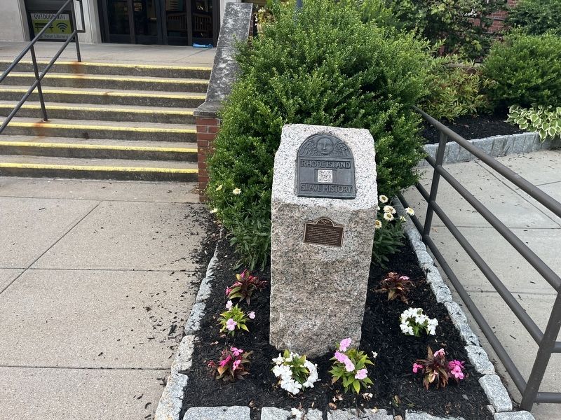
By Devry Becker Jones (CC0), July 12, 2024
Barrington Marker
| Near Town Hall Drive north of County Road (Rhode Island Route 103), on the right when traveling north. |
| On East Bay Bike Path east of County Road (Rhode Island Route 114), on the right when traveling east. |
| On East Bay Bike Path at Bay Spring Avenue, on the right when traveling north on East Bay Bike Path. |
| On East Bay Bike Path west of Kirby Street, on the right when traveling west. |
| Near Town Hall Drive north of County Road (Rhode Island Route 103), on the right when traveling north. |
| On East Bay Bike Path at Alfred Drowne Road, on the right when traveling north on East Bay Bike Path. |
| On Alfred Drowne Road at Washington Road, on the right when traveling west on Alfred Drowne Road. |
| On East Bay Bike Path at Metropolitan Park Drive, on the left when traveling south on East Bay Bike Path. |
| On East Bay Bike Path 0.3 miles west of South Lake Drive, on the left when traveling west. |
| On Rumstick Road near between Rumstick Road and Rumstick Road, on the left when traveling west. |
| On East Bay Bike Path at New Meadow Road, on the right when traveling west on East Bay Bike Path. |
| On Wampanoag Trail (Rhode Island Route 114) at Kyle Circle, on the right when traveling north on Wampanoag Trail. |
| On County Road (Rhode Island Route 103/114) at Mathewson Road, on the right when traveling west on County Road. |
| On County Road (Rhode Island Route 103/114) at Cady Road, on the right when traveling north on County Road. |
| On George Street 0.2 miles south of Warren Avenue, on the right when traveling east. |
| On Town Hall Drive north of County Road ( Route 103), on the right when traveling north. |
| Near South Lake Drive at Washington Road, on the right when traveling east. |
| On Town Hall Drive north of County Road ( Route 103/114), on the right when traveling north. |
| On Church Street west of South Street, on the right when traveling east. |
| On Ferry Road (Rhode Island Route 114) south of Old Ferry Road, on the right when traveling south. |
| Near Hope Street (Rhode Island Route 114) south of Court Street, on the right when traveling north. |
| On Ferry Road (Rhode Island Route 114) east of Old Ferry Road, on the right when traveling south. |
| Near Hope Street (Rhode Island Route 114) at Court Street, on the left when traveling south. |
| On Hope Street (Rhode Island Route 114) south of Court Street, on the left when traveling south. |
| On Thames Street at Constitution Street, on the left when traveling south on Thames Street. |
| On Thames Street south of Franklin Street, on the right when traveling south. |
| On High Street just north of Congregational Street, on the right when traveling north. |
| On Wood Street south of State Street, on the left when traveling south. |
| On Hope Street (Rhode Island Route 114) south of Washington Street, on the right when traveling north. |
| On Thames Street at Church Street, on the left when traveling north on Thames Street. |
| On High Street south of Bradford Street, on the left when traveling south. |
| On Wood Street south of State Street, on the right when traveling north. |
| On Thames Street at Oliver Street, on the right when traveling south on Thames Street. |
| Near Thames Street near State Street, on the left when traveling north. |
| Near Thames Street north of John Street, on the left when traveling north. |
| On State Street west of Thames Street, on the left when traveling west. |
| Near Thames Street at Bradford Street, on the right when traveling south. |
| Near Thames Street at Bradford Street, on the right when traveling south. |
| On Thames Street south of Franklin Street, on the right when traveling south. |
| Near Thames Street south of John Street, on the right when traveling south. |
| On Thames Street south of Franklin Street, on the right when traveling south. |
| On Hope Street (Rhode Island Route 114) south of Court Street, on the left when traveling south. |
| Near Tower Street (at milepost 0.7), 0.2 miles south of Tower Street. |
| On Thames Street north of State Street, on the left when traveling north. |
| On Church Street at High Street, on the right when traveling west on Church Street. |
| On Thames Street at Oliver Street, on the left when traveling north on Thames Street. |
| On Hope Street (Rhode Island Route 114) at Bradford Street, on the right when traveling north on Hope Street. |
| On Thames Street south of Oliver Street, on the right when traveling south. |
| Near Metacom Avenue (Rhode Island Route 136) 0.1 miles south of Mount Hope Avenue, on the right when traveling north. |
| On Mount Hope Bridge (Rhode Island Route 114) 0.1 miles south of Old Ferry Road, on the left when traveling south. |
| On State Street east of Hope Street ( Route 114), on the right when traveling east. |
| On Thames Street north of Franklin Street, on the right when traveling south. |
| On Hope Street (Rhode Island Route 114) south of Wardell Street, on the right when traveling north. |
| On Hope Street (Rhode Island Route 114) north of Colt Avenue, on the right when traveling south. |
| Near Hope Street (Rhode Island Route 114) south of Court Street, on the right when traveling north. |
| On Hope Street (Rhode Island Route 114) just north of Washington Street, on the right when traveling south. |
| On State Street west of High Street, on the right when traveling west. |
| On Hope Street (Rhode Island Route 114) south of Court Street, on the left when traveling south. |
| Near Thames Street north of John Street, on the right when traveling south. |
| On Hope Street (Route 114) at Church Street, on the right when traveling south on Hope Street. |
| On Hope Street (Rhode Island Route 114) at State Street, on the left when traveling north on Hope Street. |
| On Hope Street (Rhode Island Route 114) south of Burnside Street, on the right when traveling north. |
| On Thames Street at Franklin Street, on the right when traveling south on Thames Street. |
| On Thames Street north of Franklin Street, on the left when traveling north. |
| On Burnside Street east of Hope Street ( Route 114), on the right when traveling east. |
| On Hope Street (Rhode Island Route 114) south of Court Street, on the left when traveling south. |
| On Ferry Road (Rhode Island Route 114) south of Old Ferry Road, on the right when traveling south. |
| On Hope Street (Rhode Island Route 114) north of Elmwood Drive, on the right when traveling south. |
| On Hope Street (Rhode Island Route 114) at Church Street, on the right when traveling south on Hope Street. |
| On Hope Street (Rhode Island Route 114) at State Street, on the left when traveling north on Hope Street. |
| On Main Street (Rhode Island Route 114) at Miller Street, on the right when traveling south on Main Street. Reported damaged. |
| On Water Street south of Haile Street, on the left when traveling south. |
| On Child Street (Rhode Island Route 103) at Hugh Cole Road, on the right when traveling east on Child Street. |
| Near Asylum Road 0.3 miles west of Cole School Road, on the left when traveling north. |
| Near Asylum Road 0.3 miles west of Cole School Road, on the left when traveling north. |
| On Baker Street at Water Street, on the right when traveling west on Baker Street. |
| On Baker Street just west of Water Street, on the left when traveling west. |
| On Main Street (Rhode Island Route 114) at Market Street, on the right when traveling south on Main Street. |
| On Church Street west of Main Street ( Route 114), on the right when traveling west. |
| On Water Street south of State Street, on the right when traveling south. |
| On Water Street north of Bake Street, on the left when traveling north. |
| On Jefferson Street west of Main Street ( Route 114), on the left when traveling west. |
| On North Main Street (Rhode Island Route 114) west of Crescent Street, on the right when traveling west. |
| On State Street east of Eddy Street, on the left when traveling east. |
| On Market Street at Kickemiut Road on Market Street. |
| On State Street west of Main Street ( Route 114), on the left when traveling east. |
| On Main Street (Rhode Island Route 114) at Jefferson Street, on the right when traveling north on Main Street. |
| On Baker Street at Narragansett Way, on the right when traveling west on Baker Street. |
| On Washington Street at Main Street, on the right when traveling west on Washington Street. |
| Near Asylum Road 0.3 miles west of Cole School Road, on the left when traveling north. |
| On Water Street north of Sisson Street, on the left when traveling north. |
| On Flat River Road (Rhode Island Route 117) east of Brenda Drive, on the right when traveling east. |
| On Main Street (Rhode Island Route 117) west of Battey Avenue, on the right when traveling west. |
| On Flat River Road (Rhode Island Route 117) east of Brenda Drive (Walker Lane), on the right when traveling east. |
| On Main Street (Rhode Island Route 117) west of Battey Avenue, on the right when traveling west. |
| Near Taft Street, on the right when traveling north. |
| On Flat River Road (Rhode Island Route 117) east of Brenda Drive (Walker Lane), on the right when traveling east. |
| On Flat River Road (Rhode Island Route 117) east of Brenda Drive (Walker Lane), on the right when traveling east. |
| Near Taft Street, on the right when traveling north. |
| On Taft Street, on the right when traveling north. |
1049 entries matched your criteria. The first 100 are listed above.
Next 100 ⊳
