Stephen W. Miles was born in New York and came to this area in 1819. He was a successful businessman and acquired large tracts of land. He would stand on the bluff and say, "For miles and miles, it all belongs to Miles." He would eventually . . . — — Map (db m233012) HM WM
The Pioneer Mill was a center of early commerce. Often its water wheel ran a saw mill as well as a grist mill. Mills operated at this site for over 100 years. Prior to the War of 1812, much flour was shipped to St.Louis and New Orleans, in the late . . . — — Map (db m140360) HM
William H. Bissell 1811-1860. The eleventh governor of Illinois lived in this vicinity before he was thirty, serving as pioneer physician, teacher, and lawyer. He was elected as a democrat to the state legislature, becoming speaker of the house, . . . — — Map (db m144918) HM
Early Community History
St. Joe is located in what was originally the New Design Precinct. The name New Design originated with James Lemen, Sr., who observed that he had a "new design” to make a settlement south of Bellefontaine (Waterloo). . . . — — Map (db m198039) HM
This small community is located in the southern part of New Design Precinct. It was settled in the late 1830's by immigrants from Tipperary, Ireland. The press of economic and political circumstances caused many Irish to immigrate to Monroe . . . — — Map (db m207126) HM
Shadrach Bond Sr., a soldier of the Revolution War and the army of George Rogers Clark settled about one-third mile east of this marker in 1782.
His nephew, Shadrach Bond the first Governor of the State of Illinois (1818-1892) moved here . . . — — Map (db m199226) HM
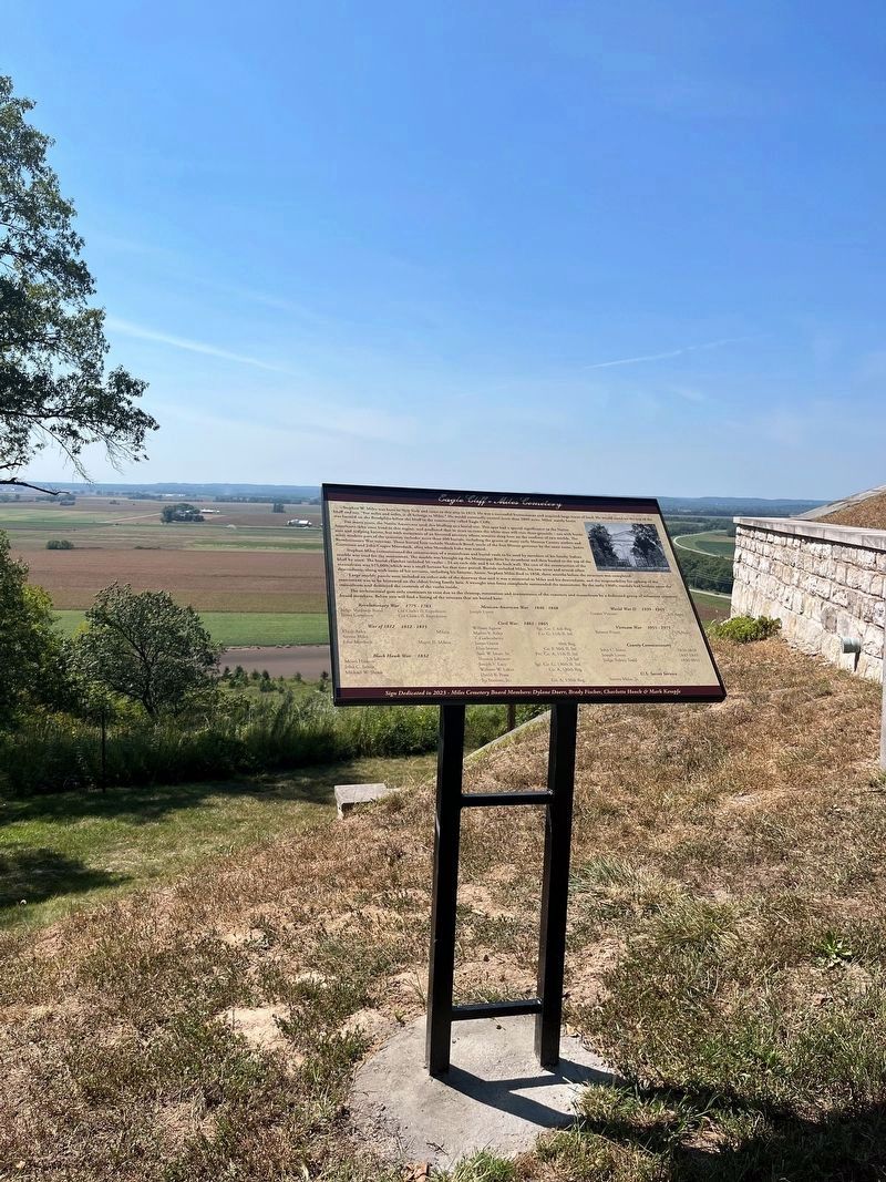
Eagle Cliff Graveyard was established as a public graveyard on land donated by Truman Miles.
The first person to be buried in Eagle Cliff Graveyard was Rachel Bond, wife of Judge Shardrach Bond, Sr. on March 17, 1806.
The vault was . . . — — Map (db m199231) HM
The earliest structures in the area of Fountain were two brick homes built by George Atcheson. Daniel Shook came to the area from Pennsylvania and operated a blacksmith shop there and farmed. When the railroad came through in the early 1900's, . . . — — Map (db m204534) HM
The church was organized in 1841 by pastor G. A. Schieferdecker and settlers from Saxony, Thuringia, and Westfalia, Germany. The site was donated in 1849 by Johann Christian and Katherine Just. The present church was erected in 1863, and the tower . . . — — Map (db m140384) HM
Armin Henry Krueger 1914-1996, served as caretaker of Illinois Caverns for 45 years his constant presence and willingness to share his affection for underground Monroe County enhanced the experience for countless visitors to the cave. His humble . . . — — Map (db m175246) HM
Bellefontaine was one of the first settlements made by Americans in what is now Illinois. The earliest settlers included families of Revolutionary War veterans who had served with George Rogers Clark. Captain James Moore brought a band of pioneers . . . — — Map (db m140335) HM
In 1838, McKendree Moore, with his father, Enoch Moore, owned a mercantile store here, which carried on until the death of McKendree Moore in 1840. The Moore family was one of Waterloo's first settlers. Enoch Moore, born in 1783 in the blockhouse at . . . — — Map (db m140341) HM
To honor the soldiers who fought in the American Civil War, Shane Douglas marked the graves of 99 Veterans buried in the City of Waterloo for his Eagle Scout Project. There are 67 buried in Waterloo City Cemetery, 31 buried in St. Peter & Paul . . . — — Map (db m146844) WM
William R. Morrison, destined to be elected a Colonel during the American Civil War, was of Scotch-Irish descent, born on September 14, 1824. Although raised on a farm, upon his father's remarriage following the death of William's mother, they moved . . . — — Map (db m136540) HM
This building as it stands today sits on combined lots, which were originally the sites of a rock residence and a butcher shop, Theodore Ruch's meat market. The meat market was a family operated business in the 1880's ran by prominent butchers . . . — — Map (db m140469) HM
The corn stubble left over from the harvest presented problems for the farmer. Plowing would not cover up the corn stalks adequately, which interfered with the planting of next year's crop. Exposed stalks promoted insects and disease. This gave rise . . . — — Map (db m187466) HM
These earliest settlers Capt. James Moore, The leader. Shadrach Bond, Robert Kidd, Larken Rutherford, and James Garretson, were who served under George Rogers Clark in 1778.
They arrived with their families in the spring of 1782 and . . . — — Map (db m227340) HM
When the early settlers came up the Mississippi River to Kaskaskia and north to Bellefontaine in 1781, they were under the government of the French. Their only elected officer was a justice of the peace. The first court was held at the Ditch . . . — — Map (db m219730) HM
Colonel William R. Morrison
One of Waterloo's most renowned and distinguished citizens was Colonel William R. Morrison, to whom the city owes its library.
The library building at the corner of Library and Park Streets was Colonel . . . — — Map (db m219967) HM
The first roads through the town of Waterloo were Indian trails created by buffalo going from one hole to another. The first trails were made for foot travel and horses traveling in single file. trails were later widened by the use of axes and . . . — — Map (db m220257) HM
SS. Peter & Paul Catholic Church
This church was established in May 1843, originally meeting in homes. The congregation, organized by Fr. M. Pendergast, completed construction of its first church in 1852, a 40-by-70-foot brick building at . . . — — Map (db m219728) HM
Near this marker stood the boyhood home of Thomas Ford, 1800-1850, eighth Governor of Illinois. He held many public offices before serving as Governor, 1842-1846. His mother Elizabeth Forquer Ford, a pioneer school teacher, raised her seven children . . . — — Map (db m144934) HM
Kaskaskia-Cahokia Trail: 40 Miles to Kaskaskia
20 Miles to Cahokia Here passed the ancient trail trod first by buffaloes and Indians, then by explorers, traders and French settlers of Kaskaskia and Cahokia. Revolutionary War soldiers with . . . — — Map (db m140364) HM
213 South Main Street
Became the headquarters of Harrisonville Telephone Company in 1905 when the Company moved in, occupying one-fourth of the building. At that time, the remaining space was apartments.
As Harrisonville . . . — — Map (db m144220) HM
In 1818 George Forquer purchased and, along with Daniel P. Cook, began laying out the lots that would become known as Original Waterloo or Old Town Waterloo. They immediately sold lot 82 in Block 11 to Alexander Wells for $20. It stayed in the . . . — — Map (db m140426) HM
The Beginning
The settlement of Madonnaville was not always called Madonnavile, it was originally known as James Settlement or James Mills, In June of 1804 ,Austin James moved here with his family. For many years the James family was the . . . — — Map (db m179195) HM
The hay tedder was introduced in the mid-1800s. It turned over the cut hay exposing it to the sun and wind, thereby speeding drying time in preparation for baling.
Donated by Henry Rahe — — Map (db m187481) HM
James Lemen
Born in Virgina, Nov. 20, 1760
Died in Illinois Jan. 8, 1823
A Revolutionary Soldier, Indian
Fighter, Anti Slavery Leader,
Baptist Minster and Organizer
of the First Churches in Illinois.
His wife
Katherine Ogle . . . — — Map (db m204648) HM
Captin James Moore was an officer of the Virginia Militia during the American Revolution. Under the command of Colonel George Rogers Clark, he took part in an expedition to Illinois in 1778. Captain Moore led his group by boat to Kaskaskia in 1782 . . . — — Map (db m143246) HM
John Deere revolutionized farming with the introduction of his steel plow in 1837, which replaced fragile and inefficient wood and cast-iron models. In 1875, The John Deere Co. introduced the riding sulky plow, which eliminated the slow and . . . — — Map (db m187467) HM
Ditch Tavern…
…was the first hotel in Waterloo located on North Main Street, and run by David and Hannah Ditch. David H. Ditch owned the land on which Waterloo was built until it was purchased by George Forquer in 1818.
The Old Tavern . . . — — Map (db m148322) HM
Log cabin donated by the:
Conrad Kolmer Family
to the Peterstown Heritage Society.
The farm was purchased in 1851.
The log cabin was moved from their
125 Acre farm two miles north of Waterloo. — — Map (db m148324) HM
The second American settlement in the northwest territory was established in 1782 by Capt. James Moore, an Officer of the American Revolution serving with the Virginia Militia. He was commissioned by Gov. Patrick Henry and sent George Rogers Clark . . . — — Map (db m145121) HM WM
Waterloo was named after the town of Belgium, site of Napoleon's defeat by Wellington, but why was this particular name given to this town?
The town was originally divided into two parts - Bellefontaine at the south, named by the French for . . . — — Map (db m219947) HM
The Illinois State Register in Springfield on September 4, 1840, reported that Lincoln arrived in Waterloo on Sunday, August 23, 1840. A notice was posted at the courthouse Monday morning, August 24, that Lincoln would address the people on . . . — — Map (db m219660) HM
Martini Cemetery
also known as Goeddeltown Cemetery
1862 to 1942
You are gone but not forgotten
Ruht in Frieden
[Rest in peace]
— — Map (db m168728) HM
In January 1946, several overseas veterans of Monroe County began talking about the possibilities of organizing a Veterans of Foreign Wars Post in Monroe County. Raymond Oestreich, Frank Eichelmann and William Emick were among these men, and that . . . — — Map (db m179272) HM WM
At 6:30p.m. on Saturday, May 14, 1966 a natural gas explosion destroyed three buildings on Mill Street. The explosion leveled the two-story Ziebold Utilities Co. and the three story vacant building formerly occupied by the Monroe County Electric . . . — — Map (db m219664) HM
On this site on August 25, 1840, Abraham Lincoln presented a political speech for Whig Party at the Monroe County Courthouse.
This tablet erected by the Monroe County Bicenntennial Committee
August 6, 2016 — — Map (db m140355) HM
January 6, 1816 — An Act of the legislature of the Illinois Territory was enacted to form a new county out of Randolph and St. Clair Counties to be called Monroe County named after then U.S. Secretary of State James Monroe who would be elected . . . — — Map (db m205551) HM
In memory of
Monroe County
World War Veterans
Apr-6-1917 - Nov-11-1918
Columbia - Waterloo
erected by
Columbia Post 581-Goeddel-Buettner Post 747 — — Map (db m140349) WM
Archie W • Berry, Missing in Action U.S. Navy, served during World War II, Memorialized: tablets of the missing, Honolulu Memorial, Honolulu, Hawaii •
John H • Bickelhaupt, Killed in Action, U.S. Army, served during World War I, Buried Plot F . . . — — Map (db m182226) WM
This beautiful mural,
hand-painted by Elaine and John Polizzi,
is dedicated to
Adolph Gaitsch,
one of the first draftees in World War II,
Earl Rietz,
who served in the Korean War
and all the Veterans who have ever called . . . — — Map (db m146072) WM
The north end of Waterloo was originally called Peter's Town, for Emery Peter Rogers, 1795-1859. Coming from Massachusetts in 1816, he started with 5 acres here on the west side of the Kaskaskia Trail, where he operated a grist mill, woolen mill, . . . — — Map (db m143475) HM
Waterloo's partnership with its Sister City, Porta Westfalica, West Germany, was formally organized on March 31, 1981. The conception took actually place on October 2, 1980, when a small group of people, led by the genealogical research done by . . . — — Map (db m219739) HM
A Potter's field is a term used for a place for the burial of unknown or indigent people. The expression potter's field derives from the Bible, referring to a field used for the extraction of potter's clay; such land, useless for agriculture, . . . — — Map (db m140353) HM
President Barak Obama visited
Monroe County in 2004, when he
was running for the U.S. Senate.
His visit occurred after his
speech at the 2004 Democratic
National Convention.
He was greeted by
a large crowd of
Monroe County Democrats, . . . — — Map (db m219663) HM
In Memory of the Revolutionary Patriots of Monroe County, Illinois
William Biggs • Shadrach Bond, Sr. • Ebenezer Bourn • John Doyle • James Garretson • Pierre Giradot • Andrew Hilton • William Howard • Jacob Judy • Robert Kidd • James Lemen . . . — — Map (db m173568) WM
On May 11, 1845, a German-speaking Protestant congregation was organized at the Philip Baum residence near here that same year, a log church was erected and a cemetery was opened on six acres immediately north of this spot which was donated by . . . — — Map (db m140506) HM
The first brewery established in Waterloo, the Koechel brewery, was built at this location in 1847 by john and Elizabeth Koechel.
It is believed to have been a wooden structure which was replaced by a brick building in 1852. John Koechel ran . . . — — Map (db m140421) HM
This tractor was used through out the 1950, by Don Stumpf Sr. to till many gardens in Columbia, IL.
Donated by the don Stumpf family — — Map (db m187502) HM
In honor of these Revolutionary War soldiers who put down roots in New Design settlement and are buried in the New Design Cemetery.
Zebediah Barker, Sgt. — MA
Born 25 Nov 1750, Essex Co., MA
Died 10 Oct 1819, Monroe Co., IL
Moses . . . — — Map (db m247112) HM WM
Built over 100 years ago this smokehouse still stans on its original site. With its distinctive red roof and door, the smokehouse remains in its original condition and is now Annbriar's logo. — — Map (db m175613) HM
In 1886, Peter Feller bought a wooden structure for $2,500 located on lots 13, 14 and 15 of block 19, which would later be addressed as 141 South Main Street, and known as the Southern Hotel. In 1892, the hotel was rebuilt of brick and a tavern . . . — — Map (db m206201) HM
Predecessor to Gibault High School
This flag pole stood in front of Memorial Hall.
Foundation stones and sandstone from the front entrance of the high
school building form the bench supports.
The bricks for the planter are . . . — — Map (db m219224) HM
St. Paul United Church of Christ, of Waterloo, Illinois, had its beginning in 1846, in response to the formation of new denomination in Europe…a merger of many churches of German Reformed and Lutheran origin into the United Evangelical Church of . . . — — Map (db m220354) HM
History
Saints Peter and Paul Parish was founded in 1843, when, "On May 7th, 1843 the first Catholic baptisms of Catharine Glessner, Jacob Syler, and George Miller were recorded by Fr. Patrick McCabe. He was an itinerant priest from Ireland . . . — — Map (db m184542) HM
The land on which Hopskeller now stands dates back to March, 1816, when William Lemon purchased nearly 255 acres at a cost of $2 per acre. This land encompassed all modern-day downtown Waterloo.
For unknown reasons, in January of 1817 (only ten . . . — — Map (db m140337) HM
According to the late Mame Wetmore Horine, who remembered watching the building go up, the Advocate building was built in 1868 at 222 South Main Street. It was a brick, three-story structure.
In 1862, J. F. Gotshall became the editor of the . . . — — Map (db m168403) HM
This stone arch bridge dates back to 1877 when it was built by Charles Liebheit and Christian Hartmann. It extends over a tributary of Fountain Creek, called Moore's Run (named after James Moore, one of the founders of Waterloo). This bridge is . . . — — Map (db m143476) HM
Captain James Moore was an officer of the Virginia Militia during the American Revolution. Moore had an adventurous spirit and organized settlers to move to the West. The government offered the emigrants land grants for settlement in the vast, . . . — — Map (db m219744) HM
This statue pays homage to the buffalo, or bison which roamed the uplands of Monroe County thousands of years ago, trampling down prairie grasses, creating what became the Kaskaskia-Cahokia Trial. The trail was also used by Native Americans and was . . . — — Map (db m143250) HM
This historic building, known officially as Tax Lot 2 in Block 8 of
Waterloo, dates back to the year 1845 and has served many purposes
throughout the years. Unfortunately, we have no record of what it was
used for in its earliest years, other . . . — — Map (db m143251) HM
John Coleman purchased three lots (115, 117, and 119 East Mill) in 1834. The present building at 115 was built before the Civil War. In 1862 Coleman sold the property to William Hursey who later sold it to Paul C. Brey, who was a German native born . . . — — Map (db m140459) HM
The first French people came to Illinois during the seventeenth century because of political instability in France. The settlers took a trail from Kaskaskia to Cahokia called the "Hill Trail" Along this trail, just south of Waterloo, is a spring . . . — — Map (db m219731) HM
The Garretson Home was built in 1852 as a family home in the Italianate style, by William C. Garretson, a prominent figure in the history of Monroe County. William Garretson was a direct relative of James Garretson, one of the founding fathers of . . . — — Map (db m140387) HM
The Küenster Building is named after its builder, Hubert Küenster, who built it as home to his pharmacy in 1871. Küenster was appointed as a Postmaster in 1865, so there is belief that the Post Office was also in this building at one point in time, . . . — — Map (db m140348) HM
Hubert Küenster immigrated to America from Germany in May 1852. He came to St. Louis, where he was a clerk in Dr. Berghoff’s drug store for a year. Some of his countrymen were residents in the neighborhood of Waterloo, and at their request, Küenster . . . — — Map (db m143986) HM
The Moore family left a distinguished mark on Waterloo's history.
Some time after settlement at Bellefontaine had been made, Captain James Moore, having established to some degree amicable relations with the Indians, took steps toward . . . — — Map (db m219950) HM
Since the late 1800’s, citizens have worked to provide the community of Waterloo, Illinois, with a public library to serve as a cultural center. In 1892, Henry and Mary Talbott donated their personal collection of over 3,000 books and periodicals to . . . — — Map (db m144987) HM
Elizabeth and William Sinnhold were the first owners of the land of which the Odd Fellows building sits today. In 1875, M.C. Rodenberger and Wm. Kestner, established M.C. Rodenberger and Company, which made and sold marble and granite monuments, . . . — — Map (db m140519) HM
This property, located at 116 North Main Street, dates back to the year 1843. Not much is known about its original owners, John H. and Mariah Pirtle. They sold the building to Thomas Singleton on June 13, 1843 for two hundred and thirty-five . . . — — Map (db m148321) HM
The Peterstown House is located at 275 North Main Street in Waterloo. In the early days, this area was part of a claim on the Kaskaskia Land Grant owned by Joseph Wooley. In 1817, Enoch Moore obtained the property by paying back taxes of four . . . — — Map (db m219949) HM
The Pluth Building was originally constructed in 1885 as a two-story building which featured a French-style mansard roof. The roof reached the height of the current building's third floor. Original sketches of the building plans detail the upstairs . . . — — Map (db m140350) HM
Original site was near Maeystown, purchased by Frederick Schatte in 1888. The Schatte family used the cabin for shelter until their home was built. Donated by Halbert Schatte to Peterstown Heritage Society in 1975. Moved to this site by Alfred . . . — — Map (db m148325) HM
The Schmitt-Nobbe Building has been a grocery store for the bulk of its existence. In 1941 Ambrose Schmitt inherited the property, along with several other properties, from his wife Annie Schmitt upon her death. Ambrose decided to leave it all to . . . — — Map (db m140381) HM
Records dating back to 1837 tell us that David Ditch, an early pioneer of Waterloo, was the original owner of this property. David Ditch is known for operating Waterloo’s first hotel and bar, called Ditch Tavern, which was about 2 blocks north of . . . — — Map (db m148323) HM
Before 1830, John Coleman erected a large windmill at the corner of Main and Mill where this building stands today. He also owned a mill next door. The mill was changed into an ox-mill in 1837 and destroyed by fire in 1857, when it was a steam . . . — — Map (db m140392) HM
Henry Wallhaus was born on April 7, 1847 in Daenkershausen, Germany. His family emigrated to the U.S. in 1855and settled in the Columbia, Illinois area. Shortly after, the Wallhaus' bought a farm in the Foster Pond area. Henry farmed his father . . . — — Map (db m181911) HM
This property, 107 South Main Street, is officially known as Tax Lot 11 in Block 12 of Old Town, now City of Waterloo, Monroe County, Illinois. Property deeds date back to 1867, when its first owners, John and Mary Harms sold the property to . . . — — Map (db m156248) HM
The Ziebold Fountain
Mary Ziebold, native of Waterloo, went off to study music at a young age, and made a name for herself as a talented opera singer. Through studying music abroad, she maintained an intense love of her home . . . — — Map (db m189613) HM
Manufactured by the Minneapolis Steel & Machinery Co. Separating the grain from the chaff and stalk via the threshing machine was one of agriculture's greatest advancements. Threshing machines enabled the U.S. to become the greatest producer and . . . — — Map (db m187503) HM
U.S. American Legion, GAR 1861-1865, U.S. World War Veteran, American Legion Auxiliary, World War 1917- 1918, Veterans of Foreign Wars United States, — — Map (db m191773) WM
From the
people of
Monroe
County
Illinois
In honor
of those
who perished
In tribute
to those
who served
In gratitude
to those
now serving
— — Map (db m143503) WM
The Waterloo City Hall is situated on Lots 75 and 76 at 100 West Fourth Street in the southerly block between Main Street and Church Street.
In 1816, George Forquer purchased a tract of land that is now part of the City of Waterloo. Forquer and . . . — — Map (db m144219) HM
By ring this bell, cast in 1894, early members of the Waterloo Volunteer Fire Company were called to action to assist their neighbors in times of emergency.
Since that time, the bell has graced every fire station the Waterloo Fire Department . . . — — Map (db m148284) HM
Tuesday night band concerts have long been special in
Waterloo-one could go uptown on a beautiful summer evening to listen to a free concert with family and friends. Ice cream and popcorn always available as a special treat.
The city has . . . — — Map (db m204834) HM
To honor the brave soldiers who fought in World War I, Sam Thomas marked the graves of WW I Veterans buried in the City of Waterloo that did not already have a military recognition. There are 25 in the Waterloo City Cemetery and 18 in St. Peter . . . — — Map (db m146821) WM