On Dunsmuir Avenue north of Siskiyou Avenue, on the right when traveling south.
Dunsmuir Centennial Committee
Baseball legend 'Babe' Ruth and his New York Yankee team mate Bob Meusel played in an exhibition game with local teams here on October 22, 1924.
Dedicated by
Grand Parlor,
Native Sons of the Golden West
June . . . — — Map (db m40198) HM
On Dunsmuir Avenue north of Siskiyou Avenue, on the right when traveling south.
Locomotive 1727 is a Class M-6 Mogul built by Baldwin Automotive Works in 1901. It served Southern Pacific in California and Oregon until 1956. 1727 is one of only seven Mogul engines surviving today out of 355 originally built.
Donated by S.P. . . . — — Map (db m40383) HM
In 1886. Alexander Dunsmuir, the son of wealthy coal baron Robert Dunsmuir from Vancouver, British Columbia, visited this area while en route to San Francisco. Alexander was charmed by the rugged beauty of the region and made a proposition to the . . . — — Map (db m40495) HM
On Howell Avenue near Collier Way, on the left when traveling west.
The city of Etna began in 1853 with the construction of a sawmill. In 1855 a flour mill was built and named Rough and Ready Mill. Stores, a hotel and schools were established by 1858.
In 1854 a flour mill was erected a mile away and named the . . . — — Map (db m70270) HM
American Legion
Perry Harris Post 260
dedicates this
Veterans Memorial
to the men and women
who have served in the
Armed Forces of the
United States of America
2006
World War I plaque
Presented by the Class of 1917
as a . . . — — Map (db m113340) WM
On Howell Road near Center Street and Diggles Road.
Hallie Morse Daggett was a refined woman educated in San Francisco, however, her deep love for her childhood home at the Black Bear Mine near Sawyers Bar drew her back to the mountains. She knew how to hunt, fish, ride, trap and shoot early in life . . . — — Map (db m57944) HM
The Etna Chapter of the Independent
Order of Odd Fellow #184 was founded
on January 18, 1871. There were 11
charter members. This brick building
was designed by Louis Fafa and was
built in 1881. The upper floor was used
for lodge . . . — — Map (db m112494) HM
Near Sawyers Bar Road, on the left when traveling south.
Arrived in California in 1852
via Isthmus of Panama
Lieut. Governor 1883-1887
Supt. San Francisco Mint 1893-1897
Owner Black Bear Mine
Production 3,000,000 dollars — — Map (db m70272) HM
Near Howell Road near Center Street and Diggles Road.
Alexander Johnson donated the land for the first High School, City Park and the Catholic Church.
Leonard Joss, naturalist, landscaped the first city park, planted diverse flora all around Etna.
In honor of their generosity we dedicated . . . — — Map (db m58567) HM
On Higway 3 (at milepost 23.5) near Holzhauser Road, on the left when traveling south.
Crystal Creek Methodist Church was organized July 1, 1854. Among the dearest memories of the Old Log Church are those of the pioneers of Crystal Creek Sanitary Association organized in 1863, for relief work during the Civil War. The Old Log Church . . . — — Map (db m70269) HM
On Diggles Street at Main Street on Diggles Street.
This land of ‘Siskiyou’...
‘Beaver Valley'...
“Rough and Ready”...
‘Aetna Mills’... ‘Etna’...
many names – but
One land of majestic mountains, pristine rivers & lakes. Sparkling streams flow through meadows filled . . . — — Map (db m57946) HM
On Deadwood Creek Road (Federal Route 45N49) at McAdams Creek Road, on the right when traveling west on Deadwood Creek Road. Reported missing.
The town of Deadwood, in its brief existence, was one of the most important business centers in early Siskiyou County. In 1857 there wee three stores, three saloons, two butcher shops, a bakery, a blacksmith shop, two stables, and a dairy. Among the . . . — — Map (db m110735) HM
On Main Street (California Route 3), on the right when traveling north.
The discovery of gold in the early 1850’s brought miners, businessmen and the army to this valley, with the army establishing a post in 1852.
Improvements to the old trail were completed in 1854 allowing freight and stagecoaches to travel the . . . — — Map (db m70258) HM
On Eastside Road 0.4 miles south of Main Street, on the right when traveling north.
On this ground there was established on Oct. 16, 1852 a military post by Companies A and B First United States Dragoons. From April 23 1853 until June 28 1858, the date of its abandonment, this fort was garrisoned by Company E 4th US Infantry. . . . — — Map (db m157682) HM
On East St at Sterling St, on the right when traveling north on East St.
To the Memory of Those Who
Made the Supreme Sacrifice For
Our Country in the World Wars
World War I
Ed Del Ray • Maud Evans • Perry Harris • George V. Mathews • Leonard Schull • William A. Sheffield • Hallet Smith • Joe Silva • Frank J. . . . — — Map (db m113424) WM
On Scott River Road (at milepost 18), on the right when traveling north.
U S Forest Ranger
John F. Williams
Memorial Bridge
Gave his life to save
the life of a drowning
girl at this location
June 24, 1940 — — Map (db m70257) HM
On Scott River Road near Quartz Valley Road, on the left when traveling west.
The Meamber School District was formed in May, 1870. Land for the schoolhouse and grounds was donated by what was then the Goodale Ranch.
For the next 87 years, children of the area were educated in the Meamber schoolhouse from first through . . . — — Map (db m70255) HM
Co. E 4th Infantry
Enlisted 1849 • Discharged 1854
Served under Lieut. U.S. Grant
Pioneer packer and rancher
Married Mary J. Fragley 1864
They had a family of nine children:
James, Charles, Alice, Lillian, Helena,
William, Gertrude, . . . — — Map (db m70268) HM
On Eastside Road at Sterling Street, on the left when traveling south on Eastside Road.
To the memory of those who made the supreme sacrifice for out county in the World Wars
World War I
Ed Del Ray • Maud Evans • Perry Harris • George V. Mathews • Leonard Schull • William A. Sheffield • Hallett Smith • Joe Silva • Frank J. . . . — — Map (db m70267) WM
On Big Springs Road (County Route A-12 E) near Lake Shore Drive, on the right when traveling south.
A dream of Dr. G.W. Dwindle and others was realized when this dam was completed in 1927. The water surface is 1,800 acres, the length of the shoreline is over 15 miles, the maximum depth is 80 feet. 11,000 acres of farm land are irrigated from this . . . — — Map (db m89115) HM
On Harry Cash Road at Aubrey Lane when traveling north on Harry Cash Road.
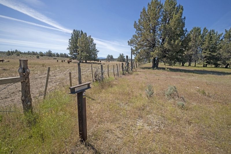
"Drove 16 miles down Shasta Valley, most of the way good roads, no hills to cross now, but in places the road is stony. Today passed one or two houses. The first I have seen for several months" - James S. Cowden, Oct 11, 1853 — — Map (db m151631) HM
On Hilt Road near King Street, on the left when traveling west.
In honor
of our veterans
who sacrificed their
lives in World War II
Alphonse, L.G. • Baugartnere, W. • Bernheisel, T.L. • Capello, A.F. • Clark, J.J. • Dunaway J.S. • Dutro, W.E. • Harris, Wm • Ladd, J. • Mottern, R. • Russell, F.S. . . . — — Map (db m88021) WM
On Front Street near Henly-Hornbook Road, on the right when traveling north.
This plaque commemorates the 60th anniversary of the American Legion. The national charter was signed in Hornbook on Sept. 16, 1919 by President Woodrow Wilson while his train stopped enroute from Portland to San Francisco. — — Map (db m88022) HM
On Iron Gate Lake Road (Copco Road) near Camp Creek Road, on the left when traveling east.
On September 29 and 30, 1841, a detachment of the Wilkes expedition numbering 33 persons under the command of lt. George Emmons camped near this site. The party was in route from Fort Vancouver, Washington to Yerba Buena, California, and spent two . . . — — Map (db m89089) HM
On Copco Road at Oregon Road, on the left when traveling east on Copco Road.
On Aug. 8, 1853 Captain Alden led 10 men of the 4th U.S. Infantry from Fort Jones and 80 volunteers from Yreka over these mountains to the assistance of the Rogue River Valley.
This force augmented by 100 volunteers from Oregon defeated the . . . — — Map (db m70216) HM
On Copco Road at Oregon Road, on the left when traveling west on Copco Road.
Originally this area was known as Cottonwood, for the trees that grew along the creek. Gold was discovered here in 1851 by John Thomas, and many rich mines were located nearby, the “Brasswire Mine” and the “Jillson Mine” . . . — — Map (db m70217) HM
On Hilt Road at Siskiyou Avenue, on the left when traveling west on Hilt Road.
In 1851 John Hilt made his way to California from Illinois, landing in Hangtown. Hearing of rich diggins made his way north to Yreka by 1852. Finding way to the Cottonwood area (Hornbrook) where he worked mining, ranching, farming and saw milling. . . . — — Map (db m112571) HM
On Klamathon Road near Ager Road, on the right when traveling west.
On this site was located the historic lumber town of Klamathon. Townsite laid out in 1888 by the Klamath River Lumber and Improvement Company with the sawmill completed on July 23, 1892. The town boasted a sawmill, box factory, sash and door . . . — — Map (db m70458) HM
On Tennant Road south of Shasta Drive, on the right when traveling north.
Named after John D. Tennant, an official of the Long Bell Lumber Co. Besides the store that is still here, the town had a church, post office, library, hotel, skidsshacks, schools, and a roundhouse at the height of logging operations. Trains were . . . — — Map (db m99900) HM
On Red Rock Road, on the right when traveling west.
"After noon we drove on until night and no water to be seen
anywhare; so we pitched camp and stayed all night without
water; in the morning we hitched up and pushed on for water"
-James Baron, Aug 9, 1855 — — Map (db m151586) HM
"At noon we came to a pine forest. Traveled in it the
rest of the day. One very steep stony hill to go up.
Road considerably stony at intervals all day."
- George McCowen, Aug 28, 1854 — — Map (db m151589) HM
"Started at 6 went on to pine woods took dinner no
water or grass then passed on to Butte Creek & followed
it three miles & campt round a little lake quite stony to
day poor country"
- Hinsdale Truman Shepard Sep 4, 1852 — — Map (db m151590) HM
On California Route 89, on the right when traveling east.
Was a stage stop on first wagon road into Siskiyou County. The road known as Military Pass Road (circling Mt. Shasta to the east & north) was a link between Fort Crook and Fort Jones with the railroad advancing as far as Bartle. The town consisted . . . — — Map (db m69858) HM
On Ager Beswick Road at Hornbrook Ager Road on Ager Beswick Road.
Here along the Oregon-California Stage Road of 1856, a new road east to Linkville, now Klamath Falls, was built in 1876.
With the arrival of the Central Pacific Railroad in 1887, Jerome B. Ager saw a need for a hotel, general store, saloon and . . . — — Map (db m151102) HM
On Lower Little Shasta Rd, on the right when traveling east.
Dedicated to the memory of the
Pioneers of Little Shasta Valley
who raised this House to the Glory of God.
On March 5, 1876
The Little Shasta Congregational Church
was formed. It was in 1877
that the first subscriptions were
taken for . . . — — Map (db m112622) HM
On South 11th Street (California Route 3) at East Webb Street, on the left when traveling south on South 11th Street.
On January 17, 1887 L.D. Norton, Assistant Engineer for the Southern Pacific Company, began to layout this townsite named in honor of Samuel S. Montague who was Chief Engineer of the Central Pacific Railroad most noted for his skillful engineering . . . — — Map (db m69875) HM
On Snowden Hovey Gulch Road at Ball Mountain Road on Snowden Hovey Gulch Road.
A small settlement started here in the 1880’s with two stores. A post office (established in 1888), saloon, blacksmith shop, slaughter-house, meat market, harness shop, race track, ball park and a few houses. Farther east was a grist mill. The post . . . — — Map (db m69873) HM
On Montague Grenada Road, on the right when traveling south.
"Started & went 15 miles to Shasta River & campt
verry cold nights frost last night not [feeling]
any better" - Hinsdale Truman Shepard, Sep 7, 1852 — — Map (db m151633) HM
On Harry Cash Road, on the left when traveling north.
"The first day of October we journeyed west fourteen miles to the Snelling Ranch, now called the Hurd Ranch, near Sheep Rock, Shasta Valley." - Andrew Soule, Oct 1, 1854 — — Map (db m151629) HM
On North Old Stage Road at Hatchery Lane, on the right when traveling south on North Old Stage Road.
Across the road from this marker stood the Strawberry Valley Stage Station which served the patrons of this line from its completion in 1857 until 1886 when the railroad construction reached the valley.
The small building across the road was . . . — — Map (db m69860) HM
On North Old Stage Road at Lassen Road, on the right when traveling north on North Old Stage Road.
Dedicated to William and Mary Parker Sullaway the first family to settle in Strawberry Valley in 1858. Sullaway was founder of the Pioneer State Line from Yreka to Shasta, Shasta County in 1857. Forest Home located on this site was this first . . . — — Map (db m69859) HM
Site of Berryvale Post Office. It operated from 1870 to 1887. Postmasters were JH Sisson, GL Lamphere, ET Keyser, Sophia J Fellows. The post office moved to the railroad station in 1887 and became known as Sisson in 1924. It was renamed Mt. Shasta. . . . — — Map (db m62786) HM
Near West Alma Street near Maple Street when traveling south.
Mount Shasta, administered by the Forest Service, United States Department of Agriculture, has been designated a Registered Natural Landmark.
This site possesses exceptional value as an illustration of the nation's natural heritage and . . . — — Map (db m89118) HM
On Eddy Gulch Lookout Road, on the left. Reported missing.
In 1913, Hallie Daggett accepted the job at the Eddy Gulch Lookout, entering history books as the Forest Service’s first woman lookout (1913-1927). At a time when men dominated the workplace, this act took special courage, self-confidence, and a . . . — — Map (db m151909) HM
On Sawyers Bar Road, on the left when traveling west.
Sawyers Bar is perhaps the most picturesque of the northern mining towns. It was founded in 1850 by Captain John Best and party who were guided to the spot by a friendly Indian. The town was originally called Bestville and had over 3,000 . . . — — Map (db m70287) HM
Near Klamath River Highway (California Route 96 at milepost 70) near Scott River Road, on the right when traveling west.
The piles of boulders you see before you were made around 1850.
The miners used both windlass and water powered derricks to lift and pile these rocks in their search for placer gold in the underlying sands.
Water power for the . . . — — Map (db m89092) HM
On Scott River Road near Mill Creek Road, on the left when traveling south.
This monument overlooking the spot where gold was first discovered in Siskiyou County in the summer of 1850 is dedicated to the memory of John Scott — — Map (db m89090) HM
On Volcanic Legacy Scenic Byway (California Route 97) 3.3 miles north of Grass Lake Fire Road, on the left when traveling north.
"Went 15 miles came to a big meadow [grass lake] & campt we took water with us this morning found no good water here" - Phoebe S. Terwilliger, Oct 11, 1854 — — Map (db m151608) HM
On Tennant Road 0.8 miles north of Forest Road 44N25, on the left when traveling north.
"Only drove 6 miles to a good camping place. Are yet on Butte Creek. There is a large amount of timber ... The hills and mountains are nearly all covered with a heavy growth of pine timber" - James S. Cowden, Oct 9, 1853 — — Map (db m151604) HM
On Forest Rd 44N06X, on the right when traveling west.
"We are now out of the diggers and and in the Shasta
Valley tribe (country) they are not so hostile" - Sophronia Helen Stone, Sep 20, 1852 — — Map (db m151592) HM
On no nearby street, on the right when traveling north.
"The next day we followed up Butte Creek for six
miles and pitched our tents. We lost a fine horse here."
- Andrew Soule, Sep 29, 1854 — — Map (db m151595) HM
On Forest Road 44N18Y 0.8 miles east of Forest Road 44N23, on the right when traveling east.
Original Marker (2008):
Yreka Trail - Splendid Pine Timber
"Passed through splendid pine timber & fur [sic] & spruce ... Passed the dividing ridge of the Shasta Mountains Verry [sic] rough & bad roads this afternoon 18 miles to day . . . — — Map (db m151902) HM
Near Hill Road (Route 10) near County Route 120, on the left when traveling south.
Forced to flee the stronghold, the Modoc took cover amid the craggy lava features in this area. A group under Scarface Charley watched from the Schonchin Flow as Army troops marched from Gillems Camp toward their concealed position.
Officers . . . — — Map (db m87906) HM
Near County Route 120 near Wildlife Refuge Tour Road, on the right when traveling west.
It was April 11, 1873, the middle of the Modoc War. Though greatly outnumbered, Modoc warriors had easily defeated the Army in the first battle for the Stronghold in January, and soldiers had waited through the winter while peace talks dragged . . . — — Map (db m298151) HM
Near County Route 120 near Hill Road (County Route 10), on the right when traveling east.
Over the years, various individuals and group have made efforts to memorialize the death of General E.R.S. Canby, the only general to be killed in an Indian War. This wooden cross is a replica of an original erected by a U.S. soldier in 1882, just . . . — — Map (db m87909) HM WM
President Franklin Delano Roosevelt established the Civilian Conservation Corps on March 31, 1933, to provide employment for America's youth and promote the nation's economic recovery. The CCC's work involved conservation projects on forest, park . . . — — Map (db m547) HM
For thousands of years, the hill rising in front of you was an island. Ancient Lake Modoc lapped against its base, scouring cliffs. Later, Native Americans canoed to these cliffs to carve symbols in the soft volcanic tuff, and Modocs still tell of . . . — — Map (db m13736) HM
Near County Route 120 near Hill Road (County Route 10), on the left when traveling west.
This was the shoreline of Tule Lake in 1872-73. The Modoc Indians occupying the Stronghold obtained water at this point.
Once nearly 100,000 acres, the lake was drained between 1912 and 1958 to make fertile land available for homesteads. — — Map (db m87914) HM
On County Route 120 near Hill Road (County Route 10), on the left when traveling west.
Thousands of years ago, flowing lava cooled forming a natural fortress. The surrounding area later became the center of the Modoc Indian homeland. A series of events made this lava stronghold a focal point in the war to remove the Modoc from their . . . — — Map (db m87917) HM
On Hill Road (County Route 10), on the left when traveling south.
Preserved for its caves and volcanic features since 1925, Lava Beds serves as an outdoor school for professional and amateur geologists alike. While the monument covers only ten percent of the surface area of the massive Medicine Lake shield volcano . . . — — Map (db m63272) HM
On Dorris Brownell Rd, on the left when traveling west.
“Crossed on the natural bridge ... Composed of
solid rock ... Went 15 miles had some stony
road and came to Clamouth Lake & campt”
-Phoebe Hogeboom Terwilliger, Oct 8, 1854 — — Map (db m113111)
On Dorris Brownell Rd, on the left when traveling south.
“Morn. Fine. Cook still sick no breakfast or dinner
for today. Get away in good time road runs
over the bluff quite rocky to lake”
-John Pratt Welsh, Aug 26, 1853 — — Map (db m113116)
On Dorris Brownell Rd, on the left when traveling west.
“Here road leaves [Klamath] Lake and follows up the
side of a steep hill 1/2 mile but is not hard to climb”
-William Cochran Stoddard, Sep 16, 1852 — — Map (db m113109)
“When I was a child…I played around Tule Lake where the tules and grass grow thick… We used to go out in the tall grass… and look for chub fish… and shoot at (them) with our arrows.”
Peter Schonchin, last surviving . . . — — Map (db m63249) HM
Near Hill Road (County Route 10), on the left when traveling south.
Imagine watching hot lava flowing toward you at this spot over twelve thousand years ago. Like treads rolling on a tank, the clinker, cooling front of the flow fell off and was run over by the hot molten core. The Devils Homestead flow, which . . . — — Map (db m63258) HM
On Hill Road near East West Rod, on the left when traveling north.
1935-1942
Civilian Conservation Corps
This camp was built and staffed by the CCC, an organization that was established during the Great Depression by President Franklin Roosevelt to reduce unemployment and to preserve the nation's . . . — — Map (db m88000) HM
He owned no car nor house, yet spent much of his life studying the Lava Beds area, walking along the shore of Tule Lake from the town of Merrill. He discovered many geologic features, naming, describing, and photographing them. He was particularly . . . — — Map (db m113342) HM
By April 1873, months of peace talks to end the Modoc War had gone nowhere. General E.R.S. Canby found himself caught between President Grant’s Indian Peace Policy and the desire of some settlers to have the Army eliminate the Modoc band. The . . . — — Map (db m63211) WM
“Peaceable if you can, forcibly if you must,” ordered Indian Agent T. B. Odeneal. The U.S. Army garrison’s task was to bring the Modocs and their leader, Captain Jack, back to the reservation. His refusal started the Modoc War in the . . . — — Map (db m63213) WM
Lower Klamath National Wildlife Refuge has been designated a Registered National Historic Landmark under the provisions of the Historic Sites Act of August 21, 1935. This site possesses exceptional value in commemorating and illustrating the . . . — — Map (db m100345) HM
It is difficult today to trace the disposition of all those killed in action during the Modoc War. This site was first consecrated January 17, 1873, when two soldiers were buried here. It became an official cemetery in April when thirteen enlisted . . . — — Map (db m63670) HM
On Hill Road (County Road 10), on the left when traveling south. Reported missing.
At some time within the last several thousand years, an eruption of magna from the bottom of the earth crust sent a broad stream of hot liquid rock across this land. The flow started to your right, 3.2 kilometers (2 miles) south of here at the site . . . — — Map (db m63253) HM
The “chimneys” before you built up as hot gasses propelled globs of lava high into the air like lumpy oatmeal boiling over a pot. This lava quickly formed dramatic, hollow spatter cones as it fell back to the ground. Later, less . . . — — Map (db m113375) HM
On Hill Road (County Road 10), on the left when traveling south.
Through the winter of 1872-1873, a vastly outnumbered group of Modoc Indians resisted attempts by the U.S. Army to remove them from their homeland. Driven from Captain Jack's stronghold, the Modoc moved into this area in mid-April. Intimate . . . — — Map (db m63270) WM
Near Volcanic Legacy Scenic Byway, on the right when traveling south.
From this command post, the U.S. Army directed part of a frustrating campaign against a small band of Modoc Indians. Determined to defend their homeland, the Modoc consistently outmaneuvered the Army, who at times outnumbered them ten to one. Just . . . — — Map (db m154350) HM
On Dorris Brownell Rd (U.S. 97), on the left when traveling south.
“Crossed the Sacremento [Lost River], over the hill
or divide to a large swamp down this to a lake
(Clammett) about 3 ms, down the lake and camped”
-Lester Hulin, Oct 8, 1847 — — Map (db m113117)
On U.S. 97 at Military Pass Road, on the right when traveling north on U.S. 97.
As early as 1852 wagon trains of overland emigrants crossed 600 feet to the north into Shasta Valley and Yreka; and at this point the 1857 Military Pass from Fort Crook emerged to join the westward emigrant road. — — Map (db m151607) HM
Near California Route 97, on the left when traveling north.
Dominating the landscape, Mt. Shasta can be seen for 100 miles from certain points drawing hikers, skiers and travelers. Mt. Shasta rises 11,000 fro the base to the summit for a total elevation of 14,162’ above sea level, one of the nation’s largest . . . — — Map (db m69866) HM
Dedicated To
Our Members Who
Gave Their Lives
In The Service
Of Their Country
World War 2
Sgt. Julian Tosi
Lt. Italo Barbieri
Mm 1c Leandro C. Bortolazzo — — Map (db m113243) WM