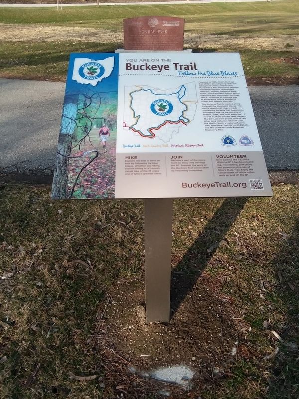
Founded in 1959, Ohio's Buckeye
Trail (BT) is the only long-distance
hiking trail entirely within Ohio.
More than 1,400 miles loop through
wooded footpaths, abandoned
railroads, historic towpaths, back
roads, rivers and lake shores, . . . — — Map (db m173056) HM
Founded in 1959, Ohio's Buckeye Trail (BT) is the only long-distance hiking trail entirely within Ohio. More than 1,400 miles loop through wooded footpaths, abandoned railroads, historic towpaths, back roads, rivers and lake shores, within both . . . — — Map (db m281475) HM
Worthington's Cemetery. Known But To God. Around 1855, Archibald Worthington designated a section of his farm land for use as a cemetery. A 1936 Works Progress Administration (WPA) survey of the area noted the significance of . . . — — Map (db m286671) HM
Ohio's Buckeye Trail (BT) was first envisioned in 1958 as a hiking trail to
connect Lake Erie to the Ohio River through the rugged hills of eastern
and southern Ohio. In 1959 a devoted group of volunteers founded the
Buckeye Trail Association . . . — — Map (db m281474) HM
The Penney Nature Center was founded in 2001, following the generous donation of 78 acres of land from Ms. Nancy Jo Penney, an heiress of the J. C. Penney Company. This land, once part of the Penney Family Farm, is now dedicated to conservation . . . — — Map (db m306838) HM
Founded in 1919, Zonta International is a global service organization of executives in business and the professions working together, across political and social boundaries, to advance the status of women worldwide. The Defiance chapter was founded . . . — — Map (db m234348) HM
(Side One)
Evansport is named after brothers Amos and Albert G. Evans who, with Jacob Coy, had the village surveyed next to the Tiffin River on December 14, 1835. The "port" suffix in Evansport's name reflects the river's significance as . . . — — Map (db m69001) HM
In true appreciation of all veterans who have preserved this great nation
Erected and donated by VFW Post 3360 - 2002
A gift by Homier's Monumental — — Map (db m196805) WM
Congregation organized - 1849
First church built - 1860
Moved across road - 1895
Merged with St. John Evangelical Lutheran
Church, Hicksville, Ohio 1926
Seventy-seven years of glory to God
and Christian service
to this community and . . . — — Map (db m269442) HM
G.A.R.
Sacred to the memory of the soldiers who served in the Union Army during the War of the Rebellion of 1861 - 65.
In God We Trust.
Liberty, Justice, Truth
One flag and one country. — — Map (db m219737) WM
[Front Side Text]:"Daeida Hartell Wilcox Beveridge"
Born in Hicksville in 1862, Daeida H.W. Beveridge co-developed and named, in 1887, the Los Angeles, California, suburb of Hollywood, since the early 1900s a world center of the film and . . . — — Map (db m53185) HM
These flagpoles are dedicated in honor of the men and women of this congregation who have faithfully served in the armed forces of the United States of America. — — Map (db m269274) WM
Presented to the community of Hicksville by
Carma Johnson Rowe
1953 A.D.
Built on the site of the home of A.P. Edgerton,
a founding father of this community. — — Map (db m173034) HM
In 1838 the honorable Mr. A.P. Edgerton, agent for the Hicks Land Company of New York, erected this building as his headquarters from which he sold land to the first settlers of this community. It became the property of the building and loan . . . — — Map (db m53137) HM
Highland is actually the oldest registered breed in the world. The Highland breed is predominantly used for beef production, but can be milked on a small scale. Their milk has a high butterfat content. They're known to live for about 20 years. — — Map (db m282704) HM
St. Paul's Episcopal Church
1875
National Historical Site
Marked in 1990
Hicksville Historical Society &
Capt. George Athey Chpt., CDXVIIC — — Map (db m53221) HM
Who?
Hicksville Historical Society (HHS) is made up of individuals, groups, & businesses dedicated to preserving Hicksville, Ohio's story. It is managed by a Board of Directors who are local residents passionate about connecting with our . . . — — Map (db m282703) HM
The majestic eastern white pine grew straight up 200 feet, perfect for ships masts it was a source of the Colonists livelihood. Great Britain claimed the pines for their ships and taxed and oppressed the colonies in many other ways. George . . . — — Map (db m221508) HM
Guardians of our flight to Freedom
Dedicated to our courageous Veterans
Revolutionary War 1775 - 1783 •
War of 1812 1812 - 1815 •
Civil War 1861 - 1865 •
Spanish American War 1898 . . . — — Map (db m221505) WM
The Meuse-Argonne Campaign was a major part
of the final allied offensive of World War I
stretching along the entire western front.
It was fought between the Meuse River and
Argonne Forest in three phases, beginning on
September 26, 1918, and . . . — — Map (db m219736) HM WM
World War One
Global war originating in Europe, July 28, 1914 to Nov. 11, 1918. The U.S. entered the war on April 6, 1917. At least fourteen Hicksville veterans lost their lives. Three local men were killed in action on the same day, . . . — — Map (db m221595) HM WM
• The Bald Eagle's transformation is a remarkable journey of growth and change. These majestic birds take approximately 5 years to achieve their iconic appearance.
• When eaglets are first born, they have downy gray feathers.
• In the . . . — — Map (db m279505) HM
This area is thought to be the burial place of more than 300 soldiers who once
camped at Fort Winchester, Camp No. 3, also known as Fort Starvation, during the
War of 1812. They were led by Brigadier General James Winchester.
Kentucky . . . — — Map (db m265379) HM
Kentucky & Ohio Soldiers
Who died in service to our country
within Defiance County, Ohio
Ensign James Liggett •
Pvt. Wyatt Stepp •
Pvt. Guy Hinton •
Pvt. William Bevis •
4th Sgt. Nathaniel Mitchell •
Johnny Logan Indian Scout • . . . — — Map (db m173603) WM
Lock No. 13 & Independence Dam
Through this lock passed many canal boats carrying produce, goods, and passengers not only from Ohio and Indiana but from as far south as New Orleans and as far east as New York City. Boats were drawn by . . . — — Map (db m195867) HM
This tree is planted in honor of the Ohio Department of Natural Resources' 75th Anniversary in 2024. The Division of Forestry, one of the oldest formal forestry programs in the nation, works to protect, sustainably manage, and expand Ohio's . . . — — Map (db m269874) HM
Introduced to Ohio during the 1800s, Osage orange is commonly found in rural areas in fields and fence rows, This deciduous tree's common name is derived from the Osage Native American tribe and its bright green, warty fruits, also known as hedge . . . — — Map (db m297962) HM
In memory of
those who have served
in the armed forces
of the
United States of America
donated
in appreciation by the
Jewell American Legion
And Auxiliary — — Map (db m264887) WM
Rivers of Life
For centuries, the Maumee and Auglaize rivers shaped life here. Native Americans, including Ottawa leader Pontiac and Shawnee chief Blue Jacket, hunted, fished, and held councils along these waterways.
From Swamp to . . . — — Map (db m297961) HM
Winchester's Camp No. 3/Fort Starvation. Camp No. 3 was located about six miles below Fort Winchester on the north side of the Maumee River. Militiamen from Kentucky, part of the forces led by War of 1812 Brig. Gen. James Winchester, occupied . . . — — Map (db m37924) HM
Founded in 1959, Ohio's Buckeye Trail (BT) is the only long-distance hiking trail entirely within Ohio. More than 1,400 miles loop through wooded footpaths, abandoned railroads, historic towpaths, back roads, rivers and lake shores, within both . . . — — Map (db m265380) HM
Memorial to the Heroes of 1861 to 1865
Who Gave Their Lives That Our Nation Might Live
Erected by Hancock WRC No. 282
Hancock Post No. 579 G.A.R.
The Monument was originally dedicated on July 3, 1909 through the
efforts of the Hancock . . . — — Map (db m223719) HM WM
The refurbished monument was dedicated on July 4, 2007 almost 98 years
to the day it was originally dedicated. The Sherwood Community dedicated
this renewed monument with an expanded mission, "In Tribute To All
Veterans.” - All Veterans who . . . — — Map (db m173175) HM
The memorial replaces this Civil War Memorial
which had been erected and dedicated July 3, 1909,
the statue is preserved from the Civil War Memorial.
The inscription on the memorial read:
Memorial to the heroes of 1861 to 1865
who gave . . . — — Map (db m173176) HM WM
Tale of Ensign James Liggett
After American militia troops forcibly ended the 1812 siege of Fort Wayne, General James Winchester's Army of the Northwest marched down the north side of the Miami (Maumee) River to stop or retard advancing . . . — — Map (db m265378) HM
In 1855, Pioneer Roman Catholic settlers
of the Black Swamp erected a 16 x 24
log church where you are now standing
reserving the land beside it for their
cemetery thus founding St. Stephen's
Parish.
Here they assembled to worship . . . — — Map (db m173133) HM
This spot marks the crossing of the Michigan
Meridian and the West Line of the 1807 Treaty of
Detroit. In October of 1815 Deputy Surveyor
Benjamin Hough, Alexander Holmes and 11
crew members passed through here as they
surveyed North from Fort . . . — — Map (db m172682) HM
In 1897, as the congregation grew, its members decided to construct a
new building. It was located at the junction of County Roads C and 13
just southeast of Wauseon, Ohio. The church had a bell tower and the
bell had two ropes, one for ringing . . . — — Map (db m171978) HM
Bur oak can be told by its fiddle-shaped leathery leaves, huge fringed acorns, thick and sometimes corky
twigs, and deeply ridged bark add to its bold texture. Bur oak is often a dominant savanna or woodland
species in the Great Plains and . . . — — Map (db m173276) HM
The caboose is one of the most iconic images related to.trains, they were much more
than simply the “end of the train.” The caboose served several practical functions. The
first use was as an office for the conductor who was . . . — — Map (db m171976) HM
As populations increased and villages began
to expand, the problem of what to do with
law breakers, who needed to be incarcerated for short periods of time, arose.
Built about 1865, this Edgerton, Ohio jail
was a temporary holding facility for . . . — — Map (db m171974) HM
The first settlers in German Township
traveled from eastern Ohio in covered
wagons created by putting bows and a canvas
on a farm wagon. The wagon was packed
with the most valuable items on the bottom.
This included seed for crops and . . . — — Map (db m171968) HM
Two Purple Hearts
Distinguished Flying Cross
O.L.C. Air Medal
Graduate of Archbold High School in May of 1967 and entered military service in June of 1967.
Entered Vietnam in August of 1969 with the 17th Air Cavalry Troop B, 3rd . . . — — Map (db m130966) WM
This building is an original one-room schoolhouse built in 1898 and located along the
Michigan border, north of current day Sauder Village. It was called the "Rosehill
School” but was renamed the "District 16 School” when it was moved . . . — — Map (db m171977) HM
A pioneer furniture manufacturer and philanthropist, Erie J. Sauder (1904-1997) was born and reared on a farm in Archbold. With the help of his wife Leona, he began woodworking in their town barn in 1934. Crafting tables and church pews, the Sauder . . . — — Map (db m69003) HM
On June 24th, 1836, Peter F. and Catherine M. Goll along with their 2 year old son, Peter F. Jr., embarked from Grand-Charmont, Doubs, France to come to America.
After 2 ½ months on the ocean they landed in New Amsterdam, (New York) and . . . — — Map (db m172017) HM
A living memorial to the Goll Family whose love of trees preserved this natural sanctuary through five generations. The forest is part of a 320-acre farm purchased in 1837 from the U.S. Government by Peter Goll, Sr. and sold in 1966 to
the state . . . — — Map (db m172010) HM
Goll Woods In 1836, Peter Goll (1808-1896), Catherine Marguerite Goll (1813-1903), and son Peter Jr. (1834-1915) arrived in German Township, Fulton County from Grand-Charmont, France. The next year, Goll purchased 80 acres along the Anse des . . . — — Map (db m225382) HM
When the first settlers to the area arrived on
August 22, 1834, they erected simple shelters for
each family. These lean-to structures provided a
place for the young and sick to sleep and a place
to fix meals. Most of the settlers only used . . . — — Map (db m171967) HM
This Log School is a reconstruction of a 1840s era
schoolhouse, based upon written accounts of schools
from the time period. Desks, arranged along the walls
near the window openings, took advantage of the
natural light. The windows themselves . . . — — Map (db m171973) HM
This tree is the largest shagbark hickory currently known in the state of Ohio. The Division of Forestry
champion tree registry utilizes three measurements to give trees a score: trunk circumference, height
and crown spread. This tree's . . . — — Map (db m172686) HM
Peter Stuckey was not only a farmer, but
also a skilled craftsman who ran a wagon
shop, similar to this one, on his farm.
Improvements in farming equipment, the
help of grown sons, and the assistance of a
hired man gave Peter time to repair . . . — — Map (db m171975) HM
In honor and memory of all men and women who served, fought and died in the armed forces of their country, to protect our freedom. — — Map (db m198502) WM
(Side One)
Henry Simon Winzeler, founder of The Ohio Art Company, was born in 1876 in the Winzeler family home just north of this site in Burlington. As a young man, he opened a dental practice in 1900 in the Murbach Building in Archbold . . . — — Map (db m68979) HM
This Hungarian migrant worker's
wagon was built in 1923 near Assumption,
Ohio. This wagon was used in the 1920s
and 30s.
This wagon was a mobile shelter used
by sugar beet workers when hoeing.
thinning, and topping the sugar beets. . . . — — Map (db m171966) HM
Given In Memory Of Fred L. Kammeyer
By His Wife Amelia And Children
This Was The Former Home Of
Frederick J. Kammeyer Which Was
Located North Of Defiance
On Stoinberger Rd. Just East Of 66
Fred L. Was Born In This House In 1901
As . . . — — Map (db m171965) HM
1897 - Brick pavement laid, making Defiance Street the first paved street in the area between Toledo & Elkhart.
2005 - A downtown renovation was completed which included brick pattern asphalt pavement, bordered sidewalks, decorative . . . — — Map (db m160328) HM
Woodcarvings and Woodcrafts are some of the
oldest art forms and cultures throughout the
world have used them for centuries. Initially,
woodcarvers and woodcrafters created items to
fulfill the basic needs of the community or family
but . . . — — Map (db m171964) HM
Steve Schnitkey was one of the major forces of a dominating defense that helped propel the famous Rocket teams of 1969- 71 to collective 35-0 record, along with three MAC Championships and three Tangerine Bowl titles. Schnitkey stepped in at middle . . . — — Map (db m299533) HM
(Plaque 1)
Soldiers
Memorial-
- Monument
Dedicated to the memory
of the soldiers of all wars
1923
"Greater love hath no man than this, that
a man lay down his life for his friends."
St. John. . . . — — Map (db m172004) WM
William and Elizabeth King and their children James, John, Elizabeth, Jane,
Mary, Catherine and William after selling their land holdings in Ireland, were
among the first pioneers in this area, purchasing Section 24, June 4, 1834,
in the Six . . . — — Map (db m171990) HM
The Kings, a family of staunch Presbyterians, were active in the Underground
Railroad. From 1838 to the end of the Civil War, here, at the John King Farm,
a network of extended families operated an Underground Railroad Station.
Following the . . . — — Map (db m227746) HM
William King, a Presbyterian clergyman, of Scottish and
English ancestry, was born in Londonderry, Northern Ireland
and died in Canada at the age of eighty-two. He is buried
in the Maple Leaf Cemetery at Chatham, Ontario, Canada.
The Old King . . . — — Map (db m171989) HM
St. John's Evangelical
Lutheran Church was the first
Lutheran Congregation to
serve the Swanton Area.
It was established in the year
1900 and a one room building
was soon constructed in 1901
to serve as a place of worship.
The congregation . . . — — Map (db m171980) HM
his 18 acre parcel is named in honor of Tom for being
instrumental in striving to restore native species (oaks)
to the area along with the cooperation of the Fulton
County Soil and Water Conservation District.
Tom was instrumental in the . . . — — Map (db m170888) HM
The trail is comprised of two rail lines, originally established by the Wabash Railroad, that converge in Maumee near Jerome Road. The North Fork of the trail runs in an east-west direction, 46 miles from Maumee to within 14 miles of the Indiana . . . — — Map (db m228836) HM
The Wabash Cannonball Trail is a 63-mile non-motorized, multi-use trail traversing four counties. Ownership is divided among six separate entities:
- Toledo Metroparks
- Lucas County
- Maumee
- Whitehouse
- Wauseon
- . . . — — Map (db m235461) HM
1815 Michigan Meridian. After the War of 1812, the United State Congress proposed two million acres of military bounty land for the Michigan Territory. To survey the land, the meridian had to first be established. U.S. Surveyor General Edward . . . — — Map (db m223935) HM
1946
4-H Camp Palmer was founded by 4-H leadership in seven NW Ohio counties. Each county 4-H program shared in the purchase of 16 acres and development of the camp by raising funds within the county.
Before 1947, . . . — — Map (db m161160) HM
1959-60
Starting in 1959 new structures were
added along with purchases of more
land to broaden the offerings and size
of Camp Palmer.
The conversation building was added in 1959.
In 1960, the summer . . . — — Map (db m161163) HM
1991-94In 1991, 4-H Camp Palmer received accreditation by The American Camp Association.
The turning point and vision for 4-H Camp Palmer came in 1993 when the camp became more closely affiliated with the . . . — — Map (db m161168) HM
In memory of those
who made the supreme
sacrifice, and in honor
of those who served
their country in the
World Wars
Korea
Vietnam
Grenada
Panama
Persian Gulf — — Map (db m171983) WM
(Side 1)
God Bless Our Native Land.
In Memoriam By W.R.C. No. 6, 1894.
(Side 2)
Resting The Battle Fought And Won.
Soldiers Of 1861-1865.
(Side 3)
One Country One Flag.
Our Fallen Heroes.
(Side . . . — — Map (db m178820) WM
Lauber Hill Community. In 1834, immigrant families from the Upper Rhine River Valley villages of Mulhausen (France) and Schaffhausen (Switzerland) first met in Marshallville, Ohio. They decided to travel west by canal boat and purchase . . . — — Map (db m282429) HM
The Wabash Cannonball Trail is a 63-mile non-motorized, multi-use trail traversing four counties. Ownership is divided among six separate entities, which include Metroparks Toledo, Lucas County, Maumee, Whitehouse, Wauseon, and the Northwestern Ohio . . . — — Map (db m254415) HM
To honor those who served in the armed
forces of our country during World War II
Allen, George •
Allen, Righard •
Arnold, Charles Jr. •
Aver, Robert •
Baker, Robert •
Baldwin, Charles •
Baldwin, Richard •
Baldwin, Robert • . . . — — Map (db m171869) WM
Congregation gathered 1852
Church Dedicated October 18, 1868
Renovated and rededicated:
December 4, 1904
Erected on land donated by Jinks Morey, Universalist and founder of Morey's Corners, now Lyons, Ohio.
Oldest Royalton Township . . . — — Map (db m175858) HM