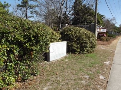
Property located to the north of this marker is part of a farm once belonging to John H. Rose an area pioneer from Fayetteville, N.C. A grist mill and saw mill on property was burned by Gen. Sherman's army. Buried in unmarked graves on the . . . — — Map (db m52370) HM
This school, built in 1923 at a cost of $2,500, is one of 500 African-American schools in S.C. funded
in part by the Julius Rosenwald Foundation from 1917 to 1932. It is a two-room school typical of smaller Rosenwald schools.
From 1923 to . . . — — Map (db m46343) HM
Dedicated to the recreation of the people and made available to the State of South Carolina by the Columbia Sesqui-Centennial Commission of 1936, in commemoration of the 150th Anniversary of the founding of the City of Columbia.
— — — . . . — — Map (db m273335) HM
This 10 inch Columbiad Cannon defended Charleston Harbor from 1863 until the end of the War Between the States in 1865. It has a smooth, non-rifled, bore and fires a 10 inch round ball weighing 104 pounds. The markings on this cannon tell a . . . — — Map (db m51733) HM
Strengthen America by employing citizens to improve local infrastructure. That concept inspired President Franklin Roosevelt's Depression-era economic recovery program, the Civilian Conservation Corps (CCC).
In its nine years, this effort . . . — — Map (db m273939) HM
Named in 1980 by the South Carolina State Highways and Public Transportation Commission in recognition of Dr. Berne’s distinguished service during three terms as a member of the Highway Commission representing the Fifth Highway District (Richland . . . — — Map (db m52107) HM
1 ½ mi. south was Woodlands, built before 1800 by Wade Hampton, I (1752-1835), Colonel in Revolution, Major General in War of 1812. ¼ mi. north was Millwood, built before 1820 by Wade Hampton II (1791-1858), aide to Gen. Jackson, War of 1812. . . . — — Map (db m52477) HM
This African-American church was
organized ca. 1865 when four men
left Sandy Level Baptist Church,
founded before the Revolution with
both white and black members, to
form their own congregation. They
elected Rev. Joe Taylor as . . . — — Map (db m63303) HM
Occupying the highest point in downtown Columbia,
Arsenal Hill is named for the military academy established
here in 1842 as a companion to The Citadel in Charleston.
Since the late 1700s, this 30 block neighborhood has been
home to black and . . . — — Map (db m41643) HM
Situated within the two-mile square grid that defined Columbia's original city limits in 1786, Arsenal Hill enjoys the distinction of being one of the second state capital's oldest neighborhoods. Established by the 1820's as a fashionable . . . — — Map (db m41837) HM
In this cemetery, 2½ blocks south, on Gadsden Street, are buried many distinguished Jewish citizens, including two mayors of Columbia: Mordecai Hendricks DeLeon (1791-1849) and Henry Lyons (1805-1858). The Benevolent Society was organized in . . . — — Map (db m28126) HM
Born Edward Hyde
Lord High Chancellor for Charles II
Persecuted the Dissenters
Exiled for Private Life
Daughter Married James II — — Map (db m50956) HM
The society has been in continuous existence since its organization in 1822. It was chartered 1834. Its charities are administered to the needs of the community without regard to creed or race. — — Map (db m27965) HM
Dedicated to the Fleishman Family, whose family members have served as officers of the Columbia Hebrew Benevolent Society over four generations covering three centuries. Their untiring and devoted service to the Society has been a mitsvah benefiting . . . — — Map (db m61562) HM
Arsenal Academy, converted from a state arsenal, occupied this square from 1842 to 1865 when Union troops burned all the Academy buildings except Officers' Quarters, erected 1855. Since 1868 this building has been the Governor's Mansion. — — Map (db m28127) HM
This home’s first owner was John R. Cornwell, an African American business man and civic leader who owned a successful barber shop on Main St. After his death, Cornwell’s wife Hattie and daughters Geneva Scott and Harriett Cornwell lived here. . . . — — Map (db m123485) HM
Harriette “Hettie” Eugenia Anderson, acclaimed African American art model of the Gilded Age, grew up in a house at this site. Anderson was born in Columbia around 1875 to Caroline (Lee) Scott and Benjamin Dickerson. Her mother's family were local . . . — — Map (db m226614) HM
First Baron Berkeley of Stratton
Supporter of the Stuarts
Skillful Military Commander
Loyal to the Royal Line
Followed Charles II into Exile — — Map (db m50953) HM
Colonel in the English Civil War
Lord Proprietor of New Jersey
Foreign Military Service
On Privy Council of King
Died at 89, Unmarried. — — Map (db m50940) HM
This sundried brick structure on a stone foundation was a arsenal which produced many guns and edged weapons for the state before and during the Civil War. Destroyed by General Sherman's army in 1865 it was soon rebuilt to manufacture iron works . . . — — Map (db m42724) HM
Philip Simmons, renowned Charleston
blacksmith, designed these wrought iron
entrance gates and they were fabricated
at the Simmons Blacksmith Shop by his
apprentices Joseph Pringle (cousin) and
Carlton Simmons (nephew). The men
forged . . . — — Map (db m50925) HM
Richard Samuel Roberts (1880-1936), a photographer who documented individuals, families, and institutions in Columbia’s black community and across S.C., lived here from 1920 until his death. Roberts, a self-taught photographer, moved his family . . . — — Map (db m53404) HM
Of Old French Stock
From the Isle of Jersey
N.C. Cape, County Named for Him
New Jersey Named for His Birthplace
Honored by Charles II — — Map (db m50957) HM
On the SW corner of this square was located the Palmetto Armory, later called Palmetto Iron Works, originally built for converting flint and steel muskets into percussion guns. Arms and munitions were manufactured here during the Confederate War, . . . — — Map (db m21802) HM
(Front text) This garden was established in 1944 by the Garden Club of South Carolina. It was the first memorial garden in the U.S. created by a state garden club in honor and in memory of those who served in World War II. Sarah P. Boylston . . . — — Map (db m32784) HM
(Side 1)
St. Timothy’s Episcopal Church dates to 1892 and is the third oldest Episcopal parish in Columbia. It began as a mission to provide Sunday School for the children of Arsenal Hill. As the congregation grew the church moved, first . . . — — Map (db m138394) HM
The symbolism of the number "8" in South Carolina's history and government is probably a coincidence; it began with Charles II's appointment of eight (8) Lords Proprietors for the Carolinas. They are named in the fountain placques.
Then there . . . — — Map (db m50936) HM
This blueprint reveals the early design process behind one of Columbia's most iconic landmarks—the Finlay Park fountain. Envisioned by renowned landscape architect Robert Marvin and constructed between 1987 and 1990, the fountain was . . . — — Map (db m292257) HM
The Fountain was Given
to the People of South Carolina
In Honor of
William Elliott Gonzales
1866 - 1937
A Founder and Editor of
The State — — Map (db m50955) HM
In tribute & honor to the gallant African American heroes of of the 371st Infantry Regiment 93rd Division "Colored" of World War I.
They were South Carolinians sent into the bloody trenches of World War I. These brave black soldiers survived . . . — — Map (db m108821) HM WM
Tradition holds that early members of Brown Chapel African Methodist Episcopal (A.M.E.) Church worshipped under a brush arbor. The church formally organized by the 1880s. Congregants built their first house of worship at this site around 1895 on . . . — — Map (db m292429) HM
Confederate Soldiers Home by an act of the General Assembly in 1908, an infirmary was established on this site for the infirm and destitute Confederate Soldiers and Sailors of the state in 1925. Eligibility for admission was extended to wives and . . . — — Map (db m46504) HM
In loving memory this cemetery contains Confederate Veterans and their families in the central area and State Hospital patients in surrounding locations. — — Map (db m51180) HM
(side 1)
The Confederate Infirmary opened here in 1909. S.C. was the last southern state to create a residence for indigent Civil War veterans. Legislation authorized space for two veterans from each county. The United Daughters of the . . . — — Map (db m123487) HM
(Front):
Confederate
1861 - Soldiers - 1865
Erected by The Confederate Home
Albertson, Maberry; Bethea, W. F.; Brooks, Robert; Brown, G. W.; Bozman, William; Bush, J. E.; Carter, F. M.; Cameron, W. C.; Chambers, H. A.; Connell, W. E; . . . — — Map (db m46844) HM
J Baker • Samuel Hill • J C Schroeder
William Barefoot • W D Hutto • Sindal
Joseph Burns • R Johnson • A Smith
F Butler • P P Killebrew • J Smith
R Campbell • D F McFarland • Scott Nimrod Smith
A C Catlett • McMaster • Suber
J Darrell • . . . — — Map (db m46632) HM
Erected Feb. 17, 1914 by Wade Hampton Chapter, U.D.C.
On the spot where Mayor T.J. Goodwyn surrendered the city of Columbia to Gen. W.T. Sherman Feb. 17, 1865
Councilmen O.Z. Bates • Samuel Leapheart John Stork • John McKenzie W.B. Stanley • . . . — — Map (db m46453) HM
(East):
Soldiers of the Confederate States
(South):
“The death of men is not the death of rights that urged them to the fray.”
(West):
A loving memory from the Richland Memorial Association
. . . — — Map (db m46628) HM
Lincoln Park, a segregated park for African Americans, was opened at this site in 1901 by the Columbia Electric Street Railway Co. Development in this part of Columbia, then known as “the highlands,” began in the 1890s when rail service was extended . . . — — Map (db m267535) HM
This square is part of the tract where state fairs were held 1856-61, 1869-1903. The buildings, used 1861-65 for Confederate barracks and hospital, as well as nitre and mining bureau in charge of Joseph LeConte and James Woodrow, were burned by . . . — — Map (db m28022) HM
(side 1)
This block was part of the fairgrounds where the S.C. State Fair was held 1856-1861 and 1869-1903. The fair, sponsored by the State Agricultural Society, featured agricultural, mechanical, household, and art exhibits. During the . . . — — Map (db m226613) HM
At this site on 15 November 1942, Maj. Gen. W. A. Burress received the 100th Infantry Division colors, marking the official activation of the "Century Division." After a distinguished World War II record in southern France and Germany, the 100th was . . . — — Map (db m59240) HM
Formed 1890 as the Essex Troop of Lt. Cavalry; mustered into the N.J. National Guard in 1893. After World War I service, became 102nd Cav. in 1921. Reorganized 1940 as 102nd Cav. (Horse- Mechanized); mobilized for active duty in World War II and . . . — — Map (db m59237) HM
Near this site on 15 March 1943 the 106th Infantry Division was officially activated and became known as the "Golden Lion Division." Although badly mauled in the "Battle of the Bulge," the division stubbornly continued to fight on. The 106th saw . . . — — Map (db m59236) HM
The “Golden Griffon” Division was created in 1946 as the 108th Airborne Division of the Army Reserve. It was reorganized as an infantry division in 1952, as a training division in 1956, and as an institutional training division in 1993. It has . . . — — Map (db m59234) HM
The "Yankee" Division, which saw extensive combat in World War I, was mobilized for active duty in World War II in January 1941. It trained here in 1942-43 and again in 1944, leaving 16 August 1944 for Europe. As part of 3rd Army the division was . . . — — Map (db m59251) HM
(Front text) After a brilliant combat record in World War I and 14 years of dedicated National Guard service, the "Old Hickory" Division was mobilized at Fort Jackson, S. C. on 16 September 1940. During World War II, the 30th Division . . . — — Map (db m59247) HM
"It shall be done"
The "Dixie" Division, created in 1917, spent most of World War II as a training division, with some units training at Ft. Jackson, but later saw combat in the Philippines 1944-45. The postwar "Dixie" Division, composed . . . — — Map (db m59248) HM
Organized in 1917, the 4th Infantry Division was stationed in this area at Ft. Jackson during World War II and received its final training here for the June 6, 1944 D-Day invasion of Normandy. The division was one of the first on the beaches. The . . . — — Map (db m59246) HM
The "Statue of Liberty Division" was reviewed by England's Winston Churchill and President Franklin D. Roosevelt after it was reactivated here in 1942. The 77th fought in World War II Pacific campaigns of Guam, Leyte, Kerama Retto Islands, and . . . — — Map (db m59252) HM
Activated at Camp McCain, Miss. in 1942, the "Golden Acorn" Division trained at this site in 1944. The division distinguished itself in the Ardennes, the Rhineland, and Central Europe during the Battle of the Bulge, the assault of the Sauer, . . . — — Map (db m59253) HM
Activated in 1918 and inspected by Gen. Dwight D. Eisenhower and Lt. Gen. George S. Patton during World War II, the 8th landed in France 28 days after D-Day (the invasion of Normandy) and participated in three other campaigns during the war. The . . . — — Map (db m59249) HM
This stone was part of the piers supporting
the historic Ludendorff Bridge which
once spanned the Rhine River at
Remagen, Germany. A forward patrol of
the US 9th Armored Division captured
the bridge in a surprise attack on
March 7, 1945, . . . — — Map (db m59296) HM
Darby Field
Named in honor of
Brigadier General William O. Darby, U.S.Army
Killed in action
1945
Erected June 1979
By his West Point classmates, USMA 1933
And the William O. Darby Ranger Memorial Foundation
To honor his . . . — — Map (db m59297) HM
Fort Jackson Elementary School. Fort Jackson Elementary School was one of the first public schools in S.C. to desegregate when classes began on September 3, 1963. The first school on post and one of the first permanent buildings at Fort . . . — — Map (db m59230) HM
(Front text) This African-American school, built nearby before 1900, was originally New Hope School, a white school affiliated with Union Church. It closed about 1914. In 1921 Rachel Hull Monteith (d. 1958) opened Nelson School as a black . . . — — Map (db m35946) HM
Front This is the site of Redfern Field, established in 1923 as the first commercial airfield in Columbia. Paul Rinaldo Redfern (1902 ~ 1927?) had shown an early interest in and aptitude for aviation, building his first full-scale airplane . . . — — Map (db m59061) HM
Temporary wartime home of Gen. and Mrs. James Chesnut. Here they entertained Jefferson Davis, president, C. S. A., and his staff, October 5, 1864. President Davis addressed the citizens of Columbia from the front steps of this cottage. — — Map (db m27960) HM
In April 1786 Alexander Gillon, Henry Pendleton, Richard Winn, Richard Hampton, and Thomas Taylor, Commissioners appointed to lay out Columbia, are said to have met under an oak which grew near here. According to tradition the first court and jury . . . — — Map (db m46449) HM
Renowned for lavish parties before and during the Civil War, this property was a popular destination for entertainment in the capital city. The labor of enslaved men, women and children lay behind every social gathering the Hall, Hampton and . . . — — Map (db m292398) HM
(Right panel) World War I was largly fought in trenches six feet deep along the Western Front which extended nearly four hundred miles, from Northern France to the French-Swiss border. Enemy trenches were close by and seperated from . . . — — Map (db m43912) WM
Deluge is an Augmented Reality (AR) Installation which immerses visitors in the harrowing experience of the historic October 2015 flood that devastated Columbia, South Carolina. In this AR experience, users encounter a transparent house . . . — — Map (db m292234) HM
On March 2, 1961, over 200 African American college and high school students marched 6 blocks from Zion Baptist Church to the S.C. State House in an NAACP-organized protest of racial segregation. Led by Benedict College theology student David . . . — — Map (db m219128) HM
The Lighthouse & Informer.The Lighthouse & Informer, long the leading black newspaper in S.C., was a weekly published here from 1941 to 1954 by journalist and civil rights advocate John Henry McCray (1910-1997). . . . — — Map (db m35824) HM
Preservation efforts in the Congaree Vista have returned historic structures to their 19th- and early-20th century appearances. A perfect example is the ca. 1900 commercial structure changed dramatically for use as an automobile tire store (seen . . . — — Map (db m134992) HM
To meet growing demands for electricity, the Columbia Water and Power Company constructed this power plant, the Columbia Hydro Plant, in 1896. It replaced the 1894 power facility upstream. This Hydro Plant provided power for city lights, trolleys . . . — — Map (db m292463) HM
1900 Block of Henderson Street. This block features a dense collection of late 19th and early 20th c. houses historically associated with and home to African Americans. Residing here through the mid-1900s were many middle- and working-class . . . — — Map (db m146467) HM
South Carolina Remembers the 2752 victims and 416 First Responders from New York City that gave their lives on September 11, 2001 — — Map (db m50333) HM
Sometime before the Civil War, the Hamptons and Prestons adorned their famous garden with a delicate marble fountain. The artwork was among many pieces the family commissioned from Hiram Powers—the most important American sculptor of the 19th . . . — — Map (db m292367) HM
The Woodrow Wilson Family Home is South Carolina's only presidential site and Columbia's earliest example of historic preservation advocacy. Traditionally celebrated for its association with the nation's 28th president, this circa-1871 property also . . . — — Map (db m134993) HM
The gardens under Historic Columbia's care form a living
collection of native and exotic plants and trees. Documentation of their care by horticultural experts serves as a local and regional resource for the public.
Generous support from . . . — — Map (db m292364) HM
For more than one hundred years, an eight-foot-tall masonry wall surrounded this property on three sides. Only the cast-iron fence running along Walnut (today's Blanding Street) provided a glimpse into the site's densely planted gardens. . . . — — Map (db m292307) HM
For more than a century, an eight-foot-tall brick wall surrounded this property on three sides. Most people could only glimpse the densely planted gardens through the cast-iron fence running along Walnut (today Blanding) Street. Sometime between . . . — — Map (db m292369) HM
Gardens have long graced these grounds. Generations of Seibels family members took great pride in having their extensive gardens, which had been established before the Civil War, well maintained. Like other gardeners of their time, the Seibels . . . — — Map (db m292291) HM
In the aftermath of Emancipation and the Civil War, African American churches were integral to the formation of strong communities across the American South. During the Jim Crow era, African American ministers and church members led social and . . . — — Map (db m226624) HM
Gardens reflect the needs, tastes, aspirations and logic of those who design them. some are cultivated for food, others for beauty. Like building design, landscape architecture has changed from era to era. Early 19th-century formal gardens and . . . — — Map (db m292336) HM
If this urban estate had been completed as originally envisioned, extensive pleasure gardens would have been planted in the 1820s to complement the impressive mansion. Realizing this, Historic Columbia commissioned landscape architect Edward . . . — — Map (db m292330) HM
By the mid-1960s, the Hampton-Preston Mansion had fallen into disrepair and buildings and parking lots of all shapes and sizes filled the entire block. Despite this condition, the State of South Carolina bought the property in 1968 for its . . . — — Map (db m292368) HM
Generations of visitors to the Hampton-Preston gardens recalled the site's greenhouse, where the property owners oversaw the propagation and display of native and exotic plants. During the mid-19th century, the estate received national attention . . . — — Map (db m292377) HM
An appreciation for nature's beauty and power inspired the generations of people who planned and nurtured the garden that occupied this former estate from the 1820s through 1947. Today's landscape, rooted in those earlier efforts, thrives thanks . . . — — Map (db m292340) HM
The gardens grew in density and diversity in the 1920s under the care of John J. and Bertha Willingham Seibels and with the assistance of three grounds men. The couple cultivated agave plants, banana and palmetto trees, bamboo, azaleas and a . . . — — Map (db m292287) HM
Throughout its history, the estate's garden was an extension of wealth and power of its white owners. Privilege and race defined who enjoyed this space and who maintained it. For some it was a living stage of beauty and environment. For others it . . . — — Map (db m292339) HM
In memory of the 2403 men
who gave their lives in
our military forces during
the attack on Pearl Harbor
and other military bases
7 December 1941
A tribute to all
U.S. Military Personnel
on this Day Of Infamy . . . — — Map (db m45075) HM WM
".... The garden is still enclosed on three sides by a brick wall topped with fragments of glass, the old method of discouraging the crashing of garden parties … A pleasing note is the background of a long white columned colonnade . . . — — Map (db m292288) HM
[South Panel]:
Gang of 25 Sea Island
Cotton and Rice Negroes
by Louis De Saussure
On Thursday, the 25th Sept., 1852, at 11 o'clock A.M. will be sold by Ryan's Mart, in Chalmers Street, in the City of Charleston,
A prime . . . — — Map (db m50922) HM
After Celia Mann [b. 1799 - d. 1867] died, Agnes Jackson (b. 1831-d. 1907] inherited her mother's house, land and personal possessions. Between the mid-1870s and 1880s the property changed dramatically. The earlier home was demolished and at . . . — — Map (db m238111) HM
In 1940, a segregated public housing complex for African Americans opened at this site. Named after nearby Allen University and Benedict College, Allen Benedict Court was the second public housing project in Columbia built under the Housing Act . . . — — Map (db m292404) HM
This Greek Revival cottage, built ca. 1872, was the residence and business of Caroline Alston, a black businesswoman who lived and ran a dry goods store here as early as 1873. She purchased the house in 1888, becoming one of the few black business . . . — — Map (db m138190) HM
Columbia was founded as South Carolina's second capital on March 22, 1786. Brothers James and Thomas Taylor owned much of the land that comprised the original city limits, including the tract upon which the Seibels House was erected in 1796. — — Map (db m134954) HM
Columbia was founded as South Carolina's second capital on March 22, 1786. Brothers James and Thomas Taylor owned much of the land that comprised the original city limits, including the tract upon which the Seibels House is said to have been . . . — — Map (db m292293) HM
580 entries matched your criteria. Entries 101 through 200 are listed above. ⊲ Previous 100 — Next 100 ⊳