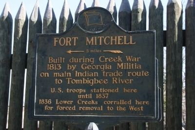
Built during Creek War 1813 by Georgia Militia on main Indian trade route to Tombigbee River
U.S. Troops stationed here until 1837 1836 Lower Creeks corralled here for forced removal to the West — — Map (db m26069) HM
Fort Mitchell
Fort Mitchell is located on the Federal Road on the West bank overlooking the Chattahoochee River.
General John Floyd received orders from Governor David B. Mitchell to pick up supplies, cross the Chattahoochee River and . . . — — Map (db m120003) HM
Originally a major path Creek Indians and indigenous tribes who preceded
them, the Federal Road became a postal route as a result of a treaty between
the Creeks and the United States government in 1805. The widening of the
Federal Road occurred . . . — — Map (db m241205) HM
Fort Mitchell served as a primary point of concentration for creeks being sent westward to Indian Territory before, during, and after the Second Creek War (1836-1837). By the terms of the 1832 Treaty of Washington, Creek heads of household and . . . — — Map (db m101840) HM
This military graveyard was established soon after Fort Mitchell was built by General John Floyd of the Georgia Militia. Located just south of the stockade, the cemetery was used between 1813 and 1840 during the fort's occupation by Georgia and . . . — — Map (db m26122) HM
The most popular game among the Indians of this region was "stick ball." This field has been constructed so that the game may be enjoyed again in the Chattahoochee Valley where it was played for hundreds of years. Sometimes known as "little brother . . . — — Map (db m26020) HM
Native plants played a significant role in the daily life of the Creek Indian civilization that inhabited the Chattahoochee Valley until relocation to Oklahoma in the 19th century. During the Woodland Period, the local inhabitants were skilled . . . — — Map (db m48166) HM
Near here was the home of Confederate Brigadier General James Cantey who arrived in 1849 to operate a plantation owned by his father. Prior to coming to Russell County he had practiced law at his birthplace, Camden, South Carolina, and had . . . — — Map (db m81715) HM
Near here is the site where John Crowell lived, died, and is interred. Colonel Crowell was born in Halifax County, North Carolina, on September 18, 1780; moved to Alabama in 1815, having been appointed as Agent of the United States to the . . . — — Map (db m26116) HM
1916. In 1916, Mt. Olive School was built on Ft. Mitchell Highway across the highway from the current location of the school. Philanthropist Julius Rosenwald, in partnership with Booker T. Washington, created matching grants to fund rural . . . — — Map (db m302424) HM
Pokkecheta, or the ball play, was an ancient and vital part of the social life of the Creeks and a popular game among many groups of Southeastern Indians. The game enhanced
interaction between towns and provided highly ritualized sport and . . . — — Map (db m101817) HM
The Creek Indians and their neighbors, the Yuchi, once lived in these woods in harmony with nature and in accordance with their beliefs and customs. During the 1700s and early 1800s, they were progressively dispossessed of their lands by . . . — — Map (db m101282) HM
In 1832, a treaty with the United States allotted parcels of land to every Indian household in the Valley. A government census enumerated, according to tribal towns, every Indian head of household, along with the number of males, females, and slaves . . . — — Map (db m101415) HM
The Creek Nation. The Creek Nation was a loose confederacy of independent towns that ranks among the most sophisticated and powerful native political organizations in North American history. Largely speakers of the Muskogee dialect, the . . . — — Map (db m101284) HM
Approximately one mile due east of this marker, back down the Old Federal Road, called by frontiersmen and Indians the Three Notched Trail or the Three Chopped Way, stood Fort Mitchell, an early 19th century American fort that in 1836 was one of the . . . — — Map (db m26100) HM
Today there are federally recognized Creek tribal groups in Oklahoma, Texas, Louisiana, and Alabama. The largest, the Muscogee (Creek) Nation, is based in the state of Oklahoma. The nation is comprised of the descendants of the Creeks who were . . . — — Map (db m101823) HM
The Battle of Horseshoe Bend, March 1814, ended the Creek Indian War. General Andrew Jackson met with Chief William Weatherford and signed the Treaty. The Creek Indians returned to their own land in the southeast Alabama territory. Travel over . . . — — Map (db m120004) HM
One of the earliest white settlements in the Old Creek Indian Nation. James Elizabeth Glenn, who named the town, and his brother Thompson Glenn, arrived here in 1835 only to have to evacuate during the Indian uprisings of 1836, at which time all . . . — — Map (db m284357) HM
Uchee
One of the oldest white settlements in the Chattahoochee Valley before and after the removal of the Indians; land deeds between whites date back to 1832, the year of Russell County's founding. The name of the town comes from the Indian . . . — — Map (db m69422) HM
This circa 1859 building is a very good and intact example of the temple front house of worship in the purest form of the Greek Revival style. It was constructed by L.S. Johnson at the same time as the nearby Good Hope Baptist Church. The Uchee . . . — — Map (db m69420) HM
East of here, on the Chattahoochee River, was the "fort among the Apalachicolas," most northern of the Spanish settlements in eastern North America. A palisaded "strong house" built by Captain Enrique Primo de Rivera to check activities of English . . . — — Map (db m101252) HM
Originally built in 1865, the First Methodist Church in Hurtsboro, then called Hurtsville, was located in Olivet, about 4 miles south. The building burned and a wooden church was built on this site in 1876. It was replaced in 1906 by the present . . . — — Map (db m69417) HM
The home was built in 1857 by the founder of Hurtsboro, Joel Hurt, Sr. (1813-1861) and his wife, Lucy Long Hurt (1822-1915). Their saw mill, constructed near Hurtsboro Creek, provided lumber for the home and surrounding community. With the . . . — — Map (db m69415) HM
Nimrod Washington Long moved to Alabama from Georgia in the 1830s. A planter, mill owner and state legislator, he had real estate and railroad interests in Russell County. This house was the plantation home of Nimrod Washington Long in Spring Hill, . . . — — Map (db m69433) HM
President Abraham Lincoln issued Emancipation Proclamation in 1863, in the midst of the Civil War. Freedom for the South's slaves, however only came with the end of the conflict, April 1865. The joyous news reached Negro slaves in this area in . . . — — Map (db m162704) HM
Coweta was the home of many influential Creek leaders, including three individuals who figured prominently in the history of the Creek people; "Emperor” Brims, Mary Musgrove, Chief William McIntosh.
The Coweta chieftain Brims, who . . . — — Map (db m101336) HM
(side 1)
Born at New Site, Alabama, he grew up working on his parents’ farm. In 1916 he worked in the oil fields in Texas and joined the Texas National Guard. He married Agnes Benson of Alabama in 1917. In 1918 he was commissioned an . . . — — Map (db m69114) HM
(obverse)
Allen Temple A.M.E. Church
In 1879, under the pastorate of Reverend George Wesley Allen, the Allen Temple African Methodist Episcopal Church had its humble beginning in Phenix City, Alabama as Grant Mission. The Russell . . . — — Map (db m69082) HM
To the native people of the Chattahoochee River Valley, the Creek or Muskogulgi Indians, the shoals of the river were a source of recreation and food. In the spring, the women and children of Coweta Town came here to fish, using dip nets, spears, . . . — — Map (db m69045) HM
(obverse)
Before The Battle
All day that Easter Sunday the Confederate forces commanded by Col. Leon von Zinken awaited the Union Army they knew was on the way from Tuskegee. Lacking the men needed to hold it, they were forced to . . . — — Map (db m69058) HM
On the hill to the northwest is an earthen fortification built in 1863 as part of the defenses of the Confederate navy yard, iron works and other war-related industries in nearby Columbus, Georgia. Designated Fort No. 5 on the plan done by the CSA . . . — — Map (db m59968) HM
Early in the afternoon of April 16, 1865 the first major act in the Battle of Girard-Columbus took place. Union General Emory Upton sent the First Ohio cavalry charging down old Crawford Road to capture the Dillingham Bridge, then known as the lower . . . — — Map (db m69060) HM
During the tumultuous decades prior to the Removal of the Creeks from their ancestral homelands in the 1830s, the vicinity of the town of Coweta became an important location for interaction between the Creek Nation and the American government. . . . — — Map (db m101339) HM
One of the founding or "mother" towns of the Lower Creeks, Coweta Tallahassee (Coweta Tribal or Old Town), located on the Chattahoochee River to the east, was a red or war town. Spain, England, and to a lesser extent, France, competed for its . . . — — Map (db m223862) HM
Coweta Town, located east of this marker on the banks of the Chattahoochee River, is sometimes called New or Upper Coweta to distinguish it from its predecessor, Coweta Tallahassee, down river. Among other well-known Creeks, Coweta was the . . . — — Map (db m69068) HM
Coweta served as a critical place of interaction between Creeks and Europeans throughout
the colonial era. Situated at the intersection of regional trading routes and the claims
of expanding Spanish, English and French colonial empires, it became . . . — — Map (db m101334) HM
The rich clay deposits along the high western bluff of the Chattahoochee River led a pioneer family to begin producing brick here. In 1859, brothers Anderson and Charles Abercrombie acquired a large tract of land from the U.S. government as a result . . . — — Map (db m223858) HM
Built in 1950, Fort Jabe Brassell has served as a hub for military training and arms storage for the local community by the Alabama Army National Guard and the Armory Commission of Alabama. Between July 1954 and January 1955, the Alabama Army . . . — — Map (db m165538) HM
(side 1)
Horace King a slave of John Godwin was construction foreman for the first Dillingham Street Bridge in 1832, when he and Godwin introduced the “town lattice” bridge design into the Chattahoochee Valley. King built most . . . — — Map (db m69064) HM
On October 11, 1939, Father Harold Purcell established Mother Mary Mission for the education of African Americans in Phenix City. In 1940, the Vincentian Sisters of Charity of Pittsburgh arrived to operate the mission. The Salvatorian Fathers of . . . — — Map (db m253882) HM
This church was organized in 1877 by Brothers Robert Anderson, Sr., Manuel Edmond and Robert Fluellen. The first services were conducted by Rev. D.L. Griffin under a brush arbor on the Flournoy Plantation. During Griffin's pastorate Anderson, . . . — — Map (db m299617) HM
Established in 1847, Newsome Family Cemetery is the
hallowed final resting place for the descendants of James
Carter Newsome and Nancy Eliza Jane Morris Newsome.
Following the Creek Indian Treaty of 1832, Levi Perry
purchased the property from . . . — — Map (db m302394) HM
POW✯MIA
You Are Not Forgotten
Dedicated to all
Our Nation's
POW ✯ MIA
Past - Present
Fort Benning Sergeants Major Association
19 September 2009 — — Map (db m69092) WM
On April 16, 1865 the batteries of Confederate Major James Fleming Waddell of Seale, Alabama were positioned on the crest of this hill. Union forces under the command of Brevet Major General James H. Wilson were expected to launch a daylight attack . . . — — Map (db m69056) HM
In November 1836, six Creek and Yuchi Indians were hanged near this spot for their role in a last desperate uprising against the frontier whites of Georgia and Alabama. Following decades of provocation from whites anxious to gain control of their . . . — — Map (db m69065) HM
South Girard High School was the first public high school for black students in Phenix City. The school was originally located on 11th Street South. Enrollment began with five students in 1945 and gradually increased to over 400 students in 1963. . . . — — Map (db m253870) HM
In 1953 the Phenix City Elementary School for Negroes was constructed during the tenure of L.P. Stough, Phenix City School Superintendent. It was built to accommodate 488 students with 13 classrooms, a multi-purpose room, clinic, library, cafeteria . . . — — Map (db m173475) HM
The town of Coweta was actually two separate Native American settlements and dozens of affiliated outlying communities occupied at different times in what is now northeastern Russell County. "Coweta Tallahassee" (old Coweta), regarded by most . . . — — Map (db m101328) HM
The Creek Indians believed this section of the river was inhabited by a giant Tie-Snake, a mythical monster that snared the unwary and dragged them down into the watery underworld. The Tie-Snake was but one of many strange creatures and natural . . . — — Map (db m69067) HM
For several years after he was made Principal Agent to the Indians South of the Ohio in 1796, Benjamin Hawkins, friend of George Washington and Thomas Jefferson, located his agency to the Lower Creeks at Coweta Tallahassee. Here, Hawkins began to . . . — — Map (db m223874) HM
Confederate Captain Nat Clanton's battery sat astride Summerville Road on April 16, 1865 when Union forces launched a three-fisted night attack from northwest of this position. Elements of the Third and Fourth Iowa and the Tenth Missouri all passed . . . — — Map (db m69069) HM
Originally known as Vilula, this community was formed about 1848 as a stage coach stop. For many years the only post office in the central part of the county was located here. William A. Lester served as the first postmaster. The Villula . . . — — Map (db m188837) HM
Russell County occupies land that once sat at the heart of the Creek Nation. Within the county's boundaries were several important Creek towns, many of which would figure prominently in the Creek and Seminole Wars era and the saga of Removal. . . . — — Map (db m111596) HM
Russell County was one of several counties created by the Alabama legislature in December, 1832 from land that had been part of the Creeks' ancestral homeland. The community of Girard (modern Phenix City) along the Chattahoochee River became the . . . — — Map (db m111609) HM
South of this site was the homeplace of Holland McTyeire Smith, born April 20, 1882. He completed the preparatory school at Seale, College at Alabama Polytechnic Institute and the University of Alabama Law School. He was commissioned Lieutenant . . . — — Map (db m69406) HM
Oldest route from Atlantic to Southwest. In 1805 it became Federal Road, over which pioneers traveled from Milledgeville to St. Stephens. Oglethorpe, Lafayette, Burr and others used this trail. — — Map (db m165635) HM
Near here is the site of the plantation of John Bacon McDonald who was born February 8, 1859. He entered the United States Military Academy on June 14, 1876, after finishing the tutelage of Colonel John M. Brannon of Seale and Captain Jerry J. . . . — — Map (db m69408) HM
Macedonia Missionary Baptist Church
Macedonia Baptist Church was organized in 1870 by Pastor Robert Fegins with the assistance of twelve members from Providence Baptist Church. The first person baptized in the church was Mr. Charles Smith . . . — — Map (db m78113) HM
Built in Glennville, Alabama by slave artisans in the early 1840's for James Billingslea and Rebecca Stone Mitchell. Moved by ox-cart and reassembled by free citizens at the present site in 1867 or 1869. Purchased in 1895 by Hugh Bennett and Jessie . . . — — Map (db m164054) HM
Old Russell County Courthouse
During the Federal occupation of the former Confederate States of America, the Alabama Legislature created Lee County primarily from the northern half of Russell County in 1866 and ordered the selection of the . . . — — Map (db m53160) HM
Marker Front:
The Methodist Congregation of which the church at Seale was organized in 1842, were pioneer families with a deep faith in God and a clear vision of the future. This group was centered around a small meeting place and a . . . — — Map (db m23594) HM
Old St. Peter A.M.E. Church Cemetery is one of Russell County's oldest African-American cemeteries. Established in the early 1880s by former slaves, the church became a central institution to many families in the Seale community. Records indicate . . . — — Map (db m78116) HM
The Old Federal Road that opened the southeastern United States to
settlers once crossed at this location. In 1805, the United States Congress
granted funds to build a post road from Georgia to New Orleans to
cross the sparsely settled wilderness . . . — — Map (db m237220) HM
The Second Creek War came about as a result of the frustration of local Creeks at their treatment following the signing of the Treaty of Washington (1832). That compact called for the Creeks to be given allotments of land which they could keep or . . . — — Map (db m111603) HM
On this lot and in the house thereon, was born William Augustus Mitchell, November 30, 1877. Mitchell entered the United States Military Academy on June 20, 1898, after finishing the schools at Seale and Alabama Polytechnic Institute. He . . . — — Map (db m164067) HM
Dean of the Law School of the University of Alabama.
Moderator of the Synod of the Presbyterian Church of Alabama.
Member of Congress of the United States from the Sixth District of Alabama.
Advocate of equality of opportunity, regardless of sex, . . . — — Map (db m195813) HM
In February, 1836, after rumors of unrest among the Creek Indians and a report of 500 having crossed the Chattahoochee River at Bryants Ferry, 22 members of the Georgia Militia under Col. John H. Watson were sent out from Columbus to investigate the . . . — — Map (db m55463) HM
Chattahoochee County, created by Act of February 13, 1854, was cut off from Muscogee and Marion Counties. It was named for the Chattahoochee River. Its courthouse, constructed in 1854, was built of select heart lumber from the Long Leaf Pine by . . . — — Map (db m38841) HM
Side 1:
This jail is situated on property that was purchased soon after the county was created on February 13, 1854. Mr. Asbury Bryan was paid $1,250 for the original two-story log jail that was completed by July 20, 1855, under the . . . — — Map (db m38971) HM
On this site, a brick school building was erected in 1911 on land purchased from G. W. King, Sr. A resolution was passed on June 6, 1922 to consolidate Big Sandy, Liberty Hill, Renfroe, and Providence Schools with Cusseta. In 1929, all high schools . . . — — Map (db m38790) HM
Kashita, “the Peace Town of the Lower Creeks,” one of two great Muskogee towns in the Creek Confederation of Indians, stood on the site of the Generals’ Headquarters at Fort Benning. Kashita, mentioned in the narrative of DeSoto’s . . . — — Map (db m38838) HM
“Riverside” was built in 1909 by Arthur Bussey, a prominent Columbus, Georgia businessman, and served as a summer home for the Bussey family. The spacious
dwelling was surrounded by one of the last self-supporting plantations in this area. When in . . . — — Map (db m57605) HM
17th Infantry Regiment “The Buffaloes” Truth and Courage Battle Campaigns Civil War · Indian Wars · War with Spain · Philippine Insurrection · Mexican Expedition · World War II · Korean War ·Vietnam War · Operation . . . — — Map (db m112532) WM
The 24th Infantry Regiment was created by Congress in 1866 and organized through 1869 from elements of the 38th and 41st (colored) Infantry Regiments. The 24th Infantry Regiment resided on Fort Benning from 1922 to 1942. The corner of Anderson . . . — — Map (db m297111) HM
This marker commemorates the activation on 6 July 1942 of the 505th Parachute Infantry Regiment in the Frying Pan area near here. Lieutenant Colonel James M. Gavin was the first commander. Assigned to the 82d Airborne Division in February 1943, the . . . — — Map (db m14512) HM
Those Who Covertly Jumped Alone or in Small Groups
WWII - Present
Office of Strategic Forces•U.S. Army Special Forces•U.S. Special Operations Command
Office of Strategic Services 1942-1945
Jedburgh Teams
Operational Groups
OSS . . . — — Map (db m297331) WM
The 34th President of the United States, Dwight D. Eisenhower, lived with his family at 206 Austin Loop, while stationed at Fort Benning as a major from 1926-1927.
During that time, he served as executive office of the 24th Infantry and . . . — — Map (db m57604) HM
Fort Benning - Station Hospital
In 1923 the U.S. Congress appropriated funds for the erection of a hospital at Fort Benning. The hospital complex, consisting of ten buildings, was opened in 1925. During World War Two as many as 36, 000 . . . — — Map (db m57705) HM
Side 1: Fort Benning
Kasihta or Cusseta Town, an important Creek Nation market, played a part in American Revolutionary affairs. In 1780 British Colonel John Tate recruited a large force of local Indians for duty with the British in . . . — — Map (db m57897) HM
Marshall House Named in Honor Of GEN George C. Marshall US Army Awarded Distinguished Service Medal 7981 First Division Road 791 — — Map (db m113103) HM
Named in honor of
Pvt. George Watson 29th. QM. Regt USA.
The first colored inductee of this
reception center to receive the D.S.C.
Awarded for heroism in action near Porloch
Harbor, New Guinea, by GO. 52, H Q.U.S.A.F.
in the Far . . . — — Map (db m297101) HM WM
Indianhead Housing was developed in 1933 to provide adequate housing to black NCOs and their families. These 18 structures mirrored white NCO quarters constructed prior to desegregation and integration of the Armed Forces. Formally utilized as . . . — — Map (db m297113) HM
The Old Federal Road, which intersected the Chattahoochee River at this natural fording site, was originally a Lower Creek Indian Nation trading path. With the advent of colonization, it became one of western Georgia's earliest and most important . . . — — Map (db m40597) HM
On this site stood Building 5, the first permanent Post HQ building and later the Judge Advocate General (JAG) Building. Built in 1911 as a dairy creamery, it became the Officers' Mess in 1919. In 1924 it became the Post HQ, headed by the . . . — — Map (db m57464) HM
On 15 December 1919, War Department Orders established the Infantry Board as a development and testing laboratory with permanent station at Fort Benning, Georgia. The Board’s mission was to consider, with continuity of effort, the improvement of . . . — — Map (db m57078) HM
Along the Federal Road built in 1811 east and west through this place there passed in 1825 Lafayette Soldier of France and volunteer in the cause of American Liberty “At the first news my heart was enrolled” Here stood the Indian . . . — — Map (db m111889) HM WM
On 28 March 1941, Private Felix Hall was discovered hanged by the neck with his hands and feet bound. A 20th Engineer Regiment Platoon found his body in a ravine near the Chattahoochee River, about 1000 meters west of the Jump Tower area. PVT . . . — — Map (db m297096) HM
At KINGSBORO, 3 mi. S., Ga.’s first narrow gauge railroad (North & South RR), chartered in 1870 (Columbus to Rome), ended in 1873. CATAULA (Big Rock) is a Creek name. Clowers Meth. Church, organized as “Providence” in 1829, was built of . . . — — Map (db m22419) HM
418 entries matched your criteria. Entries 101 through 200 are listed above. ⊲ Previous 100 — Next 100 ⊳