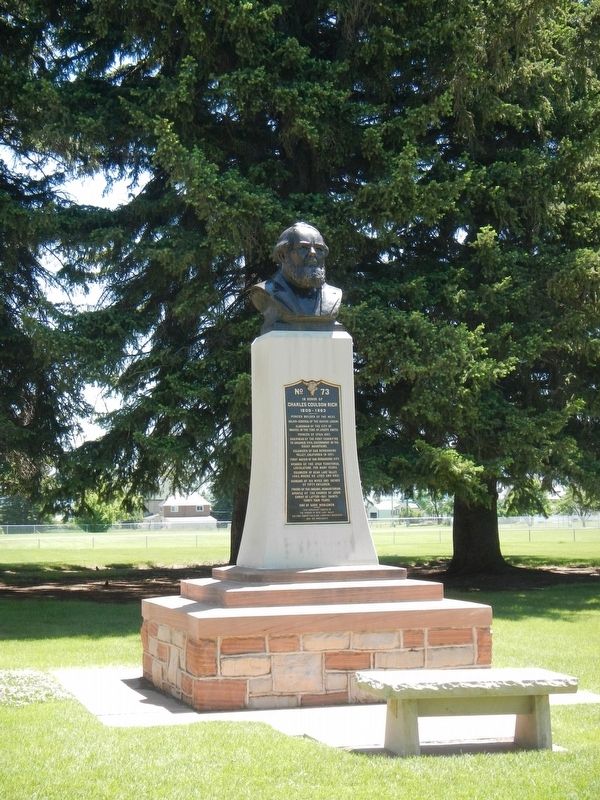
In honor of
Charles Coulson Rich
1809-1893
Pioneer builder of the west.
Major-General of the Nauvoo Legion
Alderman of the City of Nauvoo, in the time of Joseph Smith.
Pioneer of Utah, 1847.
Chairman of the first committee . . . — — Map (db m105849) HM
Paris, Idaho was settled in the fall of 1863. Two years later a building used for church, school and recreation was erected by James Nye and others, of logs hauled from George Sirrine's sawmill It was 20' X 60' with two large rooms and a stage at . . . — — Map (db m105873) HM
This pioneer Idaho town was founded Sept. 26, 1863 when a wagon train brought more than 30 families of Mormon colonizers.
More pioneers soon followed, some living in huts of quaking aspen and others building log cabins for the mild first . . . — — Map (db m105836) HM
Designed by one of Brigham Young's sons, this imposing Romanesque tabernacle was built between 1884 an 1889 by skilled local craftsmen.
Swiss stone masons cut and carved red sandstone that horse and ox teams hauled from a canyon 18 miles . . . — — Map (db m105848) HM
The Thomas Sleight Cabin was built in the fall of 1863 by Thomas Sleight and Charles Atkins, who with their wives, Marianne and Ann, occupied it together during the first winter of the settlement of Paris, Idaho.
It was first finished with . . . — — Map (db m105866) HM
Erected in Honor of
Gutzon Borglum
Born in the village of St. Charles
Idaho, March 25, 1867
He is internationally known for
his painting and sculptoring
and most famous for Mount
Rushmore National Monument
Gutzon . . . — — Map (db m105878) HM
In May, 1864 Brigham Young called Swan Arnell, Sr., Charles G. Keetch, Sr., Robert Pope, and Johh Windley with their families to settle here. Soon others followed. Charles Windley was the first child born in the village. The town site was surveyed . . . — — Map (db m105869) HM
One block west from this site, in 1894, the pioneers of this area erected a school house built of red brick made and kilned by them. It was one room, twenty-five by forty feet. Cuss Erickson laid the brick, first teachers were Edith Townsend and . . . — — Map (db m124584) HM
In 1879, Mormon farmers from Utah settled Chesterfield, 16 miles north of here.
Based on Joseph Smith's Zion Plat, Chesterfield was laid out on an orderly grid of large blocks separated by wide streets with the Meeting House on the highest . . . — — Map (db m106773) HM
Mormon pioneers settled this area along the Oregon Trail in the 1880s. The town was named Chesterfield because it reminded some of the countryside around Chesterfield, England, and to honor the settlement's founder, Chester Call.
A traditional . . . — — Map (db m124578) HM
In the summer of 1849, the California Gold Rush was diverted this way in search of a more direct route to the mines.
Stampeding 49'ers would try anything to save miles and time in their rush for California's gold: the regular Oregon and . . . — — Map (db m106774) HM
This area, known as Ten Mile Sterrett and Ivins, was opened for homesteading in 1880. Emigrants from Utah and Iceland transformed sagebrush lands to productive livestock farms. They befriended the roaming Indians and Oregon Trail travelers. Jared . . . — — Map (db m140294) HM
After the arrival of the first settlers of Chesterfield in 1875, covered wagon trains continued to use the Old Oregon Traill of 1846 which passed this point. Tired discouraged and ill, travelers arrived here from early spring to late autumn. Local . . . — — Map (db m124580) HM
The Oregon Trail was not blazed by the first wagon train of emigrants who set out on the journey in 1841. They were following pathways discovered and described by explorers, and mountain men in the early 1800s - pathways traveled for countless years . . . — — Map (db m124650) HM
In 1880, several Latter-Day Saint families settled in this valley of the Portneuf, naming the area Chesterfield. Nov. 27, 1883, a branch of the Church was organized with Judson A. Tolman presiding Elder. Labor was donated, lumber came from nearby . . . — — Map (db m124581) HM
Chesterfield
Chesterfield established in 1879, is an early Mormon settlement on the Oregon Trail.
The town features 23 historic brick buildings built between 1884 and 1904, including the old Chesterfield store.
Chesterfield is on the . . . — — Map (db m109912) HM
Bear River has its source in lakes on the north slope of Hayden Peak, 12,485 feet in elevation, near the western limit of Utah's high Uintas. The horseshoe shaped river follows a course 500 miles long, but its mouth is only 90 miles from its source. . . . — — Map (db m140343) HM
The Bidwell-Bartleson Party
In 1841, John Bidwell and John Bartleson became the first Americans emigrants to undertake a wagon crossing from Missouri to California.
Although Oregon was the primary destination of early westward-bound . . . — — Map (db m140278) HM
Approximately two miles west of here, a unique bridge built in the 1920s spanned the 11-foot-diameter flowline which crossed the fertile farmland west of the Grace Dam.
Turner, a small agricultural community located west of the town of . . . — — Map (db m279030) HM
Blocked by lava eruptions at least 140,000 years ago, the Bear River was diverted from draining into the Snake River system.
It was forced to drain southward into what were then lakes Thatcher and Bonneville and is now the Great Salt Lake.
. . . — — Map (db m109914) HM
Two miles east is located the dam and headworks of the canal system. Incorporation was effected Feb. 4, 1899 for the purpose of irrigating this valley. First filing on Bear River to supply the canal was Mar. 4, 1897. To perfect the right it was . . . — — Map (db m140280) HM
Geological processes created the complex landscape of southeastern Idaho and eventually determined the routes covered wagons would take along the Oregon Trail. In their journals, trail emigrants often wrote something about the two volcanic cinder . . . — — Map (db m140253) HM
"[Grace Dam] is the greatest development of hydraulic power between the Mississippi and California rivers. It is said to be the greatest, with the exception of Niagara Falls, in the world"
- Salt Lake Herald, June 15, 1908.
Between 1883 and . . . — — Map (db m279068) HM
Founded by a Dutch pioneer about 1884, Henry thrived as a center for cattle ranchers of the area and the transient sheep operators.
A large sheep-shearing corral was built one mile south of Henry.
It operated about 60 days each year as large . . . — — Map (db m109951) HM
Many Oregon & California bound emigrants mention seeing ten to twelve foot hight white mounds and cones in their diaries and journals while passing through the Soda Springs area in the mid-1800s. Often, one of the first natural curiosities that . . . — — Map (db m106251) HM
The first Mormon emigrants arrived in the Salt Lake Valley in 1847 and immediately began laying the groundwork for the small settlement that would become Salt Lake City. Church President Brigham Young however, had a much grander vision for his . . . — — Map (db m35469) HM
Claiming to have received "revelations" to warn Mormon leader Brigham Young that he was "wandering from the right course," a Welshman named Joseph Morris came under rebuke in 1862 for speaking out against Mormon doctrines. Growing hostilities . . . — — Map (db m106709) HM
Until about 28,000 years ago, Bear River used to flow northwest from here through Portneuf Canyon into Snake River.
Then these lava eruption blocked that route, diverting Bear River south into what now is Salt Lake. At that time a . . . — — Map (db m106728) HM
On this site in 1870, the first house in Soda Springs, Uppertown was built under the direction of John Walmsley. It was a one room log cabin twenty-two by eighteen feet, with floor, windows, and shingle roof, known as the Brigham Young Summer Home. . . . — — Map (db m35466) HM
Col. P.E. Connor set up the old town of Soda Springs, now mostly flooded, and an adjacent army post near here May 20, 1863.
The gold rush to Idaho had greatly increased traffic on the Oregon Trail, and the post was needed to protect travelers . . . — — Map (db m105972) HM
The magnet of gold
In 1870, high in the remote Caribou Range of the middle Rocky Mountains, in southeastern Idaho, gold was discovered by intrepid gold-seekers. Tales of gold and wealth drew thousands to the West during the mid-19th century . . . — — Map (db m106213) HM
Noticeable for their distinct shapes, China Hat and nearby China Cap are rhyolite domes that intruded and pierced the basalt of the Blackfoot Lava Field. The basaltic phase of this volcanic province was active in middle Pleistocene around 500,000 . . . — — Map (db m105966) HM
Floods of emigrants, gold seekers, and Mormon settlers entering the homeland of the Shoshone and Bannock people from the mid-1840s to early 1860s gave rise to conflict and often violent encounters. Despite Mormon effort to supply them with food, . . . — — Map (db m106723) HM
In 1958, Dr. Evan and Lois Kackley donated the Yellowstone Coach to the City of Soda Springs. According to Dr. Kackley's written letters to the city council he stated, "This particular coach was used to carry Pres. Theodore Roosevelt and the . . . — — Map (db m106694) HM
Southeast Idaho is a major phosphate-producing region and phosphate mining has been an important industry here since the turn of the 20th century.
1920s world-wide demand for metals and chemicals
During the 1920s, world-wide demand for . . . — — Map (db m106697) HM
Came to Soda Springs in 1898,
3 day out of Medical School at
the University of Tennessee.
People seeking his expertise came
from all over the United States.
His patients kept the hotels in
Soda Springs filled.
Except for . . . — — Map (db m124485) HM
This monument, featuring a bust of Father Pierre De Smet, has four plaques around it. They are, left to right (clockwise):
Westward Ho!
Pierre-Jean De Smet (1801-1873) traveled to America as a young man in 1821, from what . . . — — Map (db m106775) HM
In many respects, emigrants Niels Anderson and Mary Christoffersen seem like typical young Idaho pioneers of the 1860s. Niels, 28 years old, and Mary, barely 16, were wed by a Justice of the Peace at an open-air ceremony at Camp Connor on July 30, . . . — — Map (db m106726) HM
For over two decades (1834-1856), fur trappers and Oregon Trail wagon trains passed by the doors of this adobe fort. Nathaniel Wyeth, an ambitious Bostonian, built the post in 1834 but soon sold his holdings to the Hudson's Bay Company, whose staff . . . — — Map (db m106849) HM
U.S.A. Cavalry Infantry
53 families and others
Founded Soda Springs
Built fort to protect emigrants
County seat Oneida County
1864 ---- 1867 — — Map (db m124492) HM
George and Leah were parents of eleven children. In early November, 1884 George and Leah lost four of their five young daughters, in a two week period, to a terrible diphtheria epidemic. Leah did not like the Pioneer Cemetery east of town because of . . . — — Map (db m106633) HM
On February 7, 1951, the State of Idaho Department of Civil Defense set up the GOC, a Citizen Volunteer Auxiliary with the United States Air Force.
In October, 1951, Soda Springs and Caribou County Ground Observers met with Major T.A. Burda, Air . . . — — Map (db m106250) HM
The United States Government was afraid an enemy had the ability to attack our interior cities and rural areas in strong force with little or no warning.
In March 1954, a letter from N.F. Twining, Chief of Staff of the United States Air . . . — — Map (db m106218) HM
The Ground Observer Corps (GOC) was a series of Civil Defense programs in the United States to protect against air attack. Its function was to supplement the radar warning network by visually searching the skies with naked eye and binoculars for . . . — — Map (db m106219) HM
Towering 1200 feet above the waters of Bear River is Sheep Rock, a prominent landmark described in emigrant diaries and journals as they traveled west on the Oregon and California trails. Trapper and mountain men, in the early 1830s, indicate that a . . . — — Map (db m106737) HM
Free clear sparkling soda water still is available in a beautiful Soda Springs city park located 2 miles from here.
A prime attraction for more than 160 years, soda water from these springs was marketed nationally after rail service . . . — — Map (db m106256) HM
The route of US 30 traces its origin to the early 1900s. Until that time, the current route was but a well-traveled wagon road parallel with the Oregon Short Line railroad. In the spring of 1903, Dr. Horatio Nelson Jackson became the first person . . . — — Map (db m106771) HM
Native Americans traveled and camped in the Soda Springs area for centuries before emigrants traveled the Oregon Trail.
Sheep Rock (Soda Point) marked the junction of the main route of the Oregon-California Trail and the Hudspeth Cutoff and was . . . — — Map (db m106850) HM
Westward-bound emigrants entered Idaho after crossing Thomas Fork Valley. They soon encountered the climb and decent of Big Hill, witnessed nature's curiosities at Soda Springs, and discovered willing traders at Fort Hall.
In 1843 wagons first . . . — — Map (db m106845) HM
In 1840, John Bidwell began to assemble emigrants from Missouri to open a road to California; and a year later, he set out with a party of 69 Pacific Coast pioneers.
When they reached here, August 12, 1841, half of this group decided to go . . . — — Map (db m106729) HM
Excitement and anxiety mounted as emigrants prepared to launch their ox-drawn prairie schooners from St. Joseph and Independence, Missouri - bustling river ports at the edge of the frontier in the 1840s. To them, the great, gray ribbon of the . . . — — Map (db m106710) HM
Only memories remain...
In 1920, the ambitious Anaconda Copper Mining Company built the community of Conda to house its phosphate miners and their families. About 300 people resided in Conda during the mining heyday. The town closed in . . . — — Map (db m106695) HM
They were born in Denmark; joined the Mormons there. In 1857 Mrs. Anderson arrived at Burlington, Iowa; delayed there until 1859 on account of Johnston's Army, having to be sent to Utah. That year she walked nearly all the way to Salt Lake City. In . . . — — Map (db m124649) HM
The story of the American West is not simply a tale of pioneer courage and vision or of prairie schooners swaying westward to the strains of heroic music. Rather, it is a complex story of plots and sub plots, of romance and religion, of politics and . . . — — Map (db m106255) HM
This spot of ground known as the Pioneer Cedar Cemetery was used from the time of the founding of Soda Springs "Upper Town" in 1871 to 1906. It contains over 42 marked graves and as many whose identification are unknown. Each plot was selected by . . . — — Map (db m140251) HM
As many as 350,000 people and tens of thousands of covered wagons traveled the Oregon Trail between 1840 and 1870. Countless feet, hooves, and iron-rimmed wheels cut and compacted the ground, leaving long-lasting traces still visible on many western . . . — — Map (db m124577) HM
Lava eruptions west of Sheep Rock at least 140,000 years ago blocked the Bear River from draining into the Snake River system. Instead, the Bear was forced to drain into what was then Lakes Thatcher and Bonneville to the south. The Bear River's . . . — — Map (db m106847) HM
In this area are a group of springs famous to Oregon Trail travelers, most of whom stopped to try the "acid taste and effervessing gasses" of the waters.
Earlier, fur traders often -- less elegantly -- called the place "Beer Springs" . . . — — Map (db m105967) HM
This miniature locomotive played an integral part in the history of Caribou County. When the dam at Alexander Reservoir was built in 1924, it hauled supplies to the dam. Trapped by rising water, the locomotive was abandoned. In 1976 the reservoir . . . — — Map (db m106700) HM
(left panel:)
Tour Our National Byways
Click on the Tour Our National Byways photograph to enlarge it and view the local byway routes. (center panel:)
The springs of Soda Springs - indeed a . . . — — Map (db m106214) HM
When they left the main trail leading to Fort Hall, emigrants heading to California thought that Hudspeth's Cutoff would save them considerable time and miles in the race to the gold fields. To their surprise, they were still in Idaho's Raft River . . . — — Map (db m106772) HM
This is an east-west travel corridor of the earliest emigrant trails that continued even after the arrival of railroads and highways. Early explorers, such as John Fremont, Jedediah Smith, Osborne Russell, and missionary Narcissi Whitman were among . . . — — Map (db m106846) HM
The gently sloping mound around the geyser is travertine. The stone often develops into flights of pools enclosed within little dams.
These dams form through a mix of water and carbon dioxide which makes carbonic acid, and dissolved calcium . . . — — Map (db m109952) HM
This monument marks the grave of an immigrant family, father, mother, and five children, massacred on Little Spring Creek one half mile south of this spot, buried in their own wagon box by trappers and immigrants led by George W. Goodheart. — — Map (db m106254) HM
Oregon Trail Memorial
Erected 1931
Restored 1978
Caribou County 4H Builders Club
In honor of William Henry Harrison of Massachusetts who lost his life on the Oregon Trail about 1850.
Erected by his niece Mrs. Alura F. . . . — — Map (db m106732) HM
Rising to an elevation of more than 9,800 feet, Cariboo Mountain -- visible north of here -- has two of Idaho's highest gold camps.
Jesse "Cariboo Jack" Fairchild discovered gold high on Cariboo Mountain in August, 1870, and a mining rush . . . — — Map (db m105965) HM
(left panel:)
Settling Grays Lake Valley
With determination and spirit
Cattle, sheep and crops
At first cattlemen found the luxurious waist-high grass of Grays Lake Valley perfect for raising cattle. The . . . — — Map (db m106160) HM
Discovered this valley in 1818 or 1819 while hunting beaver for Donald MacKenzie's Northwest Company trappers.
An Iroquois leader -- he also explored Grey's River nearby in Wyoming. Aside from his trapping skills, he was noted for his unusual . . . — — Map (db m105964) HM
Caribou Mountain rises 9,800 feet with alpine snowfields feeding Tincup Creek, a tributary to the South Fork of the Snake River. Placer gold discoveries high on the mountain in 1871 led to a gold rush that lasted for two decades. In the 1880s sheep . . . — — Map (db m105963) HM
In 1867 Joseph Chadwick and family settled on Five Mile Creek and built a log cabin. In one room he had a supply store to accommodate the few settlers and freighters. He was followed by Peter Poole, Robert Taylor, Stephen Callan, George Mendenhall, . . . — — Map (db m140159) HM
This building is an example of the stone craftsmanship of the Mormon pioneers of southeastern Idaho. Built in 1868 of local stone cut with a rough , or rusticated, finish, the building demonstrates the gradual change in the late 19th century from . . . — — Map (db m44454) HM
Franklin is Idaho's oldest town. Settled in 1860 by Mormon pioneers who traveled to the vicinity of the confluence of Worm Creek and Muddy River, by year's end, 61 Latter-day Saints (LDS) families were there. The LDS laid out a fort-style . . . — — Map (db m105566) HM
The log Relic Hall is a fine example of Depression Era rustic architecture. Completed in 1937, it also represents a successful early effort to preserve and interpret community history. The building was designed in 1935 by architect Chris Gunderson . . . — — Map (db m44458) HM
The first school in the new colony was in the home of Hannah Comish, who was the teacher. This was the first white school taught in the State of Idaho. Her home was located on the east side of the fort where she taught about 20 pupils with a three . . . — — Map (db m105559) HM
In 1874, Bishop L.H. Hatch built a mansion that has been preserved as a fine example of pioneer Idaho architecture.
Idaho's only railroad serving Montana's thriving mining camps, reached here that year -- a time of depression between gold . . . — — Map (db m105694) HM
Franklin was settled April 14, 1860 by Mormon pioneers. The free local museum exhibits a large collection of tools and relics of pioneer days.
The founding of Franklin was part of a well organized plan of Mormon expansion. Church . . . — — Map (db m105556) HM
These two buildings are examples of the types of houses that were built in Franklin and other Mormon communities from the 1860s to the 1880s. Typically early Franklin dwellings were simple cabins with a central hall, as the residents prospered they . . . — — Map (db m105695) HM
Franklin, the first permanent Anglo-Saxon settlement in Idaho, was settled in 1860 by a group of Mormon Pioneer families from Utah. The fort in which they first lived was erected for protection against Indians, men standing guard outside at night . . . — — Map (db m105697) HM
This marks the trail of the first communication between Cache Valley and Bear Lake Valley known as the Shoshone Indian Trail in 1864. Mail was carried to Bear Lake on snowshoes, a distance of 25 miles over steep and rugged mountains from Franklin . . . — — Map (db m140344) HM
Samuel Cowley was born in Franklin, Idaho on July 23, 1899 to parents Matthais F. Cowley and Luella Parkinson. He was the fifth son in the family of nine sons and six daughters. The Cowleys lived here until Sam was six years old and the family . . . — — Map (db m105558) HM
Official outlet of the ZCMI (Zion's Co-operative Mercantile Institution), "America's First Department Store". This building housed the Franklin Co-op from circa 1877 to 1900. It was part of the ZCMI co-operative system serving more than 150 . . . — — Map (db m105563) HM
July, 1864, a company of explorers were sent to Idaho by President Brigham Young to locate suitable places for settlements. The same year Noam Brimhall and John Boice built the first homes in Oxford. William G. Nelson, George D. Lake, and George D. . . . — — Map (db m140160) HM
The four-hour fight left the Shoshone band decimated and terrified. Lodges, food caches and belongings were burned and women and children murdered. Chief Bear Hunter was cruelly tortured to death. When the killing ceased, the massacre field was . . . — — Map (db m290991) HM
Before dawn on the bitterly cold day of January 29, Shoshone leader Sagwich rose early to survey the area. As he looked toward the bluffs to the south he observed what seemed to be a mist of fog crawling down the bluffs across the river from the . . . — — Map (db m165797) HM
Very few Northwestern Shoshoni survived a battle here that turned into a massacre by Col. P.E. Connor’s California Volunteers.
In 1863, Conner and his force set out from Salt Lake City on a cold January campaign in response to friction . . . — — Map (db m165800) HM
In memory of the estimated 400 men, women, and children of the Northwestern Shoshone Nation who were brutally massacred in this vicinity on January 29, 1863, by the United States Army California Volunteers from Fort Douglas, Utah, under the . . . — — Map (db m277311) HM
Attacks by the Indians on the peaceful inhabitants in this vicinity led to the final battle here January 29, 1863. The conflict occurred in deep snow and bitter cold. Scores of wounded and frozen soldiers were taken from the battlefield to the . . . — — Map (db m105785) HM
First Overland Emigrant Party
"Left the river on account of the hills which obstructed our way on it, ... Road uncommonly broken, did not reach the river, distance about 4 miles" -- John Bidwell, Saturday, August 14, 1841
"We traveled about . . . — — Map (db m105832) HM
The tensions between the Shoshone and the settlers eventually led to a call from Utah territorial leaders of help from the Army, but the Civil War was on and military resources were stretched thin. In 1861 the third California Volunteer Infantry has . . . — — Map (db m105801) HM
End of a Way of Life
The delicate balance in which the Shoshone managed food resources for thousands of years was drastically altered by colonization. By the mid-1800s, the Oregon and California Trails brought thousands of pioneers and . . . — — Map (db m105799) HM
Here stands the stone home in which was born Matthew Cowley 3:00am 2 Aug 1897 wt. 8½ lb. to Matthias Foss Cowley & Abbie Hyde (Cowley) Mission to New Zealand 1914-1919 (translated doc. & cov. & Pearl of Great Price into Maori & . . . — — Map (db m253346) HM
Diverted into this valley by lava flows, the Bear River deposited a huge, mostly red clay delta here where it entered a vast inland sea that covered much of Utah.
About 14,500 years ago , its shoreline suddenly went down about 80 feet . . . — — Map (db m105834) HM
The Oneida Stake Academy was constructed with hand-hewn rock by Mormon pioneers between 1890 and 1895. Its purpose was to provide an inspirational setting for their youth to obtain a first-class education, despite frontier challenges. Of 35 . . . — — Map (db m105699) HM
Concrete shaft located one-half mile west on Bear River marks the site of the Nathan Williams Packer Toll Ferry and Bridge, one of the first on the river. The ferry operated with rope and carried equivalent of one team and wagon. In 1869 a bridge . . . — — Map (db m48977) HM
Bia Ogoi - Big River
The Bear River -- called Bia Ogoi or Big River by the Shoshone people -- runs west and south through this semiarid valley, eventually emptying into the Great Salt Lake. The river and its many tributaries create . . . — — Map (db m105797) HM
The Battle of Bear River was fought in this vicinity January 29, 1863 Col. P.E. Connor, leading 300 California volunteers from Camp Douglas, Utah against Bannock and Shoshoni Indian guilty of hostile attacks on emigrants and settlers engaged about . . . — — Map (db m276369) HM
We cry for the loss and sacrifice of those who did not survive and we honor the strength of those who lived.
After the massacre, the survivors, now under Chief Sagwitch, were aided by other bands as they escaped southward. Most of the . . . — — Map (db m165799) HM
Newe, The People
The Shoshone refer to themselves as Newe, the People. Their ancestral territory reached from the Wind River Range in western Wyoming to the middle of Nevada, and from the Salmon River in northeastern Idaho to central . . . — — Map (db m105795) HM
One mile south and directly west of this highway, an old 1878 railway grade is still visible, although trains have not used it since 1890.
Jay Gould -- a nationally prominent financier and Union Pacific owner -- extended Utah and Northern . . . — — Map (db m105708) HM