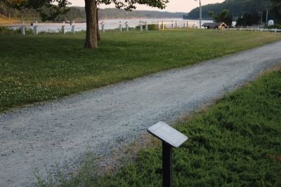
You are standing in the center of the Old Nye Estate. Before construction of the canal, this was the finest home in Bournedale, a sleepy Cape Cod village complete with post office, village hall, general store, and its own industry - the Tahanto Iron . . . — — Map (db m217361) HM
Long before the first European settlements in the Herring River Valley, a band of Wampanoag Indians lived in this area. The seasonal village called Comassakumakanit, stood beside Megansett Waye, an important trading path linking Cape and the . . . — — Map (db m225678) HM
Burying Hill
site of the
First
Meeting House
for
Indians
in
The Plymouth Colony
established by
Richard Bourne
and
Thomas Tupper
soon after their settlement in Sandwich
1637
By their influence peace was preserved . . . — — Map (db m194894) HM
In grateful memory 1st. Lt. Walter R. “Skip” Daley who died at the age of twenty four years while in the service of our country as a member of the First Cavalry Airmobile Division of the United States Army. For the Defense of Freedom and Peace in . . . — — Map (db m158472) WM
In Memory
Dec. 16, 1944 - Jan. 25, 1945
Dedicated To Those
Men and Women Who
Fought in the Historic
World War II
Battle of the Bulge
In the Ardennes, Belgium
Cape Cod Islands Chapter 58
Veterans of the
Battle of the . . . — — Map (db m158473) WM
Proudly We Pay Tribute
to the Men and Women of Brewster
who answered their Country’s call
in World War II
Henry Edgarton Allen • James Warren Allen • Lewis Franklin Bearse • Harry Wallace Bassett • Winthrop Nelson Bassett • . . . — — Map (db m164915) WM
In 1795, when John and his wife, Sarah built this house, farmers and fishermen were still recovering from the economic devastation caused by the Revolutionary War. They lived in the humblest of homes, built with their own hands from native . . . — — Map (db m282269) HM
The Old Higgins Farm Windmill was originally located in E. Brewster, about 5 miles from its present site. It is authenticated in a map dated 1795, which shows the mill standing close to what is now the corner of Rte. 6A and Ellis Landing Rd. . . . — — Map (db m282268) HM
Henry Hopkins was born in 1845, the son of housewright Moses Hopkins Jr. He lived at 463 Long Pond Road. At the age of 22, he and his father, Moses, built a blacksmith shop on their property across the street at 4 Depot Road. Here he shod horses . . . — — Map (db m282265) HM
In memory of the veterans from the Town of Brewster who served during the Korean War and the Vietnam Campaign
Tubman M. Andrew-Korea • Robert F. Baker-Korea • Francis Cash-
Vietnam • Edward F. Clark-Korea • Harold F. Clark-Korea • Karl L. . . . — — Map (db m158982) WM
Memorial to the veterans from Brewster who served in foreign campaigns
Hartwig James C-WWII • Hicks Paul V-Vietnam • Edwards William K-Vietnam • Keuch Deane-WWII • Selfe Richard A-Vietnam • Hill Russell H-WW II • Porter William H-WW II • Le . . . — — Map (db m158985) WM
Memorial
To those who served in the
World War
Presented to the Town of Brewster by
Brewster Grange 1919
Roland E Allen • Winthrop N Bassett • Ernest H Black • Allen S Bragg ☆ Herbert A Cahoon • Ernest E Chase • . . . — — Map (db m159811) WM
In Memory of
August Belmont
February 18, 1853 - December 10, 1924
Whose vision, initiative, an indomitable courage made possible the first complete construction of
The Cape Cod Canal
Connecting Buzzards Bay and Cape Cod Bay which was . . . — — Map (db m57668) HM
Chief of Engineers
Award of Excellence
US Army Corps of Engineers
Cape Cod Canal
For exceptional project managemental achievements, and the enhancement of public perception of the corps objectives. — — Map (db m57672) HM
Through her efforts suicide barriers were placed on the canal bridges.
"The Samaritans hope that saving people here will give them time to reconsider, to give themselves another chance at living, and at finding some help." — — Map (db m57669) HM
(Front of Marker)
In memory of all U.S. Submarines that are still on patrol.
U.S.S. Trout
State Boat of Massachusetts lost in action February 29th 1944
(Rear Marker)
U.S. Navy Submarines paid heavily for their success in World . . . — — Map (db m57398) HM
Opening to vessel traffic in 1914, the primary purpose of the Cape Cod Canal is to provide a safe, navigable intra-coastal route for vessels, saving 65 – 166 miles of travel around the historically treacherous outer shores of Cape Cod, . . . — — Map (db m158552) HM
William Barclay Parsons, Hon.M.ASCE
Chief Engineer, Cape Cod Canal, 1906-1914
The original construction of the Cape Cod Canal demonstrated the feasibility of constructing and operating a sea-level canal without locks. — — Map (db m57670) HM
This is an original antenna that was used here at the WCC as a receiving antenna on the “MF” band. It was originally located on the other side of Orleans Road, across from the Hotel Building (now the Education Center). It was . . . — — Map (db m159408) HM
At the foot of the trail is the Marconi/RCA receiving station complex, listed on the National Register of Historic Places. The station is significant for its engineering , its architecture, and its long and distinguished role in the history of . . . — — Map (db m159483) HM
On this trail, you will see several different types of antennas that are representative of some of the antennas which were used at WCC, both here and at the transmitter site on Forest Beach in South Chatham. There are several half wave dipole . . . — — Map (db m159432) HM
Placed in memory of Captain David F. Ryder, born on Bar Cliff Avenue in 1915, who fished out of this harbor for 56 years. Always a hook fisherman, he and his partners landed their catches from the wooden boats "Betty", "Alice" & "Nancy", "Alice & . . . — — Map (db m234501) HM
In Memory of
The Hero of the Monomoy Disaster
1862 Captain Elmer F. Mayo 1935
Chatham, Mass.
and his gallant rescue of
Surfman Seth L. Ellis
from a watery grave on Shovelful Shoal
off Monomoy Point
March 17, 1902
In . . . — — Map (db m158416) HM
Native Americans have harvested fish and shellfish in Chatham waters for millennia. Weirs – stationary structures of twine nets and wooden poles driven into the seabed – were the traditional method for catching finfish and squid. Weir fishing is . . . — — Map (db m234503) HM
The Old Village, encompassing the land between Chatham Harbor on the east and Mill/Little Mill Pond on the west, became the town center in the 1800’s probably due to the Old Harbor area becoming less navigable. A concentration of small stores on . . . — — Map (db m159151) HM
A 2-6-0 coal fired steam locomotive coupled to a string of freight cars wait for departure at the Chatham Railroad Depot in 1932. The Chatham Railroad Company constructed seven miles of tracks as a branch line with stations in Chatham, South . . . — — Map (db m159095) HM
Revolutionary War 1775-1783
Honoring Chatham Patriots
In the Cause of Liberty
Notable Leaders
Col. Benjamin Godfrey · Cpt. Nathan Bassett · Lt. David Buck · Sgt. Joseph Paine · Cpt. Joseph Doane, Jr. · Lt. James Ryder · Cpt Thomas Hamilton . . . — — Map (db m283248) WM
This set of bell chimes began their existence in the clock tower of one of this town’s notable historic homes overlooking the Old Harbor in North Chatham. The house, originally built in 1806 by George Kendrick, was purchased in 1917 by Rufus and . . . — — Map (db m159773) HM
This Lighthouse lantern room dates back to 1887, when it was installed atop the south tower of Chatham’s twin lights, the third set to be built on the bluff known as James Head overlooking Chatham Harbor and the Atlantic at the elbow of Cape Cod. . . . — — Map (db m159757) HM
We Have Always Been Here
For thousands of years Wampanoag have lived in this area inhabiting the shore during the warmer months and moving to less exposed areas in winter. Time has eradicated most of the remains of their earliest . . . — — Map (db m160412) HM
From the Municipal Fish Pier, the
Chatham commercial fishing fleet, the
Cape's largest, heads to the Atlantic.
Most days, the hard-working fleet
brings in high-quality seafood-over
25 million pounds a year-destined
for local, national, and . . . — — Map (db m234502) HM
(Front)
Here lies buried
Dr. Samuel Lord
who died of smallpox
after devoted service
to the citizens of
Chatham in the
epidemic of
1765 – 1766
(Back)
This monument was erected by
the Town of Chatham in . . . — — Map (db m160407) HM
Employee Residence of the Marconi-RCA Wireless Station
Built in 1914 for the Marconi Wireless Telegraph Company of America
Known as the “Hotel Nautilus”
In 1994 this building and the entire site
were placed . . . — — Map (db m159331) HM
“Never doubt that a small group of thoughtful, committed citizens can change the world. Indeed it is the only thing that ever has” – Margaret Meade
This land and the view you see before you were . . . — — Map (db m159214) HM
Six 350-foot masts were built by the Marconi Company to support a mile long horizontal antenna, intended to receive radio signals from a sister station in Norway. Five masts were removed in 1919. The remaining mast and several 100-foot steel . . . — — Map (db m159439) HM
The first European to land on the shores of Chatham was Samuel de Champlain, who took refuge in Stage Harbor in October, 1606. Although relations with the Natives were initially friendly, after about ten days tensions increased and a battle . . . — — Map (db m158345) HM
Like all towns in the country, Chatham was very much involved in the Civil War. More than 264 men saw action on the battlefields, of whom 16 lost their lives. But the conflict had little effect on the way Chatham people lived their lives, as the . . . — — Map (db m158564) HM
The waters off Chatham are notoriously dangerous because of the treacherous shoals and currents. The need for lights to warn mariners was recognized in early days of the country, and in 1806, nine years after the erection of the first lighthouse on . . . — — Map (db m154912) HM
He came from Norwich England in 1637. He acquired from the Indians by a series of purchases prior to the year 1683 the greater part of the present Township then known as Monomoyick. He and his sons and sons-in-laws Robert Nickerson • Samuel . . . — — Map (db m68997) HM
Operations Building of the Marconi-RCA Wireless Station
Built in 1914 for the Marconi Wireless Telegraph Company of America
Operated with distinction as Coastal Marine Station WCC, Chatham Radio from 1921 - 1997
In 1994 this . . . — — Map (db m159494) HM
The house of William Nickerson built about 1664, stood south 51 degrees west at a distance of 19 1/5 rods (about 105 yards) from this marker. He was the first settler in Monomoit where he purchased from the Indians most of what is now Chatham. . . . — — Map (db m157368) HM
Somewhere within gunshot of this stone lies the remains of Squanto, Indian guide, friend and counselor of the Plymouth Colony, who died in 1622 on the sloop “Swan” in Stage Harbor. — — Map (db m159026) HM
Imagine what it was like at the turn of the 20th century, when ships left port with no way to communicate with land. On this trail, you will walk in the footsteps of pioneers in radio technology who created a wireless lifeline for those at sea. . . . — — Map (db m159332) HM
Chatham’s only active hostilities
during the Revolutionary War occurred in Chatham Harbor,
near this site, on 20 June 1782.
At sunrise, crew members from a British privateer were discovered in Chatham’s East Harbor, attempting to sail away . . . — — Map (db m78440) HM
This wind powered grist mill was built in 1797 by Colonel
Benjamin Godfrey on a hill by his home on Stage Harbor Road
Overlooking the Mill Pond, where it served the growing needs of
Chatham residents for corn meal, a staple among early . . . — — Map (db m159325) HM
The Josiah Mayo House sits along Main Street across from the Town Hall, as it has since it was built nearly 200 years ago by Josiah himself, a blacksmith who came to town from Brewster. Although it’s been moved on the site – it originally . . . — — Map (db m166801) HM
A group of Separatist from the Church of England, later named Pilgrims, left England for Holland in 1608 in settled in Leiden in 1609. After staying there for 11 years, the group sailed back to England on the ship Speedwell, where they joined by . . . — — Map (db m78321)
Erected In Honor of
The Men of Chatham
Who Left Their Daily Tasks
Among Us to Serve Our
Country During the World War
★ ★ 1917 – 1918 ★ ★
And In Memory Of Those Who
Made The Extreme Sacrifice . . . — — Map (db m158572) WM
One of the most spectacular small boat rescues on the east coast of the United States occurred on February 18, 1952. The tanker Pendleton broke in half off the coast of Chatham during a fierce Nor' caster storm. In blinding rain and sixty foot . . . — — Map (db m63406) HM
Tisquantum (also known as Squanto), the most famous Native American to encounter the Pilgrims, died near here in 1622, roughly 40 years before William and Anne (Busby) Nickerson established their homestead on this site.
Born at Patuxet, a . . . — — Map (db m159031) HM
William Nickerson, founder of Chatham, arrived in Salem in 1637 aboard the ship, John and Dorothy, with four children, his wife, Anne Busby and her parents. A weaver by trade, he left Norwich, England to escape the persecution of Bishop Wren of . . . — — Map (db m268905) HM
The first successful cranberry cultivation occurred in this neighborhood at the Henry Hall Farm in 1816.
Dedicated by a grateful Cranberry Industry. — — Map (db m194818) HM
This glacial erratic of diorite was moved here by glacial activity from north of Boston over 50,000 years ago. The rock is 300 million years old. It is 14.5 feet high, 98 feet in circumference. Its depth into the ground is unknown. Legend says its . . . — — Map (db m308892) HM
These two pieces of steel are from the World Trade Center site. They are a reminder of the tragic events of September 11th 2001. A total of 2977 people perished on that day. The steel was entrusted by the F.D.N.Y. so that we never forget. — — Map (db m158954) HM WM
Inviting guests to step through the massive jawbones of a whale may seem an unusual way to say, “Welcome to our home.” But for Captain Edward Penniman, there could be no more appropriate greeting. Born in Eastham, Captain Penniman earned his . . . — — Map (db m111659) HM
Nauset Light is one of the most dynamic
beaches on Cape Cod. The rate of erosion
along the Outer Cape's ocean-facing beaches
has averaged about three feet per year for the
century that scientists have been measuring it.
But this beach is an . . . — — Map (db m254329) HM
This is the site of the Third Congregational Church. "The Old South Meetinghouse, Time Worn and Gray, That Stood Fronting East, by the King's Highway That Goeth To Billingsgate," so runs the phrase in quaint old records of olden days. Herman . . . — — Map (db m244044) HM
The barren sandspit to your right was once the site of the Coast Guard Beach bathhouse and its asphalt parking area. Today they are gone, erased by the forces of the sea.
In February 1978, the same winter storm that brought a famous blizzard to . . . — — Map (db m144092) HM
The spot where you now stand will eventually be at the water’s edge, and someday it will be gone entirely. Wind and waves continually reshape the shoreline. Through natural processes, the sea is eroding the land. Wind will build a dune, one sand . . . — — Map (db m141192) HM
This is the site of the original Congregational Church in Eastham and in this churchyard are the marked graves of three Mayflower passengers.
Lt. Joseph Rogers 1608-1678
Constance Hopkins 1605-1677
Giles Hopkins 1607-1690
The successive . . . — — Map (db m244137) HM
Cape Cod is composed almost entirely of rock debris deposited by the ice age glaciers over 18,000 years ago. Most of this debris, called “glacial till”, consists of clay, sand, and pebbles, but the ice age also deposited larger stones. . . . — — Map (db m111818) HM
Eastham Remembers
1917 - World War - 1919
Army
Chase Ralph A · Collins Bernard C · Clark Henry E · Horton Earl K
Camp
Brewer Leonard J · Hatch Freeman C · Gill Alfred D · Steele George B
Navy
Hopkins Clifton · Steele WM Bradley
. . . — — Map (db m147336) WM
One mile west of this site
hostile Indians had their
First Encounter
6 December 1620
(Old Style)
With Myles Standish, John Carver,
William Bradford, Edward Winslow.
John Tilley, Edward Tilley, John
Howland, . . . — — Map (db m141405) HM
On this spot hostile Indians had their first encounter December 8, 1620, old style, with Myles Standish, John Carver, William Bradford, John Tilley, Edward Winslow, John Howland, Edward Tilley, Richard Warren, Stephen Hopkins, Edward Dotey, John . . . — — Map (db m51139) HM
Near this site the Nauset tribe of the Wampanoag nation, seeking to protect themselves and their culture, had their first encounter, 8 december 1620, with Myles Standish, John Carver, William Bradford, Edward Winslow, John Tilley, Edward Tilley, . . . — — Map (db m51142) HM
For thousands of years before the Europeans landed, the Nauset Indians lived beside the marshes of Cape Cod. Among the evidence of their occupation is this community grinding rock, one of four such boulders found in the Nauset Bay area. . . . — — Map (db m111595) HM
After 66 days spent in the cramped confines of a small ship pitching and rolling its way from England across the stormy North Atlantic, the Mayflower’s passengers gave thanks. It was the morning of November 9,1620 and they had spotted land - the . . . — — Map (db m141189) HM
A bird's eye view of Cape Cod reveals a landscape dimpled with holes. Most of them are nearly round, and many are filled wit water, like Salt Pond in front of you.
Geologists call these intriguing depressions "kettles."
They were formed . . . — — Map (db m63408)
In 1836, in response to numerous shipwrecks in the area, 21 residents of Eastham petitioned the Boston Marine Society for a lighthouse. The first Nauset Beach Light Station was built more than 500 feet east of this spot. Because of constant beach . . . — — Map (db m307217) HM
”outermost cliff and solitary dune…
this is Eastham, this is the outer cape…having known and loved this land for many years, it came about that I found myself free to visit there, and so I built myself a house upon the . . . — — Map (db m144415) HM
Fifteen years before the Pilgrims landed on Cape Cod, French explorer Samuel de Champlain sailed down the Atlantic coast from Canada in search of new lands. On July 20, 1605, he entered here what was then a shallow bay. He named it Port de . . . — — Map (db m111600) HM
In the days before electronic navigational aids, the waters off Cape Cod with their hidden shoals held many dangers for passing ships, especially at night or during thick weather.
In 1872 the U.S. Life-Saving Service established nine stations . . . — — Map (db m141194) HM
The long, black cable has carried countless thousands of messages of international finance, personal hope and disaster, and news of war and peace.
Now it lies cold and dormant on the deep floor of the wide Atlantic.
If you stood here on . . . — — Map (db m63399)
In 1838 the United States Government took action to reduce the number of shipwrecks along this dangerous coast by establishing the Nauset Light. To make the signal easily recognizable three separate lanterns were set on small brick towers about . . . — — Map (db m307291) HM
Author and naturalist Henry Beston came to this shore in September 1927. On the dunes about a mile and a half to your right he built a cottage with two rooms and a fireplace. Here he lived a solitary year in the company of the ocean. His nearest . . . — — Map (db m111657) HM
Edward Penniman’s career as a man of the sea began at age 11. At 21, he was harpooning with the New Bedford, Massachusetts whaling fleet. By the time he was 29, he was master of his own whaling ship. Captain Penniman’s seven whaling voyages spanned . . . — — Map (db m111660) HM
A remnant from Cape Cod's agriculture past, this 1850-era hay barge was a common sight among the working dories, skiffs, and catboats of the area. Wide and flat-bottomed, it was rowed, poled, and sailed throughout the shallow marshes. Salt marsh hay . . . — — Map (db m63407) HM
Dedicated to the men and women of Falmouth who served their country
In Memory
Dec. 16, 1944 - Jan. 25, 1945
Dedicated to those
men and women who
fought in the historic
World War II
Battle of the Bulge
in the Ardennes, Belgium . . . — — Map (db m234493) WM
In Memoriam
William Martin
William W Wood
Charles DeWillis
William Savage
Pavl H Sherman Jr.
These men of Falmouth gave up their lives in the Great World War in honor of their memory & of those who served with them this monument is . . . — — Map (db m234492) WM
First Settlement
1660
On the "necke of land lying by the hering broke" Isaac Robinson and Jonathan Hatch built their houses. They were later joined by settlers who affirmed their rights of possession in the first general agreement for the laying . . . — — Map (db m296632) HM
Born Falmouth August 12, 1859 - Died Wellesley March 28, 1929
Teacher · Poet · Author of "America the Beautiful"
At the summit of Pike's Peak, Colorado, in 1893 the opening lines of "America the Beautiful" floated into the mind of Katharine . . . — — Map (db m234490) HM
This memorial is dedicated to one of Falmouth's lengendary citizens. Tommy was co-founder of the "Falmouth Walk" and founder of the world famous "Falmouth Road Race"
A renowned barman by trade, he spread good will and happiness throughout the . . . — — Map (db m234489) HM
Why is it called "Teaticket"?
The Wampanoag Indians named this area "Tataket," which translates roughly as "At the principal tidal stream." Fresh water springs here flowed to the ocean and provided an abundance of fish.
The Wampanoag
. . . — — Map (db m234486) HM
History
This 11-acre parcel was purchased by The 300 Committee Land Trust in 2011 for permanent protection as an open space community park in the heart of Teaticket Village, fronting on the heavily developed Teaticket Highway. The land was . . . — — Map (db m234487) HM
Martha's Vineyard
During the whaling era, wealthy Boston sea captains and merchant traders often created estates on Martha's Vineyard with their trading profits. Today, the Vineyard has become one of the Northeast's most prominent summer . . . — — Map (db m234488) HM
"There are many books about mentoring, but none of them tell you how to have a heart, which is what you need to succeed."
- James Townsel
James G. Townsel was a pioneering African American neuroscientist whose career was marked by . . . — — Map (db m305195) HM
Since 1828 Nobska Light has provided a familiar beacon for "all who go down to the sea in ships". 87 feet above sea level, Nobska's flash every six seconds is visible 17 miles out to sea. This 28,000 candlepower light used a 1000-watt lamp magnified . . . — — Map (db m264882) HM
The Mary Garden opened to the public in 1937, the idea of Frances Crane Lillie. Mrs. Lillie was a deeply religious person and was also involved within the world of science. Embracing her religion, Mrs. Lillie dedicated a 183 foot by 25 foot parcel . . . — — Map (db m305631) HM
3700 entries matched your criteria. Entries 101 through 200 are listed above. ⊲ Previous 100 — Next 100 ⊳