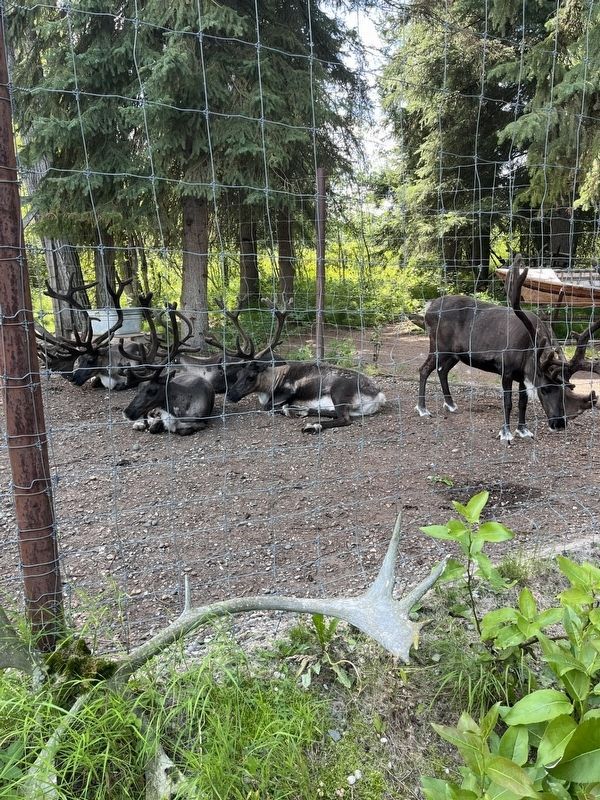
On Tall Spruce Road 5 miles Chena Pump Road when traveling north.
As nomadic hunter and gatherer people, the Athabascans relied on their ability to track and hunt herds of migrating caribou in order to survive Alaska's harsh climate. In the wild, caribou are migratory, traveling long distances each year from . . . — — Map (db m282375) HM
On Tall Spruce Road 5 miles east of Chena Pump Road, on the left when traveling east.
In Alaska, the remote areas of the state are knows as "The Bush" and the term "Bush Pilot" refers to the bold and adventuresome pilots who fly in and out of these remote locations. Even today, Bush Pilots - provide an important lifeline to . . . — — Map (db m282284) HM
On Cushman Street at 4th Avenue, on the right when traveling north on Cushman Street.
Noticeable among the earliest pioneers settling in Fairbanks were prostitutes, women of the demimonde who stampeded to the new Fairbanks gold camp from Dawson, Circle City, Rampart and points beyond. In a city where men far outnumbered women, . . . — — Map (db m47404) HM
On 1st Avenue at Barnette Street, on the right when traveling west on 1st Avenue.
In Fairbanks, mining by individuals on small claims was the norm until the late 1920's.
The arrival of the Fairbanks Exploration (F.E.) Company brought professional mining engineers and the latest dredging equipment to the area. The company . . . — — Map (db m256493) HM
On 1st Avenue east of Barnette Street, on the right when traveling east.
Steamboats crowded the Chena River in the few months between break-up and freeze-up, bringing passengers and much-needed merchandise to the isolated community. — — Map (db m256551) HM
On 1st Avenue west of Cushman Street, on the right when traveling west.
Eight hundred people lived in Fairbanks in the winter of 1903. By the summer of 1904 the population had swelled to 5,000.
The thriving town had two newspapers and numerous hotels, like the two story
Pioneer. It featured 100 rooms, steam heat, . . . — — Map (db m256490) HM
On 1st Avenue west of Cushman Street, on the right when traveling west.
Riverboats, bringing food and supplies to the miners on the creeks north of Fairbanks, plied the Chena River until the Tanana Valley Railroad was built in 1907.
To reach the gold-bearing gravels, early miners dug vertical shafts through 80-100 . . . — — Map (db m256489) HM
On 1st Avenue east of Cushman Street, on the left when traveling east.
The role of transportation in advancing the civilization of the north can be traced from the very first forms of river travel between settlements on Alaska's river systems. Long before the first Russian traders sailed . . . — — Map (db m257398) HM
On 1st Avenue east of Cushman Street, on the left when traveling east.
Like these waters that flow to the sea
we tread this uncertain path -
at this stepstone we pause,
looking to our past, forward to our destiny,
and leave these treasures of our time.
The opening of this Time Capsule
on 3 January . . . — — Map (db m257100) HM
On 1st Avenue at Cushman Street, on the left when traveling east on 1st Avenue.
The Alaska Highway was built in 1942 in 8 months. The Highway stretches 1422 miles from Dawson Creek, British Columbia, to Delta Junction. The Highway was built as a military necessity and followed along a line of existing airfields, winter . . . — — Map (db m257075) HM
On 1st Avenue at Cushman Street, on the left when traveling east on 1st Avenue.
Completed in 1942
Constructed in just 8 months in 1942, this 2,450 kilometre highway provided an essential transportation link to the northwest of North America during the Second World War, and has since remained a major . . . — — Map (db m257084) HM
On Cushman Street at 8th Avenue, on the left when traveling north on Cushman Street.
During World War II under the leadership of
Major "Muktuk" Marston and 21 paid staff, 6,368 Volunteers from
7 Native ethnic groups and European Americans, whose collective
ages ranged from 12-80 years of age, including some 30 women, . . . — — Map (db m256484) HM WM
On 1st Avenue east of Cushman Street, on the left when traveling east.
From the first communications project- an ill-fated attempt to string a trans-Siberian telegraph cable linking America with Europe in the 1860s to the satellite technology of today. Alaska has been a rugged proving
ground for the . . . — — Map (db m257333) HM
On 1st Avenue east of Cushman Street, on the left when traveling east.
Alaska's heritage has evolved from its abundant supply of minerals. Centuries before the Russians settled here, Alaska natives utilized various minerals for carved utensils, ornaments, religious objects, and weapons.
The Russians discovered . . . — — Map (db m257331) HM
On 1st Avenue east of Cushman Street, on the left when traveling east.
It was not a year
Just like other years;
Somehow 'Eighty-Four was special,
As if the hand of God
Had briefly brushed the place
And sparked a miracle.
It was a year to remember: the Bridge of Flags to lift the spirit; all those honored . . . — — Map (db m257282) HM
On 1st Avenue east of Cushman Street, on the left when traveling east.
The first people to inhabit this great land are now known as Athabascan Indians. Despite popular anthropological beliefs that describe man's migration to Alaska via a land bridge or from the southern hemisphere, Athabascan mythology contains many . . . — — Map (db m257312) HM
On 1st Avenue east of Barnette Street, on the right when traveling east.
In 1913 Fairbanks merchants invited Lilly and James V. Martin to bring their airplane to Fairbanks. The Martins shipped their crated airplane from Seattle. When it reached Fairbanks, Martin and his wife, who was England's first woman aviator, . . . — — Map (db m256495) HM
On 1st Avenue at Cushman Street, on the right when traveling west on 1st Avenue.
Captain E.T. Barnette, a passenger on the riverboat Lavelle Young, debarked near this site on August 26, 1901, and established a trading post which in 1902 became known as Fairbanks. — — Map (db m293748) HM
On 1st Avenue at Cowles Street, on the right when traveling west on 1st Avenue.
With no roads and sparse trails, the rivers were the highways in Alaska in the early 20th Century. Historically, the area along the Chena River has been a gathering place for people. It's likely that ages ago hunters and gatherers came to barter, . . . — — Map (db m257177) HM
On 1st Avenue at Cushman Street, on the left when traveling east on 1st Avenue.
Presented to the People of Fairbanks
by
Festival Fairbanks 84
and
The Fairbanks Downtown Association
[Dedicated] January 3, 1984 — — Map (db m257086) HM
On Lacey Street north of 1st Avenue, on the right when traveling north.
For many years, farmers displayed locally grown grains and vegetables in the downtown area near the site of today's Visitors' Bureau log cabin on First Avenue. The display pictured here dates from around 1914. — — Map (db m257140) HM
On 1st Avenue west of Lacey Street, on the right when traveling west.
The 1967 flood in Fairbanks made one thing clear-the city and nearby Fort Wainwright needed better flood control.
Planning Ahead
The Chena River has a history of flooding, but the damage from the 1967 flood was so extensive that it . . . — — Map (db m256591) HM
Clay Street Cemetery is the final resting place for a number of
Interior Alaska's early pioneers. Founded in 1903, it is a microcosm of
ethnicities, trades, society, and beliefs. The significance of Fairbanks'
first . . . — — Map (db m256401) HM
On 1st Avenue east of Cushman Street, on the left when traveling east.
The history of Alaska would not be complete without mention of the fuel that made possible the exploration, settlement, and industries of this immense land. COAL from the corners of Alaska (Coal Cove on the Kenai Peninsula, Admiralty Island in . . . — — Map (db m257328) HM
On Cushman Street at 8th Avenue, on the left when traveling north on Cushman Street.
Dedicated to the Recipients of the
Nation's Oldest Military Decoration
"The Purple Heart"
My stone is red for the blood they shed.
The medal I bear is my country’s
way to show they care.
If I could be seen by all . . . — — Map (db m256483) WM
On 1st Avenue east of Cushman Street, on the left when traveling east.
When people first came to Fairbanks in 1902 buildings were of log. Later "tin" was used for roofing and siding. The waterfront N.C. Co. store and powerplant behind it
were wood, sided and roofed with "tin." The N.C. Co. . . . — — Map (db m257381) HM
“Instead of row after row of empty houses (Dawson), they are building new stores. The place is alive and busy-a little too crowded when we got there.” – a tourist in Fairbanks, 1928 — — Map (db m47406) HM
On First Avenue at Lacey Street, on the left when traveling east on First Avenue.
Dr. William Ranson Wood, born February 8, 1907,came to Alaska in 1960 to serve as the fourth president of the University of Alaska. His innovative leadership transformed a small institution into a multi- campus university of international . . . — — Map (db m290706) HM
On 1st Avenue east of Cushman Street, on the left when traveling east.
It All Started with Gold
In 1901, Felix Pedro and Tom Gilmore were panning the creeks in the unexplored wilderness of the Tanana Valley. The same year, trader E. T. Barnette was traveling the river system to find a location for a trading . . . — — Map (db m257318) HM
On 1st Avenue east of Cushman Street, on the left when traveling east.
Fairbanks Aerie No. 137 and Ladies Auxiliary
5th Day of March, A.D. 1905 • 15th Day of October, A.D. 1946
The Fairbanks Eagles Aerie No. 1037, the farthest-north Aerie, has a long and colorful history. Organized and chartered in 1905, its . . . — — Map (db m257425) HM
On 1st Avenue east of Cushman Street, on the left when traveling east.
The Alaska Constitution provides that "the entire State shall be divided in boroughs, organized or unorganized." Delegates to the Constitutional Convention chose "borough" rather than the more commonly accepted term "county" to avoid restrictive . . . — — Map (db m257324) HM
On Cushman Street at 4th Avenue, on the right when traveling north on Cushman Street.
In the winter of 1904, the first Fairbanks Public School was opened. Ten students finished the spring term. In the fall of 1905, the school enrolled 50 students. The next year, 150 students attended.
Construction of a much-needed new school on . . . — — Map (db m219204) HM
Noble Dick, M D · President • Wm S Burton · Vice President
Herb Kirby · Secretary • Curtis Adams · Treasurer
Jack Winston · Director • Brice Howard · Director
Arthur S Brown · Director
Don Adler · Harry Arend · Roy Ferguson · Kenneth . . . — — Map (db m257103) HM
On 1st Avenue east of Cushman Street, on the left when traveling east.
Fairbanks first bank, First National Bank
of Fairbanks, opened its doors in 1905. We
served the Interior under that name until 1987
when we became Key Bank of Alaska. This plaque
represents our employees' pride in our . . . — — Map (db m257426) HM
On 1st Avenue east of Cushman Street, on the left when traveling east.
Riverboats have plied the rivers of Alaska and the Yukon for more than 100 years. They were the primary mode of transportation to the gold fields of Interior Alaska, bringing prospectors and supplies to the growing boom towns along . . . — — Map (db m257436) HM
On 1st Avenue at Cowles Street, on the left when traveling west on 1st Avenue.
has been designated a
National Historic Landmark
This site possesses national significance
in commemorating the history of the
United States of America
—————————
This property
has been placed on the
National Register
of . . . — — Map (db m257155) HM
On 1st Avenue east of Cushman Street, on the left when traveling east.
Residents of interior and northern Alaska are fortunate to have excellent health care resources. Strong support from the people in Fairbanks and the surrounding area has been the key in developing fine facilities and services. . . . — — Map (db m257337) HM
On 1st Avenue at Cowles Street, on the left when traveling west on 1st Avenue.
Over one hundred years ago, this narrow, period building began as the "First Avenue Bath House
and Health Clinic." Originally constructed of bare boards, this two-story building fronted First Avenue and the Chena River, tapering to one story for . . . — — Map (db m257157) HM
On 1st Avenue east of Cushman Street, on the left when traveling east.
About 200 million years before Eskimos, whalers, white hunters, trappers or explorers set foot on the barren, pond-pocked tundra of the North Slope, 250 miles north of the Arctic Circle, dynamic geologic forces were at work forming the richest . . . — — Map (db m257376) HM
On Noble Street at Wendell Avenue, on the left when traveling north on Noble Street.
Too often wars are described in terms of presidents and generals, emperors and kings, in grand strategy and elaborate campaigns. But wars affect the lives of all people — the soldiers who fight and the women, children and men who support the . . . — — Map (db m257138) HM WM
On Cushman Street at 8th Avenue, on the left when traveling north on Cushman Street.
In Memory Of:
All of our men and women who served in the U.S. Armed Forces; those who perished; our veterans
who suffered the ravages and wounds of war; American Prisoners of War; and those who still
remain missing in action.
You have the . . . — — Map (db m256482) WM
On Second Avenue, on the right when traveling east.
Construction of the Lacey Street Theater began in 1939, and this Art Deco style building opened in 1940. Austin E. “Cap” Lathrop, Fairbanks businessman and financier, was its owner. The Lacey Street Theater, with its distinguished neon sign, . . . — — Map (db m58989) HM
On Cowles Street at 5th Avenue, on the right when traveling south on Cowles Street.
In 1916 Arthur Williams began construction of this house, a variation of the
popular bungalow home featured in printed guides that came to Alaska. Windows,
doors, and some finishing items were ordered from Seattle and installed, so the
term . . . — — Map (db m257181) HM
On 1st Avenue east of Cushman Street, on the left when traveling east.
ARCO discovered Prudhoe Bay, the nation's largest oil field, in 1968.
When work began on field development and construction of the trans Alaska pipeline, Fairbanks became the major construction and supply center for this immense and . . . — — Map (db m257409) HM
On 1st Avenue east of Barnette Street, on the right when traveling east.
The flag of Northern Commercial Company-a white and red banner initialed NC Co-was once as well known to Alaskans as the state flag is today.
For many years the main store of the company did business from the Fairbanks waterfront. The story of . . . — — Map (db m256552) HM
On 1st Avenue east of Cushman Street, on the left when traveling east.
This plaque marks the original site of the Fairbanks USO organized by volunteers and chartered through USO World Headquarters in 1942. Its Mission was to serve the morale support needs of the men and women in the armed forces stationed away from . . . — — Map (db m256561) HM
On 1st Avenue east of Cushman Street, on the left when traveling east.
For thousands of years the religion of Interior Alaska was that of the indigenous Athabascan people. The earliest Christian missionaries to Alaska were Russian Orthodox priests. By the early 1800s their influence reached the Yukon . . . — — Map (db m257433) HM
On 1st Avenue east of Cushman Street, on the left when traveling east.
Fairbanks was a lively gold rush town-population 1,000-when its first newspaper began publication. It was just two years after E.T. Barrette cached his goods along the Chena River that printer George M. Hill hauled a printing plant from Dawson to . . . — — Map (db m257358) HM
On 1st Avenue east of Cushman Street, on the left when traveling east.
Following the initial organization of Igloo #1 in February 1907 at Nome, Igloo #2 in June
1907 at Candle, and Igloo #3 at St. Michael, these igloos met in convention at Nome August 4, 1908, and created the "Grand Igloo, Pioneers of Alaska." . . . — — Map (db m257405) HM
On 1st Avenue east of Cushman Street, on the left when traveling east.
No one knows for certain when the idea was first conceived to harness dogs for pulling sleds, although it is probable that dog traction has been around for at least a
thousand years. From the writings of the earliest European and . . . — — Map (db m257435) HM
On Lacey Street north of 1st Avenue, on the right when traveling north.
Tanana Indians
The Tanana River Athabascan Indians inhabited the watershed of the Tanana River Traditionally hunters and gatherers, they traveled over wide areas in their pursuit of food.
In the late eighteenth century the . . . — — Map (db m257143) HM
On 1st Avenue west of Lacey Street, on the right when traveling west.
In 1967, Fairbanks experienced the greatest flood in its history, as the Chena River
seemingly swallowed the city whole.
It's Raining, It's Pouring
Fairbanks residents expect cooler and shorter days and a little rain in August, but . . . — — Map (db m256584) HM
On 1st Avenue west of Kellum Street, on the left when traveling west.
"I made the claim for this church that it meant light: that it meant more light here in Fairbanks."
-Archdeacon Hudson Stuck in the first service at St. Matthew's.
The Episcopal Church's activity in Alaska's vast interior had been . . . — — Map (db m257165) HM
On 1st Avenue just east of Cushman Street, on the left when traveling east.
presents this Clock Tower and Carillon
to the City of Fairbanks
September 20, 1990
commemorating the First Fifty Years of
Rotary Club Service in the Alaskan Interior
1940 - 1990
Rotary Club of Fairbanks, Alaska
During the . . . — — Map (db m257121) HM
On 1st Avenue east of Barnette Street, on the right when traveling east.
Construction of an overland route from Valdez on Prince William Sound to Eagle on the Yukon River near the Canadian border started in 1899. Events in the Tanana Valley soon necessitated a trail from Fairbanks to Valdez. Between 1905 and 1906, the . . . — — Map (db m256556) HM
On Cowles Street at 5th Avenue, on the left when traveling south on Cowles Street.
This solidly built, almost square, two-story home was constructed in the 1904 to
1905 time period as a family home for Falcon Joslin and his family. Falcon Joslin was
born in Tennessee and was educated as a lawyer. He practiced law in Seattle . . . — — Map (db m257184) HM
On Cushman Street at 8th Avenue, on the right when traveling north on Cushman Street.
The First Presbyterian Church in Fairbanks has pervasive historic roots in both southeast Alaska and the Presbyterian Church in Portland, Oregon. Dr. and Reverend S. Hall Young established the first protestant church in Alaska in 1879 at Fort . . . — — Map (db m256477) HM
Captain E.T. Barnette, whose trading post on the Chena River became the city of Fairbanks, arrived here on the sternwheeler Lavelle Young with Captain Adams on August 26, 1901.
Felix Pedro and partners, mining for gold in the hills above town, . . . — — Map (db m47382) HM
On 1st Avenue east of Cushman Street, on the left when traveling east.
"If we would provide an adequate defense for the United States,
we must have Greenland and Iceland to dominate the
North Atlantic and Alaska to dominate the North Pacific"
William Henry Seward
Secretary of State, 18[6]7
Since the United . . . — — Map (db m257414) HM
On Lacey Street north of 1st Avenue, on the right when traveling north.
The Model Café
From 1907 until 1967, the Model Café was the center of social life for townspeople. Initially opened on First Avenue, the Café could be entered from both First and Second avenues.
The Fairbanks Rotary Club was . . . — — Map (db m257141) HM
On 1st Avenue east of Cushman Street, on the left when traveling east.
The Modern Sled Dog
The original sled dogs were chosen for their size, brute strength
and stamina, but modern sled dogs are generally mixed-breed
"Alaskan" huskies who have been bred for generations for their
endurance, strength, speed, . . . — — Map (db m257060) HM
On Lacey Street north of 1st Avenue, on the right when traveling north.
Gradually, prospectors drifted into the Interior. By 1900 about 100 hardy souls searched the hills and valleys of the Tanana Valley for precious metal. In 1902 Felix Pedro, an immigrant coal miner from Italy, struck gold.
He reported his find . . . — — Map (db m257139) HM
On 1st Avenue east of Cushman Street, on the left when traveling east.
They came from near and far away, from every social and economic level, representing nearly all racial and ethnic groups, men and women, young and old, skilled and inexperienced, old hands from many and far-flung construction campaigns, and . . . — — Map (db m257390) HM
On 1st Avenue east of Cushman Street, on the left when traveling east.
The University of Alaska began as the Alaska Agricultural College and School of Mines under the same federal laws as similar land-grant colleges throughout the continental United States. Its creation by Congress in 1915 and . . . — — Map (db m257406) HM
This Anchor
from the Navy Inactive Ship Facility
in Bremerton, Washington,
was presented as a gift to the
Citizens of Fairbanks from the
Gold Crew of the USS Alaska (SSBN 732)
on the occasion of the crew's official . . . — — Map (db m257127) HM
On Noble Street at Wendell Avenue, on the left when traveling north on Noble Street.
The structure of world peace cannot be the work of one man, or one party, or one nation...it must be a peace which rests in cooperative effort of the whole world.
Franklin Delano Roosevelt, March 1, 1945
Address to Congress on . . . — — Map (db m257135) HM WM
This is the site of the original cabin of James J. Wickersham. He was an author, pioneer judge, congressional delegate and Alaska Visionary.
Alaska Centennial 1867-1967
State of Alaska
Governor Walter J. Hickel
Alaska Centennial Commission — — Map (db m47384) HM
On Noble Street at Wendell Avenue, on the left when traveling north on Noble Street.
This is not the time for women to be patient. We are in a war and we need to fight it with all our ability and every weapon possible. Women pilots are a weapon waiting to be used.
Eleanor Roosevelt, 1942
LIFE [Magazine cover] JULY 19, . . . — — Map (db m257137) WM
On 1st Avenue just east of Cushman Street, on the left when traveling east.
With its challenging 1,000-miles of terrain and few checkpoints, the Yukon Quest International Sled Dog Race has been billed as the "world's toughest sled dog race." Conditions can include -60°F, rough jumble ice on the Yukon and fierce storms. . . . — — Map (db m257043) HM
Every summer in July, Fairbanks celebrates "Golden Days" in memory of Felix Pedro, a beloved, humble figure. Though there is a Barnette Elementary School and a Barnette street-there is no Barnette celebration. It took only 10 years for E. T. . . . — — Map (db m257491) HM
It took a tremendous amount of determination and fortitude to live in the Tanana Valley in the early days of Fairbanks Survival during the long winters that isolated the community from the outside world required fellowship. People had to depend . . . — — Map (db m257208) HM
Denali's high latitude (north of 63°) and high altitude (20,310 ft.) create intensely cold and windy conditions. Spring offered the optimal weather for approaching and climbing the mountain in 1913. Still, its remote location and frigid . . . — — Map (db m257234) HM
The Chena River affected all who lived in its valley. During the warm months fish camps sprang up along its banks. Caribou descended the hills to cross the river on their migration to calving grounds. Moose browsed along its backwaters, and . . . — — Map (db m257189) HM
Although the use of the riverfront changed over the years, the people of Fairbanks retained their love for the Chena River. Today, the riverfront's parks and trails make it one of the most attractive recreational areas in Fairbanks, but not too . . . — — Map (db m257212) HM
On Cushman Street south of Illinois Street, on the right when traveling north.
By August, 1904, when a Catholic priest arrived in Fairbanks, all choice lots in the center of town were taken. Father Francis Monroe, a Jesuit missionary, selected land at the edge of town, bordering the Chena River. The first Roman Catholic . . . — — Map (db m135350) HM
Sled Dogs in Territorial Alaska
Sled dogs provided Alaskans their main method of winter travel in the 1800s and early 1900s. The Siberian Husky and Alaskan Malamute were preferred breeds. People traveled by dogsled to
hunt, trap, and haul . . . — — Map (db m257253) HM
The Expedition Members
Episcopal Archdeacon Hudson Stuck and Harry Karstens co-led the expedition. Walter Harper and Robert Tatum completed the ascent team. Alaska Native youths John Fredson (Johnny Fred), who was Gwich'in, and Esaias . . . — — Map (db m257240) HM
Artist's Statement
Alaska and everything this beautiful state represents has always held not only awe but tenderness in my heart; awe for the land and its peoples - tenderness for the family and dear
friend relationships nurtured here. . . . — — Map (db m257251) HM
On Illinois Street north of Charles Street, on the left when traveling north.
Operating along Illinois Street for over 40 years, the Fairbanks Exploration (F.E.) Company was vital to the development of Fairbanks and Interior Alaska.
Boom to Bust
When gold was discovered near Fairbanks in 1902, it triggered a rush . . . — — Map (db m257229) HM
Walter Harper was the son of the Koyukon Athabascan (Dena') woman Seentaána (Jenny), and the Irish prospector and trader Arthur Harper. He was born in 1892 at Nuchalawoyya, near Tanana, as the gold rush era was transforming Alaska. Jenny and . . . — — Map (db m257249) HM
Dredges were brought in to mine gold-bearing deposits in the Fairbanks mining district after 1920. This bucket-line or ladder dredge has 68 buckets, each with a capacity of 6 cubit feet. The bucket line was driven by a 150 horsepower motor that . . . — — Map (db m144242) HM
On Steese Highway (Alaska Route 2), on the right when traveling north.
Dr. Maple was a structural engineer and principal designer of the trans-Alaska pipeline. He holds three patents for his development of innovative pipe supports that enabled the warm oil pipeline to safely traverse areas of permafrost. He pioneered . . . — — Map (db m58949) HM
On Steese Highway (State Highway 2), on the right when traveling north.
• Length: 800 miles
• Diameter: 48 inches
• Crosses three mountain ranges and more than 500 rivers and streams
• Cost to build: $8 billion in 1977, the largest privately funded construction project at that time
• Construction began March . . . — — Map (db m175383) HM
Near Steese Highway (at milepost 8.4), on the right when traveling north.
On November 16, 1973, through Presidential approval of pipeline legislation, Alyeska Pipeline Service Company received permission to begin construction of the 800-mile trans Alaska pipeline, its pump stations and the Marine Terminal at Valdez. . . . — — Map (db m20215) HM
On Richardson Highway (Alaska Route 2), on the right when traveling south.
Gold discoveries brought Alaska and the Yukon to the attention of the world. A series of stampedes occurred over more than three decades. Drawn by dreams of gold, men and women from many places and all walks of life participated in an adventure that . . . — — Map (db m59836) HM
On Richardson Highway (Alaska Route 2), on the right when traveling south.
The gold deposit found in 1902 north of present-day Fairbanks proved to be the richest in Alaska. Prospector Felix Pedro and trader E.T. Barnette played key roles in the discovery and initial rush. A second strike made the following summer . . . — — Map (db m59826) HM
On East 5th Avenue 0.1 miles east of Davis Boulevard, on the left when traveling east.
This pole is one of two poles manufactured in 1951 as part of a campaign to properly mark the top of the Earth. After a grand tour of the United States, its twin was pushed out of the tail hatch of an Alaska Airlines DC-4 over the geographic North . . . — — Map (db m58912) HM
Miners and prospectors heading to the gold fields of Interior Alaska traveled on the Valdez to Fairbanks Trail, now called the Richardson Highway. All were welcome at Rika's Roadhouse on their 380-mile trip from Valdez to Fairbanks.
Rough and . . . — — Map (db m255818) HM
Building Alaska's highways was, and is, no easy feat. The Alaska Road Commission (ARC) was one of the first groups to battle Alaska's tough working conditions.
Trail to Road
ARC crews blazed a 10-foot-wide dog team and pack horse . . . — — Map (db m255747) HM
The original ARC garage, which
this building resembles, housed
graders and other road
machinery in winter and
functioned as a maintenance
shop in summer. — — Map (db m255745) HM