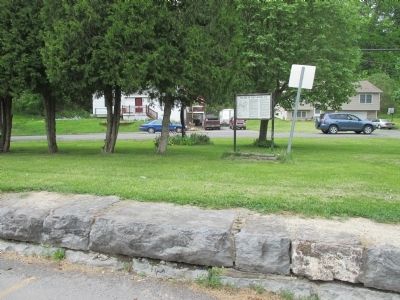
1. Park Hotel: Dates from the bustling railroad days in the mid-eighteen hundreds when it was known as "National Hotel". The Park Hotel was built by Samuel Lamkin in 1835. Its reputation and ownership has changed many times.
2. Masonic . . . — — Map (db m246397) HM
Elisha Durkee first settler
1791 Squire Gilbert,
Capt. Alanson Tracy 1793
an early commercial center
with stores and mills along
nearby Salmon Creek — — Map (db m251790) HM
The Cayuga Bridge Company was formed in 1797 to erect a bridge from Cayuga to the west shore of Cayuga Lake, serving as a “connecting link to the Great Genesee Road or Turnpike.”
The Cayuga Bridge cost $150,000 and took 18 months to . . . — — Map (db m143453) HM
Early Iroquois country 1768.
Part of Montgomery Co. 1784.
Part of Herkimer Co. 1791.
Part of Onondaga Co. 1794
Cayuga Co. set off 1799 — — Map (db m229218) HM
This memorial honors all American Veterans who, although separated by generations, shared a common, undeniable goal-to valiantly protect our country’s freedoms.
The memories of those American veterans will continue to live whenever and . . . — — Map (db m229221) WM
Slocum Howland (1794–1881) successfully combined the values of his Quaker faith with commercial pursuits, making his store part of Sherwood's busy Underground Railroad network. He signed a petition in 1835 declaring that "slavery.…. is . . . — — Map (db m172390) HM
The c.a. 1910 Railway Signal Tower was acquired in the early 1930's then used as a woodworking shop by William Williams. It was then located in Sterling Center and now generously given by grandson Roger Malcott. The Tower was originally located . . . — — Map (db m79779) HM
School House Built 1825 District No. 16 New York State and National Registers of Historic Sites, 2003 ———— Sterling Historical Society Est. 1976 Little Red School House Museum — — Map (db m79777) HM
Site of first Baptist Church of Sterling erected in 1841. Federated with United Presbyterian in 1931. Churches consolidated in 1962. Sold and dismantled in 1970. — — Map (db m79782) HM
Explore!
Two miles of lakeshore and 1400 acres of forest and field. Scenic views of Lake Ontario from glacially-formed bluffs. Varied terrain With wetlands, vernal pools, woodlands, creeks, and meadows that shelters diverse species of animals . . . — — Map (db m281238) HM
Named after a Revolutionary officer, Lord Wm. Alexander Sterling. Set off from Cato 1812. First grist and saw mill built here in 1813 — — Map (db m79753) HM
Settlers used Owasco River power to run sawmills & gristmills as early as 1798. This site was one of the three dams built in Throop. — — Map (db m87937) HM
Home of professional oarsman
Charles Courtney
Nat'l. Single Sculls Champ 1876
Winner of 83 major trophies
Crew coach Cornell University
22 years, won 117- lost 47 — — Map (db m145759) HM
A village of the Cayuga Nation,
stood near this spot. It was occupied and
destroyed by a detachment from the army
of General John Sullivan, commanded by
Lieut-Col. William Butler, which bivouacked
here on the night of September 21, . . . — — Map (db m145819) HM
Howland School
for young women
founded on this site in 1863
by George Howland.
Became Union Springs Hotel
& Sanitarium ca. 1886-1900. — — Map (db m145802) HM
Schooner master & stonemason. Carved stones for early Cornell U. buildings & former Cornell Public Library in Ithaca. Lived here 1907-1913 — — Map (db m223920) HM
The Mill Pond was lined throughout the
1800's by a variety of grist mills, bending
works, saw mills, woolen mills, and
warehouses that spurred local industry.
Today the Mill Pond is a haven for many
migratory and local birds. Because it . . . — — Map (db m145763) HM
This valley was the site
of the principal
Cayuga Indian village
To the brave French Jesuit
missionaries whose heroism
was almost without parallel
Joseph Chaumonot
and Rene Menard
who as guests as of
Chief Saonchiogwa
built here in 1656 . . . — — Map (db m145842) HM
In 1803 the Quakers became the first religious body to organize in the village.
Burials may have preceded this date as early graves had unmarked stones.
A Meeting House was erected adjacent to this cemetery on the north, at the head of . . . — — Map (db m266367) HM
front face
An expedition against the hostile Indian nations which checked the aggressions of the English and Indians on the frontiers of New York and Pennsylvania, extending westward the dominion of the United States.
rear face . . . — — Map (db m145834) HM
Grist, fulling & saw mills developed on this site between 1816 & 1842. Tannery also operated. A creamery was later established ca. 1902. — — Map (db m256088) HM
Constructed early 1840s as
a one room school house.
Used as a private residence
then returned to classroom
use. Renovated in 2009. — — Map (db m145794) HM
Owasco Flats
Site of Indian Village.
Land Cultivated Prior to
White Settlements.
Neighboring Settlers Came
to Harvest Hay 1789 - 1790 — — Map (db m213823) HM
Burial place of Lieut. Adam Helmer and wife Anna Bellinger.
Helmer, a famous Mohawk Valley scout in Revolutionary War, purchased this farm in 1803 — — Map (db m254781) HM
First Baptist Church of Weedsport has been placed on the National Register of Historic Places in 2003 by the United States Department of the Interior — — Map (db m157012) HM
Bitts salvaged from the tug boat Marion which sank in the Erie Canal
“Bitts” donated by Joe and Gwen Ostrowski once a part of “Tugboat Marion” used on the Great Lakes for many years. — — Map (db m182408) HM
Cayuga County Weed's Basin named after Elihu and Edward Weed who constructed a basin on Old Erie Canal 1821. P.O. established 1822 Weedsport Inc. village 1831 Village of Weedsport — — Map (db m83727) HM
Cayuga County
In loving memory of the sons and daughters who died during military service with the sincere belief their sacrifice will shine more brightly supporting patriotism and glory.
A tradition evolved in WWII to display red and white . . . — — Map (db m290451) WM
This 5-mile summit of the
97- mile canal (1837-78)
extends N. of Hamilton to
Solsville, receiving water
from nearby reservoirs. — — Map (db m146823) HM
Welcome to the Chenango Canal Towpath Trail
The 5-mile trail on the summit follows the historic canal through beautiful woods & farm fields. The summit ends where an aqueduct carried boats across Oriskany Creek. A lock can still be . . . — — Map (db m304137) HM
Site of the home of first family
to settle in this valley
Col. Joshua Leland
wife, Waitstill, & 10 children.
Builder of grist mills, saw
mills and also innkeeper. — — Map (db m116794) HM
Welcome to the Chenango Canal Towpath Trail
Chenango Canal Association, Inc. Mission
The Chenango Canal Association (CCA) is dedicated to preserving, maintaining and improving the historic Chenango Canal and its towpath. Preservation . . . — — Map (db m286888) HM
Built ca. 1795. Land bought
1793 by John J. Morgan.
Summer home NY Gov. John
Adams Dix. 6 generations of
Camenga family resided here. — — Map (db m133050) HM
For decades, Phoebe Bradley
walked the roads of Madison
County. At her death in 1905,
she was thought to be the
oldest person in the county. — — Map (db m262121) HM
Site Of
Bruce Opera House 1888-1909
This Cultural Hub Seated
802 Patrons & Showed Movies
Projected By The Biograph,
A Canastota Invention
— — Map (db m109611) HM
The berm (heel) side of the canal contained businesses that provided to the needs of canallers and the manufacturing of goods to be shipped by the canal, while the towpath side provided services and cottage industries.
Research & Design by . . . — — Map (db m146997) HM
Towns sprouted along the length of the Erie Canal. Canal Street was Canastota's business district. Travelers stopped here for food and supplies or a bed for the night at a hotel or boarding house. Local farmers, merchants, and manufacturers shipped . . . — — Map (db m139500) HM
A canal basin is an expanse of waterway alongside or at the end of a canal, and wider than the canal, constructed to allow boats to moor or unload cargo without impeding the progress of other traffic, and to allow room for turning.
Research . . . — — Map (db m146999) HM
Moving east in the mural are the following:
As settlement flourished, the Farr Hardware and the Canastota Bee-Journal buildings marked the beginning of S.Peterboro Street as a hub of mercantile activity.
The Peterboro Street . . . — — Map (db m146995) HM
A lift bridge was designed to lift up horizontally out of the way of canal boat traffic.
Canastota's lift bridge was constructed because the existing high bridge had an inconvenient rise to the Peterboro Street level crossing the canal. . . . — — Map (db m146998) HM
Founded by pioneers from CT on the theology of J. Edwards. Meeting house built 1824. Early leaders: R. Bushnell, E.S. Cadwell, & P. Cadwell — — Map (db m268484) HM
Its immediate success on opening from Albany to Buffalo in 1825 soon led to calls to enlarge the canal. From 1836 to 1862 the canal was deepened from 4 feet to 7 feet, with bigger locks and aqueducts, and canal boats grew threefold in capacity from . . . — — Map (db m139502) HM
Reuben Perkins
1761-1855
Capt. Perkins, a Revolutionary War veteran, moved to the area from Connecticut in 1807. He obtained a state patent in 1810 to buy 329 2/10 acres of the Canastota Reserve from the Oneida Indians for $7.50 an acre. . . . — — Map (db m149190) HM
1908 - Centennial - 2008
From New York to Paris.
Racers arrived in Canastota Feb. 14th staying overnight.
The U.S. team won the race. — — Map (db m58367) HM