534 entries match your criteria. Entries 201 through 300 are listed.⊲ Previous 100 — Next 100 ⊳
Historical Markers and War Memorials
in Greater New London Region
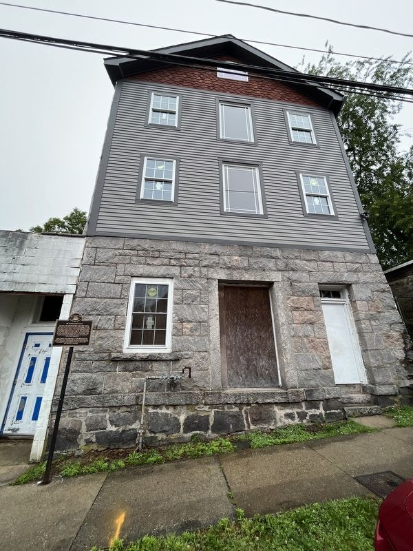
By By Devry Becker Jones (CC0), June 24, 2023
66 Hempstead Street
201 ► Connecticut, Southeastern Region, New London — 66 Hempstead Street — Black Heritage Trail — City of New London —  |
| On Hempstead Street just north of Garvin Street, on the left when traveling north. | |||
| 202 ► Connecticut, Southeastern Region, New London — 73 Hempstead Street — Black Heritage Trail — City of New London — |
| On Hempstead Street just north of Garvin Street, on the right when traveling north. | |||
| 203 ► Connecticut, Southeastern Region, New London — 80 State Street — Cronin Building — 1892 — |
| On State Street just east of Eugene O'Neill Drive, on the left when traveling west. | |||
| 204 ► Connecticut, Southeastern Region, New London — Academy Plaza — |
| Near Mohegan Ave. Pkwy. north of Williams Street, on the right when traveling north. | |||
| 205 ► Connecticut, Southeastern Region, New London — Adam Jackson — Hempsted Houses — Black Heritage Trail, City of New London — |
| On Hempstead Street west of Truman Street, on the right when traveling west. | |||
| 206 ► Connecticut, Southeastern Region, New London — Alexander Hamilton — Secretary of Treasury 1789-1795 — Father of the U.S. Coast Guard — |
| Near Mohegan Ave. Pkwy. north of Williams Street, on the right when traveling north. | |||
| 207 ► Connecticut, Southeastern Region, New London — An Act of the First Congress — |
| Near Mohegan Ave. Pkwy. north of Williams Street, on the right when traveling north. | |||
| 208 ► Connecticut, Southeastern Region, New London — Athena Stands Watch — |
| On Green Street at Pearl Street, on the left when traveling west on Green Street. | |||
| 209 ► Connecticut, Southeastern Region, New London — 11 — Bream Cove — Hempstead Historic Neighborhood — |
| On Coit Street at Reed Street, on the left when traveling west on Coit Street. | |||
| 210 ► Connecticut, Southeastern Region, New London — Changing Shoreline — New London Waterfront Park — |
| Near S Water Street at Bank Street Connector, on the right when traveling east. | |||
| 211 ► Connecticut, Southeastern Region, New London — City of New London — Connecticut — |
| On Hempstead Street at Bulkeley Place, on the right when traveling north on Hempstead Street. | |||
| 212 ► Connecticut, Southeastern Region, New London — Coast Guard Academy Observatory — |
| Near Mohegan Ave. Pkwy. north of Williams Street, on the right when traveling north. | |||
| 213 ► Connecticut, Southeastern Region, New London — Coast Guard Cutter Alexander Hamilton — |
| Near Mohegan Ave. Pkwy. north of Williams Street, on the right when traveling north. | |||
| 214 ► Connecticut, Southeastern Region, New London — Coastal Hazard Areas — New London Waterfront Park — |
| Near S Water Street east of Bank Street Connector, on the right when traveling east. | |||
| 215 ► Connecticut, Southeastern Region, New London — Colombo |
| On Bank Street at Howard Street, on the left when traveling east on Bank Street. Reported permanently removed. | |||
| 216 ► Connecticut, Southeastern Region, New London — 4 — Courthouse and Library — Hempstead Historic Neighborhood — |
| On Huntington Street at State Street, on the right when traveling south on Huntington Street. | |||
| 217 ► Connecticut, Southeastern Region, New London — Douglas Munro Hall — |
| Near Mohegan Ave. Pkwy. north of Williams Street, on the right when traveling north. | |||
| 218 ► Connecticut, Southeastern Region, New London — Eastern Oyster • Summer Flounder — New London Waterfront Park — |
| On Waterfront Park east of Ferry Loading Ramp. | |||
| 219 ► Connecticut, Southeastern Region, New London — Eugene Gladstone O'Neill 1888 - 1953 — America's Greatest Playwright — |
| On Waterfront Park at South Water Street on Waterfront Park. | |||
| 220 ► Connecticut, Southeastern Region, New London — First Step to Freedom — |
| On Bank Street just east of Pearl Street. | |||
| 221 ► Connecticut, Southeastern Region, New London — Freedom · Patriotism · Humanity — |
| On Mohegan Ave. Pkwy. at Williams Street, on the right when traveling north on Mohegan Ave. Pkwy.. | |||
| 222 ► Connecticut, Southeastern Region, New London — George Washington, Prefident of the United States of America — |
| Near Mohegan Ave. Pkwy. north of Williams Street, on the right when traveling north. | |||
| 223 ► Connecticut, Southeastern Region, New London — Guns from Reina Christina — |
| Near Mohegan Ave. Pkwy. north of Williams Street, on the right when traveling north. | |||
| 224 ► Connecticut, Southeastern Region, New London — 6 — Haley Houses & Racial Diversity — Hempstead Historic Neighborhood — |
| On Hempstead Street just south of Manwaring Street, on the left when traveling north. | |||
| 225 ► Connecticut, Southeastern Region, New London — Hempstead Historic District — |
| On Broad Street at Hempstead Street, on the left when traveling west on Broad Street. | |||
| 226 ► Connecticut, Southeastern Region, New London — 10 — Hempsted Houses — Hempstead Historic Neighborhood — |
| On Hempstead Street west of Truman Street, on the right when traveling west. | |||
| 227 ► Connecticut, Southeastern Region, New London — Honor Duty Respect — |
| Near Mohegan Ave. Pkwy. north of Williams Street, on the right when traveling north. | |||
| 228 ► Connecticut, Southeastern Region, New London — Honor Roll — 1941 - 1945 — |
| On Bank Street just west of Tilley Street, on the right when traveling west. | |||
| 229 ► Connecticut, Southeastern Region, New London — Humpback Whale — New London Waterfront Park — |
| On Waterfront Park east of Ferry Loading Ramp. | |||
| 230 ► Connecticut, Southeastern Region, New London — In Tribute to the Officers and Enlisted Men — |
| Near Mohegan Ave. Pkwy. north of Williams Street, on the right when traveling north. | |||
| 231 ► Connecticut, Southeastern Region, New London — 9 — Industry — Hempstead Historic Neighborhood — |
| On Hempstead Street at Home Street, on the right when traveling east on Hempstead Street. | |||
| 232 ► Connecticut, Southeastern Region, New London — Italian American Fountain — |
| On Bank Street at Shaw Street, on the right when traveling east on Bank Street. | |||
| 233 ► Connecticut, Southeastern Region, New London — John Winthrop — 1606 – 1676 — |
| On Hempstead Street at Bulkeley Place, on the right when traveling north on Hempstead Street. | |||
| 234 ► Connecticut, Southeastern Region, New London — Jonathan Brooks Tomb 1786 — |
| Near Hempstead Street, on the right when traveling north. | |||
| 235 ► Connecticut, Southeastern Region, New London — Letter of Instruction — |
| Near Mohegan Ave. Pkwy. north of Williams Street, on the right when traveling north. | |||
| 236 ► Connecticut, Southeastern Region, New London — Margaret Delia Geary — |
| On Jefferson Avenue north of Chester Street, on the left when traveling north. | |||
| 237 ► Connecticut, Southeastern Region, New London — Middle Passage to New London — |
| Near S Water Street east of Bank Street Connector, on the right when traveling east. | |||
| 238 ► Connecticut, Southeastern Region, New London — Monte Cristo Cottage — National Historic Landmark — |
| On Pequot Avenue. | |||
| 239 ► Connecticut, Southeastern Region, New London — Nathan Hale — |
| On Broad Street at Williams Street, on the right when traveling west on Broad Street. | |||
| 240 ► Connecticut, Southeastern Region, New London — Nathan Hale — Schoolteacher & Spy from Connecticut — |
| On Water Street at State Street, on the left when traveling north on Water Street. | |||
| 241 ► Connecticut, Southeastern Region, New London — Nathan Hale School House — |
| On Union Street just south of State Street, on the right when traveling north. | |||
| 242 ► Connecticut, Southeastern Region, New London — Nathan Hale Schoolhouse — New London, Connecticut — |
| On Atlantic Street, on the left when traveling south. | |||
| 243 ► Connecticut, Southeastern Region, New London — Native Americans — Connecting to the Sea for Centuries — |
| On State Street at Bank Street, on the right when traveling west on State Street. | |||
| 244 ► Connecticut, Southeastern Region, New London — New London |
| Near Masonic Street east of Union Street, on the left when traveling west. Reported permanently removed. | |||
| 245 ► Connecticut, Southeastern Region, New London — New London and the Sea — New London Waterfront Park — |
| Near S Water Street east of Bank Street Connector, on the right when traveling east. | |||
| 246 ► Connecticut, Southeastern Region, New London — New London Harbor — New London Waterfront Park — |
| Near S Water Street near Bank Street Connector, on the right when traveling east. | |||
| 247 ► Connecticut, Southeastern Region, New London — New London Soldiers & Sailors Monument — |
| On State Street at Bank Street, on the left when traveling east on State Street. | |||
| 248 ► Connecticut, Southeastern Region, New London — New London War Dead — |
| On Williams Street at Broad Street, on the left when traveling north on Williams Street. | |||
| 249 ► Connecticut, Southeastern Region, New London — New London War Memorial — |
| On Broad Street, on the right when traveling west. | |||
| 250 ► Connecticut, Southeastern Region, New London — New London Waterfront — A Gateway to the Connecticut Blue Heritage Trail — |
| Near S Water Street east of Bank Street Connector, on the right when traveling east. | |||
| 251 ► Connecticut, Southeastern Region, New London — New London Whalemen — |
| On Bank Street near Blinman Street, on the right when traveling west. | |||
| 252 ► Connecticut, Southeastern Region, New London — Northern Quahog / Winter Flounder — New London Waterfront Park — |
| On Waterfront Park east of Ferry Loading Ramp. | |||
| 253 ► Connecticut, Southeastern Region, New London — 3 — Religious Diversity — Hempstead Historic Neighborhood — |
| On Washington Street at Huntington Street, on the left when traveling east on Washington Street. | |||
| 254 ► Connecticut, Southeastern Region, New London — Revenue Cutter Scammel — |
| Near Mohegan Ave. Pkwy. north of Williams Street, on the right when traveling north. | |||
| 255 ► Connecticut, Southeastern Region, New London — Revolutionary New London — The Fight for Liberty — |
| On Water Street at State Street, on the left when traveling north on Water Street. | |||
| 256 ► Connecticut, Southeastern Region, New London — Revolutionary War Privateering — Led to Benedict Arnold’s Attack — |
| On Water Street at State Street, on the left when traveling north on Water Street. | |||
| 257 ► Connecticut, Southeastern Region, New London — Semper Paratus — |
| Near Mohegan Ave. Pkwy. north of Williams Street, on the right when traveling north. | |||
| 258 ► Connecticut, Southeastern Region, New London — Shaw Mansion — |
| On Blinman Street at Bank Street, on the right when traveling west on Blinman Street. | |||
| 259 ► Connecticut, Southeastern Region, New London — 12 — Shaw Mansion — Hempstead Historic Neighborhood — |
| On Bank Street at Brewer Street, on the right when traveling west on Bank Street. | |||
| 260 ► Connecticut, Southeastern Region, New London — Shiloh Baptist Church — Black Heritage Trail — City of New London — |
| On Garvin Street south of Franklin Street, on the right when traveling south. | |||
| 261 ► Connecticut, Southeastern Region, New London — Starr Street — Hempstead Historic Neighborhood — |
| On Green Street at Starr Street, on the left when traveling east on Green Street. | |||
| 262 ► Connecticut, Southeastern Region, New London — State of Connecticut Superior Court — |
| On Hempstead Street just north of Franklin Street, on the left when traveling north. | |||
| 263 ► Connecticut, Southeastern Region, New London — Stephen Hempstead — |
| On Hempstead Street west of Jay Street (Connecticut Route 641), on the right when traveling north. | |||
| 264 ► Connecticut, Southeastern Region, New London — Thames Landing — 2 State Street — (1844) — |
| On State Street at S Water Street, on the right when traveling south on State Street. | |||
| 265 ► Connecticut, Southeastern Region, New London — The Amistad Incident — Galvanizing Abolitionists — |
| On State Street, on the right when traveling west on State Street. | |||
| 266 ► Connecticut, Southeastern Region, New London — The 19th Century Port — Changing Maritime Enterprises — |
| On State Street at Bank Street, on the right when traveling west on State Street. | |||
| 267 ► Connecticut, Southeastern Region, New London — The Amistad — Black Heritage Trail City of New London — |
| Near S Water Street east of Bank Street Connector, on the right when traveling east. | |||
| 268 ► Connecticut, Southeastern Region, New London — The Atlantic Trade — New London Enters the World Economy — |
| On State Street at Bank Street, on the right when traveling west on State Street. | |||
| 269 ► Connecticut, Southeastern Region, New London — The Chain — |
| Near Mohegan Ave. Pkwy. north of Williams Street, on the right when traveling north. | |||
| 270 ► Connecticut, Southeastern Region, New London — The Hotel Bristol — Black Heritage Trail City of New London — |
| On Bank Street west of Golden Street, on the right when traveling east. | |||
| 271 ► Connecticut, Southeastern Region, New London — 3 — The Public Library of New London — |
| On Huntington Street at State Street, on the left when traveling south on Huntington Street. | |||
| 272 ► Connecticut, Southeastern Region, New London — The Roots of the US Coast Guard — Supporting and Defending Maritime Trade — |
| On State Street at Bank Street, on the right when traveling west on State Street. | |||
| 273 ► Connecticut, Southeastern Region, New London — The Submarine Industry — Rooted in Connecticut — |
| On State Street at Bank Street, on the right when traveling west on State Street. | |||
| 274 ► Connecticut, Southeastern Region, New London — The United States Coast Guard Greenland Patrol — |
| Near Mohegan Ave. Pkwy. north of Williams Street, on the right when traveling north. | |||
| 275 ► Connecticut, Southeastern Region, New London — To Alexander Hamilton from George Washington — |
| Near Mohegan Ave. Pkwy. north of Williams Street, on the right when traveling north. | |||
| 276 ► Connecticut, Southeastern Region, New London — To George Plater from George Washington — |
| Near Mohegan Ave. Pkwy. north of Williams Street, on the right when traveling north. | |||
| 277 ► Connecticut, Southeastern Region, New London — To George Washington from Hopley Yeaton — |
| Near Mohegan Ave. Pkwy. north of Williams Street, on the right when traveling north. | |||
| 278 ► Connecticut, Southeastern Region, New London — Tomb of Hopley Yeaton — |
| Near Mohegan Ave. Pkwy. north of Williams Street, on the right when traveling north. | |||
| 279 ► Connecticut, Southeastern Region, New London — U.S. Coast Guard in Vietnam War — |
| Near Mohegan Ave. Pkwy. north of Williams Street, on the right when traveling north. | |||
| 280 ► Connecticut, Southeastern Region, New London — Union Station — |
| On Water Street near State Street, on the right when traveling north. | |||
| 281 ► Connecticut, Southeastern Region, New London — US Coast Guard Memorial — |
| Near Mohegan Ave. Pkwy. north of Williams Street, on the right when traveling north. | |||
| 282 ► Connecticut, Southeastern Region, New London — USCG Mojave (W-47) — |
| Near Mohegan Ave. Pkwy. north of Williams Street, on the right when traveling north. | |||
| 283 ► Connecticut, Southeastern Region, New London — USCGA Class of 1944 Gazebo — |
| On Riverside Heights Road. | |||
| 284 ► Connecticut, Southeastern Region, New London — Wars and Conflicts — |
| Near Mohegan Ave. Pkwy. north of Williams Street, on the right when traveling north. | |||
| 285 ► Connecticut, Southeastern Region, New London — Washington Parade — |
| Near Mohegan Ave. Pkwy. north of Williams Street, on the right when traveling north. | |||
| 286 ► Connecticut, Southeastern Region, New London — Well Done — |
| Near Mohegan Ave. Pkwy. north of Williams Street, on the right when traveling north. | |||
| 287 ► Connecticut, Southeastern Region, New London — Whaling Days — New London Waterfront Park — |
| Near S Water Street east of Bank Street Connector, on the right when traveling east. | |||
| 288 ► Connecticut, Southeastern Region, New London — Whaling in New London — |
| On Water Street at State Street, on the left when traveling north on Water Street. | |||
| 289 ► Connecticut, Southeastern Region, New London — 5 — Williams Memorial Park — Hempstead Historic Neighborhood — |
| On Broad Street at Hempstead Street, on the left when traveling west on Broad Street. | |||
| 290 ► Connecticut, Southeastern Region, New London, Fort Trumbull — “Aim, Load, Fire” — |
| Near East Street, on the left when traveling south. | |||
| 291 ► Connecticut, Southeastern Region, New London, Fort Trumbull — “The Arches” — Submarine Antenna Over-Water Arch Facility — Building 101 — |
| Near East Street, on the left when traveling south. | |||
| 292 ► Connecticut, Southeastern Region, New London, Fort Trumbull — American Revolution — |
| Near East Street when traveling south. | |||
| 293 ► Connecticut, Southeastern Region, New London, Fort Trumbull — Blockhouse — |
| Near East Street, on the left when traveling south. | |||
| 294 ► Connecticut, Southeastern Region, New London, Fort Trumbull — Bottom Reflected Active Sonar System (BRASS) — |
| Near East Street at Walbach Street, on the right when traveling north. | |||
| 295 ► Connecticut, Southeastern Region, New London, Fort Trumbull — Civil War — |
| Near East Street, on the left when traveling south. | |||
| 296 ► Connecticut, Southeastern Region, New London, Fort Trumbull — Coast Guard — |
| Near East Street, on the left when traveling south. | |||
| 297 ► Connecticut, Southeastern Region, New London, Fort Trumbull — Cold War — |
| Near East Street, on the left when traveling south. | |||
| 298 ► Connecticut, Southeastern Region, New London, Fort Trumbull — Fort Interiors — |
| Near East Street, on the left when traveling south. | |||
| 299 ► Connecticut, Southeastern Region, New London, Fort Trumbull — Fort Trumbull — |
| Near East Street, on the left when traveling south. | |||
| 300 ► Connecticut, Southeastern Region, New London, Fort Trumbull — Fort Trumbull State Park — |
| Near East Street, on the left when traveling south. | |||
534 entries matched your criteria. Entries 201 through 300 are listed above. ⊲ Previous 100 — Next 100 ⊳