278 entries match your criteria. Entries 201 through 278 are listed.⊲ Previous 100
Historical Markers and War Memorials
in the Arrowhead Region
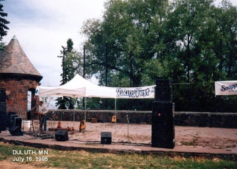
By Don Morfe, July 16, 1995
Viking Fest
201 ► Minnesota, Saint Louis County, Duluth, East Hillside — Leif Erikson —  |
| On North Shore Scenic Drive south of 12th Avenue East, on the right when traveling north. | |||
| 202 ► Minnesota, Saint Louis County, Duluth, East Hillside — The History of the Duluth Rose Garden — Rose Tips from the Lake Superior Rose Society — |
| Near London Road. | |||
| 203 ► Minnesota, Saint Louis County, Duluth, East Hillside — USS Duluth LPD-6 — Amphibious Landing Platform Dock — 18 December 1965 to 28 October 2005 — |
| Near East Superior Street 0.1 miles north of North 4th Avenue East, on the right when traveling north. | |||
| 204 ► Minnesota, Saint Louis County, Duluth, Fond du Lac — SL-DUL-242 — Fond du Lac — |
| On West 3rd Street (State Highway 23) west of 130th Avenue West, on the right when traveling west. | |||
| 205 ► Minnesota, Saint Louis County, Duluth, Fond du Lac — Fond du Lac – Minnesota — |
| On 133rd Avenue West south of West 2nd Street, on the right when traveling south. | |||
| 206 ► Minnesota, Saint Louis County, Duluth, Goat Hill — Rice's Point — |
| On West Skyline Parkway east of Hank Jensen Drive/Enger Park Cutoff, on the left when traveling west. | |||
| 207 ► Minnesota, Saint Louis County, Duluth, Lakeside/Lester Park — The Skyline Parkway — |
| On Congdon Boulevard (State Highway 61) east of 61st Avenue East, on the right when traveling east. | |||
| 208 ► Minnesota, Saint Louis County, Duluth, North Shore — Boatwatching — |
| Near Congdon Boulevard (North Shore Drive) (State Highway 61) at McQuade Road, on the left when traveling north. | |||
| 209 ► Minnesota, Saint Louis County, Duluth, North Shore — Commercial Fishing — |
| Near Congdon Boulevard (North Shore Drive) (State Highway 61) at McQuade Road, on the left when traveling north. | |||
| 210 ► Minnesota, Saint Louis County, Duluth, North Shore — Highway 61: Road to Tourism — |
| Near Congdon Boulevard (North Shore Drive) (State Highway 61) at McQuade Road, on the left when traveling north. | |||
| 211 ► Minnesota, Saint Louis County, Duluth, North Shore — Prospectors & Settlers — |
| Near Congdon Boulevard (North Shore Drive) (State Highway 61) at McQuade Road, on the left when traveling north. | |||
| 212 ► Minnesota, Saint Louis County, Duluth, North Shore — Safe Haven from Wild Winds and Waves — |
| Near Congdon Boulevard (North Shore Drive) (State Highway 61) at McQuade Road, on the left when traveling north. | |||
| 213 ► Minnesota, Saint Louis County, Duluth, North Shore — Superior: One Great Lake — Explore some fun facts about Lake Superior, one of the World's largest freshwater lakes. — |
| Near Congdon Boulevard (North Shore Drive) (State Highway 61) at McQuade Road, on the left when traveling north. | |||
| 214 ► Minnesota, Saint Louis County, Duluth, Observation Hill — Duluth-Superior Harbor — |
| On West Skyline Parkway east of 10th Avenue West, on the right when traveling east. | |||
| 215 ► Minnesota, Saint Louis County, Ely — Pillow Rocks — Ely Greenstone Outcrop — |
| On East Main Street west of 14th Avenue East, on the right when traveling west. | |||
| 216 ► Minnesota, Saint Louis County, Ely — Pioneer Mine — |
| On Pioneer Road, on the right when traveling east. | |||
| 217 ► Minnesota, Saint Louis County, Ely — Pioneer Mine A Shaft — |
| On Miners Lake Landing Road, on the right when traveling west. | |||
| 218 ► Minnesota, Saint Louis County, Embarrass — Alma Norha Playhouse — |
| Near Salo Road at County Highway 21. | |||
| 219 ► Minnesota, Saint Louis County, Embarrass — Apostolic Lutheran Church — |
| Near County Highway 21 west of County Highway 558. | |||
| 220 ► Minnesota, Saint Louis County, Embarrass — Embarrass Co-op — |
| On County Highway 21, on the right when traveling east. | |||
| 221 ► Minnesota, Saint Louis County, Embarrass — Hanka Homestead — |
| Near Pylka Road. | |||
| 222 ► Minnesota, Saint Louis County, Embarrass — Nelimark Sauna — |
| Near Salo Road at Highway 21. | |||
| 223 ► Minnesota, Saint Louis County, Eveleth — A Three-Way Continental Divide — |
| Near U.S. 53 at milepost 50, on the right when traveling north. | |||
| 224 ► Minnesota, Saint Louis County, Eveleth — John Mariucci — |
| On Hat Trick Avenue 0.5 miles north of Jones Street, on the left when traveling north. | |||
| 225 ► Minnesota, Saint Louis County, Eveleth — Paul Wellstone Memorial and Historic Site — |
| On Bodas Road (County Road 95) 0.2 miles east of Scout Camp Road (County Road 536), on the left when traveling east. | |||
| 226 ► Minnesota, Saint Louis County, Floodwood — Veterans Memorial — |
| On Elm Street (State Highway 73) at East 7th Avenue, on the left when traveling south on Elm Street. | |||
| 227 ► Minnesota, Saint Louis County, Hermantown — Sunrise Memorial Park War Memorial — |
| On West Arrowhead Road at Miller Trunk Highway (U.S. 53) on West Arrowhead Road. | |||
| 228 ► Minnesota, Saint Louis County, Hibbing, Kelly Lake — 170 & 240 Ton Production Trucks — |
| Near Greyhound Boulevard/3rd Avenue East, on the left when traveling north. | |||
| 229 ► Minnesota, Saint Louis County, Hibbing, Kelly Lake — Birthplace of Greyhound Lines — |
| Near Greyhound Boulevard/3rd Avenue East 0.2 miles north of 13th Street, on the left when traveling north. | |||
| 230 ► Minnesota, Saint Louis County, Hibbing, Kelly Lake — Business District — |
| On Lincoln Street east of 2nd Avenue North, on the left when traveling east. | |||
| 231 ► Minnesota, Saint Louis County, Hibbing, Kelly Lake — Carnegie Library — |
| On Lincoln Street east of 2nd Avenue North, on the left when traveling east. | |||
| 232 ► Minnesota, Saint Louis County, Hibbing, Kelly Lake — Congdon McIntyre Building — 402 Howard Street — |
| On East Howard Street (Business U.S. 169) at 4th Avenue East, on the right when traveling east on East Howard Street. | |||
| 233 ► Minnesota, Saint Louis County, Hibbing, Kelly Lake — Donald Kozlik Memorial — Statue of Liberty Replica — |
| On East 21st Street west of 5th Avenue East, on the right when traveling west. | |||
| 234 ► Minnesota, Saint Louis County, Hibbing, Kelly Lake — Early Finnish Pioneers — |
| On 1st Avenue south of 31st Street, on the right when traveling north. | |||
| 235 ► Minnesota, Saint Louis County, Hibbing, Kelly Lake — Finnish Workers Hall — |
| On Lincoln Street east of 2nd Avenue North, on the right when traveling east. | |||
| 236 ► Minnesota, Saint Louis County, Hibbing, Kelly Lake — Frank Hibbing — |
| On Lincoln Street east of 2nd Avenue North, on the left when traveling east. | |||
| 237 ► Minnesota, Saint Louis County, Hibbing, Kelly Lake — George R. Stuntz — |
| On 1st Avenue East at Hematite Street, on the right when traveling south on 1st Avenue East. | |||
| 238 ► Minnesota, Saint Louis County, Hibbing, Kelly Lake — Haulpak Production Truck Tires — |
| Near Greyhound Boulevard/3rd Avenue East, on the left when traveling north. | |||
| 239 ► Minnesota, Saint Louis County, Hibbing, Kelly Lake — Hibbing City Hall — National Register of Historic Places — |
| Near East 21st Street west of 5th Avenue East, on the right when traveling west. | |||
| 240 ► Minnesota, Saint Louis County, Hibbing, Kelly Lake — Hill of Three Waters or the Triple Divide — |
| Near Greyhound Boulevard/3rd Avenue East, on the left when traveling north. | |||
| 241 ► Minnesota, Saint Louis County, Hibbing, Kelly Lake — Hull-Rust Mahoning Mine Pit Overlook — |
| Near Greyhound Boulevard/3rd Avenue East, on the left when traveling north. | |||
| 242 ► Minnesota, Saint Louis County, Hibbing, Kelly Lake — Hull-Rust-Mahoning Mine — |
| Near Greyhound Boulevard/3rd Avenue East, on the left when traveling north. | |||
| 243 ► Minnesota, Saint Louis County, Hibbing, Kelly Lake — In Abiding Love — |
| Near Dillion Road north of West 41st Street (U.S. 169), on the right when traveling north. | |||
| 244 ► Minnesota, Saint Louis County, Hibbing, Kelly Lake — Marion 1150 Dragline Bucket — |
| Near Greyhound Boulevard/3rd Avenue East, on the left when traveling north. | |||
| 245 ► Minnesota, Saint Louis County, Hibbing, Kelly Lake — Mining Haul Truck Engine Module — |
| Near Greyhound Boulevard/3rd Avenue East, on the left when traveling north. | |||
| 246 ► Minnesota, Saint Louis County, Hibbing, Kelly Lake — Moving the Town — |
| On Lincoln Street east of 2nd Avenue North, on the left when traveling east. | |||
| 247 ► Minnesota, Saint Louis County, Hibbing, Kelly Lake — Oliver Club — |
| On Lincoln Street east of 2nd Avenue North, on the left when traveling east. | |||
| 248 ► Minnesota, Saint Louis County, Hibbing, Kelly Lake — Oliver Mining Co. Headquarters / Oliver Shop Laboratory — |
| On 1st Avenue at Mine View/Penobscot Road, on the left when traveling north on 1st Avenue. | |||
| 249 ► Minnesota, Saint Louis County, Hibbing, Kelly Lake — P & H 2300 Production Shovel Bucket — |
| Near Greyhound Boulevard/3rd Avenue East, on the left when traveling north. | |||
| 250 ► Minnesota, Saint Louis County, Hibbing, Kelly Lake — Schools — |
| On Lincoln Street east of 2nd Avenue North, on the left when traveling east. | |||
| 251 ► Minnesota, Saint Louis County, Hibbing, Kelly Lake — Simm Sue Building — 112 Howard Street — |
| On East Howard Street (Business U.S. 169) east of 1st Avenue, on the right when traveling east. | |||
| 252 ► Minnesota, Saint Louis County, Hibbing, Kelly Lake — The “Hup” — |
| On Greyhound Blvd. | |||
| 253 ► Minnesota, Saint Louis County, Hibbing, Kelly Lake — Train Depot / Street Car Bridge — |
| On Greyhound Boulevard/3rd Avenue East 0.4 miles north of 13th Street East, on the left when traveling north. | |||
| 254 ► Minnesota, Saint Louis County, Hibbing, Kelly Lake — Underground Mining in the Hibbing Area — |
| Near Greyhound Boulevard/3rd Avenue East, on the left when traveling north. | |||
| 255 ► Minnesota, Saint Louis County, Hoyt Lakes — Edmund J. Longyear — The Mesabi Pioneer — 1890 - 1990 — |
| On County Road 666, on the right when traveling north. | |||
| 256 ► Minnesota, Saint Louis County, Hoyt Lakes — First Diamond Drill Hole in the State of Minnesota — |
| On County Road 666, on the right when traveling north. | |||
| 257 ► Minnesota, Saint Louis County, Hoyt Lakes — Longyear Drill Site — |
| Near County Road 666. | |||
| 258 ► Minnesota, Saint Louis County, Hoyt Lakes — This Piece of Rock — |
| Near County Road 666. | |||
| 259 ► Minnesota, Saint Louis County, Independence — The Fires of Autumn 1918 — |
| On State Highway 53 near State Highway 33. | |||
| 260 ► Minnesota, Saint Louis County, Mountain Iron — 1910 Baldwin Locomotive — Class S-4 Switcher — |
| On Locomotive Street at Mountain Avenue, on the left when traveling east on Locomotive Street. | |||
| 261 ► Minnesota, Saint Louis County, Mountain Iron — Leonidas Merritt — 1844-1926 — |
| On Main Street (County Road 708) just east of Mountain Avenue, on the left when traveling east. | |||
| 262 ► Minnesota, Saint Louis County, Mountain Iron — Mountain Iron — |
| On Main Street (County Road 708) just east of Mountain Avenue, on the left when traveling east. | |||
| 263 ► Minnesota, Saint Louis County, Mountain Iron — This is Magnetic Taconite — |
| On Main Street (County Road 708) just east of Mountain Avenue, on the left when traveling east. | |||
| 264 ► Minnesota, Saint Louis County, Orr — Voyageurs Forest — |
| Near Mead Wood Road 0.7 miles north of Ash River Trail, on the right when traveling north. | |||
| 265 ► Minnesota, Saint Louis County, Proctor — Engine 225 — |
| Near 3rd Avenue. | |||
| 266 ► Minnesota, Saint Louis County, Proctor — Gonyea, Verville and National Guardsmen Memorial — |
| Near Al Shoberg Drive. | |||
| 267 ► Minnesota, Saint Louis County, Proctor, West Duluth — Geology of Duluth Harbor — |
| Near Interstate 35 at milepost 249, on the left when traveling north. | |||
| 268 ► Minnesota, Saint Louis County, Proctor, West Duluth — Minnesota’s Seaport / Welcome to Minnesota — |
| Near Interstate 35 at milepost 249, on the left when traveling north. | |||
| 269 ► Minnesota, Saint Louis County, Proctor, West Duluth — The Gate — |
| Near Interstate 35 at milepost 249, on the left when traveling north. | |||
| 270 ► Minnesota, Saint Louis County, Soudan — The Soudan Mine — |
| Near McKinley Park Road 0.5 miles north of Main Street. | |||
| 271 ► Minnesota, Saint Louis County, Tower — Old Fire Hall — 1895 — |
| On Main Street (State Highway 1) west of Spruce Street, on the right when traveling east. | |||
| 272 ► Minnesota, Saint Louis County, Tower — The Old Vermilion Trail and Winston City — |
| On County Road 526, off of Minnesota 169 (State Highway 169), on the right when traveling west on County Road 526, off of Minnesota 169. | |||
| 273 ► Minnesota, Saint Louis County, Tower — Tower — |
| On Poirier Road, on the left when traveling south. | |||
| 274 ► Minnesota, Saint Louis County, Tower — Tower Train Museum — |
| On Poirier Road on Poirier Road. | |||
| 275 ► Minnesota, Saint Louis County, Tower — Welcome to DM&IR Engine # 1218 — |
| On Poirier Road on Poirier Road. | |||
| 276 ► Minnesota, Saint Louis County, Virginia — Gunnar Peterson — |
| On Olcott Park, on the left when traveling east. | |||
| 277 ► Minnesota, Saint Louis County, Virginia — Oscar Hokka Log House — |
| Near Olcott Park. | |||
| 278 ► Minnesota, Saint Louis County, Virginia — The Laurentian Divide — |
| On U.S. 53, on the right when traveling north. | |||
278 entries matched your criteria. Entries 201 through 278 are listed above. ⊲ Previous 100