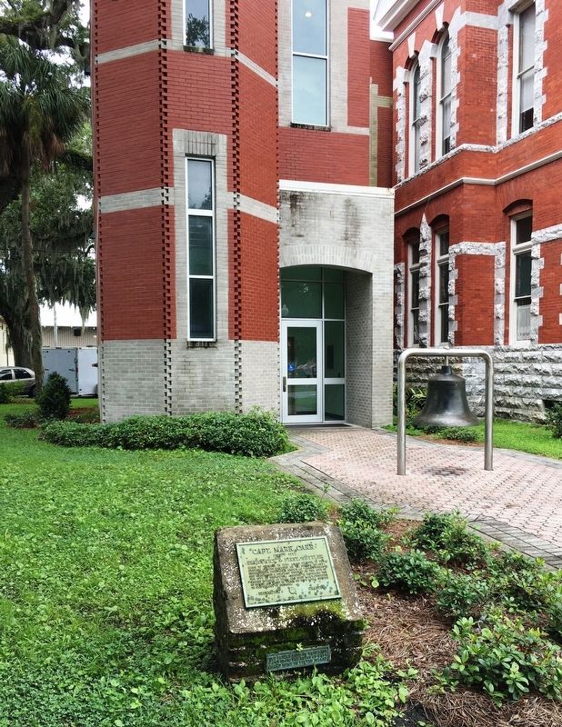
Came to Georgia in 1738 as an officer in the English forces located on St. Simons Island: Established a plantation known as "Carr’s Fields" and maintained a military outpost on the site of the City of Brunswick; assisted in repelling the Spanish . . . — — Map (db m155230) HM
This memorial marks the site of Hood Hospital
Named for General John B. Hood of Texas who commanded The Army of Tennessee in the campaign around Atlanta, July 1864 - January 1865.
Andrew Female College proffered her buildings and grounds . . . — — Map (db m117129) HM
On September 23, 1914, The Rotary Club of Augusta met for the first time in the former Albion Hotel, located here. Organized by attorney James M. Hull and local businessmen, the club promotes fellowship and service. Rotary began in Chicago in 1905 . . . — — Map (db m191174) HM
Founded in Chicago by Paul P. Harris, Rotary is a worldwide organization of business and professional leaders that provides humanitarian service, encourages high ethical standards in all vocations, and helps build goodwill and peace in the world. — — Map (db m59637) HM
First Burial: August 22, 1864
Established as a Masonic/I.O.O.F. Cemetery
September 14, 1872
Restored during the Centennial Year by
“Friends of the Pioneer Cemetery”
Boise City Celebrations, Inc
May 28, 1990 — — Map (db m267631) HM
Pioneer resident of Spring Valley. Achieved national prominence in the settlement of the Pennsylvania Anthracite Miners Strike in 1902 with the co-operation of President Theodore Roosevelt. President of United Mine Workers, 1889-1908. Author of . . . — — Map (db m308286) HM
Pioneer resident of Spring Valley. Achieved national prominence in the settlement of the Pennsylvania anthracite miners strike in 1902 with the co-operation of President Theodore Roosevelt. President of United Mine Workers, 1889-1908. Author of . . . — — Map (db m308287) HM
Don Marquis, American humorist,
dramatist, and poet, was born in Walnut,
July 29, 1878. In 1899 he went to
Washington, D. C., where he began his
career in journalism. He later worked
on newspapers in Atlanta and New York
City. In Atlanta he . . . — — Map (db m230562) HM
At this site on February 23, 1905 The Rotary Club of Chicago was organized as the first of more than 31,600 Rotary Clubs established in 166 countries at the time of its centennial celebration. — — Map (db m223807) HM
PolioPlus is the vision of a world free from poliomyelitis, a disease feared for centuries. in 1985, the Rotary Foundation of Rotary International mounted two efforts -- a fund-raising campaign to provide large quantities of vaccine, and an . . . — — Map (db m273718) HM
You are standing on a Continental Divide. Water falling on this line separates and runs to the west and to the east. To the west the water flows to the Des Plaines River in River Forest, on to the Illinois and Mississippi Rivers and to the Gulf of . . . — — Map (db m230260) HM
You are standing on a Continental Divide. Water falling on this line separates and runs to the west and to the east. To the west the water flows to the Des Plaines River in River Forest, on to the Illinois and Mississippi rivers and to the Gulf . . . — — Map (db m237480) HM
You are standing on a Continental Divide. Water falling on this line separates and runs to the west and to the east. To the west the water flows to the Des Plaines River in River Forest, on to the Illinois and Mississippi Rivers and to the Gulf . . . — — Map (db m237481) HM
You are standing on a Continental Divide. Water falling on this line separates and runs to the west and to the east. To the west the water flows to the Des Plaines River in River Forest, on to the Illinois and Mississippi Rivers and to the Gulf . . . — — Map (db m237482) HM
You are standing on a Continental Divide. Water falling on this line separates and runs to the west and to the east. To the west the water flows to the Des Plaines River in River Forest, on to the Illinois and Mississippi Rivers and to the Gulf of . . . — — Map (db m241781) HM
In remembrance of
Ernest M. Hemingway
Author, Nobel and Pulitzer Prize recipient
Born in Oak Park July 21, 1899
Class of 1917
Oak Park & River Forest High School
A gift to the community from the Rotary Club of Oak Park . . . — — Map (db m224824) HM
Top Section
Clifton H. Moore, DeWitt County’s first resident attorney, built this stately brick home in 1857-58 on an eighty-acre tract of land purchased from Judge David Davis. The original house suffered damage from a windstorm and now lacks . . . — — Map (db m24301) HM
This cannon was purchased from Willard Scott & Co. by the Village of Naperville on July 14, 1871. It is likely that the cannon was acquired through the influence of Willard Scott, Jr., a veteran of the Civil War. He served as a lieutenant in Company . . . — — Map (db m290287) HM
In this cemetery was held the first Memorial Service to the Civil War Veterans Apr. 1866 which inspired Gen. John A. Logan a citizen of Carbondale to issue General Order No. 11 as Grand Commander of G.A.R. establishing National Memorial Day May 30 . . . — — Map (db m174000) HM
In 1869, Carbondale was chosen as the location for Southern Illinois College. By the early 1870s, several new commercial brick buildings were planned for the Town Square, reflecting growth and optimism.
The Newell House Hotel at 101 South . . . — — Map (db m161969) HM
The Atlanta public library was founded in 1873 by public spirited citizens who realized the importance of books. In 1973, the museum was added for the purpose of preserving Atlanta's heritage. In 1979, this octagonal structure was listed on the . . . — — Map (db m56326) HM
Near this site Abraham Lincoln christened the Town with the juice of a watermelon when the first lots were sold on August 27, 1853.
President-Elect Lincoln spoke here, November 21, 1860, while traveling to Chicago, and Lincoln's Funeral Train . . . — — Map (db m12347) HM
On this site Dr. John Deskins erected a tavern in 1836. Abraham Lincoln, David Davis and other lawyers frequently stayed overnight here while the Eighth Judicial Circuit Court was in session at the Postville Court House. The judge, lawyers, . . . — — Map (db m56327) HM
On Abraham Lincoln's last birthday, February 12, 1865, ground was broken for Lincoln University, now Lincoln College. The town proprietors, Robert B. Latham, John D. Gillett and Virgil Hickox, donated the tract of land for the original campus, and . . . — — Map (db m105968) HM
On this site stood two former Logan County Courthouses in which Abraham Lincoln practiced law from 1856 to until elected President. During the March term, 1859, Lincoln substituted for David Davis as the presiding judge of the Logan County Circuit . . . — — Map (db m105970) HM
In 1835 Russell Post, a Baltimore adventurer, laid out the town of Postville which became the first Logan County seat. The town square is now Postville Park. Here Abraham Lincoln and his friends played townball a predecessor of baseball, threw the . . . — — Map (db m106028) HM
On this site stood the home of Robert B. Latham who joined John D. Gillett and Virgil Hickox to found the town of Lincoln in 1853. Abraham Lincoln, judges and lawyers of the eighth judicial circuit were frequent guests in his home. — — Map (db m147790) HM
On this site during the senatorial campaign of 1858 Stephen A. Douglas spoke to a Democratic political rally in a circus tent on September 4th. Douglas' opponent for the Senate seat, Abraham Lincoln, was on the train from Bloomington to Springfield . . . — — Map (db m105971) HM
On this site the Town proprietors erected the original Lincoln House in 1854.
Leonard Volk met Abraham Lincoln on the sidewalk in front of the hotel on July 16, 1858, and arranged to make Lincoln's life mask later. — — Map (db m12349) HM
Dedicated on June 3, 1982
In recognition of 50 years of outstanding service to the Edwardsville Municipal Band during which he served 25 years as its director
Edwardsville Rotary Club serving the community as the major contributor to . . . — — Map (db m54303) HM
"Compared to other surviving Greek Revival churches in Illinois, the building stands on its own. There is nothing like it in the state." - Illinois Department of Conservation, 1977
Completed in 1854, the Benjamin Godfrey Memorial . . . — — Map (db m144922) HM
Abraham Lincoln with Maj. John T. Stuart arrived at this point by canoe on his way home to New Salem during the latter part of July 1832 when he was returning from the Black Hawk War — — Map (db m267914) HM
Kenneth Leon “Tug” Wilson was a collegiate athlete, Olympian, educator, Rotarian and amateur sports administrator who promoted physical fitness, sportsmanship and humanitarian service around the world.
Born March 27, 1896 in Atwood, Wilson grew . . . — — Map (db m226052) HM
Rotary Sundial and Sunflower Calendar Explained
① HUMAN SUNDIAL:
By standing on the month marked on the foot pad, you become the "gnomon" or pointer,
and your shadow marks the time of day. Recycled pieces of granite . . . — — Map (db m302875) HM
The Lincoln-Douglas debates were the first political campaign to see reporters traveling with the candidatesthroughout the race. While newspapers in or near a debate site sent reporters to cover that particular debate, the . . . — — Map (db m233289) HM
William E. Aupperle, rotarian designed and built this structure donated by the Morton Rotarians in 1976.
Dedicated to his memory 1901-1986 — — Map (db m309395) HM
These sidewalks in the middle of Central Park
depict the gear of Rotary International's logo.
The Monmouth Rotary Club (chartered 1918)
this city's oldest service club, held their first
meetings in the “Commercial Club Room” of The
Colonial . . . — — Map (db m229743) HM
Chartered: June 8, 1917
Charter Members
Avon Burk, President •
J. O. Sellemeyer, Vice President •
Arthur Suttles, Second Vice President •
Oscar Hoffman, Secretary •
Arthur Holthouse, Treasurer •
Ashbaurcher, A. R. •
Bell, C. . . . — — Map (db m211674) HM
"First card in a traditional Tarot deck, The Magician represents the ancient mystical principle "As Above, So Below." This sculptural "card" portrays The Magician's looping figure-eight infinity symbol with kinetic flipping heads, representing . . . — — Map (db m211693) HM
The Rotary Club of Fort Wayne was established January 9, 1915, when 35 local business professionals and community leaders held the Clubs first meeting at the former Commercial Club on Harrison Street in downtown Fort Wayne. In the 100 years since . . . — — Map (db m197194) HM
The pump and pump house were reconstructed in 2017 courtesy of the Rotary Club of Brown County.
Prior to 1949, several pumps were in use around Nashville to provide water for families who were without a well on their property, and . . . — — Map (db m206742) HM
May this place always remain a quiet and reverent place for people to gather, honor, reflect, remember, and give thanks to those who served in both peace time and war. When duty called, these men and women answered and paid the price to assure our . . . — — Map (db m242069) WM
Chicago businessman Paul Harris formed the first Rotary Club on Feb. 23, 1905. He named the club "Rotary" because members met in rotation at their various places of business. The Rotary Club of Kokomo received its charter in 1919, and The Rotary . . . — — Map (db m230669) HM
Educator - Inventor - Metallurgist - Industrialist - Auto Pioneer
• 1857 Born in Portland, IN on October 14, son of Jacob M. Haynes and Hilinda S. Haines Haynes, and attended Portland Community Schools for grades 1-10.
• 1881 Graduated . . . — — Map (db m227617) HM
Was the first "Coast to Coast" road covering 3,389 miles across the U.S.A.
The dream of Hoosier Carl G. Fisher, founder of the Indianapolis 500. The Lincoln Highway Association was established on June 1, 1913.
The Boy Scouts of America . . . — — Map (db m68035) HM
The CommuniTree Partnership is a collaboration of community, industry and government agencies with a goal of creating a healthier and more diverse tree population in Northwest Indiana. The Partnership launched a grant program in the Spring of 2017 . . . — — Map (db m293014) HM
On this site South Bend was founded as a fur trading post in 1823 by Alexis Coquillard, who came here from Detroit, Michigan, representing the American Fur Company. — — Map (db m58101) HM
( Center - Engraved Walk Stone )
War on Terrorism
Memorial Garden
( Left - Engraved Rock )
SPC Luke Frist
Brookston, In
U.S. Army
Jan. 5, 2004
Iraq
( Left - Engraved Rock )
Staff Sgt.
Kenneth K. . . . — — Map (db m43005) WM
In the 1870's, Lamoni was established as a settlement for members of the Reorganized Church of Jesus Christ of Latter Day Saints, now known as Community of Christ. The church was led by Joseph Smith III, the son of Joseph Smith, Jr., prophet and . . . — — Map (db m316885) HM
Built in 1905, this unusual barn has been a noteworthy sight on the Jefferson Highway from the start. A cupola roof atop the barn is also divided into ten sections. — — Map (db m316758) HM
Built in 1907, the Decatur County Courthouse is listed on the National Register of Historic Places. This Renaissance Revival structure features a clock tower with four faces. — — Map (db m316757) HM
1850 • Decatur County was organized
1853 • County seat moved from
Decatur City to Independence
1855 • Town name change from
Independence to South Independence
to Leon
1871 • Chicago, Burlington & Quincy
Railroad arrives in Leon . . . — — Map (db m89356) HM
James F. Harvey, Leon attorney and vice president of the Farmers & Traders Bank, also served as a Jefferson Highway Association director. This park, named in his honor, became a welcome stop on the Jefferson Highway. A July 24, 1925 article in . . . — — Map (db m316858) HM
The Burlington Depot, built in 1910, is a beautiful example of railroad pride in rural community development. The Chariton Branch of the Burlington & Quincy Railroad Company and the Des Moines, Osceola & Southern Railroad both accommodated Leon . . . — — Map (db m316859) HM
On this site a Methodist Chapel was constructed in 1834.
As the first church in Iowa, it served not only as a place of worship but as a community center in an early spirit of civic concern, ecumenism and racial integration. At various times . . . — — Map (db m22957) HM
This suspension cable swinging bridge was built at the site of the "Old Mill Dam" in 1937. Labor for the construction was furnished by the Works Progress Administration (WPA), part of Franklin D. Roosevelt's "New Deal" Program. The bridge was . . . — — Map (db m233860) HM
This suspension cable swinging bridge was built at the site of the "Old Mill Dam" in 1937. Labor for the construction was furnished by the Works Progress Administration (WPA), part of Franklin D. Roosevelt's "New Deal" Program. The bridge was . . . — — Map (db m233861) HM
At first, the Lincoln Highway through Iowa consisted mainly of dirt roads, which were fine when dry but impassable when wet. Motorists were advised against trying to cross Iowa in rainy weather.
The goal of the Lincoln Highway Association (LHA) . . . — — Map (db m158227) HM
Montgomery Co. World War heroes who died in service
William Bryan Ackles • Edward Barnes • Oscar L. Benson • Andrew J. Brown • Frank R. Brown • Estey Harold Brownlee • John Bruce • Marion R. Campbell • Paul Denlinger • Henry H. Fall • . . . — — Map (db m247566) WM
During a 10-day tour between Topeka court appearances, the temperance crusader stayed overnight and visited seven saloons including J.M. Wier’s at 221 E. 2nd St. She told a large audience in Muscatine’s Grand Opera House that she would not use her . . . — — Map (db m238746) HM
The town’s first stream driven flour mill was here 1843-1850, beside a stream that meandered and often rampaged. A mother and three of her children drowned in an 1851 flood that carried away three bridges and two ancient Sycamore trees at the creek . . . — — Map (db m238748) HM
Dougherty drug store 1845-1910. The town’s first system-connected telephone installed June 1, 1881. Hardware store 1910-1999 — operated by Dethoff, then Coder, then Silberhorn — sold first Westinghouse refrigerator west of the Mississippi River. . . . — — Map (db m238762) HM
Blank Children's Hospital stands here today because of the generosity of A.H. and Anna Blank. The Blanks were steadfast in their philanthropic mission to build a children's hospital in memory of their son, Raymond Blank. At the time, Iowa had the . . . — — Map (db m237713) HM
Central power units were used to pump oil wells in the early days of the Kansas oilfields. One central power could pump as many as eighteen different wells, some up to half a mile away. In the 1950s producers began to replace central powers with . . . — — Map (db m56130) HM
Alberta and Albert Cole were born in Bath, New York. The three-year-old twins, along with their four brothers, were placed out by the Children's Aid Society in McPherson, Kansas in 1925. Walter and Anna Work of Windom, Kansas were the young couple . . . — — Map (db m212697) HM
Built for the enjoyment of all
the citizens of Pittsburg
Dedicated on June 8th 1999.
Dr. Paul Bannon Leffler practiced medicine in Pittsburg from 1945 to 1977.
He lived the Rotary Motto
"Service Above Self" — — Map (db m59573) HM
This marks the site of the Free State Hotel erected in 1855 by the New England Emigrant Aid Society. Destroyed by Sheriff Jones and his posse May 21, 1856, and rebuilt by Col. Schaler W. Eldridge. Quantrill and his raiders destroyed Lawrence August . . . — — Map (db m20397) HM
This site became known as Boot Hill due to the custom of burying gunfighters with their boots on or behind their heads. It is estimated that 32 men and one woman were buried on this site. The names of many of these are unknown as they died . . . — — Map (db m65388) HM
The oxen and Conestoga wagon sculpture was originally commissioned in 1994 for use at the Kansas Visitors Center at 119th & Strang Line Road. When the Center closed in 2002 the sculpture was awarded to the City of Olathe. The sculpture has been . . . — — Map (db m34337) HM
Below this plaque lies a capsule containing
messages from Leavenworth People of 1976
to Leavenworth People of 2076.
Buried July 3, 1976 - to be opened July 4, 2076 — — Map (db m287028) HM
In 1825 growing traffic over the Santa Fe trail brought a government survey and right-of-way treaties with certain Indians. Council Grove takes its name from an agreement made here that year with the Osage nation. Indians farther west continued . . . — — Map (db m44940) HM
In 1861 the U.S. government constructed 138 of these stone houses for the Kaw Indians. Contractor Robert S. Stevens built the huts at a total cost of $33,135.98.
The houses were situated on the diminished Kaw Reservation in or near the Neosho . . . — — Map (db m45049) HM
Standing before you is the "Big Easel" — an 80 foot tall celebration of art and agriculture. Installed in June 2001, it is a reproduction of Vincent van Gogh's "Three Sunflowers in a Vase" painted by Canadian artist Cameron Cross. . . . — — Map (db m156402) HM
Rotary Club of Lexington
Established as the 3rd Rotary Club in Kentucky and 182nd in the world, it first met on June 23, 1915. The club had weekly meetings at the Phoenix Hotel until 1942. The 2015 centennial marked 100 years of . . . — — Map (db m119117) HM
Daniel Boone - Pioneer
Born, Pa., 1734. Died, Mo., 1820. Married Rebecca Boone, 1756, N.C. First trip to Kentucky, 1767. Set up Ft. Boonesborough, 1775, blazed Wilderness Trail and settled. Frontiersman, surveyor, settler, legislator and . . . — — Map (db m262110) HM
Daniel Boone - Pioneer
Born, Pa., 1734. Died, Mo., 1820. Married Rebecca Boone, 1756, N.C. First trip to Kentucky, 1767. Set up Ft. Boonesborough, 1775, surveyed Wilderness Trail. Surveyor, colonist, legislator and sheriff. Captured by . . . — — Map (db m262111) HM
(front): Civil War troop movements through Berea were common prior to the Aug. 29-30, 1862, Battle of Richmond. Military traffic in and near Berea caused villagers to hear the Civil War "knocking at their east door." At Big Hill on the Old . . . — — Map (db m30428) HM
Irving Shrewsbury Cobb, 1876-1944. One of Paducah's famous sons. "A first-class humorist from a conversational gesture to a book wit who made all the world laugh with him." Author of more than sixty books, short story writer, recipient of O'Henry . . . — — Map (db m47263) HM
Miss Rose's Bar, designed and sculpted by local artist Al Lavergne, was
displayed at the 1984 World's Fair held in New Orleans, Louisiana.
Miss Rose's Bar is a symbolic representation and tribute to the
significant roles in African American . . . — — Map (db m272723) HM
The 1893 Hurricane hit south Louisiana on the
night of October 1 claiming over 2000 lives.
One of the survivors was 25 year old Paul
Harris who was working as an orange picker
on the Pizzati Orange Plantation near the
present site of Citrus . . . — — Map (db m205280) HM
The Rotary Club of Alexandria, Louisiana Was chartered December 1, 1916. It is the fourth oldest club in Louisiana and the 259th in the Rotary world. As of 2007, there were over 32,000 clubs in 200 countries with more than 1,200,000 members. . . . — — Map (db m116059) HM
Located 1 mile west is the site of a W.W. II prisoner-of-war camp. Formerly a 1930s Civilian Conservation Corps camp, the low-security P.O.W. camp opened October 14, 1943. It held captured German soldiers of the Afrikacorps who worked in the area . . . — — Map (db m85072) HM
In honor of All citizens of Tensas Parish Who have served in the Armed Forces of their Country Whether in war or in Peace.We must be ready to dare all for our country. For history does not long entrust the care of Freedom to the weak or the . . . — — Map (db m137185) WM
In 1945, renowned documentary filmmaker Robert Flaherty was commissioned by the Standard Oil Company of New Jersey to make a film as part of a public relations project. Flaherty directed filming of Louisiana Story on location at Avery . . . — — Map (db m105025) HM
1)The Huey P. Long Bridge (U.S.190), completed in 1940, allowed both rail and automobile traffic to cross the Mississippi River at Baton Rouge. Approximately 17,000 vehicles use the bridge daily.2)Baton Rouge's growth as a modern city . . . — — Map (db m175515) HM
High school opportunities in the parish date to at least 1897, when Eureka Central School in Brusly offered classes to white students in the ninth, tenth, and later eleventh grades. In 1899, the West Baton Rouge School Board made plans for three . . . — — Map (db m111837) HM
Originally designed and built 1892 by John A. Roebling's Sons Co. for mill workers to cross the river from new housing in Topsham to the Cabot Mill in Brunswick. The bridge has served generations of citizens of all ages between Brunswick and . . . — — Map (db m51968) HM
This anchor symbolizes the historic ties that Machias people have with the sea, and their commitment to liberty as exemplified in the first naval battle of the American Revolution fought in Machias Bay between the British ship Margaretta and the . . . — — Map (db m55066) HM WM
The Four Way Test
of the things we think, say or do
Is it the truth?
Is it fair to all concerned?
Will it build good will and better friendships?
Will it be beneficial to all concerned?
1925 - Kennebunk Rotary Club is . . . — — Map (db m186303) HM
Upper Plaque: This oak tree planted in 1967 perpetuates the memory of the original Three Mile Oak which stood nearby as explained in the marker below.
Lower Plaque: Trunk of the Three Mile Oak Under this tree passed General George . . . — — Map (db m2877) HM
Thomas Todd settled here from Gloucester County, Virginia, in 1664. Homestead has remained in Todd Family for more than three centuries. Farm once contained 1,700 acres. 17th Century brick house was burned by British Soldiers September 14, 1814, . . . — — Map (db m2123) HM
955 entries matched your criteria. Entries 201 through 300 are listed above. ⊲ Previous 100 — Next 100 ⊳