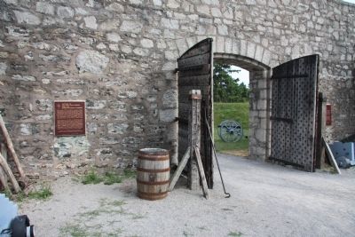
On Lakeshore Road south of Dominion Road, on the right when traveling south.
On the night of 12 August 1814, as a prelude to a British attack on Fort Erie, an expedition was mounted against three armed American schooners anchored off the fort. Captain Alexander Dobbs, R.N., embarked with 70 seamen and marines in six batteaux . . . — — Map (db m48913) HM
On West 12th Avenue at College Road South, on the right when traveling west on West 12th Avenue.
Engage. Empower. Inspire.
NPHC at The Ohio State University was initially established as the Black Greek Council. As early as the 1900's, members of the Historically Black Greek Letter Organizations were represented on campus. The . . . — — Map (db m298594) HM
On Airport Highway (Ohio Route 2) at Scott Road (County Route 107), on the right when traveling west on Airport Highway.
Ohio's Last Ottawas. Here in the Oak Openings Region of northwest Ohio, some of the last Ottawa villages in Ohio lined the banks of Swan Creek during the 1830s. These Native Americans were led by Chief Ottokee (Autokee), a descendant of . . . — — Map (db m94769) HM
On West Market Street at North Park Avenue, on the right when traveling west on West Market Street.
Pennsylvania & Ohio Canal. 1839-1872. The decision to build the P&O Canal resulted from several canal conventions at Warren's first courthouse in 1833. Canal advocates from Warren included Simon Perkins, Leicester King, David Tod, and Calvin . . . — — Map (db m225406) HM
On Stingley Road (County Route 57) 0.2 miles west of Smith Road (County Route 386), on the left when traveling west.
James and Sophia Clemens’ lives are part of a story of tens of thousands of people of color who migrated north in search of land to farm and better lives during the first half of the 19th century. In 1818, James Clemens (1781-1870) purchased 387 . . . — — Map (db m168860) HM
Near South 9th Street at Washington Street, on the right when traveling north.
St. Lawrence O'Toole Catholic Church Corner of 6th and Center Streets, Ironton Built in 1892, this beautiful Catholic church, as well as the Depot (below) and several other historic buildings are part of a self-guided walking tour of historic . . . — — Map (db m310299) HM
This tree is planted in honor of the Ohio Department of
Natural Resources' 75th anniversary. The Division of
Forestry, one of the oldest formal forestry programs in
the nation, works to protect, sustainably manage, and
expand Ohio's forested . . . — — Map (db m247798) HM
On Central Avenue (State Highway 7) 0.1 miles south of Fountain Street, on the left when traveling north.
Most Major League players of the early 20th century had few inhibitions and many enjoyed gambling during training trips to Hot Springs. Among the most popular casinos in the city were the Southern Club, built a few doors to the right in 1893, and . . . — — Map (db m102678) HM
Near North Blackford Street north of Indianapolis Cultural Trail, on the right when traveling north.
The Ohio River forms the eastern boundary of Indiana's smallest county. During the mid-1800s, more than 100 paddleboats and flatboats left the Rising Sun wharfs each week, loaded with produce for market and passengers traveling to southern river . . . — — Map (db m238646) HM
On North Front Street north of Main Street, on the right when traveling north.
The Ohio River – freeway of the past! Just as we
depend on roads to carry our goods, the river
connected people and their goods before railroads
and highways. River towns dotted the Ohio, thriving
on the exchange of goods and services enabled by . . . — — Map (db m222325) HM
On Preston Hwy (State Highway 61) at Old Preston Highway South (County Route 2237), on the right when traveling south on Preston Hwy.
July 2, 1863, CSA Gen. J.H. Morgan began raid to prevent USA move to Tenn. and Va. Repulsed at Green River, July 4. Defeated USA force at Lebanon, July 5. Moved through Bardstown, July 6. After night march, crossed here July 7. Rested troops few . . . — — Map (db m71984) HM
On South Summit Avenue south of East Diamond Avenue, on the left when traveling south.
The Gaithersburg Railroad Station and freight house were built in 1884 as handsome replacements for the adjacent small frame structure which served as a freight depot when the Metropolitan Branch of the B & O Railroad was extended to Gaithersburg . . . — — Map (db m1039) HM
On Central Avenue (Ohio Route 122) at N. Verity Parkway ( Route 73), on the right when traveling west on Central Avenue.
Canals were built in Ohio to provide a better way to transport goods to the eastern markets. Two major canals were built connecting the Ohio River to Lake Erie - the Ohio Erie & [sic Ohio & Erie] Canal running from Portsmouth to Cleveland and the . . . — — Map (db m30375) HM
Near South Henry Street south of East William Street (U.S. 36), on the right when traveling south.
On the morning of May 3, 1890, Ohio Wesleyan University and The Ohio State University met at this location for a football game. It was the first game in Ohio State football history. Ohio Wesleyan had invited the newly organized team to a contest as . . . — — Map (db m18316) HM
On West Powell Road (Route 750) at West Olentangy Street, on the right when traveling south on West Powell Road.
Ohio river otter populations are recovering, largely due to people working together to reintroduce the species and protect their habitats. By the mid-1950s, populations were eliminated through many parts of their range, including in Ohio. In the . . . — — Map (db m309480) HM
On U.S. 127 2 miles north of U.S. 20, on the right when traveling north.
1815 Michigan Meridian. After the War of 1812, the United State Congress proposed two million acres of military bounty land for the Michigan Territory. To survey the land, the meridian had to first be established. U.S. Surveyor General Edward . . . — — Map (db m223935) HM
On Stoney Creek Road (State Road 372) near North Ridge Road.
1885 -
The Ohio General Assembly established the State Forestry Bureau.
1915 - The General Assembly appropriated $10,000 for the purchase of
two forested areas in southern Ohio: Waterloo State Forest in
Athens County and Dean State Forest in . . . — — Map (db m247892) HM
On North Main Street (Ohio Route 91) south of North River Road, on the right when traveling north.
Officially opening on August 4, 1840, the Pennsylvania and Ohio Canal followed the route of present railroad tracks through Munroe Falls approximately one thousand feet south of this marker. This 82-mile long “feeder canal” connected the . . . — — Map (db m142909) HM
On West Market Street west of South Leavitt Road, on the right when traveling east.
In January 1827, the Ohio State Legislature chartered the Pennsylvania & Ohio Canal Company to build an east-west cut” canal connecting north-south canals in Ohio and Pennsylvania. The route ran from the Beaver Canal in Pennsylvania to the Ohio & . . . — — Map (db m225409) HM
On Longvue Avenue at Maratta Road, on the right when traveling west on Longvue Avenue.
Founded in 1799 as the Flaugherty Run Congregation, the group met in tents or barns at various sites, in 1828 the tent was moved to the village of Scottsville. Erected in 1831 the first church was named for the Ohio River. The present church was . . . — — Map (db m45776) HM
On South Crest Road 0.1 miles south of Ridge Road, on the right when traveling south.
4th Ohio Cavalry Battalion.
Long's Brig., Crook's Div., Stanley's Corps.
Maj. George W. Cobb.
Nov. 25, 1863.
Crossing the Tennessee in the rear of Gen. Sherman's column on the 24th, the regiment advanced with . . . — — Map (db m38674) HM
On Corinth-Pittsburg Landing Road, on the right when traveling north.
U.S. Camp of 77th Ohio Infantry, Hildebrand's (3d) Brig., Sherman's (5th) Div., Army of the Tennessee.First position in line of battle April 6, 1862 was at the left front of this camp. — — Map (db m21996) HM
On Pittsburg Landing Road, on the right when traveling west.
U.S. 54th Ohio Infantry, Stuart's (2d) Brig., Sherman's (5th) Div., Army of the Tennessee. This regiment occupied this part of the line from 5 p.m. April 6, 1862 to morning of April 7. — — Map (db m21384) HM
On Centre Avenue Northwest west of Henry Street Northwest, on the left when traveling west.
Across the street from this spot stood the Atlantic, Mississippi and Ohio Railroad Depot. The boundaries of the town of Big Lick were set out in the 1874 charter as, “commencing at this point and extending therefrom one-half mile north, east, . . . — — Map (db m150293) HM
On Union Street at Court Street, on the right when traveling east on Union Street.
The Ohio University Alumni Gate was built with funds contributed by many alumni, with the original intent of honoring the class of 1815, which was the first graduating class. The largest contribution, however, came from Edward C. Berry, a black man . . . — — Map (db m15562) HM
On South Shafer Street 0.1 miles east of Richland Avenue, on the left when traveling east.
The blossoms of Ohio University's iconic cherry trees symbolize the arrival of springtime in Athens. The trees serve as a living commemoration of the University's longest institutional partnership, with Chubu University, located in Kasugai, . . . — — Map (db m189699) HM
On U.S. 502 at Vine Street, on the right when traveling east on U.S. 502.
This tree is planted in honor of the Ohio Department of Natural Resources' 75th Anniversary in 2024. The Division of Forestry, one of the oldest formal forestry programs in the nation, works to protect, sustainably manage, and expand Ohio's . . . — — Map (db m305657) HM
On Independence Dam Road at County Road 424, on the right when traveling east on Independence Dam Road.
This tree is planted in honor of the Ohio Department of Natural Resources' 75th Anniversary in 2024. The Division of Forestry, one of the oldest formal forestry programs in the nation, works to protect, sustainably manage, and expand Ohio's . . . — — Map (db m269874) HM
On Center Street just north of Canal Street, on the left when traveling east.
Canals were an important means of transportation when Carroll was founded in 1829 by William Tong and his brother Oliver, who chose this site because it was where the proposed intersection of the Lancaster Lateral Canal and Ohio-Erie Canal would be . . . — — Map (db m80624) HM
Near Groveport Road, on the right when traveling west.
The Ohio and Erie Canal Lock 22, constructed from 1830-1831, is the only canal lock in Groveport. Constructed by W.H. Richardson as part of his $2,937 bid to build section 52 of the canal, the sandstone lock is 117 feet long and ten feet deep and . . . — — Map (db m13724) HM
On South State Street (Ohio Route 3) at Electric Avenue, on the right when traveling north on South State Street.
This marker honors the generosity of Columbus Outdoor Pursuits
and their partners in support of The Ohio to Erie Trail.
Columbus Outdoor Pursuits is a nonprofit organization that brings
together people of all ages, abilities and backgrounds . . . — — Map (db m98768) HM
On Wheeling Avenue (U.S. 40) east of 9th Street, on the left when traveling east.
The first Scottish Rite body of Free-Masonry west of the Alleghenies was formed in Cambridge, Ohio, in 1852 by Killian H. Van Rensselaer, an honorary 33rd Degree Mason. He lived in this city from 1851 to 1867. Van Rensselaer was superintendent of . . . — — Map (db m1045) HM
On U.S. 127 north of Route 707, on the right when traveling north. Reported missing.
Site of
Fort Adams
One-fourth mile east.
Built by General Wayne
In August 1794.
A deserter from this fort
warned the Indians of
the American approach. — — Map (db m136595) HM
On Ravenna Road (County Route 145) at Ferguson Road, on the right when traveling west on Ravenna Road.
This tree is planted in honor of the Ohio Department of Natural Resources' 75th Anniversary in 2024. The Division of Forestry, one of the oldest formal forestry programs in the nation, works to protect, sustainably manage, and expand Ohio's . . . — — Map (db m308808) HM
On West State Street (U.S. 20Bus) at North Arch Street, on the right when traveling east on West State Street.
Two blocks south - site of
Fort Stephenson
Here, in 1813, Major Croghan
with only 160 men and the
cannon, "Old Betsy," heroically
defended the fort against
over 1300 British and Indians.
— — Map (db m221621) HM
On North Front Street at Haynes Street, on the left when traveling north on North Front Street. Reported missing.
Site of camps during the
Pontiac Conspiracy
Here Bradstreet's British
expedition camped in 1764.
Also the farthest point
west reached by colonial
forces under command of
Israel Putnam.
— — Map (db m135756) HM
On Tuscarawas Avenue (Ohio Route 211) at West Front Street, on the right when traveling south on Tuscarawas Avenue.
Christian Deardorff (1781-1851) with his brother-in-law Jesse Slingluff (1775-1836) platted and founded Dover and built the area's first gristmill on Sugar Creek. With the coming of the Ohio and Erie Canalto Dover, Deardorff lobbied successfully . . . — — Map (db m225416) HM
On Lincoln Highway at Pollock Road, on the right when traveling north on Lincoln Highway.
Here Lies Robert Nesbitt. This is the grave site of Robert Nesbitt, an immigrant from Convoy, Ireland who named Convoy, Ohio after his home town. In 2010, the Convoy Community Foundation, Convoy Lions Club, Convoy Business Association, and . . . — — Map (db m178428) HM
On Blennerhassett Avenue, on the left when traveling east.
Side A:
The history of Belpre and the Ohio River are inextricably linked. Settlers from New England, including farmers and Revolutionary War veterans, arrived via flatboats at “Belle-Prairie” (beautiful prairie) in 1789. Lewis . . . — — Map (db m20119) HM
On Howard Avenue 0.2 miles east of Mummasburg Road, on the right when traveling east.
(Front):Battery I, First Ohio Light Artillery Artillery Brigade Eleventh Corps Capt. Hubert Dilger July 1,2 & 3, 1863. Eidus Et Audax Erected by the State of Ohio (Right): This Battery Captain Huber Dilger Commanding marched with the . . . — — Map (db m11135) HM
Near State Highway 184 0.6 miles north of U.S. 64, on the left when traveling north.
Around 1900, there were about 16 one-room
schoolhouses in and around Parkin. Most
were on plantations for the education of the
sharecroppers' and farm workers' children.
The Northern Ohio School, built around 1910,
was no different. The school . . . — — Map (db m221314) HM
Near Battleline Road 0.4 miles south of Alexander Bridge Road, on the right when traveling south.
20th Battery, Ohio Light Artillery.
4 3” Rifles, 2 Napoleons.
Dodge’s Brigade, Johnson’s Division, McCook’s Corps.
September 20, 1863.
Capt. Edward Grosskopff, Commanding.
The Battery remained in the rear of the . . . — — Map (db m103737) HM
On Pigeon Creek Greenway Passage 0.1 miles west of Ohio Street, on the left when traveling west.
Just down river from this bridge was the location of the Evansville Shipyard, which constructed L.S.T.s (Landing Ship Tanks) and 35 other vessels during World War II. Looking up river, you can see the L.S.T. 325, the last navigable LST in existence . . . — — Map (db m226907) HM
Near Emmitsburg Road (Business U.S. 15) at Long Lane, on the right when traveling south. Reported permanently removed.
"I received an order... to move my regiment...to the front of our position...and to hold my line to the last man." Lt. Col. Franklin Sawyer, 8th Ohio At 4:00 p.m. on July 2nd the 209 men of the 8th Ohio were ordered to advance and hold this . . . — — Map (db m15122) HM
On Brotherton Road east of LaFayette Road, on the right when traveling east.
Text from the Front Side of the Monument:
124th Ohio Infantry
Hazen's Brigade
Palmer's Division
21st Army Corps
Text from the Back Side of the Monument:
September 19th, 1863, this Regiment, Colonel Oliver H. . . . — — Map (db m121430) HM
On Superior Avenue (U.S. 6) at East 3rd Street, on the right when traveling west on Superior Avenue.
On this side, then known as Case Hall, the first meeting of the Ohio State Bar Association was held July 8, 1880.
Dedicated May 21, 1980 — — Map (db m17860) HM
This building, the original C & O Depot at Carroll, Ohio, was presented to the Fairfield County Agricultural Society by Mr. & Mrs. James D. McGill August 1966. It will be preserved for Historical purposes. — — Map (db m61848) HM
Plaque A
“River Ohio so called by the Iroquois on account
of its beauty- descended by Sieur Robert de la Salle.”
Discovered by the French explorer LaSalle, about
1670 and claimed by him for Louis XIV of France.
Seized by the . . . — — Map (db m135159) HM
Near Marcy Road, on the right when traveling west.
Slate Run Events
1805 Jacob Knepper and his family acquire this land from the federal government. The land is primarily virgin forest that must be cleared for farming.
1852 The Kneppers sell the farm to Isaac Fridley.
1856 The Fridleys . . . — — Map (db m250199) HM
Near Chinn Ridge Loop at Sudley Road (Virginia Road 234), on the right when traveling west. Reported missing.
August 30, 1862 5:00 p.m. 2nd Brigade (McLean), First Division (Schenk) First Corps (Sigel), Army of Virginia, USA 73rd Ohio Infantry Col. Orland Smith "The enemy in our front, moving in concert with those on our flank, came out of the . . . — — Map (db m255483) HM
Near Urbana Road (Ohio Route 72) north of Route 334, on the right when traveling north.
Site of Simon Kenton's first log cabin home in Ohio - Built beside the old war trail over which he was led into captivity - Scene of his killing the last Indian slain in combat in Clark County — — Map (db m44177) HM
Built in 1833 as a health resort named the Mansion House Hotel, Elliott Hall is noted as Ohio's oldest collegiate Greek Revival building. The closure of the Bank of the United States and an economic panic in 1837 created nation-wide financial . . . — — Map (db m12822) HM
On Columbus Pike (U.S. 23) just north of Orange Point Drive, on the left when traveling north.
The Gooding House and Tavern
Known as the "Halfway House," the Gooding House and Tavern was built by George B. Gooding halfway between the towns of Worthington and Delaware in 1827. Its location was influenced by construction of the Columbus . . . — — Map (db m12824) HM
Near Gray Road west of Winton Road, on the left when traveling west.
5th Ohio Vol. Inf.
Boys Keep the Colors Up
5th O.V.I.
Badge.
In memory of the dead
of the
5th. Regt. Ohio Vol. Infantry
Total Enrollment: 1871 Men
Mustered for 3 Mos April 20 1861
Remustered for 3 Yrs June 19 1861 . . . — — Map (db m289987) WM
On Harrison Avenue at Gieringer Drive, on the right when traveling west on Harrison Avenue.
Confederate Brigadier General John Hunt Morgan's Indiana-Ohio Raid, or Great Raid, from July 2-26, 1863 covered nearly 1,000 miles and penetrated deeper into the North than any other Confederate incursion during the Civil War. The raid was also . . . — — Map (db m225383) HM
Near Riverside Drive at Adams Street, on the right when traveling north.
Riverside's Black Civil War Burials
Riverside Cemetery opened in 1867, two years after the Civil War ended. More than 20 Black Civil War soldiers are buried in the cemetery, the majority laid to rest in the Soldier's Circle. Although the . . . — — Map (db m283889) HM
On Ohio Route 93 at Township Road 1195, on the right when traveling south on Ohio Route 93.
On February 10. 1899, a United States Weather Bureau Station
operated by Steve Eveland, in the small hamlet of Milligan, Ohio,
now part of McLuney, reported a temperature of 39 degrees
below zero. To date, this is the lowest temperature . . . — — Map (db m122407) HM
Near Interstate 70 at milepost 2, on the right when traveling east.
Welcome to the National Road
The National Road crosses six states from Baltimore, Maryland, to East St. Louis, Illinois. The road fulfilled the dreams of George Washington and Thomas Jefferson to build an all-weather route across the . . . — — Map (db m180639) HM
On Dover Zoar Road NE (County Route 82) at Towpath Road NE (County Route 111), on the right when traveling north on Dover Zoar Road NE.
Construction of the Ohio and Erie Canal, beginning in Cleveland and running south to Portsmouth, began in 1825. As a means to pay for debts on the community's 5,500 acres of Tuscarawas County land, members of the Society of Separatists of Zoar . . . — — Map (db m224969) HM
Near Union Avenue 0.2 miles west of Pemberton Avenue.
Capt. T.D. Yost.
The battery was Company F. 32D Regiment Ohio Volunteer Infantry, prior to the Battle of Champion Hill, May 16. Two 12-pounder guns and four 3-inch rifles captured in that battle were turned over to it. Two sections . . . — — Map (db m110768) HM
On Ottawa Road (Ohio Route 65) at North West Street ( Route 115), in the median on Ottawa Road.
In honor of those founders and
patriots of the northwest territory
who settled in Ohio and Allen County
1803 Ohio Sesquicentennial 1953 — — Map (db m77680) HM
On North Elizabeth Street, on the right when traveling north on North Elizabeth Street.
Ohio's first electric
Street Car Line
and
one of the first in the U.S.
Began operation in
Lima, Ohio July 4, 1887.
Operated by B.C. Faurot
as the Lima Street Rail-
way and Power Co. This
line served the city
. . . — — Map (db m79481) HM
On Campus Drive at James Biddle Drive, on the right when traveling east on Campus Drive.
Galvin Hall was the first building on The Ohio State University at Lima campus. When it opened in 1966, it housed everything from classrooms and offices to the library and administration.
The building is named for John E. Galvin, a local . . . — — Map (db m298314) HM
On Pike Lake Road at Egypt Hollow Road, on the right when traveling north on Pike Lake Road.
The Reihle family once farmed what is now Pike Lake State Park. Auselein Reihle lost her son and husband amidst the raging Civil War in 1864. A Union soldier mysteriously appeared at her property days after she heard of her husband's death. Wounded . . . — — Map (db m280784) HM WM
On Corinth-Pittsburg Landing Road, on the right when traveling south.
U.S. Army of the Ohio. Major General Don Carlos Buell. Second Division, Brig. Gen. Alex McD. McCook. Fourth Division, Brig. Gen. William Nelson. Fifth Division, Brig. Gen. Thomas L. Crittenden. Sixth Division, Brig. Gen. Thomas J. Wood. The . . . — — Map (db m21888) HM
On Pittsburg Landing Road, on the right when traveling west.
U.S. Army of the Ohio. Major General Don Carlos Buell. Second Division, Brig. Gen. Alex McD. McCook. Fourth Division, Brig. Gen. William Nelson. Fifth Division, Brig. Gen. Thomas L. Crittenden. Sixth Division, Brig. Gen. Thomas J. Wood. The . . . — — Map (db m21401) HM
Near Patrol Road 0.7 miles north of Collector Wells Road, on the right when traveling north.
Since the beginning of history, people have been drawn to the river for water, food and transportation.
1. The Earliest People Several archaeological sites at Charlestown reveal stories of temporary camps. Mounds in this region date from the . . . — — Map (db m206831) HM
On Mill Road west of Welton Road, on the right when traveling west.
The prehistory of Ohio is generally divided into four major time periods: The Paleoindian, Archaic, Woodland, and Proto-historic periods. The Archaic and Woodland are each further sub-divided into Early, Middle, and Late time periods.
The . . . — — Map (db m214343) HM
Near Dwight D. Eisenhower Highway (Interstate 70) 5 miles Belmont-Morristown Road ( Route 149), on the right when traveling east.
Common Name: Ohio buckeye
Botanical Name: Aesculus glabra
Height/Width: 20 to 40 feet/20 to 40 feet
Habitats: Mesic woods and bottomlands
Wildlife Value: Hummingbirds are attracted to the flowers, and . . . — — Map (db m271646) HM
On Ohio Route 213 south of Ohio River Scenic Byway ( Route 7), on the right when traveling north.
Common Name: Ohio buckeye
Botanical Name: Aesculus glabra
Height/Width: 20 to 40 feet/20 to 40 feet
Habitats: Mesic woods and bottomlands
Wildlife Value: Hummingbirds are attracted to the flowers, and . . . — — Map (db m288920) HM
On East Canal Street just east of South 1st Street, on the right when traveling east.
• The groundbreaking for the Ohio and Erie Canal occurred on July 4, 1825 at Licking Summit, south of Newark.
• The first canal boat from Cleveland arrived in Newark on July 10, 1830.
• 23 miles of the Ohio and Erie Canali ran through . . . — — Map (db m206045) HM
On Ohio Turnpike (Interstate 80 at milepost 197), 3 miles east of Painesville Ravenna Road ( Route 44), on the right when traveling west.
The Underground Railroad
The Underground Railroad was neither underground nor a railroad, but a system of loosely connected safe havens where those escaping the brutal conditions of slavery were sheltered, fed, clothed, nursed, concealed, . . . — — Map (db m189183) HM
The Underground Railroad
The Underground Railroad was neither underground nor a railroad, but a system of loosely connected safe havens where those escaping the brutal conditions of slavery were sheltered, fed, clothed, nursed, concealed, . . . — — Map (db m207605) HM
On Interstate 76 at milepost 45, on the right when traveling west.
Common Name: Ohio buckeye
Botanical Name: Aesculus glabra
Height/Width: 20 to 40 feet/20 to 40 feet
Habitats: Mesic woods and bottomlands
Wildlife Value: Hummingbirds are attracted to the flowers, and some . . . — — Map (db m286034) HM
On U.S. 30 at Interstate 71 when traveling east on U.S. 30.
Common Name: Ohio buckeye
Botanical Name: Aesculus glabra
Height/Width: 20 to 40 feet/20 to 40 feet
Habitats: Mesic woods and bottomlands
Wildlife Value: Hummingbirds are attracted to the flowers, and . . . — — Map (db m281279) HM
Near U.S. 50 0.1 miles west of Dill Road, on the left when traveling west.
No part of our country is so rich in per-historic remains...as Ohio.
While other States have preserved their own mementos, Ohio has
allowed her fields to be…despoiled....
Ohio Archaeological and Historical . . . — — Map (db m166831) HM
On Greene Street at Front Street, on the left on Greene Street.
Look carefully and you might see the Ohio River’s wild side! During the warmer months, great blue herons wade the shallows while osprey fly overhead in search of fish. Bald eagles and waterfowl visit in winter, driven by northern cold to find food . . . — — Map (db m103241) HM
On West Front Street (U.S. 20) west of Walnut Street, on the right when traveling west.
This monument honors, recognizes, and serves Gold Star Families and the legacy of their Loved Ones who have paid the ultimate sacrifice while serving in the Armed Forces of the United States.
The Homeland panel depicts images representing . . . — — Map (db m258031) WM
On South Crest Road 0.1 miles Ridge Road, on the right when traveling south.
Ohio Artillery. Nov. 23-25, 1863.During the engagements, the Ohio Batteries operated as indicated below:
Battery A Capt. Wilbur F. Goodspeed / Guarding fords of the Tennessee River.
Battery B Lieut. Norman A. Baldwin / Supporting General . . . — — Map (db m38712) HM
On Urbana- Lisbon Road (Ohio Route 54) at Benson Road (County Route 179), on the right when traveling west on Urbana- Lisbon Road.
Benson Road and the North Urbana Lisbon Road (SR 54) in Champaign County was the site of the 1950 National and Ohio Plowing Matches and the National Association of Soil Conservation Districts Field Days. The three-day event drew a crowd of nearly . . . — — Map (db m86249) HM
Near Broad Street (U.S. 40) at Starling Street, on the right when traveling east.
Toledo and Ohio Central Railroad Station
The only remaining Columbus railroad station, The Toledo & Ohio Central (T&OC) Railroad Station was constructed in 1895 and was the departure point for William McKinley when he left for Washington D.C to . . . — — Map (db m13067) HM
On Stage Coach Road (Local Route 52) 0.6 miles east of Zion Road NW (Local Road 39), on the left when traveling east.
In the Fall of 1808, Father Edward Fenwick, a Dominican priest, met Jacob Dittoe on this site and offered the Holy Mass for his family and their kinsmen, the Fink family. Dittoe had written to Bishop John Carroll, the first Catholic bishop in . . . — — Map (db m188389) HM
12363 entries matched your criteria. Entries 301 through 400 are listed above. ⊲ Previous 100 — Next 100 ⊳
Thin black lines indicate changes in relevance. Between each pair of lines entries are ordered geographically but all have the same relevance.
* Inflectional forms of words are their plurals, singulars, and possessives as well as gramatical tenses and similar variations.