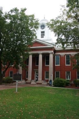
Planter, tavern operator, newspaper editor, legislator, and land developer, he sought in vain to have the Jackson County seat moved from Bellefont to the settlement that bore his name. After his death in 1863, his widow reached an agreement in 1868 . . . — — Map (db m22260) HM
Robert T. Scott, born in 1800 into a prominent North Carolina family who originally settled in Maryland, founded the Alabama town that bears his name. Between 1848 and 1858, he acquired 1,240 acres of choice land in the heart of Jackson County. . . . — — Map (db m166957) HM
The Memphis and Charleston Railroad Company constructed the Scottsboro Railroad Depot in 1860-1861 as a passenger and freight facility. The rail line ran throughout the Confederacy and the Union considered its capture vital to cutting off supplies . . . — — Map (db m22258) HM
What are the Ways to Serve?
• Commissioned Officer, Warrant Officer, or Enlisted Service Member
• Active Duty: Full-time Military
• Reserves: Military service that combines a part-time military role or career with a civilian . . . — — Map (db m268357)
How did the War begin?
Hostilities began after the unexplained sinking of the USS Maine in Havana (Cuba) harbor, the US resolution that declared Cuba's right to independence, and the US demand that Spain's armed forces be withdrawn from . . . — — Map (db m268355) HM WM
What is Changing?
The threats to the safety and security of US Citizens are changing. Where previous wars witnessed soldiers fighting soldiers, war is now being conducted against civilians in public places. Attacks on September 11, 2001 . . . — — Map (db m268178) HM
Here rests in
honored Glory
an American
Soldier
Known but to God
What is the Tomb of the Unknown Soldier?
A monument dedicated to deceased US Service members whose remains have not been identified. It is located in . . . — — Map (db m268352) HM WM
In late December 1863, Union Maj. Gen. John A. Logan established his Fifteenth Army Corps headquarters in Scottsboro, Alabama. On January 11, 1864, by command of Gen. Logan, Brig. Gen. Hugh Ewing, commanding the Fourth Division, was ordered to guard . . . — — Map (db m100044) HM
Since becoming a separate service in 1947, your Air Force has led the world in aerospace technology!
First, to break the sound barrier
Holds the world record for fastest air-breathing aircraft, the SR-71 Blackbird, Mach 3+ (2,200 . . . — — Map (db m268148) HM
U.S. Army • U.S. Space Force • U.S. Marine Corps • U.S. Navy • U.S. Air Force • U.S. Coast Guard
Did You Know What Your Armed Forces Do for you?
• Project power to deter aggression and prevent war
• Deploys service members on a . . . — — Map (db m268442) HM WM
Since 1775, when our colonists first formed the new Continental Army as conscripts armed with single shot muskets, our patriotic citizens have been fighting for our freedom. At the start of WWII your Army was ranked 19th , yet we quickly . . . — — Map (db m268346) HM WM
Motto: "Semper Paratus" - "Always Ready"
Brief History: Originally established as the Revenue Marine on 4 August 1790. At the time, it was the only armed maritime service of the United States. Still only military service . . . — — Map (db m268351) HM WM
What are Marines? While being the smallest US military service, our Marines are known for being tenacious fighters on land, sea and air by conducting task-organized amphibious and ecpeditionary landings and noted for rapid deployment and . . . — — Map (db m268348) HM WM
Infancy: On October 13, 1775, the Continental Congress voted to fit out two sailing vessels, armed with ten carriage guns, as well as swivel guns, manned by crews of eighty, and sent them to intercept British supply ships. . . . — — Map (db m268349) HM WM
Why was it formed?
The December 2019 National Defense Authorization Act created the Space Force as the sixth branch of the Armed Forces.
It was established to protect our interests in space, deter aggression in, from, and to space, . . . — — Map (db m268149) HM
This park was created to:
• Honor the men and women from Jackson County who served and sacrificed their lives to preserve our freedom.
• Recognize and honor all service men and women of the Armed Forces, Army, Marines, Navy, Coast Guard, Air . . . — — Map (db m268106) WM
How did it start? In 1950, American advisors arrived in South Vietnam to prevent a takeover by communist North Vietnam, which was backed by China and Russia. Following an attack on US destroyers by North Vietnam gunboats in 1964, congress . . . — — Map (db m268447) HM
Who Declared War and Why?
In June 1812, we declared war against Great Britain in reaction to: British economic blockade of US trade with foreign countries; forced induction of thousands of neutral American seamen into British Royal Navy, . . . — — Map (db m268245) HM
What is a Warrant Officer?
Warrant Officers are a specialist rank, above the enlisted ranks, but below the officer ranks. Warrant Officers serve in the Army, Marines, Navy, and Coast Guard.
Warrant Officers are addressed as Mr. (last . . . — — Map (db m268243) HM WM
How was it drafted?
Representatives from 13 colonies convened in May 1787 to create a new form of government in the newly independent United States of America. The outcome is our US Constitution, which created a government of the people, . . . — — Map (db m268354) HM
Why so Many Wars?
Why would a nation that values peace and freedom as its primary virtues fight in so many wars?
Freedom!
The United States of America fight for Freedom!
Freedom for ourselves, starting with the American . . . — — Map (db m268241) HM WM
Why did it Start?
Decades of ongoing global Militarism, Alliances, Imperialism, and Nationalism and the assassination of Archduke Franz Ferdinand of Austria led the Central Powers (Germany, Australia-Hungary, Bulgaria, and the Ottoman . . . — — Map (db m268356) HM
Why did this war start?
Nazi Germany invaded Poland in 1939 to achieve world domination and eradicate all Jewish people worldwide.
How was it fought?
When the US entered the war on December 11, 1941, the largest war in . . . — — Map (db m268120) HM
What Started the War?
On December 7, 1941, the Japanese conducted a major carrier-based air strike on Pearl Harbor, Hawaii crippling our Pacific Fleet. The next day, the United States and our allies declared war on Japan.
Where . . . — — Map (db m268122) HM
Section, Alabama is on a land where the Cherokee once hunted and lived. There were communities such as Kirby Creek, Gossets Hollow, and Fern Cliff. These communities came together to form the Town of Section. Pioneer settlers came in large . . . — — Map (db m79906) HM
History excerpted from various articles written
by Dr. David Campbell, president of
Northeast Alabama State Community College
Skyline Farms was an effort to build a “new world” in rural America where tenant farmers, hit hard by . . . — — Map (db m167093) HM
The Skyline School was built as part of the Skyline Farms Project, a self-help program that the United States government conducted in 1934-1945 for unemployed farmers. Started by the Federal Emergency Relief Administration, the program loaned . . . — — Map (db m167096) HM
During the Reconstruction Period following the Civil War, a freedmen’s community was established in this area called Averyville, named for the Pennsylvania minister and successful businessman Charles Avery, a longtime and faithful champion of Negro . . . — — Map (db m108803) HM
This cabin was originally constructed over 100 years ago approximately 10 miles west of this site in Bennett's Cove.
It was given to the Stevenson community park by Mary and Walker Leland Jordan.
The cabin was moved to this site and restored . . . — — Map (db m197507) HM
Side A One of the Five Lower Towns established by the Chickamauga Cherokees in 1782 under the leadership of Dragging Canoe. Territorial Governor William Blount reported to the Secretary of War in 1792 that: “Crow Town lies on the north . . . — — Map (db m28473) HM
Early on the morning of Wednesday, July 17, 1996 — hearts and minds overflowing with excitement for the journey — five of our friends, neighbors and kinfolk, left Stevenson, Alabama, bound for Paris, France.
That evening, at sunset, TWA . . . — — Map (db m108799) HM
Constructed by the Union Army in the summer of 1862 and expanded in 1864, using soldiers and freed slaves, Ft. Harker was built on a broad hill a quarter mile east of town. It overlooked Crow Creek and was well within firing range of Stevenson's . . . — — Map (db m83795) HM
A one-story depot building was constructed here in 1853, when the railroad was first laid through Stevenson. That building burned after the Civil War and was replaced by the present brick depot and hotel in 1872.
During the Civil War, Stevenson . . . — — Map (db m22271) HM
Stevenson was a major supply station and staging ground for decisive campaigns and battles of the Civil War. This small house, called "The Little Brick," was alive with activity when General William S. Rosecrans relocated his command here on . . . — — Map (db m87983) HM
Alabama’s Winter Waterfowl
The Tennessee River Valley is the winter home for thousands of waterfowl. These birds migrate from across the northern US and Canada down through the center of the continent to the Tennessee River.
Careful . . . — — Map (db m106298) HM
A vital part of Pioneer Presbyterian Witness
in Paint Rock Valley
Organized October 9, 1903
“O blest communion, fellowship divine!
We feebly struggle, they in glory shine;
Yet all are one in Thee, for all are Thine
Alleluia! . . . — — Map (db m167098) HM
Cathedral Caverns has been designated a Registered Natural Landmark under the provisions of the Historic Sites Act of August 21, 1935.
This site possesses exceptional value in illustrating the natural history of the United States. — — Map (db m76233) HM
Created by an Act of the Legislature on December 7, 1821, Decatur County was comprised of portions of Madison and Jackson Counties. "Old Woodville," two miles north along County Highway 7, was designated as the County Seat. An 1823-‘24 completed . . . — — Map (db m246851) HM
Approximately one-half mile north of this location is the birthplace of Hugh Pate Harris. He was born there on June 15, 1909. At a young age, Hugh and his family moved to Lawrence County, Tennessee. After graduating from Columbia Military . . . — — Map (db m69499) HM
(side 1)
Early settlers in Anderson date back to 1818 when James Anderson settled approximately a mile south of here. The earliest permanent settlement was located about one mile north of here on Anderson Creek around 1825 and was known . . . — — Map (db m133189) HM
(side 1)
Center Star was spelled Centre Star into the 1900s. The name evolved from the US Postal Service, which served remote areas by "star routes." The Post Office here, which existed from 1850 to 1914 (except between 1902 and 1913), . . . — — Map (db m264510) HM
About 1800 Doublehead located his village at this site, where his brother-in-law Tahlonteeskee had previously lived. Doublehead's log house was built along the same style of those of the white settlers. Chief Doublehead had previously led raids . . . — — Map (db m83942) HM
Daniel White, native of North Carolina, purchased land here in 1818, a year before Alabama became a state. His home and stagecoach stop, "Wayside Inn" was a large two~ story log house located on the North side of the highway from this site. In 1834 . . . — — Map (db m29170) HM
(side 1)
Settlement of this area began in the early 1800s. Gabriel Butler settled approximately two miles northwest of here on Bluewater Creek. His name is found on the 1810 petition for removal of white settlers leasing land on Chief . . . — — Map (db m83934) HM
Jesse James Gang
Canal Payroll Robbery
March 1881
In, 1881, approximately three miles south of here, the U.S. Corps of Engineers was constructing the Muscle Shoals Canal along the north side of the Tennessee River. On March 11, 1881, . . . — — Map (db m99897) HM
The notorious outlaw gang leader who boasted that no one would ever run over Tom Clark lies buried near the center of Tennessee Street where now all who pass by do run over him. In 1872, Clark, who terrorized helpless citizens during the Civil War, . . . — — Map (db m80320) HM
This Hamilton-Standard 23E50-505 hydromatic propeller is from Douglas Aircraft C-47 transport plane known as the Gooney Bird.
The C-47s operated in both the European and Pacific theaters of W.W. II as troop and cargo transports, and initiated . . . — — Map (db m69659) HM
At this site where once stood Fort Willingham (Armory) the 115th Signal Battalion was organized December 1, 1940. Originally the 2nd Battalion, 151st Engineers, it was organized a number of times from 1940 to 1959 as its mission was changed to meet . . . — — Map (db m208808) HM
The 1,900 lb. HC (High Capacity) Mark 13 shore-bombardment projectile is fired from the Mark 7, 16” .50-caliber gun. The HC round can create a crater 50’ wide and 20’ deep. The 16” gun turret weights 1,708 tons. The barrel weighs 267,904 lbs. . . . — — Map (db m69660) HM
Lt. Chadwick McFall Barber proudly served his country with distinction and paid the ultimate sacrifice when he was killed in action January 8, 1969, in the Republic of Vietnam. This bronze statue captures his likeness. Ola McFall Barber, David . . . — — Map (db m35656) HM
This 75mm field gun is a modification of a French gun that was designed in 1917. The 75mm was the most effective light field gun in W.W. I. It was also used
against infantry, tanks, and other armored targets in W.W.II.
This gun is 17’-3” . . . — — Map (db m83937) HM
African Americans, through enslavement and Jim Crow, constructed campus buildings and worked at the University of North Alabama since its beginnings in 1830, yet they were denied admission as students for 133 years. In 1963, Wendell Wilkie Gunn . . . — — Map (db m156930) HM
In 2001, Aaron Green, a Taliesin Fellow and a member of the College of Fellows of the American Institute of Architects, was awarded the very first Gold Medal by the Frank Lloyd Wright Foundation. — — Map (db m219167) HM
The Chickasaw lived in an area of Indian Territory bordered on the east by the Choctaw and on the west by the Comanche and other tribes. The United States government admitted that it could not protect the Chickasaw from the raiding by the . . . — — Map (db m212217) HM
The AGM-28 Hound Dog Missile was the United States’ first Air Launched Cruise Missile (ALCM). It was made to deliver W28, 4-megaton nuclear warheads. North
American Aviation was contracted in 1956 to build the protoype. The AGM-28 was put into . . . — — Map (db m69655) HM
Construction of this road, as ordered by General Andrew Jackson, began in May 1817 by troops of the U.S. Army for national defense purposes. Beginning near Nashville, Tennessee and continuing to Madison, Louisiana, it shortened the distance from . . . — — Map (db m80321) HM
About one mile west of here is the site of the Globe Cotton Factory which was erected on Cypress Creek in 1840. By 1857 its operations included three cotton mills, a flour mill, and two corn mills, all powered by the use of three dams. By 1860 the . . . — — Map (db m83938) HM
This is a T-3 (T-78) Experimental anti-tank gun. It fired a 76mm round of ammunition. Being a towed weapon
limited it to being used defensively, and its lack of mobility meant it could be easily outflanked. Towed anti-tank artillery disappeared . . . — — Map (db m69661) HM
Rev. Dr. Bennett W. Smith, as president of the Progressive National Baptist Convention, expanded the organization internationally. Active in Civil Rights in America and South Africa, he counseled President Bill Clinton on racial equality. — — Map (db m219184) HM
William Christopher Handy, acclaimed worldwide as the “Father of the Blues” was born November 16, 1873, in his grandfather’s two~room log cabin which was located at this site. All structures in this area were removed in 1954 to make way . . . — — Map (db m141964) HM
This school named Burrell Academy, formerly in Selma, Alabama, was given to Florence by the American Missionary Association. In 1903, Burrell Normal School opened and served African ~American students in grades 1-12. In 1937, the Florence City Board . . . — — Map (db m83940) HM
On December 16, 1819, two days after Alabama became a state, the Alabama state legislature authorized construction of the Byler Road. Captain John Byler supervised the construction of the road, built between 1820-1823. The Byler Road began here, . . . — — Map (db m305269) HM
John A. Murrell, known as the "Great Western Land Pirate," was captured near this site in the winter of 1834. He was said to have killed over 400 people, including many kidnapped slaves. His arrest was brought about through the clever maneuvering of . . . — — Map (db m154394) HM
Educator and author Caroline Hentz was among the first female novelists in America. Her 13 volumes were some of the most popular in the U.S. during the mid-1800s, and her three dramas were produced in major cities. — — Map (db m219187) HM
Widely known and admired both for his success in business and for his philanthropy. Charles C. Anderson was one of only 12 individuals in the United States to receive the Horatio Alger Award in 2014. — — Map (db m219339) HM
Recipient in 1989 of the first Kodak Award for Photojournalism, Charles Moore chronicled such major events as the Civil Rights Movement in the 1960's South, political violence in Haiti, and the air war in Vietnam. — — Map (db m219326) HM
Placed on the National Register of Historic Places in 1997, this district contains 52 structures, most of which were built after 1900. Cherry Street was laid out in 1818 near the east boundary of Florence. Pulitzer Prize winner Thomas Sigismund . . . — — Map (db m28406) HM
About 1849, African-Americans began holding religious services in a brick cow shed overlooking the town spring near the site. It was purchased in 1857 by the local Methodists for this congregation, with Robin Lightfoot, a slave as its pastor. In . . . — — Map (db m45812) HM
About 1840, African- Americans began holding religious services in a brick cow shed overlooking the town spring near this site. It was purchased in 1857 by the local Methodists for this congregation, with Robin Lightfoot, a slave, as its pastor. In . . . — — Map (db m156921) HM
Florence was surveyed for the Cypress Land Company in 1818 by Ferdinand Sannoner and named for the famous capital of Tuscany. The county seat of Lauderdale County, it was first incorporated in 1826. Located at the foot of Muscle Shoals, it became a . . . — — Map (db m35173) HM
(side 1)
Coffee High School opened at this site in the fall of 1917. Camilla Coffee donated the land in honor of her late husband, Capt. Alexander D. Coffee, son of Gen. John Coffee, a Founding Father of Florence. Because of her generosity, . . . — — Map (db m104643) HM
The land on which this district rests was part of the 1818 sale by the Cypress Land Company which established the City of Florence. During The Civil War Confederate soldiers constructed breastworks here for the defense of Florence. House . . . — — Map (db m35235) HM
This "double-pile cottage" is a rare Alabama example of Tidewater architecture that originated along the Southern seaboard during the colonial period. This house was built in 1833 by Thomas J. Crowe, proprietor of the early National Hotel in . . . — — Map (db m310817) HM
Constellium is a global sector leader, strongly committed to designing and manufacturing innovative and high-value-added aluminum products and solutions for a broad range of applications dedicated primarily to aerospace, automotive, and packaging . . . — — Map (db m251537) HM
Toward the end of the 19th Century, the U.S. government decided that Native Americans should integrate into American culture and give up tribal sovereignty.
The Dawes Allotment Act forced Native Americans to register on what became known as . . . — — Map (db m212215) HM
A cotton mill was established near this site in 1822. Although short~lived, it was the forerunner of other cotton and textile factories located in this area during the late 19th and early 20th centuries. Cherry Cotton Mill began operations on nearby . . . — — Map (db m48600) HM
George Washington Foster, planter, built this Greek Revival Mansion. An Act of the legislature was required to close Court Street, In fall of 1864 it was headquarters of Nathan B. Forrest, General, CSA. Foster's daughter, Sarah Independence McDonald . . . — — Map (db m28868) HM
The Chickasaw are a strong people, unconquered in battle and unconquerable in spirit. They arrived in what is now Mississippi, Alabama, Tennessee and Kentucky from the west, and this area became their homeland. The Chickassaw built large villages, . . . — — Map (db m212214) HM
This park was donated to the people of Florence by Dr. Kirk R. and Lillian Cook Deibert who initially acquired this property in 1952. The acreage was once a part of a large ante-bellum plantation owned by Judge Sidney Cherry Posey. In 1875 his heirs . . . — — Map (db m33086) HM
Michael, Don Leslie
Rank and Organization:
Specialist Fourth class, U.S. Army, Company C, 4th Battalion, 503D Infantry, 173D Airborne Brigade.
Place and Date: Republic of Vietnam, 8 April, 1967. Entered service at: . . . — — Map (db m69640) HM
One of only 141 American service men to receive the Medal of Honor during the Vietnam War, U.S. Army SP4 Don Leslie Michael Received this award posthumously, and his name appears in the Pentagon's Hall of Heroes. — — Map (db m219185) HM
Through negotiation with President George
Washington, Chief Doublehead owned all
lands between Bluewater and Cypress Creeks.
The land became federal property after 1807,
allowing a corporation to purchase
5,515 acres to establish Florence. . . . — — Map (db m219328) HM
From the time Florence was established in 1818, a slow but steady growth occurred. In the late 1880s the town's population increased by 500 percent as an industrial boom began. This area became the core of the business district. Most of the . . . — — Map (db m35177) HM
Named President of the International Fertilizer Development Center in 1992, Dr. Amit Roy distinguished himself as a leader of a team to create sustainable agricultural productivity worldwide, alleviating hunger and ensuring food security. . . . — — Map (db m219337) HM
Dr. E. B. Norton was a member of the U.S. Education Mission sent to Japan after World War II to advise Gen. McArthur on the complete reorganization of the Japanese School System, which is still in place today. — — Map (db m219325) HM
This boulevard was named in honor of Dr. Leonard Jerry Hicks by the City of Florence in 1981. Dr. Hicks was a prominent Black leader of the community and was recognized for his skills as a physician across the State of Alabama. He was born September . . . — — Map (db m35257) HM
Dred Scott, whose name is associated with the landmark U.S. Supreme Court Dred Scott Decision of 1857, was born in Virginia between 1795-1809. In 1818 he was in Madison County, Alabama. He came to Florence with the Peter Blow family in 1820. About . . . — — Map (db m35183) HM
Dred Scott, a slave who served as the hostler in Peter Blow's Florence Hotel, waged a 14-year legal fight for freedom that resulted in the U.S. Supreme Court's Dred Scott Decision of 1857, a pivotal event in American history. — — Map (db m219324) HM
The Trail of Tears led groups of Cherokee up the Tennessee River here. The Cherokee are one of southeastern tribes who were relocated to Oklahoma due to the US Indian removal policy in the 1830s.
During removal, most Cherokee went by land, but . . . — — Map (db m107267) HM
The East Florence business area began in the industrial boom of the 1880s and 1890s and continued its development through the 1920s. Originally known as "Sweetwater", the small locally owned firms were established to serve the growing population . . . — — Map (db m35769) HM
Built in 1840's, acquired 1857 by Edward Asbury O'Neal. Occupied various times during Civil War by Federals and Confederates. Edward A. O'Neal (1818-1890) attended LaGrange College; lawyer, Colonel of the 26th Alabama Regiment, C. S. A.; appointed . . . — — Map (db m153224) HM
Serving 16 years as president of the American Farm Bureau Federation (1931-1947), Mr. O'Neal developed major New Deal farm policies in the Franklin D. Roosevelt Administration. — — Map (db m219327) HM
Well-known throughout the nation and the world for his innovative work with rubber and vinyl, E. Stanley Robbins supplied rubber inner tubes, retread rubber and, later synthetic rubber for the Armed Forces in WW II. — — Map (db m219319) HM
Dr. Ellen D. Hoffleit, celebrated worldwide for her many contributions to astronomy, discovered more than 1,200 variable stars. She authored Yale Bright Star Catalogue which is used in almost every astronomical observatory in the world. . . . — — Map (db m219302) HM
With a fourth grade education, Ezra Culver employed his own innovative concrete process in major 20th century projects. His construction experience included work on Yankee Stadium, Lincoln Tunnel and the Florida Keys bridges. — — Map (db m219299) HM
On May 27, 1888, this church was established in the courthouse after a commencement sermon at the State Normal College delivered by the Rev. W. H. Smith. Its initial name was First Missionary Baptist, but in 1910 it became First Baptist. The . . . — — Map (db m83964) HM
First Muscle Shoals Canal
1836-1838
From the earliest attempts to navigate the Tennessee River, it was known that a formidable obstacle made the passage from one end to the other almost impossible. This barrier, caused by waterfalls, . . . — — Map (db m125572) HM
The Presbyterians organized the first church in Florence and purchased this property from the Cypress Land Company in 1818. A sanctuary was erected here in 1824. James L. Sloss, an early Alabama Territory missionary, was installed as the church's . . . — — Map (db m28955) HM
Established September 8, 1822 in a log house on the west side of town by Revs. John Cox and John Kerr. Cox and wife, Frances Langley had been affiliated with the Wesleys in England. Second meeting place was in Farmer's Cobbler Shop on West Mobile . . . — — Map (db m83966) HM
1371 entries matched your criteria. Entries 401 through 500 are listed above. ⊲ Previous 100 — Next 100 ⊳