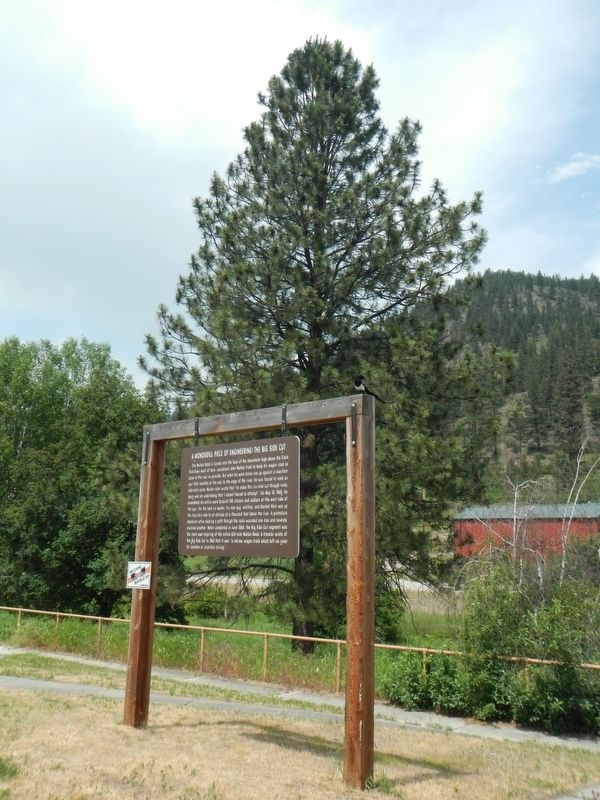
The Mullan Road is carved into the face of the mountains high above the Clark Fork River west of here. Lieutenant John Mullan tried to keep his wagon road as close to the river as possible. But when his work crews ran up against a mountain spur that . . . — — Map (db m123060) HM
"Great Spirit: teach us to walk soft upon the mother earth with all the creatures we live with ... Mitakuye oyasin! We are all related!" "Eagle Man" Ed McGaa, Oglala Lakota Sioux
The Bald Eagle is the magnificent emblem of the United . . . — — Map (db m123061) HM
During the last ice age about 15,000 years ago, an enormous glacier pushed down from British Columbia and blocked the Clark Fork River in northern Idaho. The glacier functioned as an ice dam creating the largest glacial lake known to have existed, . . . — — Map (db m123059) HM
The 1930s was a time of huge improvements to Montana's highways and bridges. The federal government provided funds to the state to alleviate massive unemployment during the Great Depression and, in the process, modernized the state's . . . — — Map (db m307137) HM
This structure is an example of how engineers incorporated a natural feature into the design of a bridge. Designed by Montana Highway Department bridge engineers, the bridge is a standard riveted Warren through truss. The bridge is unusual in that . . . — — Map (db m123057) HM
“With the cinders and ashes falling all around him, and so dark that he could not see his horse’s head at three o’clock in the afternoon, [Barringer] rode up to the face of the fire…[and] collected his scattered crews….” - . . . — — Map (db m45505) HM
“Fires of yesterday and last night have swept practically all the country from Avery to St. Regis. Nothing could have lived in the mountains last evening except for the tunnels.” - E. J. Pearson, Chief Engineer, Puget Sound . . . — — Map (db m45511) HM
“All that remained was to salvage what material that could be salvaged from the disaster, and reorganize for a new start.” - Clarence B. Swim, Assistant Forester
As the railroad operated rescue trains, Missoula residents . . . — — Map (db m45509) HM
“The whole twenty-five miles of railroad…between Avery and the Taft Tunnel was swept by a consuming blast of fire, so hot that pick handles lying in the open beside the track were utterly consumed.” - Elers Koch, Forest . . . — — Map (db m45510) HM
Just getting groceries up here could be a challenge
Deep winter snow sometimes made getting to school, going to the doctor, or buying food an adventure.
Families living at the top of the Bitterroot Mountains, here at East Portal and . . . — — Map (db m45544) HM
“I won’t die here in this creek… [I’m] getting out of here.” - Pinkie Adair, homesteader and camp cook
During the 1910 Fires, perseverance often meant the difference between life and death. At 26 years old, Ione . . . — — Map (db m45503) HM
The Milwaukee Road faced the daunting task of drilling a tunnel 23 feet high, 16 feet wide and 1.7 miles long into Idaho.
It was a damp, dark, dirty dig. After the approaches were prepared in 1906, and a faltering start in 1907, work . . . — — Map (db m45550) HM
Once a critical part of the longest electrified railroad in the world, the broken concrete foundation to your left is all that remains of the two-story, brick East Portal Substation.
Essentially a gigantic electric vault, East Portal was . . . — — Map (db m45542) HM
The Last Transcontinental Railroad
The Chicago, Milwaukee and St. Paul Railway’s Pacific Extension survived for 71 colorful years. Racing silk trains sped along the route, and long, rumbling troop trains carried men and materiel through . . . — — Map (db m45548) HM
…and Historians Trace the History along the Trail.
When the Milwaukee Road abandoned its route over the Bitterroot Mountains, salvage companies stripped the line of all the rails, ties, signals, posts and everything else of value. The . . . — — Map (db m45549) HM
Buried beneath busy Interstate 90 in the valley below are the bones of what the Chicago Tribune in 1909 named “the wickedest city in America”.
This “den of iniquity” sprouted up when the Chicago, Milwaukee and St. Paul Railroad began . . . — — Map (db m45552) HM
“The fire by this time was an awe-inspiring spectacle, the whole horizon to the west was aflame and the noise caused by the falling timber was terrific.” - Roy A. Phillips, Lolo Forest Guard
One of the most devastating . . . — — Map (db m45508) HM
Creation of the National Forest Service in 1905 brought Elers Koch, one of the nation's first professional foresters, to inspect and evaluate the Forest Reserves of Montana and Wyoming. Appointed Forest Supervisor of the Bitterroot and Lolo National . . . — — Map (db m123027) HM
Imagine a world very different than we know today. About 1.5 billion years ago during the Precambrian Era, the earth's environment was desolate, with no trees, fish, animals or birds. Shallow seas with extensive near-shore flats were fed by streams . . . — — Map (db m123024) HM
"Our work ... from the 16th of August to the 4th of December, 1859 consisted of cutting through this densely timbered section of one hundred miles, building small bridge were required, and grading thousands of places.... the work was heavy, and . . . — — Map (db m123025) HM
Wherever you are in Montana, you stand in the pathway of Lewis and Clark. Their 1804-1806 expedition was a grand adventure to investigate the people and resources of the newly acquired Louisiana Purchase and to seek a navigable passage across the . . . — — Map (db m123023) HM
The Mullan Road is carved into the face of the mountains high above the Clark Fork River west of here. Lieutenant John Mullan tried to keep his wagon road as close to the river as possible. But when his work crews ran up against a mountain spur that . . . — — Map (db m123054) HM
This marker commemorates the placement of the first 25 Bibles in November 1908 by the Gideons in the Superior Hotel, Superior (formerly Iron Mountain), Montana then located on this spot.
From that small beginning, The Gideons International . . . — — Map (db m123030) HM
Travelers along the Mullan Road and prosectors lured by the 1869 discovery of gold on Cedar Creek opened the way for settlement of this area. After the placer gold played out and other mining camps became ghost towns, the town of Superior continued . . . — — Map (db m123029) HM
Who was Frank Hamilton? No one really knows. Simple grave markers pay a humble tribute to the five miners buried at the Sand Park Cemetery between 1898 and 1914. Little more is known than their names and year of death. Most of the other . . . — — Map (db m71503) HM
For millennia, the Blackfoot River corridor has been part of the homeland of the Salish and Pend d'Oreille people. They and visiting members of other tribes used a vast network of trails to criss-cross this region of great abundance -- rich in game, . . . — — Map (db m123101) HM
By 1900 the Big Blackfoot Milling Company had largely depleted its nearby timber supplies and moved further up the Blackfoot. The mill, now owned by the Anaconda Company, got most of its timber from logs cut and dumped into the river and floated . . . — — Map (db m123103) HM
Railroad logging was an important facet of the history of Montana's lumber industry. The Big Blackfoot Railroad was one of several logging railroads created to sustain the Anaconda Copper Mining Company's sawmill at Bonner. Built by the Chicago, . . . — — Map (db m144065) HM
Once, the Garnet Mountains echoed with the blasts of dynamite, the clatter of hooves on steep, narrow roads, and the shouts of men out to find fortune.
Once, miners swapped stories in the saloons of Beartown, Top O'Deep and Reynolds City — . . . — — Map (db m130332) HM
Foresters at Lubrecht Experimental Forest study tree harvest and growth in a landscape shaped by logging. The first large-scale logging in Montana occurred on the Blackfoot River corridor in 1885.
From 1885-1900, loggers prodded oxen to skid . . . — — Map (db m130333) HM
Highway 200 near this rest area passes through one of the most spectacular ice-age landscapes in Montana. Glaciers advanced out to the Mission and Swan ranges, and the mountains in the Bob Marshall-Scapegoat wildernesses, forming an ice cap that . . . — — Map (db m123100) HM
The Ninemile Remount was, at one time, the center for the U.S. Forest Service packing activities in the Northern Rockies. Completed by the Civilian Conservation Corps (CCC) in 1935, the Remount was the home roost for more than 1500 Rocky Mountain . . . — — Map (db m123063) HM
Native Travelers at Tmsmli
You are standing at the heart of a well-used campsite and gathering place used by people for thousands of years. Traveling along time-worn trails from the four directions, families, hunters and explorers came . . . — — Map (db m123237) HM
Since Coyote first prepared this place for human beings, the Bitterroot Valley has been the homeland of the Salish-speaking peoples of western Montana -- the Qlispé (Kalispel or Pend d'Orielle) and the closely- related Selíš (Bitterroot Salish or . . . — — Map (db m142734) HM
The landscape around you has changed since Lewis and Clark first saw it in September 1805. Back then it was the aboriginal territory of the Nez Perce and Salish people. This Native Americans had less impact on natural ecological processes than did . . . — — Map (db m123127) HM
As researchers worked to pin-point the location of the Travelers’ Rest campsite, they had an unlikely ally -- an 18th century Prussian Baron.
During the Revolutionary War, Baron William Frederick Von Steuben, at the request of George Washington, . . . — — Map (db m123254) HM
(Three panels, presented left to right, form this marker.)
The Flight of the Nez Perce
In Search of Peace
In the mid-1870s the United States government attempted to force the Nez Perce (Nee-Mee-Poo or Nimiipu) people . . . — — Map (db m123125) HM
The Lewis and Clark Expedition camped near here September 9 through 11, 1805, while traveling through the ancient territory of the Salish and Pend d'Orielle people. Since time immemorial, the tribes have known this place as Tmsmli (approximately . . . — — Map (db m123385) HM
West bound, the trip up Lolo Creek was the start of a remarkably arduous and life-threatening part of the expedition's journey. Eastbound, the passage down Lolo Creek represented victory over one of the most formidable barriers to cross-country . . . — — Map (db m123124) HM
One-half mile west of here, a steep, narrow ravine runs north from Lolo Creek, In the early morning of the fourth day of standoff, the Nez Perce ascended the ridge next to this ravine. Using skills acquired by life in the mountains and plateaus of . . . — — Map (db m123241) HM
About twenty miles west of here at Lolo Hot Springs, the Nez Perce heard that soldiers were coming, so they moved cautiously and set up camp four miles from here.
Three parleys (meetings) between Nez Perce, soldiers, and citizens were held over . . . — — Map (db m123240) HM
Lewis and Clark’s “CORPS OF DISCOVERY” was the first major expedition launched by the United States to explore new lands with an emphasis on scientific inquiry. Lewis spent months being tutored in both physical and biological sciences in . . . — — Map (db m123129) HM
During the Civil War, soldiers often fought out in the open causing thousands of casualties. Because of this, the military decided to formally instruct and equip soldiers to entrench themselves. Soldiers and citizens here fully embraced this new . . . — — Map (db m123239) HM
You're standing in a replica of an entrenchment and breastworks similar to those built north of this point in July 1877. Notice the gap between the bottom and top logs. Rifle barrels could be slid through this opening while the logs provided . . . — — Map (db m123238) HM
"Capts. Lewis and Clark parted here with their parties & proceed on" Sergeant John Ordway, Thursday July 3, 1806
An often overlooked aspect of the Lewis and Clark Expedition is the decision to separate when they left Travelers' Rest on . . . — — Map (db m123256) HM
The route that lies west of here, the Lolo Trail, was different from other east-west 19th century Americans trails. It did not witness a flood of cross-county migration. There were no covered wagons here.
Unmapped and shifting over time, it . . . — — Map (db m123123) HM
Sikum is the Nez Perce word for horse. The Nez Perce people were introduced to the horse in the 1730’s. The word “appaloosa” was created by white settlers. The Nez Perce learned through selective breeding that they could . . . — — Map (db m123126) HM
Bitter Root Chapter, Daughters of the American Revolution, Missoula, Montana dedicate this marker to Captains Lewis and Clark, Sacajawea, their inspiration and guide, and the brave men of the Trans-Mississippi Expedition who encamped on Lo Lo . . . — — Map (db m123243) HM
For may years, the campsite known as Travelers’ Rest was thought to be located at the confluence of today’s Lolo Creek and the Bitterroot River (1 1/2 miles east of where you now stand). It wasn’t until 1996 that members of the Travelers’ Rest . . . — — Map (db m123255) HM
Shuttle cars were used to haul men to the logging operation in the woods. The car was a self-propelled unit with an interior engine powering the rear wheels with a chain drive. With a window on either end, it could travel in either direction and . . . — — Map (db m123282) HM
xpansion of the railroad after the turn of the twentieth century brought many new residents to Urlin’s Addition on Missoula’s Northside. Rental housing such as this one-story Pyramid Cottage style residence, constructed circa 1907 and originally . . . — — Map (db m144528) HM
In the 1890s, members of Missoula’s genteel middle class had a problem. While they welcomed the business opportunities brought by the Northern Pacific Railroad, they feared the “unsavory” characters and “seedy” nightlife that accompanied the . . . — — Map (db m212351) HM
Advertised as “The Choice Residence Section of Missoula,” the Hammond Addition attracted successful businessmen like David J. Haviland, who could afford the exclusivity the neighborhood offered. Lots in the Hammond Addition cost $500, as compared to . . . — — Map (db m144272) HM
On this site stood one of the oldest buildings of Fort Missoula. Upon the Fort's establishment in 1877, a one-story log structure was constructed for use as a laundress's quarters. The project's cost came to $450.00. According to long-time Missoula . . . — — Map (db m123279) HM
White Sulphur Springs businessman Harvey Spencer bought this newly constructed Queen Anne “Free Classic” style boardinghouse in 1902. The cross-gable roof and side bay window represent the Queen Anne form, while the pedimented porch entry and eave . . . — — Map (db m212348) HM
The Craftsman style created such local fervor that in 1911 the Missoulian Publishing Company hosted a local contest offering a Craftsman bungalow style home as the grand prize. That home stands today just outside the University Area district. By the . . . — — Map (db m144238) HM
Contractor E. S. Newton, who purchased this lot in 1910, undoubtedly constructed this fashionable bungalow. With its low-pitched hipped roof and wide, sheltering eaves, the one-story residence was designed to convey a sense of comfort and security. . . . — — Map (db m144225) HM
Insurance agent George F. Gould and his wife, Susie, purchased this lot from the South Missoula Land Company in 1913. The deed stipulated that a dwelling worth at least $3,000 be constructed on the premises within fifteen years. The Goulds, however, . . . — — Map (db m144211) HM
One hundred thirty-seven Missoulians—mostly railroad workers—lived in the Ross House, a large hotel complex that occupied half this block in 1890. Ten years later, a covered walkway still connected the two-story wooden building on this . . . — — Map (db m144493) HM
Low-pitched gables, large sheltering eaves with decorative braces, and an inviting front porch supported by “battered” piers mark this circa 1916 residence as a Craftsman style home. Irene Risley, married to railroad supply salesman Dalton Risley, . . . — — Map (db m144209) HM
Deed records show that the Northern Pacific Railroad sold this property to the South Missoula Land Company in 1889. Company shareholder A. B. Hammond subsequently platted the Hammond Addition. Buyers of his lots signed an agreement promising to . . . — — Map (db m144275) HM
Born of the 1883 arrival of the Northern Pacific Railroad, the Northside grew with the railroad’s early twentieth- century expansion. Simple housing predominated in the working-class neighborhood, which contained few brick homes. This circa 1904 . . . — — Map (db m144526) HM
As Hellgate trading post grew into Missoula after 1860, farms sprouted north of the city center. The 1883 arrival of the Northern Pacific railroad brought residential construction to the Northside. The new neighborhood housed mainly railroad . . . — — Map (db m144525) HM
On the morning of July 3, 1806, Lewis and Clark set in motion a dangerous plan to separate, and explore different routes on their return journey to the Missouri River. As he was both excited and anxious to pursue a rumored shortcut, Lewis wrote: . . . — — Map (db m123331) HM
On 3 April 1917 Chancellor Edward C. Elliott of Montana State University, Missoula, Montana sent an application to the Adjutant General, U.S. Army for the establishment of a two-year compulsory course of military training under the authority of . . . — — Map (db m144119) HM
Missoula boasted twenty-six manufacturing enterprises by 1909, including such diverse production as candy, bricks, gas, marble, and meat products. By 1910, the Northern Pacific Railroad shops employed over three hundred workers and the town’s role . . . — — Map (db m144772) HM
Bay windows and a two-story front porch dress up this home’s basic “four-square” pattern. Stately American Four-Squares—marked by their pyramidal roofs, overhanging eaves, and cubical shapes—were extremely popular with middle-class suburbanites in . . . — — Map (db m212353) HM
Benevolent and Protective Order of Elks of the U.S.A., Hell Gate Lodge #383, has offered conviviality, community service, and social support since its founding in 1898. In 1911 lodge members contracted with Montana’s premier architectural firm of . . . — — Map (db m144711) HM
Despite Civil War turmoil, progress was bravely pushing Westward, leading into the Gilded Age of substantial growth in population and wealth.
Cantonment Wright and Hell Gate
In November 1861, John Mullan established Cantonment . . . — — Map (db m123096) HM
Red-brown brick, cream terra cotta, and huge Tudor style windows belie the utilitarian function of this lofty building. Missoula architects Ole Bakke and Clarence Forbis ingeniously applied the Renaissance Revival style of other contemporary campus . . . — — Map (db m144313) HM
Two wings at right angles with a two-story section at the juncture form a very unusual floor plan in this unique eclectic residence, built circa 1927 for Charles and Ida Brothers. Inspired by the Prairie style, characteristic architectural elements . . . — — Map (db m144274) HM
Twenty-year-old Charles E. Johnson came to Missoula with the Northern Pacific as a dining car employee. He worked his way up to conductor, and after a seven-year career, changed professions. Putting his love of horses to use, he opened a livery . . . — — Map (db m212431) HM
A Public Works Administration loan and bonds funded the construction of this facility, completed in 1939. Architects R. C. Hugenin of Butte and Norman DeKay of Helena designed the distinctive building amidst criticism over the unusual mixing of . . . — — Map (db m144147) HM
Bishop Daniel Tuttle conducted Missoula’s first protestant service in 1870. The bishop noted in his journal that in the rough-and-tumble community, formerly called Hellgate, both the devil and the Holy Spirit were at work. When Reverend George . . . — — Map (db m212349) HM
Reconstruction of Fort Missoula between 1904 and 1912 transformed the old log and frame complex into a more modern, more attractive facility. The Mission style, at the height of popularity during this period, was well suited to this purpose. The . . . — — Map (db m144366) HM
The reconstruction of Fort Missoula after 1904 equipped the facility to serve as a regimental headquarters. The new cast concrete buildings in the Mission style were built along a curved boulevard a few hundred feet northeast of the original parade . . . — — Map (db m144365) HM
The construction of this women’s residence hall, completed in 1927, marks the end of an era. It was the last building erected in strict accordance with the Carsley-Gilbert campus master plan and placed within the intended U-shaped dormitory . . . — — Map (db m144182) HM
The narrow river canyons upstream from here have a long and bloody past.
As the Salish, Nez Perce and other western mountain Indian tribes passed through these canyons enroute to buffalo hunting grounds east of the Rocky Mountains, they were . . . — — Map (db m123334) HM
Two Missoula attorneys on opposing sides of the political arena teamed up to construct this attractive commercial building in 1897. Republican Joseph Dixon, who later became Governor of Montana (1921-1925), began his political career as Missoula . . . — — Map (db m144753) HM
Neoclassical influences complement the Queen Anne style in this striking transitional home built between 1905 and 1907. A polygonal two-story bay, hipped roof with intersecting gables and wrap around porch lend visual asymmetry characteristic of the . . . — — Map (db m130297) HM
Intricate spindlework and turned columns on the wraparound porch decorate this Queen Anne style house. The northeast corner of the porch roof once supported stacked second- and third-story balconies, topped by a decorative turret. Montana botanist . . . — — Map (db m212429) HM
A.J. Gibson, a prominent western Montana architect at the turn of the 20th century, conceived UM's stately brick building style. Gibson designed the first five campus buildings, three of which stand today - University Hall, Mathematics Building, and . . . — — Map (db m144099) HM
Completion of this facility in 1922 provided the School of Forestry a permanent home. In the Renaissance Revival style specified by Carsley-Gilbert’s master plan, Missoula architect Ole Bakke designed a distinctive building that vividly proclaims . . . — — Map (db m144116) HM
Fort Missoula, established in 1877 to provide military control over western Montana’s Indian tribes and protect local settlers, was the only permanent military post west of the Continental Divide. There was little conflict, but the fort’s . . . — — Map (db m123257) HM
The earliest detainees to arrive at Fort Missoula, as part of the Alien Detention Camp, were housed in these two large Mission-style barrack buildings, T-24 (on the left) and T-113 (on the right). These two-and-a-half story concrete buildings were . . . — — Map (db m144334) HM
"From 1941 to 1944 Fort Missoula served as a detention center for more than 1,000 Italians, more than 1,000 Japanese, and 22 German Nationalists.
The Italians were World's Fair workers and civilian seamen whose ships had been impounded at the . . . — — Map (db m144380) HM
During World War II, Fort Missoula was turned over to the Department of Justice (DOJ), Immigration and Naturalization Service (INS), for use as an Alien Detention Camp. The Camp was established to hold foreign nationals and resident aliens, which . . . — — Map (db m144386) HM
In 1941, Nick D. Collaer of the Immigration and Naturalization Service (INS), was assigned to establish interment camps for Italians and German sailors at Fort Missoula and Fort Lincoln, North Dakota. When Collaer arrived at Fort Missoula, he found . . . — — Map (db m144385) HM
The INS required a fence to surround Fort Missoula with a guard tower at each corner. The fence was 10 feet tall, almost 5,000 feet in length and enclosed a total of 33 acres. Separate fences were built around the hospital and some of the barrack . . . — — Map (db m144411) HM
After fires destroyed many Fort Missoula buildings in the early 1900s, a major re-build of the Fort was required. New Officer's housing was included in these upgrades.
Officer's Row consists of six, nearly identical, Mission-style concrete . . . — — Map (db m144336) HM
Fort Missoula's first chapel was completed in 1885. During the late 1930s, the Works Progress Administration allocated funds to renovate the deteriorating building in order to create a new post headquarters with an upstairs courtroom. A concrete . . . — — Map (db m123280) HM
Dedicated to the Memory of
Walter M. Johnson
Born in Leavenworth, Kansas in 1903, General Johnson graduated for the U.S Military Academy with the class of 1927. Stationed at Fort Missoula in the 1930's, he supervised many improvements . . . — — Map (db m144433) HM
The first hospital at Fort Missoula consisted of two tents and a shanty set up by the 3rd Infantry in 1877. The following year and L-shaped frame building with a capacity of 12 patients was completed. Dr. Robert Mills Whitefoot, a Civil War veteran, . . . — — Map (db m123263) HM
In 1936, the Fort received funding from the Works Progress Administration (WPA) to reconstruct and improve Fort buildings, including a new recreation center. The center became the largest project completed at the Fort by the WPA.
The Recreation . . . — — Map (db m144428) HM
Established June 7 - 1877
By a Detachment of the Seventh Regiment U.S. Infantry during the Campaign against Chief Joseph and the Nez Perce Indians. — — Map (db m123258) HM
A steeply pitched roof and a Gothic-arched attic window embellish this Folk Gothic style farmhouse, built by Francis L. Worden in 1874. Worden left New York in 1852 for adventure in California, traveled to Panama, clerked for Washington’s . . . — — Map (db m144758) HM
The Craftsman style evolved as the architectural expression of simplicity and domestic harmony, merging nature with the built environment. Its popularity in the early 1900s eased the transition from Victorian fussiness to the modern era. This . . . — — Map (db m144236) HM
In autumn 1909, Industrial Workers of the World (IWW) organizers Elizabeth Gurley Flynn and Jack Jones arrived in Missoula, soon followed by there comrade Frank Little. After renting space for a union hall, they took to the streets, determined to . . . — — Map (db m123336) HM
The parallel lines etched on the side of Mount Jumbo are testimony to a series of dramatic geologic events, the Lake Missoula Floods. Occurring as recently as 15,000 years ago, the floods resulted when the Clark Fork River, which had been dammed by . . . — — Map (db m130301) HM
212 entries matched your criteria. The first 100 are listed above. Next 100 ⊳