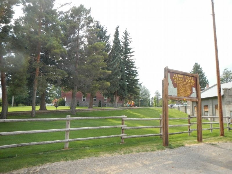
Established in March, 1893, by the Second Idaho State Legislature.
Residents of Albion erected and furnished a two-story stone building on five acres of donated land, and the very successful teacher-training school opened on September 11, . . . — — Map (db m138484) HM
The year was 1885 when Cassia County purchased an unfinished hovel for its first courthouse. Idaho was still a territory - a place where disagreements were at times decided by the business end of a gun. Sparked by disputes between cattle and . . . — — Map (db m124028) HM
J.L. Davis... Diamondfield Jack... spent most of 6 years in the Cassia County jail while the courts and pardon board were trying to figure out what to do with him. By far the best known of the gunmen who fought in Idaho's sheep and cattle wars, he . . . — — Map (db m31639) HM
Surrounded by high Rocky and very ragged looking mountains -- this valley we take the liberty to call Pleasant Valley, as it is a very good and pleasant for camping. -- Leander V. Loomis, circa 1850, describing the Circle Creek . . . — — Map (db m123961) HM
"At the entrance of the pass was a pleasant little spring & fine branch." - Wakeman Bryarly, Jul 20, 1849
Guidebook available
Trails West Inc, P.O. Box 12045 Reno NV 89510 — — Map (db m138456) HM
"We enter a gorge of the hills which in a short time brings us to a large ampitheatre surrounded with rock of every kind of fanciful character." -- Joseph Middleton Aug 26, 1849 Guidebook Available
Trails West Inc. P.O. Box 12045, Reno . . . — — Map (db m123955) HM
"A ride ... brought us to the outlet of this romantic vale, a very narrow pass - just wide enough for a wagon, and on either side very high, jagged and thin walls of granite ... called the 'Pinnacle Pass'" - J.G. Bruff, Aug 29, 1849
. . . — — Map (db m123990) HM
"The gray granit rocks stand in pyramid monument & dome forms., here & there towering aloft. The road winds along between them. Emigrants names are written ... on these curious structures" -- Augustus Ripley Burbank, Aug 4, 1849 Guidebook . . . — — Map (db m123987) HM
...with a wide plain at our left and high mountains at our right and being within sight of the...Salt Lake Route which road intersects our trail seven miles further on. - Emigrant journal entry (Lewis), circa 1850, describing . . . — — Map (db m123953) HM
The flow of emigrant traffic through City of Rocks ebbed after 1852 and virtually ceased following the completion of the Transcontinental Union Pacific Railroad. The City of Rocks remained an important transportation center, serving as a relay . . . — — Map (db m240524) HM
This vast scene holds many intriguing stories. If the land could speak, it would tell of pioneers and wagons crossing the wide Ralf River Valley from Strevell Pass to Emigrant Canyon bound for California in 1843-1882. The land would speak of stage . . . — — Map (db m123956) HM
There are thousands of names here I registered on a large Rock. -- Richard Augustus Keen at City of Rocks, June 22, 1852
Throughout the West emigrants recorded their passing by writing their names -- often with axle grease -- at unique . . . — — Map (db m123960) HM
Dedicated to the memory of those who lost their lives in a most horrible Indian massacre 1861. Three hundred immigrants west bound. Only five escaped. — — Map (db m119536) HM
At City of Rocks we were met with all kinds of Christmas greeting ... we sat down to a Christmas dinner that only youth and vigor could do justice to.... Jim has erected a Christmas tree, and decorated it with cranberries and pop corn, and on it . . . — — Map (db m124001) HM
After dinner a ride of 2 miles brought us to the outlet of this romantic vale, a very narrow pass, just wide enough for a wagon, and on either side very high, jagged. and thin walls of granite.... This is called the "Pinnacle . . . — — Map (db m123988) HM
That this journey...is perilous, the deaths of many testify...as I passed the fresh made graves, I have glanced at the side boards of the wagon, not knowing how soon it might serve as a coffin for some one of us. Lodisa Frizzell, 1852 . . . — — Map (db m123952) HM
They rise in a cone-like form from the bottom of the valley to a height of from 400 to 600 feet they are round and quite regular in form, tapering gradually to a point. -- Emigrant journal entry (Sawyer) describing the Twin Sisters, circa . . . — — Map (db m123994) HM
When completed in 1904, Milner Dam raised Snake River 38 feet to divert water into major north and south side canals.
A gravity system unmatched in size in national reclamation development, this project irrigates 360,000 acres of land. Twin . . . — — Map (db m31636) HM
In 1880, George Starrh, a Snake River placer miner, started a ferry across Snake River one mile north of here.
From 1880-2, freighters hauling supplies for a mining rush to Wood River used Starrh's ferry (powered by river current when stiff . . . — — Map (db m246253) HM
In the summer of 1880 George Starrh, a placer miner, established a ferry 4 miles west of the present city of Burley. Rich mineral mines had been discovered in the Wood River country and freight was hauled between the mines and Kelton, Utah, (the . . . — — Map (db m125404) HM
"The Oregon road take up the bluff and follows the course of the (Snake) river while we keep to the left and follow the creek (Raft River) nearly to its source. ... crossing the creek we followed up the bottom" -- Byron McKinstry, Aug 1, 1850 . . . — — Map (db m123844) HM
"Arrived at Raft River, crossed and nooned. ... traveled five miles up Raft River and camped after recrossing it. Grass in abundance and plenty of wood" -- Cyrus Loveland, Aug 3 1850
Guidebook Available
Trails West Inc. P.O. Box 12045, . . . — — Map (db m123846) HM
"We traveled up Raft River 16 miles. The road, water and grass, good. Entirely destitute of timber, except a little willow on the streams and the wild sage." -- Chester Ingersoll, Aug 13, 1847
Guidebook Available
Trails West Inc. P.O. . . . — — Map (db m123848) HM
After wheat crops flourished in the dry farm area, Idahome sprang up here in 1916 as a railroad terminal. Irrigation projects boosted its Economy.
When wheat farms disappeared and highway traffic replaced rail service here, Idahome . . . — — Map (db m123849) HM
In 1811 the first white expedition to go through this area of the Snake River and the lower end of the Raft River Valley was the Wilson Price Hunt expedition from St. Louis to Astoria. However, the area was well known to the French and British . . . — — Map (db m123843) HM
"August 26, Sabbath."
"... We got a late start traveled directly across the valley before us, (Almo Valley) amidst the best scenery we have seen since we have been among these hills. South, a high range of mountains (Raft River Mountains) . . . — — Map (db m123884) HM
"After crossing (Cassia Creek) we crossed a swamp, which required considerable persevering to get through safely. Three miles farther we encamped on the side of a hill, between two ranges of mountains" -- Wakeman Bryarly, Jul 18, 1849
. . . — — Map (db m123883) HM
"By an easy ascent reached a summit and as gradually descended to a valley (Upper Raft River Valley) of sage and sand sloping to the south east. The streams running towards the (Great) Salt Lake." Byron N. McKinstry, Aug 3, 1850
Guidebook . . . — — Map (db m123886) HM
"We came onto the Subetts Cut Off road (Hudspeth Cutoff), or rather that cut off come onto our road which is the old and longest road." -- Henry Anable, Aug 7, 1852
Guidebook Available
Trails West Inc. P.O. Box 12045, Reno NV . . . — — Map (db m123882) HM
This shortcut to the California goldfields, followed by most of the 49'ers, came out of the hills to the east and joined the old California trail just about here.
Opened by "Messrs. Hudspeth & Myers, of the Jackson County, Missouri, . . . — — Map (db m31638) HM
The Raft River Valley was used by Native Americans as a place to hunt and winter because the snow didn't lie in the valley and there was good water and plenty of grass for the animals. British and American trappers, Peter Skene Ogden, Milton . . . — — Map (db m123881) HM
"The moon just rising above the mountains, throwing mild light over the valley & opposite mountain, formed a beautiful scene of prairie mountain life." -- Hugh Brown Heiskell, Sep 3, 1849
Guidebook Available
Trails West Inc. P.O. Box . . . — — Map (db m124026) HM
Original Cassia County Jail cells where Diamondfield Jack was held in Albion from March 1897 to February 1899.
The jail was moved to Oakley after the jail here burned. — — Map (db m138483) HM
A vast display of towering granite rocks (16 miles southeast of here) attracted emigrants who were on their way to California.
A gold rush visitor, July 14, 1849, reported that "you can imagine among these massive piles, church domes, . . . — — Map (db m31637) HM
One day west of the City of Rocks: Never saw such dust! In some places it was actually to the top of the forewheels! Fine white dust; more like flour. Our men were a perfect fright, being literally covered. -- Emigrant journal entry, circa . . . — — Map (db m124025) HM
In April 1879 members of the Church of Jesus Christ of Latter-day Saints from Tooele, Utah, under direction of Wm. E. Martindale, arrived in Oakley where James Dayley and his two sons had staked claims and built cabins. On Sept. 24, 1882, the Saints . . . — — Map (db m246514) HM
David Bradley Bliss was born in Minnesota in 1840. While exploring southern Idaho on the old Kelton Road, near Clover Creek Station, He was viewing the Snake River Plain from the high bluff just north of here later known as Bliss Hill. He . . . — — Map (db m232467) HM
Thousands of years ago, immense flows of water from alpine glaciers and high levels of precipitation sent waters cascading over a broad area of the Snake River Canyon directly into the Snake River. Weak joints in the basalt walls gave way to these . . . — — Map (db m71547)
Fossil bones of zebras, beaver, otter, pelicans and other water birds are found in sediments left from a 3,400,000 year old pond on the bluff across the river. Lava flows, pouring out over the plains on this side, met and dammed up sedimentary . . . — — Map (db m31598) HM
Few places in Idaho or the United States show evidence of spring water more clearly than in Malad Gorge. These springs flow from the vast Snake River Aquifer through porous pillow basalts. On the opposite side of the canyon, where the river widens, . . . — — Map (db m71549)
Woody's Cove
This deep, basalt canyon was formed similar to Malad Gorge – by a retreating cataract, a huge waterfall. About four million years ago, local volcanoes spewed enormous amounts of lava over the area. Then, about one . . . — — Map (db m71593)
The canyon before you was once traversed by Native Americans making their way from camps on the bluffs where they prepared grass seeds for flour. At the Snake River's Salmon Falls, about one-half mile behind you, they fished with traps, hooks, . . . — — Map (db m139607) HM
Idaho was a very different place during the Pliocene Epoch (three to four million years ago). Like much of the planet, this area was warmer and more humid, with annual rain fall of 20 inches. Studies of ancient pollen found in the sand and clay . . . — — Map (db m139552) HM
Can you find traces of the three ancient lakes that helped form Hagerman Valley and preserved the fossils found here? The first, known as Lake Idaho, covered most of present-day southwestern Idaho about three to eight million years ago. Over time, . . . — — Map (db m139556) HM
Two related panels are found at the monument:
Between the close of the Civil War and the end of World War I the sheep industry played a major role in southern Idaho history. During the Civil War, precious metals were discovered in the . . . — — Map (db m139615) HM
Malad History
If eating food somewhere made you sick, how would you warn others of the danger? Fur trappers and traders named the Malad River the Riviere Aux Malad, or “sickly river,” after becoming hill from eating beaver . . . — — Map (db m71603) HM
It is ... our manifest destiny to overspread and to possess the whole of the continent which Providence has given us for the development of the great experiment of liberty." John L. O'Sullivan, columnist, New York Morning News, . . . — — Map (db m139613) HM
A trained eye, persistence - and a good deal of luck - often lead paleontologist to new fossil discoveries.
New fossil localities are discovered every year. Currently Hagerman Fossil Beds National Monument monitors over 600 fossil bearing . . . — — Map (db m139609) HM
The rock layers in the bluff across the river are made of sediments - particles of sand, silt, and clay. These layers, called strata, were carried here by the ancient Snake River and were deposited as the river entered an ancient lake. This process . . . — — Map (db m139554) HM
Never in history had so many moved voluntarily over such a distance. Look at the wagon wheel ruts in front of you. During the Great Western Migration more than 400,000 people packed up their goods and dreams and headed out over wagon roads like . . . — — Map (db m139608) HM
The features before you testify to a fiery volcanic past. Distant hills, called buttes, are actually "shield" volcanoes. Named for their shape, these shield volcanoes formed when lava flowed from cracks, or vents, in the earth's crust. Over the past . . . — — Map (db m139611) HM
Step back in time, three to four million years, and imagine a place were zebra-like horses, ground sloths, mastodons, and other amazing creatures roamed. Hagerman Fossil Beds National Monument is filled with fossil evidence of their existence in . . . — — Map (db m139551) HM
One of the earliest buildings in the new town of Wendell, Fullerton & Watson opened the store in 1910 and operated
into the late 1930s.
In the early 1940s Morris 'Dooley' Perkins bought the building and remodeled it into The Ace, a 345 seat . . . — — Map (db m232602) HM
The Honor Roll sign listed the names of Minidoka men and women who served in World War II, attesting to their honor and loyal citizenship. But not all viewed honor and loyalty in the same way. The government issued a questionnaire in early 1943 to . . . — — Map (db m71748) HM
Internees created a garden behind the Honor Roll sign. The entrance garden was a cultural expression of inner strength and patriotism in contrast to the entrance gate, a symbol of confinement and injustice. The garden spoke liberty. The gate . . . — — Map (db m62957) HM WM
Nearly every relocation center built an Honor Roll sign listing the names of Japanese American internees serving in World War II. Minidoka's sign, which stood near the rock garden, was erected on October 14, 1943. By the war's end nearly 1,000 names . . . — — Map (db m71749) HM
Excluded from their west coast homes by military authorities, more than 9000 Japanese Americans occupied Hunt Relocation Camp 4 miles north of here between 1942 & 1945.
Until they could resettle in other places, they live in wartime tarpaper . . . — — Map (db m61972) WM
You are standing at the entrance area of the Minidoka Relocation Center, one of ten American concentration camps established in World War II to incarcerate the 110,000 Americans of Japanese decent in coastal regions off our Pacific states. . . . — — Map (db m62956) HM
The camp’s entrance was a stark and constant reminder that the internees were prisoners in their own country. Even though most internees were U.S. born citizens loyal to the principles and values of the country, they were denied their civil, . . . — — Map (db m62961) HM WM
Bone fragments of extinct species of ground sloth, horse, camel, and elephant found in a nearby cave mingle with weapons and radiocarbon dates from Idaho’s earliest hunters.
Archaeologists have confirmed that people camped here at least . . . — — Map (db m62963) HM
The North Side Canal brought solace to internees homesick for the Pacific Northwest. Here in the dry Idaho desert, the canal reminded them of familiar scenes in Oregon, Washington, and Alaska, where flowing waters were commonplace. The canal was . . . — — Map (db m62962) HM
Toshio Toyoji and his 44 whse. (warehouse) 20 carpenters make and finish practically all of the office furniture. They remodel and alter barracks for schools and evacuee housing as well as the staff housing. The project sign shop is also . . . — — Map (db m71760) HM
The few letters that we did receive were inked out in black. And some ... had holes, I think they cut it out with razors so you had a holey letter. Marion Tsutakawa Kanemoto
The camp's internee-run post office stood here. Hunt Post . . . — — Map (db m138514) HM
War Relocation Authority (WRA) administration buildings lined the road where you stand. The main complex stood here, four barracks-style buildings tied together with a central passage. Camp Project Director Harry L. Stafford had his office here. . . . — — Map (db m138513) HM
The North Side Canal Company has given permission to take water from its canals for the pools. Warnings have been issued to all residents not to bathe or swim in the canal as it has a deep and treacherous current. -- Arthur Kleinhopf, Minidoka . . . — — Map (db m138512) HM
The sentry towers are always silhouetted in the distance. It is not enough that they are not being used - to the residents they stand waiting for the day when they will be used. The eight sentry towers are ever present as a symbol of their . . . — — Map (db m138515) HM
More than a century ago, fur trappers and emigrants followed an old Indian trail that crossed here on its way to Oregon.
Hudson's Bay Company traders preferred this route between Fort Hall and Fort Boise, but early emigrant wagons had to . . . — — Map (db m31500) HM
Completed in 1910 at a cost of $3,000,000 Magic Dam stores water for 89,000 acres of irrigated farms near Shoshone and Richfield.
Rising 129 feet high, it is 700 feet wide.
An adjacent 1600-foot embankment with a concrete spillway helps . . . — — Map (db m109633) HM
Shoshone
Shoshone got its start as a mining supply town during Idaho’s silver boom.
The town has been a railroad center for south central Idaho.
Shoshone has architectural gems including exceptional historic buildings built with native . . . — — Map (db m109630) HM
South Central Idaho’s rail center since 1882, when trains reached here. Shoshone has a historic district of unusual interest.
Historic District of Branch rail lines to Wood River and Camas Prairie served distant farmers and miners, while . . . — — Map (db m109628) HM
An important pioneer federal reclamation dam and power plant provides water and electricity for farms and cities nearby.
Constructed 5 miles east of here between 1904 and 1906 at a cost of $675,000, Minidoka Dam diverts water into . . . — — Map (db m124027) HM
Camp Rupert was the largest prisoner of war camp in Idaho. Housing some 4000 POWs most were German and Italian.
The Camp was built at an initial cost of $500,000 and maintained by nearly 1000 army personnel and civilians. Over 170 . . . — — Map (db m138488) HM
Near this spot, a ferry was established in 1886 by George Montgomery and Andrew Smith. Charges were fifty cents for man and horse; seventy five cents for team and wagon. Only means of crossing Snake River between Starrh's Ferry and American Falls, a . . . — — Map (db m138487) HM
The town of Buhl, second largest in Twin Falls County, was founded in 1906 and named in honor of Frank H. Buhl, a financier of the South Side Irrigation Project. Buhl was a wealthy capitalist who owned steel mills in Sharon, Pennsylvania, and . . . — — Map (db m125626) HM
The City of Buhl is a town of 4200 nestled in South Central Idaho along the Thousand Springs Scenic Byway. It was founded on April 13, 1906 and named after Frank H. Buhl of Sharon, Pennsylvania, a major investor in the Carey Act project. This . . . — — Map (db m125724) HM
When John C. Fremont came this way mapping emigrant roads in 1843, he found an important Indian village at Fishing Falls (Kanaka rapids) about 4 miles above here. He reported that native salmon spearers there were "unusually gay...fond of laughter; . . . — — Map (db m31652) HM
A scow powered by oarsmen let Oregon Trail wagons cross Snake River here from 1852 to 1870. Then Overland Stage service from Boise to a rail terminal in Kelton, Utah was moved to this crossing, and M.E. Payne installed a large (14 by 60 foot) new . . . — — Map (db m31653) HM
In 1812, Joseph Miller found 100 lodges of Indians spearing thousands of salmon each afternoon at a cascade below here. Each summer they dried a year's supply. After 1842, they also traded salmon to Oregon Trail emigrants. John C. Fremont marveled . . . — — Map (db m31597) HM
Old lava flow changed the geologic structure of this area and thus created a multitude of famous springs here. Over thousands of years, volcanic activity repeatedly spread lava over the Snake River plain, slowly forcing the river southward in a . . . — — Map (db m31595) HM
The Flood that Reshaped Southern Idaho
The Snake River Canyon is one of Idaho's most recognizable geologic features. Volcanic forces dating back more than 10 million years ago created the canyon. But it took the second largest flood in . . . — — Map (db m70474)
Historical Spot
Stricker Store and Rock Creek Stage Station. Five miles south, one mile west. First Trading Post to be established west of Fort Hall on the Old Oregon Trail in 1863. — — Map (db m125447) HM
The town of Hansen is named in honor of area pioneer and merchant John Hansen, a native of Denmark. Hansen, who had settled first near Albion in 1876, moved to Rock Creek in 1900 where he owned and operated a store until 1916. John Hansen was a . . . — — Map (db m246251) HM
Until 1919, when a high suspension bridge was completed here, this 16-mile long river gorge could be crossed only in a rowboat. With 14 cables, each more than 900 feet long, a $100,000 suspension bridge was wide enough to accommodate two lanes of . . . — — Map (db m62131) HM
This site, Old Rock Creek, was the transportation center for Southcentral, Idaho from August 1864, when Ben Holladay's stage-coach first arrived here at the stage station, until the completion of the railroad on the north side of the Snake River. . . . — — Map (db m125410) HM
The lush willow bottoms of Rock Creek provided Native Americans with a natural campsite. During the early and mid-1800s, Rock Creek was an oasis for the trappers, explorers and Oregon-bound emigrants attempting to traverse the arid Snake River . . . — — Map (db m31522) HM
An 1864 overland stage station at Rock Creek, 5 miles south and a mile west of here, offered a desert oasis for 40 years before irrigated farming transformed this area. James Bascom's 1865 store and Herman Stricker's 1900 mansion have been . . . — — Map (db m31521) HM
Original building was erected by James Bascom in 1878. The first trading post west of Fort Hall. Station for Pony Express and Ben Halliday (sic, Holladay) Stage Line. The largest artery of wagon travel in United States passed here on old Oregon . . . — — Map (db m125408) HM
Dedicated to
Herman & Lucy Stricker
Pioneers of Old Rock Creek who built an oasis in a sagebrush desert where all could find supplies and help when needed.
Old Rock Creek
1864
Ben Holladay located a stage station . . . — — Map (db m125411) HM
The Stricker house is a stockade type building. The main wall is of 4 inch by 16 inch timber standing up and down from floor to roof.
Sample as shown below. — — Map (db m125412) HM
The waters of Rock Creek and the grass that grew along its banks provided a welcome oasis for travelers traversing the arid Snake River Plain. This combination caused the area to become a favorite camping site for Oregon Trail emigrants and a . . . — — Map (db m125406) HM
Magic in the Desert
Here, at the Hansen Overlook, you are in the heart of Idaho's Magic Valley. Once this valley was a dry sagebrush covered desert. Water from the Snake River magically transformed the desert seemingly overnight into one . . . — — Map (db m70473) HM
During the 1860s and 1870s, this area was home to hundreds of miners who came seeking their fortunes in gold. Towns and mining camps with hotels and other businesses sprung up to accommodate them.
Miners removed the precious metal from placer . . . — — Map (db m125453) HM
(This marker is composed of photographs and the captions associated with them.)(top left)
Carved by a Flood
Lake Bonneville, the bigger ancestor of Salt Lake, flooded this area about 15,000 years ago. Twin . . . — — Map (db m125565) HM
Gold was discovered in 1869 below Shoshone Falls. During the summer of 1870, hundreds of prospectors entered the canyon searching the rocky slopes and sand bars for the very fine particles of gold called "flour gold". Three mining camps - Shoshone, . . . — — Map (db m125451) HM
In 1811 the Hunt party likened the terrific torrent of the Snake River three miles east of here to a boiling caldron, adding the the old Scottish word "linn," meaning a waterfall. They had lost a man and a canoe in a roaring chute upstream. . . . — — Map (db m31523) HM
Constructed in 1910 about 8 miles west of here, Salmon Dam was a spectacular early irrigation structure.
220 feet high, it blocks a narrow lava gorge of Salmon Falls Creek. Intended to create a large reservoir to irrigate desert lands . . . — — Map (db m125620) HM
[Three panels are found at the Bisbee kiosk:]
The Bisbee Collection
The earliest dreamers knew how to sell Magic Valley: you just has to see it.
By 1904 Twin Falls was a real city with platted streets, basic services, . . . — — Map (db m125455) HM
113 entries matched your criteria. The first 100 are listed above. The final 13 ⊳