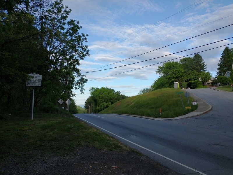
Geographer who measured elevation at sites in western N.C., 1856~1860, including Hominy Creek Gap near here & Mt. Guyot, 25 mi. N.W. — — Map (db m198719) HM
The Colonial Theater building constructed
in 1932 at a cost of $50,000,
was built specifically as a motion picture theatre.
The original owner, Marion Sprinkle
is still remembered by the letter “S”
that can be seen on the top side of each . . . — — Map (db m229431) HM
Nestled in the valley below is the Cradle of Forestry in America, the birthplace of science-based forest management and a living legacy made possible by George and Edith Vanderbilt of the nearby Biltmore Estate. Some 87,000 acres of the Vanderbilt's . . . — — Map (db m123232) HM
This Monument is Dedicated to the Men and Women of Haywood County who served during World War II and to those who gave their lives in defense of our country.
A nearby stone marker lists local World War II Congressional Medal of Honor . . . — — Map (db m19948) HM
Founded 1868. Oldest
Universalist church in
western N.C. Hannah J.
Powell led mission work
and school, 1921-42, at
site 100 yards south. — — Map (db m229442) HM
This 1807 farm is the
oldest continually operated
farm in Haywood County.
Ancestors of today's Devon
cattle arrived in this
country in the mid-1620s.
Descendants have been at
this farm since 1849.
Original owners, Colonel
Thomas Lenoir and . . . — — Map (db m229441) HM
The first Locust Old Fields Baptist Church was established here in 1803. It was among the first churches established west of Asheville. Although the original building no longer stands, it served the small community here for many years as a house of . . . — — Map (db m75504) HM
This tree has witnessed several centuries of history, provided shade for nearby early Native American settlements, edged the trail of the Rutherford Trace march against the Cherokee, and served as a boundary marker before Haywood County was . . . — — Map (db m234881) HM
The original purpose for this building was to house the local Canton Library. Constructed in 1954 with the funds of the Champion Paper Foundation, the brick structure was dedicated the same year.
William B. Umstead, North Carolina's then . . . — — Map (db m234882) HM
This Pratt through-truss bridge, known as
Truss Bridge #79, was fabricated by the Phoenix
Bridge Co. in 1891 and was originally erected
about a mile downstream. When replaced with a
larger bridge in the 1920s, the old iron bridge
was relocated . . . — — Map (db m229447) HM
“Filmore” was known as the
Pigeon River Inventor and lived
just 100 yards east of here. →
He was one of N.C.'s most prolific
inventors and was reported to have
100 or more patents for his inventions,
including several merchant's . . . — — Map (db m229432) HM
Today houses, cabins, barns, and churches still stand in Cataloochee, the largest community affected by the 1930s creation of the national park. Many signs of the more than 1,200 people who lived here during Cataloochee's heyday have disappeared, . . . — — Map (db m230812) HM
Presented in memory and gratitude by thankful friends and citizens for a task accomplished against tremendous odds, by people who said, "it couldn't be done", "it was done."
His untiring efforts and forceful presentation to the legislators and . . . — — Map (db m256530) HM
The valley before you was given its name by its original inhabitants, the Cherokee. Meaning "standing tall;" the word Cataloochee was likely a reference to the many ridges that surround this remote place. Because of its rich soil, prior to the . . . — — Map (db m230815) HM
A place unlike any other on Earth, where ancient landscapes enchant the eye and age-old traditions warm the heart.
You are now in one of America's most cherished and celebrated natural landscapes, the mountains and foothills of Western North . . . — — Map (db m283189) HM
This building is the last of three
located on this site where
students attended Clyde High School
during 48 years of existence. — — Map (db m187519) HM
In Memory of the members of the armed forces from Clyde Town-ship who gave their lives for their country.
Erected by the Town of Clyde, its citizens, and the Chamber of Commerce.
World War I
PFC. Melvin Rhinehart
World War II
CPL . . . — — Map (db m19392) WM
Home of Jacob Shook and Preaching place of Francis Asbury, pioneer bishop of American Methodism. "After crossing other streams, and losing ourselves in the woods, we came in about 9 o'clock at night to Vater Shuck's. What an awful day!"
Asbury's . . . — — Map (db m33716) HM
Named in honor of R. Gerry Browning, 1884 – 1966. Location and Claims Engineer and Parkway Consultant for North Carolina State Highway Commission, 1925 – 1964. His forceful presentation of the high quality scenery found in North . . . — — Map (db m58935) HM
Revolutionary officer, member Congress, 1817-23, where, in "talking for Buncombe" (County), he gave new meaning to the word. Home was ½ mi. N. — — Map (db m305006) HM
Junaluska was a peace-loving Chief in Western North
Carolina. When Lake Junaluska was established, the name selected was that of the mountain keeping vigil over the lake-Junaluska Mountain - Honoring the chief. Chief Junaluska, member of the famous . . . — — Map (db m17347) HM
On February 1, 1865, Col. George Kirk, 2nd North Carolina Mounted Infantry (U.S.), left Newport, Tennessee, with 400 cavalry and 200 infantry for a raid into Haywood County. He passed through the mountains at Mount Sterling, following the . . . — — Map (db m12895) HM
Before you lies the massive Plott Balsam Range. On one of its eastern slopes Henry Plott, a German immigrant’s son, made his home in the early 1800’s. In this game-filled frontier, hunting dogs were a prized possesion. Here Henry Plott and his . . . — — Map (db m99023) HM
Soco Gap, initial point
of U.S. survey, 1876,
of Cherokee Reservation,
created through earlier
efforts of W. H. Thomas,
White Cherokee Chief. — — Map (db m12781) HM
Family gatherings, revivals and assemblies are rooted deeply in the culture of Appalachia. The beauty of the mountains continues to attract group meetings today. The Masons, the world’s oldest and largest fraternal organization, hold their North . . . — — Map (db m127237) HM
In 1898 George Thomas McAulay Sr. and his brother William Aulay McAulay began a general mercantile business that would last until their deaths in 1943. Their original wooden store building was replaced by this brick building structure in 1909. — — Map (db m37184) HM
The Cherokee domain once extended far beyond the distant mountains, but the white man, with broken treaties and fruitless promises, brought trouble to the Indians and caused their banishment to an Oklahoma reservation. A few escaped capture and fled . . . — — Map (db m99019) HM
Francis Asbury, first elected Bishop of Methodism in the U.S.; rode on horseback over 275,000 miles over pioneer trails averaging one sermon a day. From New England to Charleston, S.C. More than 60 times he crossed the Appalachians. Once following . . . — — Map (db m90574) HM
Until it was demolished in 1899, the Battle House, a stagecoach house and inn, stood just to your left.
There, on May 7, 1865, a proposed Union surrender was transformed into a Confederate capitulation.
After Col. William C. Bartlett's 2nd . . . — — Map (db m12892) HM
Notice the valleys and ridges that stretch before you. Cherokees named this area Ga-da-lu-tsi, meaning "standing up in ranks," referring to the seemingly endless stands of timber that lined the ridges. Settlers later corrupted the word to . . . — — Map (db m169008) HM
Herein are mementoes from the people of the year A.D. 1976 to the people of the year A.D. 2076. Sealed during our Bicentennial Celebration July 4, 1976 Erected by the Waynesville Rotary Club — — Map (db m163899) HM
This monument is dedicated to the memory of the First American Veterans
These patriots, believing in the noble cause of liberty, gallantly fought for home and country during the American Revolution so that their descendants might enjoy civil . . . — — Map (db m261749) HM WM
Korean War
June 25 1950
July 27 1953
Cogdill, Kenneth C. • Conard, Lester • Green, Grover G. • Hollifield, James R. • Messer, Rayford K. • Saunders, James • Hannah, Jack L. • Welch, William C., Jr. • Brown, Charles • Rhinehart, Billy C. • . . . — — Map (db m187449) WM
Have you ever wondered about the significance of the colorful quilt squares that you see along Main Street and in our countryside? The Haywood County Quilt Trails (HCQT) project tells our history by featuring colorful and meaningful quilt blocks . . . — — Map (db m304982) HM
Erected to he memory of
the Revolutionary soldiers
buried in Haywood County
Colonel Robert Love • Captain John Henry • Private Thomas Abel • Private William Allen • Private George Hall • Private Edward Hyatt • Private Christian Messer • . . . — — Map (db m187454) WM
[Front]
In honor of all veterans
who served in
the armed forces of
the United States
of America
Dedicated Veterans Day
November 11, 1991
[Side]
Designed by
Blake C. Morrison
Aviation artist
Nellis . . . — — Map (db m187462) WM
1959 Vietnam 1975
Dedicated
to the
honored memory
of Haywood County's sons
who sacrificed their lives
in
the Republic of
South Viet Nam
1LT David Chappel Brown USAF • LCPL Stephen Michael Bryson USMC • SGT Michael Frank . . . — — Map (db m187452) WM
This arch commemorates the historic sign
that spanned Main Street for forty years
noting the town's relationship to the
Great Smoky Mountains National Park. — — Map (db m261757) HM
Gen. James G. Martin, surrendered the army of Western North Carolina, the last Confederate force in the state, in Waynesville, May 6, 1865. — — Map (db m11737) HM
What do a Civil War veteran, High Sheriff, Navajo Indian Superintendent,
Extension Agent and craft museum have in common – Shelton House. In
1875 Stephen Jehu Shelton, Civil War veteran and High Sheriff of
Haywood County, and Mahala Conley . . . — — Map (db m229456) HM
The United Daughters of the Confederacy in cooperation with the United States Forest Service planted this 125 acre forest as a living memorial to the 125,000 soldiers North Carolina provided the Confederacy. The 125,000 Red Spruce tree forest was . . . — — Map (db m123435) WM
Waynesville has a rich musical heritage. Today we enjoy old time music in the string bands, fiddle tunes and ballads played and sung at our street dances and many folk festivals.
The artist created this sculpture from recycled industrial . . . — — Map (db m75488) HM
This spring provided water
for people and horses that
traveled over Waynesville
Mountain between Bethel
and Waynesville in the 1800s
and early 1900s. Families
would have picnics and
reunions here. The
Community Club of
Waynesville, in . . . — — Map (db m229451) HM
In 1776, Revolutionary War General Griffith Rutherford led 2,400 men through the gap below and to your left. During the war's early phases the Cherokee, with British support, repeatedly attacked the frontier settlements. Rutherford's expedition was . . . — — Map (db m123300) HM
Model logging village
established in 1905.
Supplied lumber to WWI
effort & Champion paper
mill. Flooded by Lake
Logan, 1932. Was here. — — Map (db m229445) HM
Since the founding of Waynesville in 1810, Downtown has been the commercial and cultural heart of the community. In the early 1980s, however, the rise of shopping centers and malls brought significant challenges. More than 25% of downtown buildings . . . — — Map (db m304997) HM
Col. William Holland Thomas (February 5, 1805-May 10, 1893) is among the Confederate officers and soldiers buried here in Greenhill Cemetery. His grave is located about thirty yards in front of you on the right.
Thomas, who began trading with . . . — — Map (db m75487) HM
Founded 1865 by Capt. John Turpin, CSA (NC)-POW
Non-denominational until 1885. Became Turpin's
Chapel MEC (South) 1885. Name changed to Maple
Grove MEC (South) 1912. Became Maple Grove Methodist Church 1949 and Maple Grove United Methodist Church . . . — — Map (db m19734) HM
Col. William C. Bartlett’s 2nd N.C. Mounted Infantry (U.S.) occupied Waynesville early in May 1865. The Federals raided the surrounding countryside, relieving civilians of their horses and provisions.
On May 6, a company of Confederate Col. . . . — — Map (db m75490) HM
(Top)
Windover
James Harden and Pearl Howell House
1910
Waynesville Historic Landmark
(Bottom)
Windover
Established 1910
has been listed in the
National Register
of Historic Places
by the United . . . — — Map (db m229599) HM
Author of "Our Southern Highlanders" (1913) and other works, naturalist, librarian. Grave 3/10 mi S.W. Mt. Kephart, 30 mi. N., is named for him. — — Map (db m12693) HM
World War I
Barker, William H.,
Bates, Everett R.,
Cathy, Charlie,
Cochran, John T.,
Franklin, Walter I.,
Freeman, Caro N.,
Kincaid, William,
Leaiherwood, James L.,
Mashburn, Earnest L.,
Mason, William,
Mathis, Fred, . . . — — Map (db m52470) WM
Chief of Oconaluftee Cherokee. He advocated temperance and opposed removal of his people from their homeland. Lived in this vicinity. — — Map (db m12694) HM
“We meet today to dedicate the mountains, streams, and forests to the service of the American People.”
President Franklin Delano Roosevelt
September 2, 1940
The Rockefeller Memorial . . . — — Map (db m20022) HM
Great Smoky Mountains National Park is a sanctuary. This is one of the few places in the eastern United States where animal populations can live, propagate, and die with relatively little influence from humans. Plants flourish in untold numbers and . . . — — Map (db m20057) HM
Legendary jazz musician Charles Mingus Jr. has roots here in the Smokies, just as the genre of jazz traces strands of its origins to the multicultural music of Appalachia. Jazz is a uniquely American art form; the Mingus family experience in America . . . — — Map (db m260068) HM
Look out across the Smoky Mountains landscape.
How did this land come to be?
They carefully got all the mud and they laid it out on the rocks. And when it was dry enough, Grandfather threw it out into the water, and it became land. And . . . — — Map (db m43855) HM
According to oral tradition, the Blue Clan knew about a plant with a blue flower that was used to heal children’s diseases.
(Cherokee language translation)
Clan Facts:
Your clan came from your mother. People of the same clan . . . — — Map (db m305013) HM
Broomcorn is a member of the sorghum plant family and is the source of broomstraw for making brooms. It was introduced to this country from Asia in the late 1700s.
The straw is part of the seed head that grows at the top of the plant. Once the . . . — — Map (db m190512) HM
From here you can see the Qualla Boundary, the 56,000-acre home of the Eastern Band of Cherokee Indians. It borders Great Smoky Mountains National Park and Blue Ridge Parkway. The Cherokee originally held over 140,000 square miles in parts of eight . . . — — Map (db m150379) HM
Cherokee Indian Reservation. Established by United States for the Eastern Band of Cherokee after the removal of 1838.
(Leaving) Cherokee Reservation. Established by United States for the Eastern Band of Cherokee after the removal of . . . — — Map (db m11526) HM
This park is dedicated to all members of the eastern band of Cherokee Indians who served honorably in the Armed Forces of this Great Nation, and especially to those who died in the effort and to Charles George, the only member of the Eastern Band . . . — — Map (db m12929) HM
You hardly ever left a tree of any size standing and all the little 'uns was torn down.
Raymer Brackin
Standing her in 1910 you would have seen a far different landscape than today. You might have seen the Champion Fibre Company . . . — — Map (db m107604) HM
Commercial logging became widespread in the Smokies around 1880, about fifty years before the establishment of the national park. Loggers using hand tools an animal teams took maple, poplar, cherry, walnut, and other choice woods.
Mechanized . . . — — Map (db m20043) HM
Rainbow and brown trout, stonerollers, hogsuckers, sculpins, river chubs, and other fish live here in the lower reaches of the Oconaluftee River. But these are just a few of over 85 species found in the Smokies. The park's streams offer multiple . . . — — Map (db m107602) HM
United Nations Educational Scientific and Cultural Organization MAB
Program on Man and the Biosphere
By Decision of the Bureau of the international coordinating council of the program on man and the biosphere, duly authorized to that effect by . . . — — Map (db m20061) HM
Hogs were the main source of meat on mountain farms. They could produce several large litters of offspring each year, which helped insure a family's supply of meat. Surplus livestock could also be sold to produce extra income for the family. The . . . — — Map (db m190515) HM
Cherokees attach a special meaning to the buzzards that you often see circling over these mountains and valleys.
Along time ago, there were only two people and the animals. And they all lived together on a tiny little rock in the middle of . . . — — Map (db m260072) HM
1st resident missionary to Cherokee Indians, appointed by Holston Conference, lived in this log cabin known as the original parsonage.
Built 1847.
This log cabin was purchased in 1959 from the Soco Community Club by Dr. Walter Miller . . . — — Map (db m305008) HM
Shaconage, the Cherokee name for this area, means "land of blue smoke." A smoke-like natural bluish haze, and mist-like clouds that rise following a rainstorm, provide the inspiration for the name Smoky Mountains. During the growing season, the . . . — — Map (db m20058) HM
Few Places in North America sustain a greater variety of life than the Great Smoky Mountains. The forests, streams, and meadows here support more than 100 types of trees, 58 kinds of fish, some 1,500 flowering plants, more than 200 bird species, and . . . — — Map (db m20053) HM
Ani-Gilohi—(Cherokee language translation)
People in this clan wore their hair long. They walked with confidence and were often leaders.
(Cherokee language translation)
CLAN FACTS: Throughout the large . . . — — Map (db m73920) HM
The high, rounded mountain in front of you is Clingmans Dome (6,643 feet elevation), the highest mountain in Great Smoky Mountains National Park, the highest in Tennessee, and the third highest in the eastern United States. It bears the name of . . . — — Map (db m67901) HM
You didn't make it without corn....everyone ate cornmeal, sometimes two and three times a day. -George Moore, local resident
For 50 years, nearby farmers brought their corn and wheat to Mingus Mill, built in 1886. The miller usually . . . — — Map (db m111965) HM
Clingmans Dome is a sacred mountain to the Cherokees, where the Magic Lake was once seen. The Great Spirit told the Cherokees that, “if they love me, if they love all their brothers and sisters, and if they love the animals of the earth, when they . . . — — Map (db m43851) HM
"To preserve and perpetuate the history, culture, and stories of the Cherokee people."
To accomplish this mission, the museum maintains a permanent exhibit, extensive artifact collection, archives, education programs, artist series, and . . . — — Map (db m134805) HM
Principal Chief, Eastern Band of Cherokee, 1880-1891. Led incorporation of Band & centralization of Tribal government on his property, here. — — Map (db m73919) HM
408 entries matched your criteria. The first 100 are listed above. Next 100 ⊳