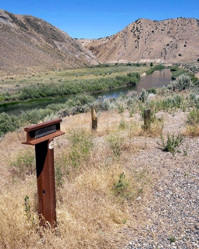
"We have to cross the river four times... on each side of you there is a perpendicular wall of vast rock... overhanging the road so one has a feeling very near bordering on fear as he passes under those precipices" -- Lewis Beers, Aug 3, 1852 — — Map (db m149731) HM
“The trail or road… ascends a considerable hill 1/3 mile ahead of us… the water here is cool, but too alkaline to be agreeable. Hot Springs in the river-bank, sulphur, &c.” —
J. Goldborough Bruff, Sep 7, 1849 . . . — — Map (db m81179) HM
Carlin, the oldest town in present Elko County, was established as a railroad division point in December 1868, by the Central Pacific Railroad. It was named, by Central Pacific officials, after William Passmore Carlin, a Union officer who served his . . . — — Map (db m67264) HM
In December 1828, Peter Skene Ogden and his trapping brigade (Hudson's Bay Company's Fifth Snake Country Expedition) were the first European Americans to enter here. Joseph Paul, one of Ogden's trappers, died nearby - the first white man to die and . . . — — Map (db m136726) HM
By the time emigrants reached this spot, they had enjoyed fairly good traveling for the past ten days or so, as they followed the Humboldt River road. But here they faced their first big physical challenge along the route. If they stayed along the . . . — — Map (db m81204) HM
Whichever direction your travels take you, you're going to have a similar experience to what the California-bound emigrants had. You're going to see the same country, except for the towns and the ranch meadows. The big difference, though, is that . . . — — Map (db m67507) HM
Whichever direction your travels take you, you're going to have a similar experience to what the California-bound emigrants had. You're going to see the same country, except for the towns and the ranch meadows. The big difference, though, is that . . . — — Map (db m146802) HM
About two miles southwest of this marker, the Greenhorn Cutoff ascended and wound through the hills for about twelve miles to avoid river crossings in Carlin Canyon. — — Map (db m70353) HM
Northern Nevada has been inhabited
for nearly 10,000 years. The Newe or
Western Bands of the Western Shoshone
Nation called this area home. The Newe
had seasonal campsites throughout
northern Nevada. During the spring,
they dispersed from the . . . — — Map (db m142657) HM
Elkoans have always made education a
priority. Higher education came to Elko
with the establishment of the University of
Nevada in 1874 at Ninth and College. The
University was moved to Reno in 1885 as citizens
of western Nevada complained, . . . — — Map (db m142662) HM
On December 29, 1868, representatives of the Central Pacific Railroad started laying out lots for the future town of Elko. By 1870, the thriving town had 5,000 people. There was an immense volume of freight and passenger traffic over the stageline . . . — — Map (db m1372) HM
On April 6, 1926, Varney Air Lines pilot Leon Cuddeback, carrying one bag of mail, landed his tiny Curtis Swallow bi-plane at Elko, Nevada, completing the first scheduled air mail run in the United States.
The single engine, 90-horsepower . . . — — Map (db m1371) HM
In 1895, Nevada established the County High School Act. Built in 1896, this was the first school building in Nevada to be constructed under this act. The structure served as the Elko County Library from 1917 to 1974, when the county offices . . . — — Map (db m1345) HM
Approximately 200 feet east of this site is the early location of Elko's first newspaper. Founded June 19, 1869 by former miner Edward Davison Kelly, when Elko was just six months old. The Independent has been in continuous publication ever since. — — Map (db m89505) HM
There were all sorts of games and vices in
progress and only two men were killed
the day I arrived,” reported a newcomer to Elko
in 1869. Legend has it, in the early days of Elko,
it was a rough and tumble cowboy town. There
were reportedly 45 . . . — — Map (db m142678) HM
Established as Camp Halleck by Captain S.P. Smith, July 26, 1867, to protect the California Emigrant Tail and construction work on the Central Pacific Railroad. The camp was named for Major General Henry Wager Halleck, at that time commander, . . . — — Map (db m67526) HM
Centuries of water runoff from mountain peaks cut channels through Nevada's mountain formations and deserts, creating river corridors that support a variety of wildlife and plants. One such river is the Humboldt, which flows across most of northern . . . — — Map (db m146801) HM
Elko was named county seat when Elko
County was formed March 5, 1869.
The creation of a new county, carved out
of neighboring counties, was necessary
to handle the fast-growing mining
communities in northeastern Nevada. A
brick courthouse was . . . — — Map (db m142660) HM
This site is approximately 2½ miles from the Humboldt wagon trail. Hoppe-Lienhard traveled west with the Harlan-Young wagon train in 1847 to Fort Sutter. History reveals this party was part of the group which was responsible for the California . . . — — Map (db m67461) HM
California Trail ruts and swales wind across Northern Nevada some touched only by the forces of nature since they were made by emigrant wagon trains on their way west in the mid 1800s.
Many of these irreplaceable historic trail segments lie on . . . — — Map (db m67505) HM
During the 1800's this site was used as a bivouack-camp area for the "Sagebrush Clippers." These wagons served the mining districts of the area almost exclusively. The name of this colorful area was derived from the Missouri Mule, a cousin of the . . . — — Map (db m105208) HM
Directly south of this point and across the valley floor are the remains of a short-lived extraction plant, which reached the peak of its productive capacity in the early twenties. Driving of the main shaft began in 1916. Of several tries at . . . — — Map (db m76742) HM
One of Elko's oldest saloons first opened in a tent in December of 1868 at this location. The building was completed in 1913 costing $50,000. The saloon featured tiled floors, metal ceiling, mahogany furniture and a mirrored back bar. With the upper . . . — — Map (db m89424) HM
The Pony Express was the first attempt to have fast mail service to California. This was done through the personal drive and bravery of very young men who were responsible for bringing the mail and other “Deliverables” to the western . . . — — Map (db m146800) HM
Right in the Heart of the Golden West, Home means Nevada to Me. Nevada State Song
About the Sculpture The Sculpture symbolizes the past, present, and the future of Nevada. The passage of time, growth, and history of the state are . . . — — Map (db m146799) HM
Constructed on Sherman Creek in Huntington Valley, 60 miles south of Elko, by rancher Valentine Walther. It took Walther, family and friends seven years to complete and was finished in 1903. The house served as a home, post office, stage stop and . . . — — Map (db m1431) HM
You are at the entrance to The National California Emigrant Trail Interpretive Center. The purpose of the center is to gather and display historical knowledge about the emigrants who made the trek to California in the 1840s, 1850s, and 1860s. . . . — — Map (db m67509) HM
Across the valley you can see the canyon of the South Fork River, a major tributary to the Humboldt River. This portal is also the western end of the infamous Hastings Cutoff, which rejoined the main California Trail not far from the California . . . — — Map (db m67506) HM
The California Emigrant Trail extended approximately 2,000 miles from the Missouri River to California. Today you are standing on a segment of the trail that followed the Humboldt River for about 280 miles across northern Nevada. It was the only . . . — — Map (db m67508) HM
Elko was established by the Central
Pacific Railroad in late December
1868 with the tracks running through the
middle of Elko. In 1908, the Western Pacific
railroad was constructed with the tracks
located in the middle of Silver Street. . . . — — Map (db m142674) HM
Basque immigrant, Peter Juaregui had a dream to open a hotel and bar to provide his fellow countrymen with a familiar place to gather, share news of the old country and to live during the off season from their ranching jobs. On December . . . — — Map (db m89425) HM
Across the Humboldt Valley southward from this point a deeply incised canyon is seen opening into the valley. Through that canyon along the South Fork of the Humboldt ran the disaster-laden route called the Hastings Cutoff. It joined the regular . . . — — Map (db m67460) HM
Built after the town was removed from the U.S. Forest by a 1911 Presidential proclamation it replaced the constable's home or Forest Service cabin to restrain rowdy miners and hold suspects for arrival of a sheriff's deputy. A colorful story tells . . . — — Map (db m171835) HM
Located about 500 feet south of this marker.
Established July 27, 1867 by Captain S.R. Smith, built by the 200 soldiers under his command and named in honor of General H.W. Halleck, commanding the Division of the Pacific. The first buildings were . . . — — Map (db m89506) HM
Because heavy use denuded the grass from the main Fort Hall route of the California Emigrant Trail along the Humboldt River, many Emigrants left the river near Starr Valley. They skirted the East Humboldt Range and the Ruby Mountains along a . . . — — Map (db m89412) HM
The Army was seeking new routes west in 1854, so scouts set out to study the land in Central Nevada. The Huntingtons, Reese, and some teamsters had worked their way to Southern Elko County.
During a noon halt at the foot of the magnificent . . . — — Map (db m138452) HM
Ten soldiers who died during the 1918 Influenza Epidemic are buried here, but their identities are a mystery. During and after World War I, troop trains regularly ran through Montello. Ill soldiers were unloaded and treated by a Southern Pacific . . . — — Map (db m81176) HM
This colorful historic camp originated with 1867 discovery of placer gold by John and Steve Beard. In 1871, W.O. Weed discovered the rich Mount Blitzen silver lodes, two miles northeast of the Beard Claims. The camp was named by C.M. Bensen, who had . . . — — Map (db m89411) HM
The building was moved from Cornicopia Nevada to its present site in 1877. In 1881 it was purchased by Elizabeth Zweifel.
Through the years it has served as a rooming house, post office, telephone office, justice court, law office and school . . . — — Map (db m89477) HM
"We had to descend a bad hill to get down to the creek, where we nooned near some well springs." -- Byron McKinstry, Aug 10, 1850
Guidebook available
Trails West Inc, P.O. Box 12045 Reno NV 89510 — — Map (db m138454) HM
Originating about 1868, Wells, Nevada focused around the Central Pacific Railroad. Chinese, Irish, and Italian immigrants were very instrumental in building the railroad and still today have a heavy emphasis on the Nevada economy. You may note that . . . — — Map (db m81177) HM
These springs, seen as marshy spots and small ponds of water in the meadows here, are the Humboldt Wells, a historic oasis on the California Emigrant Trail. Here, during the period 1845–1870, hundreds of covered wagons each year rested and . . . — — Map (db m1373) HM
In memory of those valiant pioneers who settled and built a city here, giving so much to us all in their pursuit of happiness and security. Today, we enjoy the fruits of their efforts.
The first settlers came in 1910, followed by many others . . . — — Map (db m1266) HM
“The Atomic bomb is too dangerous to be loose in a lawless world ... we pray that (God) may guide us to use it in His ways and for His purposes.” —President Harry S. Truman, August, 1945.
Lake Bonneville was a large ancient Pleistocene-era lake that existed about 32,000 to 14,000 years ago. For thousands of years, Ancient Lake Bonneville was contained by mountains acting as natural dams, occupying the lowest closed depression in the . . . — — Map (db m131446) HM
Summer temperatures in this high desert can exceed 100 degrees; winter temperatures may fall below zero. Rain and snowfall total a mere six to eight inches per year. Only drought tolerant plants such as Indian ricegrass, shadscale, and greasewood . . . — — Map (db m67967) HM
On June 17, 1914 the First Transcontinental Telephone Line was completed at this point on the border of Nevada and Utah. Construction forces of the Bell Telephone Company of Nevada and the Mountain States Telephone and Telegraph Company met here, . . . — — Map (db m131438) HM
The history of the Wendover Field began when the United States Army designated the area near the town of Wendover as an additional bombing range. Though isolated, the area was well suited to fit the needs: the Western Pacific Railroad served the . . . — — Map (db m131451) HM
In 1912, roads were dirt, bumpy and dusty in dry weather; impassable in wet weather. Asphalt and concrete roads were yet to come. To get from coast-to-coast, it was much easier to take the train. The Lincoln Highway Association conceived the first . . . — — Map (db m131448) HM
The high, symmetrically shaped mountain seen rising to the north is Pilot Peak. In the period 1845-1850, it was a famous landmark and symbol of hope and relief to the Reed-Donner party and all other wagon train pioneers who traveled the 70-odd . . . — — Map (db m67544) HM
In 1846, Lansford W. Hastings led a group of about 60 emigrant wagons on a route that diverged from the California Trail near Fort Bridger, Wyoming. After encountering almost impassable difficulties getting through the Wasatch Mountains via Weber . . . — — Map (db m226448) HM
The Victory Highway monument is a representation of the earlier bronze eagle markers of the 1920s. Original eagle markers were to be located at each county line with a plaque dedicated to the sons and daughters who served their country in World War . . . — — Map (db m131450) HM
The Bidwell-Bartleson wagon train was the first emigrant party to see Pilot Peak in 1841. Four years later, Captain John c. Fremont also saw this distinctive landmark, but from the Cedar Range in Utah - some 75 miles away. He wanted to establish a . . . — — Map (db m67545) HM
On June 17, 1914, AT&T erected the last of some 130,000 poles at Wendover, and the wires were spliced, joining more than 3,400 miles of telephone line. This splice connected the first telephone line from the East Coast to the West Coast across the . . . — — Map (db m226390) HM
Wendover Will has been greeting travelers to Wendover since 1952. His name comes from the founder of the State Line Hotel & Casino, Mr. William “Bill” Smith, who started the State Line Service, a cobble stone service station, on the . . . — — Map (db m75211) HM
The Denver and Rio Grande Western Railroad financed the Western Pacific Railroad (WP) from San Francisco to Salt Lake City to compete with the Southern Pacific route. The WP, incorporated March 6, 1903, provided a standard-gauge-track connection to . . . — — Map (db m131452) HM
Imagine Lake Bonneville some 10,000 years ago as a vast lake larger than the present Great Salt Lake. Its eastern boundary would be the Wasatch Mountains at Salt Lake City and its western boundary the Toano and Goshute Mountains to your left.
. . . — — Map (db m67968) HM
The numerous valleys of Nevada have supported a vigorous cattle industry since the 1850's. Beginning in the western part of the state, cattlemen ranged their herds throughout northern Nevada by the 1870's. The completion of the transcontinental . . . — — Map (db m149718) HM
You have arrived at this place by driving east on Interstate Highway 80. Did you know that since entering Nevada you have been traveling along the route of the historic California Trail? From 1843 to 1869, an estimated 250,000 people made the trek . . . — — Map (db m67441) HM
Whichever direction your travels take you, you're going to have a similar experience to what the California-bound emigrants had. You're going to see the same country, except for the towns and the ranch meadows. The big difference, though, is that . . . — — Map (db m67440) HM
In 1868, the town of Argenta was founded as the first Central Pacific Railroad station in Lander County. The town, 10 miles west of this marker, was named by Judge E.B. Crocker. A post office opened and the railroad established an eating station, . . . — — Map (db m81182) HM
From this vantage point one can see the steam rising from the geysers located near the base of the far hill across the valley.
The U.S. Geological Survey has designated an area south of Beowawe a Known Geothermal Resource Area (KGRA). The . . . — — Map (db m240318) HM
7 miles southeast of here was a favorite pioneer crossing of the Humboldt River, Gravely Ford. Campsite of the Donner Party, here occurred the Snyder-Reed fight, as Snyder lashed at Reed he missed and hit Reed's wife. Reed then killed Snyder. Reed . . . — — Map (db m67443) HM
Looking at the broad valley of the Humboldt River before you, close your eyes and imagine how it would have been in the mid-1800s. Instead of the sounds of traffic on I-80, you can almost hear the creak of wagon wheels. You might hear the sounds of . . . — — Map (db m81206) HM
Located in the tank-like depths of Palisade (12-mile) Canyon, Palisade first named Palisades - surveyed and laid out by the Central Pacific Railroad in February, 1870. During the 1870's it rivaled Elko and Carlin as a departure point on the C.P. for . . . — — Map (db m135385) HM
Silver ore was discovered at Mount Tango in 1862 by a group of Mexican prospectors. They took the ore to Austin, Nevada. It was assayed. They were paid, and they were never heard from again.
In May of 1863 Simeon Wenban led a group to the Mount . . . — — Map (db m138451) HM
This historic five-hole outhouse was built for prominent Eureka businessman, Frederick Bartine (1888-1964).
A native of Finland, Bartine immigrated here in 1901. Soon after, he prospered as owner of the Ruby Hill Water Works, the Bartine . . . — — Map (db m51694) HM
Giovanni Pedroni Marcellus Locatelli Teodoro Zesta Pompeo Pattini Antonio Canonica
Charcoal Burners Massacred Aug. 18, 1879 By A Sheriff's Posse Southwest Of The Fish Creek Ranch — — Map (db m89510) HM
The first known explorer of Diamond Valley was Colonel John C. Fremont, who mapped the area to aid western migration in 1845. Before Fremont, tribes of Shoshone and Paiute Indians long had gathered nature's bounty here.
Colonel J.H. Simpson . . . — — Map (db m69606) HM
“Eureka!” a miner is said to have exclaimed in September, 1864, when the discovery of rich ore was made here—and thus the town was named. Eureka soon developed the first important lead-silver deposits in the nation and during the . . . — — Map (db m14690) HM
In 1873 separate stage coach owners Gilbert and Salsbury along with Hotel owner J.P. Withington organized the E&P to supply the Eureka Mining District. With the first train reaching Eureka on October 22 1875. This 87-mile-long narrow gauge train . . . — — Map (db m183755) HM
Built in 1879-80, of locally-fired brick and of sandstone quarried nearby, the Eureka County Courthouse remains a fine example of boom town Victorian opulence. This relic, scene of many famous trials, lives on in reflected glory of the days when . . . — — Map (db m14616) HM
The opera house was constructed by Richard Ryland, Joseph Winzell, and M.D. Foley in October through December of 1880. They used the foundation of the Odd Fellows Hall. The building had been destroyed earlier in the year during a disastrous fire. . . . — — Map (db m69601) HM
Constructed in 1879 at a cost of $10,000, the Sentinel Building was designed by architect C.M. Bennett. The Eureka Sentinel was published in this building from 1879 to 1960. Three generations of the Skillman family, Archibald, Edward and Willis, . . . — — Map (db m14686) HM
When A. Skillman closed the Shermantown Reporter at Hamilton he moved is printing press to Eureka. Together with Dr. L.C. McKenny they started the Sentinel as a weekly paper in July 1870. It became a daily in June 1871 reporting local and . . . — — Map (db m14687) HM
The Tannehill brothers built this cabin for a residence in 1864 and lived here about a year before selling their mining interest to a New York company in 1866. The cabin subsequently went through a number of owners, including the firm of Nathan & . . . — — Map (db m14688) HM
"Mining is an art...one of the most ancient, the most necessary and the most profitable to mankind."
Agricola, De Re Metallica, 1556
In 1864, a group of prospectors from Austin, Nevada discovered rock containing a silver-lead . . . — — Map (db m69607) HM
He laid the foundation of the National Park Service, defining and establishing the policies under which its areas shall be developed and conserved unimpaired for future generations. There will never come an end to the good that he has done. — — Map (db m127137) HM
In 1872 gold was discovered three miles northwest of what is today Great Basin National Park. In two decades the mining town of Osceola grew to a population of more than 1500 people and uncovered almost two million dollars work of gold. Though . . . — — Map (db m271581) HM
Here, at one time, was the largest town in White Pine County. Part of the Cherry Creek Mining District, Cherry Creek’s years of largest gold and silver production were between 1872 and 1883. At the peak of its prosperity, the town had an estimated . . . — — Map (db m1370) HM
Built when Cherry Creek was founded in 1872, it is one of the two oldest standing Nevada schoolhouses. In November 1894 a dispute between Pat Green and Pat Dolan over the building’s location turned violent with Dolan killing Green in a gunfight. . . . — — Map (db m1293) HM
James H. Simpson put the future site of Ely on the map during his 1859 exploration through the Great Basin. In the 1860's, silver and gold deposits were discovered nearby in what became the Robinson Mining District. Ely developed as a regional . . . — — Map (db m69490) HM
The mines of the White Pine District were first discovered in 1865 and supported many thriving towns during the period 1868-1875. The most famous of these early towns was Hamilton, but there were others adjacent, such as Eberhardt, Treasure City . . . — — Map (db m251577) HM
The mines of the White Pine district were first established in 1865. Between 1868 and 1875, they supported many thriving towns including Hamilton, Eberhardt, Treasure City, and Shermantown. These communities, now all ghost towns, are clustered . . . — — Map (db m290323) HM
In May-June, 1827, Jedediah Smith attempted to find a route from California’s central valley to the Great Salt Lake Valley in Utah, and he became the first European to completely cross what is now Nevada. Because Smith’s journal and map have never . . . — — Map (db m1302) HM
The charcoal making process took a total of 13 days and 35 cords of wood, from the time each oven was filled, burned, and then emptied. The wood was hauled by wagons or hand carts to the front of the oven, and the process of layering the wood . . . — — Map (db m127176) HM
Mark Requa's Nevada Consolidated Copper Company built a 150-mile line from Cobre on the Southern Pacific to Ely in 1905-06 to haul ore from Copper Flat mines west of Ely.
Ore was loaded into railroad gondolas at Copper Flat for the trip to the . . . — — Map (db m69489) HM
Osceola, most famous of the White Pine County gold producers, was probably the longest-lived placer camp in Nevada.
The gold-bearing quartz belt found in 1872 was 12 miles long by 7 miles wide. Placer gold was found in 1877 in a deep ravine . . . — — Map (db m69492) HM
Schellbourne, in the foothills of the Schell Creek Range, was a Shoshone village site long before it began its recent historic career in 1859. Captain James Simpson passed through the site and this point, looking for a short route across the Great . . . — — Map (db m1304) HM
Silver and gold were discovered in 1873, in what was to become Taylor, a typical mining community supported chiefly by the Argus and Monitor Mines. In 7 years, the town boasted a population of 1500 people, 7 saloons, 3 general stores, an opera . . . — — Map (db m27289) HM
Digging began on the Liberty Pit in 1908, the same time that the Nevada Northern Railway tracks reached Copper Flat from Ely.
When work started, the pit was not a pit at all, but two small hills instead. The old map below shows the original . . . — — Map (db m126499) HM
The life histories of 46 residents of the Ward Cemetery tell a fascinating story about what life was like in the early mining boom towns of White Pine County. Most residents of Ward were not native to the area. Many came from as far away as China . . . — — Map (db m69487) HM
Willow creek, a year round stream located 1/4 mile to the north, was a major stopover for freighters on the Toano to Pioche route between 1870 and 1876. "Bullwhackers" (common term for freighters) would turn out their "Sleepers" (tired oxen) in this . . . — — Map (db m68763) HM
These ovens were constructed during the mid 1870's and are larger and of finer construction than most other ovens found in Nevada. They are 27 feet in diameter and 30 feet high with a capacity of about 35 cords of wood which was burned for a period . . . — — Map (db m62118) HM
The ghost town of Ward, in the foothills of the Egan Range, lies some eight miles west of here. Booming from 1876 until 1882, with a peak population of 1,500, Ward was somewhat of a lawless mining camp. Early killings did occur, but justice was . . . — — Map (db m27291) HM
In 1882, Congress passed the Edmunds Act causing L.D.S. Church property to be confiscated, including cattle which the receiver leased to Nichols and Parsons. Later the law was repealed and church property returned. The lessees could not fully repay . . . — — Map (db m1301) HM
109 entries matched your criteria. The first 100 are listed above. The final 9 ⊳