This British officer, “the hero of Upper Canada,” led the successful defense of the province early in the War of 1812. Appointed commander of military forces in 1810, he organized the militia and prepared the colony for possible war with . . . — — Map (db m140079) HM
On October 13, 1812, following Isaac Brock's death in a preceding assault, Major-General Sheaffe assumed command and led a successful attack which dislodged an invading American force from Queenston Heights. Born in Boston, Mass., Sheaffe was . . . — — Map (db m49161) HM
[Side of Marker Using English Text]:
When the War of 1812 began, people of African descent in the Niagara peninsular feared an American invasion. They were anxious to preserve their freedom and prove their loyalty to Britain. Many joined . . . — — Map (db m49162) HM
In the early morning of 13 October 1812, American troops under Major-General Stephen Van Rensellaer crossed the Niagara River and took possession of Queenston Heights. Major-General Isaac Brock hurried from Fort George to lead a small force against . . . — — Map (db m48908) HM
The Battle of Queenston Heights
The village below you and the heights on which you are standing were the stage for the famous Battle of Queenston Heights.
It took place during the Anglo-American conflict 1812-1815 known as the . . . — — Map (db m51682) HM
The Niagara escarpment rises above you. The British reinforcements arriving here from Fort George, in battle dress and exhausted from a "double quick march", struggled up this slope some distance to your right. While the Americans controlled . . . — — Map (db m55533) HM
On the plateau before you, the British and Americans met for battle. The British formed a line to your right, the Americans to your left. General Sheaffe formed a British counter-offensive force of nine hundred men in a line shoulder to shoulder. . . . — — Map (db m55028) HM
Following the loss, after the American Revolution of the Niagara River's east bank, a new portage around Niagara Falls was established in the 1780s' with Queenston its northern terminous. Wharves, storehouses and a block-house were built. Robert . . . — — Map (db m51621) HM
Queenston Heights is part of the Niagara escarpment. A height of land which extends 725 kilometers across Ontario from Niagara Falls to Manitoulin Island. Over 430 million years ago, a shallow tropical sea covered most of central North America. . . . — — Map (db m51623) HM
By 1808 the Rev. Elkanah Holmes, a missionary from the United States, had organized the first Baptist congregation in Queenston. Following the war of 1812 the congregation declined, was reorganized in 1831 and between 1842 and 1845 erected the . . . — — Map (db m51627) HM
"An unguarded trail up this steep cliff was the only route which the Americans had to the heights of Queenston. The trail was to your right but does not exist any longer. Trapped on the river shore by unrelenting gunfire, the Americans contemplated . . . — — Map (db m55030) HM
On this site stood the Anglican chapel, St. Catharines (1795 - 1836), the first public building in the community. The name St. Catharines became associated with the community and the church. By 1797 a log school house was situated just east of this . . . — — Map (db m76085) HM
The Salem Chapel, British Methodist Episcopal Church was the first Black church in St. Catharines. Originally known as the African Methodist Episcopal Church, the name was changed to reflect their loyalty to the British Empire. In 1793, the . . . — — Map (db m75867) HM
Bollards, used to secure ropes from a ship, are found all along the canal. Most were plain and serviceable. This bollard, made from polished carved limestone and placed on a base, was a prototype for possible use along the present canal. Though . . . — — Map (db m76086) HM
Bollards and Fairleads are used to control the lines (rope and cables) used to tie up a ship.
Bollards are steel or concrete posts, on land and on a ship, used to secure a vessel. Vessels travelling through the Welland Canal are tied up in each . . . — — Map (db m76088) HM
In 1960, the Lincoln Historical Society (now the St. Catharines Historical Society) recovered this cannon barrel from the banks of Twelve Mile Creek, formerly the route of the First and Second Welland Canals. It had been buried in the area under the . . . — — Map (db m76089) HM
Built on the site of the previous City Hall, this building was officially opened in August 1937 and was a hallmark of what was hailed as the dawn of a new era. The previous building, known as Benson House, was a former home that had been used as a . . . — — Map (db m76295) HM
The modern Welland Canal is actually the fourth version to be built since 1829. Unlike the later government-operated canals, the First Welland Canal was built by a private company.
The outline on the ground represents a typical lock from the . . . — — Map (db m76090) HM
A legendary conductor on the Underground Railroad, Harriet Tubman became known as the "Moses" of her people. Tubman was born into slavery on a Maryland plantation and suffered brutal treatment from numerous owners before escaping in 1849. Over the . . . — — Map (db m75868) HM
After the passing of the USA 1850 Fugitive Slave Law she said, "I wouldn't trust
Uncle Sam with my people no longer: I brought them all clear off to Canada." — — Map (db m75869) HM
Born on a Maryland plantation, Harriet Tubman escaped slavery to become one of the great heroes of the 19th century. The most famous "conductor" on the Underground Railroad, she courageously led many of the people she rescued from American slavery . . . — — Map (db m75870) HM
Grape hoes would be drawn by horse through a vineyard, either by pulling the earth away from the grapes or mounding it up to them in order to remove the weed growth. Modern grape hoes perform the same function today.
Niagara Grapes and . . . — — Map (db m76109) HM
[base]
In honoured memory of the men of the Township of Grantham who gave their lives in the Great War.
1914 1918 Canada
[apex]
Their name liveth for evermore.
[left]
Vimy Ridge
Passchendaele
Amiens
Arras
Drocourt
Dury . . . — — Map (db m76098) WM
'The men were very good unto us and we were not hurt. They were a wall unto us both by night and day'
1914·World War I·1918
1939·World War II·1945
1950·Korea·1953
United Nations Peacekeepers
Canadian Merchant Navy
[right] . . . — — Map (db m76294) WM
The maritime professionals who sail the ships on the Great Lakes are celebrating the 100th anniversary of their fraternal organization, the I. M. S. A. whose purpose is stated in the Association's constitution, "The purpose of this association's . . . — — Map (db m122039) HM
Born in St, Catharines, Fred Fisher abandoned his studies at McGill University when World War I broke out and served with the 13th Battalion, First Division, Canadian Expeditionary Force. Fisher was awarded the Victoria Cross for his exceptional . . . — — Map (db m76094) HM WM
A timber lock with inside dimensions of 33.7m (108 ft.) by 6.6m (22 ft.) was constructed on this site between 1824 and 1827. The lock walls consisted of earth filled cribs 5.2m (16 ft) thick and 7.6m (25 ft) deep. This was the 24th lock of 39 that . . . — — Map (db m75871) HM
A prominent Canadian shipbuilder, Shickluna was born in Malta, where he worked before emigrating to North America. By 1835 he was engaged in ship construction at Youngstown, NY. Three years later, attracted by the traffic stimulated by the Welland . . . — — Map (db m76272) HM
[Upper plaque:]
This boulder was on the half-way mark, between Niagara-on-the-Lake and Queenston
[Lower plaque:]
This memorial is erected in proud memory of pioneer ancestors and to commemorate the one hundred and . . . — — Map (db m76095) HM WM
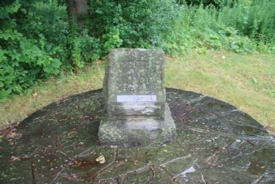
Erected to the memory of Private Alexander Watson, 90th Winnipeg Batt. Rifles, Canadian volunteers, and his companions in arms, who fell in battle during the rebellion in the N.W.T., A.D. 1885. "Dulce et decorum est pro patria mori." Lt.-Col. A.T.H. . . . — — Map (db m76338) WM
Born a slave in Virginia, Burns escaped from servitude in 1854 and fled to Boston, where he was arrested under the Fugitive Slave act of 1850. Abolitionists came to his defence and serious riots ensued. This was the last trial of a fugitive slave in . . . — — Map (db m76249) HM
One of the first Black settlers in this region, Pierpoint was born in Senegal. At the age of about 16 he was imprisoned and shipped to America where he became the slave of a British officer. During the American Revolution he enlisted in the British . . . — — Map (db m75872) HM
One of Ontario's most prominent independent boarding schools, this college, named for a 16th century Christian martyr, was opened in 1889. It was established by Anglican churchman to provide boys with a sound preparatory education and to instill in . . . — — Map (db m76250) HM
Salem Chapel, built in 1855, was an important centre of 19th-century abolitionist and civil rights activity in Canada. Harriet Tubman, the famous Underground Railroad "conductor", lived near here from 1851 to 1858 and is traditionally associated . . . — — Map (db m75873) HM
Shipbuilding has a long association with the Niagara Peninsula, and is especially linked to the Welland Canals. Russell Armington established this important industry with the launching in 1828 of the Welland Canal. St. Catharines quickly became . . . — — Map (db m76279) HM
St. Catharines became an important part of the shipping industry due to te building of the Welland Canals and its location between two Great Lakes. Louis Shickluna, a shipbuilder who emigrated to St. Catharines to Malta, began working as a builder . . . — — Map (db m76284) HM
After a vineyard has been disked, a cultivator is used to break the earth into smaller pieces for a leveller finish. This one, from the Vansickle Road farm of Jim Brown in St. Catharines, was used from about 1900 until 1980 when it was given to the . . . — — Map (db m76281) HM
St. Catharines has been known by a number of names in its history. The city is believed to have been one of the largest Native Settlements in North America. Shortly after the American Revolution, it was settled by Loyalists, the first of these known . . . — — Map (db m77056) HM
[on brick]
Exterior designated 1990. Of Italianate styling constructed in red brick (favoured by Methodist Church) between 1861 and 1863. Modeled after the Grace Methodist Church in Buffalo.
Significant features: round-headed windows, . . . — — Map (db m76307) HM WM
Lock number 6 of the original Welland Canal lies in the adjacent watercourse about 213 metres southwest of here. This first or "wooden" canal, constructed 1824-33 by the Welland Canal Company, ran from Port Dalhousie on Lake Ontario to Port Colborne . . . — — Map (db m75874) HM
Before this region was settled, several Indian trails intersected here at a ford in Twelve Mile Creek. They were improved by early settlers and a church was erected at the crossroads by 1798. A tavern soon followed and a settlement, known as St. . . . — — Map (db m76092) HM
A tribute to Canadian engineering design and construction, the Fourth Welland Canal was built to permit passage of ships between Lakes Ontario and Erie, bypassing Niagara Falls. Constructed in the period 1913 - 1932 at a cost of $130 million, it . . . — — Map (db m76084) HM
The Welland Ship Canal is the fourth in a series of successively larger canals that were built to join Lakes Ontario and Erie - the first being completed in 1829. The present Canal was opened in 1932. It forms part of the St. Lawrence Seaway/Great . . . — — Map (db m76328) HM
has been erected by his grandson William Hamilton Merritt of the City of Toronto, son of William Hamilton Merritt Jr. of St. Catharines, as a tribute to the father of Canadian transportation who through initiatory steps in first waterways and . . . — — Map (db m76186) HM
Twenty vertical lift bridges were constructed to cross the Welland Canal at the time of its opening in 1932. Of the eleven original vertical lift bridges, only three remain in use.
This sheave (a grooved wheel that forms part of a pulley) was . . . — — Map (db m76326) HM
The first person to be buried on this land was a sailor known simply as Brooks. that year, 1855, when the land was still known only as Potter's Fields, seven others were also buried, beginning the establishment of St. Catharines' largest and most . . . — — Map (db m76332) HM
This plaque erected to mark the 40th anniversary of the opening of the Welland Ship Canal to world shipping on August 6, 1932, commemorates the significant role this historic waterway and our inland fleet play in Canadian national life.
This . . . — — Map (db m76344) HM
Born of a Loyalist family in the State of New York, Merritt became a pioneer merchant and industrialist on Upper Canada's Niagara frontier. In 1818 he began to promote construction of the Welland Canal, of which he became the first general manager . . . — — Map (db m76182) HM
A pioneer in the field of transportation, Merritt was born in Bedford, New York and settled at Twelve Mile Creek (St. Catharines) with his Loyalist family in 1796. He served with the provincial cavalry during the War of 1812, then operated . . . — — Map (db m76184) HM
British by birth - January 13, 1910, Canadian by conviction, World War II veteran, noted photographer. Over 25 years dedicated municipal service on the Board of Education, Public Utilities Commission and Municipal Council with one term as Reeve. His . . . — — Map (db m54109) HM
Following their repulse at Stoney Creek the Americans sent a force from Fort George to destroy a British advanced post at Beaver Dams. Warned of their approach by an Indian scout and by Laura Secord, a force of Indians from Caughnawaga and the Grand . . . — — Map (db m48909) HM
This house of Captain John DeCou (the name was variously spelled by his relatives and descendants and latterly as DeCew) was the Headquarters of the British outpost under Lieut. James Fitzgibbon to which came Laura Secord through the woods and . . . — — Map (db m56826) HM
John Bean was born in Attercliffe, Ontario, on September 8, 1901. He attended Stratford Collegiate Institute in Ontario and Northwestern College before transferring to the University of Michigan, where he earned his degrees and spent the rest of his . . . — — Map (db m54119) HM
Who set out from her home in Queenston early in the morning of June 22, 1813, to walk an arduous nineteen miles to warn the British outpost at DeCew Falls of an impending American attack. The information enabled the local British commander, . . . — — Map (db m53392) HM
[Top plaque]
City of Thorold
The Old Firehall
1878
Designated under
the Ontario Heritage Act
[Bottom plaque]
Thorold's Old Firehall
1878
Designed by John Latshaw in red and yellow brick, this . . . — — Map (db m196305) HM
During the construction of the original Welland Canal, 1824-1829, a number of communities sprung up along its length. Here, on land belonging to George Keefer, a village known as Thorold had developed by 1828. A large flouring mill was built on the . . . — — Map (db m54088) HM
By 1809 John and George Ball had constructed a four-storey grist-mill here on Twenty Mile Creek. Equipped with two run of stones, the mill provided flour for British Troops during the War of 1812. It was expanded during the 1840's and by the end of . . . — — Map (db m57064) HM
[English Text]: Battle of Cook's Mills
In October 1814 an American army advanced from Fort Erie toward the British line along the Chippawa River. Lieutenant-General Drummond ordered a reconnaissance towards Cook's Mills on his right . . . — — Map (db m56657) HM
[English] This bridge was built in 1927-1930 during the construction of the Fourth Welland Canal (1913-1933). It was one of the three largest vertical lift bridges on the canal and is unique because its towers are set at an angle to the . . . — — Map (db m196324) HM
The Welland County Court House was built in 1855-56, four years after the creation of the County of Welland.
It was designed by architect Kivas Tully in a Neo-classical style and built of Queenston limestone by the local firm of Hellems and Bald. . . . — — Map (db m196304) HM
265 entries matched your criteria. Entries 201 through 265 are listed above. ⊲ Previous 100