On State Highway 49, on the left when traveling south.
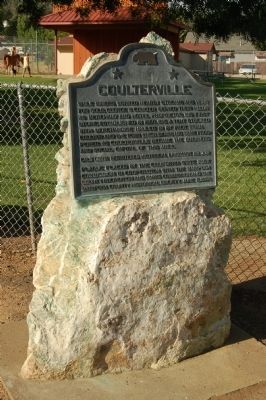
While miners worked nearby streams and veins for gold, George W. Coulter served their needs as merchant and hotel proprietor. His first store, established in 1850, was a tent stocked with merchandise hauled in by pack train. Coulter and the town . . . — — Map (db m46330) HM
On Calle Lazaro Cardenas (Route 14) at Calle Guadalupe Victoria, on the right when traveling north on Calle Lazaro Cardenas.
Antiguo Palacio Municipal
Este edificio, con un evidente estilo neoclásico, data aproximadamente de finales del
siglo XIX o principios del XX, aunque su construcción no finalizó sino hasta 1922. Fue
ocupado como Palacio de . . . — — Map (db m192310) HM
Near Mariposa Grove Road, 2.1 miles east of Wawona Road (California Route 41).
Creating an Experience to Match the Dignity of the Trees People have revered this Grove and its mighty trees for thousands of years. Through ecological restoration, the health and resilience of these giants will be protected and all visitors . . . — — Map (db m160409) HM
Near Mariposa Grove Road, 2.1 miles east of Wawona Road (California Route 41).
Trees Worthy of a Nation's Protection, June 30,1864 In the midst of the Civil War President Abraham Lincoln signed the Yosemite Grant Act. This established Yosemite Valley and the Mariposa Grove as the first federally protected wild places in . . . — — Map (db m160408) HM
Near Mariposa Grove Road, 2.1 miles east of Wawona Road (California Route 41).
”You can save a place, but it’s never really safe. It always takes people caring. It always takes vigilance. It always takes effort to keep those forces at bay that want to crowd in, want to change it, want to over-commercialize it. Once it’s . . . — — Map (db m160410) HM
On Bullion Street south of 10th Street, on the right when traveling south.
In Continuous Use Since Erection
This marker placed
by
Yosemite Parlor No. 24. N.S.G.W.
Merced
April 21, 1929
Dedicated to the memory
of
the Mariposa Pioneers — — Map (db m163762) HM
On Bullion Street south of 10th Street, on the right when traveling south.
California’s oldest seat of justice still in use. The front half, the original building, completed in 1854, cost $9.200. The lumber was sash-sawed from nearby forests; framework fastened with mortised joints and wooden pegs. Finished lumber was . . . — — Map (db m46734) HM
On Bullion Street south of 10th Street, on the right when traveling south.
This mortise and tenon Greek Revival courthouse, erected in 1854, is California’s oldest court of law and has served continuously as the seat of county government since 1854. During the 19th century landmark mining cases setting legal precedent were . . . — — Map (db m46733) HM
On Bullion Street, on the left when traveling south.
This 33 X 26 foot structure was built in 1858 from granite blocks quarried near Mormon Bar at a cost of 14,744.00 by J.O. Lovejoy. It originally had two stories and a gallows at the east end. In 1892 a fire gutted the building, taking the life of . . . — — Map (db m46443) HM
On Central Yosemite Highway (California Route 140) south of 6th Street, on the right when traveling south.
Charles Hertel purchased this property from J.C. Fremont in 1859. The original building burned down in 1866 and was replaced with a fireproof brick structure that has a sod roof. The brick is now covered with plaster. It operated under various . . . — — Map (db m192087) HM
On Jessie Street at 12th Street, on the left when traveling north on Jessie Street.
The first meeting of the Mariposa County Historical Society was held April 14, 1957. In 1958 the museum was established at the Historic Masonic Lodge located nearby.
In December 1969, Judge Thomas and Katherine Coakley donated the land to . . . — — Map (db m38670) HM
On St. Catherine Street, 0.3 miles east of High Street, on the right when traveling east.
St. Catherine Church was built during the 1860’s probably in 1865. Before the church was built, priests came from Stockton to say Mass for the people of Hornitos. Priests from Sonora and Mariposa came for Mass after the church was built. In the . . . — — Map (db m183735) HM
On State Highway 140 east of Yaqui Gulch Road, on the left when traveling east.
One fourth mile north of Carson Creek, tributary of Agua Fria, was located Agua Fria, first county seat of Mariposa County in 1850-1851 one of original 27 counties in California. Until 1852, while mining was main industry of region, Mariposa County . . . — — Map (db m51554) HM
On Central Yosemite Highway (California Route 140), on the right when traveling south.
Rebuilt of brick in 1867, one year after the devastating Mariposa fire, Joseph H. Miller's Capital Saloon also saw duty as the Mariposa Post Office. Miller served as Postmaster until his death in 1887. Daughter-in-law Lucy Miller severed as . . . — — Map (db m192088) HM
Built in 1862 by the people of Mariposa under the direction of Father Auger the church was dedicated and the first mass was said on January 18, 1863 by Archbishop Alemany — — Map (db m46444) HM
On Aqua Fria Road, 0.4 miles north of California Highway 140, on the left when traveling north.
This mining town became the seat of justice of Mariposa County when on February 18,1850, the State Legislature divided the state into 27 counties. Mariposa County the comprised one-fifth of the entire state and included what are Mariposa, Tulare, . . . — — Map (db m46411) HM
Near Carretera Toluca-Valle de Bravo, on the right when traveling west.
Temascaltepec
Temascaltepec deriva del náhuatl temazcalli, significa “baño de vapor”, y de tepetl, “cerro”, y el locativo de “c”, que significa “cerro de los temascales o baños de . . . — — Map (db m113776) HM
On Yosemite Boulevard (State Highway 132) at State Highway 49, on the right when traveling south on Yosemite Boulevard.
The original rock building was built by Thomas and Caroline McCarthy as a private home. Upon completion of the building, they placed a cornerstone with the date of 1852. Eventually, the property was leased to Percy Davis who converted the home into . . . — — Map (db m46327) HM
Near Jalpan de Serra - Xilitla Highway (Route 120), on the left when traveling east.
Edificio de las Mariposas de Cobre El simbolismo de la mariposa en Mesoamerica es muy conocido, pues existen múltiples representaciones arquelógicas de este insecto. En la parte superior de este edificio se recuperó un entierro . . . — — Map (db m120474) HM
On Old Highway Road, on the right when traveling east.
In 1852 Andrew Church established a trading post where a road from the San Joaquin Valley, crossed the Agua Fria Creek. The site, known as Bridgeport, was on the Fremont Grant, about five miles south of Aqua Fria, first county seat of Mariposa . . . — — Map (db m46846) HM
On Princeton Road at Highway 49 Frontage Road on Princeton Road.
This site is part of the 44,000 arce [sic] Las Mariposa Land Grant purchased in 1847 by Colonel John C. Fremont for $3,000. In 1850 La Mineta, a mining camp, was established here by Sonoran miners. La Mineta was changed to Princeton in 1854 for the . . . — — Map (db m46407) HM
On Fairgrounds Road east of California Highway 49, on the right when traveling east.
In 1849, a group of Mormons established a tent encampment near here while searching for land to farm. After an influx of gold miners the Mormons moved on. Next came thousands of Chinese miners, merchants and farmers. Mormon Bar became the largest . . . — — Map (db m46408) HM
Near Village Drive north of Northside Drive, on the right when traveling north.
This nine-foot section of a giant sequoia was cut 30 feet from the base of a tree that fell in the Mariposa Grove in 1919. Annual rings show the tree's to be 996 years old, but at the base of the tree, where the diameter was 14 feet, the age was . . . — — Map (db m192082) HM
On State Highway 49, on the right when traveling south.
Originally named Tower Rock, May Rock is the largest outcropping of quartz along the Mother Lode. This 82 foot high formation contains no gold ore. Most gold ore within quartz is at greater depths in the earth.
It was part of Colonel John C. . . . — — Map (db m46375) HM
On St. Charles Street (California Route 140) at 5th Street, on the left when traveling north on St. Charles Street.
The oldest building in Mariposa, and the only 3 story adobe building still in use in the state of California.
Erected in 1850 by Col. John C. Fremont and wife Jessie for Palmer Cook & Co., lease holders for the Mariposa Mine and Fremont’s agents. . . . — — Map (db m65502) HM
On Mariposa Street at F Street, on the left when traveling north on Mariposa Street. Reported missing.
[Marker mounted to the left of the entrance door.]
This building is the first Basque Hotel built near the Central Pacific Railroad lines that brought many new immigrants to Fresno and the San Joaquin Valley.
It was one of several . . . — — Map (db m101868) HM
On Jackson Street, 0 miles Columbia Street, on the right when traveling east.
In 1856 Prosper Rocher constructed Columbia's second brewery located one-half mile east of town on the north side of Yankee Hill Road. Rocher, a French physician, was first partners with Anton Bixel in the Columbia Brewery on Italian Bar Road. . . . — — Map (db m8590) HM
On Reed Avenue, 0.2 miles south of East Adams Avenue, on the right when traveling south.
James D. Savage was born in 1817 in Cayuga County, New York and moved to Illinois as a a child. He was described as a strong man with blue eyes and a magnificent physique. It was said that he was smart as a whip, shrewd in business and adept with . . . — — Map (db m101846) HM
Near Wawona Road (State Highway 41), on the left when traveling east. Reported missing.
From the crest of the ridge of a few hundred feet behind this point members of the Mariposa Battalion under the leadership of Major James D. Savage looked into Yosemite Valley on March 27, 1851.
Alarmed by the encroaching tide of California Gold . . . — — Map (db m47417) HM
Built in 1862 by the people of Mariposa under the direction of Father Auger. The church was dedicated, Confirmation was conferred and the first Mass was said by Archbishop Alameny on Jan. 18, 1863. The church has been repaired many times through the . . . — — Map (db m46599) HM
The Mount Ophir Mine is one of the most successful and conspicuous of the Mother Lode mines in Mariposa County. It includes the Mount Ophir Mint which was the first of such mints to turn gold into coins. The Mint was built by John Moffitt, who had . . . — — Map (db m46381) HM
Near Southside Drive, on the right when traveling east.
A Burning Tradition
Miwok people, who called themselves Ahwahneechee, lived in Yosemite Valley for thousands of years. Their traditional practice of regularly burning the meadows and oak woodlands of the Valley contributed to the open . . . — — Map (db m63597) HM
On June 30, 1864 the United States granted the Yosemite Valley and the Mariposa Big Tree Grove to the State of California to "be held for public use, resort and recreation...inalienable for all time." This act, signed by President Abraham Lincoln, . . . — — Map (db m81941) HM
On Yosemite Boulevard (State Highway 132) at Roberts Ferry Road, on the right when traveling east on Yosemite Boulevard.
Originally located 3/8 mile downstream, this ferry was first established by Dr. B. D. Horr about 1850. Later owned by Dickenson and by Osborn, it was purchased by John W. Roberts in 1862 and moved to this location in 1865. The ferry was the . . . — — Map (db m42598) HM
On Road 180 at Avenue 312, on the left when traveling north on Road 180.
Within one-eighth mile of this site was Woodville, the first settlement and county seat of Tulare County. It was named after John Wood, the leader of a party of eighteen from Mariposa mines, who built a log cabin and who was killed here by Indians . . . — — Map (db m141786) HM
On Q Street at 15th Street, on the left when traveling south on Q Street.
Andrew Davidson Firebaugh was born in Virginia in 1823. He served with the Texas Mounted Riflemen in the Mexican War. Coming to California in 1849, he fought in the Mariposa Indian War under Major James D. Savage on the expedition that discovered . . . — — Map (db m229464) HM
Near West Kearney Boulevard, 0.3 miles west of South Bryan Avenue.
Fremont passed within sight of this spot on April 7, 1844. He was crossing from the San Joaquin River to the Kings River with his mountain men guides, Thomas "Broken Hand" Fitzpatrick, Kit Carson and Alex Godey. Fremont described a vast prairie with . . . — — Map (db m229460) HM
On Mariposa Street east of Marengo Avenue, on the right when traveling east.
Zane Grey Estate, 396 East Mariposa Street, has been placed on the National Register of Historic Places by the United States Department of the Interior, 2002. — — Map (db m144782) HM
On State Highway 49, on the right when traveling south.
General John C. Fremont, 1813-1890. A noted military man, explorer, topographer, senator & businessman, Fremont was also a miner. He settled in Mariposa County living just outside Bear Valley. He operated the Josephine, Pine Tree & Princeton mines . . . — — Map (db m5783) HM
On State Highway 49 north of Bear Valley Road, on the right when traveling south.
Louis Trabucco was born in 1821 and emigrated from Italy in 1847. He opened his first store in Bear Valley in 1856. After becoming successful in his Mariposa mining and business ventures he returned to Italy and married 19 year old Elena . . . — — Map (db m46374) HM
On Mechanic Street at Bear Valley Road (Road J16), on the right when traveling west on Mechanic Street.
Welcome to one of the most famous ghost towns of the 1800's. Hornitos is Spanish for "Little Ovens". It got its name from the above ground graves that were shaped like little cooking ovens used in Mexico. During this time, population was about . . . — — Map (db m163538) HM
On Indian Gulch Extension, 0.2 miles south of Indian Gulch Road, on the right when traveling south.
Indian Gulch was one of the earliest settlements in Mariposa County. Originally called Santa Cruz. The town adapted the new name when the post office opened as another Santa Cruz already existed. James Morton was the first postmaster. During its . . . — — Map (db m38671) HM
On Bullion Street south of 10th Street, on the right when traveling south.
In honor of the sesquincentennial of the Mariposa County Courthouse and recognition of its continuous use since 1855.
In June 1857 Biddle Boggs vs. Merced Mining Company made legal mining history and the 1861 cases of Moore vs. Smaw and Fremont . . . — — Map (db m46739) HM
This school was originally two stories and was built in Georgetown about 1878. At that time it was called the Snow Creek School. Space was limited so the school was dismantled and moved to a larger site in 1910. The land was donated by Richard . . . — — Map (db m46771) HM
Near Second Street north of Washington Street, on the right when traveling north.
This building began life as the Wells Fargo Office located on Mariposa Str. In the 1870s it became a dressmakers shop.
Hotel owner Angelo Zanetta moved the building to this location in 1885 for employee housing.
His unmarried daughter, Victoria, . . . — — Map (db m225309) HM
Near State Highway 140, on the right when traveling east.
[This marker is composed of several panels]
[Left Panel:]
Origin of the Name of Cathey’s Valley
In 1739, the Catheys immigrated from Clones, Ireland to America. Andrew D. Cathey a native of North Carolina, his wife Mary Mariah . . . — — Map (db m46839) HM
Near Northside Drive, on the right when traveling west.
This marker is composed of four plaques secured front and back to two pillars.
Adapting to a New Life
For thousands of years, Indians adapted to climate changes, fires and droughts in the Sierra. They also survived conflicts with . . . — — Map (db m65632) HM
Near Avenida Insurgentes Sur just south of Avenida Porfirio Díaz, on the right when traveling south.
Atlante de Chichén Itza,
Yucatán Periodo Postclásico Temprano 900-1250 D.C. Representación de Tlahuizcalpantecuhtli en pie, como guerrero celeste, con los brazos colocados verticalmente sobre su cuerpo. Sobre el pecho tiene un . . . — — Map (db m172569) HM
Muchos pueblos mesoamericanos acostumbraban colocar ofrendas tanto para clausurar un edificio, como para construirlo; y este es el caso de una ofrenda encontrada aquí para consagra una nueva edificación. Los arqueólogos encontraron en . . . — — Map (db m92042) HM
Member of Fremont’s Battalion during Mexican War. Established Indian trading posts throughout Central San Joaquin Valley. Leader of the first expedition of the Mariposa Battalion into Yosemite Valley, 1851
Dr. Lewis Leach described Savage as . . . — — Map (db m34057) HM
On Highway 145 at Road 400, on the right when traveling west on Highway 145.
Once a part of Mariposa and Fresno Co, this area was traversed by local Indians, fur traders, explorers and gold seekers. The first settlement in what is now Madera County was 16 miles up the Fresno River where James D. Savage located his store, . . . — — Map (db m52241) HM
On State Highway 49 south of Bear Valley Road, on the left when traveling south.
Headquarters of Col. John C. Fremont, world-famous American, who, in 1847, purchased a floating Mexican grant of 44,000 acres for $3000. After gold was discovered, he floated his grant to include the Mother Lode gold belt from Mariposa to Merced . . . — — Map (db m5958) HM
On CA Highway 140, on the right when traveling east.
Here in 1849, James D. Savage established a store built of logs. He engaged in trading and mining and married several squaws for protection and influence. In spring of 1850, fearing Indian depredations, he moved to Mariposa Creek. In December, his . . . — — Map (db m904) HM
Walk through this living tree and look for evidence of it healing itself. Bark of this sequoia is growing inward in an attempt to close over its wound — the large tunnel carved in 1895. Thought to have served as a lower elevation winter . . . — — Map (db m84231) HM
On California Route 140, on the right when traveling north.
This property was part of Juan Alvarado's 1844 Mexican "Las Mariposas” land grant, later purchased by John C. Fremont. In 1895 John and Catherine Trabucco purchased this lot and began construction in 1896 on the site of the Arcade Saloon . . . — — Map (db m158226) HM
On Tioga Pass Road (California Route 120), on the right when traveling east.
This turnout was named in honor of famed landscape architect, Frederick Law Olmsted (1822-1903), and his son, Frederick, Jr. when Tioga road opened to automobile traffic in 1961. Olmsted senior was considered the father of American landscape . . . — — Map (db m65531) HM
On Yosemite Highway (California Route 140) 2 miles east of North Cunningham Road, on the right when traveling east.
From Stockton to Los Angeles via Millerton where the Friant Dam now is, was the first, and for many years the main road used by goldseekers and settlers. The route followed the edge of the hills to be near the mines and to provide a firm roadbed in . . . — — Map (db m61343) HM
Here lies Captain Harry Love, who with a troop of twenty others, on July 25, 1853 allegedly killed bandits Joaquin Murrieta and Three Fingered Jack near Arroyo de Cantua, Fresno County, California.
Born in Vermont, Love first visited Alta . . . — — Map (db m24122) HM
On State Highway 108 at Langworth Road, on the left when traveling west on State Highway 108.
Site of the town of Langworth. Founded in 1860 by Henry Langworthy It was on a branch of the old Mariposa Road that crossed the Stanislaus River at Islips Ferry. Was part of the 8 square league rancho granted by Mexico to A. B. Thompson in 1846. . . . — — Map (db m6365) HM
On High Street near St. Catherine Street, on the left when traveling south.
Historic Jail Museum • History of 1849 • Relics
Gold Rush Day Displays
One of the Nations Most Famous Ghost Towns early population 15,000. Here was the first Wells Fargo Express Office in county. $40000 in gold sent to Mint daily by armed . . . — — Map (db m46936) HM
On State Highway 140 east of Yaqui Gulch Road, on the left when traveling east.
Discoverd by Sonoran miners in the early summer of 1849. It was located about a quarter mile above the two springs of cold water from which the town derived its name.
Aqua Fria was the first county seat from Feb. 18, 1850 to Nov. 10. 1851. . . . — — Map (db m46410) HM
This rancho was a grant from the Mexican goverment (sic) to Jose, Maria, Mejia and Juan Perez Pacheco made November 4, 1843 and signed by Manuel Micheltorena, Mexican governor of the Californias.
The grant contained eleven square leagues . . . — — Map (db m229398) HM
On Balch Park Road, 12 miles east of CA-190 (California Highway 190), on the right when traveling east.
A long period of unrest between the settlers and Indians of Tulare County erupted in war during the Spring of 1856. Untrue reports that five hundred head of cattle had been stolen in Frazier Valley and the burning of Orson K. Smith's sawmill aroused . . . — — Map (db m173122) HM
This house, built in 1904 for Earl E. Barnes, has Classic
Revival elements as seen in its flared hip roof, clapboard
siding, and porch columns. The stained glass doors and windows, with the Mariposa Lily Design, are an original feature. This house . . . — — Map (db m131216) HM
Near Tula-Pachuca Carretera just north of Entrada a Zona Arqueológica.
Templo de la Pirámide B Los enormes atlantes y las pilastras con relieves que hoy coronan la pirámide, no se encontraban a la vista del pueblo en época prehispánica, servían de
apoyo al techo del templo que habían la parte superior. . . . — — Map (db m118431) HM
On Kings River Road, 0.1 miles south of Manning Avenue when traveling east.
In the early 1850's, before it became a town, Reedley was in Mariposa County. The only way to cross the Kings River was doing so at your own risk or to find a ferry and pay a fee to cross. The Reedley area could claim two operating ferries. . . . — — Map (db m77752) HM
On Roberts Ferry Road, 0.2 miles south of Yosemite Boulevard (California Highway 132).
[A short walk starting on the eastern side of the Roberts Ferry Covered Bridge; walking south, crossing over to the western side and returning north. Interpretive markers are placed along both sides covering the timeline from the first people who . . . — — Map (db m42617) HM
At the corner of Mariposa and I streets, from
October 1910 to March 1911, the Industrial
Workers of the World fought for the right
of free speech in their efforts to organize
Fresno's unskilled labor force. This was the
first free speech . . . — — Map (db m241573) HM
They traveled here from family hearths throughout the world to mine Sierra’s treasures from the Golden Mother Lode.
O’er claims where stood raw shacks and sailcloth tents the woodsmoke curled,
while pick and shovel, pan and sluice marked where . . . — — Map (db m42497) HM
Near Greenway Drive, 0.3 miles north of Big Bear Boulevard, on the right when traveling north.
The stamp mill was an early machine
used to crush gold bearing ore.
Many miners were employed at the
large scale mines and Big Bear
was one of the many mining towns.
Gold Mountain and Rose mines were
the largest, having 40 stamps each
on . . . — — Map (db m197824) HM
On West Commerce Street at Camaron Street, on the right when traveling west on West Commerce Street.
The San Pedro Creek Culture Park project has reintroduced aquatic plants that once grew here but disappeared as urban development impacted the creek beginning in the 1800s. Though it was necessary to build the creek channel of concrete to retain . . . — — Map (db m214347) HM
On Front Street at Mission Street, on the right when traveling south on Front Street.
Prior to the 1870s, only a hardy handful of explorers, traders, whalers and sealers worked Alaska's rugged coastline. Following the 1867 purchase of the Territory from Russia, regular boat service from U.S. ports to Sitka began on a monthly . . . — — Map (db m181965) HM
In the second half of the 19th Century, when Emeryville was transitioning from a former Mexican cattle ranch into
a future American city, two abutting property owners played major roles in its development: Joseph S. Emery and Edward Wiard. In . . . — — Map (db m238970) HM
On September 9, 1850 California became a state and the
Coulterville Independent Order of Odd Fellows Lodge
104 was instituted a year later, on October 31, 1851.
Charter members were Samuel A. Scott, George Wilson
Coulter, James Wilson, . . . — — Map (db m241718) HM
On The Embarcadero near Bryant Street, on the right when traveling north.
From 1926 until 1970, Piers 30 and 32 were famous as the San Francisco base of operations of the Matson Line, founded by Captain William Matson, who in 1882 borrowed $4,000 from a scow schooner man to buy shares in the sailing schooner Emma . . . — — Map (db m92899) HM
Near Calle Tollan just west of Calle Entrada a Zona Arqueológica, on the left when traveling west. Reported permanently removed.
Arquitectura Tolteca La arquitectura tolteca tiene tendencia a la suntuosidad decorativa, destacando por su monumentalidad. Los toltecas aprendieron de los teotihuacanos el uso de los centros ceremonials, empleando la plaza como . . . — — Map (db m118912) HM
[Front side text:]
Bgwëtth zhetthkéwen
The Potawatomi word for natural (the act of doing things naturally/wild)
La palabra Potawatomi para la natural (el acto de hacer algo al aire libre)
A City Made by Water
Though its . . . — — Map (db m242494) HM
On Terlingua Ghost Town at Ivey Road, on the left when traveling north on Terlingua Ghost Town.
To a Modern Observer, living conditions in early 20th century Terlingua may seem primitive, even brutal. For immigrant miners, Terlingua and the Chisos Mine offered a distinct improvement over their native Mexico, which was torn by political . . . — — Map (db m220385) HM
Claudia Lars
Poeta de cualidades excepcionales y una de las voces liricas más insignes de la literatura latinoamericana. Su obra, extensa y variadísima, la ubica entra grandes figuras femeninas de las letras continentales, honor . . . — — Map (db m81015) HM
Near Estado de Mexico Route 132 just east of Puerta 3 Ruta de Acceso, on the right when traveling north.
Palacio de Quetzalpapolotl Actualmente en la
arqueología la tendencia es hacer sólo una restauración, en
ella únicamente se vuelven a colocar los materiales que están
asociados con el edificio, sin embargo, anteriormente . . . — — Map (db m199062) HM
Near Calle San Fernando, on the right when traveling west.
José María Lafragua
1813-1875
Nació en Puebla. Hijo de José María Lafragua y Mariana Ibarra.
Estudió en el colegio Carolino y se tituló de abogado en 1835.
Con Casimiro del Collado fundó la publicación literaria de crítica . . . — — Map (db m217325) HM
* Inflectional forms of words are their plurals, singulars, and possessives as well as gramatical tenses and similar variations.