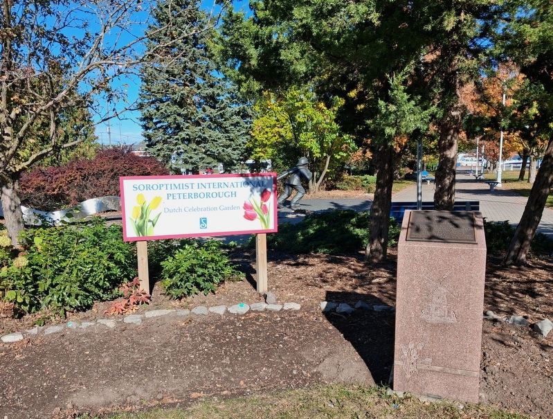
On Perry Street at Crescent Street, on the left when traveling east on Perry Street.
To commemorate 50 years of
peace, freedom and friendship
between our countries.
Dedicated on 1 May 1995
by [the] Dutch-Canadian Community
of Peterborough District.
Unveiled by His Honour
The Honourable H.N.R. Jackman,
Lieutenant . . . — — Map (db m315164) HM
This monument commemorates the 150th
anniversary of the Great Famine in Ireland.
In 1847, many Irish emigrants fleeing the
famine died in the Fever Shed near this site,
then known as "Hospital Point".
Like the Irish emigrants who . . . — — Map (db m315170) HM
On McDonnel Street just west of George Street North, on the left when traveling west.
The West Riding Peterborough Agricultural Society Fair had been searching for many years for a larger location to hold the fair, and the closure of the Burial Grounds provided a perfect opportunity for much needed open space. The “Agricultural . . . — — Map (db m260799) HM
Near Museum Drive 0.4 kilometers north of Hunter Street East, in the median.
This park was given to the
City of Peterborough by
the Women's Patriotic League
of Ashburnham in memory of
the men of Peterborough
who fell in the Great War of
1914 —— 1918 — — Map (db m315271) WM
Beloved son of A.E. & B.M. Dixon
Born 15th May 1896.
Killed in action near Arras in France,
17th September 1918.
———————
He gave his life for his Country — — Map (db m315129) WM
On Brock Street just west of Chambers Street, on the right when traveling west.
Here on December 6, 1960, the skeletal remains of a man who lived in this area about 2,000 years ago were discovered by Douglas Yaxley of Peterborough. Buried with the man were twenty-nine artifacts attributed to the Point Peninsula Culture, which . . . — — Map (db m260778) HM
On McDonnel Street just west of George Street North, on the left when traveling west.
A tribute to the Canadian volunteers and to the memory of Capt. Edward T. Brown, of Boulton’s Scouts, a native of this county who fell at Batoche on May 12th, 1885 — — Map (db m260797) HM
Who served his Country with distinction as an
Officer of the 4th Regiment in many of the
actions in the Peninsula war and at Waterloo.
Also Acted
For many years as Police Magistrate
for the County of Peterborough; he . . . — — Map (db m315142) WM
On Hunter Street West just east of Reid Street, on the left when traveling east.
[English] The parish of St. Peter-in-Chains was established in 1826 to serve the large Irish Catholic population of the surrounding Robinson Settlement. This building, erected in 1837-38 of stone from nearby . . . — — Map (db m260697) HM
On George Street North just south of McDonnel Street, on the right when traveling south.
The Citizens' War Memorial, in memory of those who fell in three wars, was designed by Toronto architect and sculptor Walter Seymour Allward (1876-1955), with the help of the English sculptor Gilbert Bayes (1872-1953). It was commissioned in 1921 . . . — — Map (db m260798) HM
On George Street North at Murray Street, on the right when traveling south on George Street North.
The transformation of the agricultural fair site and old burial grounds into a formal park was important to the citizens of Peterborough who protested the Town Council's first plan to subdivide the area into building lots. In 1884 Council agreed . . . — — Map (db m260796) HM
Near Hunter Street East 0.1 kilometers west of Ashburnham Drive, on the left when traveling south.
[English] D-Day and the Battle of Normandy 6 June-21 August 1944 After months of elaborate planning, the largest seaborne invasion in modern history commenced on 6 June 1944 (D-Day) to liberate northwestern . . . — — Map (db m260998) HM
Dedicated to the memory of
Del Crary (1919-1978)
After entertaining troops in Europe during World War II
Del Crary returned to his native Peterborough to launch his
career as a local entertainment personality joining CHEX as
a radio . . . — — Map (db m315169) HM
On King Street just east of Water Street, on the right when traveling east.
Canada's aboriginal peoples have lived here since the last glacier
melted 11,000 years ago. Living in harmony with Mother Earth,
they followed a seasonal cycle of hunting, fishing, gathering and
later farming. Their inventions of the canoe, . . . — — Map (db m315237) HM
On King Street just east of Water Street, on the right when traveling east.
While Samuel de Champlain is the first recorded European to travel
through the area (1615), full scale migration did not begin until the
promise of free land lured British settlers here in 1818. The following
year, Adam Scott built a small . . . — — Map (db m315244) HM
On King Street just east of Water Street, on the right when traveling east.
The First Nations were valued as friends and military allies by the first European
settlers. They helped the newcomers survive by sharing their knowledge about
hunting, farming, and travel. But, this relationship changed after the War of . . . — — Map (db m315238) HM
On Water Street at Simcoe Street, on the right when traveling north on Water Street.
On this site stood in 1825 Government House Log dwelling and office of Peter Robinson. In that year, 2,204 Irish immigrants were assisted in settling here by the British Government. From that time the settlement was known as . . . — — Map (db m260794) HM
On Rubidge Street just north of Hall Street, on the left when traveling north.
An outstanding example of Greek revival architecture, modified in the Palladian manner, it was begun about 1847 by P.M. Grover, a well-to-do local merchant. A type of building rare in Ontario, it was probably inspired by a "design for a villa" . . . — — Map (db m260694) HM
On Brock Street just west of Bethune Street, on the right when traveling west.
This stone house, completed by February 1837, was first occupied by Dr. John Hutchison, Peterborough's first permanently established physician. A native of Kirkcaldy, Scotland, Hutchison had come to Upper Canada by 1818 and practiced in the Rice . . . — — Map (db m260696) HM
On King Street east of Water Street, on the right when traveling east.
The Shield's rugged outcrops were covered with maple, pine, red oak, birch and
blueberries and its swampy hollows filled with cedar and black ash. Majestic
white pines flourished on the many glacial deposits. Sugar maple, beech,
basswood, and . . . — — Map (db m315235) HM
Otonabee Lodge Number 13
Founded 1846
Peterborough Lodge Number 111
Founded 1873
Golden Link Rebekah Lodge Number 81
Founded 1906 — — Map (db m315135) HM
On King Street east of Water Street, on the right when traveling east.
The Otonabee's fast flowing waters shaped Peterborough's industrial
development during the Victorian era. It provided transportation, power,
and fresh water for an assortment of flour, saw, woolen and flax mills;
foundries, breweries, and . . . — — Map (db m315249) HM
On King Street just east of Water Street, on the right when traveling east.
Peterborough serves as the gateway to the Kawarthas. These lakes were
shaped by two major land forms and later by glacial scouring. The Canadian
Shield to the north represents some of the oldest rock in the world (3 billion
years). It forms a . . . — — Map (db m315219) HM
On George Street North just south of McDonnel Street, on the left when traveling south.
This accessible entrance to City Hall
is dedicated to the life achievements of
Lois Harte-Maxwell,
a pioneer in accessibility awareness
in our community. — — Map (db m315188) HM
On Murray Street just west of George Street North, on the right when traveling west.
Central Park was an ideal site for a military training area with its expansive grounds and location — accessible by foot, horse and wagon. A drill shed was built in 1867 and used for band practices, dances and military activities. Drill sheds were . . . — — Map (db m260795) HM
On King Street just east of Water Street, on the right when traveling east.
Welcome to Peterborough's celebration
of the Millennium. This is our tribute to
a rich and diverse natural heritage; to
the First Nations and to the early
European settlers who carved a home
in the wilderness; to industries, past
and . . . — — Map (db m315203) HM
On King Street just east of Water Street, on the right when traveling east.
But, the river's role changed as the technology changed. The squared-timber
industry of the 1840's-60's gradually gave way to sawn lumber. While the arrival
of the railway marked a decline in the river's transportation role, it coincided . . . — — Map (db m315250) HM
On King Street at Water Street, on the right when traveling east on King Street.
Otonabee River Trail is a millennium project
of the City of Peterborough on the occasion
of the city's 150th anniversary.
This waterfront project celebrates the natural
and cultural heritage of the area. Otanabee
River Trail is an . . . — — Map (db m315201) HM
On King Street east of Water Street, on the right when traveling east.
Our story has come full-circle.
Who knows what the future will bring? No doubt, the ebb and
flow of people, business and industry will continue as
Peterborough grows and flourishes. But, under our
stewardship, the river will endure as . . . — — Map (db m315254)
On Murray Street just east of George Street North, on the right when traveling east.
Riding a wave of national pride and military enthusiasm following the South African War (1899-1902), the Canadian government embarked on a major reform of the nation's defence system. The new programme included an expanded and upgraded . . . — — Map (db m260700) HM
On Water Street north of King Street, on the right when traveling north.
The demise of the Ontario Canoe Company
in 1892 left an expanding market open for
new businesses such as the Peterborough
Canoe Company. However, it appears that
The Peterborough Canoe Co. was actually
formed six weeks before The . . . — — Map (db m315176) HM
On Simcoe Street at Water Street, on the left when traveling west on Simcoe Street.
During the years 1873 to 1991, 123 Simcoe Street was the site of The Peterborough Club. Originally modelled as an English gentlemen’s club, it developed at this location as a place for business and professional people to meet and as a community . . . — — Map (db m260788) HM
On Perry Street at Crescent Street, on the left when traveling east on Perry Street.
This monument stands as a proud tribute to
Peterborough Firefighters who have given
their lives in the service of our city.
To them and their families we remain
immeasurably grateful.
Orville Rome · George Reynolds · Grover Deck . . . — — Map (db m315165) HM
Near Hunter Street East 0.1 kilometers west of Ashburnham Drive, on the left when traveling south.
[English] Opened in 1904, with a lift of 19.8 metres, this is the highest hydraulic lift lock in the world and the first of two built in North America, both on the Trent-Severn Waterway. It operates on a balance principle. A . . . — — Map (db m247847) HM
On Lansdowne Street West at Roger Neilson Way, on the left when traveling west on Lansdowne Street West.
To honour the Pioneers
of this commuity
and all those who during
the past 100 years
have served the cause
of agriculture
in Peterborough County
Presented by
Ontario Department of Agriculture
in recognition of
One Hundred . . . — — Map (db m315122) HM
On King Street east of Water Street, on the right when traveling east.
The twentieth century marked a subtle transition for Peterborough. The City
slowly moved away from an economy based on large scale manufacturing to
become a regional service centre for education, healthcare, commerce,
government, specialized . . . — — Map (db m315252) HM
On George Street North at McDonnel Street, on the right when traveling south on George Street North.
Peterborough's first burial ground was laid out in 1825 on the land bounded by Aylmer, George, Murray and McDonnel Streets. At the time, this was the northern edge of the town. It was multidenominational with areas for Roman Catholics, Anglicans, . . . — — Map (db m260918) HM
On Hunter Street West just west of Water Street, on the right when traveling west.
The old Post Office, located at the north-west corner of Hunter and Water Streets, opened in 1888 and was demolished in 1955 soon after the new Post Office on Charlotte St. was opened. The building was designed in Ottawa by Dominion architect . . . — — Map (db m260785) HM
On George Street North just south of McDonnel Street, on the left when traveling south.
For outstanding stewardship of the built heritage
———————————————————————
Attestation d'excellence en gestion du patrimoine bâti — — Map (db m315190) HM
Near Hunter Street East 0.1 kilometers west of Ashburnham Drive, on the left when traveling south.
Louis Riel 1844-1885 [English] Louis Riel led the Red River Métis in opposing Canadian expansion into their region in 1869. Only 25 years old at the time, Riel was chosen to head the provisional . . . — — Map (db m260999) HM
On King Street just east of Water Street, on the right when traveling east.
Peterborough's history has been profoundly shaped by the Otonabee River.
This section of waterfront was originally called "Nogojiwanong"*—the
place at the foot of the rapids-by the Ojibway (Anishinabeg) First Nations.
The heart of our . . . — — Map (db m315205) HM
On Water Street just north of Brock Street, on the right when traveling north.
In an effort to alleviate poverty and unemployment in Ireland, the British government in 1825 sponsored a settlement of Irish emigrants in the Newcastle District of Upper Canada. Peter Robinson, later that province's Commissioner of Crown Lands, . . . — — Map (db m260695) HM
On Brock Street just west of Bethune Street, on the right when traveling west.
Sandford Fleming arrived at this house from Scotland on June 7, 1845. He resided here with his cousin, Dr. John Hutchison, for nearly two years. During this time he surveyed and made a map of the townsite of Peterborough. Here he met his future . . . — — Map (db m260698) HM
On Water Street north of King Street, on the right when traveling north.
Near this site, in 1820, the community's first resident,
Adam Scott (1796-1838), built a sawmill and a grist-mill.
The small settlement which grew around them was known
as Scott's Plains until 1826 when it was renamed in honour
of Peter . . . — — Map (db m315175) HM
The City of Peterborough gratefully acknowledges the contribution of
Sean Eyre to the establishment and success of the Peterborough
Pathway of Fame.
Known to many for his former long-running country and western
themed program on CHEX . . . — — Map (db m315167) HM
On King Street east of Water Street, on the right when traveling east.
In the brief span between 1850 to 1905, Peterborough progressed
rapidly from a frontier service town to a prosperous full-fledged city.
This is a snapshot of some of the individuals, events and distinctive
architecture that helped define the . . . — — Map (db m315246) HM
Near Ashburnham Drive at Marsdale Drive, on the left when traveling north.
The Tollington Bridge was constructed in 1998 to access the Rotary Greenway Trail along the north shore of Little Lake. Funds for this project were provided by the Tollington Park Endowment Fund. Impressed by the beauty of the parks and the . . . — — Map (db m260981) HM
Near Hunter Street East 0.1 kilometers west of Ashburnham Drive, on the right when traveling west.
[English] Did you know that…
• The Peterborough Lift Lock was inaugurated on July 9, 1904. It took eight years to build. • With a height of 19.8 metres, it is the highest hydraulic lift . . . — — Map (db m260800) HM
These twelve granite stones, encircling the Cenotaph honour the men and
women of Peterborough City and County who answered their country's call in World War One, World War Two and The Korean War. They returned, but will forever embrace those . . . — — Map (db m315185) WM
In dedication of our fighting men and women
South African War 1899 - 1902 • WWI 1914 - 1918
WWII 1939 - 1945 • Korea 1950 - 1953
[Canadian Armed Services Emblems]
We Will Remember Them
"They shall grow not old
as we that . . . — — Map (db m315132) WM
Near Hunter Street East 0.1 kilometers west of Ashburnham Drive, on the left when traveling south.
[English] Women in Canada and Newfoundland significantly contributed to Allied victory. Whereas women were military nurses during the First World War, more than 50,000 were now serving in uniform as non-combatants in . . . — — Map (db m260987) HM
On George Street North just south of McDonnel Street.
Presented to the City of Peterborough to mark the visit of the Secretary of State (Veterans), The Honourable Lawrence MacAulay, to commemorate the 50th anniversary of the end of the 2nd World War — August 1995
Plaque remise à la . . . — — Map (db m315187) HM WM