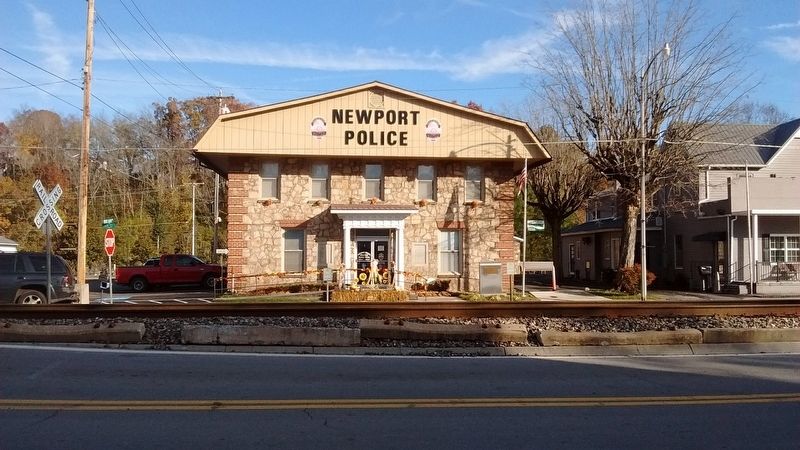
On East Main Street just east of McSween Avenue, on the right when traveling west.
The town of Newport was organized in 1867.
The county seat was established here in 1884.
L. Snease, Mayor
Aldermen
C.D. Fisher
Hugh Gray
W.E. McGaha
Frank Parks
James Murray — — Map (db m152049) HM
On East Broadway Street (U.S. 25/70) west of Court Avenue, on the right when traveling west.
In grateful appreciation
to the
men and women of Cocke County, Tennessee
who by serving as members of the armed forces
of the
United States of America
have helped
to uphold the principles of democracy
upon which this nation was . . . — — Map (db m211009) WM
On East Broadway Street (U.S. 25/70) at Court Avenue, on the right when traveling west on East Broadway Street.
This monument is dedicated
to those from
Cocke County, Tennessee
who made the supreme sacrifice
in service to their country
WWI
U.S. Army: William Austin • Charles G. Free • William Hall • Robert Johnson • Robert Maloy • . . . — — Map (db m211008) WM
Born in Newport on October 13, 1870, Hooper was a successful Cocke County attorney.
He was elected governor and served two terms, 1911-15. His election is attributed to the influence of fusion, the coalition of the prohibition factions of both . . . — — Map (db m61778) HM
On Tennessee Route 35, on the left when traveling south.
Side A
* Jefferson County *
Established 1792: named in honor of
Thomas Jefferson
Secretary of State; formerly member of the Continental Congress; principal author of the Declaration of Independence; later Governor of . . . — — Map (db m81373) HM
On E. Broadway Street at Woodlawn Ave., on the right when traveling east on E. Broadway Street.
Born in a house 500 yards south, he attended W & L University and V.M.I. Enlisted in the French Foreign Legion, August, 1914: incapacitated for infantry service by wounds, May 1915. Transferring to the French Air Force, he helped found the . . . — — Map (db m28228) HM
A swinging bridge crossed the river just east of this spot, 1914-1924. It provided access to the G.L. Goughnour home on the cliff as well as access to town from Warford Road. — — Map (db m126465) HM
On North Street (U.S. 321) at Northcutt Street, on the right when traveling north on North Street. Reported missing.
Located .2 mi. east on the Big Pigeon River is a strategic crossing used by the Cherokees. In Aug. 1782, Gen. Charles McDowell of Burke Co., North Carolina, raised an army of five hundred mounted militia from Morgan District to cross the mountains, . . . — — Map (db m61779) HM
The Great War Path of the Cherokees forded this river just west of this spot. It was the main route linking the Watauga and Chickmauga settlements. — — Map (db m126464) HM
On Wilton Springs Road (U.S. 321) at Cosby Hwy., on the left when traveling south on Wilton Springs Road.
About 2 miles northeast, south of the mouth of Cosby’s Creek, William Whitson, Jr., established a fort on the east bank of Pigeon River in 1783. It was an important frontier outpost, since there was a ford there, and the west bank of the river was . . . — — Map (db m58404) HM
On Indian Ridge Road at Old Rutledge Pike, on the left when traveling north on Indian Ridge Road.
After Confederate Gen. James Longstreet's defeat at Fort Sanders on November 29, 1863, he lifted the siege of Knoxville and headed northeast, hoping to intercept a Federal column marching toward Knoxville from Cumberland Gap. The Confederates paused . . . — — Map (db m100816) HM
On Emory Road (Tennessee Route 331) at Blaine Drive, on the left when traveling west on Emory Road.
Built from here southwest to Clinch River, about 1788. Many early settlements and institutions were
established along its route. Haley's Station, a pioneer fort, was 3 miles E., on Richland Creek.
The Mouth-of-Richland Baptist Church was . . . — — Map (db m32039) HM
On Indian Ridge Road at Old Rutledge Pike, on the left when traveling north on Indian Ridge Road.
This single-room cabin was constructed about six miles east of here, the home of John Janeway and his wife, Gertrude. It is typical of such dwellings in Appalachian Tennessee. During the Civil War, Janeway join the fighting late, in June 1864, . . . — — Map (db m100480) HM
On Rutledge Pike (U.S. 11W) 0.4 miles north of Milligan Lane, on the right when traveling north.
Built circa 1796 for Major Lea and Lavinia Jarnagin Lea, the brick house on this land is one of the oldest in Grainger County. The ninth Lea child, Albert Miller Lea, was born here in 1808. Lea assisted in two major land surveys in Tennessee and . . . — — Map (db m133761) HM
On Rutledge Pike (U.S. 11W) at Roach Lane, on the right when traveling north on Rutledge Pike.
As early as 1792 this was the property of James McDaniel who was killed near here by Indians. After 1833 a stagecoach stop was maintained here by Dr. Samuel Shields. For many years the house was a residence, as well as a post office, store, and . . . — — Map (db m100284) HM
On North Cumberland Street at Old Holt Road, on the left when traveling north on North Cumberland Street.
Bethel Methodist Church originated as First Methodist Episcopal Church, with the Reverend Owen N. Hypsher as its first minister in 1881. The home church for the former Morristown College, Bethel served as a major hub for Morristown's Black . . . — — Map (db m171104) HM
On North Jackson Street at West First N Street (Route 66), on the left when traveling north on North Jackson Street.
In 1861, Morristown was a small railroad town strategically located where the East Tennessee & Virginia Railroad crossed the road to the Cumberland Gap. Although much of East Tennessee was Unionist, Morristown's residents held secessionist . . . — — Map (db m101931) HM
On Tennessee Route 160, on the right when traveling north.
The homesite and grave of Revolutionary War officer, Colonel Robert McFarland, is located two miles north at Springvale. Born in 1759 in Orange County, North Carolina, he served in the Virginia Militia from 1776 to 1781. In 1783, McFarland moved . . . — — Map (db m80442) HM
Near Morningside Drive, on the right when traveling east.
It took Virginia and North Carolina settlers from 1607 until almost 1750 to settle as far as the Appalachians. The surge of road building between 1790 and 1840 made the Trans Allegheny accessible for further settling. During this time, development . . . — — Map (db m126538) HM
On Morningside Drive at Ridgelawn Avenue, on the left when traveling west on Morningside Drive.
Here stood the Crockett Tavern, established and operated by John and Rebecca Crockett. It was the boyhood home of David Crockett (1786-1836), pioneer and political leader in Tennessee, and a victim of the Alamo Massacre at San Antonio, Texas. — — Map (db m43711) HM
On Morningside Drive at Ridgelawn Avenue, on the right when traveling east on Morningside Drive.
In the 49 years that David Crockett called Tennessee his home he migrated from one end of the Volunteer state to the other. From his birthplace near Limestone on the banks of the Nolichucky River to his last home in present day Rutherford (Gibson . . . — — Map (db m152045) HM
On Andrew Johnson Highway (U.S. 11E) at East Manley Court Circle, on the right when traveling east on Andrew Johnson Highway.
Site of the home of Dewitt Clinton Senter, farmer and lawyer, born in Rhea County, member of the Tenn. House of Representatives, 1857-3, Tenn. Senate, 1865-69, Speaker of the Senate 1869; Governor 1869-71. — — Map (db m88029) HM
Front
Erected in Memory of the 22 Hamblen County Boys Who Made the Supreme Sacrifice in the World War.
Back
Erected by The Morningside Garden Club Morristown Tenn 1932.
This memorial was restored and rededicated in 1997 by . . . — — Map (db m88027) WM
On West 2nd North Street at North Jackson Street, on the right when traveling east on West 2nd North Street.
Hamblen County was organized
in 1870 from parts of Jefferson,
Grainger, and Hawkins Counties.
The Courthouse was finished
in 1874 on land donated by
G. W. Barnett, George W. Folsom,
D. Morris and John Murphey.
Additions were made in 1955
and . . . — — Map (db m210322) HM
On North Jackson Street at West 3rd North Street, on the right when traveling north on North Jackson Street.
This historical site was the location of the former Hamblen County Jail
Erected - 1937
Razed - 2004 County Mayor David W. Purkey
Sheriff Otto Purkey
Trustee Bill Brittain — — Map (db m171365) HM
On West 1st North Street west of North Jackson Street, on the right when traveling west.
In honored memory
of our
Hamblen County boys
who fought in
the Korean War
1950 – 1954
★ ★ ★ ★ ★
Erected and dedicated
Memorial Day 1976
by
Morristown Area
Chamber of Commerce
Veterans Council . . . — — Map (db m210329) WM
On West 1st North Street (Tennessee Route 66) at North Jackson Street, on the right when traveling west on West 1st North Street.
In honored memory
of our
Hamblen County men and women
who fought in
Desert Shield
Desert Storm
The Global War on Terrorism
Operation Iraqi Freedom
Operation Enduring Freedom
Iraq and Afghanistan
★ ★ ★ ★ . . . — — Map (db m210325) WM
On West 1st North Street (Tennessee Route 66) at North Jackson Street, on the right when traveling west on West 1st North Street.
In honored memory
of our
Hamblen County boys
who fought in
the World War
1917 – 1919
★ ★ ★ ★ ★
Erected and dedicated
November 11, 1929
by
The American Legion Auxiliary
of Morristown
Billy Bushong . . . — — Map (db m210324) WM
On West 1st North Street at North Jackson Street, on the right when traveling west on West 1st North Street.
In honored memory
of our
Hamblen County boys
who fought in
the World War
1941 – 1945
★ ★ ★ ★ ★
Erected and dedicated
November 11, 1947
by
The American Legion Auxiliary
of Morristown
Billy Bushong . . . — — Map (db m210327) WM
On East 1st North Street at North James Street, on the left when traveling east on East 1st North Street.
Founded Morristown Equal Suffrage League, 1911 & led meetings here. Wrote novel "The Closed Door" advocating votes for women. Lived Here. — — Map (db m201702) HM
On Morningside Drive, on the right when traveling east.
“My father’s name was John Crockett, and he was of Irish descent. I have learned that he was a soldier in the revolutionary war, and took part in that bloody struggle. He fought, according to my information, in the battle at . . . — — Map (db m152044) HM
On Panther Creek Road at Murrell Road, on the right when traveling north on Panther Creek Road.
Inventor, pioneer in the field of aerodynamics, patented the "American Flying Machine" in 1877, served for 45 years as a Methodist Circuit Rider. — — Map (db m87971) HM
On Cumberland Street at Louise Aveue, on the left when traveling north on Cumberland Street.
A few yards east is the family graveyard of the founders of Morristown. In 1787, Gideon, Daniel and Absalom Morris, formerly of the Watauga Settlement, received grants in this area, from which Gideon deeded the land on which the town was built. — — Map (db m80441) HM
Near East North 6th Street, 0.1 miles east of North James Street, on the left when traveling east.
“One of Tennessee’s most powerful statements of how the American Civil War transformed the people and places of Appalachia.” – MTSU Center for Historic Preservation.
Morristown College, an historic African American . . . — — Map (db m146233) HM
On N Cumberland Street at Cherokee Dr., on the right when traveling north on N Cumberland Street. Reported missing.
Morristown College, a two-year co-educational liberal arts institution, was founded as Morristown Seminary by Reverend Judson S. Hill in 1881. The first building used to provide education for the Negro youth of East Tennessee stood near this site . . . — — Map (db m128454) HM
On Old Highway 11-E (U.S. 11E) at Panther Creek Road, on the right when traveling south on Old Highway 11-E.
½ mile along the Old Stage Road, a thriving pioneer community grew up around the enormous spring at which one Col. Bradley killed a panther. Panther Springs Academy was here. Tate's Store, also the post office, was the meeting place for the . . . — — Map (db m28484) HM
On Tennessee Route 160 at Grigsby Road, on the right when traveling north on State Route 160.
Built around 1799 of native limestone rock by Alexander Outlaw for his son-in-law Joseph Hamilton and his wife Penelope, original settlers in Bend of the Chucky in 1783. Hamilton served for many years as court clerk of Jefferson county and was a . . . — — Map (db m84486) HM
On St. Paul Road, on the right when traveling north.
Founded in 1804, the original church was on Flat Creek. The present structure was built in 1857 under the supervision of Col. Joseph Hamilton. Rooms were added in the basement in 1946 and major renovations to the interior made in 1969. The exterior . . . — — Map (db m126430) HM
On Panther Creek Park Road, 1.5 miles Panther Creek Road, on the right.
The valley before you was located at the heart of Cherokee Indian tribal territory until the late 1700's
Welcome to the Overlook at Panther Creek State Park.
The platform, on which you stand, is dedicated in memory of Bill Catron, . . . — — Map (db m81631) HM
On Morningside Drive, on the right when traveling east.
“I was twelve years old; and about that time, that I began to make up my acquaintance with hard times, and a plenty of them.” – David Crockett From his Narrative, 1834
Adversities can make or . . . — — Map (db m152043) HM
On Gay Street south of East Meeting Street (U.S. 70), on the left when traveling south.
(preface)
In November 1863, Confederate Gen. James Longstreet led a force from Chattanooga to attack Union Gen. Ambrose E. Burnside’ s army at Knoxville. The campaign failed, and in December Longstreet’s men marched east along the East . . . — — Map (db m69520) HM
A critical point in the bitter cavalry actions during Longstreet's withdrawal to winter quarters near Morristown. The 1st Brig., 1st Cav. Div., Army of the Cumberland, coming from the NW through Dandridge, was attacked at Hays' Ferry, four mi. NE, . . . — — Map (db m82195) HM
Near Oak Grove Road at Spring Creek Road, on the left when traveling west.
(preface)
In November 1863, Confederate Gen. James Longstreet led a force from Chattanooga to attack Union Gen. Ambrose E. Burnside’ s army at Knoxville. The campaign failed, and in December Longstreet’s men marched east along the East . . . — — Map (db m69526) HM
On East Main Street at Graveyard Alley, on the right when traveling east on East Main Street.
(preface)
In November 1863, Confederate Gen. James Longstreet led a force from Chattanooga to attack Union Gen. Ambrose Burnside’s army at Knoxville. The campaign failed, and in December Longstreet’s men marched east along the East . . . — — Map (db m151536) HM
On Chestnut Hill Road (Tennessee Route 92) at Public Drive, on the right when traveling north on Chestnut Hill Road.
A Bridge Over Time
From 1942 to 1944, the Tennessee Valley Authority (TVA) designed and built a new State Route 92 bridge over the French Broad River and Douglas Reservoir at Dandridge. The two-lane bridge was impressive for its time: 1,468 . . . — — Map (db m225850) HM
On Tennessee Route 92, 0.1 miles east of U.S. 25W, on the right when traveling south.
Permanently settled 1783. Francis Dean built meeting house where Revolutionary Cemetery remains. Jan., 1793, commissioners of County Court, Jefferson Co., Territory South of the River Ohio, located county seat here. Dean donated land & Samuel Jack . . . — — Map (db m82196) HM
On Chestnut Hill Road (Tennessee Route 92) at Circle Drive, on the right when traveling north on Chestnut Hill Road.
Powerful Transformations
Named for First Lady Martha Dandridge Custis Washington, the town of Dandridge became the Jefferson County seat in 1793. Dandridge spent almost 150 years as the center of government and commerce in Jefferson County. A . . . — — Map (db m225853) HM
On Dumplin Valley Road at Chucky Pike, on the right when traveling east on Dumplin Valley Road. Reported missing.
Legendary frontiersman David Crockett and his first wife, Polly Finley, were married on August 14, 1806, at the home of Polly's parents, William and Jean Finley, one-fourth mile southeast of here. After the wedding, David and Polly lived in this . . . — — Map (db m80231) HM
On Interstate 40, 1.4 miles east of Tennessee Route 113, on the right when traveling west.
(preface)
In November 1863, Confederate Gen. James Longstreet led a force from Chattanooga to attack Union Gen. Ambrose E, Burnside's army at Knoxville. The campaign failed, and in December Longstreet's men marched east along the East . . . — — Map (db m100483) HM
(preface)
In November 1863, Confederate Gen. James Longstreet led a force from Chattanooga to attack Union Gen. Ambrose E, Burnside's army at Knoxville. The campaign failed, and in December Longstreet's men marched east along the East . . . — — Map (db m100826) HM
On West Meeting Street, 0.1 miles west of U.S. 92, on the left when traveling east.
William M. Hill was a 1st Sergeant in the 9th Tennessee U.S. Cavalry during the Civil War and was a grocer in Dandridge the rest of his life.
He began building this ‘Greek Revival’ style house in 1870 and, on 7 Jan 1871, was deeded the property . . . — — Map (db m225860) HM
On West Main Street (Tennessee Route 139) at Gay Street, on the right when traveling west on West Main Street.
Around 1820 to 1837, this large 38-inch diameter grindstone was used at John Cunningham (J.C.) Turnley's farm known as the Mill Place. J.C. Turnley was the founder of Oak Grove and built the Mill Place upstream from Hay's Ferry on the south side of . . . — — Map (db m118844) HM
On Gay Street (Tennessee Route 92) south of West Meeting Street (Tennessee Route 9/66), on the right when traveling south.
First court house and jail erected on this site in 1815 – addition to jail erected in 1935 by Jefferson County in conjunction with Tennessee Emergency Relief
Administration.
Building committee J.E. Swann CHM C.C.
Luther Chilton Harry Vance Ben . . . — — Map (db m210333) HM
On Church Street, 0.1 miles south of U.S. 70, on the left when traveling south.
Samuel Scott McCuistion was born August 12th, 1817 on the waters of Long Creek near Finley’s Gap in Jefferson County. He never married and died January 13th, 1893.
He inherited Davy Crockett’s first rifle from his father James who had bought it . . . — — Map (db m225856) HM
On U.S. 25W at Swansylvania Road, on the right when traveling east on U.S. 25W.
"In commemoration of Pine Chapel Cemetery one half mile north of this spot, and Pine Chapel Methodist Church on this spot about 1787, together with Pine Chapel School House near this spot, being the first public institutions in the Wilderness. . . . — — Map (db m28571) HM
Samuel McSpadden, powdermaker and Revolutionary War veteran, built this house in 1804, and died here on August 3, 1844. From a crude powdermill located 1/4 mile north he sent flatboats loaded with gunpowder to New Orleans, where General Andrew . . . — — Map (db m80438) HM
On Church Street north of East Meeting Street, on the left when traveling north.
John Seabolt was a local businessman who manufactured building and decorative red brick. The material was of the finest quality as well as the construction techniques. The walls are three brick thick which is a testament to the excellent . . . — — Map (db m225859) HM
On U.S. 25W/70 at Swansylvania Road, on the right when traveling east on U.S. 25W/70.
One-half mile south, on Seehorn Creek, the first Stokely Brothers cannery was built in 1898 with $3,900 invested by Colonel Alfred R. Swann, Anna Rorex Stokely, and her sons, James and John. In the 30-by-60-foot shed, 4,000 cases of tomatoes were . . . — — Map (db m28296) HM
On East Main Street east of Chestnut Hill Road (a.k.a.: Gay Street), on the right when traveling east.
A portion of the town of Dandridge would have been flooded by the waters of Douglas Lake if the Tennessee Valley Authority had not built a dike. The top of the dike is an elevation of 1009 feet, seven feet above the dam's crest gates. All of the . . . — — Map (db m225855) HM
On Tennessee Route 92 south of West Dumplin Valley Road, on the left when traveling north.
"Along the vallies of what is now East Tennessee and South-western Virginia, lay the great route and thoroughfare between the northern and southern Indians, in their intercourse with distant tribes, in the hunting excursions, in their . . . — — Map (db m220472) HM
On East Old Andrew Johnson Highway, 0.1 miles south of Municipal Drive, on the right when traveling south.
Federal cavalry under Gen. S.D. Sturgis established a line just east of Mossy Creek. At 9:00 a.m., Confederate Gen. W.T. Martin assembled 2000 dismounted cavalry and eight cannons at Talbott's Railroad Station, three miles east. They advanced along . . . — — Map (db m28311) HM
On Russel Avenue at Andrew Johnson Highway (Tennessee Highway 11E), on the right when traveling north on Russel Avenue.
½ mi. Following organizational meetings in 1849, this was chartered as Mossy Creek Missionary Baptist Seminary in 1851. It closed 1861-65, its buildings being occupied and badly damaged by Federal troops in that period. Resuming operation in . . . — — Map (db m28488) HM
On Fielden Store Road at River Road, on the right when traveling west on Fielden Store Road.
A Revolutionary War veteran wounded at the Battle of King's Mountain on October 1, 1780, William Cox Sr. built Cox Mill, a grist mill, on this site about 1792. He was an "Overmountain Man" living in Watauga in 1775. As a delegate from Washington . . . — — Map (db m84368) HM
On East Main Street near Mechanic Street, on the right when traveling east.
The old First National Bank had a brief life on the north side of Main Street. Another bank, Citizen's Trust Company, operated on the east end of Main Street for about 20 years. It consolidated with First National Bank and moved across the street to . . . — — Map (db m190812) HM
On East Main Street, on the left when traveling east.
View of this building and others along North Depot Street (now Main Street) in the 1900s. You can see the name Godwin Bros located at the top of the building. Other businesses located in this row of buildings during the early years include Ingram . . . — — Map (db m190807) HM
On East Main Street, on the left when traveling east.
J.W. Godwin and Oscar Godwin established Godwin Brothers, general merchants in this building in 1870. (Courtesy of Hele Jolley) — — Map (db m190808) HM
On East Main Street near Mechanic Street, on the right when traveling east.
Mossy Creek Bank had a slogan of "Safe, Sound, Solid, Conservative". The bank advertised "Fire Proof Vault, Burglar Proof Safe and Time Locks" to solicit customers to open a bank account. Among the services offered were loans, stocks and bonds. One . . . — — Map (db m190811) HM
On East Main Street near Mechanic Street, on the right when traveling east.
There were a variety of businesses including the Melody Theater, First National Bank, Lloyd May Clothing Company and the J.B. Dick 5c & 10c Store. (Courtesy of Juanita Franklin) — — Map (db m190813) HM
On East Main Street, on the right when traveling east.
Looking East on Main Street you see a bustling downtown with retail stores, a theater and café. The Jefferson Theater shown in this image was located in this building. (Photo courtesy of Juanita Franklin) — — Map (db m190814) HM
On East Main Street near Mechanic Street, on the right when traveling east.
John Roper Branner provided the land for the East Tennessee & Virginia Railroad Company to pass through Mossy Creek in 1858 as it completed its new route connecting Knoxville and Bristol. Branner stipulated that all passenger trains must stop in . . . — — Map (db m190810) HM
On East Main Street at Mechanic Street, on the right when traveling east on East Main Street.
The old Mossy Creek Bank was located on Depot Street, which later became Main Street. It stood above the side walk between two large trees, wiht stone steps leading up to the door. The bank failed during the Depression after the stock marker crash . . . — — Map (db m190809) HM
On East Old Andrew Johnson Highway, 0.1 miles south of Municipal Road., on the right when traveling south.
(preface)
In November 1863, Confederated Gen. James Longstreet led a force from Chattanooga to attack Union Gen. Ambrose E. Burnside’s army at Knoxville. The campaign failed, and in December Longstreet’s men marched east along the East . . . — — Map (db m70659) HM
On South Elementary School Road, on the left when traveling south.
Oldest log school in Jefferson County. Built by R.R. Bryant in 1850 for his and neighbors' children. He was the second president of Mossy Creek Baptist Seminary, later Carson~Newman University. — — Map (db m204560) HM
On Russell Avenue at Summitt Street, on the right when traveling north on Russell Avenue.
In the late nineteenth century, African-American members of the Baptist Church determined that a black college was needed in East Tennessee. The town of Mossy Creek (the former name of Jefferson City) was chosen as the ideal location. Thanks in . . . — — Map (db m232066) HM
On East Main Street at Branner Road, on the left when traveling east on East Main Street.
Several grist mills operated in Mossy Creek. Sometime around 1835, George Branner built a gristmill on Mossy Creek's west bank near Glenmore Mansion. Over 30 years later, it had fallen into disrepair, but was revived by Frank Jarnagin. Later known . . . — — Map (db m190806) HM
On East Main Street, on the right when traveling east.
The U.S. Post Office in Mossy Creek/Jefferson City was on Branner Street, then moved to two other locations on Main Street (Depot Street) before moving to its present location on the corner of Old Andrew Johnson Highway and Russell Avenue. The Post . . . — — Map (db m190815) HM
On Russell Avenue at Swann Avenue, on the left when traveling north on Russell Avenue.
Side 1 Sarah Swann Hall, Grand Lady of Carson~Newman University, has been "home" to generations of students. Colonel Alfred Reuben Swann (1843~1926), visionary Jefferson County businessman and Carson~Newman trustee, built this stately home . . . — — Map (db m108736) HM
For Black Methodist Episcopal Church, School, and Cemetery. Deeded 1867 to Trustees:
John Roper •
Jacob Branner •
Joseph Peck •
William Houston •
Richard Dan — — Map (db m107951) HM
On U.S. 11E close to Churchview Street, on the right when traveling south. Reported missing.
The author of this book, probably the most famous of her several works, spent her first winter in the United States in a small house which stood about 250 yards south. Besides this juvenile work, she was the author of numerous popular adult books . . . — — Map (db m100828) HM
On Old Andrew Johnson Hwy, on the left when traveling south.
In a log cabin which stood here, Frances Eliza Hodgson, newly from England with her family, spent the winter of 1865. She helped support her family with music lessons, also opened a "Select Seminary for Young People." Here she met Dr. Swan Burnett, . . . — — Map (db m28493) HM
On U.S. 11E, on the right when traveling south. Reported missing.
1/2 mile NW, near the present railway bridge, this ferry was established by William McBee in the last decade of the 18th century. Many early travelers have, in their diaries, mentioned using it. — — Map (db m101788) HM
On Ebenezer Church Road, 0.2 miles south of Valley Home Road (Tennessee Route 66), on the left when traveling south.
(preface)
In November 1863, Confederate Gen. James Longstreet led a force from Chattanooga to attack Union Gen. Ambrose E. Burnside’ s army at Knoxville. The campaign failed, and in December Longstreet’s men marched east along the East . . . — — Map (db m69548) HM
On Main Street (Tennessee Route 113), on the left when traveling north.
White Pine derived its name from the white pine tree which stood here in 1893. The name was suggested by Richard White to satisfy government officials who requested a name to make the post office a legal reality. The original pine tree was destroyed . . . — — Map (db m208814) HM
On Emory Road (Tennessee Route 331) 1 mile west of Washington Pike (Tennessee Route 61), on the right when traveling east.
On this site, about 1785, Col. John Sawyer, a soldier of the Revolution, built a homestead and fort for protection against Indians. Emory Road, which ran Southwest to the Clinch River in 1788, passed through here. — — Map (db m82198) HM
On Kodak Road at Deaton Hollow Road, on the left when traveling east on Kodak Road.
1797 – Manifold Station – 1820
Here at the mill and trading post
of Benjamin Manifold, Jr., many a
weary traveler westward bound
found provision, safety and hope. — — Map (db m195432) HM
The Lucile Borden traveled the French Broad River under Captain James E. Newman at a time before other modes of transport had come to the area.
In the late 1800s, roughly 50 country stores served the needs of residents along or near the French . . . — — Map (db m110594) HM
On Winfield Dunn Parkway (Tennessee Route 66) at West Dumplin Valley Road, on the right when traveling south on Winfield Dunn Parkway.
About 2 mi. E., at mouth of Dumplin Creek, was Henry's Station, founded by Maj. Hugh Henry. Here, the state of Franklin, represented by John Sevier, and the Cherokee Nation, represented by Ancoo, Chief of Chota, signed, on June 10, 1785, the treaty . . . — — Map (db m82598) HM
On Douglas Dam Road (Tennessee Route 139) 0.5 miles south of W. Dumplin Valley Road, on the right when traveling south.
Founded by Maj. Hugh Henry, it was 300 yards from here. On June 10, 1785, the Treaty of Dumplin Creek was signed here by commissioners of the State of Franklin and the chiefs of the Cherokee Nation. Blount, Hamblen, Jefferson, Knox and Sevier . . . — — Map (db m32782) HM
On Bent Road south of Underwood Road, on the left when traveling south.
A member of Watauga Association 1772, he served with Bledsoe in 1777. In 1778 he took the Oath of Allegiance to the state in Washington District Court of N.C. He joined the Mountain Men of John Sevier at King's Mountain and was later at the Battle . . . — — Map (db m195429) HM
Prior to the creation of Seven Islands State Birding Park, several generations of the Kelly family farmed and lived on this land.
The French Broad River's "Kelly Bend" name comes from the family, however, the Kellys called it "Seclusion Bend". . . . — — Map (db m110595) HM
The only treaty made by the state of Franklin was signed here after some negotiation. Commissioners were John Sevier, Alexander Outlaw, and Daniel Kennedy. Signatory Cherokee chiefs were the King of the Cherokees, Ancoo of Chota, Abraham of . . . — — Map (db m33197) HM
On Fox Cemetery Road, 0.1 miles south of Newport Highway (U.S. 411), on the right when traveling south.
Here was an early German settlement. First settlers were Jacob Derrick, Jacob Bird, and Adam Fox. A fort stood on Derrick's land nearby. Mark Fox was killed by Indians on Muddy Creek, 1787; he was buried in Fox Cemetery. An early Lutheran church is . . . — — Map (db m40732) HM
145 entries matched your criteria. The first 100 are listed above. The final 45 ⊳