224 entries match your criteria. The first 100 are listed. Next 100 ⊳
The Spirit of ’76, America’s Bicentennial Celebration Historical Markers
During the time America was celebrating its Bicentennial (1776-1976), historic markers were erected to commemorate different events or projects. This Marker Series is for those historic markers that have the Bicentennial logo, were inspired by, have reference to it in someway within its context or was placed by a Bicentennial committee, commission etc.
William Bartram, America’s first native born artist - naturalist, passed through Baldwin County during the Revolutionary era, making the first scientific notations of its flora, fauna and inhabitants. As the appointed botanist of Britain’s King . . . — — Map (db m81855) HM
William Bartram, America’s first native born artist-naturalist, passed through Clarke County during the Revolutionary era, making the first scientific notations of its flora, fauna and inhabitants. As the appointed botanist of Britain’s King George . . . — — Map (db m101568) HM
William Bartram, America’s first native born artist-naturalist, passed through Elmore County during the Revolutionary era, making the first scientific notations of its flora, fauna and inhabitants. In 1776 the appointed botanist of Britain’s King . . . — — Map (db m69431) HM
Jackson County was created by the State Legislature on December 13, 1819 while in session in Huntsville, Ala. The county was named in honor of Gen. Andrew Jackson who was visiting in Huntsville at the time.
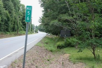
This Statue was presented by the . . . — — Map (db m22262) HM
William Bartram, America's first native born artist - naturalist, passed through Macon County during the Revolutionary era, making the first scientific notations of its flora, fauna and inhabitants. As the appointed botanist of Britain's King George . . . — — Map (db m99676) HM
Patterned after forts designed by French military engineer Sebastian Le Pestre de Vauban, Fort Condé protected Mobile and its citizens for nearly 100 years from 1723-1820. Built by the French as a defense against British and Spanish attack, the . . . — — Map (db m160801) HM
William Bartram, American's first native born artist - naturalist, passed through Russell County during the Revolutionary era, making the first scientific notations of its flora, fauna and inhabitants. As the appointed botanist of Britain's King . . . — — Map (db m164144) HM
1776
Two events destined to change the history of the world took place the first week of July 1776.
On the fourth day of July, the Representatives of the United States of America, in general congress assembled at Philadelphia, declared . . . — — Map (db m69767) HM
A worn and hungry band of Spanish explorers made camp at Johnson Wash, six miles to the east, on October 21, 1776. Fathers Dominguez and Escalante called it Santa Barbara. They found no water for horses or the men who were subsisting on meager . . . — — Map (db m94920) HM
Text from: Historical Markers with The Arizona Department of Transportation right of way. Prepared by: Roadside Development Section April 1, 1997
Fatigued by a thirty mile ride, the padres picked their way down the rocky north slope . . . — — Map (db m39917) HM
In desperate search for a crossing of the Colorado River before the wild storms of winter might further weaken their starving bodies, Fathers Dominguez and Escalante led their expedition past this point on October 26, 1776.
Five days were spent . . . — — Map (db m94896) HM
Within sight of this place the Franciscan priests Dominguez and Escalante and their ten companions experienced two of the most difficult challenges among many along the 1,800 miles of their epic journey from the Spanish presidio at Santa Fe, New . . . — — Map (db m40324) HM
This seedling was grown from the very seeds that journeyed to the moon and back on board Apollo 14. It symbolizes the major role forests played in developing our American Heritage and the vital role forests have in our future.
This planting made . . . — — Map (db m83012) HM
The International Society of Arboriculture and the National Arborist Association jointly recognize this significant tree in this bicentennial year as having lived here during the American Revolutionary Period. 1776 1976.
[Added brass . . . — — Map (db m18861) HM
The Arkansas Indians (the down stream people), a branch of the Quapaw tribe, lived in Desha County. Their presence was first recorded by Marquette and Joliet, French explorers, in 1673. They were known as les Beaux Hommes. La Salle while . . . — — Map (db m107809) HM
The first school in McGehee was started about 1903 in a one room frame building at this location, with Miss Puntney as teacher. In 1905, in this building Reverend J. L. Cannon organized the McGehee First Methodist Episcopal Church. There were ten . . . — — Map (db m229500) HM
Watson became the county seat of Desha County after Napoleon was abandoned to the Mississippi River. Lewis W. Watson donated the land and built the courthouse near this site. The county seat was moved to Arkansas City in 1880. Watson remained the . . . — — Map (db m107757) HM
Joseph Taylor Robinson Home - 204 NE Front St. Practiced law in Lonoke - 1893-1912 U.S. Congressman - 1902-1913. Governor of Arkansas - January - March 1913. U.S. Senator - 1913-1937. Lonoke was named for lone oak tree, surveyor's landmark for . . . — — Map (db m65710) HM
Before 1776 this area was inhabited by Indian Mound builders, bayous were the only drainage and there was no flood control, there was an immense forest that consisted mostly of hardwoods and cypress, in the early 1900's drainage districts began to . . . — — Map (db m212074) HM
Among early settlers were Price, Houston, Greathouse, Rison, Blackwell, Buckingham and Bland. Perryville was named after Commodore Oliver H. Perry, established as a county seat 1840 and incorporated as a town in 1878. First church organized in Rison . . . — — Map (db m156771) HM
Following the discovery of extensive bauxite ore deposits in 1887, an ore drying plant was located here by The Pittsburg Reduction Co. In 1903 a small village was laid out to house the workers. This village which included a bank, hospital, theater . . . — — Map (db m96634) HM
"Scouting will deliver to a nation a great gift, a new generation of prepared, young citizens-physically strong, mentally awake, and morally straight-young people who are growing through their scouting experience, learning the lessons of responsible . . . — — Map (db m172129) HM
In honor of two Revolutionary War soldiers who chose Saline County, Arkansas as their home. After enlisting in the spring of 1777, they served through the winter at Valley Forge and to the end of the war in 1783.
ASHER BAGLEY, Private . . . — — Map (db m96595) WM
Built in 1893, the office of Dr. Dewell Gann, Sr. is the only known bauxite building in existence. The building was constructed by patients who could not afford to pay for services he had rendered them. The soft stone was dug from a farm nearby, . . . — — Map (db m96597) HM
After the fall of Little Rock to Union forces in September, 1863, the area immediately south of the Arkansas River became a No Man’s Land. On the morning of October 23, 1864, a Federal detachment of the 7th Army Corps, returning to Little Rock after . . . — — Map (db m96635) HM
This tree was grown from a seed
that journeyed to the Moon and back
aboard Apollo 14 1971
Planted here on Arbor Day March 15
Bicentennial Year 1976 — — Map (db m92358) HM
This ten-acre park is on the site where Dublin was originally settled in 1850.
Within the park are the:
Murray Schoolhouse, 1856
Old St. Raymond Church, 1859
Sunday School Barn, c. 1860
Kolb’s Old House, c. 1870
Hay Barn, c. 1900
Kolb . . . — — Map (db m201625) HM
Lt. Colonel Juan Bautista de Anza by decree of Carlos III of Spain led an expedition to this site – The mission being to colonize the San Francisco Bay Area
In the center of the marker is a circular motif, designed by Doris Birkland . . . — — Map (db m28815) HM
“…there ought to be a shaft raised to Snow-Shoe Thompson: Not of marble; Not carved and not planted in the valley, but a rough shaft of basalt or of granite, massive and tall, with top ending roughly as if broken short, to represent a life . . . — — Map (db m12028) HM
In 1767, when our yet to be united nation felt the stirrings of revolution, freedom-loving colonists carved and erected the first “Liberty Pole”. It served as a rallying point for those who opposed the British imposed Stamp Act. . . . — — Map (db m65843) HM
Built 1855
Restored 1976 by
Aerie No. 196 – Fraternal
Order of Eagles, Oroville
(Seal of the American Revolution Bicentennial 1776-1976) — — Map (db m65907) HM
McWilliams & Tymeson
1855
Wells Fargo & Company
Express Agents
First Brick Bldg in Oroville
Fraternal Order of Eagles No. 196
(Seal of the American Revolution Bicentennial 1776-1976) — — Map (db m65906) HM
After finding Humboldt Bay from the sand dunes near Fairhaven on December 20, 1849, the Dr. Josiah Gregg exploring party reached the present site of Eureka. December 26, passing an open area near this point, to camp by an Indian village close to . . . — — Map (db m91923) HM
Dominated by a shingled belfry and resonant bell, the first
schoolhouse in the Crescenta-Cañada Valley was erected on
this site in 1888.
Rehung in 1914, this bell summoned children to school until it
was dismantled in 1948, when it began . . . — — Map (db m147003) HM
The original Liberty Bell, cast in 1752, continues to serve as a symbol of courage and freedom. In the bicentennial year of 1975, the White Chapel Foundry in London cast 100 duplicate bells, two for each state. California cities which secured . . . — — Map (db m161082) HM
Coast Redwood
Sequoia sempervirens
This "Moon Tree" is a Coast Redwood grown from a seed that in January 1971 was carried to the moon and brought back to earth by Major Stuart Roosa, Command Module Pilot for Apollo 14.
The . . . — — Map (db m63500) HM
The construction of the San Joaquin River Bridge completed the last link of the Transcontinental Railroad. Building had simultaneously proceeded from the Bay Area and Sacramento and met at the San Joaquin River. The first train crossed the bridge on . . . — — Map (db m11380) HM
The Chinese community of Stockton dedicates this monument to the city of
Stockton to commemorate the bicentennial year of 1976, in memory of the
contributions which the Chinese have made to Stockton.
The ingenuity of the Chinese . . . — — Map (db m103083) HM
James Johnston, a forty-niner from Ohio, established a homestead on this wild, romantic vista of sloping fields and ocean shore in 1853. For his Californiano bride, Petra Maria de Jara, he built this typical eastern saltbox, whose origins from the . . . — — Map (db m25518) HM
Connecticut Charter Oak Descendent
Planted In Commemoration Of The Celebration Of
The Bicentennial Of The United States Of America
July 4, 1976
The Simsbury Bicentennial Committee
Jackson F. Eno, Chairman — — Map (db m88144) HM
First American theologian and philosopher. Born in 1703, son of Timothy Edwards. He graduated from Yale at age 17, was pastor in Bolton, tutor at Yale, missionary at Stockbridge, and in 1758 became pres. of Princeton University where he died. His . . . — — Map (db m114044) HM
In observance of the Nation’s Bicentennial, this park by resolution of the city council of Wilmington was named
In Memory of
Tadeusz Kosciuszko
1746 ~ 1817
Colonel, Army of the United States
American Soldier
Major General, . . . — — Map (db m68371) HM
In Congress, July 4, 1776.Unanimous Declaration of the thirteen united States of America.And for the support of this Declaration,
with a firm reliance on the protection of Divine Providence,
we . . . — — Map (db m137039) HM
Dedicated
July 20, 1976
To those men, women and children of Brevard County who through the practice of the American way of life, liberty and the pursuit of happiness, gave sacrificially of their time and money in the commemoration of the . . . — — Map (db m217589) WM
The men and women of the Air Force Eastern Test Range proudly dedicate this monument to our national progress in missile and space technology in recognition of the American revolution Bicentennial. Erected on site of support elements for early space . . . — — Map (db m57602) HM
In loving memory of those who gave their lives in the service of their country World War I World War II Korea Vietnam Erected by American Legion in cooperation with the Hernando County Action ‘76 Committee and the Florida State Bicentennial . . . — — Map (db m132461) WM
Construction of this historic church was started in 1887. Completion was delayed until 1889 due to a yellow fever epidemic which claimed the lives of the pastor and many members of the congregation. Used to house the first Christian congregation . . . — — Map (db m43102) HM
This marker commemorates the dedication of the Mulberry Time Capsule. The capsule was placed here on June 12, 1977 by the Greater Mulberry Chamber of Commerce. The capsule will be opened in the year 2076 to view the mementoes of the 1976 . . . — — Map (db m4984) HM
Spanish Public Well
Constructed prior to 1763
Filled and partially destroyed
during British Occupation
1763 – 1784
Restored 1975 as a Bicentennial project of:
City Of St. Augustine
Historic St. Augustine Preservation . . . — — Map (db m220568) HM
Crossed north to south near this site. This road was constructed from 1763-1773 by the English, connecting St. Augustine north to St. Mary's River and south to New Smyrna, Florida. First originated as an Indian trail, and later improved by the . . . — — Map (db m45478) HM
The Old Kings Road crossed north to south near this site. First originated as an Indian trail, later improved by the Spanish, and then constructed by the British as a road in 1763-1773 to connect St. Augustine and New Smyrna, Florida. Improved by . . . — — Map (db m101665) HM
The Concord Covered Bridge, constructed with the Queenpost design. was built in 1872 by Daniell and Ruff, who owned land and mills nearby. It replaced a bridge believed to have been built in the 1840's and destroyed during the Civil War. The Concord . . . — — Map (db m197630) HM
North Inscription
Royston, GA
The tri-county city
where agriculture and industry
join hands with progress!
Mid Strickland, Mayor
Imogene Lester, City Clerk
Councilmen
Ben Dickson
Jerry Gaines, Mayor Pro-tem . . . — — Map (db m61735)
For years called “The Park,” this area was set aside by Roswell’s founders. Present walks duplicate original paths. President Theodore Roosevelt spoke here from a bandstand in 1905. Historic Roswell Square Bicentennial Restoration . . . — — Map (db m112081) HM
1776 - 1976
[Crossed U.S. and Georgia Flags]
By the Citizens & Friends
of Glascock County in
Commemoration of Our
Nation's Two Hundredth
Birthday — — Map (db m90543) HM
were planted October, 1976, during our Bicentennial Celebration by the Jekyll Island Garden Club in commemoration of the Thirteen Original Colonies — — Map (db m227663) HM
First erected prior to 1900 Fell when fire destroyed church and tower on June 21, 1969 Mounted and rung on the Nation’s Bicentennial on July 4, 1976 Erected on present site July 1980 — — Map (db m190997) HM
In 1975, this wagon joined 49 other state wagons from across the country in a pilgrimage to Valley Forge, Pennsylvania to celebrate America'a Bicentennial.
Prior to leaving for Valley Forge, the wagon visited schools, communities, and parks . . . — — Map (db m125729) HM
Built in 1859 by Elijah Amasa Allen. In 1888 Eugene Berbecker, foster son of E.A. Allen Became Owner. Berbecker Park is named in his honor. — — Map (db m117510) HM
This fountain is given by Elmhurst citizens and organizations so that this and future generations may share his beauty and tranquility and be reminded of our national heritage. — — Map (db m236994) WM
George Rogers Clark arrived at Fort Massac on June 30, 1778, with about 175 men, under orders from Virginia to capture the British outposts in Illinois. British failure to regarrison the old French fort here enabled Clark to enter the Illinois . . . — — Map (db m60313) HM
George Rogers Clark's capture of Kaskaskia in July, 1778, doomed British control of the Illinois country. The occupation of Kaskaskia was the first step in Clark's plan to capture the western headquarters of the British at Detroit. Under . . . — — Map (db m143482) HM
George Rogers Clark captured Kaskaskia on the night of July 4-5, 1778, and then sent a small company under Captain Joseph Bowman northward to Cahokia. Bowman met no resistance from the French settlers along the way, and took possession of Cahokia on . . . — — Map (db m140497) HM
To preserve our heritage, this house was restored during the bicentennial year with funds from a grant from the American Revolution Bicentennial Administration, the Fairview Heights Bicentennial Army, the City of Fairview Heights and it's citizens. . . . — — Map (db m215636) HM
Decatur was selected as a County Seat on May 18, 1836. The founders were Samuel Rugg and Thomas Johnson. Decatur was surveyed by Jacob Hofer. The land for the site was owned by Thomas Johnson. Decatur was selected by a special county board comprised . . . — — Map (db m211666) HM
The first election was held in 1833 at the Jeremiah Roe home. Samuel Rugg was appointed Justice of the Peace, David McKnight was appointed first Sheriff. The first County Election was held June 23, 1836.
The officials were: . . . — — Map (db m211668) HM
Forever honoring the pioneers of Montpelier and the community who built the foundation for the freedom we cherish today.
1836 - 1976 — — Map (db m222231) HM
Aurora was laid out by Jesse L. Holman, trustee for the “Aurora Association for Internal Improvements” in 1819. Judge Holman was an early statesman, preacher, educator, and federal justice.
His son, U.S. Congressman William S. Holman served . . . — — Map (db m22105) HM
Birthplace of two Indiana Governors. Albert Gallatin Porter, eighteenth Governor (1881-1885), born here April 20, 1824, died Indianapolis, May 3, 1897; and Winfield Taylor Durbin, twenty-fourth Governor (1901-1905), born here May 4, 1847, died . . . — — Map (db m66907) HM
In 1860 the Alles Furniture Store was established here. This later became the Jasper Furniture Co., predecessor of the Jasper Desk Co., which was formally established in 1876 at another location. — — Map (db m195444) HM
Lessel Long was a Huntington County pioneer, a Union soldier in the Civil War, and a prisoner of war at Andersonville prison (Camp Sumter) where 13,000 prisoners died. After the war he became a manufacturer and merchant in Andrews. In 1886 he . . . — — Map (db m76418) HM
The canal boat "Indiana" docked here on the evening of July 3, 1835, opening the Wabash and Erie canal to traffic from Fort Wayne to Huntington. This was the first section of the canal opened in Indiana. John Burk, for whom the lock was named, was a . . . — — Map (db m7546) HM
In 1840 the Miami Indians agreed to move from the upper Wabash area to eastern Kansas. Francis La Fontaine was his tribe’s last principal chief. After leading his people west in 1846, he died at Lafayette, Indiana, en route to his home. The body was . . . — — Map (db m76449) HM
In a landmark decision on April 3, 1866, the United States Supreme Court overturned the conspiracy against the national government conviction of Huntington attorney Lambdin P. Milligan (1812-1899). This decision, rising out of the Civil War, set a . . . — — Map (db m71300) HM
John R. Kissinger, who lived in Huntington in his latter years, became the first volunteer to subject himself to the bite of an infected mosquito (1900) in an experiment to identify the cause of "Yellow Jack" (Yellow Fever). This successful . . . — — Map (db m239627) HM
This city, township and county were named for Samuel Huntington, signer of the Declaration of Independence and important political figure in the Revolutionary War era. Records indicate the name was given by Elias Murray, Huntington's nephew, when he . . . — — Map (db m71299) HM
Was redesigned and cast in bronze by Eleftherios Karkadoulias, Cincinnati, Ohio with funds from the bicentennial citizens of historic Madison Indiana as a gift to the tricentennial citizens and for generations thereafter. Warren R. Rucker . . . — — Map (db m181160) HM
After taking Kaskaskia on July 5, 1778, George Roges Clark, Acting under Virginia authority, sent Father Pierre Gibault, as his envoy, to Vincennes. Gibault convinced the villagers there to take an oath of loyalty to the Americans. In early August, . . . — — Map (db m176262) HM
The original log cabin of John D. Markle 1793 – 1865 was erected on this site in 1833. An early pioneer of Adams Township, Mr. Markle founded the town of Markleville in 1854, and was Postmaster until 1860. — — Map (db m106449) HM
Located 5 feet north To be opened July 4, 2076 Dedicated November 15, 1976 Newton County Bicentennial Committee County Board of Commissioners “Pun’kin Vine” Fair Board — — Map (db m237798) HM
First post in Indiana area built nearby in 1717 by French Canada to counter British expansion in valleys of Wabash and Ohio rivers. Served as trade and communication post. French surrendered fort to British in 1761 during the French and Indian War. . . . — — Map (db m36207) HM
In grateful appreciation for the heritage of our forefathers, this monument and its contents are dedicated to those generations yet to come. Time capsule to be opened July 4, 2076 — — Map (db m238399) HM
Franklin D. Roosevelt's New Deal and Works Progress Administration was the basis for the construction of Abilene's swimming pool, stadium, rose garden, and other buildings located in this park. This park project under the WPA was one of thirty such . . . — — Map (db m49551) HM
This monument is dedicated to the men and women who gave of themselves and far too often their lives to foster and perpetuate the American dream.
To those who conceived our Constitution, those who wrote it, and those who fashioned the quills. . . . — — Map (db m49723) WM
Beneath this stone is buried a capsule containing papers and items used in celebrating the American Revolution Bicentennial in Johnson County, Kansas. Placed on this Thanksgiving Eve November 24, 1976 A.D. by the Johnson County Bicentennial . . . — — Map (db m69376) HM
The history of this rural, one-room schoolhouse began in 1874. That year, local citizens built the one-room Honey Creek School, originally painted white, located two miles east and three miles south of Glen Elder. The building served to educate . . . — — Map (db m212974) HM
In 1862, when Federal troops captured New Orleans and blockaded the mouth of the Mississippi River, Taylor's army, then in Central Louisiana, retreated from Bank's army and it became necessary to furnish them with supplies. For this purpose a . . . — — Map (db m176941) HM
224 entries matched your criteria. The first 100 are listed above. Next 100 ⊳