By Craig Swain, August 27, 2010
Map in the Upper Right
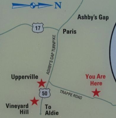
| On Trappe Road (County Route 619), on the right when traveling south. |
| On John Mosby Highway (U.S. 50) at Hill Road / Trappe Road (County Route 619), on the right when traveling east on John Mosby Highway. |
| On John S. Mosby Highway (U.S. 50), on the right when traveling east. |
| On Vint Hill Road (Virginia Route 215) at Lee Highway (U.S. 15/29), on the right when traveling north on Vint Hill Road. |
| On North Calhoun Street, on the right when traveling north. |
| On Colonial Road at U.S. 29 on Colonial Road. Reported missing. |
| On Main Street (Business U.S. 15) at Courthouse Square, on the right when traveling east on Main Street. |
| On Waterloo Street (Business U.S. 211) at Ashby Street, on the left when traveling west on Waterloo Street. Reported permanently removed. |
| On West Lee Street at South Chestnut Street, on the left when traveling west on West Lee Street. Reported permanently removed. |
| On South Chestnut Street at West Lee Street, on the left when traveling south on South Chestnut Street. |
| On South Main Street at South Street, on the left when traveling south on South Main Street. |
| On South Main Street at South Street, on the left when traveling south on South Main Street. |
| On South Main Street at South Street, on the left when traveling south on South Main Street. |
| On Old Hollow Road, on the right when traveling west. |
| On Indian Hollow Road (Virginia Route 679) at North Frederick Pike (U.S. 522), on the right when traveling west on Indian Hollow Road. |
| On North Buckton Road (Virginia Route 842) at Larrick Lane, on the right when traveling west on North Buckton Road. |
| On Main Street (U.S. 11) south of Fairfax Street (Virginia Route 277), on the right when traveling north. |
| On Valley Pike (U.S. 11), on the right when traveling north. |
| On Jordan Springs Road (County Route 664), on the right when traveling east. |
| On Milburn Road (County Route 662) at Old Charlestown Road (County Route 761), on the right when traveling south on Milburn Road. |
| On Milburn Road (County Route 662) at Old Charlestown Road (County Route 761), on the right when traveling south on Milburn Road. Reported missing. |
| On Martinsburg Pike (U.S. 11), on the right when traveling south. Reported damaged. |
| Near Fortress Drive, 0.1 miles north of North Frederick Pike (U.S. 522), on the right when traveling north. |
| Near Fortress Drive, 0.1 miles north of North Frederick Pike (U.S. 522), on the right when traveling north. |
| On Martinsburg Pike (U.S. 11) at Brooke Road (Route 1322), on the right when traveling north on Martinsburg Pike. |
| On Martinsburg Pike (U.S. 11), on the right when traveling south. Reported damaged. |
| On Jones Road (County Route 621), on the right when traveling north. Reported permanently removed. |
| Near Jones Road (Virginia Route 621) 0.1 miles south of Cedar Creek Grade (Virginia Route 622), on the right when traveling north. |
| On Martinsburg Pike (U.S. 11), on the right when traveling south. Reported damaged. |
| Near Fortress Drive, 0.1 miles north of North Frederick Pike (U.S. 522), on the right when traveling north. |
| Near Fortress Drive, 0.1 miles north of North Frederick Pike (U.S. 522), on the right when traveling north. |
| On Fortress Drive, on the right when traveling north. Reported missing. |
| Near Fortress Drive, 0.1 miles north of North Frederick Pike (U.S. 522), on the right when traveling north. |
| On Redbud Road (County Route 661), on the right when traveling east. Reported permanently removed. |
| Near Redbud Road (Virginia Route 661) 0.9 miles east of Martinsburg Pike (U.S. 11), on the right when traveling east. Reported permanently removed. |
| Near Redbud Road (Virginia Route 661) 0.9 miles east of Martinsburg Pike (U.S. 11), on the right when traveling east. Reported permanently removed. |
| On Redbud Road (Virginia Route 661) 0.9 miles east of Martinsburg Pike (U.S. 11), on the left when traveling east. |
| On Caroline Street (State Highway 1) at Charlotte Street, on the left when traveling north on Caroline Street. |
| On Caroline Street (State Highway 1) at Charlotte Street, on the left when traveling north on Caroline Street. |
| On Sophia Street south of Frederick Street. |
| On Sophia Street south of Frederick Street. |
| On Sophia Street south of Frederick Street. |
| Near Main Street (Business U.S. 17), on the right when traveling north. |
| Near Vernon Street near Riverview Street. |
| On Smoky Ordinary Road at Purdy Road, on the left when traveling east on Smoky Ordinary Road. |
| On North Main Street (U.S. 501) at Houston Street (Virginia Route T-1110), on the right when traveling north on North Main Street. Reported damaged. |
| On Kings Way, 0.1 miles south of Lincoln Street, on the right when traveling south. |
| On Settlers Landing Road (U.S. 60) at South King Street, on the right when traveling west on Settlers Landing Road. Reported permanently removed. |
| On West Queens Way at High Court Lane, on the right when traveling east on West Queens Way. Reported permanently removed. |
| On West Queens Way just west of West Queens Court, on the left when traveling west. |
| On Bernard Road, on the right when traveling south. Reported damaged. |
| On Bernard Road just south of Mathews Lane, on the right when traveling south. |
| Near Big Bethel Road, 0.1 miles north of Semple Farm Road, on the left when traveling north. |
| Near Big Bethel Road (Virginia Route 600) 0.1 miles north of Semple Farm Road, on the left when traveling north. |
| Near Big Bethel Road (Virginia Route 600) 0.1 miles north of Semple Farm Road, on the left when traveling north. |
| Near Big Bethel Road (Virginia Route 600) 0.1 miles north of Semple Farm Road, on the left when traveling north. |
| Near Big Bethel Road (Virginia Route 600) 0.1 miles Semple Farm Road, on the left when traveling north. |
| Near Big Bethel Road (Virginia Route 600) 0.1 miles north of Semple Farm Road, on the left when traveling north. |
| Near Big Bethel Road (Virginia Route 600) 0.1 miles north of Semple Farm Road, on the left when traveling north. |
| Near Big Bethel Road (Virginia Route 600) 0.1 miles north of Semple Farm Road, on the left when traveling north. |
| Near Big Bethel Road (Virginia Route 600) 0.1 miles north of Semple Farm Road, on the left when traveling north. |
| Near Big Bethel Road (Virginia Route 600) 0.1 miles north of Semple Farm Road, on the left when traveling north. |
| On Water Street (Virginia Route 143), on the left when traveling south. |
| Near Emancipation Drive, 0.1 miles east of East Tyler Street. Reported permanently removed. |
| On Emancipation Drive just south of William R. Harvey Way, on the right when traveling south. |
| Near Settlers Landing Road (U.S. 60) at South King Street. |
| On Chesapeake Avenue (Virginia Route 167) at East Avenue, on the left when traveling west on Chesapeake Avenue. |
| On North Center Street north of England Street (Virginia Route 54), on the right when traveling south. |
| On Virginia Route 30, on the left when traveling east. Reported missing. |
| On Verdon Road (Virginia Route 684) 0.2 miles west of New Market Mill Road (Virginia Route 685), on the right when traveling west. |
| On Hanover Courthouse Road (U.S. 301) 0.2 miles north of Depot Road, on the left when traveling north. Reported permanently removed. |
| Near Hanover Courthouse Road (U.S. 301) at Library Drive, on the right when traveling south. |
| On Rural Point Road (County Route 643) at Heatherwood Drive, on the right when traveling north on Rural Point Road. |
| On Immanuel Trail at Old Church Road (Virginia Route 606), on the left when traveling south on Immanuel Trail. |
| On Studley Road (County Route 606) at Buckeye Road, on the left when traveling east on Studley Road. |
| On Rural Point Road (County Route 643) 0.1 miles south of Studley Road (County Route 606), on the right when traveling south. |
| On Studley Road (County Route 606) 0.1 miles east of Williamsville Road (County Route 615), on the left when traveling east. |
| Near Turner Ashby Lane, 0.2 miles north of Neff Avenue. |
| On South Main Street (U.S. 11) 0.1 miles north of Campbell Street, on the left when traveling north. |
| On Main Street (Business U.S. 11), on the left when traveling north. |
| On South Main Street (Business U.S. 11) south of East Bruce Street, on the right when traveling north. |
| On South Main Street (U.S. 11) 0.1 miles north of East Bruce Street, on the right when traveling north. |
| On South Main Street (Business U.S. 11), on the left when traveling north. Reported permanently removed. |
| On South Main Street (Business U.S. 11) at Franklin Street, on the left when traveling north on South Main Street. |
| Near East Market Street (U.S. 33) at Reservoir Street. |
| On Meadow Farm Drive, 0.5 miles north of Mountain Road, on the left when traveling north. |
| On Telegraph Road south of Towering Road, on the right when traveling south. |
| Near Longbridge Road, 0.4 miles south of Darbytown Road, on the left when traveling south. |
| On Richmond Airport Connector Road south of Seven Hills Boulevard, on the right when traveling south. |
| On New Market Road (Virginia Route 5) east of Laurel Hill Lane, on the right when traveling east. |
| On Richmond Henrico Turnpike, 0.7 miles east of Azalea Avenue. |
| On Darbytown Road (County Route 600), on the right when traveling east. |
| Near Nine Mile Road (State Highway 33) 0.1 miles west of Dabbs House Road, on the left when traveling east. Reported permanently removed. |
| Near Nine Mile Road (Virginia Route 33) at Evergreen Road, on the right when traveling west. |
| Near Nine Mile Road (Virginia Route 33) at Evergreen Road, on the right when traveling west. Reported missing. |
| On Deep Bottom Road, on the left. Reported permanently removed. |
| On Deep Bottom Road east of James Street, on the left. |
| On Richmond Airport Connector Road south of Seven Hills Boulevard, on the right when traveling south. |
| Near Brook Road (U.S. 1) 0.1 miles west of Brook Road, on the right when traveling south. Reported missing. |
| Near Brook Road (U.S. 1) 0.1 miles north of Brook Run Drive, on the left when traveling north. |
776 entries matched your criteria. Entries 201 through 300 are listed above.
⊲ Previous 100 —
Next 100 ⊳