368 entries match your criteria. The first 100 are listed. Next 100 ⊳
Oregon Trail Historical Markers
The Oregon Trail was the only practical corridor to reach the entire western United States from 1836 – 1869. Over half a million people went west during the Oregon Trail’s “glory years.”
"… we found a gap in the bluffs of Boise valley, where we turned down and succeeded in reaching the valley in safety, although our road was very steep and stony, and long…" -- P.V. Crawford, 1851
In 1863 and 1864, overland packers hauling supplies from Salt Lake City to Idaho City crossed here and took a direct route northward to More's Creek.
They cut a steep grade from the Oregon Trail down to Beaver Dick's Ferry, which served a . . . — — Map (db m22641) HM
From the high ridge above the Boise River 5 miles southwest of here, westward-bound travelers got their first view of the Boise Valley. In 1811, Wilson Price Hunt and the Overland Astorians' party were the first white sojourners to enjoy the scene. . . . — — Map (db m119002) HM
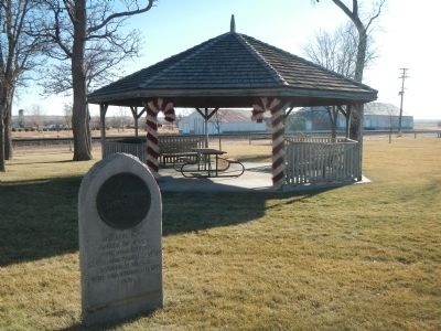
In 1906, at the age of seventy-five, Ezra Meeker began a journey east from his home in Puyallup, Washington, to retrace the route of the Oregon Trail over which he originally traveled in 1852 with his wife and young son. He traveled the route with . . . — — Map (db m118993) HM
Westward-bound emigrants entered Idaho after crossing Thomas Fork Valley. They soon encountered the climb and descent of Big Hill, witnessed nature's curiosities at Soda Springs, and discovered willing traders at Fort Hall.
In 1843 wagons . . . — — Map (db m118992) HM
After the transcontinental railroad was completed on May 10, 1869, new stage and freight routes were established to connect southwester Idaho with newly established railheads.
Kelton, Utah, soon became the main shipping point for Boise, when John . . . — — Map (db m118996) HM
Along this historic trail, from 1841 to 1861, traveled the greatest land migration in history. Nearly half a million pioneers came to settle America's Northwest. One out of every eight would perish along the way. — — Map (db m125859) HM
Between 1843 and 1869 over 300,000 emigrants fulfilled Americas's Manifest Destiny by voluntarily relocating to Oregon and California. Their nearly 2,000 mile journey along game trails long used by the early Native Americans would become known as . . . — — Map (db m119239) HM
Indians, trappers, and emigrants who came this way before 1900 used a more direct route to get between Boise and Glenns Ferry. Their road still can be seen at Bonneville Point 5 miles from here. Following close to a line of hills bordering a . . . — — Map (db m22181) HM
Placed here by Ezra Meeker on May 9, 1906
Pioneer • Preservationist • Visionary
Ezra Meeker was largely responsible for locating and preserving the Old Oregon Trail. To commemorate the centennial of this monument, a time capsule of . . . — — Map (db m128544) HM
Wednesday September 15th "Today we traveled up a long hill some 4 miles. Road good, ascent very gradual. When we arrived at the top we got a grand view of the Boise River Valley. It is all filled or covered with dry grass and a few trees . . . — — Map (db m125787) HM
The Oregon Trail is still clearly visible coming off the rimrock across the river. Here the west bound emigrants after 1840 came gratefully down into this green valley.
The first cart passed here with Spalding and Whitman, pioneer missionaries, . . . — — Map (db m22639) HM
"When we first came in sight of Boise City and valley we were upon a hill seven miles distant." -- Julius Caesar Merrill, 1864
Creaking, groaning wheels, the dust so thick that the hunch-back oxen ahead looked more like tawny . . . — — Map (db m125861) HM
(Three Panels are found at this overlook:)
"The River Boise..."
"Descending some steep hills we came down on the river 'Boisee,' which deserved its appellation from the dense fringes of cottonwood and willow trees that . . . — — Map (db m125862) HM
Centuries ago the Bannock-Shoshone Indian tribes set aside these natural hot mineral springs as neutral ground for all tribes. Trapper Joseph Miller and party camped here in 1812. By 1863, it was a favorite stop for Oregon Trail travelers. Most . . . — — Map (db m140285) HM
Most early Bear Lake settlers came from Britain. One was the first woman convert to the LDS church in Europe.
Born in Preston, England, Aug. 24, 1806. Ann Elizabeth Walmsley Palmer was baptized July 30, 1837. An invalid, she was carried into the . . . — — Map (db m99318) HM
"... the greatest impediment on the whole route from the United States to Fort Hall." - Theodore Talbot, 1843
Near the Wyoming/Idaho border the pioneers face Big Hill, on of the most challenging obstacles of their journey. The dusty . . . — — Map (db m90854) HM
On their way west to Oregon and California, emigrant wagons often crossed high ridges in order to avoid gullies and canyons.
When he came here in 1843, Theodore Talbot noted that he "had to cross a very high hill, which is said to be the . . . — — Map (db m90807) HM
"the steepest and longest ascent we have made on the route..." - James Wilkins
Looking east across the fields is Big Hill, one of the most difficult obstacles along the 2,000-mile Oregon/California Trail. The trail crosses the Thomas . . . — — Map (db m90851) HM
Beginning in Independence, Missouri, the Oregon/California Trail passes through present-day Missouri, Kansas, Wyoming, and Idaho. it ends in Oregon, California or Utah - depending on the destination of the pioneers.
While the . . . — — Map (db m90876) HM
Westward-bound emigrants entered Idaho after crossing Thomas Fork Valley. They soon encountered the climb and descent of Big Hill, witnessed nature's curiosities at Soda Springs, and discovered willing traders at Fort Hall.
In 1843 wagons first . . . — — Map (db m90852) HM
Coming west with Ezra Meeker in 1852, Thomas McAuley decided to build a road to let emigrants bypass Big Hill.
Worst of all Oregon Trail descents, Big Hill needed replacement. Eliza McAuley reported that her brother Tom "fished awhile, . . . — — Map (db m90808) HM
"One continual stream of honest looking open harted people going west" - James Cayman, mountain man, captured this sentiment in his diary as he watched pioneers heading west in 1846.
Between 1841 and 1869 nearly 300,000 farmers, . . . — — Map (db m90853) HM
In 1848, Pegleg Smith established a trading post on the Oregon Trail at Big Timber somewhere near here on the river.
Some travelers called it "Fort Smith", though it had only four log cabins and some Indian lodges. Packing a plow and tools . . . — — Map (db m90805) HM
On April 7, 1852, seventeen-year-old Eliza Ann McAuley, with her older brother Thomas and sister Margaret, left Mount Pleasant, Iowa, to travel overland to California. For a time they were accompanied by the "Eddyville Company," led by William Buck . . . — — Map (db m90850) HM
A bad ford gave trouble to wagon trains crossing this stream on the trail to California and Oregon in 1849.
In that year, gold-seeking 49'ers developed a shortcut that crossed here. Then emigrants built two bridges here in 1850. But an . . . — — Map (db m90804) HM
(Five panels in the kiosk deal with the history of Goodale's Cutoff and the surrounding area)
Idaho's Emigrant Trails
Westward-bound emigrants entered Idaho after crossing Thomas Fork Valley. They soon encountered the climb . . . — — Map (db m110138) HM
An old emigrant road headed west across Camas Prairie and then descended to the valley below on its way to rejoin the Oregon Trail 28 miles west of here.
This route, discovered by Donald Mackenzie's fur trade party in 1820, came into use for . . . — — Map (db m125602) HM
After reaching Boise River, emigrant wagons had to travel 30 miles to find a good crossing about 1/4 mile north of here.
They had to avoid a wide zone of shifting channels, so they descended Canyon Hill where the route is still visible. In . . . — — Map (db m22326) HM
Only 2 young boys survived the Indian attack on Alexander Ward's 20 member party, Oregon bound on August 20, 1854. Military retaliation for the slaughter so enraged the Indians that Hudson's Bay Co. posts Fort Boise and Fort Hall had to be . . . — — Map (db m22328) HM
An important Hudson's Bay Company fur trade post was established in 1834 four miles west of here on the bank of the Snake River. Fur trading declined, but this British post became famous for its hospitality to American travellers on the Oregon . . . — — Map (db m21992) HM
In the summer of 1849, the California Gold Rush was diverted this way in search of a more direct route to the mines.
Stampeding 49'ers would try anything to save miles and time in their rush for California's gold: the regular Oregon and . . . — — Map (db m106774) HM
This area, known as Ten Mile Sterrett and Ivins, was opened for homesteading in 1880. Emigrants from Utah and Iceland transformed sagebrush lands to productive livestock farms. They befriended the roaming Indians and Oregon Trail travelers. Jared . . . — — Map (db m140294) HM
After the arrival of the first settlers of Chesterfield in 1875, covered wagon trains continued to use the Old Oregon Traill of 1846 which passed this point. Tired discouraged and ill, travelers arrived here from early spring to late autumn. Local . . . — — Map (db m124580) HM
The Bidwell-Bartleson Party
In 1841, John Bidwell and John Bartleson became the first Americans emigrants to undertake a wagon crossing from Missouri to California.
Although Oregon was the primary destination of early westward-bound . . . — — Map (db m140278) HM
Geological processes created the complex landscape of southeastern Idaho and eventually determined the routes covered wagons would take along the Oregon Trail. In their journals, trail emigrants often wrote something about the two volcanic cinder . . . — — Map (db m140253) HM
For over two decades (1834-1856), fur trappers and Oregon Trail wagon trains passed by the doors of this adobe fort. Nathaniel Wyeth, an ambitious Bostonian, built the post in 1834 but soon sold his holdings to the Hudson's Bay Company, whose staff . . . — — Map (db m106849) HM
Towering 1200 feet above the waters of Bear River is Sheep Rock, a prominent landmark described in emigrant diaries and journals as they traveled west on the Oregon and California trails. Trapper and mountain men, in the early 1830s, indicate that a . . . — — Map (db m106737) HM
Native Americans traveled and camped in the Soda Springs area for centuries before emigrants traveled the Oregon Trail.
Sheep Rock (Soda Point) marked the junction of the main route of the Oregon-California Trail and the Hudspeth Cutoff and was . . . — — Map (db m106850) HM
Westward-bound emigrants entered Idaho after crossing Thomas Fork Valley. They soon encountered the climb and decent of Big Hill, witnessed nature's curiosities at Soda Springs, and discovered willing traders at Fort Hall.
In 1843 wagons first . . . — — Map (db m106845) HM
In 1840, John Bidwell began to assemble emigrants from Missouri to open a road to California; and a year later, he set out with a party of 69 Pacific Coast pioneers.
When they reached here, August 12, 1841, half of this group decided to go . . . — — Map (db m106729) HM
Lava eruptions west of Sheep Rock at least 140,000 years ago blocked the Bear River from draining into the Snake River system. Instead, the Bear was forced to drain into what was then Lakes Thatcher and Bonneville to the south. The Bear River's . . . — — Map (db m106847) HM
When they left the main trail leading to Fort Hall, emigrants heading to California thought that Hudspeth's Cutoff would save them considerable time and miles in the race to the gold fields. To their surprise, they were still in Idaho's Raft River . . . — — Map (db m106772) HM
This is an east-west travel corridor of the earliest emigrant trails that continued even after the arrival of railroads and highways. Early explorers, such as John Fremont, Jedediah Smith, Osborne Russell, and missionary Narcissi Whitman were among . . . — — Map (db m106846) HM
Oregon Trail Memorial
Erected 1931
Restored 1978
Caribou County 4H Builders Club
In honor of William Henry Harrison of Massachusetts who lost his life on the Oregon Trail about 1850.
Erected by his niece Mrs. Alura F. . . . — — Map (db m106732) HM
"...we rode as much as half mile in crossing and against the current too, which made it hard for the horses, the water being up to their sides. Husband had considerable difficultly in crossing the cart. Both cart and mules were turned upside . . . — — Map (db m125673) HM
Contrary to popular belief, the emigrant wagon was not the large heavy Conestoga that is represented by the Idaho Bicentennial Wagon. Instead, many people used wagons from their farms or purchased smaller, lighter wagons at the start of their . . . — — Map (db m125727) HM
A perilous ford at Three Island State Park was a formidable Oregon Trail barrier. Those who could not cross here faced a longer, more difficult southern route. No other ford between Missouri and Oregon troubled them so much. This was their largest . . . — — Map (db m31677) HM
Stretching from Independence, Missouri, to Oregon City, the two thousand mile Oregon Trail lured over 300,000 pioneers on a long six month journey. When pioneers entered present-day Idaho, many had traveled more than one thousand miles of hot, dusty . . . — — Map (db m125674) HM
Thursday July 24
"Traveled 13 miles struck the river 2 miles above the ford. Here we found a company ferrying in wagon beds we unloaded two our best wagon beds and commenced calking them got them finished and ferried their loads that . . . — — Map (db m125677) HM
Thursday August 14 "...We had a squally time ascending the bluffs, which are severaly hundred feet high. We passed from a hill to the side of a bluff, upon a high narrow ridge of just sufficient width upon the top for the wagon road, the . . . — — Map (db m125733) HM
Sunday July 27 "Traveled 15 miles 5 miles brought us to a marshy hollow (Hot Springs Creek) which wound to right of the direction were traveling. Traveled in this marsh 3 miles then drove out leaving this marsh to our right..." -- Susan . . . — — Map (db m125751) HM
Directly in front of you, the Oregon Trail descends the steep bluff to the Snake River. The trail lies parallel to and directly above the major road scar that is easily seen. On sunny days, the trail is visible to the keen eye.
While the . . . — — Map (db m125725) HM
Located on an old Indian and fur trade route, the Three Island Ford presented a difficult challenge to the emigrants. Those who dared attempted this crossing using the southern two islands and connecting sand bars to cross the river. Those who were . . . — — Map (db m125726) HM
To all pioneers who crossed over Three Island Crossing and helped to win the west. Erected 1931 by Troop One Boy Scouts of America Roslyn, New York Scoutmaster E.K. Pietsch Reproduced 1990 — — Map (db m31679) HM
Up toward Camas Prairie, a road goes by Castle Rock and other eroded granite outcrops that were landmarks on Goodale's Cutoff, an Oregon Trail route that came this way.
Emigrants generally had not seen large granite rock formations of this . . . — — Map (db m110143) HM
An old emigrant road headed west across Camas Prairie and then descended to the valley below on its way to rejoin the Oregon Trail 28 miles west of here.
This route, discovered by Donald Mackenzie's fur trade party in 1820, came into use for . . . — — Map (db m125603) HM
Saturday August 16 "...we passed a hot springs near the foot of the same range, the water of which was nearly at a boiling temperature, so that one could not hold is finger in it, and a dog careless stepping across it put one foot in and ran . . . — — Map (db m125752) HM
Friday September 10th "...Traveled along the foot of the mountain about 5 miles to another creek and stopped for the night. Plenty of dry bunchgrass. No timber, but willows and sage. Found eight graves here. Made fifteen miles." Parthenia . . . — — Map (db m125754) HM
August the 13th "...the road to day way level but very rocky A long chain of mountains on our right and we travel close to them to day..." -- Absolom B. Harden, 1847
After the transcontinental railroad was completed in 1869, . . . — — Map (db m125755) HM
August 4th "This day we traveled nineteen miles over tolerably rough road ... After watering, we traveled eight and a half miles, which brought us to a barrel creek (Canyon Creek). Here we found a small creek running through a barrel-shaped . . . — — Map (db m125756) HM
Monday October 9th "This evening yellowish granite appeared in needle form fragments and masses. Country mountainous, good grass, water in the creek on which we are camped partially dried up. We struck a large and much travelled Banak trail . . . — — Map (db m125785) HM
August 5th "This morning our road was very hilly for three miles. Here we found water and grass plenty, and brush for fire wood. Having had no water since we left Barrel creek we halted here for a rest. We halted here till 1 o'clock in the . . . — — Map (db m125786) HM
First Overland Emigrant Party
"Left the river on account of the hills which obstructed our way on it, ... Road uncommonly broken, did not reach the river, distance about 4 miles" -- John Bidwell, Saturday, August 14, 1841
"We traveled about . . . — — Map (db m105832) HM
Never in history had so many moved voluntarily over such a distance. Look at the wagon wheel ruts in front of you. During the Great Western Migration more than 400,000 people packed up their goods and dreams and headed out over wagon roads like . . . — — Map (db m139608) HM
The valley of the Snake, historic passage from the Midwest to the Northwest, has been a primary route for travel since the days of Indians and fur traders.
The Oregon Trail forded the river at Old Fort Boise, the Hudson's Bay Company 12 miles . . . — — Map (db m23195) HM
(There are five historical panels in this kiosk:)
Idaho's Emigrant Trail
Westward-bound emigrants entered Idaho after crossing Thomas Fork Valley. They soon encountered the climb and descent of Big Hill, witnessed nature's . . . — — Map (db m124029) HM
These reported incidents of Shoshone Indian attacks on emigrant wagon trains in this gap and surrounding area between 1851 and August 10, 1862, led to the naming of these rock outcrop as "Massacre Rocks."
The granite marker was dedicated by the . . . — — Map (db m124160) HM
In this defile on August 10, 1862 a band of Shoshone Indians ambushed an Immigrant Train bound for Oregon killing nine white men and wounding six. — — Map (db m124159) HM
Immediately west of here you will cross a small canyon that Oregon Trail emigrants regarded as their most dangerous exposure to Indians.
After 1854, they had good reason to be alarmed. Wagon traffic has ruined important traditional Indian . . . — — Map (db m124148) HM
After their meals were cooked and their livestock grazed, early pioneers took time to record their presence on this and other rocks in the area. The land around Register Rock was a common camping area along the Oregon and California trails. It has . . . — — Map (db m124166) HM
(There are five historical panels in this kiosk:)
Idaho's Emigrant Trails
Westward-bound emigrants entered Idaho after crossing Thomas Fork Valley. They soon encountered the climb and descent of Big Hill, witnessed . . . — — Map (db m124037) HM
A scow powered by oarsmen let Oregon Trail wagons cross Snake River here from 1852 to 1870. Then Overland Stage service from Boise to a rail terminal in Kelton, Utah was moved to this crossing, and M.E. Payne installed a large (14 by 60 foot) new . . . — — Map (db m31653) HM
In 1812, Joseph Miller found 100 lodges of Indians spearing thousands of salmon each afternoon at a cascade below here. Each summer they dried a year's supply. After 1842, they also traded salmon to Oregon Trail emigrants. John C. Fremont marveled . . . — — Map (db m31597) HM
An 1864 overland stage station at Rock Creek, 5 miles south and a mile west of here, offered a desert oasis for 40 years before irrigated farming transformed this area. James Bascom's 1865 store and Herman Stricker's 1900 mansion have been . . . — — Map (db m31521) HM
Guiding Oregon Trail emigrants and a party of prospectors who had discovered gold in Boise Basin, Tim Goodale opened a new miners' trail through here in August 1862.
A gold rush followed that fall, and John Brownlee operated a ferry here from . . . — — Map (db m23227) HM
Heavy freight wagons lumbering to and from New Mexico, and emigrant families and gold seekers heading west to Oregon and California all shared this route from Independence and Kansas City. The trails split here at Gardner Junction.
Preserving . . . — — Map (db m131353) HM
From the late 1820s to the 1870s, an estimated 300,000 fur traders, missionaries, settlers, and gold seekers followed these trails. In the 1840s and 1850s, emigrants from the eastern and central United States walked 2,000 miles from the Missouri . . . — — Map (db m131376) HM
The Indian Removal Act of 1830 required that many American Indian Tribes in the eastern part of the United States be moved to the Great Plains Region west of the Missouri River — lands identified as the “Permanent Indian Frontier.” . . . — — Map (db m131313) HM
"This morning we passed the road to Oregon that leaves, about eight miles from Round Grove, the Santa Fe Road, and turns to the right towards the Kansas. A way post had been put there, marked "Road to Oregon." —Dr. Frederick A. . . . — — Map (db m131352) HM
"We took the Oregon road, instead of that to Santa Fe and went twelve miles before we discovered our error. In returning two of our wagons broke down, by which we were detained two days until July 4th. We at last got fairly on the Santa Fe . . . — — Map (db m131312) HM
Travel along the Oregon and California trails increased in the 1840s with the cry of “Westward Ho.” When the 1848 discovery of gold was made at Sutter’s Mill in California, the desire to reach the gold fields ahead of others intensified . . . — — Map (db m131310) HM
Here US-56 lies directly on the route of the Oregon-California and Santa Fe trails. Nearby, the trails branched. On a rough sign pointing northwest were the words, "Road to Oregon." Another marker directed travelers southwest along the road to Santa . . . — — Map (db m21669) HM
The Lone Elm Campground
The land here at Lone Elm met the three requirements for a stopover for travelers on the trail...wood, water, and grass. Wood for campfires and wagon repairs, water for the support of people and animals, and grass for . . . — — Map (db m34342) HM
For over three decades starting in 1827, Elm Grove Campground, one mile east of near the bridge on Cedar Creek, was an important frontier camp site. Thousands of Santa Fe traders, Oregon and California emigrants, missionaries, mountain men, soldiers . . . — — Map (db m20093) HM
Lone Elm is one of the most historic and important frontier trail camp sites in America and was used as a campground and rendezvous point for all three of our nation's great western roads to the frontier.....the Santa Fe, Oregon, and California . . . — — Map (db m34334) HM
"Travelers came to look upon it as an old friend - they felt an attachment for the tree that had so often sheltered and shaded them from storm and sun..."
W.W.H. Davis (1853)
Lone Elm Park was purchased by the City of Olathe in 2000 to . . . — — Map (db m34339) HM
The Santa Fe Trail
The Santa Fe Trail began in 1821 when William Becknell led a small group of men on a trading expedition from frontier Missouri to colonial Santa Fe. Mexico had recently declared its independence from Spain and abolished . . . — — Map (db m34340) HM
The Travelers
For more than four decades, tens of thousands of travelers camped here. The Lone Elm campground was one or two nights out from the frontier "jumping off" points on the Missouri River. The great lone elm tree that gave this . . . — — Map (db m34355) HM
In 1857, Newton Ainsworth claimed this land and allowed the trail travelers to continue camping here. A decade later, the railroads began to make their way west and the great overland trails became a part of history. The need for camping at Lone . . . — — Map (db m34357) HM
The oxen and Conestoga wagon sculpture was originally commissioned in 1994 for use at the Kansas Visitors Center at 119th & Strang Line Road. When the Center closed in 2002 the sculpture was awarded to the City of Olathe. The sculpture has been . . . — — Map (db m34337) HM
[Inset]
"from 'Sappling Grove' where there is an excellent fountain spring & a very good place to camp.. The road runs a little round on the high ridge."
The Santa Fe Trail began in 1821 when William Becknell and a small . . . — — Map (db m100228) HM
Both the Santa Fe and Oregon Trails crossed here, northeast to southwest, beginning 1821. The trails took separate courses farther west. A route through Kansas Territory was opened north of here in the 1830's after the founding of Westport, Mo. Long . . . — — Map (db m20213) HM
368 entries matched your criteria. The first 100 are listed above. Next 100 ⊳