By Bill Coughlin, May 11, 2008
Marker on Hamburg Turnpike
GEOGRAPHIC SORT WITH USA FIRST Geographic Sort Title Sort Marker Number Sort Marker Number Sort N Marker Number Sort T Publication Order Sort Publication Order Sort A Erected Year Sort Most Viewed Sort Most Recent-Interest Sort Most Recently Changed Sort SEE FAQ #33 FOR DESCRIPTIONS
On Hamburg Turnpike (U.S. 202), on the right when traveling east.
On Totowa Road (County Route 644), on the left when traveling east.
On Entrance Road to Passaic County Golf Course, on the left when traveling north. Reported missing.
On Morristown Road (U.S. 202) 0.2 miles north of N Maple Avenue, on the left when traveling south.
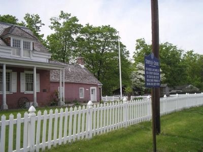
On Middlebrook Road, on the left when traveling east.
On Middlebrook Road, on the left when traveling east. Reported missing.
On Middlebrook Road at Cedarcrest Road, on the left when traveling north on Middlebrook Road. Reported missing.
On St Georges Avenue at West Grand Avenue, on the left when traveling south on St Georges Avenue.
On Stuyvesant Avenue (County Route 619), on the right when traveling south.
On Main Street (New Jersey Route 46), on the right when traveling east.
On Broadway at West 230th Street, on the right when traveling west on Broadway.
On Beekman Road (County Route 9) at Phillips Road, on the left when traveling east on Beekman Road.
On U.S. 82 at Lomala Road, on the right when traveling north on U.S. 82.
On Canal Street (New York State Route 5S), on the left when traveling west.
On Currytown Road, on the left when traveling south.
Paid Advertisement
On Cove Road at Cove Neck Road, on the right when traveling north on Cove Road.
On Canal Street at Bowery, on the right when traveling west on Canal Street.
On Pearl Street and Dover Street.
On Broadway at Battery Place, on the right when traveling south on Broadway.
On Cherry Street at Catherine Slip, on the right when traveling east on Cherry Street.
On Jumel Terrace at Sylvan Terrace, on the right when traveling north on Jumel Terrace.
On Jumel Terrace at Sylvan Terrace, on the right when traveling north on Jumel Terrace. Reported permanently removed.
On Jumel Terrace north of Sylvan Terrace, on the right when traveling north.
On Jumel Terrace north of Sylvan Terrace, on the right when traveling north.
On Liberty Street at Washington Street, on the left when traveling south on Liberty Street.
Near Lafayette Street at Edward Street, on the left when traveling east.
On Washington Avenue at Lafayette Avenue, on the left when traveling north on Washington Avenue.
Near Livingston Street at Oak Tree Road, on the right when traveling south.
On Oak Tree Road, on the left when traveling west.
On Livingston Street, on the right when traveling south.
Near Livingston Street, on the right when traveling south.
Paid Advertisement
Near Livingston Street at Oak Tree Road, on the right when traveling south.
On Middle Line Road at Charlton Road, on the left when traveling north on Middle Line Road.
On Washington Ave.. Reported missing.
On Village Lane south of Orchard Street, on the right when traveling south.
On New York State Thruway (Interstate 87), on the right when traveling north.
On New York State Thruway (Interstate 87 at milepost 66) near the Route 32 overpass, on the right when traveling south.
Near Oregon Road, on the left when traveling east.
On Ocean Highway (U.S. 17) at Ocean Isles Beach Road, on the right when traveling north on Ocean Highway.
On Concord Parkway N (Bypass U.S. 29) at McGill Avenue NW, on the right when traveling north on Concord Parkway N.
On Union Street South just north of Means Avenue Southeast, on the right when traveling south.
On North Carolina 86 (State Highway 86) at Collins Road, on the right when traveling north on North Carolina 86.
On Pollock Street at Eden Street, on the right when traveling west on Pollock Street.
On North Main Street (U.S. 64), on the right when traveling south.
On Salem Ave. at Old Salem Ave, and South Main St., on the right when traveling west on Salem Ave..
On South King Street south of Ferrell Lane, on the right when traveling south.
Paid Advertisement
On Dock Street at North 3rd Street (U.S. 74), on the right when traveling west on Dock Street.
On Lee Street near West 5th Street, on the right when traveling south.
On N Main Street at W Council Street, on the left when traveling north on N Main Street.
Near Railroad Avenue, 0.2 miles south of Mellott Street.
On Ohio Route 124 south of County Route 151, on the right when traveling south.
On Ohio River Scenic Byway (Ohio Route 7) 0.2 miles north of Morrison Lane, on the right when traveling north.
On Biglerville Road (Pennsylvania Route 34) at Goldenville Road, on the left when traveling north on Biglerville Road.
On Goldenville Road at Russell Tavern Road, on the right when traveling west on Goldenville Road.
On Shrivers Corner Road, on the right when traveling east.
Near Commonwealth Place at Liberty Avenue, on the right when traveling south.
On Pitt Street (Business U.S. 30) 0 miles west of Richard Street (Pennsylvania Route 220), on the right when traveling west.
On State Street (Business U.S. 202) at Orchard Street, on the left when traveling east on State Street.
On Mercer Street at Seneca Drive, on the right when traveling south on Mercer Street.
Near North French Street south of Mead Avenue, on the right when traveling south.
Paid Advertisement
On Hanover Street (Pennsylvania Route 34) at Liberty Avenue, on the right when traveling north on Hanover Street.
On National Pike (U.S. 40) west of the entrance to Fort Necessity Nat. Battlefield, on the right when traveling east.
On National Pike (U.S. 40) west of the Fort Necessity National Park entrance, on the left when traveling west.
On Jumonville Road (Pennsylvania Route 2021) 1.2 miles north of National Pike (U.S. 40). Reported unreadable.
Near Valley Forge Park Road (Pennsylvania Route 23) 0.3 miles east of Gulph Road, on the left when traveling east.
On Inner Line Drive at Valley Forge Road (Pennsylvania Highway 23), on the left when traveling east on Inner Line Drive.
On Halderman Road, 0.1 miles east of Skippack Pike (Pennsylvania Route 73), on the left when traveling east.
On Halderman Road at Skippack Pike (Pennsylvania Route 73), on the left when traveling east on Halderman Road.
On Germantown Avenue, on the left when traveling north.
On Main Street west of National Pike (U.S. 40), on the right when traveling west.
On Main Street just east of Claude W Fike Lane, on the right when traveling east.
On Broadway at Carlisle St. on Broadway.
On Carlisle Avenue (Pennsylvania Route 74) at Rockdale Avenue, on the right when traveling east on Carlisle Avenue.
On Church Street north of Tradd Street, on the left when traveling north.
On U.S. 17 at Long Point Road (South Carolina Highway 10-97), on the right when traveling south on U.S. 17.
Paid Advertisement
On Ocean Highway (U.S. 17) south of Hobcaw Road, on the right when traveling south.
On Front Street north of King Street, on the right when traveling north.
On Henry Flagg Loop near William Alston Loop.
On Kings Road, on the left when traveling north.
On Flat Rock Road at Hanging Rock Road, on the left when traveling south on Flat Rock Road.
On Charlotte Highway (U.S. 521) at Old Charlotte Road, on the left when traveling south on Charlotte Highway.
On Rock Hill Highway (State Highway 5) 0.1 miles west of Charlotte Highway (U.S. 521), on the right when traveling east.
On Augusta Road (U.S. 1), on the right when traveling north.
On Main Street at Washington Street, on the right when traveling north on Main Street.
On State Highway 23, 0.3 miles west of Main Street (State Highway 39), on the left when traveling west.
On Cameron Street near North St. Asaph Street, on the left when traveling west.
On U.S. 220, 2.7 miles south of County Route 606, on the right when traveling north.
On Virginia Route 39 at Dinwiddie Trail, on the right when traveling west on State Route 39.
On King Street, on the right when traveling north.
On White Post Road at Berry’s Ferry Road, in the median on White Post Road.
On South Durant Road (Virginia Route 154) at West Riverview Drive and West Parklin Drive, on the left when traveling south on South Durant Road.
Paid Advertisement
On Mount Eagle Drive, 0.5 miles west of Richmond Highway (U.S. 1) when traveling west.
Near George Washington Memorial Parkway (at milepost 1) at Stratford Lane, on the right when traveling east.
On Colvin Run Road (Virginia Route 743) east of Robindale Road, on the right when traveling west.
On Mount Vernon Memorial Highway (Virginia Route 235) at Mount Vernon Highway, on the right when traveling east on Mount Vernon Memorial Highway.
On Old Dumfries Road (County Route 667) at Taylor Road / Old Auburn Road (County Route 670), on the right when traveling north on Old Dumfries Road. Reported missing.
228 entries matched your criteria. Entries 101 through 200 are listed above.
⊲ Previous 100 —
The final 28 ⊳