By Don Morfe, June 26, 2009
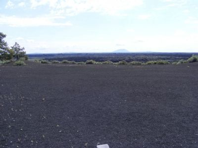
Big Southern Butte
| On U.S. 26/93 near Loop Road, on the right when traveling east. |
| On U.S. 20 west of Craters Loop Road, on the right when traveling east. |
| On State Highway 33 at N 1480W (County Highway 1480), on the right when traveling west on State Highway 33. |
| On 3150 North near Main Street (3350 West), on the right when traveling south. |
| On 3150 North near Main Street (3350 West), on the right when traveling south. |
| On U.S. 20 at milepost 148 near Washington/Wheat Ranch Road, on the left when traveling west. |
| Near Main Street near South 7th Avenue, on the right when traveling west. |
| Near Main Street near South 7th Avenue, on the right when traveling north. |
| On U.S. 30, 0 miles east of West Plymouth Road, on the right when traveling east. |
| On Main Street near Avenue, on the left when traveling east. |
| On Riverside Road, on the right when traveling north. |
| On Cleveland Boulevard at South 20th Avenue, on the right when traveling east on Cleveland Boulevard. Reported missing. |
| Near Marsing Murphy Road (State Highway 78) 0.2 miles east of Poplar Drive, on the right when traveling east. |
| Near Marsing Murphy Road (State Highway 78) 0.2 miles east of Poplar Drive, on the right when traveling east. |
| On Carrie Rex Avenue at 4th Street, on the left when traveling north on Carrie Rex Avenue. |
| On Lincoln Road, 0.2 miles east of Middleton Road, on the left when traveling east. |
| On Lincoln Road, 0.2 miles east of Middleton Road, on the left when traveling east. |
| On Lincoln Road, 0.2 miles east of Middleton Road, on the left when traveling east. |
| On Lincoln Road, 0.2 miles east of Middleton Road, on the left when traveling east. |
| On Lincoln Road, 0.2 miles Middleton Road, on the left when traveling east. |
| On 16th Avenue at Garrity Boulevard, on the right when traveling south on 16th Avenue. |
| On 5th Street North at 11th Avenue North (Business U.S. 84) on 5th Street North. |
| On U.S. 20/26 just east of Notus Road, on the left when traveling west. |
| On East Grove Road (U.S. 26) at Parma Road, on the left when traveling east on East Grove Road. |
| On Parma Road, 0 miles Parma Road, on the left when traveling west. |
| On Parma Road, 0 miles west of Parma Rd., on the left when traveling north. |
| On East Grove Road at Parma Road, on the left when traveling east on East Grove Road. |
| On Main Street at 1st Street South, on the right when traveling north on Main Street. |
| On U.S. 30 at milepost 378.8 near Lund Road, on the right when traveling west. |
| On Chesterfield Road at 24 Mile Road on Chesterfield Road. |
| On U.S. 30 at milepost 376.2 near Lundgren Canyon Road, on the left when traveling west. |
| On Rigby Road near Invins Road, on the right when traveling north. |
| On Chesterfield Road near 24 Mile Road. |
| Near Chesterfield Road near 24 Mile Road, on the left when traveling north. |
| On State Highway 34 at State Line Road, on the right when traveling west on State Highway 34. |
| On Turner Road at River Road, on the left when traveling west on Turner Road. |
| On State Highway 34 near U.S. 30, on the right when traveling south. |
| On Last Chance Lane, 1.3 miles west of State Highway 34, on the right when traveling west. |
| On Main Street (State Highway 34) near 2nd Street North, on the left when traveling south. |
| On State Highway 34 near U.S. 30, on the right when traveling south. |
| On State Highway 34, on the right when traveling west. |
| Near East 1st Street South near South Main Street. |
| On Main Street (U.S. 30). |
| On South 3rd Street West near West 3rd Street South, on the right when traveling south. |
| On Soda Point Power Plant Road near Reservoir Road, on the right when traveling south. |
| On Main Street (U.S. 30), on the right when traveling east. |
| On U.S. 30 near South 3rd Street West, on the left when traveling west. |
| On East 1st Street South near South Main Street, on the right when traveling west. |
| On State Highway 34 near Blackfoot River Road, on the right when traveling west. |
| On South 3rd Street West near West 3rd Street South. |
| On East 2nd Street South (U.S. 30) near South Main Street, on the right when traveling west. |
| On East 2nd Street South (U.S. 30) near South Main Street, on the right when traveling west. |
| On Main Street near East 2nd South (U.S. 30), on the left when traveling south. |
| On West Center Street near South 1st Street West, on the left when traveling west. |
| On South 3rd Street West near West 3rd Street South, on the right when traveling south. |
| On Soda Point Power Plant Road near Reservoir Road, on the right when traveling south. |
| On South Main Street at East 2nd South, on the left when traveling south on South Main Street. |
| Near East 1st Street South near South Main Street. |
| Near East 1st Street South near South Main Street. |
| Near East 1st Street South near South Main Street. |
| Near East 1st Street South near South Main Street. |
| On Soda Point Power Plant Road near Reservoir Road, on the right when traveling south. |
| On East 2nd Street South near South Main Street, on the right when traveling west. |
| On Soda Point Power Plant Road near Reservoir Road, on the right when traveling south. |
| On Soda Point Power Plant Road near Reservoir Road, on the right when traveling south. |
| On Soda Point Power Plant Road near Reservoir Road, on the right when traveling south. |
| On Soda Point Power Plant Road near Reservoir Road, on the right when traveling south. |
| On South 3rd Street West near West 3rd Street South, on the right when traveling south. |
| On East 2nd Street South (U.S. 30) near South Main Street, on the right when traveling west. |
| Near West Center Street at South 1st Street West. |
| Near South 1st Street West near West Center Street. |
| Near Pioneer Drive near railroad tracks, on the left when traveling east. |
| Near U.S. 30 near Valley View Drive, on the left when traveling west. |
| On Soda Point Power Plant Road near Reservoir Road, on the right when traveling south. |
| On U.S. 30 near South 3rd Street West, on the left when traveling west. |
| On South Main Street near West Center Street, on the left when traveling south. |
| Near East 1st Street South near South Main Street. |
| On Soda Point Power Plant Road near Reservoir Road, on the right when traveling south. |
| On Soda Point Power Plant Road near Reservoir Road, on the right when traveling south. |
| Near South 1st Street West near West Center Street. |
| On Soda Point Power Plant Road near Reservoir Road, on the right when traveling south. |
| On Wayan Loop Road (State Highway 34) near Wayan Loop Road, on the right when traveling east. |
| On Wayan Loop Road (State Highway 34) near Call Lane, on the right when traveling west. |
| On Wayan Loop Road (State Highway 34) near Wayan Loop Road, on the right when traveling west. |
| On State Highway 34 near Tincup Road, on the left when traveling west. |
| On State Highway 77 at East Miller Hall Court, on the left when traveling north on State Highway 77. |
| On Main Street (State Highway 77 at milepost 18) near South Street, on the right when traveling north. |
| On State Highway 77 at milepost 18,, 0.2 miles south of North St., on the right when traveling north. |
| On City of Rocks Road (Road 3075 S) near Twin Sisters Road (Highway 3400 S), on the right when traveling west. |
| On West 3700 South near Junction Valley Road, on the left when traveling west. |
| On City of Rocks Road (Road 3075 S) at Elba-Almo Road, on the left when traveling west on City of Rocks Road. |
| On Twin Sister Road (Road 3400 S) near City of Rocks Road (Road 3075 S), on the left when traveling west. |
| On City of Rocks Road (Road 3075 S) near Twin Sisters Road (Road 3400 S), on the right when traveling south. |
| On Twin Sister Road (Road 3400 S) near Birch Creek Road, on the left when traveling west. |
| On Elba-Almo Road near 3000 South, on the left when traveling south. |
1101 entries matched your criteria. Entries 301 through 400 are listed above.
⊲ Previous 100 —
Next 100 ⊳