(This marker consists of three panels:)
The Payette River is a major tributary of the Snake River and drains about 3,200 square miles, an area about the size of Delaware and Rhode Island. Annual rainfall within the drainage ranges . . . — — Map (db m119311) HM
An immigrant from Denmark where he had studied forestry, he came to this part of Idaho in 1883 to mine, hunt and trap.
Before Idaho became a state in 1890, he built a winter cabin below Grandjean Peak on a site later occupied by Grandjean Ranger . . . — — Map (db m22638) HM
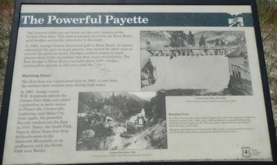
Gold was struck in Boise Basin (over the ridge to the east) in 1862, and the rush to these new mines came through here.
Traffic came by steamer up the Columbia to Umatilla, and thence overland. At first there were only pack and saddle trains, but . . . — — Map (db m23235) HM
In 1867 this building was built by James A. Pinney to house the post office and a book and specialty shop. In 1882 Mr. Pinney sold the building to S.C. Silsby for the sum of $1,000.00.
Around 1868 the northern most portion of the building was . . . — — Map (db m119062) HM
In July of 1871 construction began on this handsome brick building, which was completed by October of the same year.
The building was built by C.S. and E.A. Kingsley as a general store.
Several businesses have occupied this building . . . — — Map (db m109935) HM
Originally George Kettler’s Blacksmith Shop with ox and horseshoeing sheds on both sides.
In more recent years it was owned by Tom and Florence Adams.
From 1948 – 1975 they published the “Idaho Mountaineer” newspaper and . . . — — Map (db m110260) HM
This building was originally George Kettler's Blacksmith shop, built in 1889 with ox and horse shoeing sheds on both sides. As the horse and buggy gave way to the automobile, it became an early garage. In 1947, it was acquired by Tom and Florence . . . — — Map (db m119110) HM
Named for George Grimes who, with Moses Splawn, led the party which on August 2, 1862 made the strike that started the Boise basin gold rush.
The party was searching for a rich basin described to Splawn a year earlier by an Indian. Farther up . . . — — Map (db m22600) HM
The Independent Order of Odd Fellows pioneer Lodge No. 1 was organized on February 16th 1864.
The building was completed by September 15, 1875 at a cost of $1,974.00 and the grand opening was held on November 19th 1875.
It is the oldest . . . — — Map (db m119107) HM
This roaring metropolis was founding early in October, 1862, about ten weeks after gold was discovered in Boise basin.
By the next summer, this was the largest city in the Northwest, with 6,275 people -- 5,691 of them men! Families followed, and . . . — — Map (db m22601) HM
Built in May, 1864 by G.B. Walker at a cost of $10975. Jointly used by Idaho Territory and Boise Co. Original site was on Buena Vista Bar west of City. Building was moved in 1930 to make way for gold mining, and move twice more before being placed . . . — — Map (db m119105) HM
This is the home of Lodge No. 1 of Idaho's Ancient Free and Accepted Masons.
This Masonic Temple, built in 1865 is the oldest Masonic Temple in Idaho, and reputedly the Oldest Temple west of the Mississippi , still in use.
Although the . . . — — Map (db m119064) HM
Dispensation from Oregon in 1863.
Charter June 22, 1864.
This building erected in Sept. 1865 after the original building at another location was destroyed by fire in May, 1865.
The Grand Lodge of Idaho A.F. & A.M. was formed in this . . . — — Map (db m119104) HM
In 1865 John Clarsey started the brick building that was to house the John Clarsey's saloon.
In 1867 Mr. Clarsey added a new club room to the south side of the saloon.
On the north side of the building was the Vantine & Co. General Store. The . . . — — Map (db m119060) HM
The first Odd Fellows Lodge in the state of Idaho instituted by men of faith that never wavered. Through good times and bad, the members found solutions. The took great pride in belonging to this Lodge which is truly the "Shrine of Odd Fellowship" . . . — — Map (db m119108) HM
Picturesquely set on East Hill above the City center, this simple two story frame building is actually the second Saint Josephs Church. The original church dedicated on November 15, 1863, burned to the ground in Idaho City's second fire on May 17, . . . — — Map (db m119109) HM
This building was constructed in 1865 by Elias Brown. It originally housed a newspaper office, restaurant and grocery store. It was one of several brick buildings known as "fireproofs" that were constructed after a disastrous fire swept through . . . — — Map (db m119061) HM
In September of 1863 the pioneer printers Joseph & Thomas Butler founded the newspaper called the “Boise News.”
It was later changed to the “Idaho World.”
The Idaho World boasts the title of Idaho’s oldest newspaper.
. . . — — Map (db m109942) HM
The Old Toll Road to Idaho City crossed the ridge from Boise through the lowest point you can see in the skyline across the valley.
Climbing the More's creek canyon wall, it crossed this highway about here and swung north. The road was built and . . . — — Map (db m22599) HM
"It's never too late - nor are the odds ever to great - to try. In that spirit the West was won, and in that spirit I now declare my candidacy for President of the United States."
U.S, Senator
Frank Church
March 18, 1976
At . . . — — Map (db m119034) HM
In Memory Of
The boys who gave their lives in World War II from Boise County, Idaho
Stanley B. Banks • George Berry • Harry E. Brechenridge • Henry Luther Beckman • William S. Lawson • John Myers • Edgar Rae • Commodore Perry Ritter • . . . — — Map (db m119059) WM
At 4:00pm on July 29, the Lowman Fire exploded, consuming five square miles of forest.
In two hours it grew into a fire storm that destroyed parts of the dispersed Lowman community.
Saving lives was the first priority of fire fighters who . . . — — Map (db m110747) HM
(Three panels make up this marker:)
In the 1930s, Gallagher CCC widened and surfaced this road, built Scott Mountain Road, developed Hot Springs and Pine Flat Campgrounds, erected fences to control livestock grazing, fought fires, and . . . — — Map (db m119235) HM
A talented artist, Emma Edwards went to work in 1890 to to design Idaho's state seal when she was only 18 years old.
Although her father had moved to California after serving as governor of Missouri (1844 to 1848), Emma preferred to spend much of . . . — — Map (db m22637) HM
(Three panels make up this marker:) In the summer of 1989, the Lowman Fire burned the area north and east of here. The fire consumed 72 square miles of forest, and area larger than the Boise metropolitan area. In addition, 26 structures in . . . — — Map (db m119233) HM
Imagine, the battle against this immense fire was launched from this small Ranger Station!
More than 2,300 people came from all over the country to work on the fire lines.
Many of them lived in “fire camps” scattered around the . . . — — Map (db m110749) HM
In 1907, Nathaniel W. Lowman settled here, and four years later, when he started a post office in his large log house, this community was named for him.
Only a few scattered settlers lived here then. Lowman got all its supplies once a year from a . . . — — Map (db m22616) HM
The Boise Basin Mercantile was built in the 1860's and was among the first stores in Placerville. The store holds the distinction of belonging to the first chain stores founded in Idaho. The owners operated similar businesses in Idaho City until the . . . — — Map (db m119031) HM
On June 4, 1865 near the tollgate on the road from Placerville to Centerville, George Wilson was murdered, robbed of his gold dust and his body hidden in a prospect hole full of water. Two musicians, banjo player L. Moulton and fiddler Fred Cursons . . . — — Map (db m119032) HM
Originally constructed as the Magnolia Saloon in the 1860's, the building was partially damaged by a fire that destroyed the community's businesses in August 1899. Located on the town square, the saloon was rebuilt in 1900 allowing it to continue . . . — — Map (db m119030) HM
At Mamaloose Point, two miles
South, Kullyspell house,
first trading post in Idaho,
was built September, 1809 by
David Thompson
and
Finnan Macdonald — — Map (db m112928) HM
Glaciers advanced and retreated a dozen times or more
Damming Glacial Lake Missoula
Bursting with gargantuan force
Flooding areas 400 miles away
Shaping today's landscape in Idaho, Washington and Oregon
Glacial ice above . . . — — Map (db m73493) HM
Force of energy unleashed was hundreds of times the explosive energy of Mt. Saint Helens
Flood events occurred more than a dozen times before the last torrential cataclysm of 12-15,000 years ago
Glacial Lake Missoula and the Channeled . . . — — Map (db m73495) HM
Henrietta
Tugboat for Hope Lumber
Original Thornton School
Spring Creek ca 1909
1894 Flood Changed Landscape
Destroyed buildings along the tracks
Floodwaters at level of present highway
. . . — — Map (db m73480) HM
Idaho’s fur trade began in the fall of 1809 when David Thompson built a trading post 2½ miles southwest of here. Kullyspell House (Thompson spelled “Kalispell” that way) was the earliest fur trade post in the American Pacific . . . — — Map (db m112927) HM
When the last of the continental ice sheets blocked this valley, a great lake extended over 200 miles into Montana. Ice about as high as the mountain ridges held back water as deep as 800 to 1000 feet at Missoula, ten to twenty thousand years . . . — — Map (db m73490) HM
...the falls
As you look down at the Pend Oreille (Pond O'Ray) River and Albeni Falls Dam (Albany) you may be looking for the falls. In 1887 a 26 year-old French Canadian farmer living in Blanchard, Idaho, also wondered where the falls . . . — — Map (db m109902) HM
Harnessing the Flow
During the year, the Corps of Engineers regulates the flow of water through the dam.
Water is released from Lake Pend Oreille to maintain seasonal lake elevations and to adjust for rain and snowmelt.
Water at . . . — — Map (db m109906) HM
Canadian explorer David Thompson noted a point of sand in his diary in 1809 which he believed to be near where the city of Sandpoint is today.
Settlement began in Sandpoint in the 1880s, but it was the panhandle's timber wealth that brought . . . — — Map (db m122665) HM
This village, first called South Iona, was settled by Latter-day Saints. A branch of the Church was organized Nov. 26, 1889 with Arthur M. Rawson as presiding elder. He later became bishop. On Feb. 12, 1893, the ward name was changed to Ammon, . . . — — Map (db m140511) HM
Six men came to this area from Hooper, Utah, to homestead in the early spring of 1885: John, Edward and William Priest, Smith Johnson, and Edwin and Abiah Wadsworth Jr. They each built a log house on their claim before returning to Utah for their . . . — — Map (db m231554) HM
Honoring builders of bridges and trails and pioneers who passed this way in the development of the West.
The first wagon bridge over Snake River was erected here by James M. Taylor in 1865 replacing the ferry established on the . . . — — Map (db m152316) HM
On June 20, 1863, Bill Hickman started a ferry 9 miles up Snake River for thousands of gold hunters headed for mines that now are in Montana.
Named for an eagle that had a nest on a rock there, his ferry flourished until James Madison . . . — — Map (db m70584) HM
Marking the site of the first Latter-Day Saints meeting house, built in 1885.
This was the first building erected in this community for religious purposes. The building was 16 X 28 feet costing $450.00, money for which was obtained by donation.
. . . — — Map (db m109814) HM
Early day big game hunters who occupied lava caves around here more than 12,000 years ago, had a diet that included elephants, camels and giant bison.
When a gradual change to a warmer, drier climate made local grasslands into more . . . — — Map (db m174239) HM
The Idaho Falls Temple, visible across the Snake River, was the first temple constructed by The Church of Jesus Christ of Latter-day Saints in Idaho.
Construction began in 1939 and was completed in 1945.
The temple’s soaring tower draws the eye . . . — — Map (db m110540) HM
A special tribute to Joseph Allen Taylor and his son Chet, who were the first to develop the potato cellar in 1909. At this time the Russet Burbank had been introduced to the Taylors. They planted the first 20 ares just to the west. The . . . — — Map (db m140510) HM
Keefer’s Island occupies 1.85 acres and is located approximately ¼ mile south (downstream) from a cut in the Snake River known as John’s Hole.
Keefer’s Island was named for Fred. W. Keefer, a member of a prominent family in the early days of Eagle . . . — — Map (db m110484) HM
The earliest known human occupation of the Idaho Falls area reaches back about 1,200 years, according to archaeological evidence.
The bones of mammoths, ground sloths, camels, and other extinct mammals, discovered in association with Native . . . — — Map (db m110497) HM
After German Field Marshall Erwin Rommel’s North African Army surrendered on May 13, 1943, the allies had approximately 275,000 prisoners-of-war in their possession.
During 1945, 15,000 of the prisoners lived and worked in Idaho.
Rupert, Idaho . . . — — Map (db m110477) HM
On December 10, 1864 a franchise was granted to Edward M. Morgan, James M. (Matt) Taylor, and William F. Bartlett to operate a ferry one and one-half miles below Cedar Island and build a bridge over Snake River at Black Canyon. Mr. Taylor selected . . . — — Map (db m70571) HM
Idaho’s earliest toll bridge spanned Snake River at this rocky site in 1865, replacing Eagle Rock Ferry, 9 miles upstream.
James Madison Taylor (a relative of Presidents Madison and Taylor and a founder of Denver, Colorado) settled here in . . . — — Map (db m70583) HM
The idea of the hospital was conceived by Heber C. Austin with construction commencing in 1919, though the completion of the building was delayed because of a depressed economy.
On 22 October 1923, the hospital was dedicated by President Heber J. . . . — — Map (db m109826) HM
The fertile soil and abundance of water in this
valley lured pioneer settlers. With small slip
scrapers, hand plows, picks and shovels, they
cleared sagebrush, built log homes, made canals,
ditches and dams to put water on the land. One of . . . — — Map (db m239843) HM
which means "The Beautiful" was named by apostle W. Taylor in honor of a town in Palestine. It was originally known as Sand Creek and embraces a tract of country lying east of Eagle Rock (now Idaho Falls). The first settlement was made in 1883 by . . . — — Map (db m140538) HM
The Willow Creek pioneers established farms in this area in 1874, a school and irrigation canal in 1879, and early branch of the Latter-day Saints church in 1885
This portion of the East Willow Creek country became Shelton Ward on Aug. 14, 1892. . . . — — Map (db m140539) HM
In 1888 the first settlers of the Coltman Ward cleared the sage brush, dug canals and ditches, and built humble homes. At first it was a part of what was called Poverty Flat, later named Grant Ward. In 1896 Grant was divided and this, the south . . . — — Map (db m140544) HM
The Lower Kootenai people, on their seasonal migrations, were the first to travel through this area. They walked time-worn forest trails and paddled their sturgeon-nosed canoes on the Kootenai River and through the valley marshlands.
In 1808 . . . — — Map (db m122713) HM
Gold miners rushing to Wild Horse in British Columbia in 1863 were paddled across this river by Indians; in 1864 E.L. Bonner established a proper ferry here.
This ferry and its trading store served the Wild Horse packtrains for many years. . . . — — Map (db m122203) HM
Bonners Ferry riverfront today is quiet compared to the bustling center of activity it was during the 1860s gold rush. Picture prospectors and pack trains, traders and supples, all gathered here waiting to be ferried across the river to continue . . . — — Map (db m122656) HM
Coming from Canada, the famous map maker and trader for the North West Company explored this area and river in 1808.
On May 8 somewhere near here, Thompson's famished party, all sick from eating a "much tainted" antelope, met ten lodges of . . . — — Map (db m122201) HM
Harnessing water for power
Electricity and fast-flowing rivers are inseparable in the Pacific Northwest. In the early 1900s, harnessing the power of water to supply Bonners Ferry's ever-increasing demand for electricity was challenging. . . . — — Map (db m122658) HM
Moving from the north down this valley, the edge of the continental ice sheet blocked rivers and formed glacial lakes.
Then as the ice gradually melted, a lake rose here behind the receding ice dam, and extended up Kootenai valley into . . . — — Map (db m122174) HM
James J. Hill realized his vision of a northernmost transcontinental railroad in 1892, after the 1889 discovery of the Marias pass in Montana. The gentle grade and wide valley of the 5,213 ft. pass through the Rocky Mountains contrasted with the . . . — — Map (db m122715) HM
The Kootenai Tribe of Idaho has lived in their aboriginal homeland of Idaho, Montana and British Columbia for thousands of years.
A unique culture, the Kootenais are known for their distinctive sturgeon-nose canoe and their linguistically . . . — — Map (db m122202) HM
The Kootenai Valley Railroad, a subsidiary of the Great Northern, connected the main line from a spur near Bonners Ferry to the southern end of Kootenay Lake in British Columbia. Completed in 1899, its purpose was to connect with the Canadian Kaslo . . . — — Map (db m122716) HM
In the early days, this area was forested with vast swaths of huge virgin timber. As timber became less available along waterways, logging spur lines and railroad sidings were constructed to access more distant timber. Many logging camps sprang up . . . — — Map (db m122720) HM
[front side] Constructed in 1964, the 1223 ft. long steel truss bridge spans the Moyie River Canyon at a height of 464 ft. It replaces the old bridge built in 1923 and 1¼ miles of narrow, winding highway. It is the second highest bridge in . . . — — Map (db m73505) HM
This Pelton Wheel provided the power to generate the first electricity from the foot of Myrtle Creek 6 miles west of town, for the Village of Bonners Ferry from 1906 – 1921. — — Map (db m109851) HM
A vast labor force was needed during construction of the railroads. Workers came from many ethnic groups, bringing a piece of "home" with them as they contributed to the growing culture of Boundary County.
Laborers hired for low wages, . . . — — Map (db m122718) HM
Railroads brought many changes to rural life, providing access to roadless areas. Depots were built in towns like Leonia, Meadow Creek, and Addie. Passenger cars carried people comfortably on business and pleasure trips, dramatically reducing travel . . . — — Map (db m122719) HM
Semaphores were signaling devices used along railroads to control the movement of trains. The position of the blades and colored lenses told the engineer whether he should continue at the present speed, slow down and proceed with caution or move to . . . — — Map (db m122721) HM
During the 1920s, the Bonners Ferry Water and Light Department made multiple improvements to the Moyie River and Myrtle Creek power plants, but relying on hydroelectric power alone has its drawbacks. Generating electricity depended on river . . . — — Map (db m122661) HM
In 1905 Inland Empire construction magnate, D.C. Corbin, set out to build a railway line from Spokane to the international border. His plan was import coal from British Columbia to markets in eastern Washington.
The Spokane International Railroad . . . — — Map (db m122717) HM
Thousands of eager miners came by here in an 1864-65 gold rush to Wild Horse, BC. Parts of their pack trail still can be seen.
An extension of North Idaho's earlier gold excitements, Wild Horse was served by a pack trains that hauled . . . — — Map (db m122176) HM
The shallow arc of Idaho’s Snake River Plain spans southern Idaho, gently rising from west to east. Current theories suggest that the plain marks the path of continental movement over a deep hotspot now lying beneath the Yellowstone Plateau. As the . . . — — Map (db m71602)
A Memorial To Those Whose
Lives Were Lost In Defense
Of Freedom, By Acts Of War
Or Terrorism; And A Tribute
To The Heroic Actions Of All
Patriotic Americans — — Map (db m103591) WM
Walking off trails may be destroying these spatter cones which are some of the rarest volcanic features on the face of the earth.
Photographs taken at different times demonstrate that unrestricted visitor use left these fragile volcanic cones . . . — — Map (db m80429) HM
An important page in atomic history was written here on July 17, 1955, when the lights of Arco were successfully powered from atomic energy. Chosen by the Atomic Energy Commission as an experiment in the peaceful use of atomic power, Arco, Idaho . . . — — Map (db m68916) HM
On old maps, this region was referred to as "the Cinder Buttes." Towering above the surrounding landscape by more than 700 feet (200 meters) and spreading across an area of more than three square miles (eight square kilometers) the tallest and . . . — — Map (db m140015) HM
Look for lava and ice stalactites ("lavacicles" and "icicles") on the ceiling and walls of this lava tube. They were formed by dripping hot lava and melting ice. Born of fire, this cave now retains ice year-round—a cool place to visit on a hot . . . — — Map (db m92943)
Two thousand years ago, nearby volcanoes erupted so violently that they tore themselves apart. Rivers of lava floated huge chunks of crater wall down to this spot. Time passed. Rocks crumbled. The seeds of rabbitbrush and limber pine root in the . . . — — Map (db m183502) HM
Beginning in the 1850s, armed skirmishes broke out between Shoshone Indians and emigrants traveling by wagon train to the west. Many pioneers tried new paths through Idaho that would avoid the Snake River, where they were most vulnerable to attack. . . . — — Map (db m140017) HM
The United States Submarine Force
Has lost 65 submarines and more
Than 4,027 crewmembers are still on
Final patrol since submarines became
Part of the Naval Service in 1900
It Is Well That They Should Be Remembered
1915 - USS F-4 . . . — — Map (db m103593) WM
Indian Tunnel is named for the mysterious stone circles that lie near the path to this large lava tube. Ancient stone structures are visible in many locations throughout the Monument. Archeologists believe that some of these structures may have had . . . — — Map (db m183501)
The Strangest 75 square miles on the North American continent
-Comment from an early traveler.
The landscape before you was explosively created by volcanic eruptions. Cracks in the earth’s crest allowed lava to blast, . . . — — Map (db m70597) HM
The Strangest 75 square miles on the North American continent Comment from an early traveler The landscape before you was explosively created by volcanic eruptions. Cracks in the earth's crust allowed lava to blast, plop, . . . — — Map (db m92942)
When its water is not diverted for upstream irrigation, Lost River flows past here into a sink 14 miles to the northeast.
Lava flows in the Snake River plains buried old channels of Lost River, Little Lost River, and Birch Creek. No longer able . . . — — Map (db m70448) HM
Statistics
Length: 20.5 feet
Diameter: 21 inches
Weight: 3300 pounds
Range: 5500 to 9000 yards
Propulsion: Steam Turbine
History
The Mark 14 torpedo was introduced into the navy in 1929. The warhead contained . . . — — Map (db m103596) WM
Here in the path of a lava flow you can view a variety of volcanic features, now frozen in time. The trail crosses over the most recent of several successive flows that originated from the North Crater area. As you walk the path, imagine slow moving . . . — — Map (db m70602) HM
After centuries of rest, North Crater stirred once more. The old crater wall broke open and lava poured out carrying great chunks of broken wall. Again it rested. About 2000 years ago, lava flowed out for the last time. — — Map (db m70603) HM
Since 1949, more nuclear reactors – over 50 of them – have been built on this plain than anywhere else in the world.
This 900-square-mile Idaho National Laboratory is the birthplace of the Nuclear Navy. Commercial power reactor . . . — — Map (db m70447) HM
Big Southern Butte -- A Waypoint for Thousands of Years
“Just passing through, ma’ma”
The harsh conditions on the plain discouraged most long-term settlement, but Big Southern Butte was a clear waypoint. In the 1800s, travelers headed . . . — — Map (db m70573) HM
A study initiated in 2008 found that a narrow but lengthy corridor passing through Craters of the Moon links pronghorn between their summer and winter ranges. Although pronghorn are considered to be the fastest land mammals in the western . . . — — Map (db m140018) HM
This silent volcano made some noise approximately 6,500 years ago when eruptions ejected cinders and pumped out lava from the crater.
Today, the shady north-facing slope of this cinder cone supports a forest of Limber pines and a few larger . . . — — Map (db m140026) HM
USS Hawkbill (SSN-666)
Class: (Sturgeon Variant) Sturgeon
Built At: Mare Island Naval Shipyard
Keel Laid: 12 September 1966
Launched: 2 April 1969
Christening: Mrs. Bernard F. Roeder
Commissioned: 4 February 1971
First Commanding . . . — — Map (db m103649) WM
USS S-27
USS S-27 (SS-132) was one of
52 United States Submarines Lost
In World War ll
S-27 was commissioned on 22 January, 1924
under command of Lt. Herbert Jukes
S-27 was lost in the early morning hours of
19 June, 1942 When she ran . . . — — Map (db m103595) WM
1101 entries matched your criteria. Entries 201 through 300 are listed above. ⊲ Previous 100 — Next 100 ⊳