By Craig Doda, April 20, 2022
Spencerville Marker
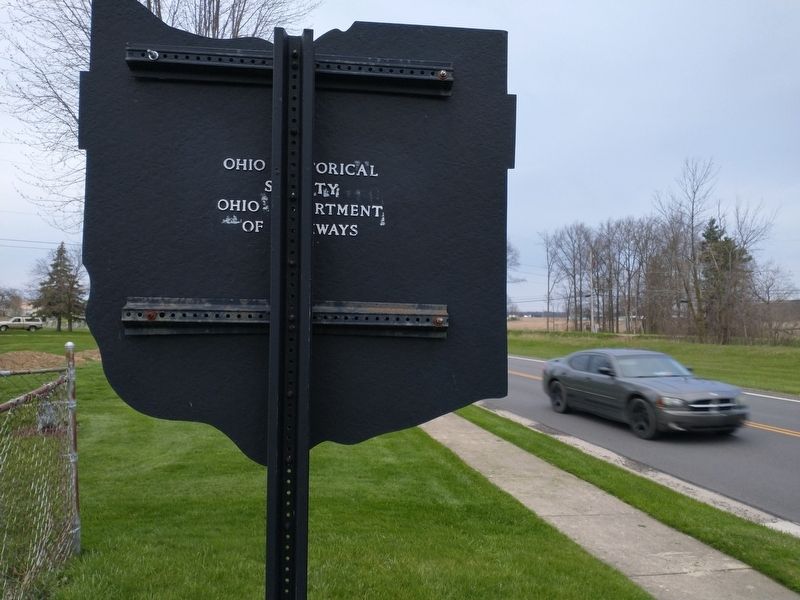
| On South Broadway Street (Ohio Route 66) north of Wurster Drive, on the right when traveling north. |
| On North Main Street (Ohio Route 117) at West 6th Street, on the right when traveling north on North Main Street. |
| On North Main Street (Ohio Route 117) at West 6th Street, on the right when traveling north on North Main Street. |
| On N. Main Street (Ohio Route 117) at W. 6th Street, on the right when traveling north on N. Main Street. |
| On South Broadway (Ohio Route 66) at Kolter Road, on the right when traveling north on South Broadway. |
| On N. Main Street (Ohio Route 117) at W. 6th Street, on the right when traveling north on N. Main Street. |
| On North Main Street (Ohio Route 117) at West 6th Street, on the right when traveling north on North Main Street. |
| On North Main Street (Ohio Route 117) at West 6th Street, on the right when traveling north on North Main Street. |
| On North Main Street (Ohio Route 117) at West 6th Street, on the right when traveling north on North Main Street. |
| On Defiance Trail, on the right when traveling north. Reported missing. |
| On North Main Street (Ohio Route 117) at West 6th Street, on the right when traveling north on North Main Street. |
| On South Broadway Street (Ohio Route 66) at East 3rd Street, on the right when traveling south on South Broadway Street. |
| On South Broadway Street (Ohio Route 66) at East 3rd Street, on the right when traveling south on South Broadway Street. |
| On North Broadway Street (Ohio Route 66) at East 3rd Street, on the left when traveling north on North Broadway Street. |
| On North Main Street (Ohio Route 117) at W. 6th Street, on the right when traveling north on North Main Street. |
| On N. Main Street (Ohio Route 117) at W. 6th Street, on the right when traveling north on N. Main Street. |
| On North Main Street (Ohio Route 117) at West 6th Street, on the right when traveling north on North Main Street. |
| On North Main Street (Ohio Route 117) near West 6th Street, on the right when traveling north. |
| On Defiance Trail North, on the right when traveling north. |
| Near Miami-Erie Canal Walkway/Bike Path south of Zion Church Road, on the right when traveling south. |
| Near Miami-Erie Canal Walkway/Bike Path south of Zion Church Road, on the right when traveling south. |
| On Miami-Erie Canal Walkway/Bike Path south of Zion Church Road, on the right when traveling south. |
| On Bellefontaine Road (Ohio Route 117) 0.5 miles north of Madden Road, on the right when traveling north. |
| On Cottage Street (Ohio Route 60/511) at 3rd Street, on the right when traveling north on Cottage Street. |
| On 2nd Street at Cottage Street (Ohio Route 60/511), on the right when traveling west on 2nd Street. |
| On 2nd Street at Cottage Street (Ohio Route 60/511), on the right when traveling west on 2nd Street. |
| On Main Street (Ohio Route 60/511) at Claremont Avenue, on the right when traveling west on Main Street. |
| On Center Street (Ohio Route 60/511) at Lauretta Avenue, on the left when traveling south on Center Street. |
| On Cottage Street (Route 60/511) at 2nd Street, on the right when traveling north on Cottage Street. |
| On 2nd Street at Church Street, on the right when traveling west on 2nd Street. |
| On Ohio Route 603, on the right when traveling south. |
| On Main Street (Ohio Route 302) at Liberty Street, on the right when traveling east on Main Street. |
| On Ohio 302, on the right when traveling east. |
| On Farm to Market Road 250 near Ohio Route 89. |
| On Ohio 302, on the right when traveling east. |
| On Main Street (U.S. 250) just south of Center Road, on the right when traveling south. |
| On Main Street (U.S. 250) just south of Center Street, on the right when traveling south. |
| On South Mechanic Street (Ohio Route 60) just south of Main Street (Ohio Route 179), on the right when traveling north. |
| On Mechanic Street (Ohio Route 60) at Main Street (Ohio Route 179), on the left when traveling south on Mechanic Street. |
| On Main Street (Ohio Route 179) at Mechanic Street (Ohio Route 60), on the left when traveling west on Main Street. |
| On East Main Street at South Pleasant Street on East Main Street. |
| On West Main Street (Ohio Route 39) just west of North Market Street, on the right when traveling west. |
| On West Main Street (Ohio Route 39) just west of North Market Street, on the right when traveling west. |
| On West Main Street (Route 39) west of North Market Street, on the right when traveling west. |
| On Park Place just west of South Market Street (Ohio Route 3), on the right when traveling west. |
| On South Market Street (Ohio Route 3) just south of West Main Street (Ohio Route 39), on the right when traveling south. |
| On South Market Street (Ohio Route 3) south of West Main Street (Ohio Route 39), on the right when traveling south. |
| On Ohio Route 97 west of Park Road, on the right when traveling east. |
| Near Ohio 3, on the right when traveling north. |
| Near Ohio 3, on the right when traveling north. |
| Near Ohio 3, on the right when traveling north. |
| Near Ohio 3, on the right when traveling north. |
| Near Ohio 3, on the right when traveling north. |
| Near Ohio 3, on the right when traveling north. |
| Near Ohio 3, on the right when traveling north. |
| Near Ohio 3, on the right when traveling north. |
| On Ohio 3, on the right when traveling north. |
| On Lincoln Highway (County Route 30A) at Iowa Street, on the right when traveling west on Lincoln Highway. |
| On Ohio Route 39, on the right when traveling west. |
| On Ohio Route 39, 1 mile north of Ohio Route 95, on the left when traveling north. |
| On South Bridge Street north of East Church Street, on the left when traveling south. |
| On County Road 3006 north of Pleasant Hill Lake Trail, on the right when traveling north. |
| On U.S. 250, on the right when traveling east. |
| On Ohio Route 89, 0 miles south of County Road 800. |
| On U.S. 250, 0.2 miles west of County Road 175, on the left when traveling west. |
| On North Main Street (U.S. 250) at East Main Street, on the right when traveling north on North Main Street. |
| On North Main Street (U.S. 250) at East Main Street, on the right when traveling north on North Main Street. |
| On North Main Street (U.S. 250) at East Main Street, on the right when traveling north on North Main Street. |
| On North Main Street (U.S. 250) at East Main Street, on the right when traveling north on North Main Street. |
| On U.S. 224 at Ohio Route 58, on the right when traveling east on U.S. 224. |
| On U.S. 224 at Ohio Route 58, on the right when traveling east on U.S. 224. |
| On Pymatuning Lake Road (County Route 274) 1.2 miles north of Martin Road (County Route 269), on the left when traveling south. |
| On South Main Street (U.S. 6) at East Main Street (Ohio Route 85), in the median on South Main Street. |
| On Lakeshore Drive north of East 1st Street, on the right. |
| On Bridge Street (Ohio Route 531) at Goodwill Drive, on the right when traveling west on Bridge Street. |
| On Bridge Street (Ohio Route 531) west of Goodwill Drive, on the right when traveling west. |
| On Bridge Street (Ohio Route 531) west of Goodwill Drive, on the right when traveling west. |
| On Goodwill Drive at Bridge Street (Ohio Route 531), on the right when traveling south on Goodwill Drive. |
| On Bridge Street (Ohio Route 531) west of Goodwill Drive, on the right when traveling west. |
| On Bridge Street (Ohio Route 531) west of Goodwill Drive, on the right when traveling east. |
| On West Bridge Street (Ohio Route 531) west of Goodwill Drive, on the right when traveling east. |
| On Bridge Street (Ohio Route 531) west of Goodwill Drive, on the right when traveling east. |
| On Bridge Street (Ohio Route 531) east of Hulbert Avenue, on the right when traveling west. |
| On Bridge Street (Ohio Route 531) west of Goodwill Drive, on the right when traveling east. |
| On Bridge Street (Ohio Route 531) west of Goodwill Drive, on the right when traveling east. |
| On Bridge Street (Ohio Route 531) west of Goodwill Drive, on the right when traveling east. |
| On Bridge Street (Ohio Route 531) east of Hulbert Avenue, on the right when traveling west. |
| On Bridge Street (Ohio Route 531) west of Goodwill Drive, on the right when traveling east. |
| On Bridge Street (Ohio Route 531) east of Hulbert Avenue, on the right when traveling west. |
| On Bridge Street (Ohio Route 531) east of Hulbert Avenue, on the right when traveling west. |
| On Bridge Street (Ohio Route 531) west of Goodwill Drive, on the right when traveling east. |
| On Bridge Street east of Hulbert Avenue, on the right when traveling west. |
| On Bridge Street (Ohio Route 531) east of Hulbert Avenue, on the right when traveling east. |
| On Bridge Street (Ohio Route 531) east of Hulbert Avenue, on the right when traveling east. |
| On Bridge Street (Ohio Route 531) east of Hulbert Avenue, on the right when traveling west. |
| On Bridge Street east of Hulbert Avenue, on the right when traveling west. |
| On Bridge Street (Ohio Route 531) west of Hulbert Avenue, on the right when traveling east. |
9390 entries matched your criteria. Entries 201 through 300 are listed above.
⊲ Previous 100 —
Next 100 ⊳