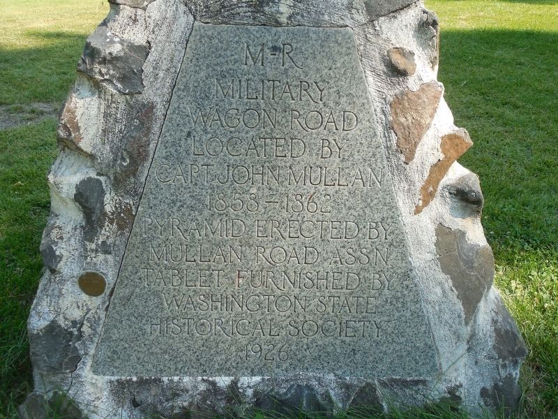
M - R
Military
Wagon Road
Located by
Capt. John Mullan
1858-1862
Pyramid erected by
Mullan Road Ass'n
Tablet Furnished by
Washington State
Historical Society
1926 — — Map (db m113458) HM
The eruption of Mount St. Helens on May 18, 1980 triggered a huge landslide causing a powerful, laterally directed blast. A pyroclastic flow consisting of rock fragments, highly charged gas and super heated steam, devastated almost 150,000 . . . — — Map (db m146049) HM
Chas S Chism • George Eaton • Elmer O. Leonard • Thomas Martin • Harlan Merrill • Rudolph Rockwell • Albert W. Rosin • Richard Sugars — — Map (db m94544) WM
This library was privately financed as a gift to the City of Longview by its founder, Robert A. Long. It was the second building constructed to face the Civic Center and designed in the Georgian Revival style. Listed on the National Register of . . . — — Map (db m197139) HM
In 1916 Finnish immigrants constructed a hall near this site under the name of a literary association (Kirjallixuus Seura), forming a lending library. Although they brought their diet, language, and saunas with them, some old country beliefs were . . . — — Map (db m8382) HM
World War I
James A Forbes •
Frank L. Gaddis •
Walter Kalahan •
Alfred Earl Wells •
Tom C. Bair •
Fred S. Millard
World War II
Elmer Beebe •
Harold R. Chilcoat •
Harry A. Lillard, Jr. •
Elmer Mattila •
Claude M. . . . — — Map (db m8399) WM
One of the most colorful of the early Northwest railroad towns once existed near junction of the Snake and Columbia Rivers. Ainsworth was founded, 1879, when the railroad bridge was building over the Snake River.
In its heyday it was a wild, . . . — — Map (db m34519) HM
The Lewis and Clark Expedition camped nearby on October 16 and 17, 1805 on its way to the Pacific Ocean. One of the members of the Expedition was a young Northern Shoshone, Sacagawea.
During the winter of 1804-05 at Fort Mandan, in . . . — — Map (db m38587) HM
Raging Ice Age floodwaters carved spectacular features throughout eastern Washington, creating unique landscapes. Follow the path of the floods and discover more about this amazing story.
Path of Least Resistance
As floodwaters rushed . . . — — Map (db m83044)
You are standing in the pathway of some of the largest floods ever known. They carved steep-walled canyons, sculpted immense waterfalls, and left behind landscapes found nowhere else on earth.
Massive Glacial Dams and Lakes
During the . . . — — Map (db m83019)
Geologist J Harlen Bretz spent decades meticulously documenting evidence to support his theory that massive Ice Age floods carved the Channeled Scabland of eastern Washington. But the geologic community only ridiculed and scorned his work ... until . . . — — Map (db m83025) HM
Long before the Ice Age floods could carve the coulees, waterfalls, and cliffs that dominate this landscape, basalt was needed, and in huge quantities! Vents from deep in the earth’s crust supplied the basalt, erupting again and again to cover much . . . — — Map (db m83023)
Welcome to Palouse Falls, Washington's official state waterfall. Behind this designation by the state legislature is a story of how local students with a vision created state law - and made state history.
Waterfall Facts Palouse Falls is . . . — — Map (db m129494) HM
Before the Ice Age floods, no stream or waterfall existed here. Instead, the Palouse River flowed through Washtucna Coulee. What caused the river to jump its course?
When the floods surged across the area, they cut a path through the fractured . . . — — Map (db m83021)
"great quantities of the qualmish"
After breaking camp on May 4, 1806, a cold and disagreeable morning, the Lewis and Clark Expedition crossed 'Alpáha (Alpowa) Summit, just north of here. The explorers noticed the rich soil of . . . — — Map (db m159274) HM
"the road leaves the creek"
You can see where two timeworn trails once intersected here. The trail descending the hillside (Photo B) crossed the Patáha Creek valley trail, and then continued up the hill to the northeast (across . . . — — Map (db m159254) HM
[Front]
Erected by
Garfield County
Roster of Deceased Comrades
Collins, Michael • Garrett, David - Co. E, 134 Ill. In. • Hand, Cyrenus - Co. C, 47 Ill. In. • Ryan, Thomas - Co. I.N.Y.H.A. • Spedden, Col. R.R. - 40 Mo. • Conwell, . . . — — Map (db m197093) WM
Early in May, 1806, Captains Meriwether Lewis and William Clark, with a 30-man party and 23 pack horses passed eastward through this roadless area after wintering near the ocean at the western terminus - Fort Clatsop. They were short of food, horses . . . — — Map (db m159255) HM
Flood waters, perhaps 300 feet above you, once rushed over these cliffs. During the ice age, glaciers to the north blocked the Columbia River and forced it to find a new route. The river, swollen from melting glacial ice, began to carve a new . . . — — Map (db m129678) HM
Raging Ice Age floodwaters carved spectacular features throughout eastern Washington, creating unique landscapes. Follow the path of the floods and discover more about this amazing story.
Gouging Deep Coulees The powerful floods cut . . . — — Map (db m129681) HM
Near this site President Roosevelt, accompanied by Mrs. Roosevelt delivered the address dedicating Grand Coulee Dam. Nearly 20,000 people attended the ceremony which was preceded by an inspection of the dam’s construction. — — Map (db m99855) HM
You are standing in the pathway of some of the largest floods ever known. They carved steep-walled canyons, sculpted immense waterfalls, and left behind landscapes found nowhere else on earth.
Massive Glacial Dams and Lakes During the last . . . — — Map (db m129680) HM
These cliffs are skeletal remnants of what was once the world’s largest waterfall. They bear stark witness to the tremendous power of catastrophic floods that swept over Eastern Washington at the end of the last Ice Age.
The falls began 20 mi. to . . . — — Map (db m129677) HM
Indians lived in this coulee many centuries ago. You are standing on an ancient Indian camp site. The Indian trail came down the steep hill behind you and crossed the coulee to the east. The famous Cariboo Cattle Trail crossed the coulee here going . . . — — Map (db m208186) HM
Grand Coulee Dam is the key structure in water utilization for the Columbia River Basin. The dam began operation in 1942 and is one of the world’s largest concrete structures. It is a mile long and contains almost 12 million cubic yards of concrete . . . — — Map (db m99853) HM
The sheer cliff in front of you was once the world's greatest waterfall. From here, you see only the western portion of this remarkable Ice Age floods feature. With the end of the last Ice Age, floodwaters no longer swept through Grand Coulee, . . . — — Map (db m129679) HM
Begun in time of adversity it stood in war as a sentinel of strength safeguarding the nation. Forever a monument to those who shared in its conception and its construction in peace it is the key to new American frontiers of opportunity in . . . — — Map (db m129615) HM
Indians, fur traders, military expeditions and settlers traveled where you are now standing. A major Indian trail passed at this location. Alexander Ross passed here in 1841. John Works, Hudson's Bay Company was here in 1825. The famous botanist, . . . — — Map (db m129671) HM
Ephrata was a summer Indian camp. Hundreds of Indians spent weeks gathering roots at the springs west of here. Ephrata was the gateway between Walla Walla & Okanogan. Indians, military expeditions, and wagons traveled here in 1880. The first . . . — — Map (db m129093) HM
Chief Moses and many Indians from miles around came to gather food, trade & race horses each summer at the great encampment 3/4 mile east of here on Rocky Ford Creek. During the Nez Perce War of 1877, Chief Joseph sent runners to Chief Moses camp . . . — — Map (db m208206) HM
Dance halls, boardwalks, taxi dancers, muddy streets, gambling, dance music, ladies-of-the-evening, bright lights, boxing, bars, construction stiffs and no empty parking spaces, even at 4:00a.m.
“B” Street was the working man's social center from . . . — — Map (db m196830) HM
Directly across the Columbia River is Ginkgo Petrified Forest State Park, covering 6,000 acres.
Although the presence of petrified wood had been reported as early as 1898, the first indication of its presence in quantity in this vicinity was . . . — — Map (db m92611)
Until recent times the Wanapum Indians inhabited the banks of the Columbia River from Beverly Gap to where it is joined by the Snake River near Pasco about 75 miles south.
The Wanapums were a very religious and peaceful people living on fish, . . . — — Map (db m92610) HM
Indians camped along Crab Creek in Stratford to gather roots and other food. The main Indian trail came past Stratford across the creek. The Indian trail branched here and one went past Pinto Dam. Lt. Symons came past here while laying out military . . . — — Map (db m129096) HM
These sandstone blocks, hewn from a quarry in the Cascades, were hand-carved and incorporated into Aberdeen's historic 1909 Weatherwax High School.
When the school burned down in 2002, the stones were wisely pulled from the ashes, but without . . . — — Map (db m199021) HM
The spirit of the American Doughboy. Who in peace represented the nation of freemen and in the world war fearlessly faced death in defense of human rights and liberty. Cherishing the memories of those who fell, and with gratitude to the survivors of . . . — — Map (db m198823) WM
In 1854, the U.S. Commissioner of Indian Affairs instructed Isaac I. Stevens, Governor of the Washington Territory, to enter into treaties with the coast Indian tribes. Following the initial council meetings here in Cosmopolis, treaty councils were . . . — — Map (db m129124) HM
An atmospheric-style theatre
built in 1928
This property has been
placed on the
National Register
of Historic Places
By the
United States
Department of Interior
1987
and the
Hoquiam Register
of . . . — — Map (db m73008) HM
Registered National
Historic Place
F. Arnold Polson House
and Alex Polson Grounds
Under the provisions of the
National Historic Preservation
Act of 1966, this property possesses
exceptional value in illustrating
American . . . — — Map (db m72802) HM
John James, Hoquiam's first settler, recalled in his memoirs an encounter which aptly, albeit unknowingly, identifies him as Hoquiam's first “librarian:”
One evening Humptulips Pete (an Indian) was sitting by my fire. He asked me about . . . — — Map (db m197152) HM
In 1912 a committee was formed to construct a fire hall for the 1892 volunteer fire department. They acquired three lots on this corner & moved the post office that was here. James Movic was the contractor; the project bankrupted him & the $490 tile . . . — — Map (db m197150) HM
Tradition links this tree
with the name of
Captain Robert Gray
who on May 7th 1792, entered
this harbor in his ship Columbia.
This tablet was erected in his honor by
Robert Gray Chapter
Daughters of the American Revolution . . . — — Map (db m117933) HM
For nearly 60 years this turbine helped make power at Bonneville Dam. Throughout these years it has meant different things to different people at different times. During installation, it meant jobs to help people recover from the Great Depression. A . . . — — Map (db m92685) HM
The Camano City School District #18 was formed in 1903. This
classic example of that eras "One-Room Schoolhouse” was
built around 1905, to serve the children of the surrounding
community of about 300 families.
The land was deeded to the . . . — — Map (db m143264) HM
History Of Camano/Camano City
(Early records often interchanged these place names)
In 1898 the Esary brothers with assistance from
Porter Garrison and sons established one of
Camano's major logging companies, in the area
surrounding the . . . — — Map (db m143255) HM
We extend you a warm and friendly welcome to Coupeville in the heart of Ebey's Landing National Historical Reserve!
In 1792, Captain George Vancouver sailed the HMS Discovery into Puget Sound. His first mate, Joseph Whidbey then . . . — — Map (db m179345) HM
In 1968, a seemingly simple zoning request kicked off a fight over the future of Central Whidbey Island.
When proposed development threatened to cut off access to a beloved beach and replace the heritage farmland you see today with subdivided . . . — — Map (db m196842) HM
Humans have been part of this landscape for at least 10,000 years. By the time European explorers entered the Salish Sea in the late 1700s, the Lower Skagit people had [utilized] Whidbey Island for millenia, living in mobile and established . . . — — Map (db m179286) HM
Under the provisions of the National
Historic Preservation Act of
October 15, 1966, this property
possesses exceptional value in
commemorating, or illustrating
American history
Placed on the National Register on
Dec. 12, 1973 by . . . — — Map (db m179278) HM
In honor of the founder
of Island County and his wife
Col. Isaac Neff Ebey – Rebecca Whitey Ebey
1818 – 1857 1822-1858
Whidbey Island’s first permanent settler 1850.
Proposed the separation of Island County from Thurston County . . . — — Map (db m61038) HM
On May 28, 1840 Father Francois Norbert Blanchet came to Ebey's Landing, from his Cowlitz Mission. The visit was in answer to a request by Chief Tslalakum to come and teach his people the new religion.
He was received with great joy by the . . . — — Map (db m179284) HM
This Douglas Fir is about
700 years old. It would,
therefore, have been a
sapling about 200 years before
Columbus discovered America.
—————————————
Restored October 1986
This slab was found near Perrigo's Lake in the early 1930's . . . — — Map (db m179324) HM
You are standing in the nation's first historical reserve, a unique unit of the National Park Service.
The Reserve was originally championed by a group of concerned residents in the 1970s when Ebey's Prairie was subdivided for large-scale . . . — — Map (db m179320) HM
Ebey's Landing, the nation's first National Historical Reserve, was established by Congress in 1978 "in order to preserve a rural community which provides an unbroken historical record from nineteenth century exploration and settlement in Puget . . . — — Map (db m179349) HM
Places to visit
1 Island County Museum
908 NW Alexander Street
The Island County Museum features local and regional history. Ice Age relics, woolly mammoth remains, a Native American collection that includes . . . — — Map (db m179321) HM
A Glimpse In Time
Like the majority of the coastal forts built in the United States, Fort Casey never fired its guns in warfare.
Fort Casey is one of three coastal forts constructed in the late 1890s to defend the entrance to Puget Sound . . . — — Map (db m61063) HM
Penn Cove and Coupeville are home to the Schooner SUVA, during sailing season. See her moored at the historic wharf.
A FAMILY YACHT
In 1925, Frank J. Pratt Jr. had SUVA built in Hong Kong. Her old growth Burmese Teak hull and . . . — — Map (db m179319) HM
...came to Whidbey Island in 1895 as a young lawyer and stayed, having been struck with a life-long love of its beauty. Served as Island County Prosecuting Attorney 1896-1907, and Superior Court Judge for Clallam, Island, and Jefferson Counties . . . — — Map (db m179283) HM
History
The Alexander Block house is one of four blockhouses remaining in Central Whidbey Island. Few original blockhouses of this type remain throughout the United States. John Alexander, Sr. built this blockhouse on his donation land claim . . . — — Map (db m60986) HM
Left side of marker is written in Gaelic and right side is in English
Died here. April, 9 AD 1861
One year ten and twenty
(years) of age
Born at Mineth, Ireland
Gentle wife (of) Sam’l Maylor
They married in Liverpool
At the . . . — — Map (db m60979) HM
From the end of the Lake Ozette Road, 2 trails lead to the ocean beaches. One, the Indian Village Trail, leads to the site of an abandoned Ozette Indian village at Cape Alava. For over 2000 years, Cape Alava was home to the Makah Indians. . . . — — Map (db m179353) HM
“I bought a small old fashion coffee roaster and I plan to roast my own coffee. Front Street will never smell the same!”
– Jim Stewart 1969
Jim and Dave Stewart, coffee pioneers and founders of Seattle’s Best Coffee, . . . — — Map (db m60942) HM
Saved Blockhouse
In 1921 a local civic group, the Ladies of the Round Table (LORT) began a ten year effort to restore the decaying Davis Blockhouse. Local carpenter Fred Krueger handled the project carefully replacing rotting beams while . . . — — Map (db m60991) HM
Donation claim of Jacob Ebey.
Served in War of 1812, the Black Hawk War and the Mexican War.
When 61 yrs old led company across plains with covered wagons.
Settled on Whidbey Island and built this home, four blockhouses and stockade in 1856 . . . — — Map (db m60977) HM
Sudden Indian attacks at Seattle and Bellingham in 1855 caused consternation among the small pioneering settlements on Puget Sound. The tradition of blockhouse defense was well known to American settlers, dating from the earliest English colonies. . . . — — Map (db m61040) HM
Ferryboats have been active on Puget Sound since January 1, 1889. The City of Seattle offered the first scheduled service between Seattle and West Seattle; a bargain at 5 cents per passenger!
The Washington State Ferry System traces . . . — — Map (db m179348) HM
The Coupeville Wharf was built in 1905 in response to the increased economic, military and social activities in the area, and was one of several that supported the busy shipping commerce to and from Whidbey Island.
In the late 1800s, sailing . . . — — Map (db m179287) HM
Died in Service
Harvey Baker · Camano • Glenn E. Muzzall · San de Fuca
Ernest Knowles · Crescent Harbor • George B. Morris · Smith's Prairie
Math. L. English · Fort Casey • Harry Nourse · Maxwelton
Harry Burton · Langley • . . . — — Map (db m179280) WM
The cottage was actually built as two separate buildings. The eastern half was built as a law office for James Zylstra. The western half was added and the building became the medical office for Dr. Chas. White. In 1998 Rev. Barry Burton & Capt. Mike . . . — — Map (db m61037) HM
The swirling waters that pass in and out of the narrow channels between Whidbey Island and Fidalgo Island have captivated visitors to this area for thousands of years. Salish Native American tribes were the first human inhabitants of these . . . — — Map (db m74012) HM
It's hard to imagine Deception Pass without the bridge. But until 1935, the gap between Fidalgo Island and Whidbey Island could only be crossed by boat. In 1924 a small ferry called the Deception Pass began running between Yokeko Point . . . — — Map (db m74083) HM
When the federal government transferred 1,700 acres of land on Fidalgo Island and Whidbey Island to the State of Washington in 1925, Deception Pass State Park was barely an idea. For decades, the land had been a military reservation set aside . . . — — Map (db m74085) HM
Built by Richard Luhn
on the site of Anderson's
blacksmith shop. Housed his
realty and a dentist's office.
Robert Smith's "First Properties"
realty followed. Lawyer Tim Martin added an addition in
1982. Waterman Enterprises, Inc. bought the . . . — — Map (db m195450) HM
Built in 1939 on the site
of Langley's first hotel
that burned in 1921, it
served as the Post
Office until 1960.
It next housed a
laundry, pottery studio,
appliance repair shop, wine shop, antique store,
and flower shop, before becoming . . . — — Map (db m195443) HM
Joe Primavera founded
the Star Store in 1919
as a shoe repair
business in his home at
Second Street and
Anthes Ave. He
moved the business to
First Street in 1922.
Joe, wife Martina and son Victor are standing in
front of the new 1929 . . . — — Map (db m195446) HM
Frederick Tiemeyer ran a
bakery here from 1925 to
1944. His nickle
butterhorns were very
popular.
The building next housed
linoleum and furniture
stores, beauty and barber
shops, and several other
businesses before becoming the Cafe . . . — — Map (db m195445) HM
Dedicated to all U.S. Navy Patrol and Reconnaissance Naval Aviators, Naval Flight Officers and Aircrewmen who, for the cause of freedom, have made the ultimate sacrifice.
Special thanks to Mr. John Christiansen for his many contributions to . . . — — Map (db m74000) HM WM
Family Origins
This park is named after the family of Egbert and Betty Beeksma in recognition of the business they started on the site of park and their contribution to the development of Oak Harbor.
Egbert Beeksma was born the Netherlands . . . — — Map (db m60940) HM
Before the bridge was completed in 1935, the only way to cross Deception Pass was by boat.
If you wanted to take your car from Whidbey to Fidalgo Island in 1929 your crossing would look like this, aboard the MV Acorn.
Your captain could . . . — — Map (db m61465) HM
Named by Captain George Vancouver 10 June 1792. Feeling that he had been “Deceived” as to the nature of the inner waterway, Port Gardner (now Saratoga Passage) he wrote on his chart “Deception Pass”. He . . . — — Map (db m60904) HM
To the north of this narrow passage is Fidalgo Island, so named for the Spanish explorer, Lieutenant Salvador Fidalgo. To the south is Whidbey Island, second largest island in the contiguous 48 states, which Captain George Vancouver, while exploring . . . — — Map (db m60903) HM
This Navy flagstaff is placed here to honor all those Navy people who have served aboard the Naval Air Station on Whidbey Island, their families, and the people of Oak Harbor who have long supported the Navy mission.
Our National Ensign was . . . — — Map (db m73990) HM WM
Oak Harbor’s early “town” was built along the waterfront, and stretched from Maylor’s store along Pioneer Way to about a block east of the junction of Flintstone Freeway and Midway and Pioneer.
The east end of the town burned in a . . . — — Map (db m60938) HM
'Why do we love the sea? Because she has the power to make us think things we like to think.'
- Robert Henry
The Old Wharf and Steamships
Look offshore toward Maylor's Point and you will see a concrete block that remains from Oak . . . — — Map (db m73991) HM
The Skagit Indians maintained several villages on Penn Cove. The paramount Skagit chief lived at Snakelum Point, southeast across the cove. The village at Monroe’s Landing was called cokwol’a. Cokwol’a was a major village of the Skwdabs, a subgroup . . . — — Map (db m61074) HM
Just as the cabin tells a story of the site's history, so does nature. The large stumps in the area tell about early logging activity. Notice in the photo how different the cabin must have been with an expansive view before the new forest . . . — — Map (db m115751) HM
Emory Finch, the son of Hoodsport pioneers, moved into Interrorem with his new bride Maybelle Peterson on their wedding day, April 22. 1908. Like her husband, she saw at home in the outdoors. The couple met when she and two friends came over from . . . — — Map (db m116139) HM
Interrorem Ranger Cabin is the oldest Forest Service dwelling on the Olympic Penninsula and one of the oldest in the Northwest.
As you gaze through the trees at Interrorem Ranger cabin, step back in time to the Spring of 1907. From this spot you . . . — — Map (db m116138) HM
The name Interrorem, according to the most popular theory, was derived from Latin meaning "between the gold". Others believe it was slang for "Interim," used by those who thought the cabin would be a temporary site for managing the forest. Instead, . . . — — Map (db m116137) HM
968 entries matched your criteria. Entries 101 through 200 are listed above. ⊲ Previous 100 — Next 100 ⊳