Half an acre of this Old State Burial Ground was laid off for state officials in 1835. Although exact location is unknown, it is thought to be in this area. In 1874 the monument and remains were moved to South Hill Cemetery. Four Representatives . . . — — Map (db m42421) HM
John B. E. Canal
A representative from
Madison County in the
General Assembly of Illinois
Born at Baltimore
June 24, 1809
Died at Vandalia
December 31, 1830
Benjamin A. Clark
Representative of the
General Assembly . . . — — Map (db m42627) HM
Born in Kentucky. Circuit Clerk of Fayette County 1826-56. Adjutant General 1834-39. First talented artist of Illinois. Portrait painter of state officers and legislators. Commissioned by General Assembly to copy portraits of Washington and . . . — — Map (db m42381) HM
Dr. Morey was born in Erie Co. Penna. but moved to Illinois when a young man. He was nearly 50 yrs. old at his death and had been engaged in the practice of medicine for nearly thirty years.
He graduated from the Physio-Medical College of Ohio . . . — — Map (db m42700) HM
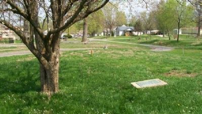
On June 12, 1823, the Third General Assembly, meeting in the newly formed city of Vandalia, conveyed one and one-half acres of land to the city of Vandalia, with the proviso that the land be used as a burial ground. This is the location of that . . . — — Map (db m42428) HM
Wife, born in Kentucky, and son of James Hall, first Man of Letters in Illinois. State Treasurer 1827-31. President of first state historical society 1827-33. Author of first book of literary style in Illinois 1828. Trustee of Illinois College . . . — — Map (db m42388) HM
On Edwards Street at 3rd Street, on the right when traveling east on Edwards Street.
The Illinois General Assembly authorized Governor Edward Coles in 1823 to convey to Vandalia one and one-half acres for a state burial ground. Here were buried four members of the legislature and several state officials who died while in office. . . . — — Map (db m42371) HM
Born in Kentucky. State Printer. Publisher of Laws of United States. Editor of newspaper "Illinois Intelligencer" 1825-32 and Co-Owner with James Hall 1829-32. House of Representatives 1832. Senate 1838-40. Black Hawk War soldier. . . . — — Map (db m42376) HM
Born in Virginia. State Treasurer 1819-23. Trustee of Vandalia appointed by Legislature 1821. House of Representatives 1826-28. Senate 1828-32 and 1836-38. State Bank Commissioner 1835-37. Registrar of U.S. Land Office. Isabella, niece of Shadrach . . . — — Map (db m42423) HM
Born in Maryland. Clerk of First General Assembly of Illinois Territory, Kaskaskia 1812. Clerk of House of Representatives and of Legislative Council, 1815. Clerk of Constitutional Convention 1818. Secretary of Senate 1818-20. Chief Surveyor of . . . — — Map (db m42374) HM
On 5th Street (U.S. 67) just north of South Main Street, on the left when traveling north.
Thomas Carlin, sixth elected Governor of Illinois (1838-1842), was an early settler of Illinois and a prominent figure in organizing Greene County and establishing Carrollton as its county seat in 1821.
Born in Kentucky in 1789, Carlin came to . . . — — Map (db m142746) HM
On Liberty Street just south of East Washington Street, on the right when traveling north.
Erected prior to 1700, over the grave of Chief Nucquette, near foot of Wauponsee Street, Morris.——— Moved by City Council — 1925 — — Map (db m232999) HM
Forty acres of land were acquired by the Catholic church in the early 1830's from land in the Military Tract, which had been set aside for the veteran survivors of the War of 1812. Title to this land on the Southeast Quarter of the Northeast . . . — — Map (db m181443) HM
On West Main Street (Illinois Route 9) west of Center Street, on the right when traveling east.
Abraham Lincoln came into LaHarpe from the west, riding in a phaeton borrowed from Daniel Bainter. There were some dissenters along his parade route. He spoke at the Methodist Episcopal Church, the so-called "Little Church Around the Corner," . . . — — Map (db m181448) HM
Joseph, Sr., and Lucy Mack Smith, parents of the prophet Joseph and the patriarch Hyrum. Descended from industrious and religious New England families. From the beginning of the restoration, they consistently filled supportive roles in establishing . . . — — Map (db m244533) HM
The founder of the restoration. His wife and his brother possessed an enduring love and devotion toward each other.
Joseph once described the bond between himself and Hyrum as "Love that is stronger than death."
Joseph and Emma's marriage . . . — — Map (db m244534) HM
On Water Street west of Main Street, on the right when traveling east.
The Smith Family Cemetery is the final resting place of Joseph Smith, his wife Emma, and brother Hyrum, Lucy Mack and Joseph Smith Sr., and many other family members and friends.
After Joseph and Hyrum were assassinated at the Carthage jail on . . . — — Map (db m244536) HM
On Main Street (Illinois Route 34) at 2nd Street, on the right when traveling east on Main Street.
Travel the Byway and discover the importance of the Ohio River to the nation and the world. Experience the magnificent natural landscapes of southern Illinois while coming to know how the historic events and people that shaped the region and the . . . — — Map (db m196762) HM
On North 5th Street north of Mercer Street, on the right when traveling north.
This memorial is dedicated in memory of an elephant named Norma Jean, who was killed by lightning at this location and lies buried here. — — Map (db m181372) HM
Near East Main Street (Illinois Route 13) east of South Logan Avenue.
In this cemetery was held the first Memorial Service to the Civil War Veterans Apr. 1866 which inspired Gen. John A. Logan a citizen of Carbondale to issue General Order No. 11 as Grand Commander of G.A.R. establishing National Memorial Day May 30 . . . — — Map (db m174000) HM
On South Logan Avenue south of East Main Street (Illinois Route 13), on the right when traveling north.
The first memorial service in Illinois, and one of the first in the nation, to honor those who had died in the Civil War, took place at Woodlawn Cemetery on April 29, 1866. On that day, a group of more than 200 veterans gathered at the old "Blue . . . — — Map (db m163493) HM
On South Logan Avenue south of East Main Street (Illinois Route 13), on the right when traveling north.
On April 29, 1866, over 200 veterans and several thousand citizens gathered at Woodlawn Cemetery to honor those who had died in the Civil War. General John A. Logan delivered the keynote address, saying "Every man's life belongs to his country, and . . . — — Map (db m161076) HM
On North Clear Lane, 1.5 miles east of North Campground Lane, on the right when traveling east.
The Atkinson Cemetery was established March 11, 1875, by James Atkinson, who granted the land as a community burial ground. The first recorded burial (1843) was of Sarah A. Short, daughter of Thomas Jefferson and Martha "Patsy" (Maddux) Short. The . . . — — Map (db m236731) HM
Near Broadway Street (Illinois Route 15) east of South 24th Street.
Founded by Samuel H. Watson and Van Wilbanks, consisting of 58.89 acres. The first burial was Frank M. Watson on October 7, 1875. Cemetery deeded to Oakwood July 6, 1883. First officers were G.F.M. Ward and John H. Rackaway. Burial site for James M. . . . — — Map (db m209606) HM
Near North State Street (U.S. 67) just south of Snedeker Street, on the left when traveling south.
This memorial is dedicated to the three mothers and their five children buried in the Hathaway Cemetery. Located in Section 34 of Jersey Township North, the cemetery was the final resting place of: Lydia and John McCluer; Katherine, Elizabeth, and . . . — — Map (db m142828) HM
On Batavia Avenue (Illinois Route 31) at Morton Street, on the right when traveling north on Batavia Avenue.
This monument erected in honor and in commemoration of the loyal patriotic men who enlisted from the Township of Batavia Illinois in the War for the Preservation of the Union 1861-1865.
"On fame's eternal camping ground
Their silent tents are . . . — — Map (db m94260) WM
On Farragut Avenue near Sampson Road, on the left when traveling east.
The First Recruit17-year old Joseph Gregg of Terre Haute, Indiana arrived at Great Lakes Naval Center on July 1, 1911, the day of the first commissioning of the Station. Later that year on October 8, President William Howard Taft officially . . . — — Map (db m37970) HM
In appreciation of his service to the Boyhood of America. Inspired by the good turn of an unknown English Scout, he brought scouting to the United States. — — Map (db m82183) HM
On Chapel Road east of Governor's Dr, on the left when traveling west.
Northeast of this site on Elkhart Hill is Oglehurst, home and burial place of Richard J. Oglesby (1824-1899) the only three time Governor of Illinois. (1864-1872-1884) He was also a U.S. Senator and a personal friend of Abraham Lincoln. Oglesby . . . — — Map (db m156873) HM
On Chapel Road east of Governor's Dr, on the right when traveling east.
(left:)
Elkhart's central location, superb soil and timberland attracted the first settlers in 1818. James Latham and his son, Richard, chose the hill's western slope to settle. Robert Latham, the youngest son, would later play a . . . — — Map (db m156859) HM
On Pulaski Street, on the left when traveling east.
In the Spring of 1876 a gang of counterfeiters plotted to steal the body of Abraham Lincoln from the Tomb in Springfield, Illinois. Hoping to be paid a ransom of $200,000.00 and the release of one of their gang, Ben Boyd, their engraver, who was in . . . — — Map (db m12319) HM
On Boiling Spring Road, on the right when traveling south.
John Hanks was born in 1802 in Kentucky, he was a second cousin of Abraham Lincoln through Lincoln's mother, Nancy Hanks Lincoln. John Hanks stated that he first knew Lincoln when he was a boy of twelve in Spencer County, Indiana. However, it . . . — — Map (db m41240) HM
On Mt. Olive Road at Old Reservoir Road, on the right when traveling south on Mt. Olive Road.
The Union Miners Cemetery in Mt. Olive, Illinois, is the only labor union-established and union-owned cemetery in the United States. It is the result of the Battle of Virden fought in Virden on October 12, 1898, when the Chicago-Virden Coal Company . . . — — Map (db m184803) HM
On Pearl Street just north of Joesting Avenue, on the left when traveling north.
Civil War Dead
An estimated 700,000 Union and Confederate soldiers died in the Civil War between April 1861 and April 1865. As the death toll rose, the U.S. government struggled with the urgent but unplanned need to bury fallen Union . . . — — Map (db m185503) HM
On Pearl Street north of Joesting Avenue, on the left when traveling north.
Civil War Alton
In spring, 1861, pro-Confederate militia in St. Louis, Missouri, threatened to capture the U.S. arsenal there. Union forces in Illinois commandeered the steamboat City of Alton, sailed south, and and at midnight on . . . — — Map (db m133299) HM
Near East 5th Street at Monument Avenue, on the left when traveling east.
Elijah Parish Lovejoy (Nov. 9, 1802 - Nov. 7, 1837) was a newspaper editor, social reformer, and Presbyterian minister whose death at the hands of an angry mob at Alton, Illinois, made him an enduring symbol of the fight for human liberty and . . . — — Map (db m133297) HM
Near East 5th Street at Monument Avenue, on the left when traveling east.
Considered by many to be the first casualty of the Civil War, abolitionist editor and Presbyterian minister Rev. Elijah P. Lovejoy was killed defending the freedom of the press.
Editor of the St. Louis Observer, Lovejoy wrote . . . — — Map (db m133295) HM
On Rozier Street west of State Street, on the left when traveling south.
Alton Military Prison
In late 1861, Union Gen. Henry Halleck received permission to use the former Illinois State Penitentiary in Alton, Illinois, as a military prison. The old prison had 256 cells, a hospital, a warden's house, and . . . — — Map (db m154164) HM
On Riverfront Drive west of Boat Launch Road, on the right when traveling east.
A now-submerged island directly across from you is a mass gravesite for hundreds of Confederate solders.
"In this sad world of ours, sorrow comes to all and to the young it comes with bittersweet agony, because it takes them . . . — — Map (db m133283) HM
Near Pearl Street north of Joesting Avenue, on the left when traveling north.
More people died during the Civil War than during any other war in U.S. history. An estimated 200 Union soldiers are buried at the Alton Cemetery.
More than three million fought in the Civil War. Two percent of the population—more than . . . — — Map (db m133300) HM
On William Street north of Broadway Street, on the left when traveling north.
While the Alton Military Prison operated here during the Civil War, there were approximately 1,570 deaths among the soldiers and civilians and about 200 deaths among the Union soldiers who acted as their keepers. Burials occurred in three places, . . . — — Map (db m210695) HM
On Cemetery Street at South Center Street, on the right when traveling east on Cemetery Street.
This cemetery was the original burial place for the first settlers of the Collinsville community. It was donated by the first settler, William B. Collins. Since there were no city officials then, it was deeded to the care of the trustees of the . . . — — Map (db m169485) HM
On St. Louis Road at National Terrace on St. Louis Road.
On April 5, 1918, German immigrant Robert Prager was hanged by a mob at this site. Prager's lynching was the high-water mark of the anti-immigrant and anti-German hysteria that gripped the nation during World War I. Persecution in the guise of . . . — — Map (db m151267) HM
On Oak Lane at Randle Street, on the right when traveling south on Oak Lane.
This tract of ground was the first cemetery in the City of Edwardsville. Buried here are the soldiers of our early wars and the pioneer settlers of this community. — — Map (db m144183) HM
On West Schwartz Street west of South Main Street (Illinois Route 159), on the right when traveling east.
In 1844, Madison County began a program of caring for the poor. Ten years later the county purchased this property and the first permanent buildings were constructed during the Civil War. The purpose of the facility was to provide care for the . . . — — Map (db m163349) HM
Near Bluff Road (Illinois Route 157) north of Interstate 270.
Some of the earliest families of the Goshen Settlement are resting here. Cira 1801 Lewis and Clark had not yet embarked on their westward exploration. Madison Territory extended to the Canadian border. An inventory of these gravestones has been . . . — — Map (db m151123) HM
Near Bluff Road (Illinois Route 157) north of Interstate 270.
(front:)
Buried in Nix/Judy Cemetery on hilltop:
Pvt John Nix served with the SC troops under Cpt Davis, Richard Win's Rgt. He served under Cpt Thomas Baker in the battles of Eutaw Springs and Orangeburg.
Pvt Henry Thornhill . . . — — Map (db m151118) HM WM
Near Mulberry Street west of Godfrey Road (U.S. 67).
The Godfrey Cemetery, originally known as Monticello Cemetery, was part of the property owned by Benjamin Godfrey that was donated to the Monticello Seminary in February 1840. Four acres of the property were to be used for interments for the . . . — — Map (db m144940) HM
On Illinois Route 143 east of Lower Marine Road, on the left when traveling east.
Michael Deck with his wife Susannah, and their eleven children, George J., Henry, Felix, Elizabeth, Michael, Jacob, Nicholas, Joseph, Anna, Christiny and her husband Samuel Fitch, Margaret with her husband Mattmias Long and Mike's brother Jacob . . . — — Map (db m156733) HM
Dr. Kasper Koepfli wished to lead a party of fellow Swiss to the United States where opportunities existed for immigrants. He persuaded a number of relatives and friends, all from Sursee, Switzerland to make the trip. The party consisted of Dr. . . . — — Map (db m156737) HM
Louis Latzer was born in 1848 on a farm just south of Highland. He was educated in the Highland public schools and attended Illinois Industrial School (now University of Illinois) for a time before he returned to Highland in 1869 to run the family's . . . — — Map (db m156752) HM
Chapel built in 1884
Presented to City of Highland July 7, 1884 by Mayor F.B. Suppiger. According to the will of John Suppiger family who died in the Schiller shipwreck, 1875
Declared Historical Landmark August 8, 1974
Restored through . . . — — Map (db m153058) HM
From its settlement in 1831 and onward, Highland attracted citizens from Switzerland and southern Germany. The more well-to-do of these early Highland families would travel to visit their homelands. In the summer of 1875, a group of Highlanders . . . — — Map (db m156739) HM
John Jacob Spindler (1825-1899) arrived here from Basel, Switzerland. After trying distillery and milling businesses, he opened a large general merchandise store.
In 1883, his son, John Jacob Spindler Jr., helped form the Highland Swiss . . . — — Map (db m156751) HM
Near Marine Road (County Road 13) at Hunter School Road, on the left when traveling south.
In memory of
Capt. Curtis Blakeman
and the
Marine Settlement
Just north of here, in 1819, a group of sea captains,
Blakeman, Allen, Breath, Deselherst, and Mead
from Connecticut, arrived and built log cabins,
naming the . . . — — Map (db m48946) HM
Pvt. Anthony Alexander Harrison, son of Lovell and Hannah Sanford Harrison, enlisted in Capt. Lucas' CO in Feb 1781. He also served in Capt. Newsome's CO, and the CO commanded by his brother, Capt. Joseph Harrison, Col. Dick's Regt., Gen. . . . — — Map (db m154161) HM WM
On North Randolph Street south of East University Drive, on the right when traveling south.
Oakwood Cemetery was developed by William H. Randolph in 1857, on land settled by his wife's family, the Brookings, in 1834. It was laid out by surveyor Charles Gilchrist - later a Civil War colonel and brevet brigadier general. A former sheriff and . . . — — Map (db m181706) HM
On North Randolph Street, on the right when traveling south.
Macomb's historic Oakwood Cemetery is burial ground of approximately 300 Civil War soldiers.
It also is the last resting place for various conductors of McDonough County's legendary Underground railroad, most notably the area's Allison and . . . — — Map (db m181708) HM
On Spring Creek Road at Meadow Hill Road, on the right when traveling east on Spring Creek Road.
This former school, now a residence, and cemetery were named for the David Haeger family, from Germany, who settled in this part of McHenry County. This area was the boyhood home of David Henry Haeger, the eldest son of the Haeger children, who . . . — — Map (db m65892) HM
On County Route 2400E north of County Route 1300N, on the right when traveling north.
Benjaminville was founded in the 1850's by Quaker farmers looking for rich prairie soil on which to grow their wheat. The Friends Meeting House, built in 1874, has changed little since then. The adjacent burial ground is divided into two sections: . . . — — Map (db m157153) HM
Married Letitia Green Dec. 26, 1866
Member of the 44th US Congress 1875-1877 and the 46th US Congress 1879-1881. Under President Grover Cleveland he was appointed first Assistant Postmaster General 1885-1889. Was elected Vice President of . . . — — Map (db m160458) HM
Twice made unsuccessful bid for the office of US President on the democratic ticket in 1952 and 1956. Named US Ambassador to the United Nations by President John F. Kennedy serving in London, England until his death. — — Map (db m160459) HM
Married Ward Hill Lamon Mar. 17, 1850
The 8th circuit court and the members including the Honorable Judge David Davis and Abraham Lincoln, future president of the United States of America gathered here at the burial site of Angeline Turner . . . — — Map (db m160308) HM
Inducted into the Baseball Hall of Fame in 1940, Charles pitched professionally for 11 years in the National League and the Players League.
In those 11 years he won 310 games and lost 191 for a winning percentage of .619.
In 1884 he won 62 . . . — — Map (db m160304) HM
Little Dorothy was born to Sophie Jewell and Thomas C. Gage, five months later the family was devastated by her death. Shortly after this, Thomas and Sophie left Bloomington for Aberdeen S.D. Dorothy's uncle, L. Frank Baum, named the main character . . . — — Map (db m160313) HM
Family Patriarch
Asahel Gridley
04/21/1810 - 01/20/1881
Banker, lawyer, politician, merchant, and first millionaire in McLean County.
The town of Gridley is named for him.
Gridley was once sued for slander and hired Abraham Lincoln . . . — — Map (db m160311) HM
Wife, mother, and registered nurse.
A driving force behind the merging of the Bloomington City Cemetery and Bloomington Cemetery.
It was with great dedication that she served Evergreen Memorial Cemetery first as an advocate then as a . . . — — Map (db m160445) HM
John served as judge to the 8th Judicial Circuit in Illinois 1862-1870
Elected to the Illinois Supreme Court 1870-1888
One of the founders of the McLean County Historical Society in 1892
John considered Sarah his equal and life . . . — — Map (db m160306) HM
Five generations of the McCormick family are buried here in the Big Circle.
Family Patriarch
Henry W. McCormick, Ph. D.
Irish immigrant, farm laborer, teacher, college professor.
For his contribution to the university, McCormick Gym, at . . . — — Map (db m160456) HM
On May 31, 1948, a group of citizens gathered at Evergreen Memorial Cemetery's Civil War Veteran's enclosure to honor those who had given to our great nation through their military service. During the ceremony, a WWII trainer plane flown by James A. . . . — — Map (db m160452) HM
The American Veterans Traveling Tribute Vietnam Wall was brought to this site in August of 2016. It was through the hard work and dedication of many volunteers that made this event possible. The black granite monument to commemorate the Honor, . . . — — Map (db m160455) HM WM
Near North 3100 East Road south of County Route 850N.
This park is the location of the major village of the Kickapoo Indians in central Illinois. The French first recorded a well established Kickapoo presence here in 1752. The 1818 surveyor's map for the new state of Illinois showed the grand village . . . — — Map (db m157173) HM
On Illinois Route 97, 0.1 miles south of Illinois Route 123.
"I think I may say that he was my scholar and I was his teacher." At New Salem, Lincoln read Graham's books and in 1833 studied grammar and surveying. Teacher in Kentucky and Illinois more than fifty years, Graham died in South Dakota. In 1933 his . . . — — Map (db m124185) HM
Near Palmer Road, 0.3 miles north of Quarry Road, on the right when traveling north.
Revolutionary War
War of 1812 • Civil War • WW I • WW II
Laid out in the late 1700s on acreage donated by the Ogles,its elevated grounds afford a view of lands settled by the pioneers—the Piggotts, Ogles, Biggs, Wilson and others. It was named . . . — — Map (db m143369) HM WM
On Palmer Rd, 0.7 miles north of Quarry Rd., on the right when traveling east.
Palmier Cemetery was established in 1783, laid out on ground donated by Benjamin and Joseph Ogle-part of the Ogle Estate on Palmier
Hill, for what would become the oldest cemetery in the Columbia precinct. Flooding in the area caused the cemetery . . . — — Map (db m203961) HM WM
Near D Road, 0.2 miles south of Hh Road, on the right.
Stephen W. Miles was born in New York and came to this area in 1819. He was a successful businessman and acquired large tracts of land. He would stand on the bluff and say, "For miles and miles, it all belongs to Miles." He would eventually . . . — — Map (db m233012) HM WM
On Eagle Cliff Cemetry Road, 0.2 miles west of Local Road D, on the right when traveling west. Reported missing.
Eagle Cliff Graveyard was established as a public graveyard on land donated by Truman Miles.
The first person to be buried in Eagle Cliff Graveyard was Rachel Bond, wife of Judge Shardrach Bond, Sr. on March 17, 1806.
The vault was . . . — — Map (db m199231) HM
Near Rogers Street, 0.2 miles south of Hamacher Street (County Route 2), on the right when traveling south.
To honor the soldiers who fought in the American Civil War, Shane Douglas marked the graves of 99 Veterans buried in the City of Waterloo for his Eagle Scout Project. There are 67 buried in Waterloo City Cemetery, 31 buried in St. Peter & Paul . . . — — Map (db m146844) WM
On Brittany Court, 0.7 miles south of Kasey Lane, on the left when traveling south.
These earliest settlers Capt. James Moore, The leader. Shadrach Bond, Robert Kidd, Larken Rutherford, and James Garretson, were who served under George Rogers Clark in 1778.
They arrived with their families in the spring of 1782 and . . . — — Map (db m227340) HM
On KK Road (County Road 1300N) just west of Ahne Road, on the right when traveling west.
The Beginning
The settlement of Madonnaville was not always called Madonnavile, it was originally known as James Settlement or James Mills, In June of 1804 ,Austin James moved here with his family. For many years the James family was the . . . — — Map (db m179195) HM
On Kopp Road at Konarcik Road, on the right when traveling north on Kopp Road.
Martini Cemetery
also known as Goeddeltown Cemetery
1862 to 1942
You are gone but not forgotten
Ruht in Frieden
[Rest in peace]
— — Map (db m168728) HM
A Potter's field is a term used for a place for the burial of unknown or indigent people. The expression potter's field derives from the Bible, referring to a field used for the extraction of potter's clay; such land, useless for agriculture, . . . — — Map (db m140353) HM
Near Adams Drive at Adams Drive, on the left when traveling east.
To honor the brave soldiers who fought in World War I, Sam Thomas marked the graves of WW I Veterans buried in the City of Waterloo that did not already have a military recognition. There are 25 in the Waterloo City Cemetery and 18 in St. Peter . . . — — Map (db m146821) WM
On McKean Road west of Woods Lane, on the right when traveling east.
A leading figure of the 19th-century "Stone-Campbell" Restoration movement, Barton Warren Stone owned and lived on this farm from 1838 to 1844. Stone advocated the unity of all Christians, served as an educator and church planter, and published . . . — — Map (db m149893) HM
On West Michigan Avenue just east of Havendale Drive, on the right when traveling west.
Miss Dorothea Dix in her "memorial to the Senate and House of the Representatives of Illinois" urged their serious consideration of the afflicted condition of an increasing class of insane sufferers, whose healthful exercise of their intellectual . . . — — Map (db m149907) HM
On Illinois Route 72 at Spruce Street, on the right when traveling east on State Route 72.
In memory of the Illinois volunteers who fell at Stillman's Run, May 14, 1832, in an engagement with Black Hawk and his warriors.
Captain John G. Adams
Sergeant John Walters
Corporal James Milton
Private Isaac Perkins
Private Joseph . . . — — Map (db m131319) HM WM
On Southwest Adams Street at South Griswold Street, on the right when traveling west on Southwest Adams Street.
This plaque dedicated by
Colonel John C. Bryner, Camp 67
Sons of the Union Veterans of the Civil War
in memory of veterans interred in Moffatt Cemetery
Veteran • Rank • Co. • Regiment
Amsler, Henry Pvt G 14 IL Inf Cons • Anderson, . . . — — Map (db m239257) WM
On Southwest Adams Street at South Griswold Street, on the right when traveling west on Southwest Adams Street.
Aquilla Moffatt arrived here in 1822 and began mining and milling ventures.
On return from the Black Hawk War, he built his home on South Adams
Street and set aside a small burying ground for family and friends. After
the Civil War he named an . . . — — Map (db m239258) HM
Near North Prospect Road south of East Forrest Hill Avenue, on the left when traveling south.
Captain Zeally Moss is buried in the
Bradley family circle, with his daughter
Lydia Moss Bradley in the Mt. Prospect
area at the southeast corner of the
cemetery. He was born in Loudoun County,
Virginia. on March 6, 1755, the son of
Nathaniel . . . — — Map (db m220299) HM WM
Near North Prospect Road south of East Forrest Hill Avenue, on the left when traveling south.
Founded August 4, 1854
This property is listed in the
National Register
of Historic Places
by the United States
Department of the Interior
2004 — — Map (db m220302) HM