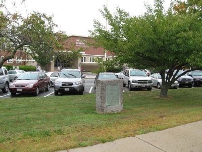
On Cabot Street (Massachusetts Route 1A) at Roosevelt Avenue, on the right when traveling south on Cabot Street.
Roger Conant
Leader of the Old Planters
And Founder in 1626
Of Naumkeag (Salem)
Built His House Here in 1636
In the Southern Angle Of
A Two Hundred Acre Grant
He Lived Here Until His Death
November 19, 1679
Erected by the Roger . . . — — Map (db m36444) HM
On Water Street, on the left when traveling north.
From 1632-1754 a few farms and native American habitations dotted the woodlands among this land originally granted to pioneer settlers Gov. John Endecott and Rev. Samuel Skelton. On the road to Salem lay the farm of George Jacobs, Sr., a victim . . . — — Map (db m43938) HM
Near Conant Street at Conant Street & High Street (Massachusetts Route 35).
One of the most strategic and daring exploits of the patriot cause during the revolution. Part of the troops encamped in the Town of Danvers on the night of September 14, 1775 on their way to Newburyport where they embarked for the Kennebeck and . . . — — Map (db m48470) HM
On Pine Street at Adams Street, on the left when traveling north on Pine Street.
In 1636 Francis Weston was granted this land upon which he laid out a farm. This property was purchased by Governor John Endicott in 1648, and in 1678 Francis and Rebecca Nurse moved here and built a house. In March, 1692, 71-year-old Rebecca was . . . — — Map (db m185940) HM
On Hobart Street at Forest Street, on the left when traveling west on Hobart Street.
Directly across from this site was located the original Salem Village Meeting House where civil and military meetings were held, and ministers including George Burroughs, Deodat Lawson, and Samuel Parris preached. The infamous 1692 witchcraft . . . — — Map (db m48726) HM
In 1681 the Salem village inhabitants built a home for their minister at this site. Ministers residing here were George Burroughs (1681-83), Accused in 1692 of being a witch and hanged; Deodat Lawson (1684-88), Author of the first volume about . . . — — Map (db m48720) HM
On Hobart Street at Forest Street, on the left when traveling west on Hobart Street.
In memory of those innocents who died during the Salem Village Witchcraft Hysteria of 1692 Back Monument: “I am an innocent person. I never had to do with witchcraft since I was born. I am a Gosple woman.” Martha Cory “The . . . — — Map (db m48725) HM
On Centre Street at Holten Street, on the left when traveling south on Centre Street.
A fine example of chronological and architectural house development, this was the 1692 home of Sarah Holton, who gave damaging testimony against Rebecca Nurse during the witchcraft hysteria. Here during revolutionary period lived Samuel Holten . . . — — Map (db m17988) HM
{Not all of the text on this marker can be transcribed.}
In February, 1681, the Salem village inhabitants voted, "We will build a house for the Ministry and provid convenient Land for that end. The Dementions of the House are as . . . — — Map (db m48721) HM
{Not all text on marker is transcribed here.}
In 1717 Rev. Peter Clark became minister at Salem Village. The 1681 parsonage was in poor condition, so that by the early 1730's Clark asked the inhabitants to come to a decision either to . . . — — Map (db m48722) HM
On Hobart Street at Centre Street, on the left when traveling west on Hobart Street.
To this church, rent by the witchcraft frenzy, came in 1697 the Reverend Joseph Green, aged twenty-two. He induced the mischief makers to confess, reconciled the factions, established the first public school, and became noted for his skill at . . . — — Map (db m48723) HM
Near Water Street at Endecott Street. Reported missing.
One-eighth of a mile distant.
On a part of the 300 acres
granted to Governor John
Endecott, is the pear tree
planted by the Governor in
1632. This tree still bears
fruit. — — Map (db m46192) HM
On Maple Street near Central Ave, on the right when traveling north.
Called "Porter's Plain" after 17th century settler
John Porter, this level expanse of about one square
mile was sparsely inhabited into the mid-18th century.By the time of the American Revolution, patriot
Captain Jeremiah Page had settled here, . . . — — Map (db m38341) HM
On Centre Street, on the right when traveling west.
Defense was a prime necessity to the early settlers of Salem Village, and as early as 1671 the male inhabitants began meeting here for military drill. This preparation was heightened in 1675 during the King Philip War in which many villagers took . . . — — Map (db m17991) HM
A free school for Chebacco
parish was opened in an
upper room of this house in
1695 by the appointed master,
Nathaniel Rust, Junior. The town
gave "Six acres of pasture land
for the benefit of the school
and one-quarter acre for
Mr. Rust's . . . — — Map (db m47496) HM
On John Wise Avenue (Massachusetts Route 133), on the right when traveling north.
Erected in 1701 by John Wise, pastor of the Chebacco parish of Ipswich, now Essex. Son of a laborer, Harvard graduate, army chaplain, protestant against taxation without representation and against the witchcraft delusion, defender of democracy in . . . — — Map (db m47955) HM
On Main Street (Massachusetts Route 133), on the left when traveling east.
Dedicated to the those men of Chebacco and Essex who by the skill of mind and hand within sight of this spot created nearly 4000 wooden vessels 1650-1982 — — Map (db m97208) HM
On Main Street (Massachusetts Route 133), on the right when traveling north.
In 1668 the town granted the
adjacent acre of land "To the
inhabitants of Ipswich for a yard
to build vessels and to employ
workmen for that end."
The shipbuilding industry has
continued uninterruptedly in
Essex since that date. — — Map (db m47495) HM
On North Street, 0.2 miles north of Meadowview Road when traveling north.
Ten rods east stood the
house of Benjamin Goodrich
who, with his wife and two
children, was slain by the
Indians on October 23, 1692 — — Map (db m47864) HM
On Eastern Avenue (Massachusetts Route 127) 0.5 miles south of Sheehan Terrace, on the right when traveling south.
James Babson
Farm
Granted by Special Town Act December 23, 1658
James and his mother Isabel were the first Babsons to reach America, arriving in 1632.
James' father died on shipboard while crossong.
-----------------
Town records show . . . — — Map (db m36302) HM
Here in 1630-31 a company from Plymouth, under Abraham Robinson, established a fishing station
and built curing stages. For nearly two centuries and a half Annisquam was a fishing and ship-building center. — — Map (db m48615) HM
On Rocky Neck Avenue, on the left when traveling south.
In September, 1606, Samuel de Champlain landed at Rocky Neck in what is now Gloucester Harbor, to caulk his shallop, and made an accurate chart of the harbor which he called Le Beauport. — — Map (db m48686) HM
On this site in 1623 the Dorchester Adventurers founded the nucleus of the Massachusetts Bay Colony, and fishing industry. Here Roger Conant averted bloodshed between two factions contending for a fishing stage, a notable example of arbitration in . . . — — Map (db m48614) HM
Near Western Avenue (Massachusetts Route 127) at Essex Avenue (Massachusetts Route 133), on the right when traveling north.
Oldest Defenses in the Mass. Bay Colony. Thrown up in 1625 by Capt. John Hewest. Occupied in King Philips War 1675 and in King Georges War 1743. Companies under Capt. John McCaw and Capt. John Lane stationed here during War for Independence . . . — — Map (db m36355) HM
On Bay Road (Alternate Massachusetts Route 1), on the right when traveling south.
On December 3, 1787, the first covered wagon to leave
Massachusetts for the west
set forth from this spot
arriving the next spring in
the northwest territory and
founding Marietta, Ohio. — — Map (db m47272) HM
On Mill Street, 0.1 miles south of Hope Street, on the right when traveling south.
On this spot the Indians signed a deed granting Pentucket, now Haverhill, to the white settlers for three pounds ten shillings. The original deed dated November 15, 1642, is now in possession of the Haverhill Historical Society. — — Map (db m47862) HM
On Country Road (Massachusetts Route 133) at Ward Street, on the right when traveling north on Country Road.
Among the founders and early
residents of Ipswich - 1630 -
were John Winthrop, Junior,
scientist and industrial pioneer; Nathaniel Ward, lawmaker
and wit; Richard Bellingham
and Richard Saltonstall, magistrates who defended popular
rights; . . . — — Map (db m47556) HM
On S. Main Street at S. Village Green, in the median on S. Main Street.
Side 1 A few rods east of this spot were the dwelling and school house of Ezekiel Cheever first master of the Grammar School 1650-1661. In the east side of the common was the home of Rev. Nathaniel Ward 1634 Minister of Ipswich 1637 . . . — — Map (db m97170) HM WM
From the date of its settlement by John Winthrop and twelve associates, 1630, Agawam (Ipswich) was the seat of pillow lace making, by 1790 the annual production was 41,979 yards. This craft continued until the introduction of lace machinery. — — Map (db m47920) HM
Here on August 23, 1687,
the citizens of Ipswich, led by
the Reverend John Wise, denounced the levey of taxes by
the arbirary government of
Sir Edmund Andros, and from
their protest sprang the
American revolution of 1689 — — Map (db m47594) HM
On Broad Street (Massachusetts Route 1A) at Nahant Street, on the right when traveling west on Broad Street.
The Indian region called Saugus, settled 1629 by people from the Puritan colony at Salem, named for Lynn Regis in England, 1637. First place in North America to make boots and shoes for export. — — Map (db m48071) HM
On Orne Street at Fountain Inn Lane, on the right when traveling north on Orne Street.
Belonging to the Fountain Inn, where Sir Harry Frankland, collector of the Port of Boston, while supervising the erection of Fort Sewall, met Agnes Surriage in 1742. Agnes, a poor fisherman's daughter, later became Lady Frankland and returned with . . . — — Map (db m47951) HM
On Front Street at Fort Sewall Terrace, on the right when traveling north on Front Street.
Built in 1742 for defence (sic) against French cruisers. U.S.S. "Constitution" sought shelter under the fort's guns when chased by H.M.S. "Tenedos" and "Endymion" April 3, 1814. Named after Samuel Sewall of Marblehead, Chief Justice of . . . — — Map (db m47952) HM
On Orne Street at Pond Street, on the left when traveling north on Orne Street.
Established in 1638, one of the oldest graveyards in New England. Site of first meetinghouse. Six hundred Revolutionary heroes and several early pastors were interred at the top of the hill. — — Map (db m48005) HM
On Maple Street (Massachusetts Route 62), on the right when traveling west.
Under a giant oak near this spot on July 9, 1728, Middleton held its first town meeting & received its charter from the province of Massachusetts Bay — — Map (db m48472) HM
On High Street (Massachusetts Route 113) at High Street & Jefferson Street when traveling east on High Street.
First ferry across the Merrimack river from Newbury to Salisbury, established about 1639, and the only route from Boston to the eastern frontier. In 1641 George Carr was appointed ferryman with rights which continued in his family for generations. — — Map (db m47972) HM
On State Street at Prospect Street, on the right when traveling north on State Street.
Built in 1746 by Michael Dalton, later the residence of his son, Tristram Dalton, one of the first two United States Senators from Massachusetts. Here were entertained George Washington and
other distinguished men. — — Map (db m49452) HM
On High Street (Massachusetts Route 113), on the right when traveling east.
On this site dwelt Edward Rawson, secretary of the bay colony for thirty-six years, deputy to the General Court for twelve years, elected clerk of the House of Deputies in 1645, he died in Boston 1693. — — Map (db m47984) HM
Near Merrimac Street at Market Square, on the right when traveling east.
When the British Parliament in 1773 imposed a tax on tea imported into the American Colonies the act was widely resented.
In indignation tea was brought by the people to Market Square and burned.
To commemorate the incident this tablet was . . . — — Map (db m115416) HM
Near this spot was "Watts Cellar," a landmark before the settlement of Newbury in 1635. An excavation used for the storage of fish by fishermen who visited the New England coast. — — Map (db m47985) HM
On Greenleaf Street north of Pond Street, on the left when traveling north.
(left tablet)
Reverend …
John Lowell
Thomas Cary
John Murray
Charles Milton
Christopher Bridge Marsh
Ministers of this City
Judge Theophilus Bradbury
Nicholas Pike
Timothy Palmer
”Lord” Timothy . . . — — Map (db m115614) HM WM
On Mt. Pleasant Street (Massachusetts Route 127A) at Main Street, on the right when traveling north on Mt. Pleasant Street.
Named from a bear caught by the tide and killed in 1700. Commercial and shipbuilding center of Rockport for 160 years. First dock built here 1743. Sandy Bay Pier Company organized 1809. Site of Stone Fort and Sea Fencibles Barrack during War of 1812. — — Map (db m48007) HM
On Main Street at Highland Street, on the right when traveling south on Main Street.
Here stood the cabin of Richard Tarr founder of the Tarr Family on Cape Ann. He came to Marblehead in 1680, then settled in Sacco, Maine. Driven thence by Indians, he became the first settler of Sandy Bay (Rockport) in 1690. — — Map (db m48008) HM
On King Street at Smith Street, on the right when traveling north on King Street.
Here stood the first framed house in Sandy Bay (Rockport) built in 1700 by the second settler John Pool. He built the first sawmill, bridge and vessel in this settlement, and furnished the lumber used in building Long Wharf, Boston, in 1710. — — Map (db m48842) HM
On Bearskin Neck east of Tuna Wharf Road, on the right when traveling east.
Straitsmouth Island was first sighted in 1614 by Captain John Smith. He also spotted nearby Thacher and Milk Islands and named all three the Turks' Heads.
Lighting the Way
Built in 1834, the island's first lighthouse was 19 feet . . . — — Map (db m115515) HM
To the glory of God and in honor of the first settlers of Sandy Bay
The First Parish in Rockport was constituted in 1755. The corner stone of this meeting house laid in 1803. The tower was shattered by a British bombardment in 1814. . . . — — Map (db m73110) HM
Near Mt. Pleasant Street (Massachusetts Route 127A) at Broadway, on the right when traveling north.
Town Wharves
First timber wharf built in 1743 to shelter fishing boats. In 1793 62 vessels of 5 to 10 tons were sighted in Rockport Harbor. From incorporation of Sandy Bay Pier Co. in 1811 wharves were rebuilt and extended of durable granite blocks . . . — — Map (db m36262) HM
On Main Street (Massachusetts Route 1A) south of Summer Street, on the right when traveling north.
Near this spot, their graves unmarked, lie buried
Maximilian and Joseph Jewett
sons of
Edward and Mary (Taylor) Jewett
of Bradford England
They came over in 1638 in the Company led by
Rev. Ezekiel Rogers
which settled the . . . — — Map (db m115313) HM
On Main Street (Alternate Massachusetts Route 1), on the right when traveling north.
The burial ground set apart at the settlement of the
town of Rowley in 1639. Here
are buried Ezekiel Rogers,
Samuel Phillips, Samuel
Shepard, Edward Payson and Jedediah Jewett, the earliest
ministers of the town, and
nearly all the original . . . — — Map (db m115314) HM
On Essex Street at Orange Street, on the right when traveling east on Essex Street.
This house was built in 1750 by
Capt. John Hodges, a West Indies
trader. In 1788, it passed to his son,
Capt. Benjamin Hodges.
Benjamin Hodges (1754 – 1806) was one of Salem’s most distinguished sea captains of the . . . — — Map (db m115326) HM
On New Liberty Street at Brown Street, on the left when traveling south on New Liberty Street.
In 1629, along with the royal charter, the fledgling settlement at Salem in Massachusetts
Bay received a shipment of green and red uniforms, drums, and weapons for the purpose of forming
a defensive militia. In 1636 the General Court organized . . . — — Map (db m220824) HM
The Derby House is the oldest brick house still standing in Salem, and one of the finest examples of Georgian colonial architecture in the United States.
Merchant and fleet-owner Richard Derby built the house in 1762 as a wedding present for . . . — — Map (db m62546) HM
On Derby Street just west of Palfrey Court, on the left when traveling east.
The Derby House is the oldet surviving brick building in Salem, and one of the finest examples of Georgian architecture in the city.
Wealthy merchant Richard Derby, Sr. built this house in 1762 as a wedding present for his second son, Elias . . . — — Map (db m186237) HM
On Derby Street at Orange Street, on the right when traveling east on Derby Street.
The wharf in front of you was Salem’s longest, and was once one of the busiest in the nation. The first 800 feet of the wharf was begun in 1762 and completed about 1770 by Capt. Richard Derby, Sr. (1712-1783), one of the wealthiest merchants in . . . — — Map (db m86545) HM
On North Street at North Street & Commercial Street, on the right when traveling south on North Street.
In the Revolution the first armed resistance to the Royal authority was made at this bridge 26 Feb. 1775 by the people of Salem. The advance of 300 British troops, led by Lt. Col. Leslie and sent by Gen. Gage to seize munitions of war, was here . . . — — Map (db m48471) HM WM
On Essex Street just east of North Pine Street, on the right when traveling west.
The Friends Burying Ground is Salem's third oldest and smallest cemetery. Its earliest existing gravestone is dated 1702 for Cestofor Foster. Members of the locally well-known Southwick family are also buried here. On this site in 1718 the Religious . . . — — Map (db m197170) HM
On Broad Street at Winthrop Street, on the left when traveling east on Broad Street.
Built by
John Pickering II
Carpenter
c. 1660
Occupied by 10 generations
of the Pickering family
Birthplace in 1745 of
Colonel
Timothy Pickering — — Map (db m223342) HM
Here, in defiance of King George III, local minutemen hid 17 cannons, and were confronted by 300 British troops under command of Colonel Leslie. The Redcoats were routed, with only Joseph Whicher of Salem being wounded. This was the first open . . . — — Map (db m47991) HM
On Church Street just west of St Peter Street, on the right when traveling west.
This Liberty Tree and Plaque were dedicated on Patriots' Day, 1976 to the memory of Benjamin Peirce, a baker, the only Salem Minuteman killed on April 19, 1775 at Menotomy (Arlington). — — Map (db m230437) HM WM
On Washington Street, on the right when traveling south.
Nearly opposite this spot stood, in the middle of the street, a building devoted, from 1677 until 1718, to municipal and judicial uses. In it, in 1692, were tried and condemned for witchcraft most of the nineteen persons who suffered death on the . . . — — Map (db m230537) HM
The modest house in front of you is one of the oldest in Salem. Built here in 1672, the Narbonne House is also one of America’s few surviving middle-class homes of the 1600s.
The builder and first owner was a”slaughterer,” or butcher, Later, . . . — — Map (db m62543) HM
Near Derby Street, on the left when traveling east.
The modest house in front of you is one of the oldest in Salem. Built in 1675, the Narbonne House is one of America's few surviving middle-class homes from the 17th century.
Thomas Ives, the building's first owner was a "slaughterer" or . . . — — Map (db m233306) HM
Elias Hasket Derby, Salem’s prosperous ship-owner, and his bride Elizabeth Crowinshield began their married life in the brick house behind you in 1762. Seven children later, in 1780, Derby began building a much larger structure on the site in front . . . — — Map (db m220597) HM
On Brown Street at Washington Square, on the left when traveling east on Brown Street.
“I was a means, through grace assisting me, to stop the flight of those few that then were here with me, and that by my utter denial to go away with them, who would have gone either for England, or mostly for Virginia.” — — Map (db m230547) HM
On St Peter Street, on the right when traveling north.
The first congregation of the Church of England gathered in Salem in 1626. Driven underground by the puritans, it re-emerged in 1733 as Saint Peter's Parish, built on land given by Philip English, one of the accused Salem witches. Just before the . . . — — Map (db m47989) HM
On Washington Square (Massachusetts Route 1A) just south of Oliver Street, on the right when traveling south.
Salem Common was originally a nine-acre parcel of swampy land used for grazing livestock and training the local militia. In 1637, the first regiment of the Massachusetts Bay Colony militia to muster (train) was the East REgiment. This volunteer . . . — — Map (db m186220) HM
On Derby Street, on the right when traveling east.
Welcome to Salem Maritime National Historic Site. The site was established in 1938 to preserve the wharves and historic buildings associated with Salem's contributions to the economic development of the young United States.
From its founding in . . . — — Map (db m86459) HM
On Essex Street at Hawthorne Boulevard (Massachusetts Route 1A), on the left when traveling west on Essex Street.
The home in which author Nathaniel Hawthorne was born on July 4, 1804 once stood near this spot. The Georgian-style house, two-and-a-half stories high and two byas wide, was built for blacksmith Jonathan Phelps between 1745 and 1750. In 1772, . . . — — Map (db m186223) HM
Here stood from 1634 until 1673
The First Meeting House
erected in Salem.
No structure was built earlier
for congregational worship
by a church formed in America.
It was occupied
for secular as well as religious uses.
In it . . . — — Map (db m85825) HM
The Pedrick Store House, originally located on Marblehead Harbor, was built by Marblehead merchant Thomas Pedrick (1736-1802) in about 1770. It was first used as a store house for salt and goods from the cod fish trade, with a sail loft on the . . . — — Map (db m220593) HM
On Broad Street at Winthrop Street, on the left when traveling east on Broad Street.
Built By John Pickering 1660
Here Was Born In 1745
Col. Timothy Pickering
In The Revolution He Was
Quartermaster General And
President Of The Board Of War
In Washington's Cabinet He Was
Secretary Of State, Secretary of War
and . . . — — Map (db m220805) HM
In 1692, nearly two hundred people in the Salem area were accused of witchcraft, then considered a crime. Twenty of the accused were tried and executed – victims of fear, superstition, and a court system that failed to protect them.
This . . . — — Map (db m85901) HM
Near Chester Street east of Central Street, on the right when traveling east.
Hayden Hillsgrove Stonemason
This memorial is dedicated to the enduring lessons
of human rights and tolerance learned from
the Salem witch trials of 1692.
The Salem award foundation for human rights
and social justice gratefully . . . — — Map (db m162188) HM
On Washington Street at Essex Street, on the right when traveling north on Washington Street.
Three rods west of this spot
stood, from 1718 until 1785,
The Town House.
Here Governor Burnet convened
The General Court in 1728 and 1729,
a Town Meeting held here in 1765
protested against The Stamp Act,
and another in 1769, . . . — — Map (db m85899) HM
Here stood the Salem gaol
built in 1684, used until 1813
razed in 1957
--------
During the witchcraft
persecution of 1692, many
of the accused were
imprisoned here. One of
them, the aged Giles
Cory (b. 1611), was pressed
to . . . — — Map (db m85900) HM
On Charter Street east of Central Street, on the right when traveling east. Reported permanently removed.
This Ground
the first place set apart in
Salem
for the burial of the dead,
and, since 1637, known as
The Burying Point.
Contains the graves of
Governor Bradstreet,
Chief Justice Lynde,
and others whose virtues,
honors, courage, . . . — — Map (db m220590) HM
On Interstate 95 at milepost 90 south of New Hampshire State Line, on the left when traveling south.
This 90-mile roadway links 14 coastal communities from Lynn to Salisbury and features scenic views, period architecture, historic sites and recreational opportunities throughout.
1. Lynn
Lynn, the southernmost community on the Essex . . . — — Map (db m220847) HM
On Elm Street (Massachusetts Route 110) at Mudnock Road, on the right when traveling east on Elm Street.
Site of the first meetinghouse built
on the open green in 1640. The bell, hung in 1642, is said to have been brought from England by order of the Reverend William Worcester, who settled here in 1639. — — Map (db m48121) HM
On Lafayette Road (U.S. !) 0.2 miles Pike Street (Massachusetts Route 286).
Early name Colchester settled in 1638. Name changed to Salisbury in 1640 in compliment to its Puritan clergyman William Worcester of Salisbury, England. — — Map (db m77223) HM
On Appleton Street, 0.2 miles west of Central Street, on the right when traveling west.
In 1687 Major Appleton of Ipswich made a speech on this rock denouncing the tyranny of the Royal Governor, Sir Edmund Andros. A watch was stationed on the hill to give warning of any approach of the Crown Officers. — — Map (db m48112) HM
A ringing anvil and glowing forge were signals that the blacksmith was working. The skill, stamina, and strength of the blacksmith played an important role in constructing machinery and maintaining the ironworkers' equipment. Using simple tools and . . . — — Map (db m86452) HM
On Central Street, on the right when traveling south. Reported missing.
"The Company of Undertakers for the Iron Works," consisting of English gentlemen and colonists, erected a furnace on this site in 1643. Joseph Jenks, their employe, built a forge here in 1647, invented the modern type of scythe, and built Boston's . . . — — Map (db m48222) HM
A furnace at full blast kept founders preparing to receive up to a ton of molten liquid iron. Crucible contents were checked frequently and slag impurities that float on top of the heavier molten iron were removed. All preparations had to be . . . — — Map (db m86454) HM
On Howard Street west of Main Street, on the right when traveling west. Reported missing.
Erected in 1650 or 1651 by The Undertakers of the Iron Works in Lynn (Saugus) to house Scotch prisoners captured by Cromwell at the Battle of Dunbar and sold into seven years' service in New England as indentured servants. — — Map (db m50198) HM
On Howlett Street, on the right when traveling north.
Parson Capen House
has been designated a
National Historc Landmark
This site possesses national signficance
in commemorating the history of the
United States of America — — Map (db m47177) HM
On Boston Street (U.S. 1) at High Street (Massachusetts Route 97), on the left when traveling north on Boston Street. Reported missing.
One half mile west of here is the Parson Capen House. Built in 1683 for the minister and a fine specimen of domestic architecture of the Puritan century. Now the home of the Topsfield Historical Society. — — Map (db m82375) HM
On Main Street (State Highway 1A), on the right when traveling west.
This stone marks the site of
Peter Hill
on which about the year 1638
Reverend Hugh Peter
Pastor of the church in Salem
preached the first sermon in
Wenham
Text from John III.23
"In enon near to Salim because there was . . . — — Map (db m48730) HM
Settled about 1636, called Enon, "Because there was much water there" (St. John III, 23). Set off from Salem and name changed to Wenham 1643. — — Map (db m48728) HM
656 entries matched your criteria. Entries 101 through 200 are listed above. ⊲ Previous 100 — Next 100 ⊳