After filtering for Rhode Island, 169 entries match your criteria. The first 100 are listed. ⊳
Colonial Era Topic
By Devry Becker Jones (CC0), May 5, 2023
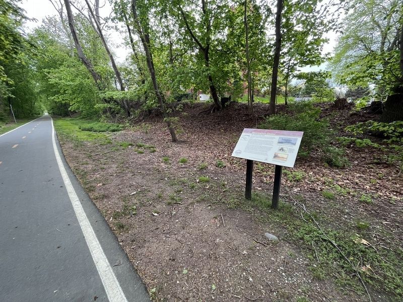
Barrington Center Marker
| 1 ► Rhode Island, Bristol County, Barrington — Barrington Center — The Commercial Hub — |
| On East Bay Bike Path east of County Road (Rhode Island Route 114), on the right when traveling east. | |||
| 2 ► Rhode Island, Bristol County, Barrington — New Meadow Neck — Rivers, Bridges, and an Early Town Center — |
| On East Bay Bike Path at New Meadow Road, on the right when traveling west on East Bay Bike Path. | |||
| 3 ► Rhode Island, Bristol County, Barrington — Osamequin — Great Leader of the Pokanokets — |
| On Wampanoag Trail (Rhode Island Route 114) at Kyle Circle, on the right when traveling north on Wampanoag Trail. | |||
| 4 ► Rhode Island, Bristol County, Bristol — Columbus Quincentennial Memorial — |
| On Thames Street south of Franklin Street, on the right when traveling south. | |||
| 5 ► Rhode Island, Bristol County, Bristol — Early Bristol 17th Century Beginnings — Sowam's Heritage Area — |
| On High Street just north of Congregational Street, on the right when traveling north. | |||
| 6 ► Rhode Island, Bristol County, Bristol — East Burial Ground — 1680 - 1930 — |
| On Wood Street south of State Street, on the left when traveling south. | |||
| 7 ► Rhode Island, Bristol County, Bristol — First Congregational Church — |
| On High Street south of Bradford Street, on the left when traveling south. | |||
| 8 ► Rhode Island, Bristol County, Bristol — Founders and Builders of Bristol — 1680 - 1930 — |
| On Wood Street south of State Street, on the right when traveling north. | |||
| 9 ► Rhode Island, Bristol County, Bristol — Historic Distillery Site — |
| Near Thames Street near State Street, on the left when traveling north. | |||
| 10 ► Rhode Island, Bristol County, Bristol — Historical Bristol — From Colonial Days to the Federal Era — ❔ — |
| Near Thames Street north of John Street, on the left when traveling north. | |||
| 11 ► Rhode Island, Bristol County, Bristol — Historical Bristol — Changing Transportation — ❔ — |
| Near Thames Street at Bradford Street, on the right when traveling south. | |||
| 12 ► Rhode Island, Bristol County, Bristol — In the Miery Swamp — King Philip Fell — |
| Near Tower Street (at milepost 0.7), 0.2 miles south of Tower Street. | |||
| 13 ► Rhode Island, Bristol County, Bristol — James DeWolf — |
| On Thames Street north of State Street, on the left when traveling north. | |||
| 14 ► Rhode Island, Bristol County, Bristol — St. Michael's Church in Bristol — |
| On Hope Street (Route 114) at Church Street, on the right when traveling south on Hope Street. | |||
| 15 ► Rhode Island, Bristol County, Bristol — The War of Independence / Honor Roll — |
| On Thames Street north of Franklin Street, on the left when traveling north. | |||
| 16 ► Rhode Island, Bristol County, Warren — Baptist Church in Warren, R.I. — Founded November 15, 1764 |
| On Main Street (Rhode Island Route 114) at Miller Street, on the right when traveling south on Main Street. Reported damaged. | |||
| 17 ► Rhode Island, Bristol County, Warren — Burr's Hill — Royal Pokanoket Burial Site — Sowams Heritage Area — |
| On Water Street south of Haile Street, on the left when traveling south. | |||
| 18 ► Rhode Island, Bristol County, Warren — Early Warren and the start of King Philip's War — |
| On Child Street (Rhode Island Route 103) at Hugh Cole Road, on the right when traveling east on Child Street. | |||
| 19 ► Rhode Island, Bristol County, Warren — In Memory of Hugh Cole — |
| Near Asylum Road, 0.3 miles west of Cole School Road, on the left when traveling north. | |||
| 20 ► Rhode Island, Bristol County, Warren — The Baptist Church in Warren — |
| On Main Street (Rhode Island Route 114) at Market Street, on the right when traveling south on Main Street. | |||
| 21 ► Rhode Island, Bristol County, Warren — Warren, RI — Home of the Massasoit Ousamequin who met the Pilgrims in 1621 — |
| On Main Street (Rhode Island Route 114) at Jefferson Street, on the right when traveling north on Main Street. | |||
| 22 ► Rhode Island, Bristol County, Warren — Washington St. — |
| On Washington Street at Main Street, on the right when traveling west on Washington Street. | |||
| 23 ► Rhode Island, Kent County, Coventry — Liberty Tree Memorial — |
| On Flat River Road (Rhode Island Route 117) east of Brenda Drive (Walker Lane), on the right when traveling east. | |||
| 24 ► Rhode Island, Kent County, Coventry — The General Nathanael Greene Homestead — |
| On Taft Street, on the right when traveling north. | |||
| 25 ► Rhode Island, Kent County, East Greenwich — Armory of the Kentish Guards — |
| On Peirce Street south of Armory Street, on the left when traveling south. | |||
| 26 ► Rhode Island, Kent County, East Greenwich — Kentish Guards Drill Field — |
| Near Church Street, on the right when traveling east. | |||
| 27 ► Rhode Island, Newport County, Jamestown — Conanicut Battery — |
| Near Battery Lane. | |||
| 28 ► Rhode Island, Newport County, Jamestown — Foundation of the Original Beavertail Lighthouse — |
| Near Beavertail Road south of Clarkes Village Road, on the right when traveling south. | |||
| 29 ► Rhode Island, Newport County, Jamestown — The 1749 Foundation — |
| On Beavertail Road, on the right when traveling south. | |||
| 30 ► Rhode Island, Newport County, Jamestown, Fort Wetherill State Park — History of the Dumplings — |
| On Fort Wetherill Road, on the right when traveling east. | |||
| 31 ► Rhode Island, Newport County, Little Compton — Col. Benjamin Church — |
| On Commons Street. | |||
| 32 ► Rhode Island, Newport County, Newport — Billy Bottomore — Confectioner — circa 1750 — |
| On Mill Street west of Division Street, on the left when traveling east. | |||
| 33 ► Rhode Island, Newport County, Newport — Bowen's Wharf — |
| On America's Cup Avenue (Rhode Island Route 138A) at Bowen's Wharf, on the right when traveling south on America's Cup Avenue. | |||
| 34 ► Rhode Island, Newport County, Newport — Bowen's Wharf — |
| On America's Cup Avenue (Rhode Island Route 138A) at Bowen's Wharf on America's Cup Avenue. | |||
| 35 ► Rhode Island, Newport County, Newport — Buffum-Redwood House — c. 1700 enlarged 1740 — NRF Founded by Doris Duke 1968 — |
| On Spring Street. | |||
| 36 ► Rhode Island, Newport County, Newport — Cap't George Buckmaster House — c. 1768 — NRF Founded by Doris Duke 1968 — |
| On Division Street. | |||
| 37 ► Rhode Island, Newport County, Newport — Capt. John Wanton House — moved 1930 — ca. 1771 — |
| On Washington Street at Bridge Street, on the left when traveling south on Washington Street. | |||
| 38 ► Rhode Island, Newport County, Newport — Cap't. William Read House — 1740 — NRF Founded by Doris Duke 1968 — |
| On Thames Street at Cozzens Court, on the left when traveling south on Thames Street. | |||
| 39 ► Rhode Island, Newport County, Newport — Captain Phillips House — 42 Elm Street — |
| On Elm Street west of 2nd Street, on the left when traveling west. | |||
| 40 ► Rhode Island, Newport County, Newport — Christopher Ellery House — ca. 1750 — 80 Division Street — |
| On Division Street south of Church Street, on the left when traveling south. | |||
| 41 ► Rhode Island, Newport County, Newport — David Braman House — 1706 — NRF Founded by Doris Duke 1968 — |
| On Thames Street north of Sanford Street, on the right when traveling north. | |||
| 42 ► Rhode Island, Newport County, Newport — Elisha Johnson House — c. 1750 — 86 Spring Street — |
| On Spring Street. | |||
| 43 ► Rhode Island, Newport County, Newport — Equality Park — |
| On Equality Park Place at Broadway, on the right when traveling north on Equality Park Place. | |||
| 44 ► Rhode Island, Newport County, Newport — Equality Park — |
| On Equality Park West at Gould Street, on the left when traveling south on Equality Park West. | |||
| 45 ► Rhode Island, Newport County, Newport — Gideon Cornell House — c. 1765 — NRF Founded by Doris Duke 1968 — |
| On Division Street just south of Touro Street when traveling south. | |||
| 46 ► Rhode Island, Newport County, Newport — Governor Gideon Wanton House — 11 Cross Street — Newport National Historic Landmark District — |
| On Cross Street at Elm Street on Cross Street. | |||
| 47 ► Rhode Island, Newport County, Newport — Hathaway-Macomber House — c. 1715 — NRF Founded by Doris Duke 1968 — |
| On Thames Street south of Cozzens Court, on the right when traveling south. | |||
| 48 ► Rhode Island, Newport County, Newport — Howland House — c. 1721 — NRF Founded by Doris Duke 1968 — |
| On Bridge Street west of Thames Street, on the left when traveling west. | |||
| 49 ► Rhode Island, Newport County, Newport — Isaac Dayton House — c. 1725 — NRF Founded by Doris Duke 1968 — |
| On Washington Street south of Bridge Street, on the left when traveling south. | |||
| 50 ► Rhode Island, Newport County, Newport — James Nicholl House — Circa 1750 — 42 Thames Street — |
| On Thames Street at Cross Street, on the left when traveling south on Thames Street. | |||
| 51 ► Rhode Island, Newport County, Newport — John Coddington House — c. 1730 — NRF Founded by Doris Duke 1968 — |
| On Marlborough Street east of Thames Street, on the right when traveling west. | |||
| 52 ► Rhode Island, Newport County, Newport — John Simpson House — c. 1774 — 39 Elm Street — |
| On Elm Street at 2nd Street on Elm Street. | |||
| 53 ► Rhode Island, Newport County, Newport — John Stevens House — c 1725 — 9 Elm Street — |
| On Elm Street east of America's Cup Avenue (Rhode Island Route 238), on the right when traveling west. | |||
| 54 ► Rhode Island, Newport County, Newport — John Stevens House — ca. 1709 — 30 Thames Street — |
| On Thames Street at Sanford Street on Thames Street. | |||
| 55 ► Rhode Island, Newport County, Newport — John Stevens House — before 1750 — also called The Penny Post House — |
| On Bridge Street west of Thames Street, on the right when traveling west. | |||
| 56 ► Rhode Island, Newport County, Newport — Jonathan Gibbs House — c. 1771 — NRF Founded by Doris Duke 1968 — |
| On Spring Street. | |||
| 57 ► Rhode Island, Newport County, Newport — Militia Common — c. 1700 — |
| On Marlborough Street at Meeting Street, on the right when traveling east on Marlborough Street. | |||
| 58 ► Rhode Island, Newport County, Newport — Mitchell Trevitt House — c. 1758 & 1828 — NRF Founded by Doris Duke 1968 — |
| On Elm Street. | |||
| 59 ► Rhode Island, Newport County, Newport — Newport — A bustling port with a long history — |
| On Washington Street at Long Wharf Mall, on the right when traveling south on Washington Street. | |||
| 60 ► Rhode Island, Newport County, Newport — Pelham Street — Walking Tour of the Historic Hill — The Museum of Newport History, Newport Historical Society — |
| On Corne Street at Pelham Street, on the right when traveling north on Corne Street. | |||
| 61 ► Rhode Island, Newport County, Newport — Peter Lee House — c. 1740 — 283 Spring Street — |
| On Spring Street north of Brewer Street, on the left when traveling north. | |||
| 62 ► Rhode Island, Newport County, Newport — Queen Anne Square — |
| On Thames Street at Mill Street, on the left when traveling south on Thames Street. | |||
| 63 ► Rhode Island, Newport County, Newport — Rhode Island Slave History — Scan for Historical Content — |
| On Bowens Wharf west of America's Cup Avenue (Rhode Island Route 138A), on the right when traveling west. | |||
| 64 ► Rhode Island, Newport County, Newport — Richard Simpson House — Circa 1757 — Historic District — |
| On Elm Street west of 2nd Street, on the right when traveling west. | |||
| 65 ► Rhode Island, Newport County, Newport — Richardson-Peckham House — c. 1740 — NRF Founded by Doris Duke 1968 — |
| On Thames Street north of Coddington Street, on the right when traveling south. | |||
| 66 ► Rhode Island, Newport County, Newport — Sheffield Huntington House — c. 1719 — 43 Elm Street — |
| On Elm Street west of 2nd Street, on the right when traveling west. | |||
| 67 ► Rhode Island, Newport County, Newport — Sherburne-Nichols House — c. 1758 - 1774 — NRF Founded by Doris Duke 1968 — |
| On Elm Street west of Cross Street, on the left when traveling west. | |||
| 68 ► Rhode Island, Newport County, Newport — Spring & John Streets — Walking Tour of the Historic Hill — The Museum of Newport History, Newport Historical Society — |
| On Spring Street at John Street, on the right when traveling south on Spring Street. | |||
| 69 ► Rhode Island, Newport County, Newport — The Colony House — |
| On Washington Square, on the right when traveling east. | |||
| 70 ► Rhode Island, Newport County, Newport — The Colony House / The State House — |
| On Washington Square at Broadway, on the right when traveling east on Washington Square. | |||
| 71 ► Rhode Island, Newport County, Newport — The Tree of Liberty — William Ellery Park — |
| On Poplar Street at Thames Street, on the right when traveling east on Poplar Street. | |||
| 72 ► Rhode Island, Newport County, Newport — Thomas Walker House — c. 1713 — NRF Founded by Doris Duke 1968 — |
| On Cross Street south of Elm Street, on the right when traveling south. | |||
| 73 ► Rhode Island, Newport County, Newport — Tom Robinson House — |
| On Washington Street at Poplar Street, on the right when traveling south on Washington Street. | |||
| 74 ► Rhode Island, Newport County, Newport — Touro Synagogue — National Historic Site — |
| On Touro Street at Division Street, on the left when traveling east on Touro Street. | |||
| 75 ► Rhode Island, Newport County, Newport — Washington Square — Walking Tour of the Historic ill — The Museum of Newport History, Newport Historical Society — |
| On Washington Square, on the left when traveling east. | |||
| 76 ► Rhode Island, Newport County, Newport — White Horse Tavern — 1673 — |
| On Marlborough Street at Farewell Street, on the left when traveling east on Marlborough Street. | |||
| 77 ► Rhode Island, Newport County, Newport — Wilder House — c. 1735 — NRF Founded by Doris Duke 1968 — |
| On Thames Street at North Baptist Street, on the right when traveling south on Thames Street. | |||
| 78 ► Rhode Island, Newport County, Newport — William Stevens House — c. 1720 — 9 Cross Street — |
| On Cross Street at Elm Street, on the right when traveling north on Cross Street. | |||
| 79 ► Rhode Island, Newport County, Portsmouth — Portsmouth Compact — 1638-1936 — |
| Near Anthony Road Extention/Old Boyd's Lane, 0.1 miles west of Boyds Lane. | |||
| 80 ► Rhode Island, Providence County, Central Falls — Pierce Park and Riverwalk — |
| On High St. | |||
| 81 ► Rhode Island, Providence County, Cumberland — Nine Men’s Misery — |
| Near Diamond Hill Road (Rhode Island Route 114) 1 mile south of Angell Road (Rhode Island Route 116). | |||
| 82 ► Rhode Island, Providence County, Lincoln — Splendid Mansion of Eleazer Arnold — |
| On Great Road (Rhode Island Route 123) at Preserved Arnold Court, on the right when traveling east on Great Road. | |||
| 83 ► Rhode Island, Providence County, Pawtucket — A Mechanic's Life — Blackstone River Valley National Historical Park, Slater Mill Historic Site — National Park Service, U.S. Department of the Interior — |
| On Slater Street just east of Roosevelt Avenue, on the left when traveling west. | |||
| 84 ► Rhode Island, Providence County, Pawtucket — Daggett House — |
| On Armistice Blvd. | |||
| 85 ► Rhode Island, Providence County, Pawtucket — River and Fields at Pawtucket — |
| On Exchange Street near Roosevelt Avenue, on the right when traveling east. | |||
| 86 ► Rhode Island, Providence County, Pawtucket — Sylvanus Brown House |
| Near Roosevelt Avenue, 0.1 miles north of Main Street (Rhode Island Route 15), on the right when traveling north. Reported permanently removed. | |||
| 87 ► Rhode Island, Providence County, Providence, College Hill — A Place for Your Ideas — |
| Near North Main Street (U.S. 1) south of Smith Street, on the left when traveling north. | |||
| 88 ► Rhode Island, Providence County, Providence, College Hill — A Thoroughfare Town |
| On North Main Street, on the left when traveling north. Reported permanently removed. | |||
| 89 ► Rhode Island, Providence County, Providence, College Hill — Around the Corner from Market Square — taken from “The Civic and Architectural Development of Providence” by John Hutchins Cady — |
| On Canal Walk. | |||
| 90 ► Rhode Island, Providence County, Providence, College Hill — Brown University Slave Trade Memorial — |
| Near Prospect Street. | |||
| 91 ► Rhode Island, Providence County, Providence, College Hill — Burning of British Taxed Tea — |
| On South Main Street (U.S. 44) at College Street, on the left when traveling north on South Main Street. | |||
| 92 ► Rhode Island, Providence County, Providence, College Hill — College Hill Historic District — |
| On Benefit Street, on the right when traveling south. | |||
| 93 ► Rhode Island, Providence County, Providence, College Hill — Court and State House — |
| On South Court Street, on the right when traveling west. | |||
| 94 ► Rhode Island, Providence County, Providence, College Hill — Crawford Street Bridge Without Crawford Street — |
| On South Water Street (U.S. 44) at Packet Street, on the right when traveling south on South Water Street. | |||
| 95 ► Rhode Island, Providence County, Providence, College Hill — First Baptist Church in America 375th Anniversary — |
| On Main Street at Washington Street, on the right when traveling north on Main Street. | |||
| 96 ► Rhode Island, Providence County, Providence, College Hill — First Town House of Providence — |
| On South Main Street (U.S. 44), on the right when traveling north. | |||
| 97 ► Rhode Island, Providence County, Providence, College Hill — Gabriel Bernon — |
| On Canal Street, in the median. | |||
| 98 ► Rhode Island, Providence County, Providence, College Hill — John Brown House — Rhode Island Afro-American Heritage Trail — |
| On Powers Street, on the left when traveling east. | |||
| 99 ► Rhode Island, Providence County, Providence, College Hill — Prospect Terrace — |
| On Congdon Street north of Cushing Street, on the left when traveling north. | |||
| 100 ► Rhode Island, Providence County, Providence, College Hill — Realizing Providence — |
| Near North Main Street (U.S. 1) at Bowen Street, on the left when traveling north. | |||
169 entries matched your criteria. The first 100 are listed above. The final 69 ⊳