The Charlestown Navy Yard was established in 1800 to build, repair, and supply the nation's warships. For 174 years the yard expanded and adapted to serve a growing, changing navy.
In early years, skilled workers build and repaired wooden . . . — — Map (db m191822) HM
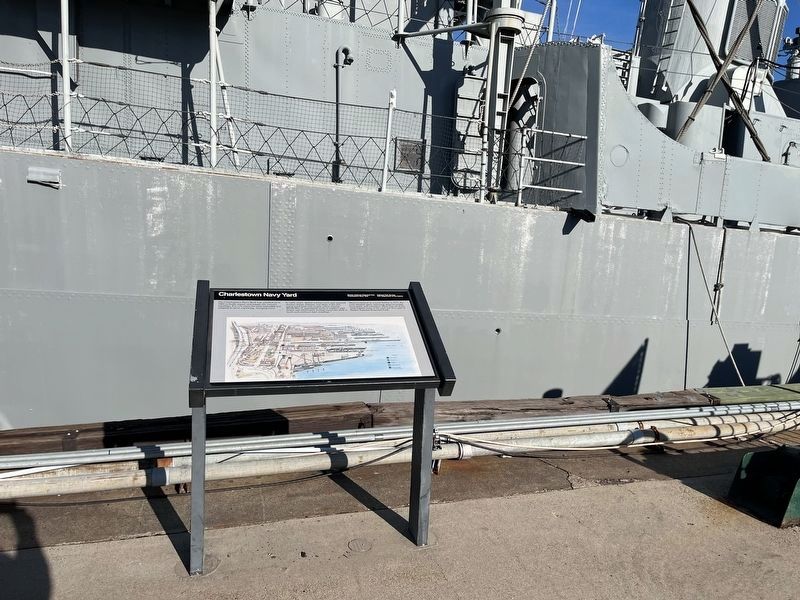
One of our nation's first naval shipyards was established here at Moulton's Point, Charlestown, in 1800, and remained active until 1971. During that period, the yard contributed greatly to the birth and growth of American naval power, and was the . . . — — Map (db m192056) HM
Welcome to the Charlestown Navy Yard, home of USS Constitution (Old Ironsides), a place of shipbuilding, repair and outfitting for over 200 years. Enjoy the story of the yard, the ships it served and the people that kept them . . . — — Map (db m215734) HM
In Memoriam
Commander
Barry Carle
U.S. Navy
1933-1974
Died while in the service of his country
Deputy District Civil Engineer for the Commandant of the First Naval District
Responsible for the concept and the initial development of the . . . — — Map (db m58455) HM WM
On 1st Avenue at Baxter Road, on the right when traveling east on 1st Avenue.
In Loving Memory
David M. Whelan
Anchoring the Charlestown
community to make us one
Founding Board Member
Friends of the
Charlestown Navy Yard
2004 - 2015 — — Map (db m215743) HM
Near 3rd Street, on the right when traveling south.
This stone and metal structure is Dry Dock 1, completed in 1833. As one of America’s first two granite dry docks, Dry Dock 1 made the repair of large naval ships faster, easier, and safer. Returning warships to sea duty in less time was a . . . — — Map (db m37697) HM
Near 3rd Street south of Freedom Trail, on the right when traveling south.
Building 10
Pitch House and Oakum Loft
Black smoke billowed from Building 10 when it first opened in 1853. There, pine tree sap was boiled down into the tar and pitch that kept wooden ships like USS Constitution watertight. . . . — — Map (db m215731) HM
Near 1st Avenue south of 5th Srteet, on the left when traveling south.
Ships use flags to communicate and to identify each other. These five flags are replicas of historic flags and ensigns (national flags flown at sea) used during the Barbary War and the War of 1812.
Star Spangled Banner
USS . . . — — Map (db m193742) HM
The Charlestown Navy Yard served the nation for 174 years as a base of the building, outfitting, repair, and modernization of ships. During World War II, the yard’s busiest years, almost 50,000 men and women worked here, around the clock, seven days . . . — — Map (db m62586) HM
During the day, workers at the Charlestown Navy Yard built, repaired, and supplied American warships. In the evening, theses men left for their homes. Only the Commandant, a few administrative officers, and a detachment of Marines stayed behind. . . . — — Map (db m191803) HM
By 1940 this navy yard supported a powerful fleet of modern steel ships. Where once carpenters, joiners, and sail- makers responded to the morning shipyard bell, now a shrill steam whistle summoned welders, boilermakers, and electronics specialists . . . — — Map (db m191801) HM
In its first years, the navy yard consisted of a small dock and several wooden storehouses, surrounded by mud flats and rolling pastures. In 1812, the commandant noted:
"the establishment… afforded no advantage or facility for . . . — — Map (db m60130) HM
Thousands of civilians spent their work days in the yard, then returned home to their Boston neighborhoods. For a few naval personnel, however; the yard was both a work-place and a home. For those who lived here, whether in the luxurious . . . — — Map (db m145105) HM
On Constitution Road east of Constitution Plaza, on the right when traveling east.
In the 1830s, Frederick Tudor became known as Boston's Ice King. Since around 1805, he had ice cut from local ponds and shipped to such faraway places as Calcutta, Rio de Janeiro, the West Indies and the Far East. As his business grew, he did his . . . — — Map (db m145104) HM
Near Constitution Road, on the right when traveling east.
Launched in 1797, USS Constitution set sail the next year on the world’s oceans to protect American commerce. Her victories soon earned her a permanent place in United States naval history. On August 19, 1812, USS Constitution took on . . . — — Map (db m71540) HM
Near Constitution Plaza, on the right when traveling east.
In memory of our shipmates and civilians lost in the disastrous explosion aboard the USS Leyte on October 16, 1953 while in the Boston Naval Shipyard. Shipmates James Robert Bedford, CHMACH, USN • Leonard Michael De Rose, Lt, USN • Charles . . . — — Map (db m37701) HM
When the Charlestown Navy Yard opened in 1800, Boston's skilled maritime workers provided a ready source of labor. As sail gave way to steam, and wooden hulls gave way to iron and steel, the work of building, repairing, and maintaining a fleet . . . — — Map (db m191807) HM
On Harborwalk east of Courthouse Way, on the right when traveling east.
The water is cleaner. Porpoises and seals are back. Mussels and sea urchins are re-colonizing rocky areas. Fish and shellfish diseases are declining. Swimmers are returning.
Boston Harbor has made a remarkable recovery since the installation . . . — — Map (db m215565) HM
Near Tremont Street, on the left when traveling north. Reported missing.
Until a few decades before the American Revolution, Boston was the largest port in the British colonies. It thrived on maritime trade, shipbuilding, and the work of hundreds of craftspeople. While the tombs of the rich merchants and politicians ring . . . — — Map (db m18795) HM
Near Tremont Street north of Bosworth Street, on the right when traveling south.
First Master of U.S. Revenue Cutter Massachusetts
The Revenue Cutter Service is the forerunner of the United States Coast Guard. Captain Williams was the commander of the first authorized ship. — — Map (db m215171) HM
On Columbus Avenue at Church Street, on the left when traveling west on Columbus Avenue.
The Statler Park site once fronted on Boston Harbor Bay's shoreline, close to where the British landed and embarked for the Battle of Lexington in 1775. This area was filled in between 1857 and 1882 to form what is now known as Boston's back Bay . . . — — Map (db m215825) HM
On Lewis Street at East Pier Drive, on the right when traveling south on Lewis Street.
The 1851 New York Tribune headline trumpeted Flying Cloud's record-breaking sail: 89 days 21 hours from New York around Cape Horn to San Francisco. There a newspaper described Donald McKay's most famous clipper ship as "a monument . . . — — Map (db m215794) HM
On London Street south of Sumner Street, on the right when traveling south.
Carlton's Wharf, one of the earliest wharves in East Boston, was built around 1851 by Massachusetts native John K. Carlton.
Carlton himself was among the first wave of Bostonians to settle in the nascent, but promising, planned township . . . — — Map (db m215773) HM
On Lewis Mall, 0.1 miles north of Marginal Street, on the left when traveling north.
A grant from Boston's Edward Ingersoll Browne Trust Fund made possible the 2012 restoration of the commemorative plaque depicting events at Noddle's Island, the area that eventually became East Boston. The plaque was designed by Theodore Cotillo . . . — — Map (db m215803) HM
On Lewis Street at East Pier Drive, on the right when traveling south on Lewis Street.
For 118 years, ferries connected East Boston to Boston's downtown waterfront. In fact, the first vessel built here was a ferry, the East Boston, launched in 1834. At one time three separate routes were operating—an essential part of East . . . — — Map (db m215796) HM
On London Street south of Sumner Street, on the right when traveling south.
Beginning with Native Americans, a succession of people have made their homes here as shipbuilding and other industries replaced farming and fishing. East Boston, which was originally five islands, has welcomed immigrants from afar, creating a . . . — — Map (db m215769) HM
On Father Jacobbe Road at Lisbon Street, on the right when traveling east on Father Jacobbe Road.
Beginning with Native Americans, a succession of people have made their homes here as shipbuilding and other industries replaced farming and fishing. East Boston, which was originally five islands, has welcomed immigrants from afar, creating a . . . — — Map (db m215775) HM
On Lewis Street at East Pier Drive, on the right when traveling south on Lewis Street.
Beginning with Native Americans, a succession of people have made their homes here as shipbuilding and other industries replaced farming and fishing. East Boston, which was originally five islands, has welcomed immigrants from afar, creating a . . . — — Map (db m215801) HM
On Lewis Street west of Marginal Street when traveling east.
Much of Boston's shoreline between high and low tide — the intertidal zone — was lost during the 19th century, when the city was the second largest port in the country. Sea trade, ship building, and related industries dominated and changed the . . . — — Map (db m215785) HM
On London Street at Father Jacobs Road, on the right when traveling south on London Street.
Hodge Boiler Works was a metalworking shop that operated in East Boston for 130 years, weathering more than a century of change. When Ebenezer Hodge founded the business in 1864, it was surrounded by shipyards that built and repaired wooden . . . — — Map (db m215767) HM
On Lewis Street west of Marginal Street, on the right when traveling east.
Boston Harbor has seen many vessels over time, from canoes transporting Native Americans to the islands and fully-rigged sailing ships bound for ports around the world, to steamships bringing goods and new Bostonians to the docks. The harbor . . . — — Map (db m215784) HM
On Father Jacobbe Road at Lisbon Street, on the right when traveling east on Father Jacobbe Road.
Situated on the Clippership Wharf Harborwalk, 'Islands' is inspired by the historic transition of five natural islands (Noddles, Hogg, Apple, Bird and Governors Island) into a manufactured peninsula which is now known to us as East Boston. As . . . — — Map (db m215779) HM
Near Lewis Street west of Marginal Street, on the right when traveling east.
Otis Tufts built the first iron-hulled vessel in the United States on this wharf in 1854. Named the R.B. Forbes, after its owner Robert Bennet Forbes, it was often used to tow clipper ships built along Border Street to their owners in New . . . — — Map (db m215788) HM
On New Street just north of Summer Street, on the right when traveling south.
Dye wood, also called logwood, is the heartwood of a tree native to Central America and the Caribbean that was imported, ground, and distilled to produce a deep black-blue dye used to dye leather, silk, cotton, and wood. The Atlantic Dye Wood . . . — — Map (db m215763) HM
On Lewis Street at East Pier Drive, on the right when traveling south on Lewis Street.
Much has changed along Boston's waterfront and in the harbor since this image was drawn in 1848. Wharves were constructed and mud flats filled, creating more land. Buildings went up; others were torn down.
What else is different? Which . . . — — Map (db m215790) HM
Near New Street at Summer Street, on the right when traveling south.
The new street site was developed in the mid-1800s for a variety of water-dependent uses, including a mast-making yard, graving dock, and marine railway. Mackerel was sorted and inspected for export on Miller's Wharf, which was later used as a . . . — — Map (db m215762) HM
On Central Street at India Street, on the right when traveling east on Central Street.
The Continental Wingate Company Building A certified historic rehabilitation Constructed, c. 1816 Restored 1984 The Continental Wingate Building is the western terminus of old Central Wharf, which originally consisted of 54 attached brick . . . — — Map (db m176214) HM
On State Street at McKinley Square, on the left when traveling west on State Street.
The Walk to the Sea encompasses four centuries
of Boston history. Beginning at the State House on
Beacon Hill, overlooking Boston's ancient Common,
the Walk passes among historic landmarks and
skyscrapers. The Walk crosses ground that, . . . — — Map (db m176235) HM
On Congress Street at State Street, on the right when traveling north on Congress Street.
Thatcher Magoun, a ship designer, builder and merchant, founded Thatcher Magoun & Son, a counting-house which operated on this site in the 19th century. Magoun's fleet of sailing ships carried the house flag into ports around the world.
The . . . — — Map (db m176004) HM
Near Commercial Street near Charter Street, on the right when traveling west.
Climate Ready Boston is the city's program to prepare for rising seas, stronger coastal storms, hotter days, and heavier rainfall due to climate change. One strategy is to redesign waterfront parks — like this one — so they can be enjoyed . . . — — Map (db m215176) HM
Near Commercial Street east of Charter Street, on the right when traveling west.
For over 50 years residents enjoyed a sandy harbor beach here. Designed by Charles Eliot, of Olmsted, Olmsted and Eliot, North End Park transformed an area of wharves and industrial buildings into a "neighborhood pleasure ground" that included . . . — — Map (db m215182) HM
John Winthrop 1588 - 1649 In the early autumn of 1630, Winthrop and his company landed at the foot of Prince Street from Charlestown. Thus was begun the settlement of Boston. The spirit of Winthrop is forever a challenge to America: "To . . . — — Map (db m191824) HM
Near Atlantic Avenue south of Commercial Street, on the right when traveling north.
Boston's legendary clipper ship trade centered around Lewis Wharf. Ships bound for faraway ports sailed from here in the 1840s and '50s:
• to buy tea in China and sell it in Europe.
• to California where most of the '49ers' famous gold . . . — — Map (db m115279) HM
Near Commercial Street at Copps Hill Terrace, on the right when traveling west.
In the late 1800s, summers brought a heartbreaking spike in the number of children who died, especially in Boston's congested, poor neighborhoods. Few medicines existed at the time, but people believed sea air could help restore health. Social . . . — — Map (db m215179) HM
Samuel Tucker 1747 - 1833 High on the roll of the valiant fighting men of the Old Navy, he captured sixty-two enemy vessels, more than six hundred cannon, and three thousand prisoners. A pride to the North End, he lived on Fleet Street.Increase . . . — — Map (db m76590) HM
Sir William Phips 1651 - 1695 First Royal Governor of Massachusetts under the Charter of 1691. One of twenty-six brothers and sisters. A poor boy apprenticed to a ship's carpenter in the North End. In 1687 he recovered from a Spanish galleon . . . — — Map (db m76593) HM
On Harborwalk north of Northern Avenue, on the left when traveling north.
Boston Then and Now
Maritime commerce through Boston Harbor was the lifeblood of early New England. Goods and services change with each century, yet the port's economic vitality endures.
By 1900, Boston had successfully transformed . . . — — Map (db m215549) HM
On Harborwalk north of Northern Avenue, on the left when traveling north.
The Expansion of Boston's Commerce and Industry
After the end of the Revolution in 1783, Boston merchants built huge fortunes through foreign trade. Commerce further expanded after 1830 with the birth of railroads and the boom of industry. . . . — — Map (db m215563) HM
On Harborwalk west of Courthouse Way, on the left when traveling east.
The Expansion and Transformation of the Port
Fan Pier is the fulcrum between old and new Boston. It was created by investors who saw the potential of rail to ship connections. Today, the South Boston Seaport District, located near downtown . . . — — Map (db m215564) HM
On Atlantic Avenue south of State Street, on the right when traveling north.
This mural celebrates Boston's waterfront heritage, fishing history, revitalized harbor and the important role the codfish has played throughout Massachusetts' history.
Artists worked with 12 shades of tumbled recycled glass pieces to . . . — — Map (db m215755) HM
On Atlantic Avenue south of State Street, on the left when traveling north.
On a Drowned Drumlin Field They Built Lighthouses, Forts, and Harbor Homes…
Landscape architect Frederick Law Olmsted, as he embarked on the creation of Boston's Emerald Necklace in 1886, commented. We have … a city of some repute for . . . — — Map (db m215575) HM
On Harborwalk north of Congress Street, on the right when traveling north.
The great fire of 1872 was a tragedy…but also an opportunity. Developers used rubble from the fire to create new land along the channel. After all, real estate was in high demand but access to the water was not since trains had largely replaced . . . — — Map (db m215494) HM
Near Central Wharf east of Old Atlantic Avenue, on the right when traveling east.
California Sea Lion
Zalophus californianus
Size: Females up to 6.5 feet long, males up to 8 feet long.
Weight: Females up to 400 pounds, males up to 1,000 pounds.
Diet: A variety of . . . — — Map (db m215753) HM
On Atlantic Avenue north of Seaport Boulevard, on the right when traveling north.
A native Bostonian, John Foster Williams was an extraordinary man who courageously served this country. he went to sea at the age of 15 and by the age of 22, was commanding merchant vessels. During the Revolutionary War he commanded several ships . . . — — Map (db m215566) HM
On Central Wharf east of Old Atlantic Avenue, on the right when traveling east.
In memory of our principal founder
David B. Stone
whose vision for a gateway to the oceans along the Boston waterfront led to the creation of the New England Aquarium in 1969.
A place to inspire, engage and educate the next . . . — — Map (db m215749) HM
On Harborwalk north of Congress Street when traveling north.
Looking out at the placid channel of the water in front of you, it is hard to believe that this site was once jammed with commercial ships. Throughout the 1800s, sugar and molasses dominated Boston trade but plenty of other businesses flourished . . . — — Map (db m215487) HM
On Harborwalk north of Congress Street, on the right when traveling north.
Fortifications and Navigation
Adjacent to this spot stood Fort Hill and Fort Point; the primary landmark for ship captains navigating a deep channel leading to the South Cove and South Bay. Hence, the name Fort Point Channel was adopted. . . . — — Map (db m215427) HM
On Harborwalk, 0.4 miles north of Congress Street, on the right when traveling north.
The Transformation of Russia Wharve
The buildings in the photo (left) constitute the Russia, Graphic Arts, and Tufts buildings, and occupy what was once Russia Wharf immediately south of this point. In 1829 alone, Russia Wharf handled 39 . . . — — Map (db m215428) HM
On Atlantic Avenue north of State Street, on the left when traveling north.
Little Brewster Island is home to Boston Light (1716), the oldest continually used light station in the U.S. The beacon beams light 27 miles out into the Atlantic. It's part of The Brewsters, a group of the outermost islands in the park. It's . . . — — Map (db m215585) HM
On Atlantic Avenue north of State Street, on the left when traveling north.
You can spend days relaxing on a remote beach, and nights listening to the sounds of the harbor from your campsite on Lovells Island. Tour the remaining gun batteries, bunkers, and foundations of Fort Standish. Pub on your water shoes and wade . . . — — Map (db m215584) HM
On Harborwalk north of East India Row, on the right when traveling north.
Boston Harbor is an environmental success story. Thanks to aggressive environmental efforts and the determination of organizations and environmental groups, the Harbor has been restored to better health after a century of pollution that began . . . — — Map (db m215754) HM
On Atlantic Avenue north of State Street, on the left when traveling north.
Just fifteen minutes from downtown Boston, Spectacle Island is for hiking, swimming, boating, and learning.
Stop in at a visitor center with exhibits about the history and evolution of the island and alternative energy. Go swimming on a . . . — — Map (db m215573) HM
On Harborwalk north of Congress Street, on the right when traveling north.
The land you are standing on was once known as Russia Wharf, one of dozens of wooden piers built to accommodate traffic in busy Boston Harbor. Between 1790 and 1850, many of the ships were bound for far-off Russia.
Vessels left New England . . . — — Map (db m215471) HM
On Harborwalk north of Congress Street, on the right when traveling north.
The Boston Tea Party was an act of resistance by colonists against the British government after passage of the Tea Act 1773. Colonists believed it violated their right to be taxed by only their own representatives. The boycott would embattle . . . — — Map (db m215429) HM
On Atlantic Avenue north of State Street, on the left when traveling north.
Thompson Island is the hub of youth education at Boston Harbor Islands. Thompson Island's Outward Bound programs inspire character development and academic achievement through challenging experiential learning. Schools, youth organizations, and . . . — — Map (db m215572) HM
On Causeway Street west of North Washington Street, on the right when traveling east.
The Keany Square Building stands at the northeast corner of historic Mill Pond. A marshy body of water that existed until the early 19th century, Mill Pond's shape is now roughly defined by Merrimac Street, North Washington Street, and . . . — — Map (db m215174) HM
On Essex Street at Rutherford Avenue (Massachusetts Route 99) when traveling north on Essex Street.
The Middlesex Canal, constructed between 1793 and 1803, once stretched from this point to Lowell, 27 miles to the northwest. In the early 19th century, when travel over land was more difficult than water travel, the canal served as a highway for . . . — — Map (db m245586) HM
On Central Street north of Ironstone Stree, on the right when traveling north.
The Raceway crosses under Central Street on the southerly side of the Longfellow Municipal Center. The water moved through it from a west-to-east direction from the Blackstone River and discharged back into the river on its northeast bank. . . . — — Map (db m192540) HM
On Church Street Extension, 0.5 miles east of Providence Road (Massachusetts Route 122), on the right when traveling east.
Northbridge, MA
Canal Route & Lock Location
This property
has been listed in the
National Register
of Historic Places
by the United States
Department of the Interior — — Map (db m117520) HM
On Church Street Extension, 0.5 miles east of Providence Road (Massachusetts Route 122), on the left when traveling east.
In 1836 Israel Plummer built a store beside a boat basin and dock here—the mid-point of the canal journey between Worcester, Massachusetts and Providence, Rhode Island. Retail products sold at Plummer's store included stove parts, tools and . . . — — Map (db m117521) HM
On Church Street Extension, 0.5 miles east of Providence Road (Massachusetts Route 122), on the right when traveling east.
"The hardest working river, the most thoroughly harnessed to the mill wheels of labor in the United States, probably the world, is the Blackstone."
Winthrop Packard, 1909
The Massachusetts Department of Environmental Management (DEM) created . . . — — Map (db m117522) HM
On Quinsigamond Avenue at Canton Street, on the right when traveling north on Quinsigamond Avenue.
The Blackstone River Canal generally followed the Mill Brook through Worcester, but between Kelly Square and Brosnihan Square it separated from the brook, creating a bell-shaped island that later became known as Green Island. The Blackstone River . . . — — Map (db m151753) HM
On Quinsigamond Avenue at Canton Street, on the right when traveling north on Quinsigamond Avenue.
End of an Era
Opened in 1828 to connect Worcester and Providence, the Blackstone Canal transported goods throughout the Blackstone Valley. The canal system was replaced by the faster and more efficient railroad by the 1840s. When the canal . . . — — Map (db m151752) HM
Near Front Street at Commercial Street, on the left when traveling west.
As World War II began, President Franklin Delano Roosevelt described the United States as "the arsenal of democracy." Even before the attack on Pearl Harbor and the German declaration of war on the United States, the nation had been providing . . . — — Map (db m151794) HM
On Front Street just east of Foster Street, on the right when traveling west.
"We were alerted for Korea and I remember it very clearly. We would be gone a couple of weeks at the most to make a show of force, a parade in Korea, then back to Japan." — U.S. Soldier of the 34th Infantry . . . — — Map (db m151872) HM
On Front Street at Commercial Street, on the left when traveling west on Front Street.
Formal warfare began in Europe on September 1st, 1939 with the German invasion of Poland, but there had already been fighting in Spain's civil war and in Ethiopia when Italy invaded North Africa in 1936. Furthermore, in a process called . . . — — Map (db m151806) HM
Near Front Street at Commercial Street, on the left when traveling west.
The Japanese Empire, like its European ally Germany, was determined to expand its control in East Asia by "annexing" territory and asserting control over the region. Japan took advantage of the European war to invade and seize French, Dutch, and . . . — — Map (db m151791) HM
On Front Street at Commercial Street, on the left when traveling west on Front Street.
The Second World War began when the German army, led by Nazi Führer Adolf Hitler, invaded Poland on September 1st, 1939. Germany already controlled Austria and parts of Czechoslovakia through a process called "Appeasement." In Asia, the conflict . . . — — Map (db m151809) HM
On Franklin Street just east of Main Street, on the left when traveling east.
The President of the United states takes pride in presenting the Medal of Honor posthumously to
Lieutenant John V. Power
United States Marine Corps Reserve
for service as set forth in the following . . . — — Map (db m151822) WM
282 entries matched your criteria. Entries 201 through 282 are listed above. ⊲ Previous 100