On S. Clinton Street, on the right when traveling north.
South Clinton Street gained notoriety as a Depression era "Shanty town.” The "hobo
heaven” or "hobo jungle” that sprang up on the "Jail Flats” became home to hundreds
of families at its peak in 1933, filling the area with tarpaper shacks and smoke . . . — — Map (db m197137) HM
On Indiana Route 37 at Antwerp Road, on the right when traveling east on State Route 37.
On north bank of prehistoric Lake Maumee. The ridge formed by the bank was part of the pioneer overland trace from Detroit to Fort Wayne. This route was surveyed as early as 1837 for the ridge road, served in the late nineteenth century as a toll . . . — — Map (db m183602) HM
On West Main Street at South Jefferson Street, on the left when traveling west on West Main Street.
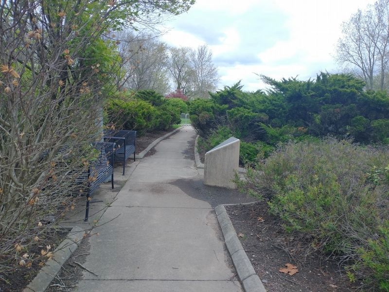
The pump and pump house were reconstructed in 2017 courtesy of the Rotary Club of Brown County.
Prior to 1949, several pumps were in use around Nashville to provide water for families who were without a well on their property, and . . . — — Map (db m206742) HM
On East Main Street (U.S. 421) at South Franklin Street, on the right when traveling east on East Main Street.
Once featuring a cupola at its peak, this 1867 structure displays Italianate Commercial architecture. The only building with four stories, it was first known as the Seitz House Hotel in 1886 and remained a hotel for over 30 years. It housed the . . . — — Map (db m207335) HM
On Road 500W at Road 100N, on the right when traveling south on Road 500W.
1886 --- Lyles Station, Indiana --- 1986
Dedicated to preserve the memory of Joshua Lyles
Lyles Station, Indiana, the State’s only remaining black-named community, was settled more than one hundred years ago by Joshua Lyles, a Freed . . . — — Map (db m47898) HM
On North 8th Street north of Conner Street, on the right when traveling north.
The Noblesville Commercial
Historic District
has been placed on the
National Register of Historic Places
by the united States
Department of the Interior
- - + - - + - - + - -
The District is roughly bounded . . . — — Map (db m37887) HM
Just north of the Hancock Hospital on State St. was the Leon E. Harker ranch. In the 1930s Leon collected rocks from all over the US to build a massive rock garden. It had lights, waterfalls, plants and pools. Northgate Shopping Center and Holiday . . . — — Map (db m233251) HM
On North Elm Street, on the right when traveling north.
In the home of Reuben W. Nelson two blocks east of here, eleven Master Masons representing the nine lodges of Indiana assembled Dec. 3, 1817 and called a meeting at Madison to organize a Grand Lodge. — — Map (db m9616) HM
On North Capitol Avenue (State Road 62) at West Cherry Street, on the right when traveling south on North Capitol Avenue.
First Log Jail erected 1809. Spier Spencer, First Sheriff, was killed 1811 commanding the Harrison County Yellow Jackets in the Battle of Tippecanoe.
During first twelve years, Harrison County had a whipping post where justice was meted out by . . . — — Map (db m9628) HM
On North Capitol Avenue near East Cherry Street, on the right when traveling north.
The Capital of Indiana Territory was moved to Corydon from Vincennes, 1813.
This building became first State Capitol, 1816.
Offices were moved to Indianapolis in 1825. — — Map (db m9626) HM
On East Walnut Street at North Elm Street, on the right when traveling east on East Walnut Street.
This original Liar's Bench was located under a shade tree on the corner of Chestnut and Capital from 1929 to 1986. It was a popular and cool place for the men to congregate. Many generations of stories have been told on this bench, but it was always . . . — — Map (db m9641) HM
On East Vaughn Drive at Jefferson Street, on the right when traveling east on East Vaughn Drive.
Madison Historic District, listed in National Register, 1973, in over 130 blocks contains hundreds of structures of every type, size, and period, 1812-1920, including many outstanding examples of major 19th century architectural styles. Madison is . . . — — Map (db m65654) HM
On State Road 7 at Muscatatuck Park Entrance Road, on the left when traveling north on State Road 7.
Side one:
Opened 1921 as Indiana's fourth state park for its natural beauty and recreation potential. Named Vinegar Mills State Park after stone-cutting mill in park. Renamed Muscatatuck State Park 1922. Stone shelters and stairways, . . . — — Map (db m45877) HM
On Jackson Street (State Road 7) at North Pike Street, on the left when traveling east on Jackson Street.
Side 'One':
Vernon platted 1815. Jennings County formed by Indiana General Assembly 1817; Vernon named county seat 1817. Madison-Indianapolis Railroad reached Vernon 1839; masonry arch, elevating track over Pike Street, remains. Vernon . . . — — Map (db m45809) HM
On North Main Street north of Madison Street, on the left when traveling north.
1906 - ∮ - ∮ - ∮ - 1946
Built in 1906
First and only Hospital in Johnson County
until after World War II
(Second Plaque)
To Honor the lineage of Family Physicians
who have served here . . . — — Map (db m69390) HM
On West Scott Street at Park Street, on the right when traveling west on West Scott Street.
Welcome to
"Grouseland"
Built 1803 - 1804
Home of
William Henry Harrison
Governor Indiana Territory 1800 - 1812
President of the United States 1840
Mansion owned and restored by
Francis Vigo Chapter
Daughters of the . . . — — Map (db m167023) HM
On Park Street east of East Scott Street, on the right when traveling east.
The larger millstone is made from French Buhr cut into wedge-shaped pieces and bound together by a heavy metal loop. A “stand” is made of two similar stones, the “upper stone” rotating on the “nether stone” to . . . — — Map (db m23275) HM
On North 2nd Street north of Busseron Street, on the left when traveling north.
The second State Bank, chartered in 1834,
was a successful and stable venture in
uncertain times. John Ewing of Vincennes
was a leader in its creation.
This branch was built by John Moore
by 1838, saved by the Francis Vigo Chapter,
DAR, . . . — — Map (db m23282) HM
On North Detroit Street south of Michigan Street, on the right when traveling south.
The Centennial Stone was erected in 1936 to commemorate the one hundredth anniversary of the founding of the Town of LaGrange on June 13, 1836.
LaGrange County was established by act of the Indiana Legislature in 1832, sixteen years . . . — — Map (db m53909) HM
On State Road 2 at Colfax Avenue, on the right when traveling west on State Road 2.
Two Civil War training camps: Colfax and Jackson, were located near La Porte. The 9th and 29th Indiana Volunteer Infantry regiments were organized and trained here. — — Map (db m43375) HM
On Lincolnway west of Michigan Avenue, on the right when traveling west.
Side One
County formed by Indiana General Assembly and La Porte selected county seat 1832. Three courthouses built on this site: first 1833, second 1847-1848. Present courthouse constructed 1892-1894 of Lake Superior Red Sandstone; designed . . . — — Map (db m43373) HM
On J Street south of 15th Street (U.S. 50), on the left when traveling south.
From 1851 to 1892 this was the location of the first railroad depot in Lawrence County. It was built by the New Albany and Salem R. R. And handled both passengers and freight. Starting in 1876 it was also the depot of the narrow gauge Bedford and . . . — — Map (db m243574) HM
On Tunnelton Road, 0.1 miles south of Parkview Drive (16th Street) (U.S. 50), on the left when traveling south.
A gift of newspaperman Fred B. Otis, May 13, 1937. The mansion was built circa 1865 by William A. Ragsdale. Pioneer stone worker, Nathan Hall purchased the property in 1875 and named it "Pine Hall." Later it was owned by industrialist Alvin T. Hert. . . . — — Map (db m74152) HM
Near Tunnelton Road, 0.1 miles Parkview Drive (16th Street) (U.S. 50).
Presented to the City of Bedford October 31, 1935 by Fred B. Otis, editor of the Bedford Daily Mail. An area of 145.81 acres of beautiful landscape, including the fine old mansion, Pine Hall. Dedicated to refined recreation and pleasure of all the . . . — — Map (db m74153) HM
On Parkview Drive north of Lincoln Drive, on the right when traveling north.
Camp Chesterfield began as an actual “camp” where visitors would come to have
readings and attend message services in the open air. Eventually, the area called the
“toad stools” was made to allow mediums to give messages to the many people . . . — — Map (db m231383) HM
On Sherwood Drive at North College Avenue, on the left when traveling west on Sherwood Drive.
The land that eventually became Sherwood Village was first granted to James Bonnell by the U.S. Government in 1822. In 1872, the property was conveyed to Lorenzo Van Scyoc and became part of the Van Scyoc Farm. Although Sherwood Village was . . . — — Map (db m132867) HM
Near North Delaware Street north of East Washington Street, on the right when traveling north.
In an act of January 6, 1821, the Indiana General Assembly, then meeting at Corydon, named the new capital of the state "Indianapolis." Jeremiah Sullivan, later an eminent Hoosier jurist, acting in cooperation with Samuel Merrill and with the . . . — — Map (db m132868) HM
On East 14th Street west of North Delaware Street, on the right when traveling west.
June 12th, 1925
"The committee on location of the Children's Museum reported that the building on the Propylaeum grounds now occupied by The Little Theater Society could be secured..."
. . . — — Map (db m127642) HM
On Central Avenue near East 15th Street, on the right when traveling south.
Vibrant historic district was home to many social, political, commercial, and industrial leaders of Indianapolis during the last half of nineteenth through early twentieth centuries. Revitalization of Old Northside is part of national historic . . . — — Map (db m127503) HM
On West St Clair Street at Camp Street, on the left when traveling east on West St Clair Street.
Ransom Place, established in 1887, was named after Freeman B. Ransom, prominent attorney, civic activist, and business leader in the Indianapolis African-American community. Ransom Place was the first African-American neighborhood in Indiana to be . . . — — Map (db m127961) HM
On West St Clair Street at Camp Street, on the left when traveling east on West St Clair Street.
Area includes subdivisions platted
1865 and 1871; most intact neighborhood associated with city’s African-American population. Numerous
prominent citizens lived in area,
including attorney and civic leader
Freeman B. Ransom (1882-1947).
Listed . . . — — Map (db m127959) HM
On Wellington Road at Holliday Drive on Wellington Road.
Wellington Estates and Wellington Park Heights,
carved out of the 97 acre Van Scyoc family farm,
was subdivided in 1923 by Oscar Schmidt,
founder of Wellington Estates Realty Co.
In 1924, a model home was built at 95 Wellington Road.
This New . . . — — Map (db m231491) HM
On South Washington Street, on the left when traveling south.
Side one
In 1897, the Current Events Club, like many women’s clubs during this era, helped organize city’s public library. Andrew Carnegie donated $25,000 in 1901 for library building construction; city provided land and annual . . . — — Map (db m18825) HM
On Main Street at North Orange Street, on the right when traveling west on Main Street.
Albion - Noble County Seat
The Center - later named Albion was chosen the Seat of Noble County Indiana by the vote of its citizens in August 1846.
Since that time three courthouses have been located on this square.
The first which . . . — — Map (db m53950) HM
On North Orange Street at West Main Street, on the left when traveling north on North Orange Street.
Albion Downtown Historic Courthouse District has been placed on the National Register of Historic Places by the United States Department of the Interior — — Map (db m241006) HM
Near West State Road 56 (State Road 56) near State Road 145.
Historic Hotels of America Nation Trust for Historic Preservation
Second Plaque
This property has been placed on the National Register of Historic Places. — — Map (db m9917) HM
On South Maple Street south of West Jefferson Street, on the right when traveling south.
Side A:
Orleans was platted March 11, 1815. This town square, called Congress Square, was part of the plat. Orleans Academy was built here 1866, in operation by 1867. In 1870s, the Academy was purchased, and its building was made part . . . — — Map (db m22064) HM
On State Road 37 at East Pivot Point Road, on the left when traveling south on State Road 37.
600 yards west, intersection of the baseline and the second principal meridian, the lines fixed in 1805 by Ebenezer Buckingham, to govern land survey in Indiana under the Ordinance of 1785. — — Map (db m47345) HM
An 1860 addition to Western Manual Labor School. The school was operated by Quakers from 1846 to 1916. The name was changed to Friends Bloomingdale Academy in 1862. — — Map (db m17258) HM
On Bank Street east of County Road N100W, on the right when traveling east.
1809 (Relief of Lincoln) 1865
The Gettysburg Address
“Four score and seven years ago our fathers brought forth on this continent, a new nation, conceived in Liberty, and dedicated to the proposition that all . . . — — Map (db m17260) HM
On County Road E780S north of Road S350E, on the left when traveling north.
The famous Indian Reserve Line of 1809 which began at the mouth of Big Raccoon Creek and ended on the Ohio boundary crossed this point. — — Map (db m164849) HM
On Nyesville Road north of County Road 100 N, on the left when traveling north.
Front
In memory of the heritage of
John & Ann (Sneath) Batty
———————————
Immigrants of England 1844
Nyesville — Circa 1866 . . . — — Map (db m59804) HM
On West Ohio Street (U.S. 36) west of South Jefferson Street, on the right when traveling east.
In February, 1824, this site was chosen as the permanent seat of justice for Parke County. Eight men christened the town-to-be in honor of the ancient boulders found here. — — Map (db m8927) HM
On East High Street at South Virginia Street, on the left when traveling east on East High Street.
This building, erected in 1832, replaced an 1824 log structure and served as jail and sheriff’s residence until ca. 1879.
A scaffold erected just east of the jail was the scene of the last hanging in Parke County. — — Map (db m59820) HM
On Ohio River Scenic Byway (Indiana Route 66) 0.2 miles east of Girl Scout Road, on the right when traveling west.
Dedicated to Abraham Lincoln and the Lincoln ideals and to the old Perry County of his boyhood years (1816-1830) Lincoln-Humble-Homely-Lonely-Gifted-Great — — Map (db m243582)
On Main Street north of Mozart Street, on the right when traveling north.
In the early 1800s, the Ohio River was the font of Midwestern settlement. Easy river travel helped spur colonization. German speaking Swiss people were among the many ethnic groups who migrated to America seeking economic opportunity and freedom . . . — — Map (db m47526) HM
On State Road 61 north of Riverwood Drive, on the right when traveling north.
Crossed White River at a nearby ford. It was made by migrating buffalo herds. The trace ran from Vincennes to Louisville and was the only through trail in pioneer days. — — Map (db m23217) HM
On Main Street west of South 2nd Street, on the right when traveling west.
Site of depot for canal which passed through town at foot of Main Street. Operations through Petersburg ceased 1860. Constructed 1832-1853, canal was nation's longest, connecting Lake Erie at Toledo with Ohio River at Evansville, through Fort Wayne, . . . — — Map (db m23215) HM
On Walnut Street at East 4th Street (State Road 62), on the right when traveling north on Walnut Street.
He served his fellow man with distinction as lawyer, Judge, Civil War General, Diplomat and Congressman.
Erected by the Posey County
Historical Society Inc. 1975 — — Map (db m48119) HM
On East 4th Street (State Road 62) at Walnut Street, on the left when traveling west on East 4th Street.
Mt. Vernon’s public square was laid out in 1816. The present court house, built in 1876 at a cost of $95,000, dominates the public square with its Italianate-style elegance. The brick and stone building is lavishly decorated with bracketed . . . — — Map (db m48216) HM
On Church Street (State Road 66) east of Main Street, on the right when traveling east.
Location of two attempts at communal living: The Harmonists under Reverend George Rapp, 1814-1825, and the Owenites under philanthropist Robert Owen, 1825-1826. New Harmony remained, an important cultural center for many, years thereafter. — — Map (db m47821) HM
On Tavern Street west of Main Street, on the left when traveling west.
Side One
William Maclure and other intellectuals came to New Harmony 1826 to join Robert Owen's utopian experiment. Maclure established the Workingmen's Institute 1838 to serve as model of self-education for laborers. Operated in various New . . . — — Map (db m47840) HM
On South Vine Street at East Washington Street (U.S. 231), on the right when traveling south on South Vine Street.
Indiana Historic Site and Structure
the
Julian Family Home
715 Crown Street
Greencastle, Indiana
1920 - - 1944
In this house once lived Elizabeth and James Julian and their six children – Percy, James, . . . — — Map (db m56306) HM
On South College Avenue at Park Street, on the left when traveling south on South College Avenue.
Side one
On January 27, 1870, Bettie Locke, Alice Allen, Hannah Fitch, and Bettie Tipton established first female Greek-letter college fraternity, Kappa Alpha Theta, at Indiana Asbury University. Fraternity fostered unity, promoted . . . — — Map (db m18832) HM
On U.S. 40 east of County Road S900W, on the right when traveling west.
Runs northwest-southeast through this point. On September 30, 1809, Indiana Territorial Governor, William Henry Harrison, obtained for the United States almost three million acres from the Potawatomi, Delaware and Miami tribes. — — Map (db m18880) HM
On South Main Street north of East Henry Street, on the right when traveling north.
Side - A
Farmland platted 1852 in Randolph County and listed as station on Indianapolis and Bellfontaine Railroad. Town incorporated 1867. Commerce based on agriculture and, by late 1880's, gas and oil production nearby. Responding to . . . — — Map (db m31322) HM
On South Main Street south of West Washington Street (a.k.a. State Rd. 32), on the right when traveling south.
Randolph County first in Nation with all Rural Consolidated High Schools
Lee L. Driver, School Superintendent
Lincoln (1st) • McKinley
Spartanburg • Lynn
Farmland • Parker
Jefferson • Saratoga
Ridgeville • Green
Stoney Creek . . . — — Map (db m31380) HM
On West Washington Street (a.k.a. St. Rd. 32) at South Main Street, on the right when traveling east on West Washington Street (a.k.a. St. Rd. 32).
Established in 1818 and was split off the north end of Wayne County with Winchester made the County Seat. 1820 - 1825 the County included all Territory North to the Michigan Line. Until 1836, included Territory North to Allen County. The 1875 . . . — — Map (db m31376) HM
On East McClain Avenue at South Main Street, on the right when traveling east on East McClain Avenue.
Side A:
County formed by Indiana General Assembly 1820. First county seat located at Lexington; first courthouse built 1821. Several attempts made 1822-1870 to move county seat to more central location, creating animosity among . . . — — Map (db m22063) HM
On South 1st Street at Clark Street, on the left when traveling south on South 1st Street.
Marking Old Lower Landing where in 1828 – age 19 – Abraham Lincoln with Allen Gentry made his first flatboat trip to New Orleans. He saw slaves sold and said. “If I ever get a chance to hit that thing, I’ll hit it . . . — — Map (db m47358) HM
On Main Street at South Second Street, on the left when traveling east on Main Street.
In October 1844 Abraham Lincoln gave a speech at Spencer County Courthouse to promote Henry Clay, Whig presidential candidate. Lincoln, during his first trip to Indiana in 14 years, was a guest at the Tavern. Site first marked October 28, 1926. — — Map (db m47356) HM
Near Parking Lot of "Lincoln Ferry Park" (State Road 66) at County Road 1290E.
Do you want to experience the world of young Abe Lincoln? You’ve come to the right place. At Lincoln Ferry Park, just west of Troy, the Lincoln family arrived by ferry from Kentucky in 1816. Young Abe Lincoln walked these woods with his long, . . . — — Map (db m47543) HM
On W. Mishawaka Ave at Charlotte St, on the left when traveling west on W. Mishawaka Ave.
Mishawaka's oldest park, circa 1860s; given to city (1881) by members of Battell family. Features include Civil War soldiers monument (1884); neoclassical copper-domed, brick and limestone bandshell commemorating WWI (1927); exceptional Works . . . — — Map (db m61835) HM
On Toledo Street (State Road 120) at Wayne Street (State Road 827) on Toledo Street.
Settled in 1834 as Willow Prairie.
Village of Brockville - Platted in 1837.
Post Office and town changed to Fremont in 1848 in honor of John C. Fremont “the Great Pathfinder.” Located on the Vistula Trail, the meeting place for people . . . — — Map (db m3406) HM
On North 4th Street north of Columbia Street, on the left when traveling north.
Lafayette.
Named for America’s friend from France. Founded by William Digby in May 1825. Head of navigation on Wabash River. Important Port of Wabash Canal 1843 - 1859. Well-known station in “underground Railroad.” Home of . . . — — Map (db m34763) HM
On North 2nd Street at Main Street, on the left when traveling north on North 2nd Street.
1902 - Built at Second and South Streets by the Cleveland, Cincinnati, Chicago, & St. Louis Railroad, nicknamed “Big Four” and the lake Erie & Western Railroad; served as a train depot until 1975
1979 - Reopened by City of . . . — — Map (db m34768) HM
On N. 6th Street at Brown Street, on the right when traveling north on N. 6th Street.
Area platted as Bartholomew and Davis Addition, 1829. Neighborhood grew rapidly during citywide expanson after canal (1843) and railroad (1853) arrived. Most structures, of many architectural styles, built 1870 - 1910. Named after Centennial School, . . . — — Map (db m8696) HM
On Miami Avenue west of Pontiac Avenue, on the right when traveling west.
Neighborhood in late-Victorian "landscape garden suburb" style, designed by Cincinnati firm, Earnshaw and Punshon. Platted 1891, 1893. Houses are of a wide variety of architectural styles. Important for this suburban development was 1892 spur on . . . — — Map (db m34222) HM
On Owen Street at Highland Avenue, on the right when traveling east on Owen Street.
Neighborhood in late-Victorian "landscape garden suburb" style, designed by Cincinnati firm, Earnshaw and Punshon. Platted 1891, 1893. Houses are of a wide variety of architectural styles. Important for this suburban development was 1892 spur on . . . — — Map (db m69388) HM
On Highland Avenue south of Kossuth Street, on the right when traveling south.
Highland Neighborhood Park
Has Been Placed on the
National Register
of Historic Places
by The United States
Department of the Interior
Listed March 14, 1996 — — Map (db m34914) HM
On 9th Street at East State Street, on the right when traveling north on 9th Street.
Side One
Lafayette platted 1825. This area was first known as Prospect Hill. Wealthy families built country estates here 1850's - 1860's. Streetcar lines of 1880's transformed Hill into popular suburb. Area declined after World War II. . . . — — Map (db m8694) HM
On Perrin Avenue at Main Street, on the right when traveling north on Perrin Avenue.
Platted in 1873, this district was Lafayette's first planned residential area which conformed to geographic contours. It was developed by James J. Perrin, Margaret Cason Perrin, Edward Asher, and Consider Tinkler. Listed in National Register of . . . — — Map (db m8695) HM
On South West Street (a.k.a.: Ct. Rd. S 1150 W) north of State Road 28, on the right when traveling north.
In 1849, Jacob Dunham and Catherine Goodnight Dunham, originally from Virginia and Pennsylvania, purchased this land, formerly part of the Miami Indian Reserve, through a U. S. Land Grant. Their grandson, William Riley Dunham, was an Indiana . . . — — Map (db m37787) HM
On Wabash Avenue west of South 7th Street, on the left when traveling west.
U.S. Highway 40, the old National Road which opened the west for settlement, and U.S. Highway 41, a major north-south route, were designated part of the original federal highway system in 1926. Their intersection in Terre Haute at Wabash Avenue and . . . — — Map (db m58380) HM
On Wabash Avenue west of South 7th Street, on the left when traveling west.
The City of Terre Haute has a rich history, spurred by transportation advancements Terre Haute became the “Crossroads of America“. This plaza commemorates the achievements of the first steamboat on the Wabash in 1823, the National . . . — — Map (db m58418) HM
On Maple Avenue at Lafayette Avenue, on the right when traveling west on Maple Avenue.
The community was named for the twelve corners created by the intersection of Lafayette, Maple and 13th Street. Twelve Points was begun in 1889 when Walter Phillips had his land surveyed and the business district laid out. At that time the area . . . — — Map (db m58417) HM
On 8th Avenue at Norht 7th Street, on the right when traveling west on 8th Avenue.
In 1892, near this site, Union Hospital was founded by Leo J. Weinstein, M.D., and Benjamin F. Swafford, M.D., with the support of local citizens. This hospital established Terre Haute's first School of Nursing in 1900. — — Map (db m58385) HM
Near E. Hanging Rock Road, 0.8 miles east of State Road 524, on the left when traveling east.
The Legend of Hanging Rock
Wy-nu-sa was a beautiful Miami Indian maiden who thought she was in love with two handsome, strong, stalwart Indian braves. Both of the young men were deeply in love with the maiden, too, but she was not able . . . — — Map (db m71305) HM
On South Main Street (State Road 55) south of Boyer Street, on the right when traveling south.
side one
Local team was important Indiana precursor to modern professional football organizations. Clinton Beckett introduced football to Pine Village High School 1898. Town and high school teams played on bottomland, northwest of here, . . . — — Map (db m8559) HM
On East Independence Road near North 800 East, on the right when traveling east.
In 1838 a band of over 800 Potawatomi Indians were forcibly removed from their homeland in Northern Indiana and marched to Eastern Kansas. Many died along the trail during the two month trek. This mournful caravan traveled this road on September 14, . . . — — Map (db m9307) HM
On Main Street at South 2nd Street, on the right when traveling east on Main Street.
About 850 Potawatomi Indians camped here near Williamsport September 14, 1838. Two deaths occurred in the evening. Three chiefs were transported in a jail wagon because they refused to leave their beloved homeland in Indiana. — — Map (db m32620) HM