After filtering for Kentucky, 356 entries match your criteria. The first 100 are listed. ⊳
Education Topic
By Mark Hilton, May 8, 2015
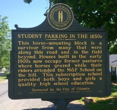
Student Parking in the 1850s Marker
| 1 ► Kentucky, Adair County, Columbia — 2242 — Male and Female High School Site / Student Parking in the 1850s — |
| On East Guardian Street, on the right when traveling south. | |||
| 2 ► Kentucky, Anderson County, Lawrenceburg — 1479 — Distinguished Officers - Alumni of Kavanaugh / Kavanaugh School — |
| On East Woodford Street (U.S. 62) near Dogwood Drive, on the left when traveling east. | |||
| 3 ► Kentucky, Anderson County, Lawrenceburg — 1273 — Kavanaugh School / Mrs. "K" — “The Sun Never Sets on Kavanaugh.” — |
| On East Woodford Street (U.S. 62) east of Dogwood Drive, on the right when traveling west. | |||
| 4 ► Kentucky, Anderson County, Lawrenceburg — 2029 — William H. Townsend — (1890 - 1964) — |
| On West Broadway Street (U.S. 62) at Old Frankfort Road (U.S. 127), on the right when traveling west on West Broadway Street. | |||
| 5 ► Kentucky, Barren County, Glasgow — 2474 — F. M. Jones and Bro. General Store — |
| On Coral Hill-Lecta Road at Coral Hill Road (Kentucky Route 740), on the right when traveling east on Coral Hill-Lecta Road. | |||
| 6 ► Kentucky, Barren County, Glasgow — 2417 — Henry Clay Morrison / Morrison Park — (1857~1942) — |
| On Tompkinsville Road (Kentucky Route 63) at Bristletown Road, on the left when traveling north on Tompkinsville Road. | |||
| 7 ► Kentucky, Barren County, Glasgow — 2019 — Luska Joseph Twyman — (1913-1988) — |
| On Washington Street / South Public Square at South Race Street, on the right when traveling east on Washington Street / South Public Square. | |||
| 8 ► Kentucky, Barren County, Glasgow — 2397 — Nettie B.C. Depp — (1874 - 1932) — |
| On Race Street at Washington Street, on the left when traveling south on Race Street. | |||
| 9 ► Kentucky, Bell County, Clear Creek Springs — 1286 — Henderson Settlement — Settlement is 17 miles west on Ky 190 — |
| On State Highway 190 at U.S. 25E, on the right when traveling east on State Highway 190. | |||
| 10 ► Kentucky, Bourbon County, Millersburg — 2407 — Millersburg Military Institute — |
| On Main Street, 0.1 miles north of East 11th Street, on the right when traveling north. | |||
| 11 ► Kentucky, Bourbon County, Paris — 178 — William Holmes McGuffey — |
| On High Street (U.S. 460) south of Ardery Place, on the left when traveling south. | |||
| 12 ► Kentucky, Boyd County, Ashland — Ashland Schools Faculty — |
| On 15th Street at Greenup Avenue (Kentucky Route 23), on the left when traveling north on 15th Street. | |||
| 13 ► Kentucky, Boyd County, Ashland — 2184 — Booker T. Washington School — |
| On Central Avenue at 8th Street, on the left when traveling west on Central Avenue. | |||
| 14 ► Kentucky, Boyd County, Ashland — 1815 — Gov. Simeon Willis — (1879–1965) — |
| On Bath Avenue east of 16th Street, on the right when traveling east. | |||
| 15 ► Kentucky, Boyd County, Ashland — 2125 — Putnam Stadium — |
| On Stadium Drive. | |||
| 16 ► Kentucky, Boyd County, Catlettsburg — Country Music Highway — Small Town Big Fun — |
| On Louisa Street. | |||
| 17 ► Kentucky, Boyd County, Catlettsburg — 2136 — Mary Elliott Flanery — |
| On 28th Street at Panola Street, on the right when traveling west on 28th Street. | |||
| 18 ► Kentucky, Boyle County, Danville — 1091 — "Uncle" Charlie Moran — |
| On College Street, on the left when traveling north. | |||
| 19 ► Kentucky, Boyle County, Danville — Brick Schoolhouse — |
| Near East Walnut Street. | |||
| 20 ► Kentucky, Boyle County, Danville — 923 — Centre College — |
| On West Main Street, on the left when traveling west. | |||
| 21 ► Kentucky, Boyle County, Danville — 2527 — Family Services Association of Boyle County — |
| On South 3rd Street at Jacob Street, on the left when traveling north on South 3rd Street. | |||
| 22 ► Kentucky, Boyle County, Danville — 2005 — Jacobs Hall / John A. Jacobs, Sr. (1806-69) — |
| On South Second Street, on the left when traveling north. | |||
| 23 ► Kentucky, Boyle County, Danville — 2186 — John William Bate — (1855~1945) — |
| On Stanford Ave (Kentucky Route 150), on the left when traveling north. | |||
| 24 ► Kentucky, Boyle County, Danville — 1705 — Lottie Moon (1840-1912) — |
| On North Danville Bypass (Bypass Route 127) 0.2 miles north of Lannock Drive, on the right when traveling north. | |||
| 25 ► Kentucky, Boyle County, Danville — Old Centre — Built 1820 — |
| Near West Walnut Street, 0.1 miles west of College Street, on the right when traveling west. | |||
| 26 ► Kentucky, Boyle County, Danville — 197 — School for the Deaf — |
| On West Main Street at South Fourth Street, on the right when traveling east on West Main Street. | |||
| 27 ► Kentucky, Bracken County, Augusta — 750 — A Foster Inspiration — |
| On Heather Renee French Boulevard (Kentucky Route 8) at Frankfort Street, on the right when traveling west on Heather Renee French Boulevard. | |||
| 28 ► Kentucky, Bracken County, Augusta — 94 — Augusta College — 1822 - 1849 — |
| On Frankfort Street north of East 3rd Street, on the right when traveling south. | |||
| 29 ► Kentucky, Bracken County, Augusta — Schoolfield Preparatory School — Bracken County's First School — Built in 1797 — |
| On West Riverside Drive at Williams Street, on the right when traveling east on West Riverside Drive. | |||
| 30 ► Kentucky, Bracken County, Bradford — 2288 — Bradford Schoolhouse — |
| On Bradford Road (Kentucky Route 1109) south of Mary Ingles Highway (Kentucky Route 8), on the left when traveling south. | |||
| 31 ► Kentucky, Bracken County, Germantown — 2076 — John Gregg Fee / Arnold Gragston — (1816–1901) / — |
| On Bridgeville Road (Kentucky Route 875) south of Brooksville-Germantown Road (Kentucky Route 10), on the right when traveling south. | |||
| 32 ► Kentucky, Butler County, Morgantown — 2379 — Bishop John Monroe Moore — |
| Near North Main Street at East Ohio Street, on the right when traveling north. | |||
| 33 ► Kentucky, Caldwell County, Princeton — 1453 — Cumberland Presbyterian College — |
| On U.S. 62 at West Main Street, on the right when traveling west on U.S. 62. | |||
| 34 ► Kentucky, Caldwell County, Princeton — 1903 — Historic Educational Site — |
| On North Plum Street at West Main Street, on the right when traveling south on North Plum Street. | |||
| 35 ► Kentucky, Caldwell County, Princeton — 2183 — Site of Dotson School — |
| On North Donnivan Street at Calvert Street, on the right when traveling north on North Donnivan Street. | |||
| 36 ► Kentucky, Caldwell County, Princeton — 2118 — U.K. Research and Education Center — |
| On Hopkinsville Street (State Road 91) at University Drive, on the right when traveling south on Hopkinsville Street. | |||
| 37 ► Kentucky, Calloway County, Murray — 1945 — Calloway Normal College — |
| On Kirksey Road (Kentucky Route 299) 0.2 miles south of Backusburg Road (Kentucky Route 464), on the right when traveling south. | |||
| 38 ► Kentucky, Calloway County, Murray — 1977 — Cleanth Brooks (1906-94) — |
| On North 16th Street, 0.1 miles north of Miller Avenue, on the right when traveling north. | |||
| 39 ► Kentucky, Calloway County, Murray — 2191 — Desegregation of Murray State College — |
| Near North 15th Street at Olive Boulevard, on the left when traveling north. | |||
| 40 ► Kentucky, Calloway County, Murray — 1427 — Murray State University — |
| On North 16th Street at University Drive, on the right when traveling north on North 16th Street. | |||
| 41 ► Kentucky, Calloway County, Murray — 2198 — Waters Schoolhouse — |
| On Gil Hopson Drive (County Road 1084) 0.3 miles north of Arcadia Circle, on the right when traveling north. | |||
| 42 ► Kentucky, Campbell County, Fort Thomas — 2323 — Highland United Methodist Church — |
| On Memorial Parkway (Kentucky Route 1120) at North Fort Thomas Avenue, on the right when traveling south on Memorial Parkway. | |||
| 43 ► Kentucky, Campbell County, Newport — 1730 — Northern Kentucky University / Early Schoolhouse — |
| On Louie B Nunn Drive west of University Drive, on the right when traveling west. | |||
| 44 ► Kentucky, Campbell County, Newport — 2071 — Southgate Street School — |
| On East Southgate Street east of Saratoga Street, on the left when traveling east. | |||
| 45 ► Kentucky, Carter County, Olive Hill — Historical Mural by Northeast WIA Youth — 2002-2006 — |
| On West Tom T Hall Boulevard (U.S. 60) just west of Whitt Street, on the left when traveling east. | |||
| 46 ► Kentucky, Casey County, Yosemite — 2328 — Utah School — |
| On Fishing Creek Road, 0.3 miles east of Jones Road, on the right when traveling east. | |||
| 47 ► Kentucky, Christian County, Hopkinsville — 1269 — Bethel College — |
| On West 15th Street west of Bethel Street, on the left when traveling west. | |||
| 48 ► Kentucky, Christian County, Hopkinsville — Round Table Literary Park — |
| On Talbert Drive just west of North Elm Street, on the left when traveling west. | |||
| 49 ► Kentucky, Clark County, Winchester — 2098 — Allen Tate (1899-1978) — |
| On West Lexington Avenue (U.S. 60) at McCann Drive, on the right when traveling west on West Lexington Avenue. | |||
| 50 ► Kentucky, Clay County, Manchester — 1929 — Gov. Bert T. Combs (1959-1963)/Bert T. Combs (1911 – 1991) — |
| On Town Branch Road, on the right when traveling west. | |||
| 51 ► Kentucky, Clay County, Oneida — John Gilbert, Sr. Memorial Highway — |
| On State Highway 66, 0.6 miles north of U.S. 421, on the right when traveling south. | |||
| 52 ► Kentucky, Clay County, Oneida — 2024 — Oneida Baptist Institute — |
| On College Street south of River Street, on the right when traveling south. | |||
| 53 ► Kentucky, Clinton County, Albany — 1927 — Bible Mission School / Bible Mission School and Orphanage — |
| On State Highway 1351 at Groce Gibson Road, on the left when traveling south on State Highway 1351. | |||
| 54 ► Kentucky, Clinton County, Albany — 811 — County Named, 1835 — |
| On North Washington Street at Cumberland Street, on the left when traveling north on North Washington Street. | |||
| 55 ► Kentucky, Crittenden County, Marion — In Honor of Crittenden Countian Dr. Forrest Carlisle Pogue, Jr. — 1912 - 1996 — |
| On Carlisle Street at Court Street, on the left when traveling west on Carlisle Street. | |||
| 56 ► Kentucky, Crittenden County, Marion — Original Site of Piney Fork Cumberland Presbyterian Church & School — |
| Near Piney Cemetery Road at Kentucky Road 506, on the right when traveling west. | |||
| 57 ► Kentucky, Crittenden County, Marion — 1499 — Senator W. J. Deboe / Senators from Marion — |
| On South Main Street at East Depot Street, on the right when traveling north on South Main Street. | |||
| 58 ► Kentucky, Cumberland County, Burkesville — Dedicated to Dr. Joseph Schickel — 1913 - 1992 — |
| On Upper River Street east of Veterans Street, on the left when traveling east. | |||
| 59 ► Kentucky, Daviess County, Owensboro — Born With a Purpose — |
| Near West 5th Street at Cs-1186-30, on the right when traveling west. | |||
| 60 ► Kentucky, Daviess County, Owensboro — Dr. and Mrs. Clay E. Simpson, Sr. — Owensboro Outstanding Community Service — |
| On West 4th Street at Poplar Street, on the right when traveling east on West 4th Street. | |||
| 61 ► Kentucky, Daviess County, Owensboro — Two Early Civil Rights Cases in Owensboro — |
| Near West 5th Street at Cs-1186-30, on the right when traveling west. | |||
| 62 ► Kentucky, Daviess County, Utica — 2403 — Pleasant Point Missionary Baptist Church / Pleasant Point Missionary Baptist Cemetery — |
| On Kentucky Route 764 just south of U.S. 231, on the right when traveling north. | |||
| 63 ► Kentucky, Estill County, Irvine — 1922 — Estill Seminary / Collegiate Institute — |
| On Main Street (Kentucky Route 89) south of Orchard Avenue, on the right when traveling south. | |||
| 64 ► Kentucky, Fayette County, Lexington — 2381 — Artistides — |
| Near McGrathians Pky.. | |||
| 65 ► Kentucky, Fayette County, Lexington — 2070 — Barker Hall and Buell Armory — |
| On Administration Drive at Patterson Drive, on the left when traveling north on Administration Drive. | |||
| 66 ► Kentucky, Fayette County, Lexington — 2392 — Class Competitions / Tug of War — |
| Near Hilltop Avenue north of University Drive, on the right when traveling north. | |||
| 67 ► Kentucky, Fayette County, Lexington — Cleona Belle Matthews Boyd / Boyd Hall — 1874-1955 / 1923-2014 — |
| Near Avenue of Champions (Kentucky Route 1974) south of South Limestone (U.S. 27), on the left when traveling south. | |||
| 68 ► Kentucky, Fayette County, Lexington — 2022 — Desegregation of UK / Lyman T. Johnson — / 1906- 1997 — |
| On Hilltop Avenue north of University Drive, on the left when traveling north. | |||
| 69 ► Kentucky, Fayette County, Lexington — 1480 — Dr. Robert Peter — |
| On Newtown Pike (Kentucky Route 922) 1 mile north of Iron Works Pike (Kentucky Route 1973), on the right when traveling north. | |||
| 70 ► Kentucky, Fayette County, Lexington — 1001 — Ellerslie — |
| On Richmond Road (U.S. 25, 421) south of Lake Park Road, on the right when traveling south. | |||
| 71 ► Kentucky, Fayette County, Lexington — 1447 — Fairlawn, ca. 1845 / Dr. Benjamin Dudley — |
| On North Broadway (U.S. 27/68) north of Kenyon Road, on the right when traveling north. | |||
| 72 ► Kentucky, Fayette County, Lexington — 2444 — Family & Consumer Sciences Extension in Kentucky / Myrtle Weldon (1890-1971) — |
| On Farm Road at University Drive, on the left when traveling west on Farm Road. | |||
| 73 ► Kentucky, Fayette County, Lexington — Frances Jewell McVey / Jewell Hall — 1889-1943 / 1939-2014 — |
| On Avenue of Champions (Kentucky Route 1974) north of South Martin Luther King Boulevard, on the right when traveling north. | |||
| 74 ► Kentucky, Fayette County, Lexington — 2012 — Gillis Building 1889 — |
| On Administration Drive north of South Limestone (U.S. 27), on the right when traveling north. | |||
| 75 ► Kentucky, Fayette County, Lexington — Haggin Hall — |
| On Huguelet Drive north of University Drive, on the right when traveling north. | |||
| 76 ► Kentucky, Fayette County, Lexington — Herman L. Donovan / Donovan Hall — 1887-1964 / 1955-2014 — |
| On Huguelet Drive south of Rose Street, on the right when traveling north. | |||
| 77 ► Kentucky, Fayette County, Lexington — 2169 — Kentucky Kernel — |
| 78 ► Kentucky, Fayette County, Lexington — 1553 — Lexington Courthouses / Cheapside — |
| On Cheapside, on the right when traveling north. | |||
| 79 ► Kentucky, Fayette County, Lexington — 2138 — Main Building — |
| On Administration Drive, 0.1 miles S. Limestone (U.S. 27), on the right when traveling east. | |||
| 80 ► Kentucky, Fayette County, Lexington — 2315 — Margaret Isadora King / Margaret I. King Library — |
| Near Funkhouser Drive. | |||
| 81 ► Kentucky, Fayette County, Lexington — 2069 — Maxwell Place — |
| Near Rose Street. | |||
| 82 ► Kentucky, Fayette County, Lexington — 2009 — Scovell Hall / M.A. Scovell 1855-1912 — |
| On South Limestone (U.S. 27) at Huguelet Drive, on the right when traveling north on South Limestone. | |||
| 83 ► Kentucky, Fayette County, Lexington — 2232 — Thomas D. Clark — 1903-2005 — |
| Near Patterson Drive south of Administration Drive. | |||
| 84 ► Kentucky, Fayette County, Lexington — 1966 — WBKY/WUKY — |
| Near Graham Avenue north of Gladstone Avenue, on the right when traveling north. | |||
| 85 ► Kentucky, Fayette County, Lexington — 2289 — What's in a Name? — |
| Near Patterson Drive. | |||
| 86 ► Kentucky, Fayette County, Lexington, Ashland Park — 2476 — A&M College at Ashland — |
| Near Sycamore Road near Fincastle Road. | |||
| 87 ► Kentucky, Fayette County, Lexington, Eastside — 2481 — Mentelle Park / Mentelle School — |
| On Mentelle Park north of Richmond Road (U.S. 25/421), in the median. | |||
| 88 ► Kentucky, Fayette County, Lexington, Georgetown — 1963 — Colored Orphan Industrial Home — |
| On Georgetown Street (U.S. 25) north of Ash Street, on the right when traveling north. | |||
| 89 ► Kentucky, Fayette County, Lexington, Gratz Park — 8 — Black Lexingtonians Believed Strongly in Education 1865 — Empowerment through Learning — Downtown African-American Heritage Trail — |
| On Church Street west of North Limestone Street, on the right when traveling west. | |||
| 90 ► Kentucky, Fayette County, Lexington, Gratz Park — 1549 — Transylvania Pavilion — |
| On Market Street, 0.1 miles south of West 3rd Street, on the left when traveling north. | |||
| 91 ► Kentucky, Fayette County, Lexington, Historic South Hill — Keeneland Hall — 1955-2014 — |
| On South Limestone north of Campus Drive, on the right when traveling north. | |||
| 92 ► Kentucky, Fayette County, Lexington, Historic South Hill — Sarah Bennett Holmes / Holmes Hall — 1886-1983 / 1958-2014 — |
| On Avenue of Champions south of South Limestone, on the right when traveling north. | |||
| 93 ► Kentucky, Fayette County, Lexington, Martin Luther King — 125 — Colonel George Nicholas — |
| On East 3rd Street west of Elm Tree Lane, on the left when traveling east. | |||
| 94 ► Kentucky, Fayette County, Lexington, Montclair — 2542 — Kentucky Educational Television / KET, the Kentucky Network — |
| On Cooper Drive, on the right when traveling east. | |||
| 95 ► Kentucky, Fayette County, Lexington, Northside District — 5 — From Enslaved to Community Activist / The Original Power Couple — 1871 — Downtown African-American Heritage Trail — |
| On North Limestone Street at East Short Street, on the right when traveling north on North Limestone Street. | |||
| 96 ► Kentucky, Fayette County, Lexington, Northside District — 1406 — Old Morrison / Transylvania Alumni — |
| Near West 3rd Street, near North Upper Street, on the right when traveling west. | |||
| 97 ► Kentucky, Fayette County, Lexington, Northside District — 2538 — Paul Laurence Dunbar High School — 1922-1967 — |
| On North Upper Street south of West 6th Street, on the right when traveling south. | |||
| 98 ► Kentucky, Fayette County, Lexington, Northside District — 2197 — Sayre Female Institute / David Austin Sayre — / 1793-1870 — |
| On North Limestone west of Templeman Street, on the right when traveling east. | |||
| 99 ► Kentucky, Fayette County, Lexington, Northside District — 1445 — School Of Medicine — |
| On West 2nd Street at North Broadway Street (U.S. 27 & 68), on the right when traveling west on West 2nd Street. | |||
| 100 ► Kentucky, Fayette County, Lexington, Northside District — 1714 — Thomas Hunt Morgan / Genetic Research — |
| On North Broadway Street (U.S. 27 & 68) north of West 2nd Street, on the right when traveling north. | |||
356 entries matched your criteria. The first 100 are listed above. Next 100 ⊳