After filtering for Nevada, 297 entries match your criteria. The first 100 are listed. ⊳
Industry & Commerce Topic
By Syd Whittle, July 6, 2009
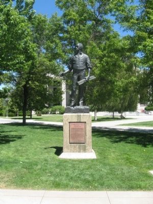
Abraham Van Santvoord Curry Marker and Statue
| 1 ► Nevada, Carson City — Abraham Van Santvoord Curry — 1815 – 1873 — “A Man with a Vision” — |
| Near South Carson Street (U.S. 395/50). | |||
| 2 ► Nevada, Carson City — Blackwell Ponds — |
| On Spooner Drive near Windridge Drive, on the right when traveling west. | |||
| 3 ► Nevada, Carson City — Carson City — Original Station — Apr. 3, 1860 - Nov. 20, 1861 — |
| On South Carson Street (Business U.S. 395), on the right when traveling south. | |||
| 4 ► Nevada, Carson City — 258 — Charles W. Friend House, Observatory, and Weather Station — |
| On North Stewart Street, on the left when traveling south. | |||
| 5 ► Nevada, Carson City — Chinatown — |
| On East 3rd Street just east of South Stewart Street, on the right when traveling west. | |||
| 6 ► Nevada, Carson City — 1 — Empire and the Carson River Mills — 1864 - 1964 — |
| On U.S. 50 at Akron Way, on the right when traveling east on U.S. 50. | |||
| 7 ► Nevada, Carson City — 194 — Gardner’s Ranch — |
| On South Carson Street (U.S. 395/50), on the right when traveling south. | |||
| 8 ► Nevada, Carson City — 193 — Historic Flume and Lumberyard — |
| Near South Carson Street (U.S. 395/50). | |||
| 9 ► Nevada, Carson City — Isaac Evan James — January 6, 1830 – January 1, 1887 — |
| Near Seely Loop near North Saliman Road, on the left. | |||
| 10 ► Nevada, Carson City — 213 — Lakeview — |
| On U.S. 395 Alterate (Alternate U.S. 395) at Hobart Road, on the right when traveling south on U.S. 395 Alterate. | |||
| 11 ► Nevada, Carson City — Logging Wagon — |
| Near South Carson Street (Business U.S. 395) at Fairview Drive, on the right when traveling south. | |||
| 12 ► Nevada, Carson City — 252 — Rinckel Mansion — |
| On North Curry Street near West King Street, on the right when traveling south. | |||
| 13 ► Nevada, Carson City — St. Charles Hotel — |
| On West 3rd Street at Carson Street (Business U.S. 395), on the right when traveling west on West 3rd Street. | |||
| 14 ► Nevada, Carson City — The United States Mint at Carson City, Nevada — |
| On North Carson Street (U.S. 395), on the right when traveling south. | |||
| 15 ► Nevada, Carson City — 196 — The United States Mint Carson City, Nevada — |
| On West Robinson Street near North Carson Street, on the right when traveling west. | |||
| 16 ► Nevada, Carson City — Tribute to Nevada Miners — Adolph Sutro — 1830-1898 — |
| Near South Carson Street (Business U.S. 395) at West 2nd Street, on the right when traveling north. | |||
| 17 ► Nevada, Carson City — Virginia and Truckee Roundhouse — |
| On North Carson Street, on the right when traveling north. | |||
| 18 ► Nevada, Churchill County, Fallon — 202 — Fairview — 1905 - 1917 — 1-1/2 Miles South — |
| On U.S. 50, 5 miles east of Nevada Route 839, on the right when traveling east. | |||
| 19 ► Nevada, Churchill County, Fallon — Swift Steeds Tie East to West — |
| Near Lincoln Avenue (U.S. 50) 25 miles east of Maine Street (U.S. 95), on the left when traveling east. | |||
| 20 ► Nevada, Churchill County, Fallon — 1 — The Brothers of E.C.V. — |
| On Lincoln Highway (U.S. 50) near Wildes Road (County Route 118), on the left when traveling east. | |||
| 21 ► Nevada, Churchill County, Fallon — What Are Those Rocks Out There? — |
| Near Lincoln Avenue (U.S. 50) 25 miles east of Maine Street (U.S. 95), on the left when traveling east. | |||
| 22 ► Nevada, Churchill County, Fallon — Williams Station — |
| On U.S. 50, on the right when traveling east. | |||
| 23 ► Nevada, Clark County, Boulder City — Heroes of Hoover — |
| On Hoover Dam Access Road, on the left when traveling north. | |||
| 24 ► Nevada, Clark County, Boulder City — Puddler's Break — |
| On Nevada Way at Avenue B, on the right when traveling west on Nevada Way. | |||
| 25 ► Nevada, Clark County, Boulder City — The Hoover Dam Construction Mascot — The Dog Who Owned the Dam — |
| Near Hoover Dam Access Road. | |||
| 26 ► Nevada, Clark County, Boulder City, Boulder City Historic District — Alabam — |
| On Nevada Way at Ash Street, on the right when traveling west on Nevada Way. | |||
| 27 ► Nevada, Clark County, Boulder City, Boulder City Historic District — Boulder City, Nevada — |
| On Park Street, on the right when traveling east. | |||
| 28 ► Nevada, Clark County, Boulder City, Boulder City Historic District — Frank T. Crowe — |
| On Nevada Way at Cherry Street, on the right when traveling west on Nevada Way. | |||
| 29 ► Nevada, Clark County, Boulder City, Boulder City Historic District — Hoover Dam Memorial — |
| On Nevada Way at Cherry Street, on the right when traveling west on Nevada Way. | |||
| 30 ► Nevada, Clark County, Boulder City, Boulder City Historic District — Hoover Dam Turbine Runner — |
| On Colorado Street at Nevada Highway, on the right when traveling west on Colorado Street. | |||
| 31 ► Nevada, Clark County, Boulder City, Boulder City Historic District — The Boulder Dam Hotel — |
| On Arizona Street, on the right when traveling east. | |||
| 32 ► Nevada, Clark County, Goodsprings — The Pioneer Saloon — |
| On Spring Street (Nevada Route 161) 0.1 miles east of Vegas Street, on the left when traveling east. | |||
| 33 ► Nevada, Clark County, Henderson, Mission Hills — Alunite — "There's Gold In Them Thar Hills". . . Or Is There? — |
| Near U.S. 95/93. | |||
| 34 ► Nevada, Clark County, Las Vegas, Charleston — Las Vegas Springs — |
| On South Valley View Boulevard at Meadows Lane, on the right when traveling north on South Valley View Boulevard. | |||
| 35 ► Nevada, Clark County, Las Vegas, Cultural Corridor Coalition — Bow & Arrow Motel — |
| On Las Vegas Boulevard North, on the right when traveling north. | |||
| 36 ► Nevada, Clark County, Las Vegas, Cultural Corridor Coalition — Jerry's Nugget — |
| Near North Las Vegas Boulevard near East McWilliams Avenue, on the right when traveling north. | |||
| 37 ► Nevada, Clark County, Las Vegas, Cultural Corridor Coalition — The "H" Wall — |
| Near North Las Vegas Boulevard near East McWilliams Avenue, on the right when traveling north. | |||
| 38 ► Nevada, Clark County, Las Vegas, Cultural Corridor Coalition — The Las Vegas Hard Rock Café Guitar Sign — |
| Near Las Vegas Boulevard North at East McWilliams Avenue, on the right when traveling north. | |||
| 39 ► Nevada, Clark County, Las Vegas, Cultural Corridor Coalition — The Neon Boneyard Park Sign — |
| On Las Vegas Boulevard North, on the right when traveling north. | |||
| 40 ► Nevada, Clark County, Las Vegas, Downtown Las Vegas — Block 16 — |
| On East Ogden Avenue at North 1st Street, on the right when traveling west on East Ogden Avenue. | |||
| 41 ► Nevada, Clark County, Las Vegas, Downtown Las Vegas — Fremont Street — |
| Near Fremont Street. | |||
| 42 ► Nevada, Clark County, Las Vegas, Downtown Las Vegas — 9 — Jackson Street Commercial District — 1942 — |
| On Jackson Avenue at F Street, on the right when traveling east on Jackson Avenue. | |||
| 43 ► Nevada, Clark County, Las Vegas, Downtown Las Vegas — Las Vegas' Most Historic Hotel & Casino — |
| Near Fremont Street. | |||
| 44 ► Nevada, Clark County, Las Vegas, Downtown Las Vegas — 13 — Las Vegas Paiute Colony — 1911 — |
| On North Main Street at Paiute Drive, on the right when traveling south on North Main Street. | |||
| 45 ► Nevada, Clark County, Las Vegas, Downtown Las Vegas — Nevada Motel — Circa 1950 — Neon Museum — |
| On East Ogden Avenue at North Casino Center Boulevard (Nevada Route 602), on the right when traveling north on East Ogden Avenue. | |||
| 46 ► Nevada, Clark County, Las Vegas, Downtown Las Vegas — Old Betsy — |
| On South Main Street at Garces Avenue, on the right when traveling north on South Main Street. | |||
| 47 ► Nevada, Clark County, Las Vegas, Downtown Las Vegas — 190 — Original Homesite of a Las Vegas Pioneer: Charles 'Pop’ Squires — 1865 - 1958 — |
| On 400 S. 7th Street at Stanley W Cooper Pl, on the right when traveling south on 400 S. 7th Street. | |||
| 48 ► Nevada, Clark County, Las Vegas, Downtown Las Vegas — Silver Slipper Gambling Hall — Circa 1950s — |
| On North Las Vegas Boulevard at East McWilliams Avenue, in the median on North Las Vegas Boulevard. | |||
| 49 ► Nevada, Clark County, Las Vegas, Downtown Las Vegas — The First Telephone — |
| Near Fremont Street at South Main Street. | |||
| 50 ► Nevada, Clark County, Las Vegas, Downtown Las Vegas — Von Tobel's Hardware Store |
| On South First Street, on the right when traveling north. Reported missing. | |||
| 51 ► Nevada, Clark county, Las Vegas, Downtown South — Green Shack — |
| On East Fremont Street, 0.1 miles east of East Charleston Boulevard, on the right when traveling east. | |||
| 52 ► Nevada, Clark County, Las Vegas, Downtown South — The Wengert Mansion — |
| On E. Charleston Blvd., on the left when traveling west. | |||
| 53 ► Nevada, Clark County, Las Vegas, Rancho Oakey — Old Well Tower #10 — |
| 54 ► Nevada, Clark County, Las Vegas, West Sahara — Outlaws and Horse Thieves on the Old Spanish Trail — |
| On South Cimarron Road, on the right when traveling north. | |||
| 55 ► Nevada, Clark County, Las Vegas, West Sahara — The Las Vegas Mormon Mission — |
| On South Cimarron Road at Eldora Avenue, on the right on South Cimarron Road. | |||
| 56 ► Nevada, Clark County, Laughlin — 140 — Camels and Commerce — |
| Near South Casino Drive, on the right when traveling south. | |||
| 57 ► Nevada, Clark County, Laughlin — Laughlin, an Oasis on the Colorado — |
| Near South Casino Drive, on the right when traveling south. | |||
| 58 ► Nevada, Clark County, Mesquite — 3 — Abbott Way Station — Circa 1917 — |
| On West Mesquite Boulevard, on the right when traveling west. | |||
| 59 ► Nevada, Clark County, Mesquite — 15 — Abram Woodbury Home and Gas Station — Circa 1919 — |
| On East 1st North at North Sandhill Boulevard, on the left when traveling east on East 1st North. | |||
| 60 ► Nevada, Clark County, Mesquite — 16 — Drug Store / Bakery — Circa 1940 — |
| On North Sandhill Boulevard, on the right when traveling north. | |||
| 61 ► Nevada, Clark County, Mesquite — 2 — Egg House / Telephone Building — Circa 1929 — |
| On West Mesquite Boulevard, on the right when traveling west. | |||
| 62 ► Nevada, Clark County, Mesquite — 18 — Ervin "Casey" Jones House — Circa 1932 — |
| On East Mesquite Boulevard, on the right when traveling east. | |||
| 63 ► Nevada, Clark County, Mesquite — 4 — Tithing Lot — |
| On East Mesquite Boulevard, on the right when traveling west. | |||
| 64 ► Nevada, Clark County, Mesquite — 19 — William Abbott Home / Abbott Hotel — Circa 1901 — |
| On East Mesquite Boulevard east of North Sandhill Road, on the right when traveling east. | |||
| 65 ► Nevada, Clark County, Moapa — Glendale and "Glendale Nick" Nicolaides — |
| On Glendale Boulevard, on the left when traveling east. | |||
| 66 ► Nevada, Clark County, Nelson — 6 — El Dorado Canyon — |
| On Nevada Route 165, 12.9 miles east of U.S. 95, on the left when traveling east. | |||
| 67 ► Nevada, Clark County, Nelson — 6 — El Dorado Canyon — |
| On Nevada Route 165, 11.2 miles east of U.S. 95, on the right when traveling east. | |||
| 68 ► Nevada, Clark County, Nelson — 6 — Eldorado Canyon — Head of Steamboat Navigation in Nevada — |
| On Nevada Route 165 at Veterans Memorial Highway (U.S. 95), on the right when traveling east on State Route 165. | |||
| 69 ► Nevada, Clark County, Nelson — Techatticup Mine — |
| On Nevada Route 165, 12.9 miles east of U.S. 95, on the left when traveling east. | |||
| 70 ► Nevada, Clark County, North Las Vegas — 224 — Kyle (Kiel) Ranch — |
| On Kiel Way at East Carey Way, on the left when traveling north on Kiel Way. | |||
| 71 ► Nevada, Clark County, Overton — Valley of Fire Behind the Camera — |
| Near White Domes Road (Mouse's Tank Road) north of Fire Canyon Road. | |||
| 72 ► Nevada, Clark County, Paradise — The Red Barn — |
| On South Las Vegas Boulevard, on the left when traveling north. | |||
| 73 ► Nevada, Clark County, Paradise — The Welcome To Las Vegas Sign — |
| Near Las Vegas Boulevard South (Nevada Route 159) 0.4 miles south of West Russell Road. | |||
| 74 ► Nevada, Clark County, Searchlight — George Frederick Colton and the Duplex Mine — |
| Near State Highway 95. | |||
| 75 ► Nevada, Clark County, Searchlight — 116 — Searchlight — |
| On U.S. 95, 0.2 miles north of Nevada Route 164, on the right when traveling south. | |||
| 76 ► Nevada, Douglas County, Carson City, Spooner Summit — Life at the Summit — |
| Near Lincoln Highway (U.S. 50 at milepost 13) west of Kings Canyon Road, on the right when traveling east. | |||
| 77 ► Nevada, Douglas County, Gardnerville — Adaven Building — 1435 Highway 395 — Vernacular Commercial Style — |
| On U.S. 395 near Eddy Street, on the right when traveling north. | |||
| 78 ► Nevada, Douglas County, Gardnerville — Arendt Jensen Home — 1243 A&B Eddy Street — Vernacular with Bungalow Elements Style — |
| On Eddy Street at Ezell Street on Eddy Street. | |||
| 79 ► Nevada, Douglas County, Gardnerville — Arendt Jensen Merchandise — (Carson Valley Mercantile) — 1423 Highway 395 — |
| On U.S. 395 at Eddy Street, on the right when traveling north on U.S. 395. | |||
| 80 ► Nevada, Douglas County, Gardnerville — East Fork Hotel Building — 1441 Highway 395 — Vernacular Utilitarian Style |
| On U.S. 395 at Gilman Avenue on U.S. 395. Reported permanently removed. | |||
| 81 ► Nevada, Douglas County, Gardnerville — J & T Basque Restaurant Building — 1426 Highway 395 — Italianate Commercial Style — |
| On U.S. 395 at Eddy Street on U.S. 395. | |||
| 82 ► Nevada, Douglas County, Gardnerville — Jensen Mansion — 1431 Ezell Street — Colonial Revival Style — |
| On Ezell Street at Eddy Street, on the left when traveling south on Ezell Street. | |||
| 83 ► Nevada, Douglas County, Gardnerville — Jensen/Schacht House — 1235 Eddy Street — Vernacular Neoclassical Rowhouse Style — |
| On Eddy Street at Mission Street, on the right when traveling east on Eddy Street. | |||
| 84 ► Nevada, Douglas County, Gardnerville — Perry's Dry Goods — 1448 Highway 395 — Vernacular Residential Style — |
| On U.S. 395 at Gilman Avenue, on the left on U.S. 395. | |||
| 85 ► Nevada, Douglas County, Gardnerville — Record Courier Building — 1218 Eddy Street — Vernacular Style — |
| On Eddy Street west of Main Street, on the right when traveling west. | |||
| 86 ► Nevada, Douglas County, Gardnerville — Ritchford Hotel — 1404 Highway 395 — Styless Utilitarian Style — |
| On U.S. 395 north of Douglas Avenue. | |||
| 87 ► Nevada, Douglas County, Gardnerville — Sharkey's Nugget — 1440 Highway 395 — |
| On 1440 Highway 395 at Nevada Route 756, on the right when traveling south on 1440 Highway 395. | |||
| 88 ► Nevada, Douglas County, Gardnerville — St. Galls Catholic Church — 1475 Highway 395 — |
| On U.S. 385 at High School Street, on the right when traveling north on U.S. 385. | |||
| 89 ► Nevada, Douglas County, Gardnerville — The East Fork Hotel — |
| On Courthouse Alley at Gillman Avenue, on the left when traveling north on Courthouse Alley. | |||
| 90 ► Nevada, Douglas County, Gardnerville — The French Hotel and Bar — 1437 Highway 395 — Mixed Architectural Style — |
| On U.S. 395 north of Eddy Street. | |||
| 91 ► Nevada, Douglas County, Gardnerville — 125 — Twelve Mile House — |
| On U.S. 395N south of Riverview Drive, on the right when traveling south. | |||
| 92 ► Nevada, Douglas County, Genoa — Finding Opportunity in a Declining Town — Mormon Station State Historic Park — |
| Near Main Street south of Kinsey Way, on the right when traveling north. | |||
| 93 ► Nevada, Douglas County, Genoa — 36 — Mormon Station - Genoa — |
| Near Jacks Valley Road/Main Street (Nevada Route 206) near Genoa Lane. | |||
| 94 ► Nevada, Douglas County, Genoa — Old Genoa Bar — |
| Near Foothill Road/Main Street (Nevada Route 206) near Genoa Lane. | |||
| 95 ► Nevada, Douglas County, Genoa — Old Mormon Station — |
| On Genoa Lakes Drive near Jacks Valley Road (Nevada Route 206). | |||
| 96 ► Nevada, Douglas County, Genoa — 2 — The Cary Mill — |
| On Foothill Road at Old Kingsbury Road, on the right when traveling south on Foothill Road. | |||
| 97 ► Nevada, Douglas County, Genoa — The General Store — |
| On Main Street north of Mill Street, on the right when traveling south. | |||
| 98 ► Nevada, Douglas County, Genoa — The Pink House — |
| On Genoa Lane near Jacks Valley Road, on the left when traveling west. | |||
| 99 ► Nevada, Douglas County, Genoa — The Pony Express — 1860 - 1960 ** 1861 - 1961 — |
| On Jacks Valley Road/Main Street (Nevada Route 206), on the right when traveling south. | |||
| 100 ► Nevada, Douglas County, Genoa — 120 — Walley's Hot Springs — |
| Near Foothill Road (Nevada Route 206), on the right when traveling north. | |||
297 entries matched your criteria. The first 100 are listed above. Next 100 ⊳