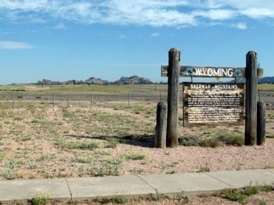
The Sherman Mountains are erosional remnants rising above the general level of the surface of the Laramie Range. The flat topped characteristic of the range resulted from beveling during an ancient erosion cycle. Bedrock here is granite, a . . . — — Map (db m68051)
The granite rocks to the west are more than a billion years old (Pre-Cambrian in age). The sedimentary rocks to the east are some 10 million years old (Late Miocene in age). After the mountains were elevated, some 20,000 feet of rocks were eroded . . . — — Map (db m92157) HM
This tree was growing out of a crevice in the rock when the Union Pacific Railroad built its original main line fifty feet south of this rock in 1868.
The fence and cable were provided by the Union Pacific Railroad Co. at the request of the . . . — — Map (db m95273) HM
Tall trees, short trees, shrubs, grasses and flowering plants -- mountains, canyons, river bottoms, and prairies -- all intermingle to form the landscape. The greater the variety of landforms and vegetation, the more homes or habitats there are for . . . — — Map (db m47149) HM
Big Horn Basin in northwest Wyoming is bound on the west by the Beartooth and Absaroka Mountains, on the south are the Wind River and Owl Creek ranges, on the north the Pryor Mountains and on the east are the Big Horns. The Basin is nearly . . . — — Map (db m91289) HM
These two plaques offer brief history of the Bighorn Basin.
Bighorn Basin -- It's Creation
Before you lies the Bighorn Basin, which has its southern end in Wyoming and extends into Montana. Six hundred million years of . . . — — Map (db m91305) HM
The large, granite building blocks of Shell Canyon are an extraordinary 2.5 billion years old. Called basement or bedrock, they form the bottom layer covering the molten material in the earth’s core. At some point, the huge plate of bedrock . . . — — Map (db m88189) HM
The red cliff face to your left flanks Sunlight Mesa. At the top is Elephant Head Rock, so named because of its shape. The triangle-shaped mountain to the right is named Pyramid Peak. To your far right is a prominent rock-topped mountain called . . . — — Map (db m68892) HM
If you are a seeker of waterfalls . . . . . . . mark Shell Falls as unique in terms of waterfall origin. Waterfalls form in three basic ways: 1. Where Hard Meets Soft Falls commonly form where a hard, resistant streambed meets a softer one. . . . — — Map (db m88179) HM
Can water really move mountains? Bit by bit, grind of water rippling over rock wears the mountain away. In a more dramatic fashion, run-off from melting snow during May and June creates a massive force capable of muscling huge boulders downstream. . . . — — Map (db m88168) HM
2.5 billion years of geologic history lie exposed in the canyon walls of Shell Creek. Gradual cutting action by Shell Creek eventually exposed the basement granite layer that lies above the earth’s molten core. However, Shell Canyon itself formed . . . — — Map (db m88178) HM
The hills located to the south and west (your left) are part of the Rawlins Uplift, a 40 mile long, north trending fold in the earth's crust. The geologic feature rises a thousand feet above the surrounding plains. Granite rocks that range in age . . . — — Map (db m95470) HM
Ages ago Wyoming was covered by seas. Through a period of millions of years the land gradually rose, leaving the present landscape of plains, mountains and rolling hills. As the land emerged, erosion began and through eons of time, formed Ayres . . . — — Map (db m92098) HM
Meandering La Prele Creek drainage cuts into alternating layers of sandstone and sandy limestone of the Permian / Pennsylvanian Casper formation.
La Prele Creek erodes both the upstream and downstream sides of the outcrop.
Undercutting by . . . — — Map (db m71496)
Devils Tower, an important landmark for Plains Indian tribes long before the white man reached Wyoming, was called Mateo Tepee, or Grizzly Bear Lodge, by the Sioux. A number of Indian legends describe the origin of Devils Tower. One legend tells . . . — — Map (db m34465) HM
Although Devils Tower has long been a prominent landmark in northeastern Wyoming. the origin of the mammoth rock obelisk remains somewhat obscure. Geologists agree that Devils Tower consist of molten rock forced upward from deep within the earth. . . . — — Map (db m97986) HM
President Theodore Roosevelt proclaimed Devils Tower a national monument on September 24, 1906.
President Roosevelt acted under the authority of of the Antiquities Act of 1906 which declared, "that the President of the United States is . . . — — Map (db m98001) HM
The arid basins and prairies of Wyoming lie in the rain shadow of our great mountain ranges. The shortgrass prairie of eastern Wyoming and Colorado are also that is left of this native grassland type. Buffalo grass and drama grasses typify the . . . — — Map (db m97985) HM
On the wind-blown mountain slopes south and west of Dubois winters the world’s largest herd of Rocky Mountain bighorn sheep. The bighorn once was found throughout all mountain habitats of the Rockies: today its range is but a remnant. The . . . — — Map (db m96241) HM
Union Pass the cultural site must first have been Union Pass the natural site. As a natural site it commenced to produce vegetation and was afterwards inhabited by animals before it ever became attractive to man==for any purpose other than the . . . — — Map (db m180421) HM
Jutting like the topsail of a ship from beyond the apparent horizon. a tip of the Ramshorn is seen. It serves to remind the viewer of the Absarokas, a cragged mountain range broader and longer than the Wind Rivers but slightly less elevated. These . . . — — Map (db m180420) HM
Southwest rises a mountain given a lyrical name, one such as Indians or mountain men discovering a geographical phenomenon might have chosen. Midway of its four-mile long crest is the key point, one of only two in North America, were as many as . . . — — Map (db m180333) HM
Postulating the traverse of the Continental Divide the eye climbs to Union Peck, some four airline miles but nearer six by that tortuous route. At ll,491 feet Union Peak is a nondescript rise that draws attention only because it is the final . . . — — Map (db m180418) HM
Ice Slough is a small stream that flows into the Sweetwater River five miles east of here. In front of this point is a slough (i.e. a marsh or shallow un-drained depression). This slough gave the name to the stream east of here. In the "Ice Slough" . . . — — Map (db m62076) HM
“The Sinks” are a series of cracks and crevices at the back of the cavern before you. The water of the Popo Agie River flows into the Sinks. It then reappears at the “Rise of the Sinks,” a large calm pool ¼ mile down canyon. . . . — — Map (db m95824) HM
The Red Canyon Wildlife Habitat Management Area (WHMA) before you is a crucial part of the entire winter range complex along the Southern Wind River Mountains in the Lander Area. The 1785 acres of the Red Canyon WHMA were purchased in 1958 primarily . . . — — Map (db m96368) HM
From the time the glaciers of the last Ice Age retreated about 16,000 years ago, people have journeyed into Sinks Canyon. The canyon is a natural pathway into and over the southern Wind River Mountains. For thousands of years people, and wildlife, . . . — — Map (db m95818) HM
The heavily timbered slope before you provides excellent habitat for many species of wildlife. Douglas Fir trees with Oregon Grape, Mountain Lover, Snowberry, Wild Rose and many other shrubs in the under story, cover the slope. Vegetation is thicker . . . — — Map (db m95825) HM
The Rise of the Sinks is a large spring where the water of the middle fork of the Popo Agie River reappears after flowing into a limestone cavern called the Sinks, located a quarter of a mile upstream.
The water flows underground following an . . . — — Map (db m95819) HM
The Wind River Canyon provides a unique slice through geologic time. While driving through the canyon, you can see rocks that were deposited when life was beginning and when Wyoming was covered by a sea with a tropical climate similar to the . . . — — Map (db m88141) HM
With spring, the meadow grasses and broad-leafed plants, called forbs, emerge green and succulent. Antelope, mule deer, and elk wintering south and west of here return each spring to the green grass and forb meadows found in the sagebrush desert and . . . — — Map (db m96700) HM
In summer, the trilling “Kroo-oo-oo” of the sandhill crane is heard along the Sweetwater River. The endangered whooping crane has been seen in the marshy meadows immediately south of this spot. The Sweetwater’s wide floodplain, enhanced . . . — — Map (db m95747) HM
The red cliffs seen in and around the park are called the Red Peak Formation - part of the Chugwater Group. This rock outcrop is composed of fine-grained sandstone and is up to 600 feet thick. The brick red color is caused by oxidation of iron . . . — — Map (db m97658) HM
In April of 1896 a treaty was signed whereby the Shoshone and Arapahoe Tribes gave the legendary Sacred Springs of Healing to the United States government and, subsequently, to the state of Wyoming. Upon signing the treaty, Chief Washakie . . . — — Map (db m97759) HM
Thermal features at Hot Springs State Park differ from those found in Yellowstone, which are heated by magma near the earth’s surface. The hot spring water found here originates in the Owl Creek Mountains to the south, where surface water seeps down . . . — — Map (db m97691) HM
In the foreground across the river are the Rainbow Terraces formed of mineral deposits called travertine. The Big Spring produces 127° mineral water and as it makes its way down the terraces the water temperature changes and different colors of . . . — — Map (db m86916) HM
The reds, oranges, yellows, and greens that paint the hot spring's pools and streams are actually heat-loving (thermophilic_ microscopic life forms (microbes). Microbes which include algae, are visible when vast numbers cluster together. The . . . — — Map (db m97653) HM
This river begins in the Absaroka (ab-sore-uh-ka) Mountains located 90 miles to the northwest. It runs southeast, then swings north and flows through two mountain ranges before it joins the Yellowstone River at Bighorn, Montana, 180 miles northeast . . . — — Map (db m97650) HM
White Sulphur Spring is one of many attractions in the park. In the early 1890s a bathhouse and dance pavilion were built nearby. Unfortunately, a fire destroyed the buildings in 1899.
Early settlers in the area recognized the therapeutic values . . . — — Map (db m97701) HM
See this natural phenomenon while you are in Thermopolis. Monument hill, pictured here, and visible from this site, overlooks the "Big Spring"
(map with arrows and diagram)
See other springs and beautiful terraces created by the mineral . . . — — Map (db m97783) HM
The high country backdrop on top of the Big Horn Mountains encompasses much of the Cloud Peak Wilderness area. This 195,000 acre area was designated as wilderness by Congress in 1984. The highest point in the wilderness area is Cloud . . . — — Map (db m87714) HM
From this point in any direction is Powder River Country.
Twelve thousand years ago. the rich grassland and abundant wildlife attracted Native American hunters into the area. As the United States expanded, commerce and conflict occurred. The . . . — — Map (db m91531) HM
From this point in any direction is Powder River Country.
Twelve thousand years ago. the rich grassland and abundant wildlife attracted Native American hunters into the area. As the United States expanded, commerce and conflict occurred. The . . . — — Map (db m91575) HM
The region’s unique geology created ‘woodland islands’ for planes and animals, and played a key role in the routing of the Transcontinental Railroad
Pine Bluffs
The area’s distinctive Pine Bluffs are the result of early geologic activity . . . — — Map (db m76851) HM
Located 4 miles east of Afton in the Salt River Range, is the largest of three natural springs in the world that is naturally turn of and on. Water flow is interrupted from anywhere between 3 to 30 minutes, generally between the months of August - . . . — — Map (db m90524) HM
The Legend of Devil’s Gate
American Indian legend says a powerful evil spirit in the form of a tremendous beast with enormous tusks ravaged the Sweetwater Valley, preventing the Indians from hunting and camping. A holy man told the . . . — — Map (db m95488) HM
Fremont Canyon was named after General John Charles Fremont, who explored the canyon in 1842 when he was a Lieutenant in the Army. Pathfinder Dam located three miles upstream was also named for the explorer known as the "Pathfinder" who was . . . — — Map (db m95573) HM
Probably discovered by returning Astorians, 1812. Given its name by emigrants who celebrated Independence Day here July 4, 1825. Capt. Bonneville passed here with first wagons 1832. Whitman and Spalding, missionaries with their wives stopped here . . . — — Map (db m95548) HM
An important landform like Independence Rock is protected and preserved only through the efforts of many people and organizations. Not all attempts at preservation and commemoration are acceptable by current standards, however, and some actions left . . . — — Map (db m95551) HM
"Sunday Jun 15. Traveled 25 miles, about one mile from the springs is Prospect Hill. It is a delightful view, and here you can see the range of Sweet water mountains..." Excerpt from the 1851 journal of Amelia Hadley in Covered Wagon . . . — — Map (db m95597) HM
This unique setting of natural beauty cover approximately 320 acres. Viewed from a point of maximum depth, its walls and pinnacles show soft and varied hues comparable to the Grand Canyon of the Yellowstone.
Investigation has confirmed that in . . . — — Map (db m80126) HM
Rawhide Buttes in front of you is an island habitat within the shortgrass prairie. Because the Buttes contain forest habitat, they support different species of wildlife than the surrounding prairie. Elk, deer, turkeys, bobcats and mountain lions are . . . — — Map (db m98301) HM
Rawhide Buttes, visible west of this point, once served as a favorite camping spot for Indians and fur trappers. Several different tales explain the origin of the name. One account holds that this locale served as a departure point from which . . . — — Map (db m98304) HM
"Vast seas of grass as far as the eye can see", wrote the migrants traveling west in the 1840s. Before the plowing of "America's bread basket" native grassland prairies made up more than 500 million acres in the central region of the U.S. and . . . — — Map (db m98258) HM
Several area landmarks, including Bennett Buttes, Bennett Creek, and Little Rock Creek, are now named for Captain Andrew S. Bennett and Little Rock, a Crow interpreter for the U.S. Army, who lost their lives when the Army attacked a camp of Bannock . . . — — Map (db m167161) HM
John Colter, famed among the famous breed of "Mountain Men," passed this landmark late in the fall of 1807 while on business for the fur trader Manuel Lisa. Searching for Indians in order to conduct trade, he also hunted salt caves reputedly located . . . — — Map (db m91010) HM
Colter’s Hell is a large, mostly extinct, geyser basin. Today, there are a few hot springs, and vents which release sulphurous gasses along the Shoshone River. This site includes some of the world’s largest extinct geyser cones and thermal pools. . . . — — Map (db m86147) HM
Looking west is the Shoshone Canyon, named for the Shoshoni Indians, who hunted in the region. However, most of the Big Horn Basin had been Crow territory until the Fort Laramie Treaty of 1868. West of the canyon, the north and the south forks of . . . — — Map (db m87558) HM
Shoshone Canyon is a gorge cut through Rattlesnake Mountain by the wearing action of the Shoshone River. The mountain is a northwest trending uplift in the earth’s crust that rises 3700 feet above the surrounding terrain. Beds of sedimentary rock . . . — — Map (db m86154) HM
Look to your left and you will see the canyon cut by the Shoshone River. The mountain to the left of the canyon is Cedar Mountain. To the right of Shoshone Canyon you can see Rattlesnake Mountain. The red butte (to the right of Rattlesnake Mt.) is . . . — — Map (db m87565) HM
This travertine (calcium carbonate) mound was formed more than a century ago by a hot spring. Only small amounts of hydrothermal water and hydrogen sulfide gas currently flow from this once more prolific spring. This formation is very fragile. It . . . — — Map (db m88308) HM
The Shoshone National Forest provides a habitat for more Rocky Mountain bighorn sheep than any other national forest. Grazing on nutritious bunchgrasses, bighorn sheep evolved in open, high visibility habitats near steep, rocky cover, making it . . . — — Map (db m89018) HM
Stretching across 9,000 square miles, the Absaroka Volcanic Field forms one of the largest volcanic fields in the continental United States. Between thirty-five to fifty-five million years ago volcanoes in the Yellowstone region erupted, depositing . . . — — Map (db m87599) HM
The Buffalo Bill Scenic Byway stretches 27.5 miles from the Shoshone National Forest boundary to Yellowstone National Park. Originally built in 1901, the byway spans the North Fork of the Shoshone River Valley and divides two vast wilderness areas: . . . — — Map (db m89038) HM
About 480,000 years ago, after the last caldera-forming eruption, lava flowing from the east covered this area. The lava hardened into erosion-resistant rock. Over time, superheated water rose through the hardened lava, altering and making it easier . . . — — Map (db m228140) HM
Scattered across this unusual landscape are hot springs – hot springs that are reshaping the mountain. Water, heated deep underground, rises to the surface. As it rises, the water percolates through buried limestone, dissolving calcium . . . — — Map (db m88449) HM
A Photographer's Canvas
Artist Point offers a magnificent view of Lower Falls plunging 308 feet (93 meters). Framed by canyon walls, forest, and sky, the picturesque scene has been photographed countless times for more than a century. . . . — — Map (db m45265) HM
Living Color The vivid colors of Beauty Pool’s basin and runoff channels are created by microscopic lifeforms. Incredibly, these organisms survive and thrive in an environment that would be lethal to us and most other living creatures. . . . — — Map (db m88364) HM
this geyser, named for its 4-foot high cone, resembles an old fashioned beehive. Though its cone is modest by comparison to others in the Upper Geyser Basin, Beehive is one of the most powerful and impressive geysers in Yellowstone. The cone acts as . . . — — Map (db m46274) HM
This mudpot roared into existence in 1948, blowing trees out by roots and forever changing this once quiet forested hillside. A park interpreter named the new feature for its resemblance to a darkly colored “demon of the backwoods.” For . . . — — Map (db m88693) HM
Black obsidian (volcanic glass) “sand” gives this geyser basin its name. Oranges, greens, and other colors in and around the hot springs come from thermophiles (heat-loving microorganisms). While you walk the trail, watch for one of . . . — — Map (db m88865) HM
Sculpting Lower Falls
Reaching the Brink of Lower Falls overlook requires hiking a steep trail that winds down the canyon wall…a wall of hardened rhyolite lava…a wall exposed by the Yel1owstone River while excavating the canyon. . . . — — Map (db m45293) HM
Between a Rock and a Hard Place
From the Brink of Upper Falls viewpoint you can witness the power of the Yellowstone River as you watch millions of gallons (liters) of water plunging 109 feet (33 meters).
From the brink, notice the . . . — — Map (db m45291) HM
Mineral stains mark the sites of hot springs and steam vents in the canyon walls. For thousands of years,upwardly percolating fluids have altered the chemistry of the rocks, turning them yellow, red, white, and pink.
From the rim, the bright . . . — — Map (db m45266) HM
The massive cone is a sign of old age. Eruption after eruption, probably for thousands of years, scalding water has deposited this silica mineral formation. By contrast, Old Faithful’s fledgling cone may only be a few hundred years old. Castle . . . — — Map (db m88374) HM
Frothing and fuming as heat and gas rise from Yellowstone’s magma chamber, this muddy pool churns and cooks. Shaken again and again by earthquakes, the temperature beneath it rises and falls, transforming Churning Caldron. Roiling or Boiling? . . . — — Map (db m88689) HM
Hot springs create different water temperature environments for living things. Cistern Spring’s brown, orange, and green colors represent species of visible algae and bacteria, each requiring a different temperature environment. Only a . . . — — Map (db m89128) HM
Shake, then Bake Covered by dense forest until 1978, this hillside changed dramatically after a swarm of earthquakes struck the area. In spite of being jolted again and again, the trees remained standing, but met their demise soon afterward . . . — — Map (db m88682) HM
Hot springs are the most numerous type of thermal feature in Yellowstone. More than 10,000 are scattered across Yellowstone’s 2 million acres, but few are as hot and as intensely colored as Crested Pool. Water temperatures within the pool often . . . — — Map (db m88373) HM
Daisy Geyser is part of an interconnected group of geysers and hot springs. Underground cracks and fissures allow water and heat to circulate between the various features in this group. When the activity of one feature affects the behavior of . . . — — Map (db m88380) HM
An unknown park visitor named this feature around 1912, perhaps due to the water that frequently surged from the cave like the lashing of a dragon's tongue. Until 1994, this dramatic wave-like action ofter splashed water as far as the boardwalk. The . . . — — Map (db m46269) HM
Millions of spine-shaped deposits surround Echinus Geyser. Iron, arsenic, manganese, and aluminum are all found in the acidic fountain of water that showers the landscape. With each eruption, these metals help build miniature rust-colored sinter . . . — — Map (db m89129) HM
Millions of spine-shaped deposits surround Echinus Geyser. Iron, arsenic, manganese, and aluminum are all found in the acidic fountain of water that showers the landscape. With each eruption, these metals help build miniature rust-colored sinter . . . — — Map (db m89130) HM
A hot spring’s color often indicates the presence of minerals. In a clear blue pool, the water is absorbing all the colors of sunlight except one – blue, which is reflected back to our eyes. Here in Emerald Spring’s pool, another factor joins . . . — — Map (db m88440) HM
Morning Glory Pool is losing its brilliant color. Through ignorance and vandalism, people have tossed objects into the hot spring, clogging its vent and lowering the temperature. Brown, orange, and yellow algae-like bacteria thrive in the cooler . . . — — Map (db m88349) HM
Like wind, rain, and sunshine, fire is part of the Yellowstone ecosystem. Plants decompose very slowly in Yellowstone’s cool, dry environment. Fire speeds up this process. Wood and other organic material are turned into ash. Minerals and valuable . . . — — Map (db m88912) HM
A Special Place Yellowstone’s northern range is home to a large variety of plants and animals. It is unique – different from other areas in the park. What makes it different? • Elevations are 5,200 – 7,000 feet – lower than . . . — — Map (db m88954) HM
The hottest of Yellowstone’s geothermal features are fumaroles (steam vents). Fumaroles in Norris Geyser Basin have measured up to 280°F (138°C). A plentiful water supply would help cool these features; however, steam vents are usually found on . . . — — Map (db m88432) HM
When active, Giant Geyser is one of the largest in the world. Historic accounts describe Giant’s eruptions soaring to heights of 250 to 300 feet. However, recent eruptions have ranged from 200 to 250 feet. Giant Geyser displays cycles of activity . . . — — Map (db m88352) HM
Cascading to the Caldera This frothy veil of water plunges 84 feet (26 m), then tumbles toward the Yellowstone Caldera about ¼ mile (.4 km) downriver. As Gibbon Falls erodes the rock below, the waterfall forever grows higher and migrates . . . — — Map (db m88339) HM
The large boulder beside you was left by a glacier – the glacier that sculpted the broad valley you are standing in. A Cold Ride How did this boulder get here? Like many others scattered across Yellowstone, it was scraped from the . . . — — Map (db m88935) HM
Known for the height and beauty of its eruptions, Grand Geyser’s activity is linked with that of nearby geysers. An intricate sequence of events that takes place over 7 to 15 hours culminates in explosions of boiling water and steam from Grand’s . . . — — Map (db m88369) HM
Deep and Wide
The Grand Canyon of the Yellowstone River is…
• More than 1,000 feet deep in most places (305 m)
• Up to 4,000 feet wide (1,219 m)
• 20 miles long (32 km)
• Carved from old rhyolitic lava flows
• Thermally . . . — — Map (db m45298) HM
Changing with the Seasons All hydrothermal features change, but Grizzly Fumarole changes from day to day, and season to season, reflecting recent weather conditions. What is Hydrothermal? Hydro = Water Thermal = Heat During dry . . . — — Map (db m88698) HM
Grotto is perhaps the most unusual of Yellowstone’s geysers. Geologists believe that hundreds (or thousands) of years ago, Grotto Geyser emerged in a stand of dead or dying trees and, through time, deposited layer upon layer of siliceous sinter . . . — — Map (db m88445) HM
A Youthful Glow
The Grand Canyon of the Yellowstone River was born thousands of years ago, but is till young in geologic time.
After Yellowstone’s most recent icecap melted about 14,000 years ago, the Yellowstone River began . . . — — Map (db m45301) HM
Welcome to Lookout Point
Lookout Point is popular for its lofty view. The trail to the overlook is about 145 yards (133 m) long, and includes 13 steps.
A steep descent to Red Rock will take you to the North Rim's . . . — — Map (db m45295) HM
Minute Geyser’s eruptions have changed dramatically. Its larger west vent (right) is clogged with rocks tossed in by early visitors when the park’s main road was near this trail – passing within 70 feet (21 meters) of the geyser. Minute . . . — — Map (db m88414) HM
Landslides are epidemic in this valley. In late spring and summer, storm clouds travel through the Gardner River canyon, striking Mt. Everts with brief but intense showers. The dry, layered cliffs have little protective vegetation. Loosened by . . . — — Map (db m123360) HM
After a steady ascent through whitebark pine and fir forest the trail reaches alpine tundra – a wind-scoured world of stunted trees and briefly blooming wildflowers. Mt. Washburn’s steep slopes and low groundcover are ideal habitat for . . . — — Map (db m89353) HM
168 entries matched your criteria. The first 100 are listed above. The final 68 ⊳