On Harpers Ferry Road near Limekiln Road, on the right when traveling north.
Israel Friend in 1727 secured a deed from the Indian chiefs of the Five Nations. Beginning “at the mouth of Andietum Creek thence up the Potomack River 200 shoots as fur as an arrow can be slung out of a bow” thence “100 shoots . . . — — Map (db m1972) HM
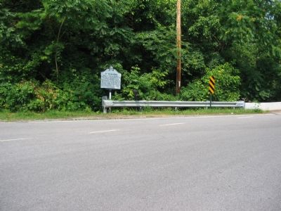
On Harpers Ferry Road at Limekiln Road, on the right when traveling east on Harpers Ferry Road.
This four-arch stone bridge spanning the Antietam Creek was built in 1832 by John Weaver. It is located at the site of a large ironworks complex, first known as the Frederick Forge and later as the Antietam Iron Works which operated intermittently . . . — — Map (db m3206) HM
On Chestnut Grove Road, 0.3 miles east of McCoy Road, on the left when traveling east.
In June 1864, Confederate Gen. Robert E. Lee sent Gen. Jubal A. Early's corps from the Richmond battlefield to the Shenandoah Valley to counter Union Gen. David Hunter's army. After driving Hunter into West Virginia, Early invaded Maryland . . . — — Map (db m169873) HM
On Chestnut Grove Road, on the left when traveling north.
and his associates collected arms and ammunition on the Kennedy Farm (Samples Manor) in Maryland for months prior to the raid on the arsenal at Harpers Ferry, October 17, 1859 — — Map (db m1988) HM
On Chestnut Grove Road, 0.7 miles north of Harpers Ferry Road, on the left when traveling north.
In Memoriam
To the Provisional Army of the United States of America
and their presence at Kennedy Farm the Summer of 1859
John Brown, 59, Hanged
Annie Brown, 16, Sent Home
Martha Brown, 17, Sent Home
John Henry Kagi, 24, Killed . . . — — Map (db m151957) HM
Kennedy Farm
Has Been Designated a
National
Historic Landmark
This site possesses National significance in commemorating the history of the United States of America
1974
National Park Service
United States Department of the . . . — — Map (db m151983) HM
On Chestnut Grove Road, on the right when traveling south.
This is the Kennedy farmhouse, which abolitionist John Brown (using the pseudonym Isaac Smith) leased in July 1859 from Dr. Robert Kennedy's heirs, ostensibly to do some prospecting. Brown's fifteen-year-old daughter, Annie Brown, identified the . . . — — Map (db m169872) HM
On Taylors Landing Road, 1.2 miles west of Sharpsburg Pike (Maryland Route 65), on the left when traveling west.
Mercersville was named for Charles Fenton Mercer, who served as the first president of the Chesapeake and Ohio Canal Company from June 1828 through June 1833. Mr. Mercer, from Loudoun County, Virginia, also served as a member of the U.S. House of . . . — — Map (db m95690) HM
On Mummas Lane, on the right when traveling south.
Union soldiers described the fighting at the Mumma farm: "I do not see how any of us got out alive. The shot and shell fell about us thick and fast, I can tell you, but I did not think much about getting shot after the first volley." "Just in . . . — — Map (db m6184) HM
On Dunker Church Road / Old Hagerstown Pike, on the right when traveling south.
Gen. Edwin Vose Sumner, Union Second Corps Commander (1) As the battle shifted away from the Cornfield, Gen. John Sedwick's division of Federal troops, personally led by corps commander Gen. Edwin Sumner, advanced from the East Woods. . . . — — Map (db m20659) HM
On Dunker Church Road / Old Hagerstown Pike at Smoketown Road, on the right when traveling south on Dunker Church Road / Old Hagerstown Pike.
Before the Battle of Antietam, President Abraham Lincoln sent a telegram to General George B. McClellan, commanding the Union Army of the Potomac: GOD BLESS YOU AND ALL WITH YOU DESTROY THE REBEL ARMY IF POSSIBLE McClellan, with an . . . — — Map (db m6293) HM
On Cornfield Avenue at Dunker Church Road / Old Hagerstown Pike, on the right when traveling west on Cornfield Avenue.
Americans fought back and forth across the Cornfield for three hours. Those three hours may encompass the most concentrated fury in American history. The Union First Corps and Twelfth Corps were fought out. On the Confederate side, Jackson's corps . . . — — Map (db m5813) HM
On Mansfield Avenue, on the left when traveling east.
At a farmhouse and barn not far from here, Clara Barton labored without sleep for three days, comforting the wounded of the Battle of Antietam with water, food, and medical supplies. Clara Barton, founder of the American Red Cross, began her . . . — — Map (db m5902) HM
On Old Burnside Bridge Road, on the right when traveling north.
Five hundred Georgia and a few South Carolina riflemen kept the entire Union Ninth Corps on the far side of Antietam Creek for three hours. A Union general described what Northern soldiers were up against: "From the crest to bridge the slope was . . . — — Map (db m6802) HM
On Mansfield Avenue, on the left when traveling east.
Dawn was at 5:43 a.m. By 6 a.m. Southern defenders could see the Union's First Corps: "In apparent double battle lines, the Federals were moving toward us at charge bayonets, common time, and the sunbeams falling on their well polished guns . . . — — Map (db m5903) HM
On Richardson Avenue, on the left when traveling east.
Major General Edwin Sumner commanded the Second Corps, largest corps in the Union Army of the Potomac - but he never could get his three divisions together. His lead division was broken in the West Woods. Brigadier General William French's . . . — — Map (db m5496) HM
Near Dunker Church Road / Old Hagerstown Pike, on the right when traveling south.
Sedgwick's division entered the West Woods. "The last of the charging lines had gone beyond, and was sweeping majestically into the jaws of death when the mass seemed to halt, while from the front line spouted forth a long angry sheet of flame . . . — — Map (db m6267) HM
On Richardson Avenue, on the left when traveling east.
Before the fighting started here, General Robert E. Lee rode up to encourage his men. Colonel John B. Gordon responded loud enough for all to hear: "These men are going to stay here, General, till the sun goes down or victory is won!" Years . . . — — Map (db m5495) HM
Near Dunker Church Road / Old Hagerstown Pike, on the right when traveling south.
A few days before the battle, bidding farewell to a friend, Union General Mansfield said: "We may never meet again." Brigadier General William E. Starke, C.S.A. He led the counterattack that helped stop the first Union attack down the . . . — — Map (db m6973) HM
Near Old Burnside Bridge Road, on the left when traveling east.
Ever since the battle the Lower Bridge has been Burnside Bridge. Confederate Colonel Douglas was a native of Sharpsburg, and familiar with Antietam Creek. After the war he wrote: "Go look at it and tell me if you don't think Burnside and his . . . — — Map (db m6449) HM
Near Old Burnside Bridge Road, on the left when traveling east.
Union Major General Ambrose Burnside's Ninth Corps was ready at 7 a.m. The order to attack came at 9 a.m. 1. One division spent the morning looking for the ford downstream. 2. At the bridge the 11th Connecticut Regiment made the first attack. They . . . — — Map (db m6459) HM
Near Dunker Church Road / Old Hagerstown Pike, on the right when traveling south.
The Cornfield was quiet. The first two Union attacks had failed to break the Confederate line. Union Major General John Sedgwick's division formed up in column of brigades: three brigades - each with more than 1,700 men - each brigade a double rank . . . — — Map (db m6268) HM
On Cornfield Avenue at Smoketown Road, on the right when traveling west on Cornfield Avenue.
Union Major General Joseph Mansfield led his Twelfth Corps into the East Woods. He had commanded the corps only two days. Mansfield saw soldiers from the 10th Maine Regiment firing into the woods: "Stop, you are firing into our own men!" . . . — — Map (db m5812) HM
Second Corps, with 15,000 soldiers was the largest corps in the Union Army of the Potomac. Its lead division went into the West Woods alone. The other two divisions strayed to the south and passed in front of this point, marching from left to right. . . . — — Map (db m6212) HM
On Branch Avenue, on the left when traveling south.
The battle was over, but the two armies still faced one another. The Union army was still twice as strong. General Robert E. Lee, CSA "If McClellan wants to fight in the morning, I will give him battle again." Lee stayed at Antietam one more . . . — — Map (db m6519) HM
On Dunker Church Road / Old Hagerstown Pike, on the right when traveling north.
Confederate Colonel Stephen D. Lee positioned his batteries to repel Union attacks toward the Dunker Church. The attacks came and the guns fired solid shot and explosive shells and canister - tin cans filled with small lead or iron balls that . . . — — Map (db m6368) HM
On Branch Avenue, on the left when traveling south.
Outnumbered Southerners watched the Northern Ninth Corps climb the hills toward them: "The first thing we saw was the gilt eagle that surmounted the pole, then the top of the flag, next the flutter of the stars and stripes itself, slowly . . . — — Map (db m6520) HM
On Dunker Church Road / Old Hagerstown Pike, on the right when traveling north.
Civil War canoneers of both armies learned from the Artillery Drill manual: "To the Field Artillery belongs the service of the batteries which manoeuver with the troops on the field of battle. It is divided into two parts. Horse Artillery, which . . . — — Map (db m6350) HM
On East Main Street (Maryland Route 34) 0.1 miles east of Truman Lane, on the right when traveling east.
After the battle over 4,000 bodies were buried in mass graves, along rock outcroppings, and in farmers' fields. Many more soldiers died of wounds or disease. The peaceful village of Sharpsburg was turned into a huge hospital and burial ground, an . . . — — Map (db m157772) HM
On Branch Avenue at Old Burnside Bridge Road, on the left when traveling south on Branch Avenue.
2nd Brigade 1st Division 9th Corps Location 495 yards north 79 degrees west —————— Casualties at Antietam Wounded 7 Missing 1 Total 8 Recruited in Lawrence Washington Butler Beaver Mercer and Westmoreland . . . — — Map (db m6513) HM
On Cornfield Avenue, on the right when traveling west.
(Wadsworth Guards) ————— 1st Brigade (Duryee's) 2nd Division (Rickett's) First Corps (Hooker's) Fought in the 'Cornfield,' near this spot, September 17, 1862 in the memorable morning engagement between Hooker and . . . — — Map (db m5691) HM
On Dunker Church Road, on the right when traveling north.
This cast iron rifle with its band of wrought iron reinforcing the breech was a modern weapon of the day. It was effective at moderately long range. The 20-pounder, similar except for size, was the heaviest rifled cannon used at Antietam. — — Map (db m67864) HM
Near Burnside Bridge Road, on the right when traveling east.
(Around the edge of the Monument): 11th Conn. V.I. 2nd Brigade 3rd Division 9th Corps (Rear of Monument):
Col. W. Kingsbury
Capt. J.D. Griswold, Co. A
Christian Steinmetz, Co. C
William Halbeass, Co. C
1st Sergt. J.R. . . . — — Map (db m6416) HM
On Cornfield Avenue, on the right when traveling east.
(Front):11th Mississippi Infantry Regiment Law's Brigade Hood's Division C.S.A. Dedicated 2012 on the Sesquicentennial of the Battle Duty brought them to the field Honor led them into battle Valor covered them with glory Ducit amore . . . — — Map (db m59120) HM
On Branch Avenue, on the left when traveling south.
(Front Inscription): OHIO 11th Infantry Commanded by Lieut. Col. Augustus H. Coleman (Killed) Maj. Lyman Jackson Crook's (2nd) Brigade Kanawha Division Ninth Army Corps Army of the Potomac (Rear Inscription):
This Regiment . . . — — Map (db m6785) HM
On Starke Avenue at Dunker Church Road, on the right when traveling west on Starke Avenue.
Colonel Joseph W. Hawley
(Right Plaque):
Sept. 17, 1862
Antietam
Chancellorsville
May 1-2-3, 1863
(Lower Right Inscription):
Recruited in Chester and Delaware Counties August 1862 for Nine Months Service
(Rear . . . — — Map (db m6134) HM
On Smoketown Road, on the right when traveling west.
While forming the extreme left front as Sedgewick's Division was being shot down in the West Woods, the 125th Penna. Inf. Rgt. was at times only 50 yards from Confederate Infantry. Of the Regiment's 54 killed and 91 wounded, most were lost here in . . . — — Map (db m6903) HM
On Smoketown Road, on the right when traveling north.
U.S.A. Through the fields west of this road the Twelfth Army Corps moved to the front between 6 a.m. and 7 a.m. on September 17, 1862, Williams' Division in advance, Greene's Division following. — — Map (db m7190) HM
On Branch Avenue, on the left when traveling south.
(Front Inscription):OHIO 12th Infantry Commanded by Col. Carr B. White Hugh Ewings (1st) Brigade Kanawha Division Ninth Army Corps Army of the Potomac (Rear Inscription):
This Regiment advanced to this place on the afternoon of . . . — — Map (db m7116) HM
On Mansfield Avenue at Smoketown Road, on the left when traveling east on Mansfield Avenue.
113th of the Line 4th Brigade Cavalry Division Recruited in Philadelphia Battles Participated in Second Manassas - Fisher's Hill - Clarksburg Sugar Loaf Mountain - Monocacy - Charlestown South Mountain - Frederick - Maryland Heights Antietam - . . . — — Map (db m5969) HM
On Richardson Avenue, on the left when traveling east.
(Front): 130 Pennsylvania
Vounteer Infantry 2 Brigade 3 Division 2 Corps (Rear): This memorial marks the regiment's right of line in battle. Its left extended to Roulette's Lane below. It went into battle by way of the Roulette Farm . . . — — Map (db m6916) HM
On Cornfield Avenue, on the right when traveling west.
September 17, 1862 —————————
First position under artillery fire, about 150 yards north of this point at 10 a.m. advanced to the Hagerstown Road and became closely engaged. — — Map (db m5789) HM
On Hagerstown Pike (State Highway 65), on the right when traveling north.
(Front): 15th Reg. Mass. Vols. Here, September 17, 1862, the Fifteenth Reg. Mass. Volunteers, with the First Company Andrew Sharpshooters attached, 606 men of all ranks, commanded by Lieut. Col. John W. Kimball, Gorman's Brigade. . . . — — Map (db m7215) HM
On Shepherdstown Pike (Maryland Route 34), on the left when traveling north.
Fresh from victory at the Second Battle of Manassas, Gen. Robert E. Lee’s Army of Northern Virginia crossed the Potomac River on September 4-6, 1862, to bring the Civil War to Northern soil and to recruit sympathetic Marylanders. Union Gen. George . . . — — Map (db m1967) HM
Fresh from victory at the Second Battle of Manassas, Gen. Robert E. Lee’s Army of Northern Virginia crossed the Potomac River on September 4-6, 1862, to bring the Civil War to Northern soil and to recruit sympathetic Marylanders. Union Gen. . . . — — Map (db m1970) HM
On Boonesboro Pike (Maryland Route 34), on the left when traveling east.
Fresh from victory at the Second Battle of Manassas, Gen. Robert E. Lee’s Army of Northern Virginia crossed the Potomac River on September 4-6, 1862, to bring the Civil War to Northern soil and to recruit sympathetic Marylanders. Union Gen. George . . . — — Map (db m67693) HM
On Burnside Bridge Road, on the right when traveling north.
(Front Face): OHIO 1st Battery
Light Artillery Commanded by Capt. James R. McMullin Hugh Ewings (1st) Brig. Kanawha Division Ninth Army Corps Army of the Potomac (Rear Face): This battery occupied position about 250 yards due . . . — — Map (db m6799) HM
On Mansfield Avenue, on the left when traveling east.
U.S.A.
On the night of September 16, 1862, three regiments of Magilton's Brigade, Meade's Division bivouacked in the North Woods, a few feet south of this point in support Seymour's skirmishers; one regiment was in second line, in the open . . . — — Map (db m5905) HM
Delaware
1st Delaware Volunteers
Colonel John W. Andrews
3rd Brigade, 3rd Division, II Corps
On the morning of Sept. 17, 1862 this regiment crossed Antietam Creek forming right of first line of French's Division. Advanced with heavy . . . — — Map (db m207972) HM
Near Old Burnside Bridge Road, on the left when traveling east.
(Front Face):
21st Mass. Vol. Inf'y 2nd Brig. 2nd Div. 9th A.C. Erected by 21st Regt. Mass. Vol. Association
(Rear Face):The following Comrades were killed near this bridge: 2nd Lieut. Henry C. Holbrook Co. "D"
Priv. Wm. B. . . . — — Map (db m6453) HM
On Branch Avenue, on the left when traveling south.
(Front Inscription): OHIO
23d Infantry
Commanded by
Major James M. Comly
Hugh Ewing's (1st) Brigade
Kanawha Division
Ninth Army Corps
Army of the Potomac (Rear Inscription):
This Regiment with its Brigade . . . — — Map (db m6669) HM
On Cornfield Avenue, on the right when traveling west.
3d Brigade, 1st Division, 12th Army Corps Colonel Silas Colgrove Commanding, was engaged with the enemy 400 yards north of this marker, September 17th 1862. Number engaged 440. Killed and Wounded 209. — — Map (db m5697) HM
On Branch Avenue, on the left when traveling south.
OHIO 28th Infantry Commanded by Lieut. Col. Gottfried Becker Crooks (2d) Brigade Kanawha Division Ninth Army Corps
Army of the Potomac (Rear of Monument): This Regiment was conducted by Gen. Crook on a reconnaissance above the Bridge . . . — — Map (db m155756) HM
Delaware 2nd Delaware Volunteers Capt. David L. Stricker 3rd Brigade, 1st Division, II Corps This regiment of Richardson's reserve brigade crossed Antietam Creek, advanced with division and came under heavy artillery fire while holding position . . . — — Map (db m207974) HM
Near Old Burnside Bridge Road, on the left when traveling east.
Maryland 2nd Md Infantry At 9:30 a.m. advanced on the stone bridge, defended by Toombs' Brigade and two batt- eries on high ground beyond. Charged to within 100 yards of the bridge when, checked by the severity of the enemy's fire it took . . . — — Map (db m6463) HM
On Branch Avenue, on the left when traveling south.
(Front Inscription):
Ohio 30th Infantry
Commanded by Lieut. Col. Theodore Jones (captured) Major George H. Hildt Hugh Ewing's (1st) Brigade Kanawha Division Ninth Army Corps
Army of the Potomac
(Rear Inscription): This . . . — — Map (db m6685) HM
On Smoketown Road, on the right when traveling west.
(Front Side): Thirty-Fourth Regiment N.Y.S.V Col. James A. Suiter
Commanding Enlisted under President Lincoln's call, issued April 15, 1861, for 75,000 men, to serve two years. Mustered into the State service May 1, 1861 Mustered into . . . — — Map (db m6902) HM
Near Old Burnside Bridge Road, on the left when traveling east.
The Thirty-fifth Regiment
of
Massachusetts Volunteers
Crossed this bridge with Ferrero's
Brigade, Ninth Army Corps
at noon, Sept. 17, 1862, and
moved to the right up the hill
where, at the lane, two hundred
and fourteen of their . . . — — Map (db m6455) HM
On Branch Avenue, on the left when traveling south.
(Front of Monument): 36th Infantry commanded by Lieut. Col. Melvin Clarke (Killed) Crook's (2d) Brigade Kanawha Division Ninth Army Corps Army of the Potomac Ohio (Rear of Monument): This Regiment advanced near the Bridge over . . . — — Map (db m6518) HM
On Dunker Church Road, on the right when traveling north.
This was one of the most accurate weapons used here. It was preferred over the heavier 10-pounder Parrott which fired the same size ammunition. — — Map (db m67862) HM
On Dunker Church Road / Old Hagerstown Pike, on the right when traveling south.
Delaware 3rd Delaware Volunteers Major Arthur MaGinnis 3rd Brigade,
2nd Division, XII Corps This regiment, worn down from active service in the second Manassas Campaign, went into action Sept. 17, 1862 with only five officers and 120 men. It . . . — — Map (db m7219) HM
On Dunker Church Road / Old Hagerstown Pike, on the right when traveling north.
Maryland 3rd Md. Infantry. 2nd Stainbrook's Brigade. 2nd Greene's Division. 12th Mansfield's Corps. Advanced to the corner of the Dunkard Church, in front of this Marker. Loss, 4 killed, 25 wounded. The monument to the Maryland troops is near . . . — — Map (db m6857) HM
On Mansfield Avenue, on the left when traveling east.
32nd Reg. Penna. Vol. Inf. 2nd Brigade, 3rd Division, 1st Corps. Arriving on the field on the afternoon of September 16th, Lieut. Col. John Clark, com'd'g. the regiment immediately deployed eight companies as skirmishers. When the 2nd Brigade . . . — — Map (db m5912) HM
On Branch Avenue at Old Burnside Bridge Road, on the left when traveling south on Branch Avenue.
2nd Brigade 1st Division 9th Corps The regiment advanced 264 yards northwest of this point returning to this position later in the day ————— Casualties at Antietam Killed 1 Wounded 36 Missing 1 Total 38 . . . — — Map (db m11424) HM
On Boonsboro Pike (Maryland Route 34), on the right when traveling east.
U.S.A. At 10 A.M., September 16, 1862, four companies of the Fourth United States Infantry crossed the stone bridge over the Antietam at this point and took position behind the rock ledge and barn on the left of the road and under the bank on . . . — — Map (db m6792) HM
On Boonsboro Pike (State Highway 34), on the right when traveling east.
(Top Plaque): 4th New York Vols. First Scott Life Guard 3rd Brigade, 3rd Division 2nd Corps (Lower Plaque):
Mustered in service May 4, 1861. Participated with the Army of the Potomac in the Battles of South Mountain, Antietam, . . . — — Map (db m7282) WM
Near Old Burnside Bridge Road, on the left when traveling east.
(Front Inscription):
The 51st Regt. P. V. was organized Sept. 1861 By Col. afterwards, Maj. Gen. John F. Hartranft its leader in many battles and in this charge Mustered out July 1865 Engaged in 20 battles or minor combats and . . . — — Map (db m58219) HM
On Dunker Church Road / Old Hagerstown Pike at Smoketown Road, on the right when traveling north on Dunker Church Road / Old Hagerstown Pike.
3d Brig. - 2d Div. - 2d Corps ———— John Lemuel Stetson of Plattsburgh, N.Y. Lieutenant Colonel ———— "Men Rally on Your Colors" Out of 300 men and 21 officers who went into battle nearby, there fell . . . — — Map (db m6274) HM
On Richardson Avenue, on the left when traveling east.
Maryland 5th Md Infantry 3rd Max Weber's Brigade. 3rd French's Division. 2nd Sumner's Corps. Advanced to the knoll above the Bloody Lane. 300 feet in the rear of of this marker. Loss. 43 killed 123 wounded. The monument to the Maryland troops . . . — — Map (db m5487) HM
Near Richardson Avenue, on the left when traveling east.
Erected by the survivors of Company A & I to the memory of our fallen comrads who fell on this spot September 17, 1862. ———— This stone marks the extreme advance of Weber's Brigade French's Div. 2nd Army Corps . . . — — Map (db m17622) HM
On Mansfield Avenue, on the left when traveling east.
36th Regiment in line, 2nd Brigade. 3rd Division, 1st Corps. Organized June 26, 1861. Mustered out June 16, 1864. The regiment arrived on the field on the afternoon of September 16, 1862. Formed at this point on the morning of the 17th. Advanced . . . — — Map (db m5900) HM
On Cornfield Avenue, on the right when traveling west.
At the Battle of Antietam
On this spot, known as "The Cornfield," the 84th N.Y. Volunteer Infantry (14th Brooklyn, N.Y.S.M.) of the 1st Brigade, Col. Phelps, 1st Division Gen. Doubleday, 1st Corps, Gen. Hooker, was hotly engaged on the . . . — — Map (db m5654) HM
On Richardson Avenue at Roulette Farm Lane, on the left when traveling east on Richardson Avenue.
(Front): Ohio
8th Regiment Ohio Volunteer Infantry Lieut. Col. Franklin Sawyer 1st Brigade Gen. Nathan Kimball
3rd Division Gen. W. H. French 2nd Corps, Gen. Edwin V. Sumner Army of the Potomac On this field Ohio's sons sacrificed life . . . — — Map (db m5493) HM
On Mansfield Avenue, on the left when traveling east.
(At the base of the front):
37th Regiment of the Line
(Inscription on the Back): 8th Pa. Reserve Vol. Inf. Major Silas M. Baily. 2nd Brigade, 3rd Div., 1st Corps. Advanced about 800 yards south and became engaged with . . . — — Map (db m5919) HM
Near Harpers Ferry Road, on the right when traveling north.
(West Face): "Toujours Pret"
Erected by the State of New York to the memory of the Ninth New York Infantry - Hawkins Zouaves - who fought on this Field, Sept. 17, 1862.
(North Face): Members present for duty in action 373, . . . — — Map (db m6778) HM
On Dunker Church Road / Old Hagerstown Pike, on the right when traveling north.
Confederate Col. Stephen D. Lee placed his battalion of nineteen cannons here. Throughout the morning, Union infantry and artillery aimed their attacks towards this high ground and the Dunker Church. Twenty-five percent of his men were killed or . . . — — Map (db m20575) HM
On Cornfield Avenue near Dunker Church Road / Old Hagerstown Pike, on the right when traveling west.
"Through a shower of bullets and shells, it was only the thoughts of home that brought me from that place." Pvt. James Dougherty, 128th Pennsylvania Infantry, wounded in the Cornfield (1) At daybreak, Gen. Joseph Hooker's First Corps, . . . — — Map (db m20624) HM
Near Old Burnside Bridge Road, 0.5 miles east of Rodman Avenue.
Known at the time of the battle as the Rohrbach or Lower Bridge, this picturesque crossing over Antietam Creek was built in 1836 to connect Sharpsburg with Rohrersville, the next town to the south. It was actively used for traffic until 1966 when . . . — — Map (db m168291) HM
Near Dunker Church Road, 0.2 miles east of Sharpsburg Pike (Maryland Route 65), on the right when traveling north.
An estimated 100,000 US and Confederate soldiers clashed at Antietam on September 17, 1862. During the battle, Sergeant William H. Paul, Company E, 90th Pennsylvania Infantry, put his life on the line to recapture his unit's fallen flag.
He . . . — — Map (db m231979) HM
On Mummas Lane, on the right when traveling south.
This cemetery and the farm buildings to your right were part of Samuel and Elizabeth Mumma's farm in 1862. Warned of the coming battle, the Mummas and their ten children fled to safety. Fearful that Union sharpshooters would use the farm . . . — — Map (db m20715) HM
On Dunker Church Road / Old Hagerstown Pike, on the right when traveling north.
At Antietam, the open and rolling terrain benefited the artillerymen of both armies. By placing their cannon on high ground, Blue and Gray alike were able to effectively strike enemy troop positions at great distances. Over 500 cannon thundered . . . — — Map (db m20591) HM
On Richardson Avenue, on the left when traveling east.
During the early hours of the battle, Col. John Brown Gordon promised Robert E. Lee, "These men are going to stay here, General, till the sun goes down or victory is won." The Confederate troops that Gordon commanded were part of a well protected . . . — — Map (db m20742) HM
On Shepherdstown Pike (State Highway 34), on the right when traveling north.
This Civil War era photograph offers a glimpse into the two Shepherdstown communities that grew up along the river. The stone pilings in this photograph were all that remained of the covered bridge burned by Confederate troops led by Stonewall . . . — — Map (db m60705) HM
On Hagerstown Pike (Maryland Route 65) at Piper Farm Lane, on the right when traveling north on Hagerstown Pike.
Near this spot an abandoned Confederate gun manned by a Second Lieutenant of the 6th Virginia Infantry, Mahone's Brigade, and two infantry volunteers from Anderson's Georgia Brigade, was placed in action September 17, 1862. — — Map (db m5470) HM
422 entries matched your criteria. The first 100 are listed above. Next 100 ⊳